|
| On the other side of the Wabash River, U.S. 41, SR 28 & SR 55 enter the city of Attica (population 3,425). Despite its modest size, Attica is the largest community that U.S. 41 has gone through since St. John in Northwest Indiana. 12/03/11 |
|
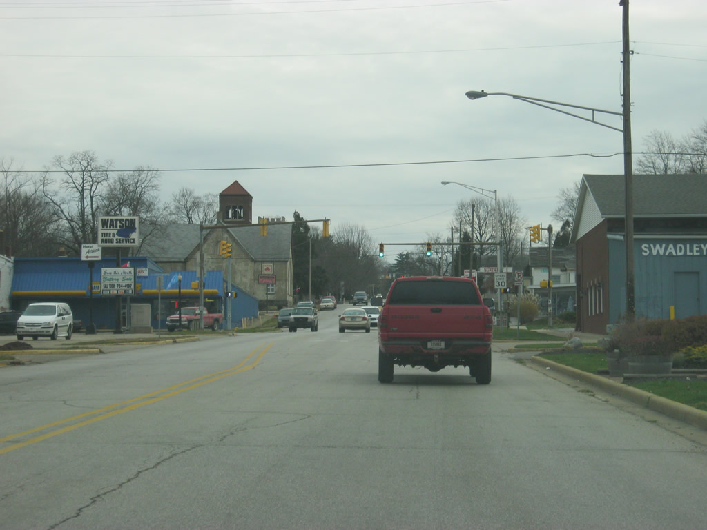
| U.S. 41, SR 28 & SR 55 (Jackson Street) cross a railroad spur near the central part of Attica. Most of the commercial businesses in Attica are in this general vicinity and traffic can get a little heavy along this stretch of highway. 12/03/11 |
|
| Perry Street crosses U.S. 41, SR 28 & SR 55 (Jackson Street) to the south of the main business district to Attica at this traffic light. 12/03/11 |
|
| East of Attica's business district, U.S. 41/SR 55 near their split with SR 28 along Jackson Street. Frankfort is the next major community to the east along SR 28 at a distance of 42 miles. 12/03/11 |
|
| U.S. 41/SR 55 turn south onto Council Street at this intersection toward the communities of Veedersburg and Wingate respectively. SR 28 continues east along Jackson Street toward the east side of Attica. 12/03/11 |
|
| A stoplight marks the intersection between Jackson Street and Council Street. This will be the last stoplight along U.S. 41 until Rockville. 12/03/11 |
|
| U.S. 41/SR 55 (Council Street) remain multiplexed for nearly four miles as the highways follow Council Street through the south side of Attica before leaving town. 12/03/11 |
|
| Leaving Attica, U.S. 41 is 12 miles from Veedersburg and 61 miles from Terre Haute. 12/03/11 |
|
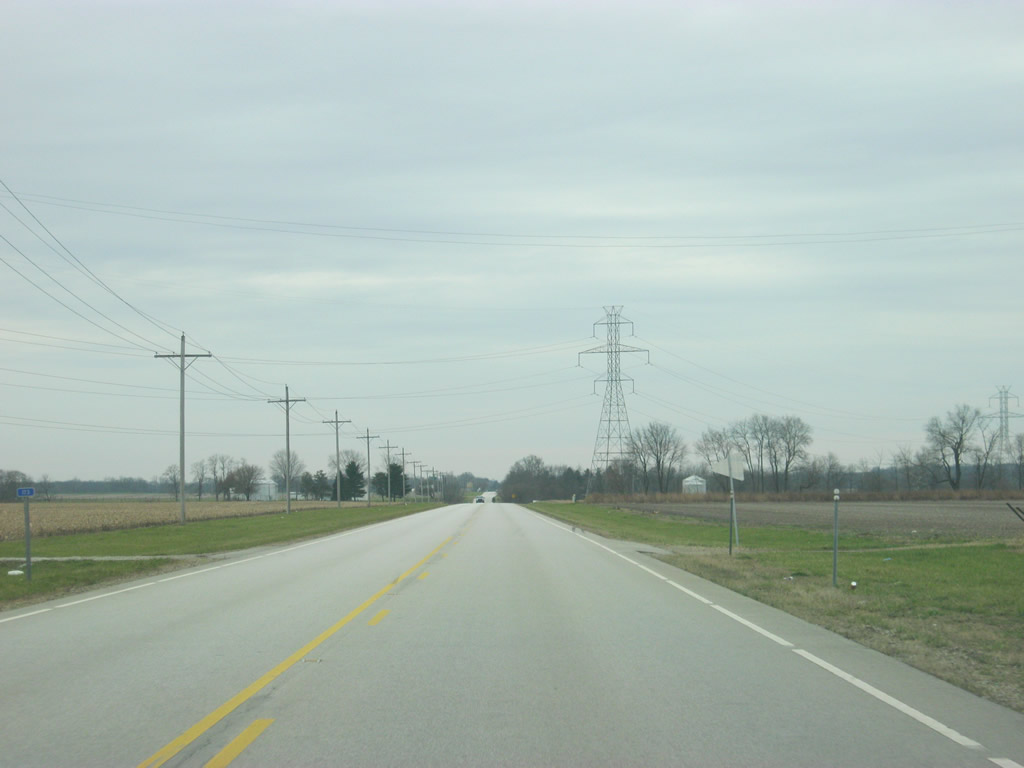
| Attica resides within the valley of the Wabash River, but on either side of the valley the terrain returns to typical Indiana plains as the flatness of Hoosier topography greets U.S. 41/SR 55 to the south of Attica. 12/03/11 |
|
| Along SR 55 south, Wingate is 11.5 miles to the southeast. Newtown is six miles to the southeast along SR 55 while Rob Roy is just to the west via County Road 750 North and Rob Roy Road. 12/03/11 |
|
| SR 55 departs U.S. 41 as it continues southeast toward Newtown and Wingate. 12/03/11 |
|
| South of the junction with SR 55 south, U.S. 41 is 34 miles from the Parke County seat of Rockville and 171 miles away from Evansville. 12/03/11 |
|
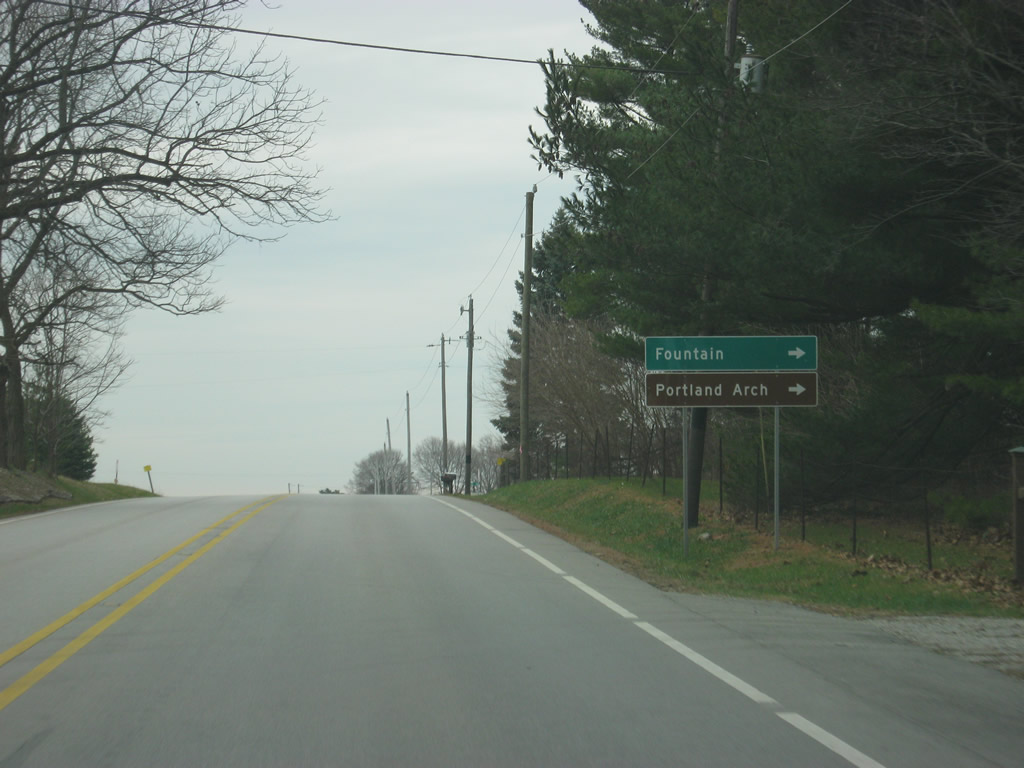
| County Road 650 North connects U.S. 41 with the town of Fountain a few miles to the west. The Portland Arch Nature Preserve is located in the area around Fountain. 12/03/11 |
|
| A view of U.S. 41 and its reassurance shield to the south of the intersection with County Road 650 North. 12/03/11 |
|
| U.S. 41 crosses Stonebluff Road, which connects the communities of Stonebluff to the west with Mellott to the east with U.S. 41. 12/03/11 |
|
| Approaching the Veedersburg area, U.S. 41 expands to four lanes as it is only a mile away from its interchange with Interstate 74. I-74 provides a faster route to the nearby communities of Crawfordsville to the east and Covington to the west.
Interstate 74 is a 423 mile highway that begins in Davenport, Iowa and ends in Cincinnati, Ohio, with an additional 75 mile segment in North Carolina. 12/03/11 |
|
| About a half mile away of the interchange with Interstate 74. Within Indiana, Interstate 74 goes for 172 miles as it stretches from outside Danville to Crawfordsville, Brownsburg, Indianapolis, Shelbyville, Greensburg, and Batesville before leaving at West Harrison. 12/03/11 |
|
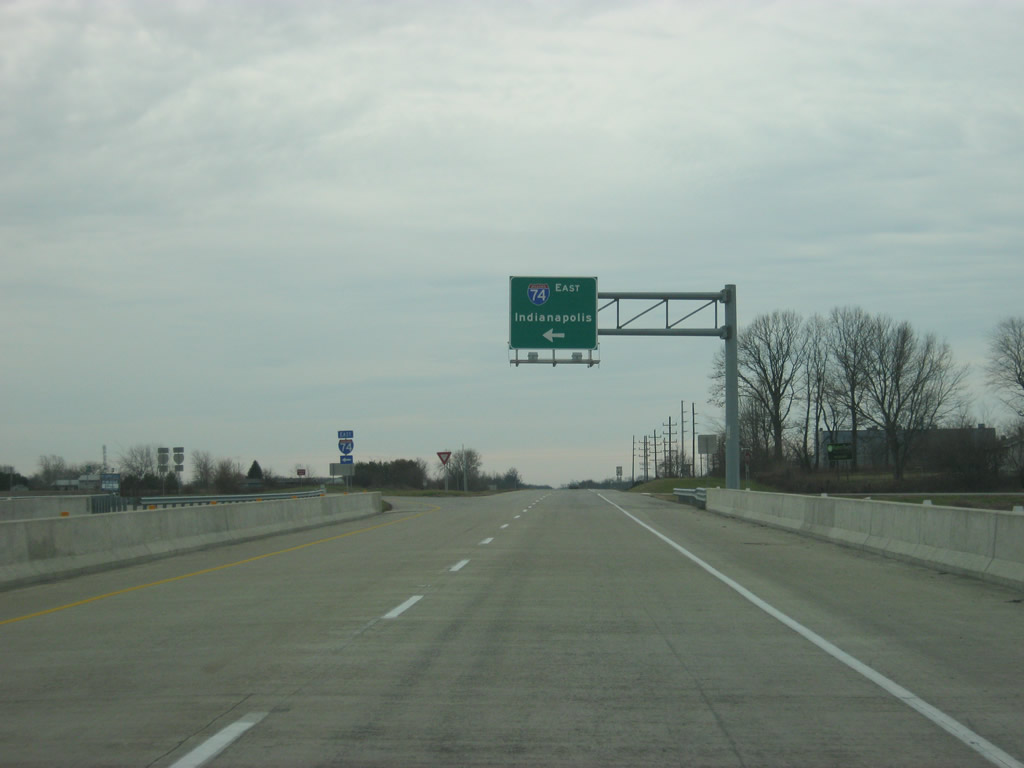
| A right off of U.S. 41 directs traffic to Interstate 74 west to Danville, Champaign, Bloomington, and Peoria, Illinois. 12/03/11 |
|
| A turn to the left off of U.S. 41 directs traffic to Interstate 74 east toward Crawfordsville and Indianapolis. 12/03/11 |
|
| To the south of the Interstate 74 interchange U.S. 41 remains a divided four lane highway as it passes by the town of Veedersburg to the east. 12/03/11 |
|
| U.S. 41 nears the junction with U.S. 136 west (2nd Street). U.S. 136 goes nationally for 804 miles from the town of Edison, Nebraska to the interchange with Interstate 465 in Indianapolis. It follows Interstate 74 across western Indiana. 12/03/11 |
|
| U.S. 136 multiplexes with U.S. 41 for just 0.6 miles south from the upcoming intersection with 2nd Street. U.S. 136 west (2nd Street) leads straight into Veedersburg, which serves central Fountain County. From Veedersburg, the highway follows Interstate 74's path for 7.4 miles to the Fountain County seat of Covington along the Wabash River. 12/03/11 |
|
| A flashing light marks the intersection between U.S. 41 and U.S. 136 west (2nd Street) on the east side of Veedersburg. 12/03/11 |
|
| As soon as U.S. 136 joins U.S. 41, it's already time for their split. Up ahead is the intersection with U.S. 136 east/State Street. 12/03/11 |
|
| The town of Hillsboro is five miles away while Crawfordsville follows at just over 17 miles. U.S. 136 provides a slower path along the same corridor as Interstate 74 and can be used as an emergency detour should something happen along Interstate 74. 12/03/11 |
|
| A four-way stop marks the intersection between U.S. 41 and U.S. 136 east. State Street heads to the west of this intersection and enters Veedersburg from the south side. 12/03/11 |
|
| South of Veedersburg, U.S. 41 returns to two lanes and four miles down the road it enters the intersection with SR 32. Crossing the state of Indiana, SR 32 goes for 157 miles from the Illinois state line and east through Perrysville, Crawfordsville, Lebanon, Noblesville, Anderson, Muncie and Winchester before ending at the Ohio state line at Union City. 12/03/11 |
|
| The Montgomery County seat of Crawfordsville is 18 miles to the east while the town of Perrysville is 12.6 miles to the west from U.S. 41. 12/03/11 |
|
| U.S. 41 crosses SR 32 at Steam Corner. 12/03/11 |
|
| South of the junction with U.S. 41 and SR 32, Rockville is 20 miles away while Terre Haute is getting a bit closer at a distance of 45 miles. 12/03/11 |
|
| County Road 800 South connects U.S. 41 with the town of Yeddo a mile to the west. 12/03/11 |
|
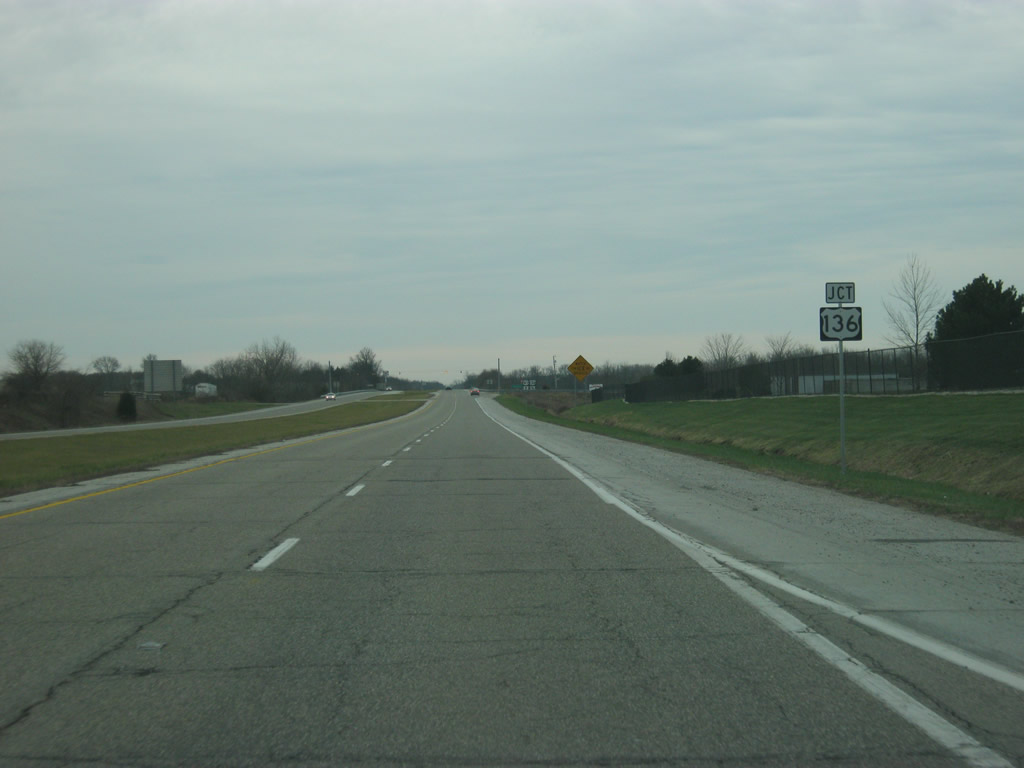
| U.S. 41 nears the junction with SR 234. SR 234 exists in two segments, the western of which begins at the Illinois state line and goes for 86.5 miles through the small towns of Cayuga, Kingman, Ladoga and Jamestown. 12/03/11 |
|
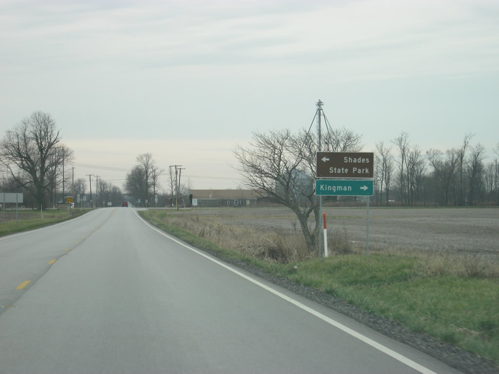
| Shades State Park, a smaller state park with similar land features as the more well-known Turkey Run to the south, lies about ten miles to the east while the town of Kingman is two miles to the west. 12/03/11 |
|
| U.S. 41 crosses SR 234, which spans the far southern tier of Fountain County. 12/03/11 |
|
| Rockville and Terre Haute are now 15 and 40 miles away respectively. 12/03/11 |
|
| Turkey Run State Park is nine miles away via U.S. 41 and SR 47. 12/03/11 |
|
| South of the intersection with SR 234, U.S. 41 enters Parke County (population 17,339). Parke County is best known as the Covered Bridge Capital of the World, with 31 covered bridges located throughout the county and the famous Covered Bridge Festival that is held every October. There is an Amish presence within Parke County as the sign indicates (not the actual county line sign of course). 12/03/11 |
|
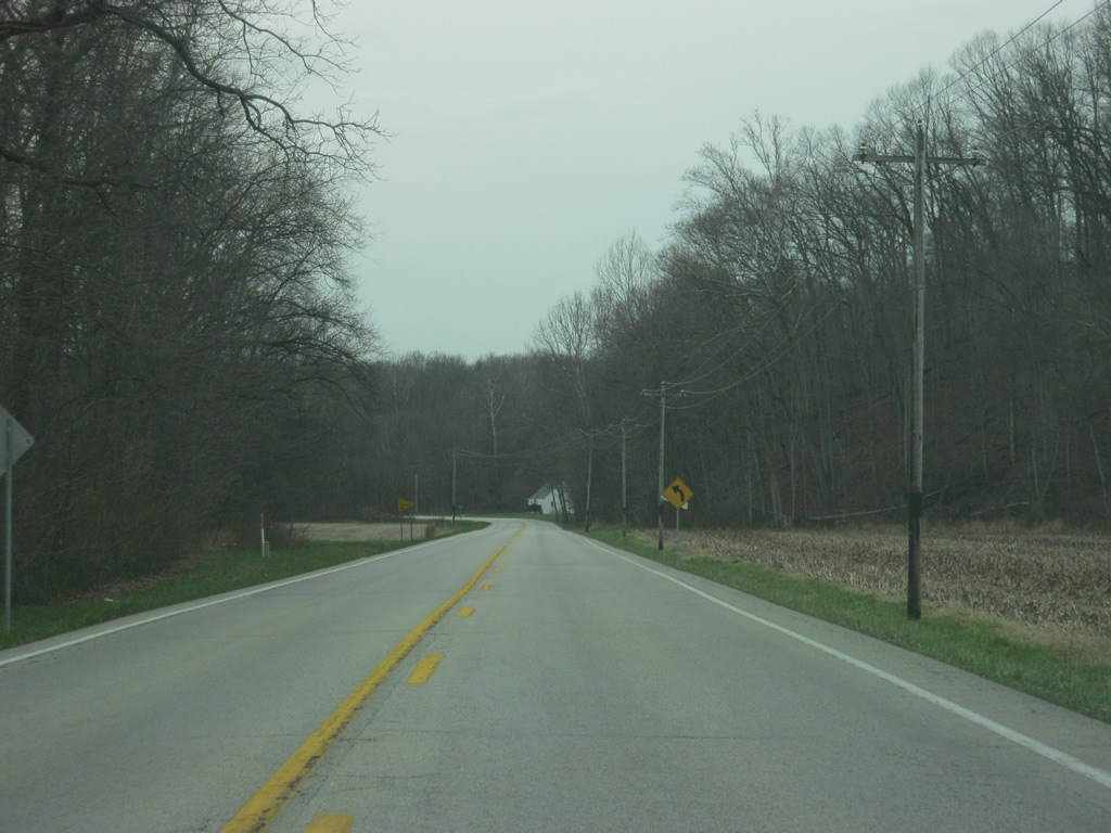
| U.S. 41 starts to wind its way along what is the most windiest portion of the highway across Indiana. Here the highway crosses the valley of one of the tributaries of Sugar Creek, a major river across northern Parke County. 12/03/11 |
|
| On the north side of the Sugar Creek valley, U.S. 41 nears the junction with County Road 1050 North, which heads west to the town of Tangier in northwestern Parke County. 12/03/11 |
|
| U.S. 41 transcends the valley of Sugar Creek, a glacially-forged waterway that has created some dramatic landscapes along its banks in the form of rock gorges and hilly terrain. Naturally, one must slow down along U.S. 41 as they pass through this area. 12/03/11 |
|
| U.S. 41 now nears the junction with SR 47 east. SR 47 travels for 64 miles from U.S. 41 east through the communities of Crawfordsville and Thorntown before ending at SR 38 in Sheridan. 12/03/11 |
|
| SR 47 connects U.S. 41 with the entrance to Turkey Run State Park, only two miles to the east. Turkey Run was Indiana's second state park and is among the most popular. The park is best known for Sugar Creek and the rock gorges that were formed from the rivers and creeks in the park's vicinity. 12/03/11 |
|
| SR 47 turns off from U.S. 41 toward the town of Waveland, 10 miles to the east, and Crawfordsville 25 miles away. 12/03/11 |
|
| We are now eight miles away from Rockville and 33 miles from Terre Haute. 12/03/11 |
|
| Annapolis Road connects U.S. 41 with the town of Annapolis a mile to the west. 12/03/11 |
|
| Now coming up with the junction with SR 236 east. SR 236 goes for 40 miles from U.S. 41 east to near the community of Danville at SR 39. 12/03/11 |
|
| The town of Marshall lies only 2.6 miles to the east of U.S. 41. 12/03/11 |
|
| SR 236 begins its journey toward the communities of Marshall, Roachdale and North Salem. 12/03/11 |
|
| Same towns as before on the distance sign, six miles to Rockville and 31 miles to Terre Haute. 12/03/11 |
|
| U.S. 41 passes through what used to be a B&O railroad overpass. The abandoned rail line is slated to become a trail that will span western Indiana from Parke County eastward to Indianapolis. Currently only a little of the trail exists in Hendricks County. 12/03/11 |
|
| County Road 460 North leads west from U.S. 41, less than a mile to the town of Bloomingdale. 12/03/11 |
|
| U.S. 41 follows a generally straight path south toward Rockville as it passes through mostly agricultural fields. Outside of Rockville, Parke County is very rural with only a few towns that see brief action during the Covered Bridge Festival. With the SR 63 expressway carrying the long-haul traffic across Western Indiana, U.S. 41's traffic is generally very local. 12/03/11 |
|
| U.S. 41 enters the Parke County seat of Rockville (population 2,765). In the center of county, Rockville is the principal community for Parke County and the main base of operations for the Parke County Covered Bridge Festival. 12/03/11 |
|
| A view of U.S. 41 (Lincoln Road) on the north side of Rockville. The road was rebuilt in the 2000s to have a continuous center turn lane to coincide with the installation of decorative lighting and sidewalks. U.S. 41 is the main commercial strip serving the town of Rockville. U.S. 41 (Lincoln Road) passes through the western edge of Rockville. 12/03/11 |
|
| Three stoplights serve Rockville along U.S. 41 (Lincoln Road), the second stoplight is with Howard Avenue, which angles in a northwest direction, from two blocks north of the courthouse square, out of Rockville toward the community of West Union. The Rockville Correctional Facility is located just outside of the town along Howard Avenue. 12/03/11 |
|
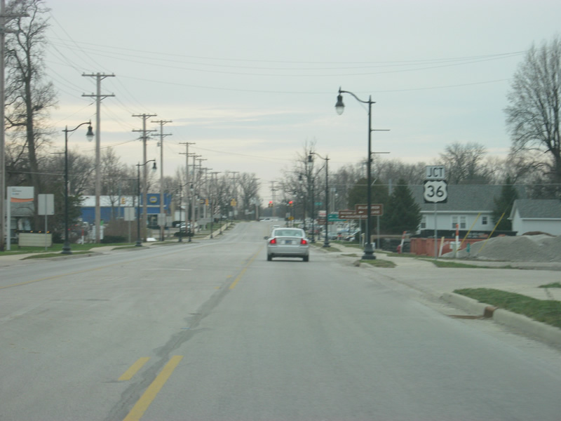
| A view of U.S. 41 (Lincoln Road) to the south of the Howard Avenue intersection. More commercial businesses abut the sides of U.S. 41 (Lincoln Road) as the highway approaches the intersection with U.S. 36 (Ohio Street). 12/03/11 |
|
| U.S. 41 (Lincoln Road) nears the intersection with U.S. 36 (Ohio Street), a 1,141 mile highway that goes from the Rocky Mountain National Park in Colorado to Uhrichsville, Ohio. 12/03/11 |
|
| U.S. 36 (Ohio Street) spans Indiana along a 139 mile path that begins west of the town of Dana and continues east through Rockville, Danville, Indianapolis and Pendleton before leaving for Ohio outside of Lynn. The Ernie Pyle State Memorial is about 14 miles to the west in Dana while Raccoon Lake State Recreational Area is about nine miles to the east of Rockville. U.S. 36 is about 60 miles away from the state capital of Indianapolis while Montezuma is only 7 1/2 miles away to the west. 12/03/11 |
|
| U.S. 36 (Ohio Street) connects U.S. 41 (Lincoln Road) with the Rockville business district, only a five blocks to the east, and the Parke County Courthouse located at the intersection of U.S. 36 (Ohio Street) and Market Street. Traffic can get heavy in this area around the time of the Parke County Covered Bridge Festival. 12/03/11 |
|
| U.S. 41 makes a turn toward the southwest as it departs the community of Rockville. Terre Haute is now the next community that U.S. 41 will travel through and is 25 miles away. Evansville is still 138 miles off. 12/03/11 |
|
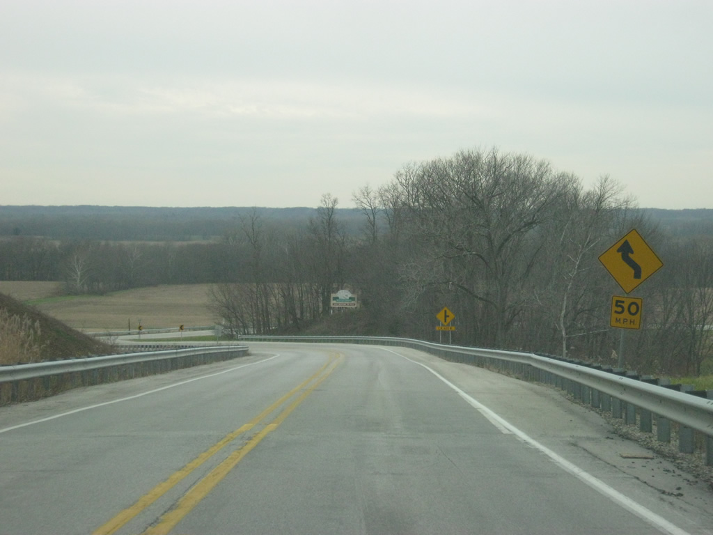
| U.S. 41's path southwest from Rockville consists of winding roads as it passes through the valley of the Big Raccoon River. U.S. 41 is a major route for those in Rockville who head toward the communities of Clinton and Terre Haute for major services, but otherwise is still lightly traveled as it goes through some valleys and plains toward the southwest. 12/03/11 |
|
| U.S. 41 crosses Coxville Road, which leads to the town of Mecca a mile to the north and Rosedale several miles to the south near the Parke-Vigo County line. 12/03/11 |
|
| Southwest of the Coxville Road intersection, U.S. 41 descends from the series of hills and valleys into the larger valley of the Wabash River. From this point, U.S. 41 follows the edge of this bluff toward the south. 12/03/11 |
|
| U.S. 41 nears the junction with SR 163 west. Among the shorter of Indiana highways, SR 163 goes for only nine miles from its eastern end at U.S. 41 to the west across the Wabash River and into the town of Clinton. From there it continues for another few miles through the town of Blanford and to the Illinois border. 12/03/11 |
|
| A Y-junction forms the intersection between U.S. 41 and SR 163. The city of Clinton, the largest community in both Vermillion and Parke Counties, is only one mile to the west across the Wabash River. The SR 63 expressway is two more miles beyond that. Traffic continuing to Terre Haute is directed toward the right to continue on U.S. 41. 12/03/11 |
|
| SR 163 turns off to the west toward the city of Clinton. At one time before the construction of the SR 63 expressway; the state highway had overlapped with U.S. 41 from this point south into Terre Haute. From here, SR 63 turned west along SR 163's current path into Clinton where it would proceed to the north along its original routing across Vermillion County. So in older times this was the main route from Terre Haute to Clinton. 12/03/11 |
|
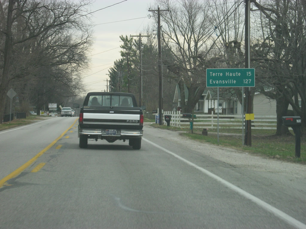
| Terre Haute gets closer at a distance of only 15 miles. Evansville is 127 miles away, about a 2 1/2 hour drive from this point. Furthermore, Evansville will not get mentioned as a control city again along U.S. 41 until Vincennes. 12/03/11 |
|
| South of the junction with SR 163 and the small town of Lyford, U.S. 41 passes underneath the CSX (formerly Louisville & Nashville) railroad track, which is a major rail corridor that stretches from Evansville north to Chicago. 12/03/11 |
|
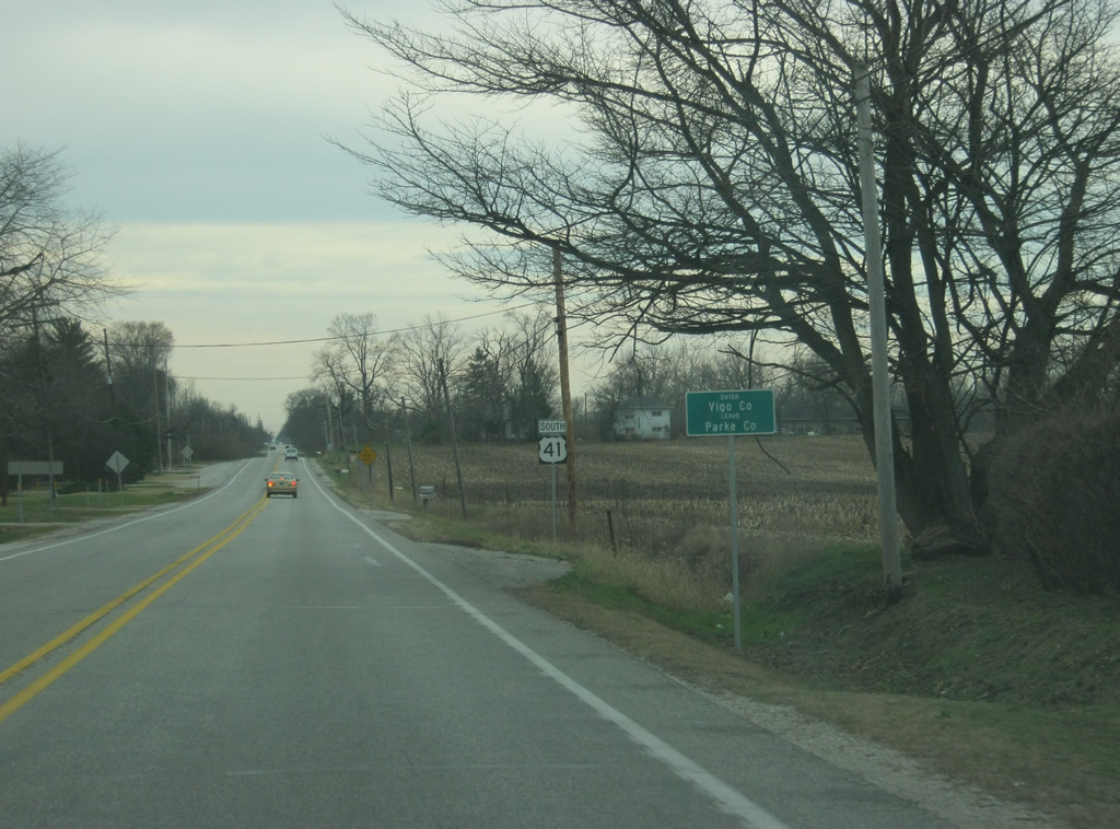
| U.S. 41 enters Vigo County (population 107,848). Vigo County is the most populous county that U.S. 41 travels through in between Evansville and Chicago. 12/03/11 |
Page Updated 04-29-2013.