|
| U.S. 50 remains in the woods for the first mile into Ripley County. The Big Oaks National Wildlife Refuge, formerly the Jefferson Proving Grounds, lies to the south of the highway. 12/18/11 |
|
| Leaving the forest, U.S. 50 enters the town of Holton. 12/18/11 |
|
| Scenes of U.S. 50 as it passes through Holton. As with some of the other communities along the highway, U.S. 50 bypasses the heart of town to the immediate south. 12/18/11 |
|
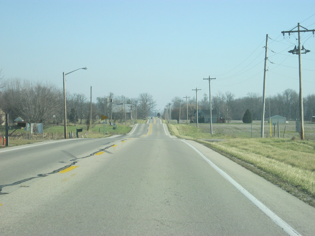
| East of Holton, U.S. 50 follows a straight path to the east along the baseline of Ripley County en route to the city of Versailles. 12/18/11 |
|
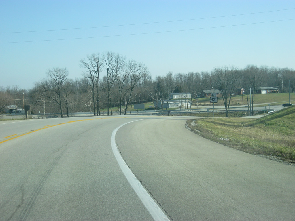
| U.S. 50 turns toward the southeast as it approaches the junction with U.S. 421 north. U.S. 421 travels for 941 miles from Michigan City to the north to Wilmington, North Carolina to the south. 12/18/11 |
|
| U.S. 50 enters the city of Versailles (population 2,113), the county seat of Ripley County. Up ahead is the signalized intersection with U.S. 421 north, which heads to Osgood, Greensburg, Shelbyville, Indianapolis, Frankfort, Delphi, Monticello and Michigan City as part of its 232 mile trek across Indiana. 12/18/11 |
|
| Now at the intersection of U.S. 50 east and U.S. 421 north. Originally, this junction was a wye-intersection between the three legs that meet here, but the intersection was reconfigured to a tee-intersection in the 2000s. 12/18/11 |
|
| U.S. 50 east & 421 south combine 19 miles from Aurora and 24 miles from Lawrenceburg. Madison, reached by taking U.S. 421 south, is 28 miles away. In Versailles, U.S. 50 is also known as Perry Street. 12/18/11 |
|
| Light retail abuts U.S. 50 & 421 (Perry Street) on the west side of Versailles. As with both Jackson and Jennings County, Versailles is also not the largest community in the county despite being the county seat. Batesville, located about 15 miles to the north along Interstate 74, is the county's biggest settlement. 12/18/11 |
|
| Up ahead is the junction with SR 129 south (Adams Street). SR 129 goes for almost 32 miles from Vevay in Switzerland County north to Batesville at SR 46. 12/18/11 |
|
| Approaching the next signalized intersection, U.S. 421 will head south, while SR 129 north will combine with U.S. 50 to the east. 12/18/11 |
|
| Clifty Falls State Park can be reached by taking U.S. 421 south to Madison, while Versailles State Park can be reached by continuing east on U.S. 50 for a mile outside of town. 12/18/11 |
|
| U.S. 421 branches southward from U.S. 50 east alongside SR 129 while Adams Street leads north from Perry Street into Downtown Versailles. Historic Madison can be reached by taking U.S. 421 south of here for about 25 miles. 12/18/11 |
|
| A close up of the U.S. 50 and U.S. 421 shields at the intersection of Perry and Adams Street in central Versailles. U.S. 50 stays south of Downtown with SR 129 north to exit the city. 04/03/10 |
|
| East of the split with U.S. 421 (Adams Street) south, U.S. 50 east & SR 129 (Perry Street) bend southeastward to leave Versailles. The pair will descend into the valley of Laughery Creek to the east of Versailles. 04/03/10 |
|
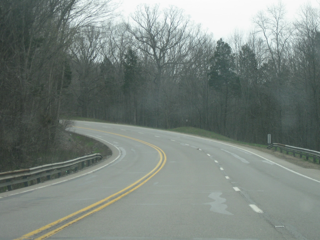
| Scenes of U.S. 50 & SR 129 as they wind their way through the Laughery Creek valley to the south of Versailles State Park. Versailles Lake within the state park was created by damming the creek to the north of the highway. Truck climbing lanes exist in both directions of travel as the tandem ascend 200 feet in elevation from the valley. 04/03/10 |
|
| Beyond Laughery Creek valley, U.S. 50 approaches the split with SR 129 north. From here, SR 129 continues north to Delaware and Batesville while U.S. 50 continues solo toward Dearborn County. 04/03/10 |
|
| East of the junction with SR 129 north, U.S. 50 is four miles from the community of Dillsboro and 18 miles from Lawrenceburg. 04/03/10 |
|
| East of the junction with SR 129 north, U.S. 50 passes the intersection with SR 101, serving the towns of Milan and Sunman. Milan is best known for being the home of the 1954 Milan Indians basketball team that won the state championship, inspiring the movie Hoosiers. 04/03/10 |
|
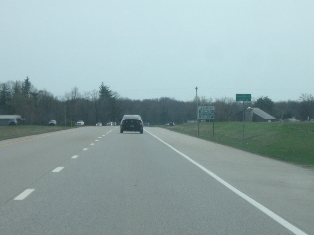
| Beyond SR 101, U.S. 50 expands to a four lane expressway that leads all the way to the Ohio state line. U.S. 50 enters Dearborn County (population 50,047) along this stretch.
Dearborn County is the furthest west county of the Cincinnati Metropolitan area. 04/03/10 |
|
| Up ahead is the community of Dillsboro. U.S. 50 bypasses Dillsboro to the north along a four lane highway while Bank Street southeast to SR 62 represents the former in-town alignment. 04/03/10 |
|
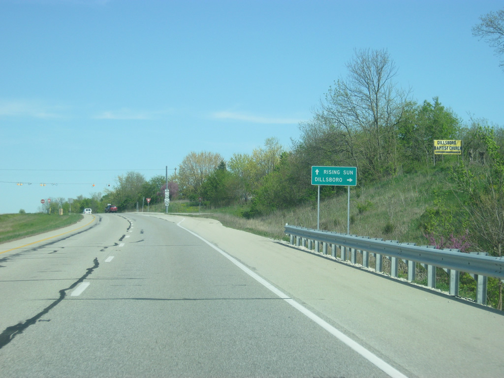
| SR 262 concludes at U.S. 50 on the east side of Dillsboro. The state road totals 15 miles from here to Rising Sun. 04/08/12 |
|
| Station Hollow Road ties into the intersection of U.S. 50 and SR 262 from Dillsboro Station to the north. 04/08/12 |
|
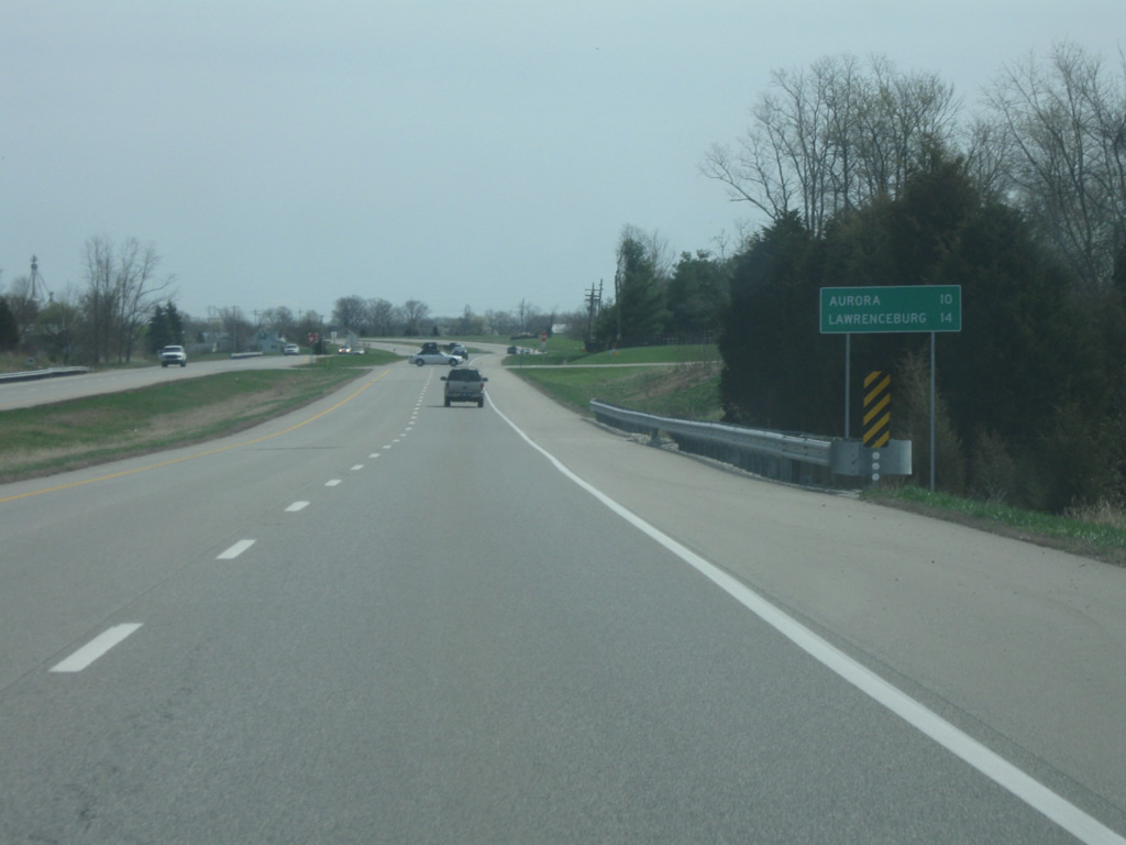
| East of Dillsboro and the junction with SR 262, Aurora is now ten miles away with Lawrenceburg being 14 miles away. 04/03/10 |
|
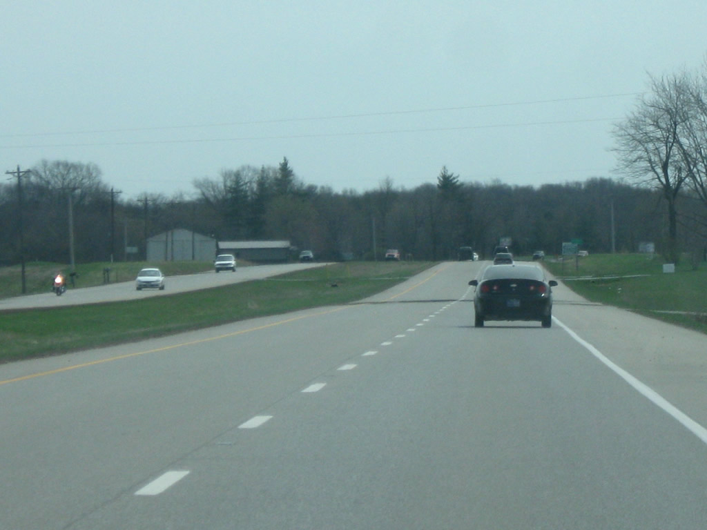
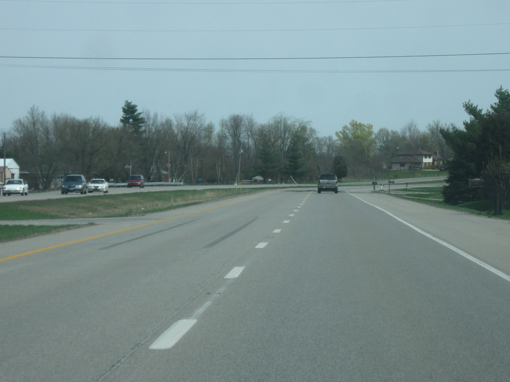
| East of Dillsboro, U.S. 50 follow the hills of Dearborn County along Mt. Tabor Ridge on an easterly course to Aurora. 04/03/10 |
|
| U.S. 50 was widened to four lanes to better handle the traffic that uses it from Ripley County and Dearborn County to Interstate 275 and Cincinnati, Ohio. 04/03/10 |
|
| Now approaching Aurora, U.S. 50 descends into the valley of the Ohio River providing for a dramatic entrance into the Aurora-Lawrenceburg-Greendale urban conglomeration that follows U.S. 50 north to the Ohio state line. 04/03/10 |
|
| Entering the city of Aurora (population 3,965) along U.S. 50 east ahead of the intersection with SR 56 east and 350 west. The US highway now takes on the name of Green Boulevard.
SR 56 follows the Ohio River from U.S. 50 south to Rising Sun, Vevay, Madison, Scottsburg, Paoli and Jasper before ending its 194 mile journey at U.S. 41 in Gibson County. SR 350 goes for 23 miles west to Milan and Osgood. 04/03/10 |
|
| U.S. 50 (Green Boulevard) east at the intersection of SR 56 (Importing Street) east and SR 350 west. Downtown Aurora is to the immediate east of this intersection along SR 56, which takes several streets before leaving town heading south along the Ohio River. The Rising Star Casino in Rising Sun can be reached by taking SR 56 south for about ten miles.
SR 350 continues west out of Aurora and past the South Dearborn Middle and High Schools complex on its way to Milan. 04/03/10 |
|
| Heading toward Lawrenceburg, U.S. 50 (Green Boulevard) starts to take more of a northerly trajectory. A few blocks north of the SR 56 east and SR 350 west intersection, the intersection for SR 148 (Sunnyside Avenue) approaches. SR 148 goes for five miles to connect U.S. 50 with SR 48 to the north. 04/03/10 |
|
| North of the SR 148 junction, U.S. 50 enters the city of Lawrenceburg (population 5,042) and becomes Eads Parkway. 04/03/10 |
|
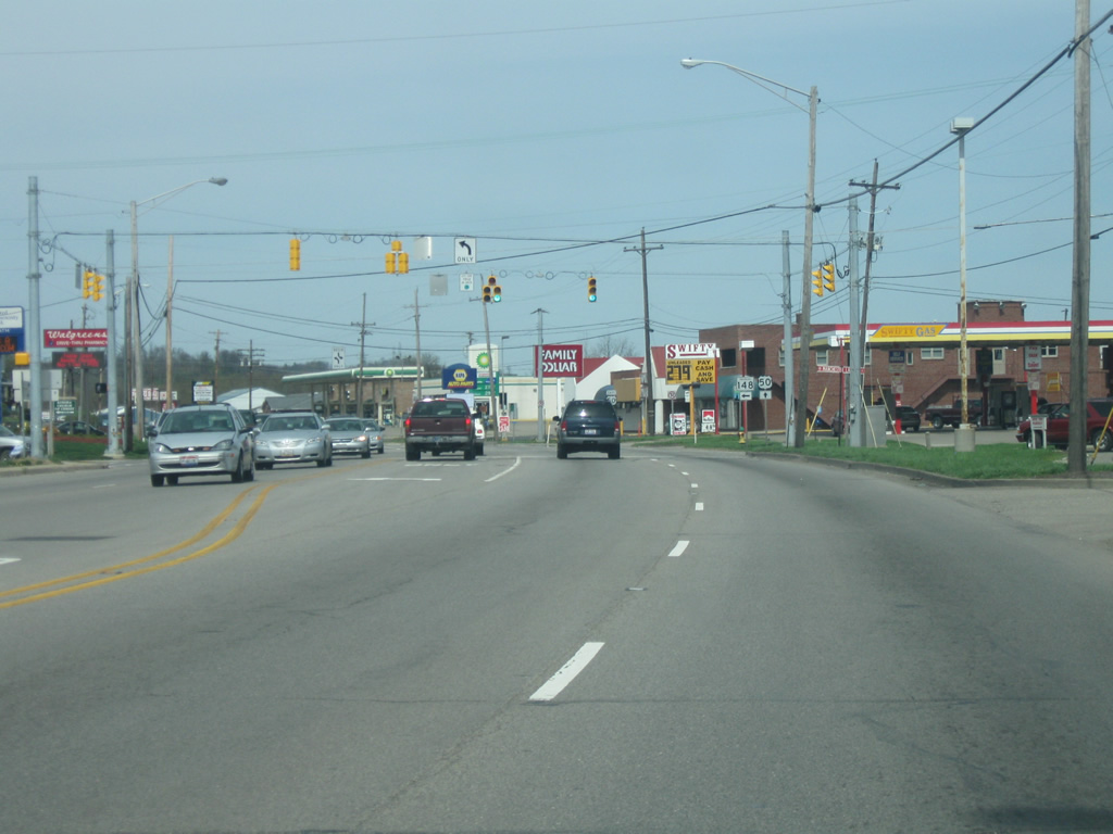
| The stretch of U.S. 50 (Eads Parkway) from Aurora to Lawrenceburg contains the majority of the retail for the Dearborn County region. 04/03/10 |
|
| Now coming up to the junction between U.S. 50 (Eads Parkway) and SR 48 west (Bielby Road). SR 48 exists in three segments with the eastern one stretching from U.S. 50 west for 33 miles to SR 229 in Napoleon. SR 48 originally winded its way up a series of hills from U.S. 50 (Eads Parkway) to the Dearborn County Hospital, but was rebuilt to follow a straight path to the south through rock cuts down to U.S. 50 (Eads Parkway). 04/03/10 |
|
| East of the junction with SR 48 west, U.S. 50 (Eads Parkway) is one mile away from the center of Lawrenceburg and 26 miles from Downtown Cincinnati. The forthcoming traffic light connects with Doughty Road, which winds its way onto Ludlow Hill as the former alignment of State Road 48. 04/03/10 |
|
| East of Doughty Street (former SR 48), U.S. 50 (Eads Parkway) approaches the bridge across Tanners Creek ahead of the Lawrenceburg street grid. There are plans to construct a new bridge across the creek and adjacent railroad tracks along U.S. 50 east to match the completed westbound span. The eastbound span has yet to be constructed as of 2013. 04/03/10 |
|
| On the other side of the crossing over Tanners Creek, the westbound lanes rejoin U.S. 50 (Eads Parkway) at the Front Street intersection. 04/03/10 |
|
| U.S. 50 (Eads Parkway) goes through the northern part of Lawrenceburg as it approaches the intersection with Walnut Street. Walnut Street spurs southeast through Downtown Lawrenceburg to the Ohio River riverfront. Lawrenceburg High School is located to the west of U.S. 50 (Eads Parkway) at Walnut Street via Stadium Lane. 04/03/10 |
|
| Past the Walnut Street intersection, U.S. 50 (Eads Parkway) angles to the north and passes by the Arch Street intersection. 04/03/10 |
|
| Outside of the heart of Lawrenceburg, U.S. 50 (Eads Parkway) approaches Hollywood Boulevard. Hollywood Boulevard leads to the Hollywood Casino Lawrenceburg, which was the closest casino to the Cincinnati area until the March 4, 2013 opening of downtown Cincinnati's Horseshoe Casino. 04/03/10 |
|
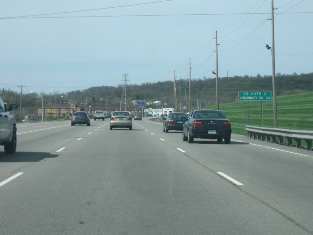
| North of Hollywood Boulevard, U.S. 50 (Eads Parkway) enters the city of Greendale (population 4,520). Greendale is the last community U.S. 50 serves in the state of Indiana. North of Hollywood Boulevard, U.S. 50 (Eads Parkway) becomes six lanes in width as it approaches the junction with Interstate 275. 04/03/10 |
|
| Interstate 275 is two miles away from this point where Cincinnati is 24 miles away along U.S. 50. Going for 83.71 miles, Interstate 275 serves as the beltway for the Cincinnati Metropolitan Area and is the longest loop interstate in the country. Interstate 275 goes for only three miles in Indiana, serving only this interchange. 04/03/10 |
|
| A few shopping centers and restaurants serve the area around the interchange between U.S. 50 (Eads Parkway) and Interstate 275. 04/03/10 |
|
| The two right lanes on U.S. 50 (Eads Parkway) eastbound turn into the entrance ramp for the trumpet interchange with Interstate 275. To the west, the road becomes SR 1, a 137 mile highway that goes from Greendale north to Fort Wayne. U.S. 50 continues as a four lane highway east across the Ohio state line into Hamilton County as it heads toward Cincinnati, Ohio. 04/03/10 |
|
| North of the junction with Interstate 275 & SR 1 north, U.S. 50 (Eads Parkway) is mere miles from the Ohio state line. Cleves is six miles out while Downtown Cincinnati is 23 miles away. 04/03/10 |
|
| U.S. 50 (Eads Parkway) is a four lane undivided highway as it follows Interstate 275 northeastward toward the Ohio border. 04/08/12 |
|
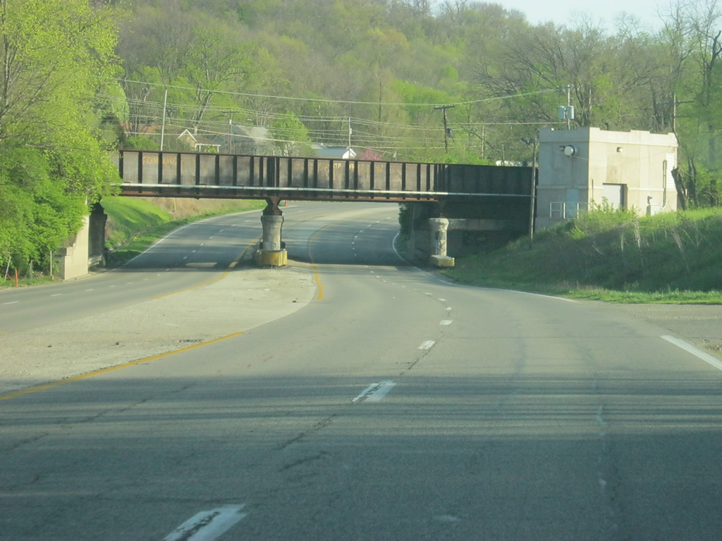
| U.S. 50 (Eads Parkway) passes underneath the CSX Railroad tracks ahead of Oberting Road, a former alignment of U.S. 50. 04/08/12 |
|
| U.S. 50 (Eads Parkway) finishes its journey across Indiana at the intersection with State Line Road, which heads north along the Indiana-Ohio state line before turning back to the northwest to the community of Bright. At the stoplight, U.S. 50 crosses into Hamilton County, Ohio. 04/08/12 |
Page Updated 08-13-2013.

 east
east