|
| The first shield for U.S. 51 north stands just north of U.S. 61 and across from Riverwood shopping center. 05/09/15 |
|
| U.S. 51 north of U.S. 61 from 16 years prior. This stretch of U.S. 51 opened in 1986.1 11/06/99 |
|
| The five lane arterial of U.S. 51 ventures northeast through LaPlace by a number of strip malls and subdivisions. 05/09/15 |
|
| Woodland Drive connects U.S. 51 with several subdivisions and a business park to the south of Interstate 10. 05/09/15 |
|
| A diamond interchange joins U.S. 51 with Interstate 10 on the northeastern outskirts of LaPlace. 05/09/15 |
|
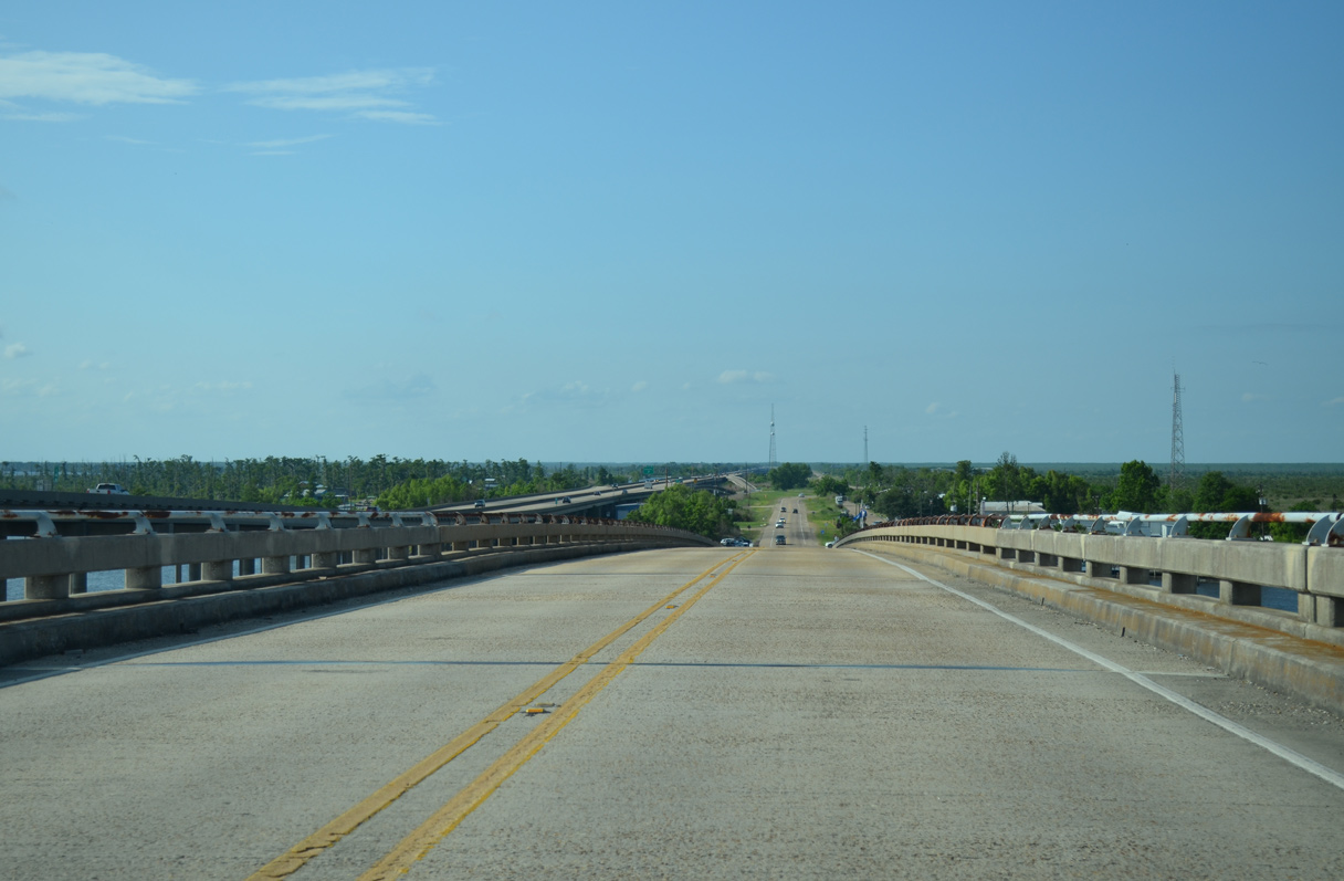
| Motorists turning onto Interstate 10 east from U.S. 51 enter a 10.3 mile exit less stretch to Interstate 310. The entire drive east to Kenner along I-10 is elevated over wetland areas or waters of Lake Pontchartrain. 05/09/15 |
|
| U.S. 51 north provides the connection for eastbound drivers along I-10 bound for Interstate 55 north. 05/09/15 |
|
| Interstate 10 continues beyond LaPlace across swamp land to Sorrento, where the freeway turns northwest toward Baton Rouge. 05/09/15 |
|
| U.S. 51 expands to a four lane divided highway between Interstates 10 and 55. A truck stop plaza occupies the space between the converging freeways. 05/09/15 |
|
| The Interstate 55 mainline passes over U.S. 51. A half diamond interchange provides access from I-55 south to U.S. 51 south for the connection with I-10 west. 05/09/15 |
|
| Approaching the left turn of U.S. 51 north onto the adjacent Interstate 55 viaduct. Old U.S. 51, referenced simply as Frontage Road here, continues northward at grade to Manchac. 05/09/15 |
|
| U.S. 51 follows the northbound on-ramp from Old U.S. 51 opposite Frenier Road. I-55/U.S. 51 continue together north to Exit 26 outside Hammond. 05/09/15 |
|
| Old U.S. 51 quickly reduces from four to two lanes as it travels north alongside an abandoned railroad line. Further north at Rudduck, a Canadian National Railroad accompanies the former US highway to Sharkey. 05/09/15 |
|
| Trailblazers direct motorists from Old U.S. 51 north to a diamond interchange connecting I-55/U.S. 51 with Rudduck. 05/09/15 |
|
| The predecessor shields posted at Rudduck were used for target practice. The old alignment of U.S. 51 extends from the abandoned settlement of Rudduck northward to Manchac. Obscured to the right is an abandoned railroad line. 11/06/99 |
|
| A high rise bridge takes Old U.S. 51 across Pass Manchac between the settlements of Galva and Manchac. 05/09/15 |
|
| The Interstate 55/U.S. 51 viaducts appear nearby as Old U.S. 51 north lowers to Manchac. A restaurant, church and fish camp line the route nearby. 05/09/15 |
|
| A diamond interchange (Exit 15) connects Old U.S. 51 with I-55/U.S. 51 just north of Pass Manchac and the Tangipahoa Parish line. 11/20/08 |
Page Updated 10-04-2016.

 North
North