|
| Wis 29 west merges with U.S. 51 north for 3.3 miles to the Big Rib River. County N (Rib Mountain Drive) ties into the overlap at the first of two exits by Rib Mountain. 06/15/15 |
|
| U.S. 51/Wis 29 separate a residential street grid just to the west of Lake Wausau to the diamond interchange (Exit 188) with County N (Rib Mountain Drive). CTH-N heads south then west initially as an arterial (South Mountain Road) before transitioning into a rural two lane road due west across Marathon County to Wien and Colby. 06/15/15 |
|
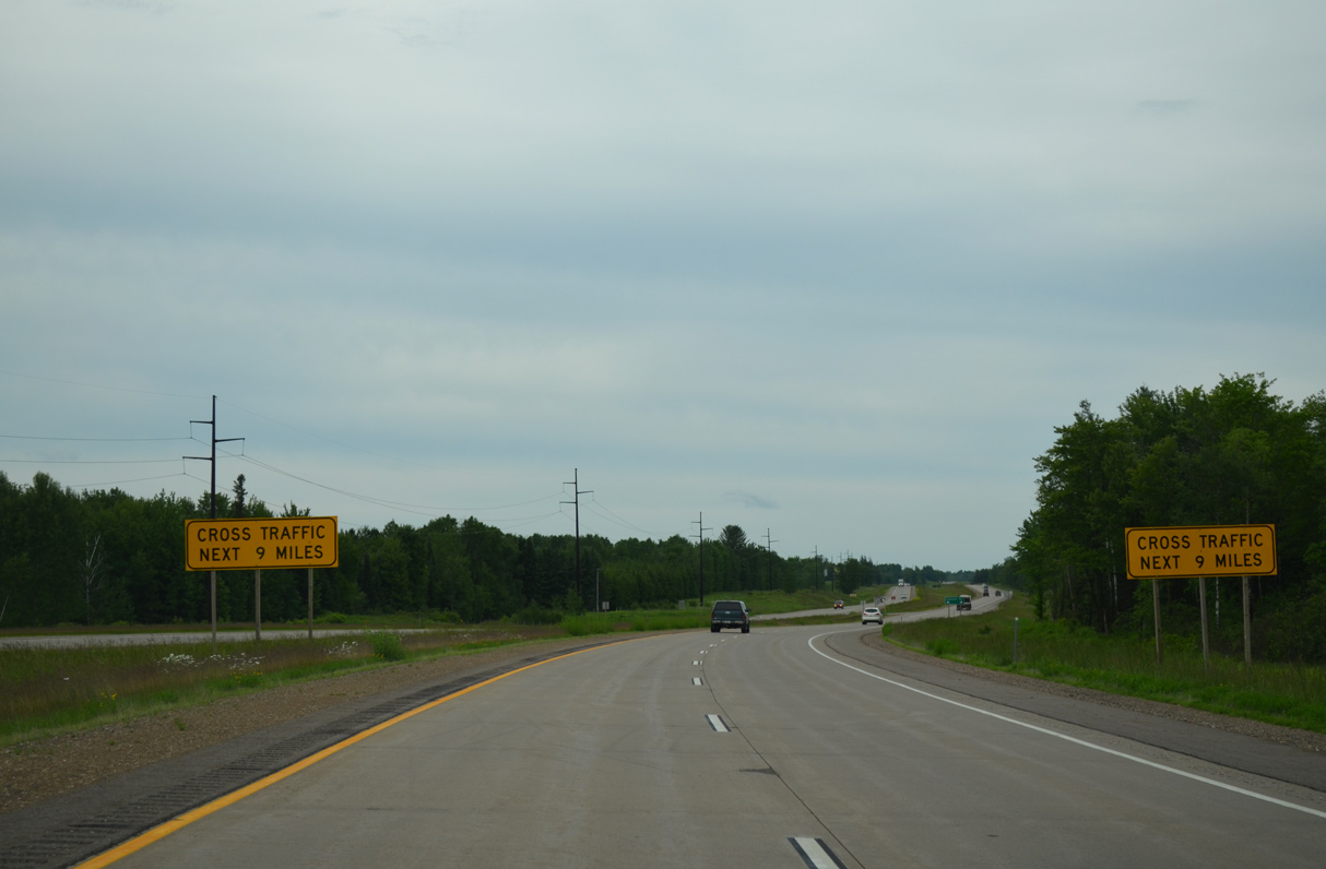
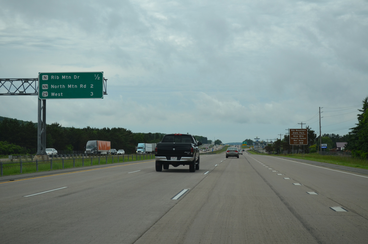
| Interchange sequence sign posted three miles ahead of the U.S. 51 north and Wis 29 west split. Forthcoming Exit 188 serves interests to both Rib Mountain State Park (via Park Road west) and Nine Mile County Forest Recreation Area (via CTH-KK south). 06/15/15 |
|
| Lilac Avenue extends north from Lakeshore Drive as the frontage road to the freeway along U.S. 51/Wis 29 beside this shield assembly. 06/15/15 |
|
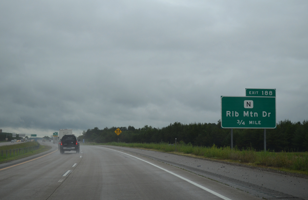
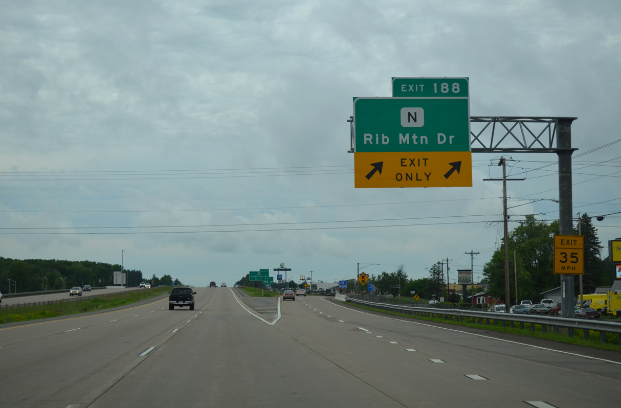
| County N ends at Exit 188 from the southwest. Rib Mountain Road continues north through a commercial strip anchored by several big box stores to North Mountain Road. 06/15/15 |
|
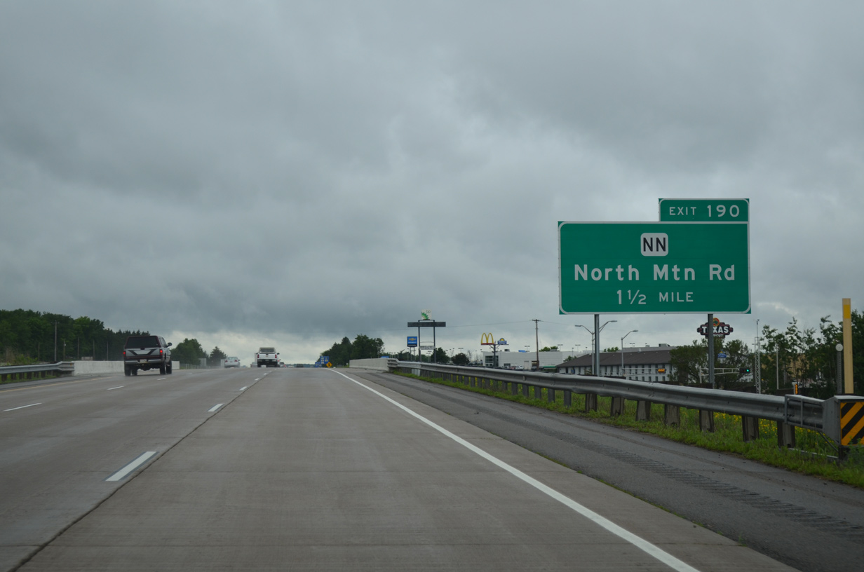
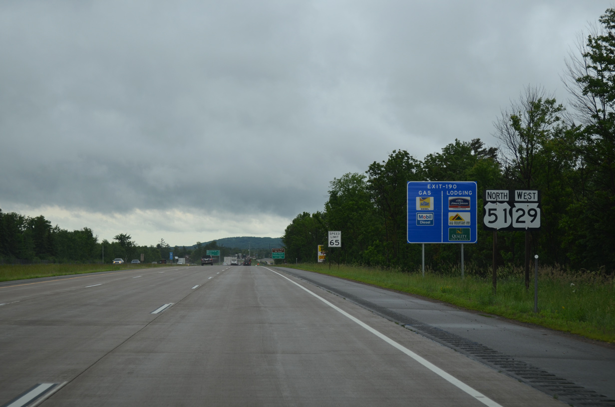
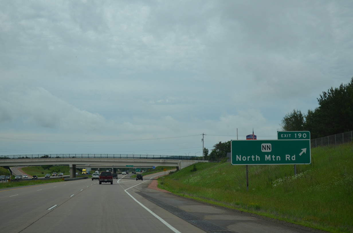
| Advancing north, U.S. 51/Wis 29 next meet County NN (North Mountain Road) at Exit 190 in one mile. 06/15/15 |
|
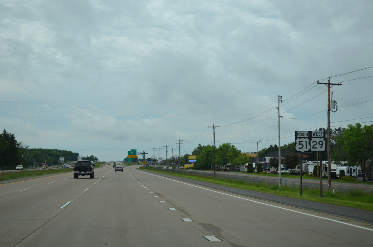
| Confirming shields for U.S. 51/Wis 29 posted west of the adjacent retail area on Rib Mountain Drive. 06/15/15 |
|
| County R (Hummingbird Road) parallels the west side of the freeway between Exits 188 and 190. The approaching diamond interchange serves Granite Peak Ski Area via CTH-NN west. 06/15/15 |
|
| Like CTH-N, CTH-NN begins at U.S. 51/STH-29. The trunk highway parallels the Big Rib River and Wis 29 freeway corridor west to Marathon City. North Mountain Road east links Exit 190 with Rib Mountain Drive (old County N) north to 17th Avenue in Wausau. 06/15/15 |
|
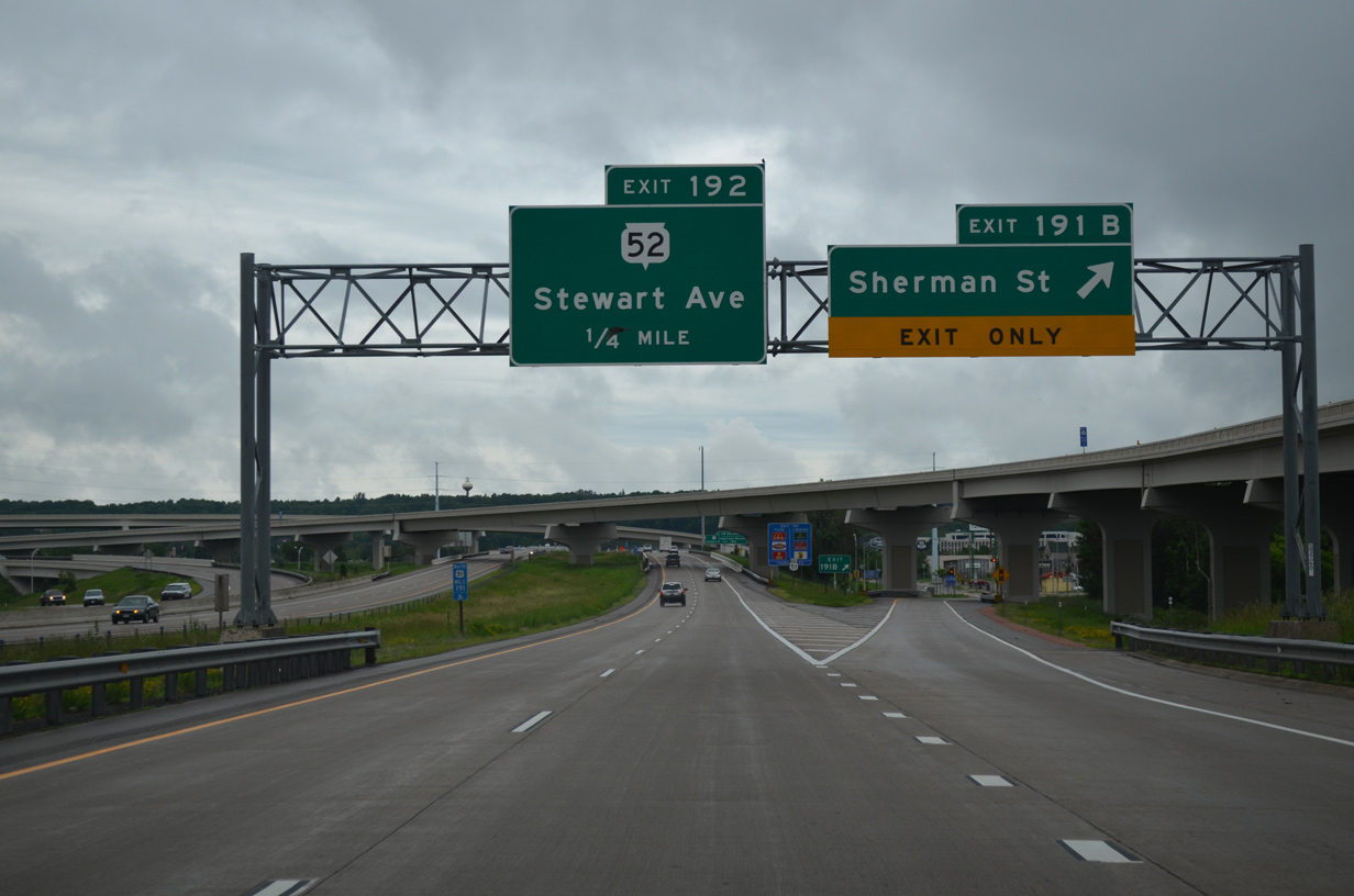
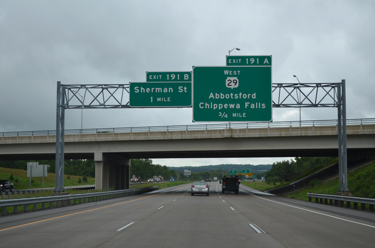
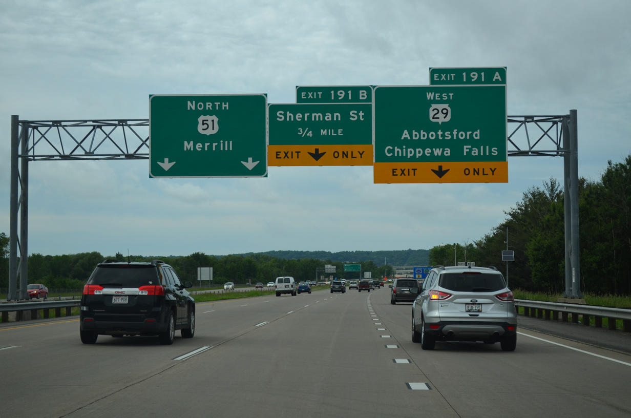
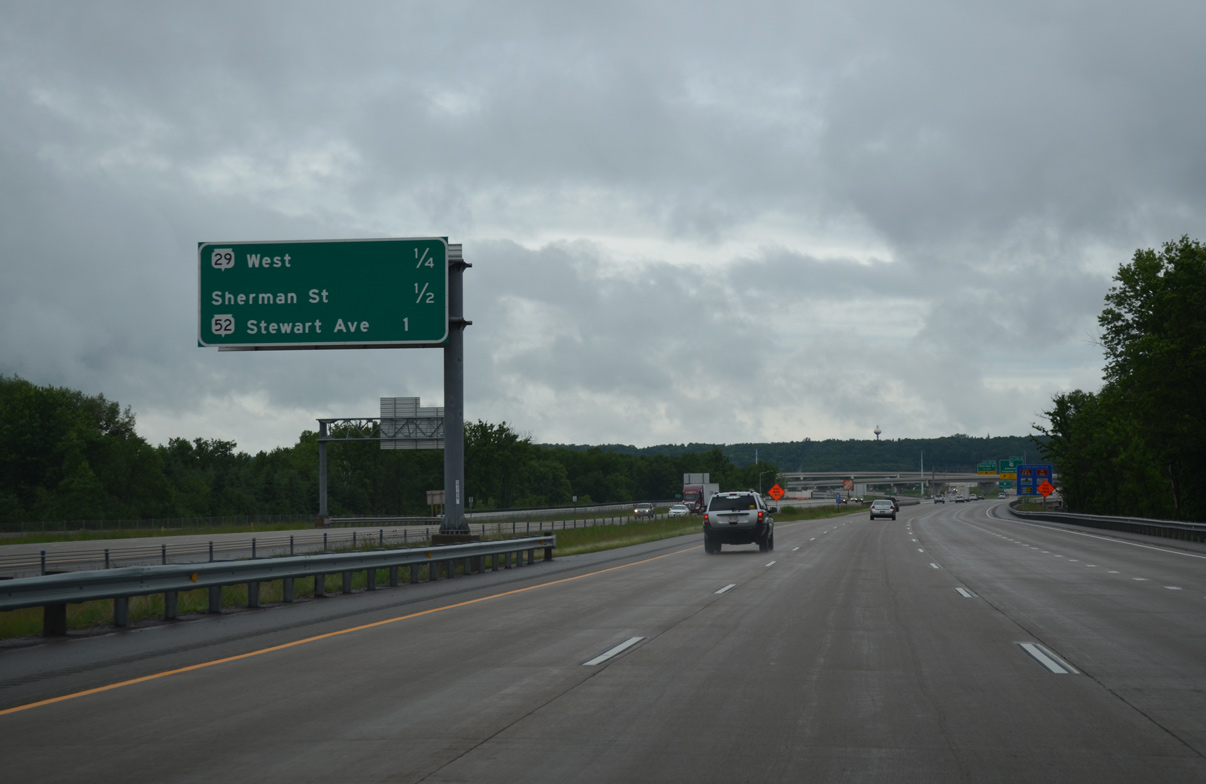
| Wis 29 branches west from U.S. 51 north in 0.75 miles at a directional T interchange (Exit 191B). Completed in 2010, the US 51/WIS 29 project added the systems interchange at Exit 191A to replace the previous connection with Wis 29 west via the diamond interchange (Exit 192) with Stewart Avenue (Wis 52). 06/15/15 |
|
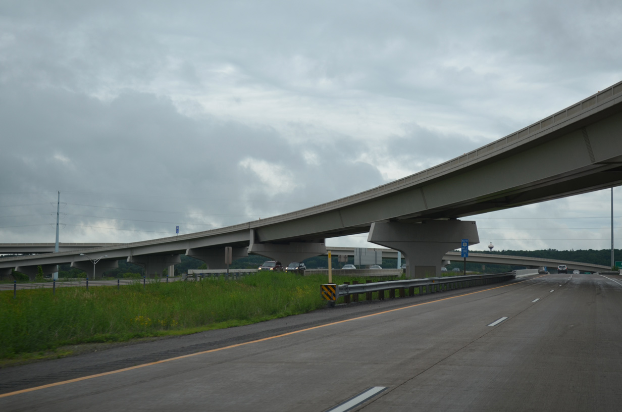
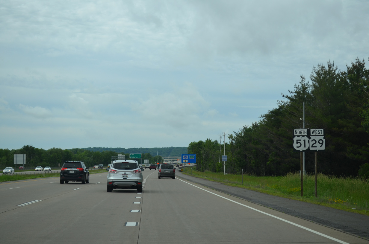
| U.S. 51/Wis 29 expand to eight overall lanes to their split at the Big Rib River bridge. Wis 29 resumes a westward heading along a freeway to Marathon City and expressway corridor to Chippewa Falls, Eau Claire and I-94 at Elk Mound. 06/15/15 |
|
| The final set of shields for the U.S. 51/STH-29 overlap. CTH-R remains just to the west along Hummingbird Road to 28th Avenue in Wausau. 06/15/15 |
|
| The half diamond interchange (Exit 191A) with Sherman Street predates the systems interchange with the departing Wis 29. Sherman Street spurs west to industrial businesses south of Wis 29 and east into the Wausau street grid. 06/15/15 |
|
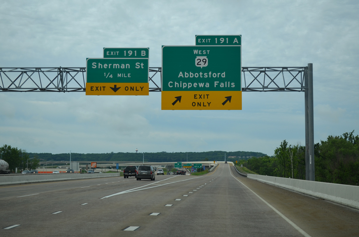
| A high speed flyover takes motorists onto Wis 29 west for the 32 mile drive to Abbotsford. This ramp opened in 2008.
Exit 191B quickly follows for Sherman Street. 06/15/15 |
|
| The Sherman Street exits serves adjacent big box retail with connections to the commercial strip along Stewart Avenue. Wis 52 overtakes Stewart Avenue east from upcoming Exit 192 to a one way street couplet into Downtown Wausau. 06/15/15 |
|
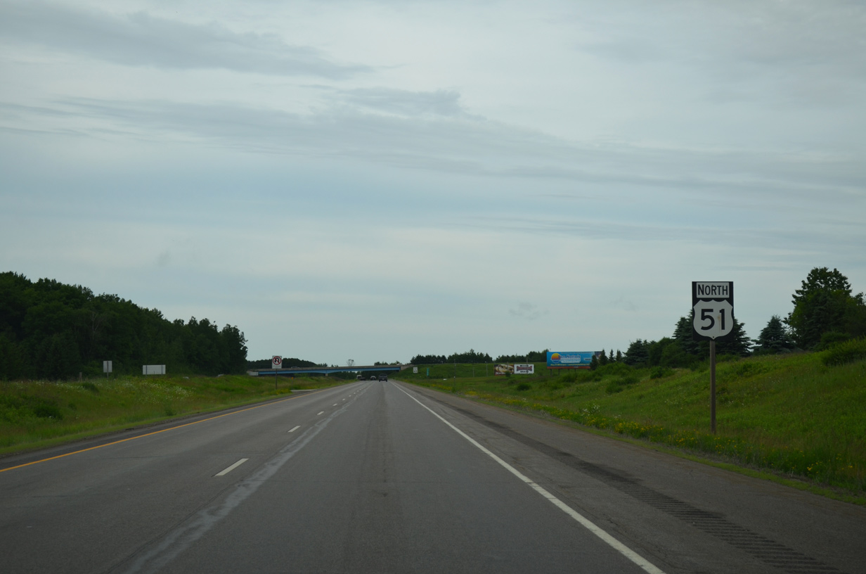
| U.S. 51 travels solo for the final 125 miles of the route north to U.S. 2 at Hurley. 06/15/15 |
|
| The flyover for Wis 29 passes overhead as Sherman Street passes below U.S. 51 north. 06/15/15 |
|
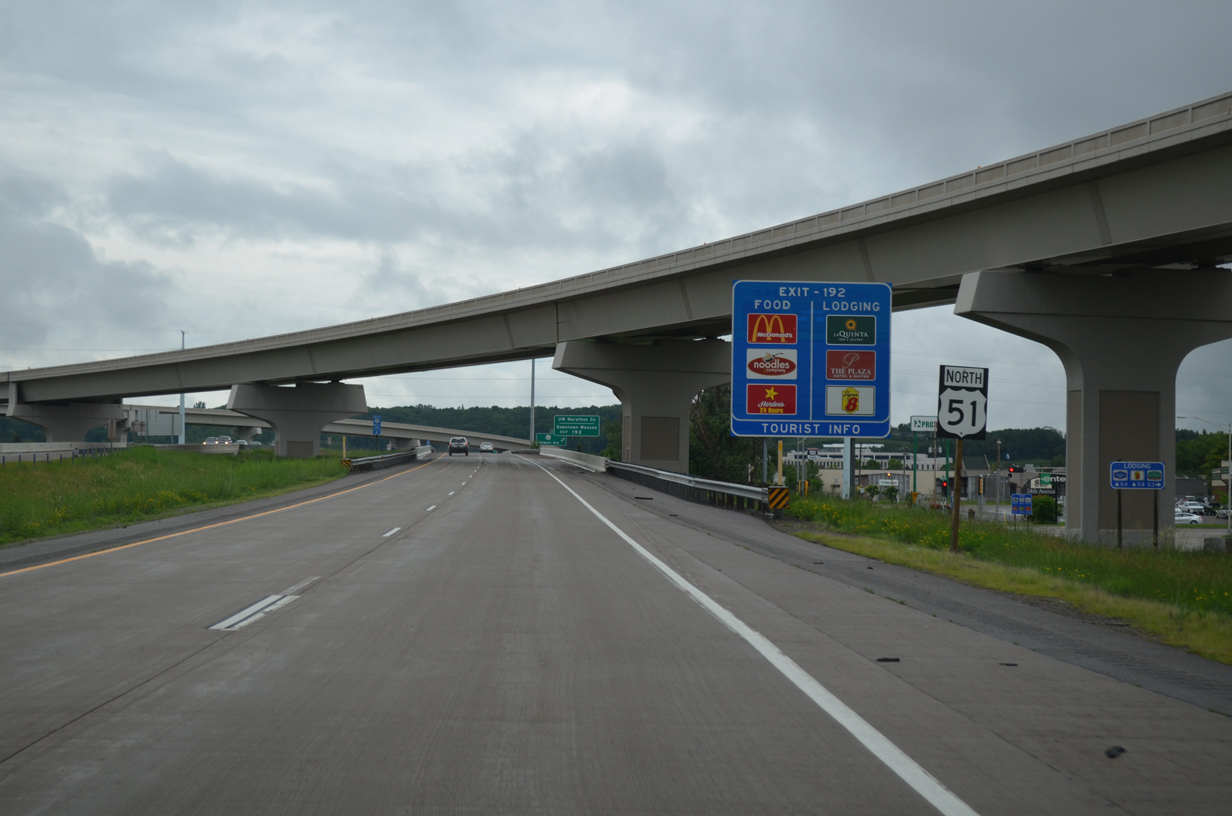
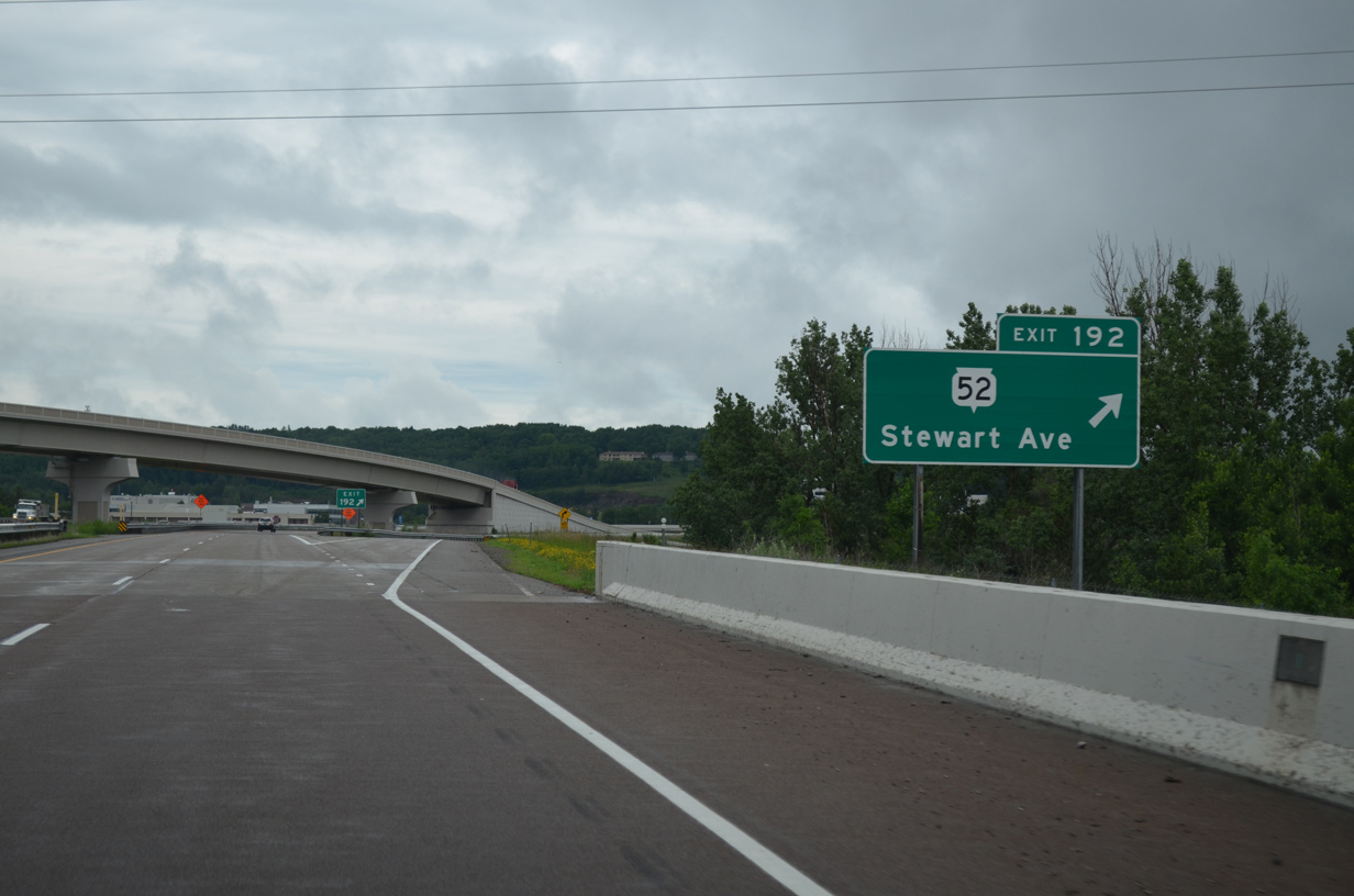
| Exit 192 departs U.S. 51 north as the freeway crosses above a Canadian National Railroad line. Wis 52 begins a 75 mile route from an adjacent wye interchange with Wis 29. The trunk highway joins Wausau with Wis 32 in the Northwoods via Antigo. 06/15/15 |
|
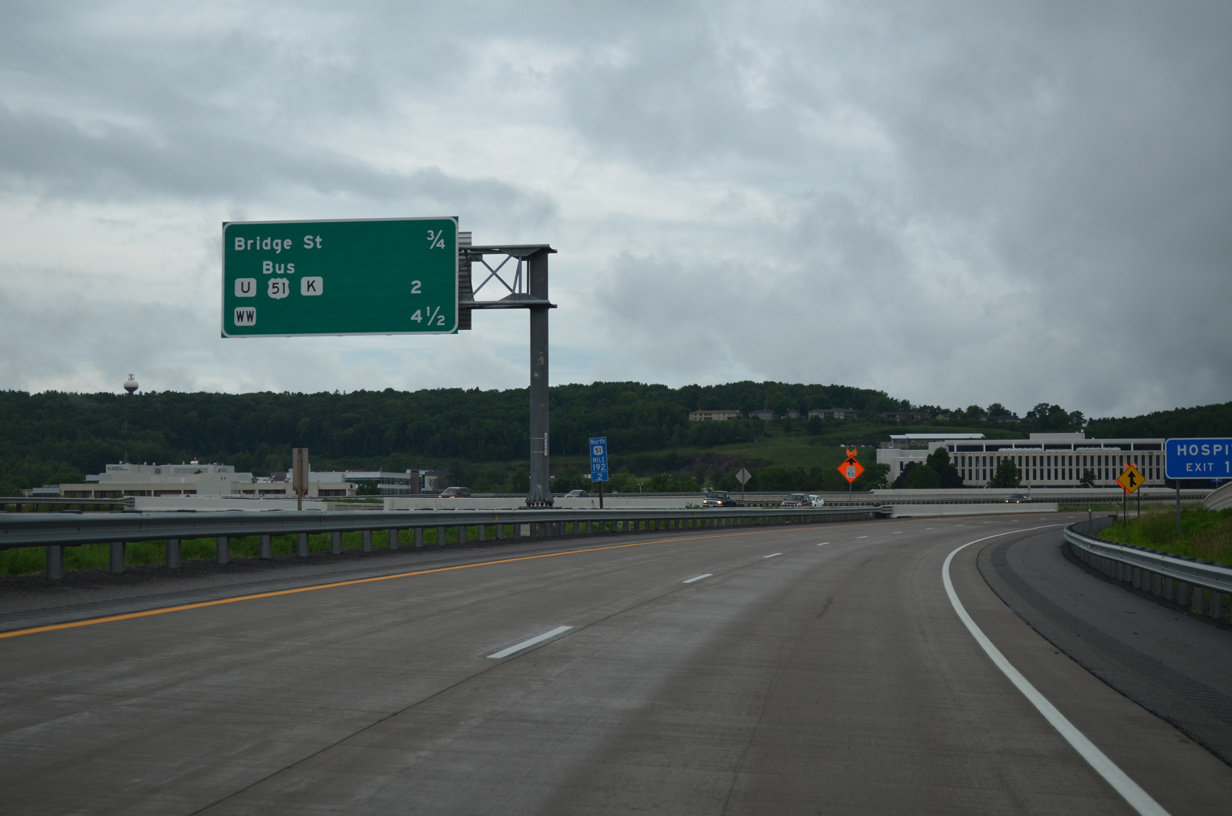
| Subsequent Wausau interchanges join U.S. 51 with Bridge Street, County U and the return of U.S. 51 Business over the ensuing two miles. 06/15/15 |
|
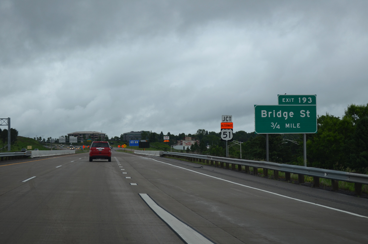
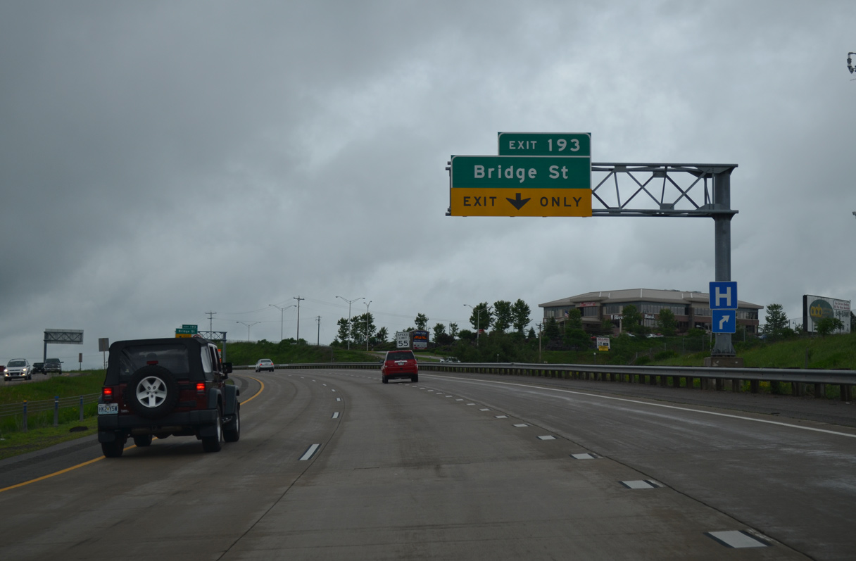
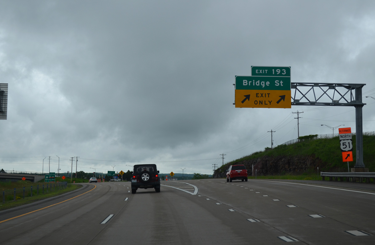
| The US 51/WIS 29 project rebuilt the freeway north to the diamond interchange (Exit 193) with Bridge Street. Work between October 2006 and September 2007 closed the east-west arterial and realigned it. 06/15/15 |
|
| An auxiliary lane accompanies U.S. 51 north to Exit 193. Bridge Street leads west to the Aspirus Wausau Hospital complex. 06/15/15 |
|
| Exit 193 carries two lanes from U.S. 51 north to Bridge Street. Bridge Street constitutes a four lane mostly divided boulevard east to Wis 52 (5th / 6th Streets). 06/15/15 |
|
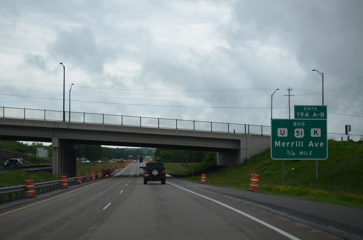
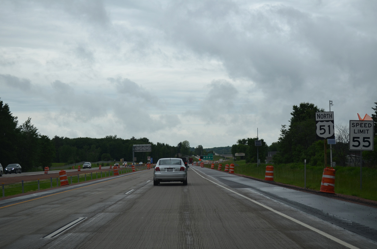
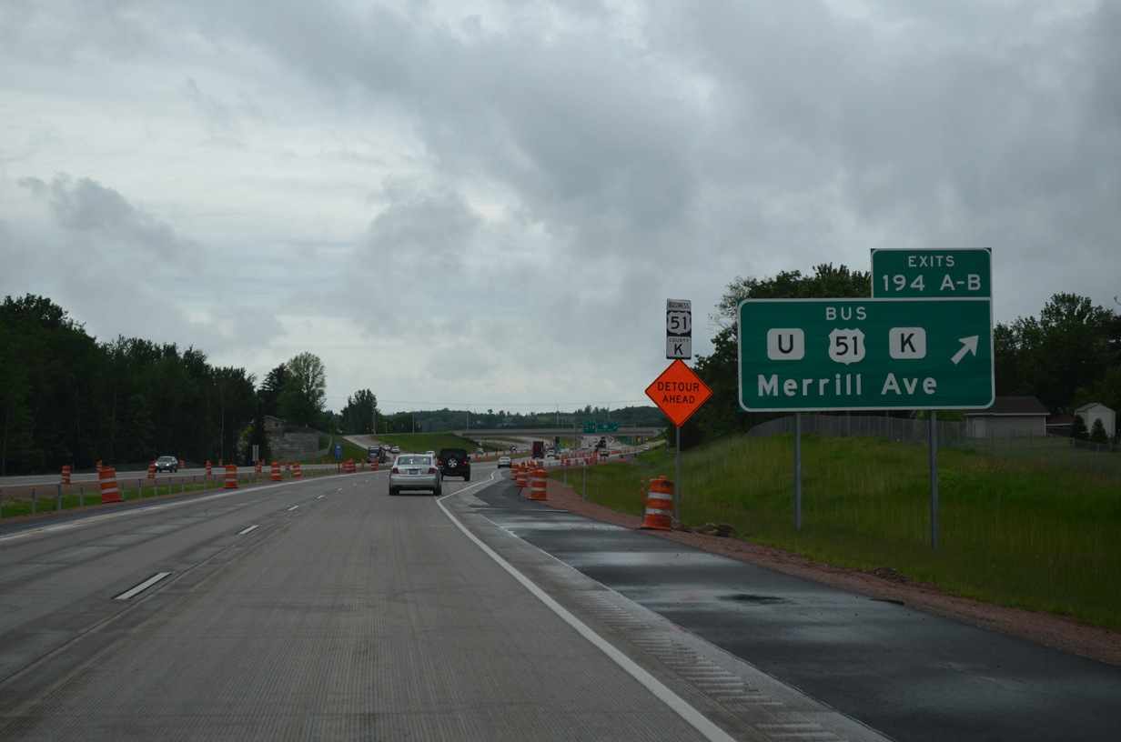
| $28 million in construction between April 1, 2013 and late June 2015 rebuilt the previous split diamond interchange (Exit 194) with County U (Merrill Avenue), U.S. 51 Business (Badger Avenue) south and County K north.1 06/15/15 |
|
| Exits 194A/B was reconfigured to utilize a northbound distributor road to a half diamond interchange with County U and a dumbbell interchange with U.S. 51 Business south and County K north. 06/15/15 |
|
| County U stems west from U.S. 51 Business (Badger Avenue) at Northcentral Technical College to run across rural areas of Maine to Wis 107.
U.S. 51 Business angles southeast back into the Wausau residential street grid while County K takes the 1950s alignment of U.S. 51 northwest to County WW. 06/15/15 |
|
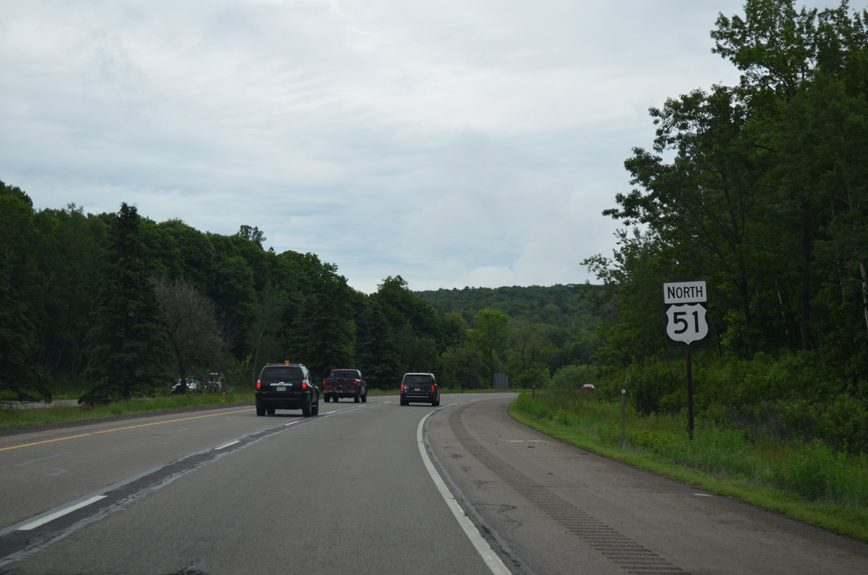
| U.S. 51 transitions back into a rural freeway through the village of Maine. 06/15/15 |
|
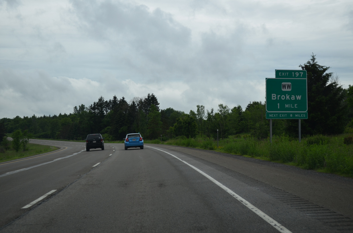
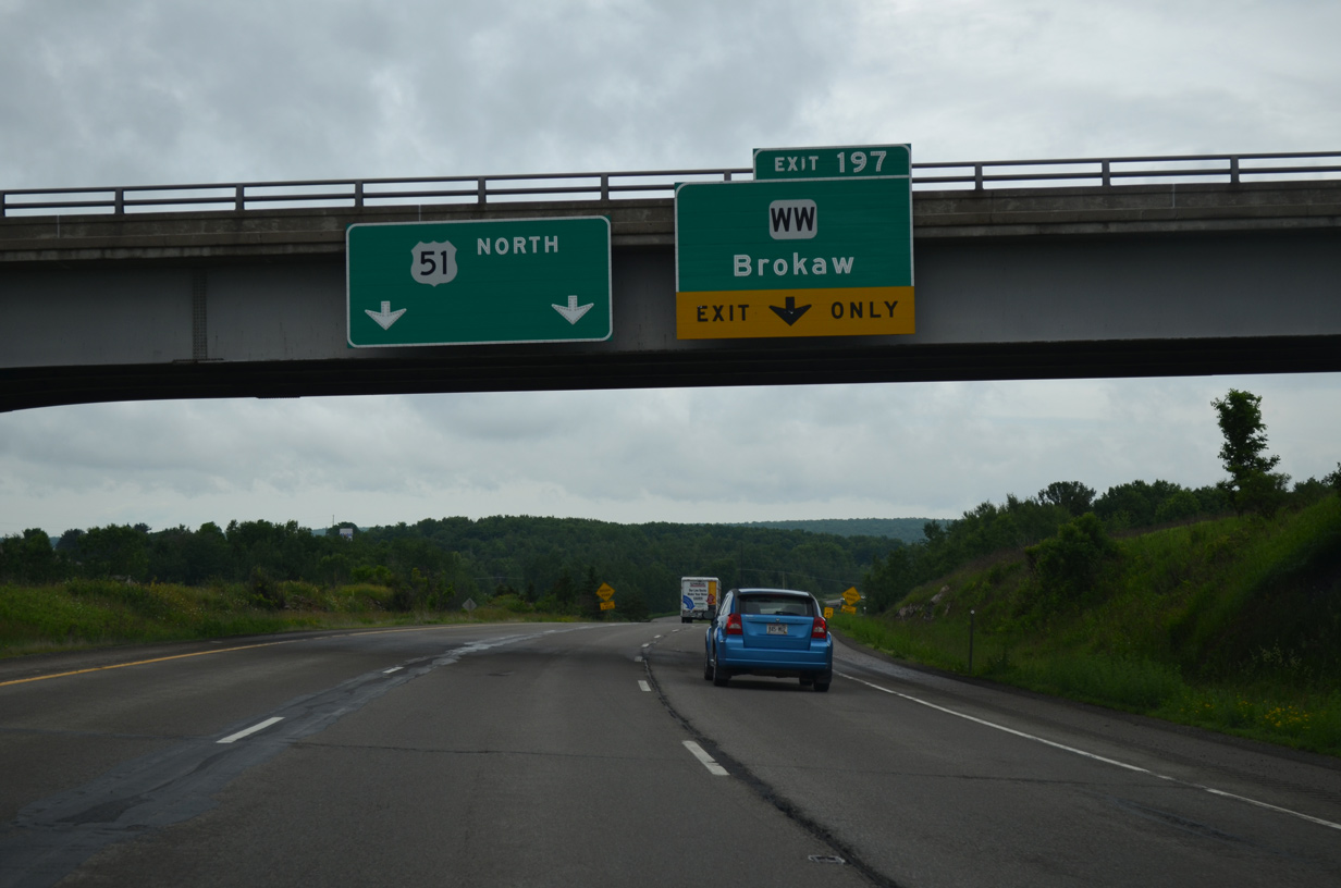
| A truck climbing lane precedes the diamond interchange (Exit 197) with County WW. 06/15/15 |
|
| A lane drop occurs north of the Falcon Drive overpass for Exit 197. CTH-WW ends 1.2 miles to the west at CTH-K. The trunk highway crosses the Wisconsin River to the immediate east into the village of Brokaw. 06/15/15 |
|
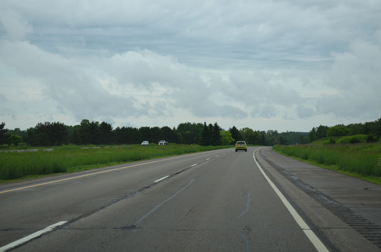
| U.S. 51 remains within the village limits of Maine to the Lincoln County line. 06/15/15 |
|
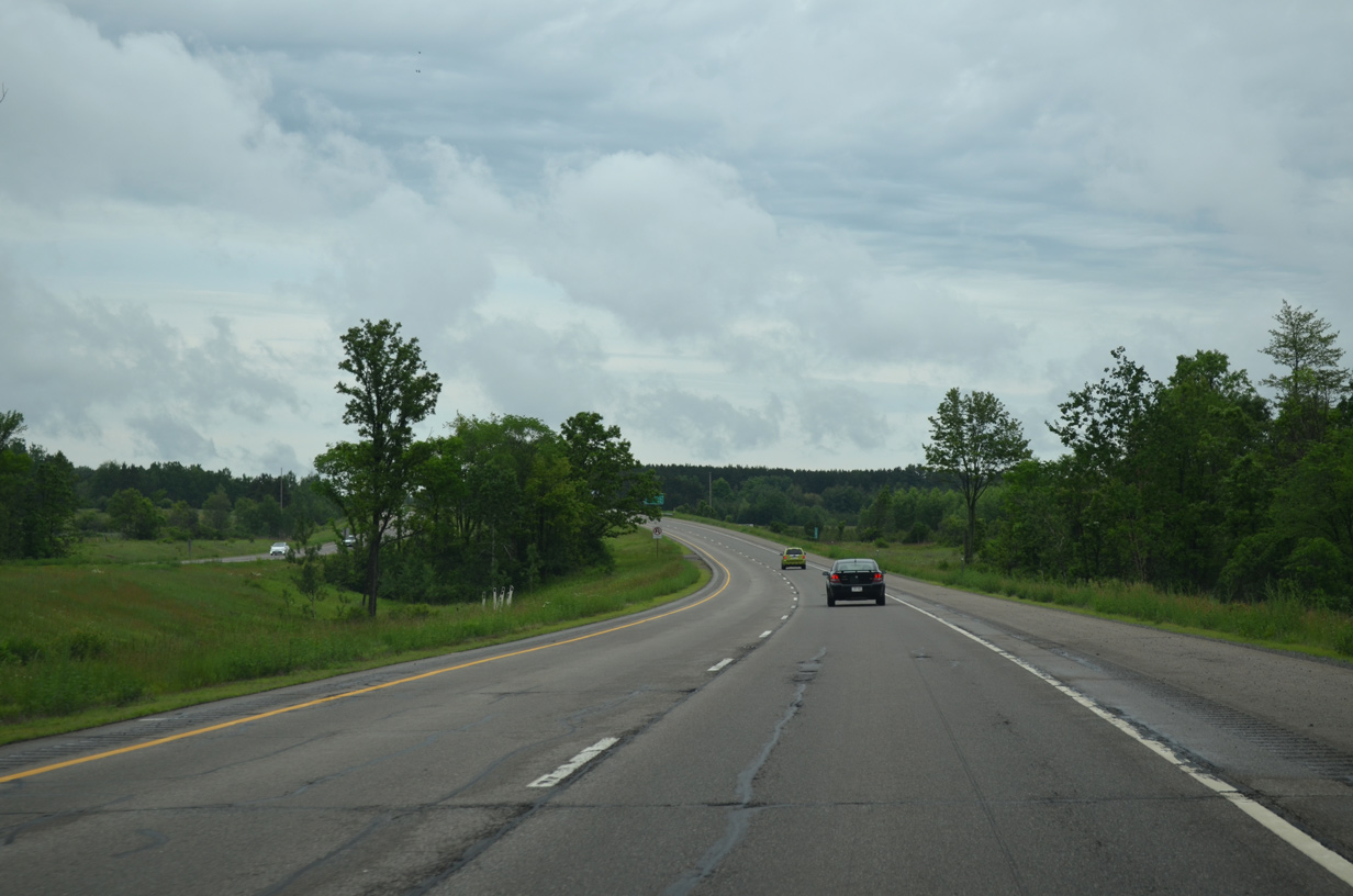
| Progressing north, drivers along U.S. 51 reach the city of Merrill in 12 miles, the city of Tomahawk in 32 miles and town of Minocqua in 61 miles. The Connections 2030 plan for U.S. 51 includes potential upgrades of the remaining expressway segments between Merrill and Tomahawk into a freeway corridor. 06/15/15 |
|
| Hills rise to over 1,500 feet above sea level to the west as U.S. 51 stays closer to the Wisconsin River at around 1,250 feet. 06/15/15 |
|
| U.S. 51 curves over County Line Creek and Rainbow Drive by milepost 203. 06/15/15 |
|
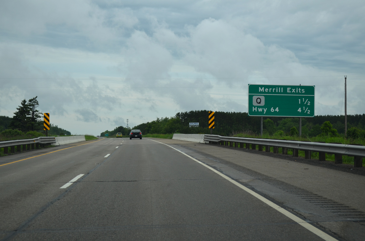
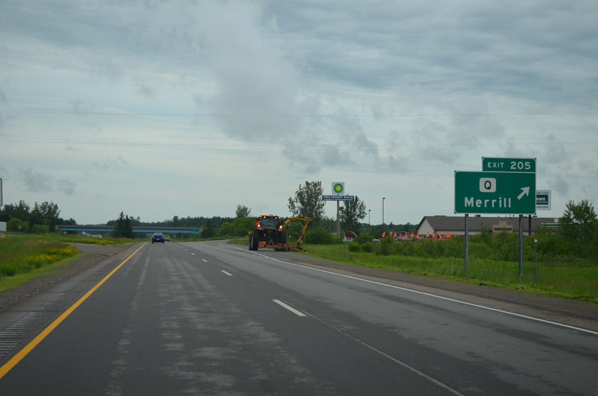
| The two Merrill exits are outlined on this community interchanges identification sign posted 1.5 miles ahead of County Q. 06/15/15 |
|
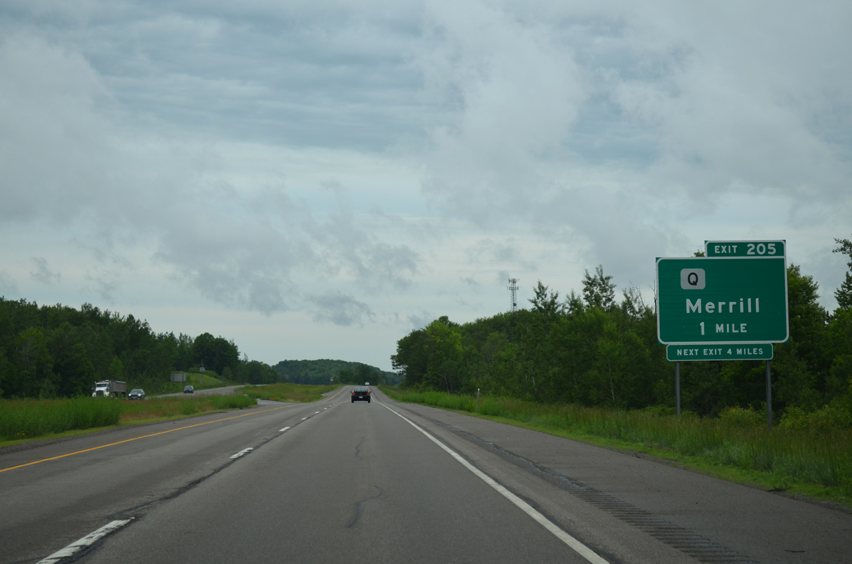
| County Q dog legs west and north to State Street in Merrill via an overlap with County K. County K follows Center Avenue north directly to Downtown.
The blank space here alludes to the former designation of U.S. 51 Business between Exits 205 and 211. 06/15/15 |
|
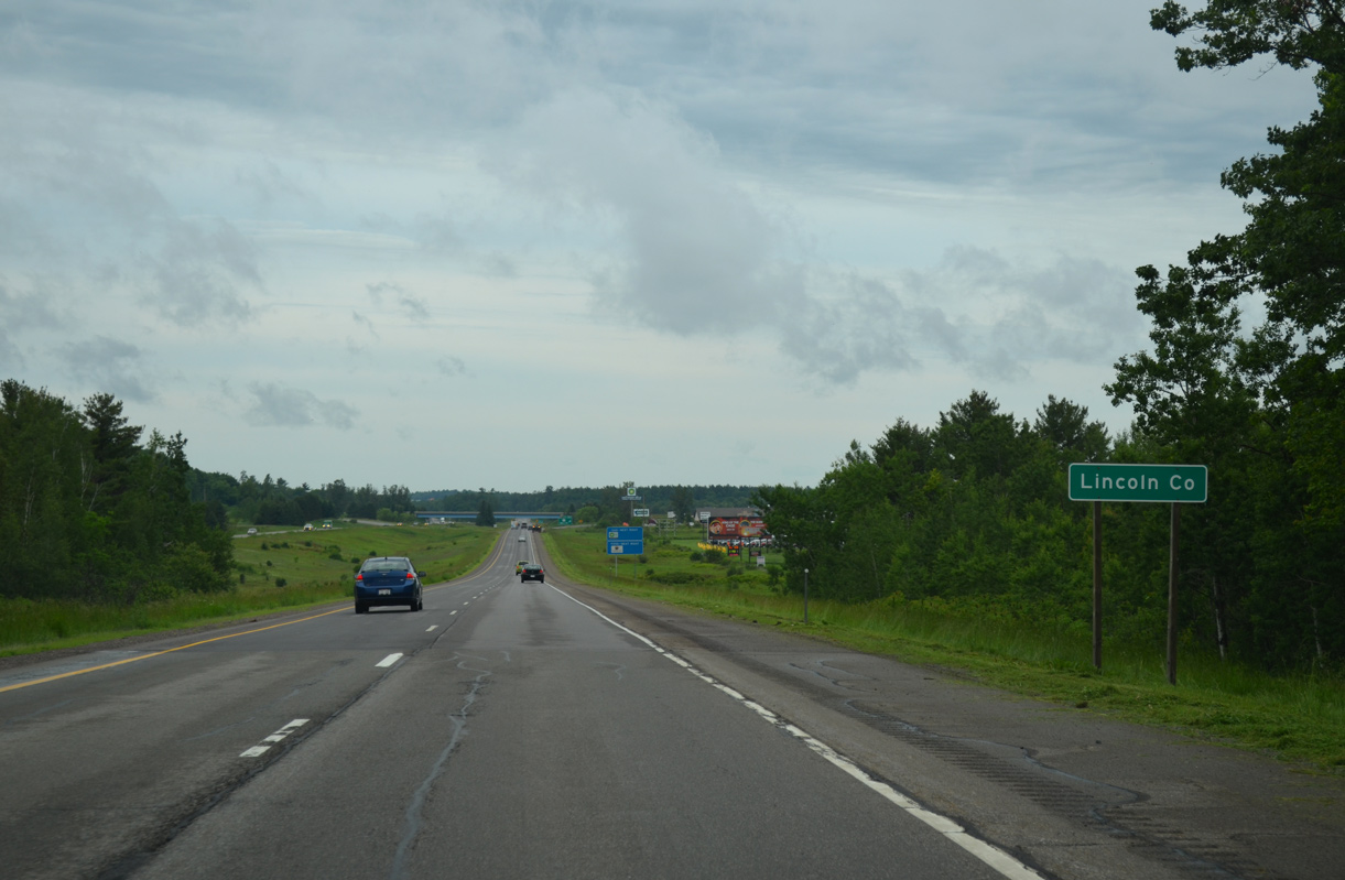
| The northbound freeway crosses the Lincoln County line just ahead of the diamond interchange with CTH-Q west and adjacent Branderburg Avenue. 06/15/15 |
|
| Exit 205 leaves U.S. 51 at the first of seven interchanges along U.S. 51 in Lincoln County. U.S. 51 Business along County Q west and County K / Center Avenue north through Merrill was decomissioned in 1998. 06/15/15 |
|
| U.S. 51 spans the Wisconsin River for the second time just north of Exit 205 to enter the town of Pine River. 06/15/15 |
|
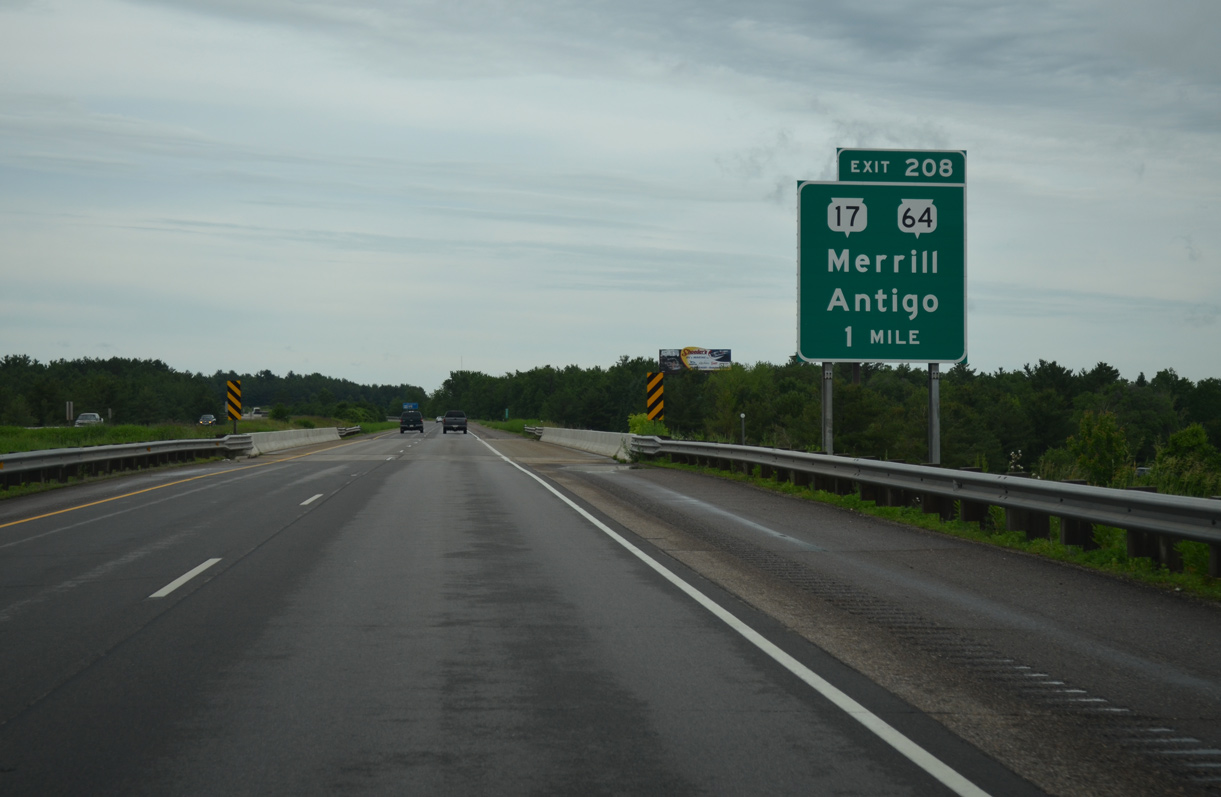
| Wis 64 (Main Street) bisects the city of Merrill through Downtown to meet U.S. 51 along a commercial strip by Exit 208. The trunk highway ventures 28 miles east to the Langlade County seat of Antigo. 06/15/15 |
|
| Wis 17 begins an 86.5 mile route just east of the Wis 64 diamond interchange (Exit 208) with U.S. 51. The north-south highway takes a rural route to Rhinelander, Eagle River and the Michigan state line east of Phelps. 06/15/15 |
|
| The freeway stays just east of Merrill to the CTH-G (14th Street) overpass. U.S. 51 turns northwest from there to cross the Prairie River. 06/15/15 |
|
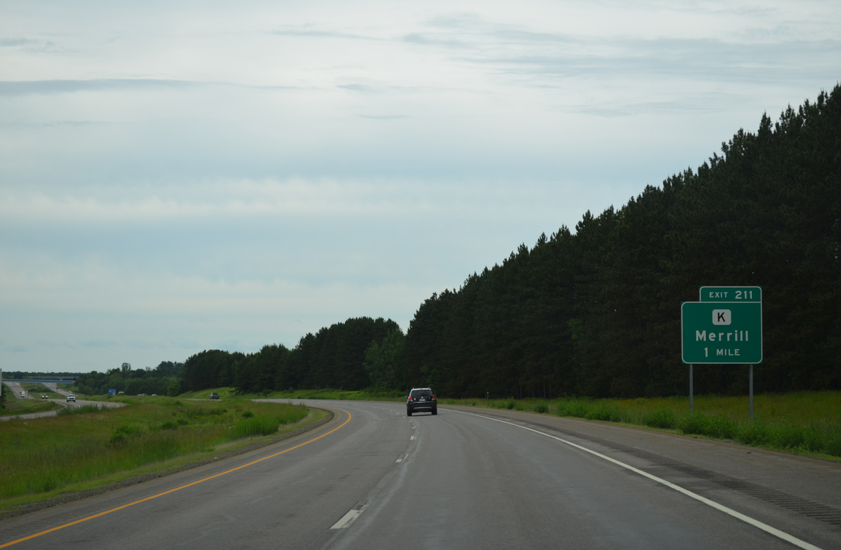
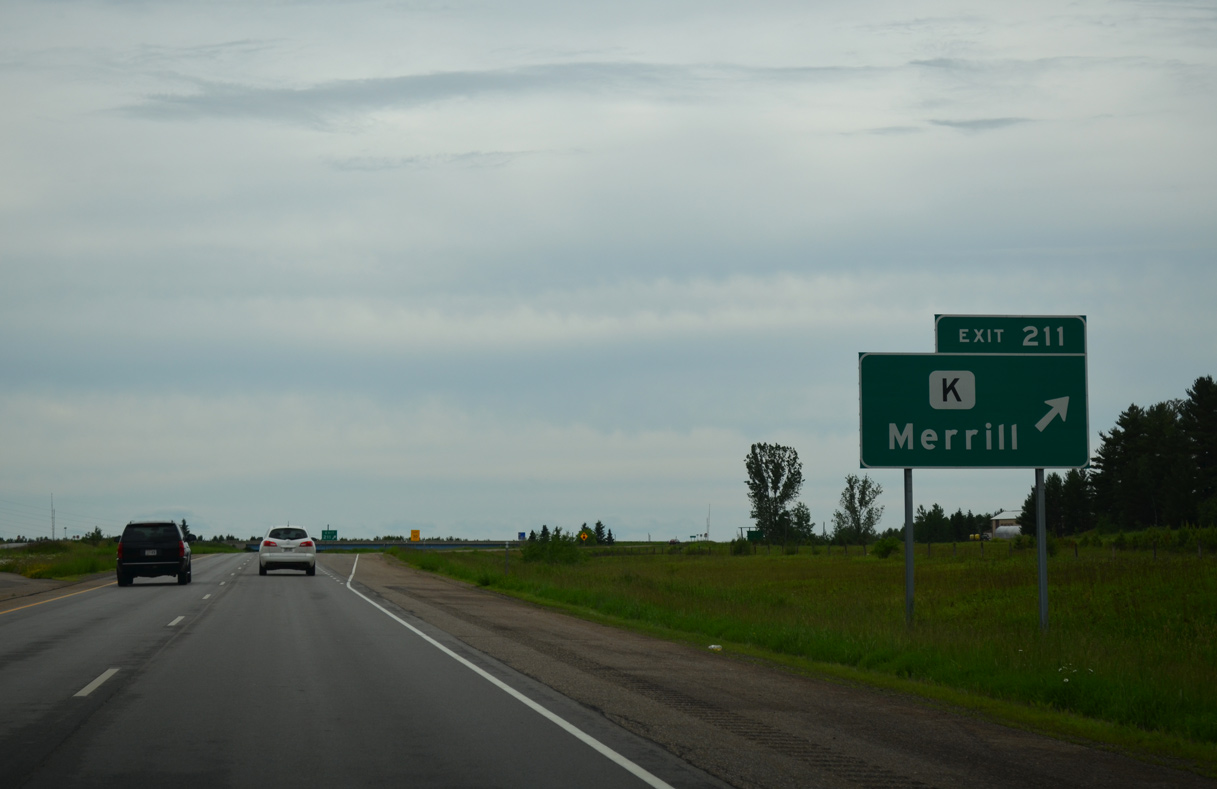
| County K leaves Merrill along old U.S. 51 / U.S. 51 Business to a rural diamond interchange (Exit 211) with the U.S. 51 freeway. 06/15/15 |
|
| North from Exit 211, CTH-K remains along old U.S. 51 north to the U.S. 51 expressway near Irma. 06/15/15 |
|
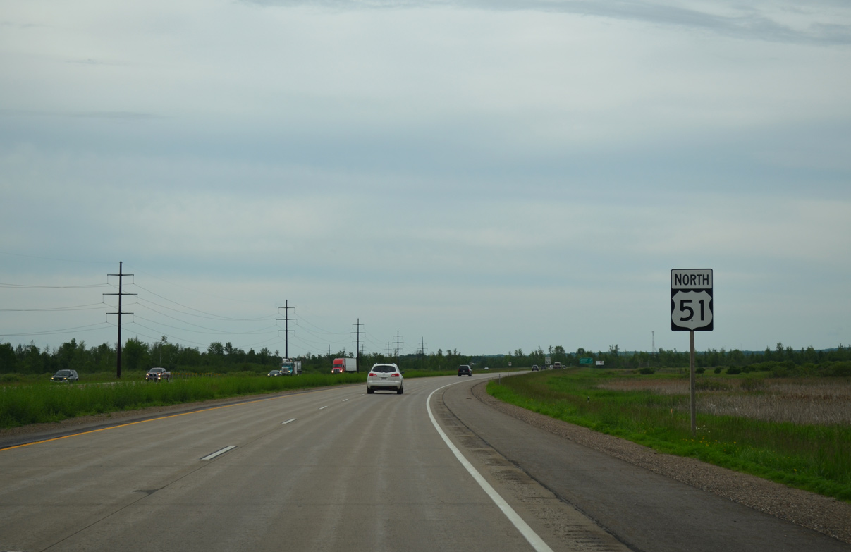
| The limited access section of U.S. 51 extends another 3.5 miles from Exit 211 to Lincoln Drive. A $1.8 million project added an overpass for County C (North Star Road) above the US highway between May 13 and September 2013.2 06/15/15 |
|
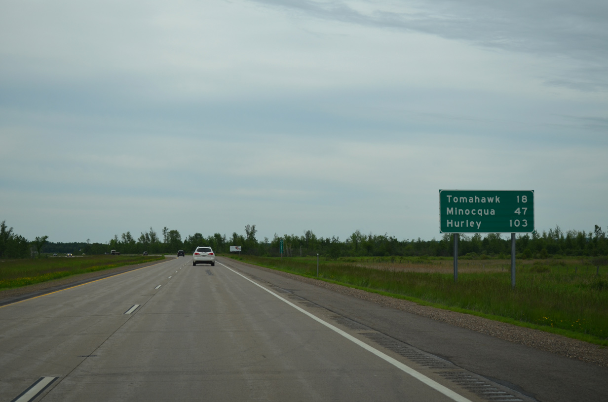
| Tomahawk is now 18 miles away while 103 miles of U.S. 51 remain to Hurley. 06/15/15 |
|
| A U.S. 51 reassurance marker stands just north of the County C (North Star Road) overpass, left over from when the two met at-grade. 06/15/15 |
|
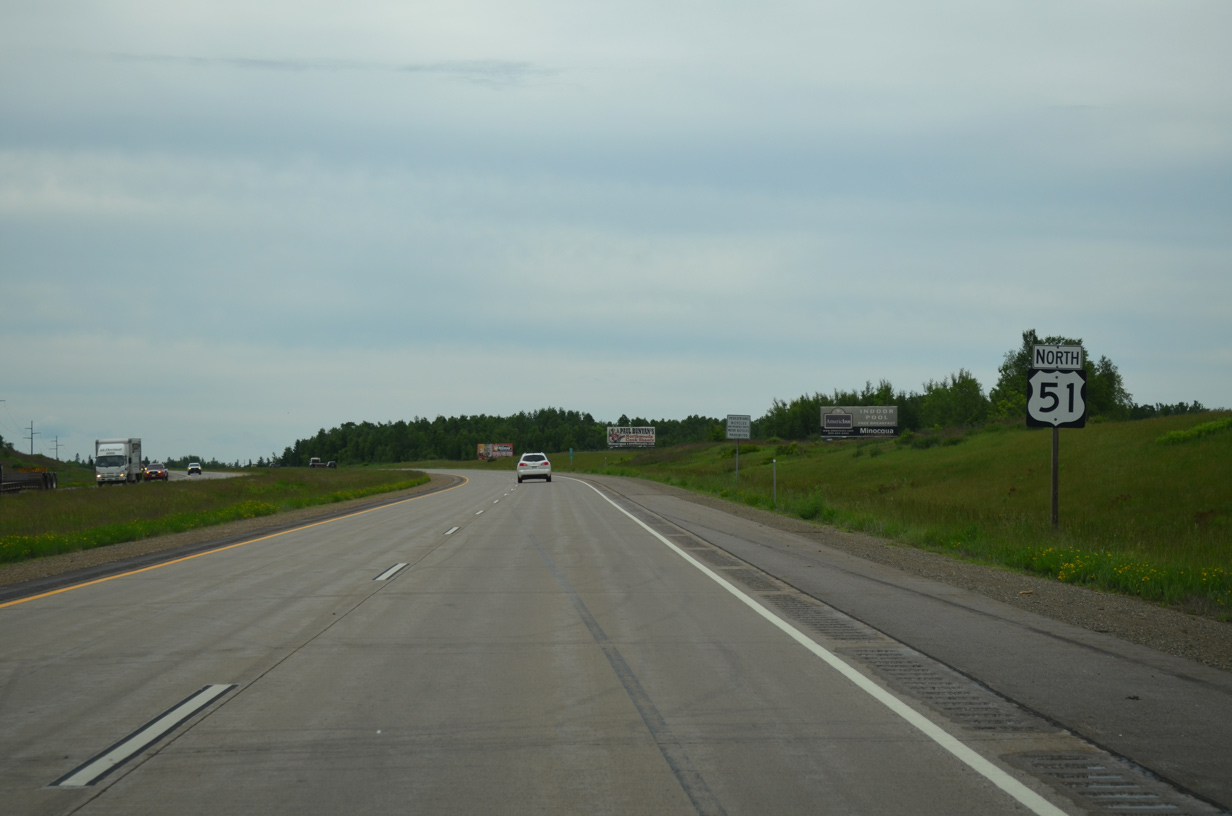
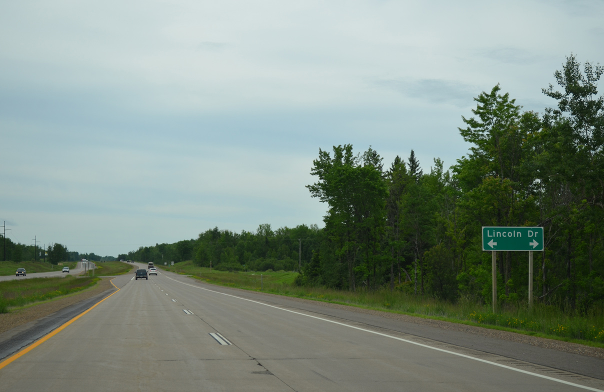
| U.S. 51 downgrades to an expressway for nine miles between Lincoln Drive and a driveway located 1.7 miles south of Exit 225 with County S. 06/15/15 |
|
| Lincoln Drive comprises a local road west to Pier Street (old County K) and east to County K (old U.S. 51). 06/15/15 |
Page Updated 04-29-2016.


 North
North