|
| U.S. 61 continues as a freeway south from the Summit Street overpass through Maquoketa. Myatt Drive parallels the freeway along the west side to serve a number of businesses. 05/23/08 |
|
| U.S. 61 turns east toward Main Street, its original alignment south from downtown Maquoketa. Davenport is 38 miles to the south via the U.S. 61 and the 2010-designated U.S. 61 Business south of I-80. 05/23/08 |
|
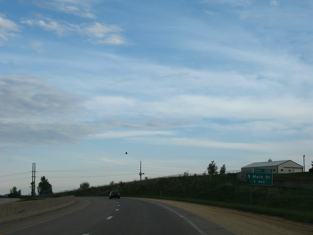
| A folded diamond interchange joins U.S. 61 with South Main Street in one mile. South Main Street doubles as U.S. 61 Business north to Iowa 64 (Platt Street). 05/23/08 |
|
| Exit 156 leaves U.S. 61 south for South Main Street. Highway 61 and City Industrial Parks reside nearby. 05/23/08 |
|
| Curving back to the south, U.S. 61 parallels South Main Street as it exits the city as 220th Avenue. The former alignment of U.S. 61 converges with the freeway by the forthcoming diamond interchange with Iowa 136. 05/23/08 |
|
| Delmar, a city of 525, lies three miles to the east from the next southbound exit of U.S. 61 south. Davenport is now 35 miles away. 05/23/08 |
|
| Entering Clinton County along U.S. 61 south. 05/23/08 |
|
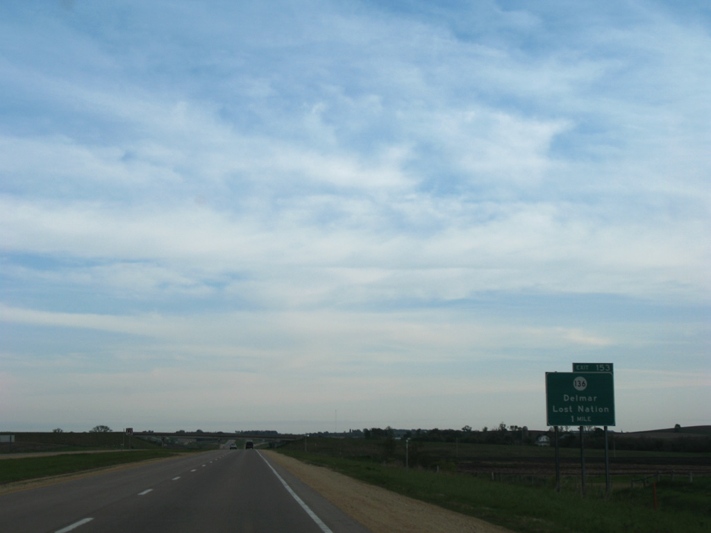
| Iowa 136, a 98 mile route between Luxemburg and Fulton, Illinois, crosses paths with U.S. 61 in one mile. 05/23/08 |
|
| Southbound at Exit 153 to Iowa 136 for Delmar to the east and Lost Nation to the west. The state highway also travels 12 miles eastward to Charlotte and westward 17 miles to Oxford Junction, where IA 136 turns north to Wyoming. 05/23/08 |
|
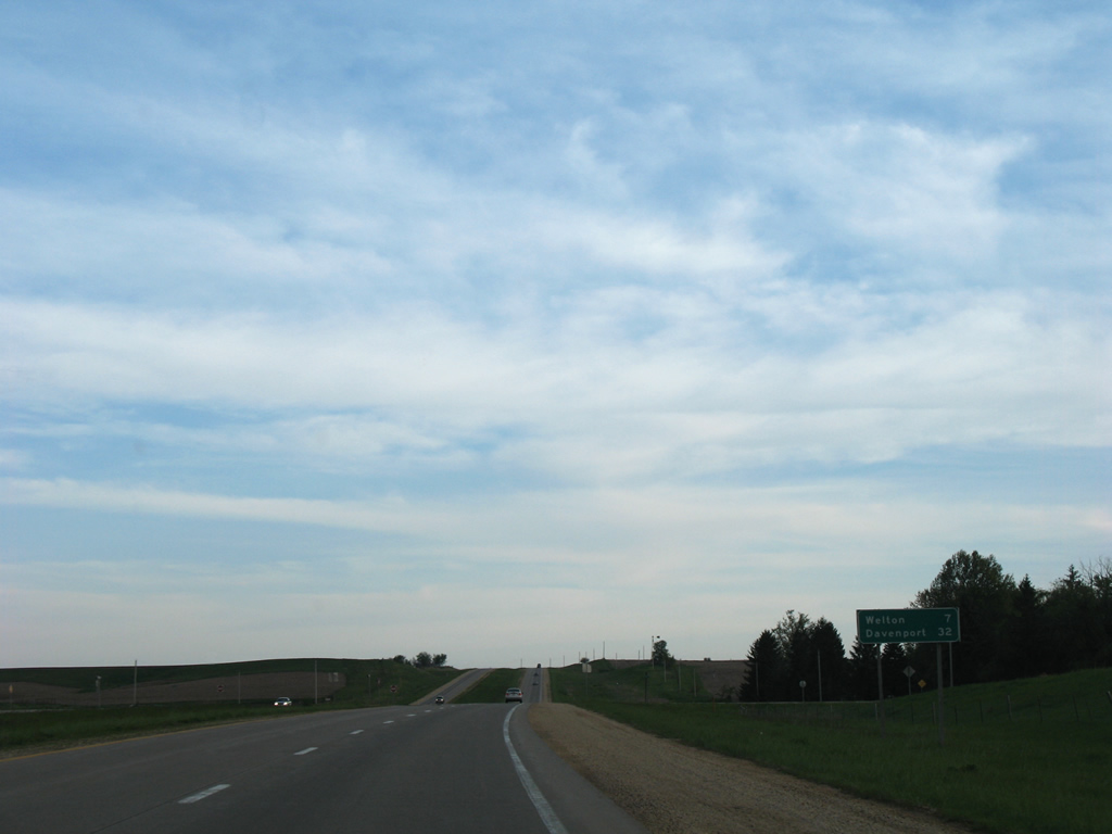
| The freeway portion of U.S. 61 around Maquoketa transitions into an expressway just south of Iowa 136. Welton is next in seven miles. 05/23/08 |
|
| Portions of former U.S. 61 remain in service as frontage roads for adjacent residences and farms along the expressway southward throughout Clinton County. A portion of Old Highway 61 lines the southbound side of U.S. 61 from 140th Street to intersect 150th Street in this scene ahead of Deep Creek. 05/23/08 |
|
| Clinton County Y60 (250th Avenue) heads south from Delmar to end at U.S. 61. A section of Old Highway 61 ties into CR Y60 adjacent to the expressway. 05/23/08 |
|
| A reassurance marker follows the south end of County Road Y60 as U.S. 61 approaches North Welton. 03/25/16 |
|
| 260th Street connects U.S. 61 with Old Highway 61 / Main Street leading south through the adjacent city of Welton. 03/25/16 |
|
| County Road E63 (190th Street) crosses paths with U.S. 61 on the south side of Welton. 03/25/16 |
|
| U.S. 61 and Old Highway 61 come together again with the expressway alignment overtaking the original ahead of 197th Street. 03/25/16 |
|
| County Road Y68 (218th Street) branches southeast from U.S. 61 at 212th Street. CR Y68 is the pre-freeway alignment of U.S. 61 through the city of De Witt. 03/25/16 |
|
| South of 212th Street west and 210th Street east, U.S. 61 upgrades again along the freeway bypass of De Witt. 03/25/16 |
|
| The freeway of U.S. 61 south to Davenport was opened north into De Witt in 1975 and from De Witt south to the Quad Cities in 1982.1 03/25/16 |
|
| Crossing Silver Creek along U.S. 61 south, one mile out from the cloverleaf interchange (Exits 139A/B) with U.S. 30 west and 11th Street east. 03/25/16 |
|
| 11th Street carried U.S. 30 through De Witt until 1975, when the route shifted to the freeway bypass to the west. 11th Street heads 1.6 miles east to 6th Avenue (Old U.S. 61) just north of Downtown. 03/25/16 |
|
| U.S. 30 ventures west four miles from Exit 139A to Grand Mound and 60 miles to Interstate 380 in Cedar Rapids. 03/25/16 |
|
| Exit 139B, which should be Exit 139A given the southbound direction, loops onto 11th Street east into De Witt. Old U.S. 30 continued east from the city onto 245th Street to 330th Avenue near Malone. 03/25/16 |
|
| U.S. 30 east joins U.S. 61 south for 0.9 miles to a trumpet interchange (Exit 312). 05/26/18 |
|
| Exit 312, which utilizes U.S. 30 mile posts, departs one half mile south of the Union Pacific Railroad underpass. U.S. 30 bypasses De Witt to the south, meeting South 6th Avenue (former U.S. 61) on the 20 mile trek to Clinton. 05/26/18 |
|
| 252nd Street passes over U.S. 30 east / U.S. 61 south ahead of their partition. U.S. 30 exits Iowa via the Gateway Bridge into Whiteside County, Illinois. U.S. 61 remains southward 16 miles to Interstate 80. 05/26/18 |
|
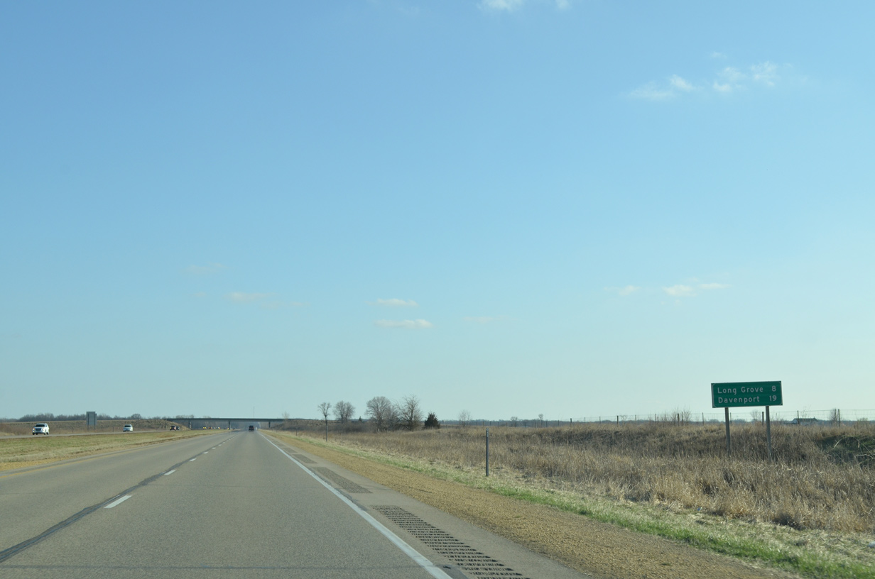
| Long Grove is the first Scott County exit in eight miles. Downtown Davenport is now 19 miles away. 03/25/16 |
|
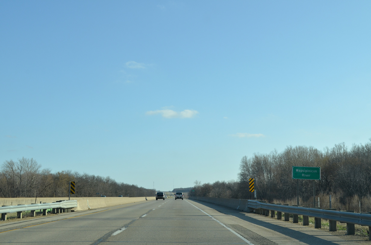
| U.S. 61 southbound at the Wapsipinicon River, which separates Clinton and Scott Counties east from near Big Rock to the Mississippi River. 03/25/16 |
|
| One mile north of the diamond interchange (Exit 129) with Scott County Road F41 (267th Street) on U.S. 61 south. 05/26/18 |
|
| County Road F41 connects the city of Longview and County Road Y64 (1st Street) to the west with Scott Park Road (old U.S. 61), Parkview and Scott County Park to the east. 05/26/18 |
|
| Eldridge precedes Interstate 80 along U.S. 61 south in three miles, with Downtown Davenport now just 11 miles away via U.S. 61 Business (Brady Street) south. 03/25/16 |
|
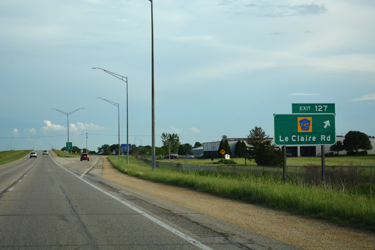
| A diamond interchange (Exit 127) joins the U.S. 61 freeway with Le Claire Road (County Road F45) amid a large area of industrial and business parks in northeast Eldridge. 05/26/18 |
|
| Eldridge precedes Interstate 80 along U.S. 61 south in three miles, with Downtown Davenport now just 11 miles away via U.S. 61 Business (Brady Street) south. 03/25/16 |
|
| Le Claire Road travels west to central Eldridge. East from U.S. 61, County Road F45 becomes 240th Street en route to County Road Z30. 05/26/18 |
|
| U.S. 61 runs alongside Country Club Estates and the Rustic Ridge Golf Course to the Lincoln Road overpass in Eldridge. 03/25/16 |
|
| The second Eldridge exit departs U.S. 61 south in one mile for County Road F51 (Blackhawk Trail). 03/25/16 |
|
| An advisory sign directs trucks headed south from the Quad Cities toward Muscatine or Burlington on U.S. 61 to bypass Davenport along I-80 and I-280. This sign predates the realignment of U.S. 61 onto the Quad Cities beltway. 03/25/16 |
|
| Entering the diamond interchange (Exit 125) with Scott County Road F51 (Blackhawk Trail). Blackhawk Trail links U.S. 61 with County Road Y64 (1st Street) to the west and Scott Park Road (former U.S. 61) to the east. 05/26/18 |
|
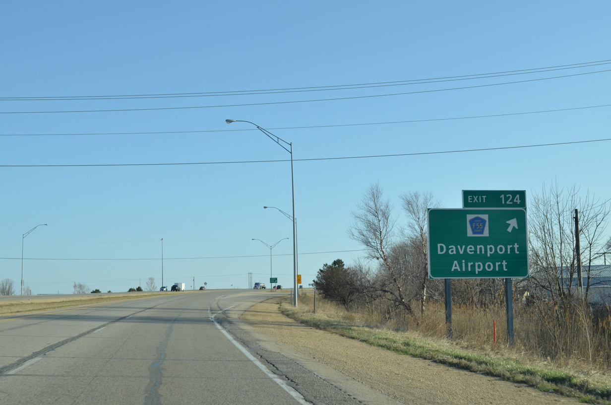
| A six-ramp parclo interchange (Exit 124) lies just south of Crow Creek with Scott County F55 (210th Street) at Mt. Joy.
Previous guide signs for Exit 124 referenced Mt. Joy in place of Davenport Municipal Airport (DVN). 03/25/16 |
|
| Exit 124 leaves U.S. 61 south for County Road F55 west to Davenport Municipal Airport (DVN) and east to County Road Z16 (Utica Ridge Road). Scott County F55 between the airport and U.S. 61 was designated as Iowa 387 between 1953 and 1978. 03/25/16 |
|
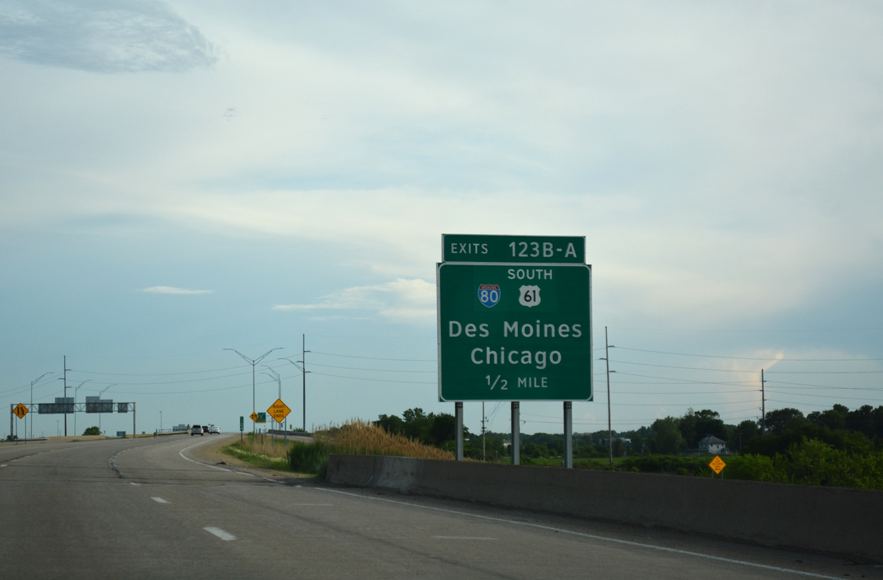
| U.S. 61 continues one half mile south to a cloverleaf interchange (Exits 123B/A) with Interstate 80. 05/26/18 |
|
| The lane added from County Road F55 to U.S. 61 south departs ahead for Interstate 80 west to Iowa City and Des Moines. The 2011 realignment of U.S. 61 takes the route west and south along a bypass the city via Interstates 80 and 280. 04/01/16 |
|
| Southbound drivers enter the Davenport city limits south of the CR F55 underpass. U.S. 61 Business takes over along Brady Street south to Welcome Way in Davenport. This shield assembly referenced the former mainline route. 01/01/15 |
|
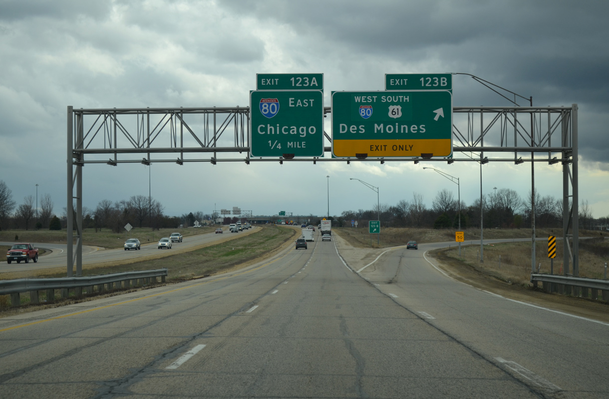
| Exit 123B carries U.S. 61 south onto Interstate 80 west through northern reaches of Davenport. 04/01/16 |
|
| U.S. 61 Business begins as the U.S. 61 freeway transitions onto Brady Street south. A loop ramp for Interstate 80 east leaves next. 01/01/15 |
|
| Interstate 80 travels two miles east from Exit 123A to the western terminus of Interstate 74 before entering north Bettendorf. 04/01/16 |
Page Updated 06-07-2018.

 South
South


 East
East