|
| US 69's first standalone route marker, approximately 75 miles from its southern terminus in Port Arthur. 11/21/10 |
|
| US 69 runs north through the remainder of the small town of Woodville, carrying a bit more traffic than the section through southern Tyler county. The next town, Colmesneil, is 9 miles distant. 11/21/10 |
|
| Another Big Thicket Parkway sign as the route heads north out of Woodville. 11/21/10 |
|
| US 69 runs north through northern Tyler County and returns to a two lane rural highway. 11/21/10 |
|
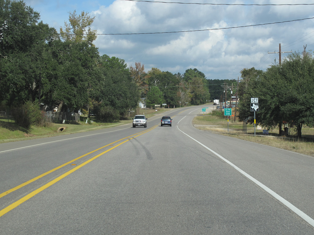
| The large trees return the farther away from Woodville the highway goes. FM 1632 runs west from here into the rural areas. 11/21/10 |
|
| US 69 northbound shield in Tyler County. 11/21/10 |
|
| Lufkin, the next major town, is about 50 miles north of Woodville and is a regional center. 11/21/10 |
|
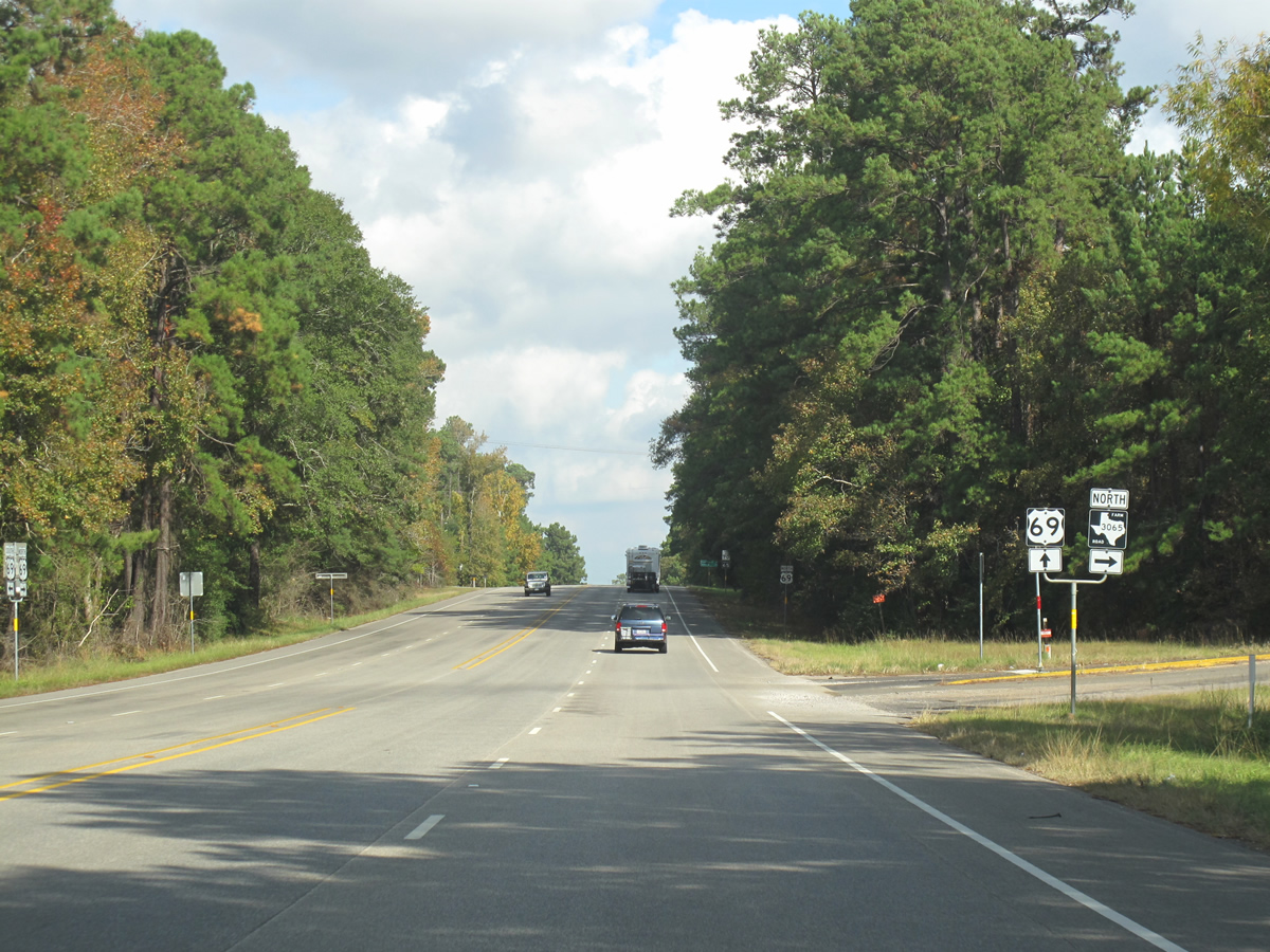
| FM 3065 runs north and east as a loop off the US highway through forested land, returning to the highway at Colmesneil. 11/21/10 |
|
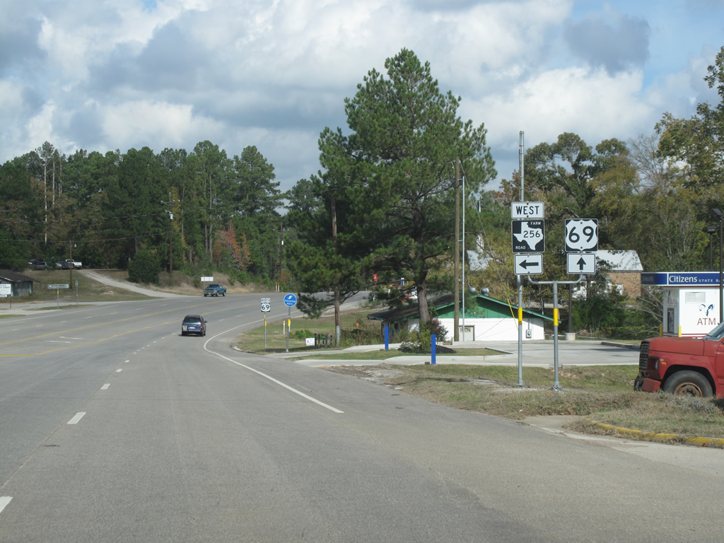
| US 69 enters the town of Colmesneil here at the junction with FM 256 east. Colmesneil only has about 650 residents, but its booming lumber industry made it briefly larger than Beaumont was in the 1890s. 11/21/10 |
|
| US 69 northbound through Colmesneil at the junction of FM 256 east. 11/21/10 |
|
| Like Warren, Colmesneil has a brief overlap between its US highways and east/west FM road, and the highway is five lanes town. 11/21/10 |
|
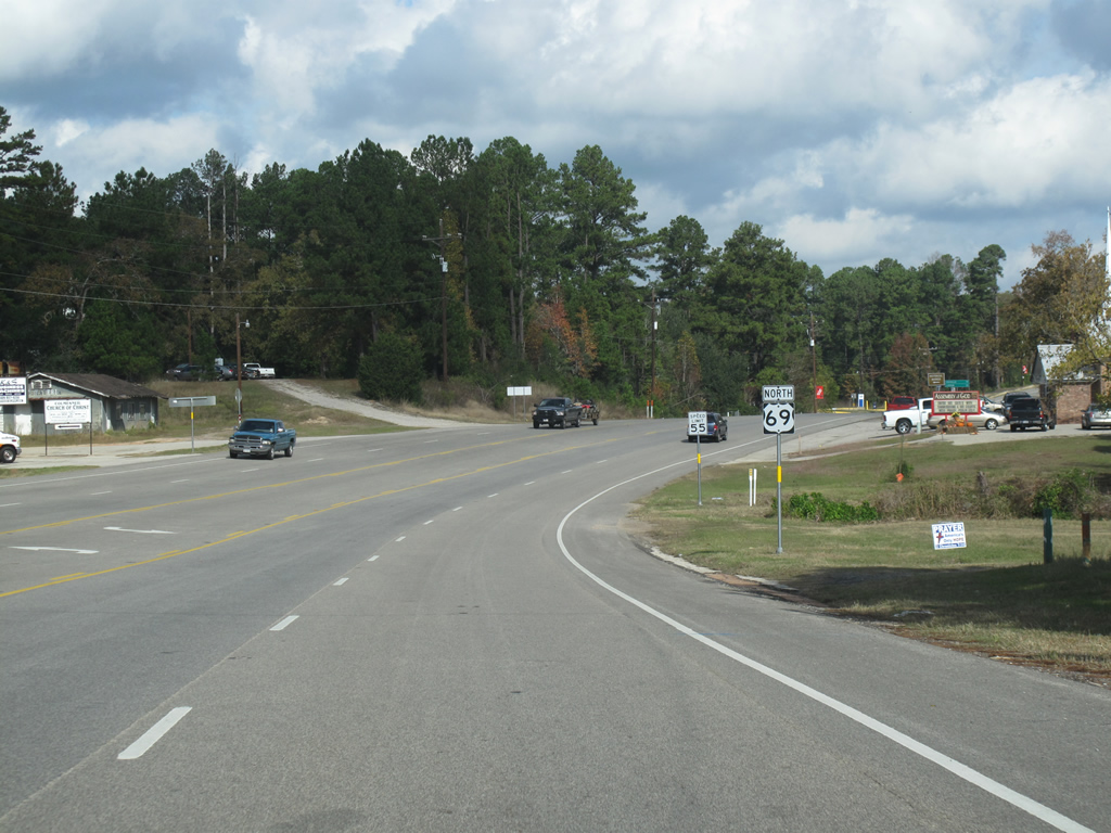
| This view looks northbound along US 69 at the northern end of Colmesneil, Texas. 11/21/10 |
|
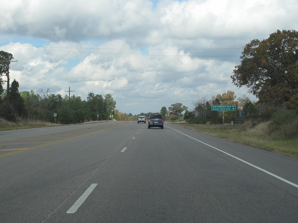
| Control points for the next highway junction are listed as the Sam Rayburn Dam and the Toledo Bend Dam - which impound reservoirs of the same names. Sam Rayburn Reservoir is the largest lake wholly within Texas, while Toledo Bend is the largest lake in the state - but is shared with Louisiana. 11/21/10 |
|
| US 69 northbound at the western end of Recreational Road 255. The rec road shares the same basic style shield as the FM routes, but with a brown outline and an "R" displayed at the top. These types of routes were signed in the early 1970s. 11/21/10 |
|
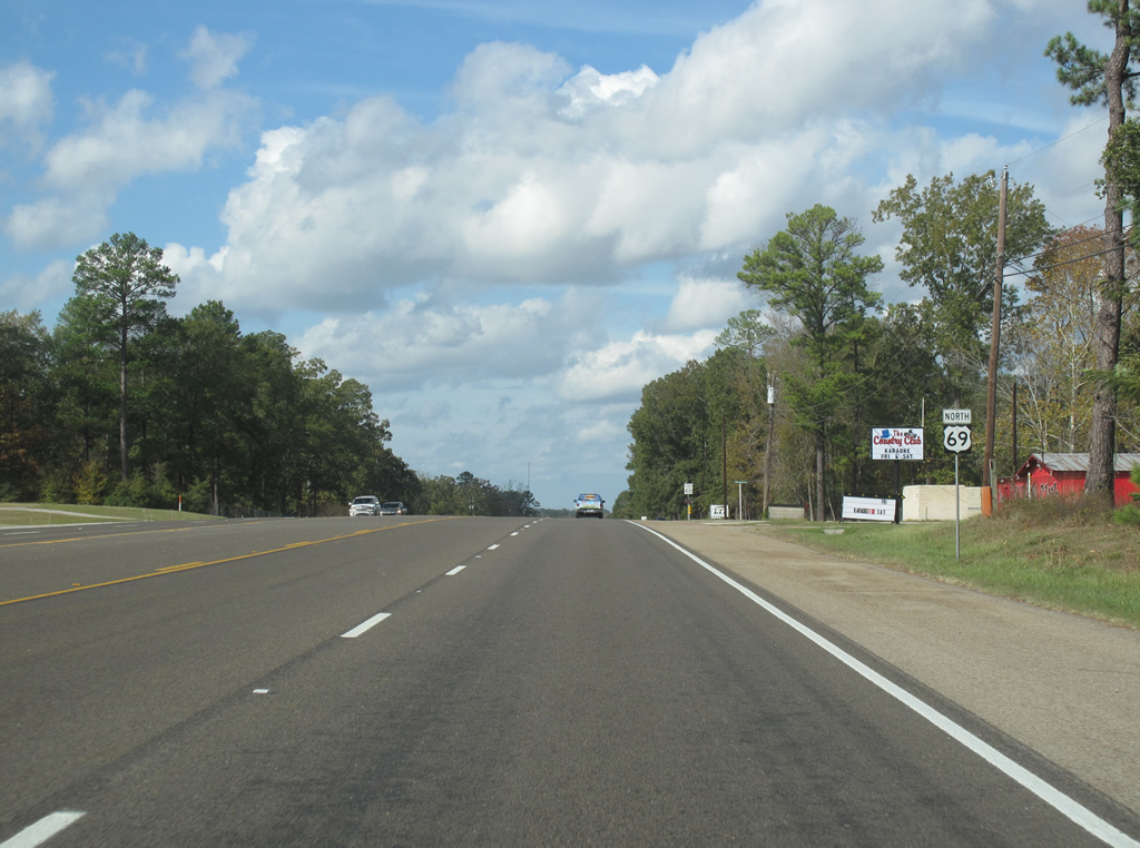
| US 69 north of Rec Road 255 in Tyler County. Hurricane evacuation signs are still prominently displayed along the road through here. 11/21/10 |
|
| "Evacu Lane" sign in Tyler County. The shoulder is obviously not large enough to permit its use as a through-traffic lane, but is signed for hurricane evacuation purposes periodically anyway. 11/21/10 |
|
| US 69 is four lanes for a short stretch north of Colmesneil. 11/21/10 |
|
| US 69 through northern Tyler County continues northbound with a series of beautiful vistas and thick pine forests. While not very hilly, even small changes in terrain in this area can provide nice views. 11/21/10 |
|
| US 69 northbound at FM 1014. FM 1014 runs eastward a few miles to the former town of Rockland. 11/21/10 |
|
| US 69 northbound at the Neches River. A large portion of East Texas is drained by the Neches, which empties into Sabine Lake near Port Arthur. 11/21/10 |
|
| US 69 very briefly enters Jasper County here. Additionally, the road enters the far western portion of the Angelina National Forest as it crosses the Neches River. 11/21/10 |
|
| Almost immediately after entering Jasper County, US 69 enters Angelina County. Additionally, the road enters a new DOT region at this county line which means slightly different paving and signage. 11/21/10 |
|
| US 69 northbound at FM 1270. 11/21/10 |
|
| US 69 enters the town of Zavalla north of FM 1270. The town is located entirely within the boundaries of the national forest, and tall pine trees line the road for many miles in this area. 11/21/10 |
|
| SH 63 is encountered at Zavalla. 11/21/10 |
|
| US 69 meets SH 63 and nearly runs into SH 147 at Zavalla. The routes run east along the very large Sam Rayburn Reservoir and through the national forest. This marks the western terminus of SH 63. 11/21/10 |
|
| US 69 is briefly part of the Texas Forest Trail. The state marks a variety of tourist-oriented routes with these unique blue and white trailblazers. 11/21/10 |
|
| US 69 through the Angelina National Forest is a blur of green pine trees and very light traffic. 11/21/10 |
|
| After leaving the national forest, US 69 encounters the town of Huntington. The town was named after railroad magnate Collis P. Huntington, and shares a namesake with the larger Huntington, West Virginia. 11/21/10 |
|
| US 69 northbound at FM 1669 in Huntington, Texas. This is the first traffic light encountered in many miles. 11/21/10 |
|
| Huntington is close enough to the regional center of Lufkin to be considered a bedroom community or exurban area. From here, the road is four or five lanes into the larger city. 11/21/10 |
|
| US 69 runs through a more heavily developed area west and north of Huntington. The route intersects several FM roads and busy county roads. 11/21/10 |
|
| This view looks northwestward along US 69 just outside of Lufkin. 11/21/10 |
|
| US 69 northbound at the Lufkin welcome sign. Several communities in this region of East Texas have similar brown welcome signs. 11/21/10 |
|
| Like many cities throughout the country, Lufkin's regional attraction makes it have more traffic and a stronger economy than many other cities its size located in more densely populated regions. The city is an important regional shopping destination and its main industries are lumber, health care, and poultry processing. 11/21/10 |
|
| Just after entering Lufkin, US 69 meets US 59 and Loop 287. 11/21/10 |
|
| US 69 is routed around Lufkin on the city's expressway Loop 287. It shares a brief overlap with US 59 on the eastern and northern sides of the city. 11/21/10 |
|
| US 69 just before Loop 287. 11/21/10 |
|
| US 69 turns north here to go around Lufkin on the city's loop. There is a Business US 69 that begins here along the old alignment through the city, but it is poorly signed. 11/21/10 |
|
| US 69 merges with US 59 and Loop 287 here. The expressway around Lufkin is generally four or six lanes with many business driveways, but with grade crossings at numbered routes. 11/21/10 |
|
| This view looks northbound along US 59/69 on the northeast side of Lufkin. 11/21/10 |
|
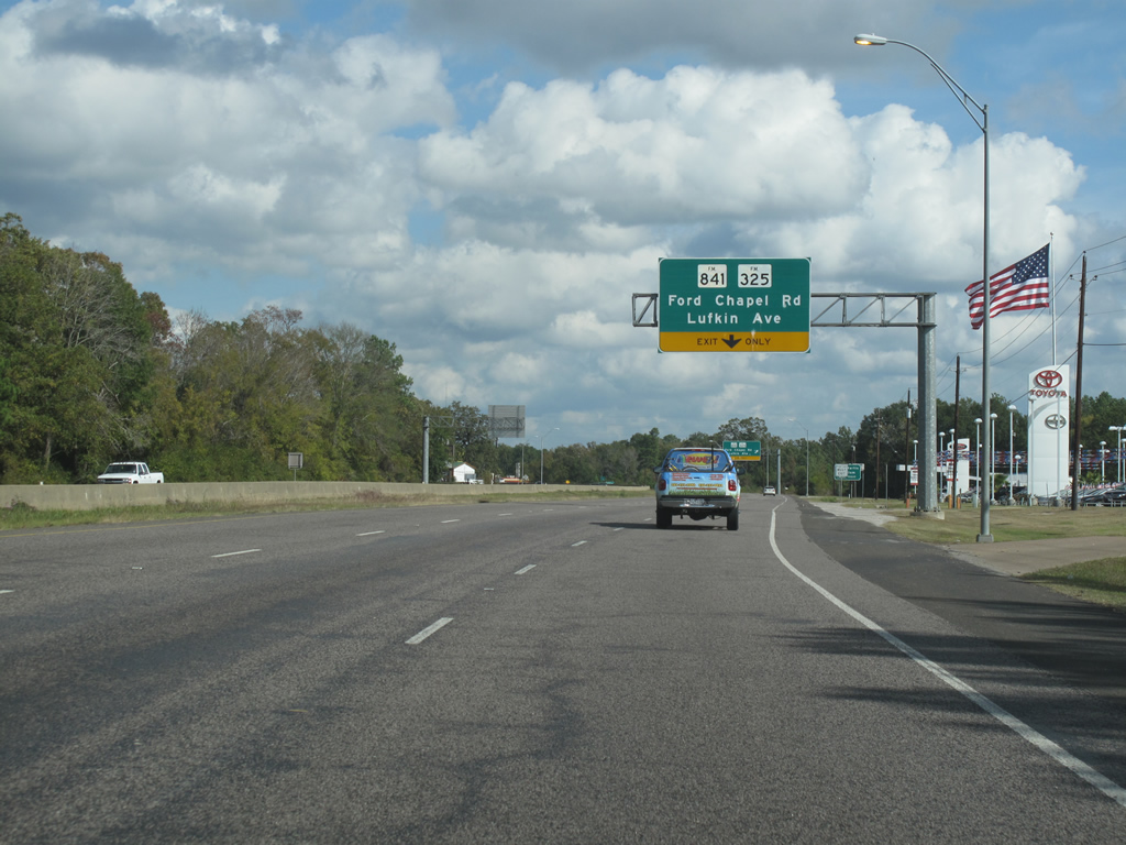
| US 59/69 northbound at FM 325/841. FM 841 runs east and south from here and goes back to US 69. FM 325 heads west into town. 11/21/10 |
|
| A general view of the Lufkin loop road, north of FM 325. 11/21/10 |
|
| US 59 signage takes precedence in most cases, with US 69 reassurance markers omitted around Lufkin. Regionally, US 59 is a more important road. 11/21/10 |
|
| Locally known as Atkinson Dr, SH 103 runs east out of Lufkin into the piney woods region, reaching almost to Louisiana. 11/21/10 |
|
| On the north side of Lufkin, US 69 shields finally accompany US 59 trailblazers. The expressway through this area has several driveways and cross streets at-grade. 11/21/10 |
|
| FM 2021 is the next signed highway that meets the loop. 11/21/10 |
|
| The first signage for the end of the US 59/69 multiplex comes on the north side of town just before the intersection with FM 2021. 11/21/10 |
|
| FM 2021 heads north parallel to US 59 and runs near old rail tracks through the old communities of Prosser and Davisville. It is possibly an old alignment of US 59. Plans are underway in late 2010 to convert this to a grade-separated interchange. 11/21/10 |
|
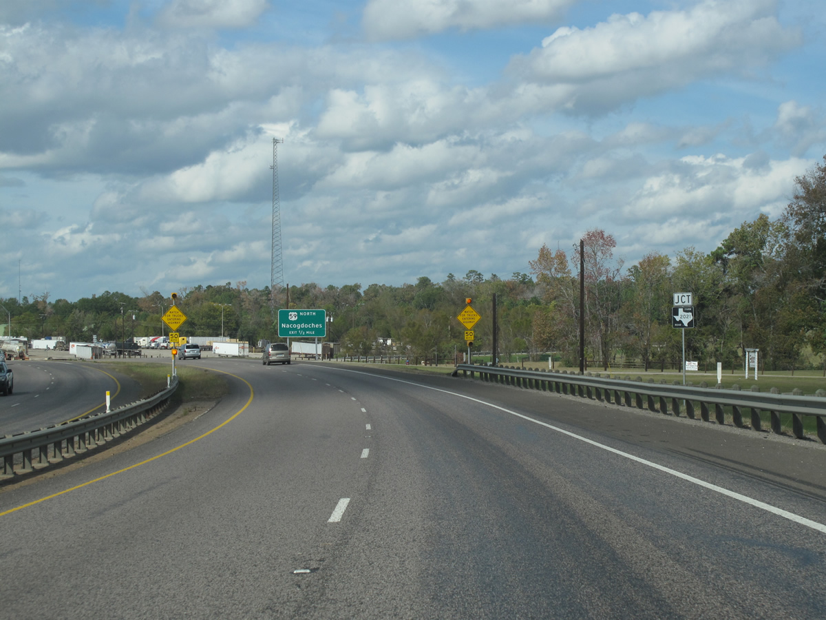
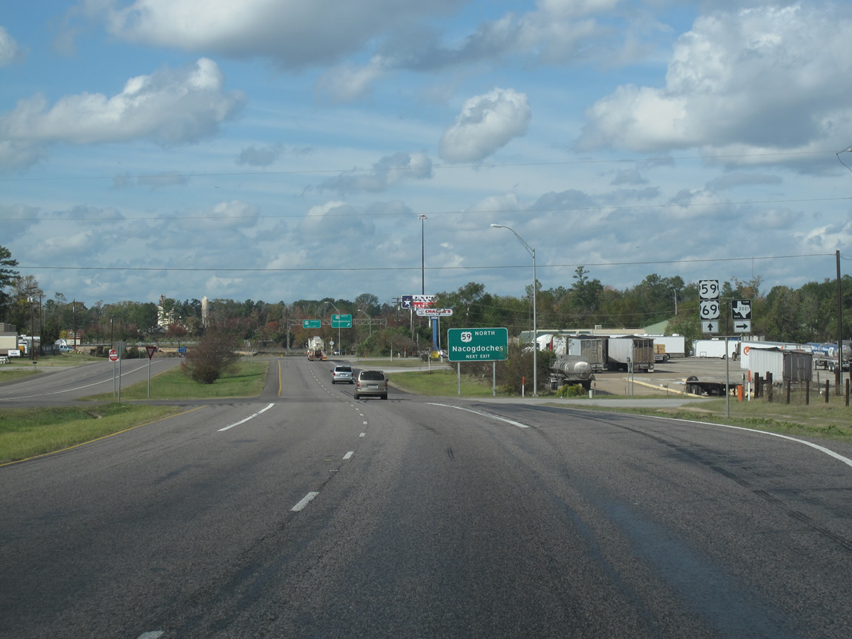
| At FM 2021 more signage for US 59 northbound appears. Nacogdoches is about 20 miles north and both cities are considered a single media and statistical market. 11/21/10 |
|
| US 59 leaves the Lufkin area heading north. This intersection is considered part of the future Interstate 69 corridor, although some alignments have a new freeway being constructed further outside of town. Lufkin and Nacogdoches are expected to one day be connected by I-69. 11/21/10 |
|
| Traffic headed south on US 59 business must make a left turn here. The US 59/US 69 intersection here is planned to be totally reconstructed into a free-flowing freeway style interchange. Construction is scheduled to begin in 2012. 11/21/10 |
|
| US 69/Loop 287 at Business US 59. The business route runs along the old alignment of US 59 through Lufkin and re-emerges south of the city. 11/21/10 |
|
| US 69 northbound/Loop 287 just west of the US 59 interchange. 11/21/10 |
|
| FM 3439, one of the highest numbered FM roads, runs only about .7 miles north back to US 59. 11/21/10 |
|
| Reassurance markers in Lufkin. 11/21/10 |
|
| The next westbound intersection comes at FM 2251. 11/21/10 |
|
| FM 2251 runs north for about 5.4 miles out of Lufkin to rural areas. The loop road passes Lufkin's Ellen Trout Park and zoo here, as well as the corporate headquarters for the regional Brookshire Brothers grocery stores. 11/21/10 |
|
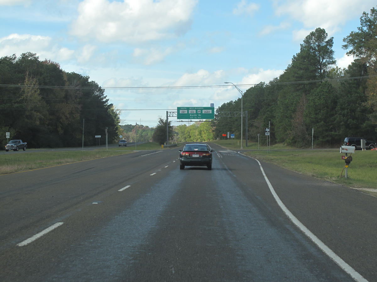
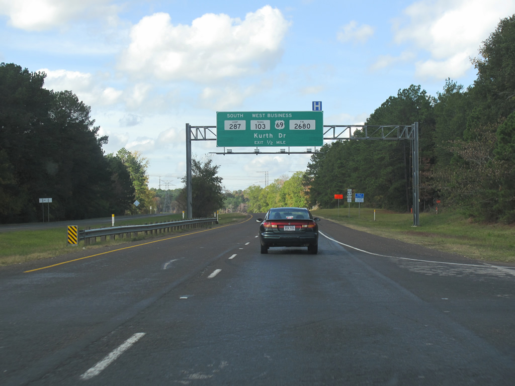
| The large intersection with Kurth Dr and Loop 287 south comes next, and is the last in Lufkin. 11/21/10 |
|
| US 69 gets a northbound control city here with Tyler. Loop 287 leaves US 69 here to head south on the west side of Lufkin as a (mostly) at-grade roadway. SH 103 briefly continues west, and business US 69 finally gets a mention. US 69 Business is very poorly signed through Lufkin. 11/21/10 |
Page Updated 04-30-2012.


 North
North