|
| Descending from the crest of the Pensacola Bay Bridge along U.S. 98 eastbound. The new bridge provides 65 feet of vertical clearance, 15 feet more than the 1960 span.1 05/16/14 |
|
| Until 2004, two lengthy fishing piers lined the east side of the Three Mile Bridge. Retained from portions of the original toll bridge across Pensacola Bay, those two piers were permanently damaged by the storm surge of Hurricane Ivan in 2004. The northbound pier was replaced in 2009 with a higher span; the southbound pier was dismantled in 2011 without a replacement. 07/15/07 |
|
| Southwesterly view of Pensacola Bay and the west end of Santa Rosa Island at Fort Pickens. 05/29/10 |
|
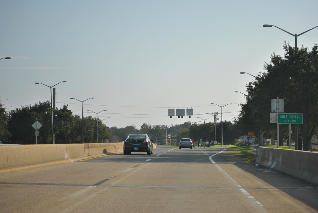
| U.S. 98 formally enters the city limits of Gulf Breeze at the south end of the Three Mile Bridge. Speed limits drop along U.S. 98 to 35 miles per hour through the city. 01/01/12 |
|
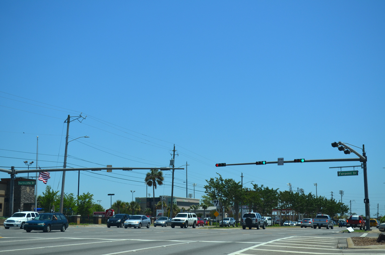
| Fairpoint Drive, along with Shoreline Drive to the south, comprise the original County Road 30A loop west from U.S. 98 in Gulf Breeze. 05/15/14 |
|
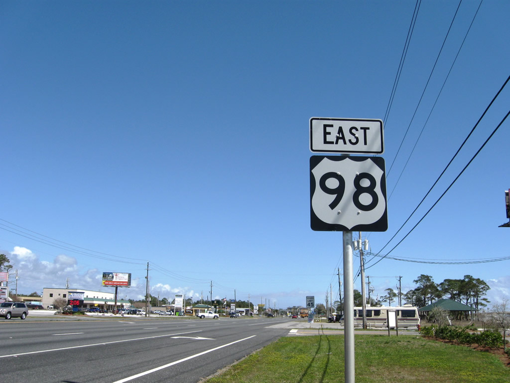
| Reassurance marker for U.S. 98 east posted after the traffic light with Fairpoint Drive west and Northcliff Drive east. 05/16/14 |
|
| Shoreline Drive ties into U.S. 98 opposite a shopping center. Through traffic was rerouted from Shoreline Drive onto an extension of Daniel Street (as Daniel Drive) to a new signalized intersection nearby by 2007. 11/19/15 |
|
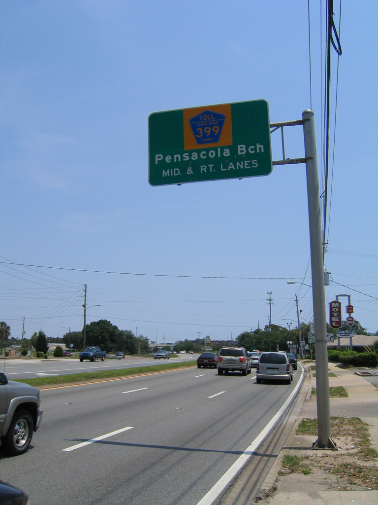
| The first in a series of sign changes for CR 399 (Pensacola Beach Road) along U.S. 98 east took in place in 2000. The overhead installed then reflected a maintenance transfer of SR 399 and the Bob Sikes Bridge southward into Pensacola Beach to county control. 05/09/04 |
|
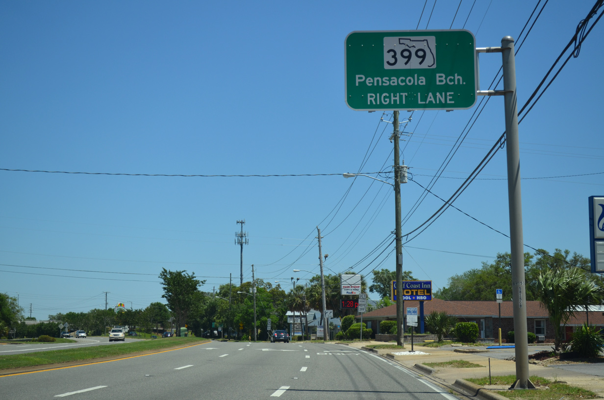
| A subsequent sign replacement made by 2006 restored SR 399. SR 399 constitutes just a 0.28 mile snippet of Pensacola Beach Road at the trumpet interchange with U.S. 98. 05/15/14 |
|
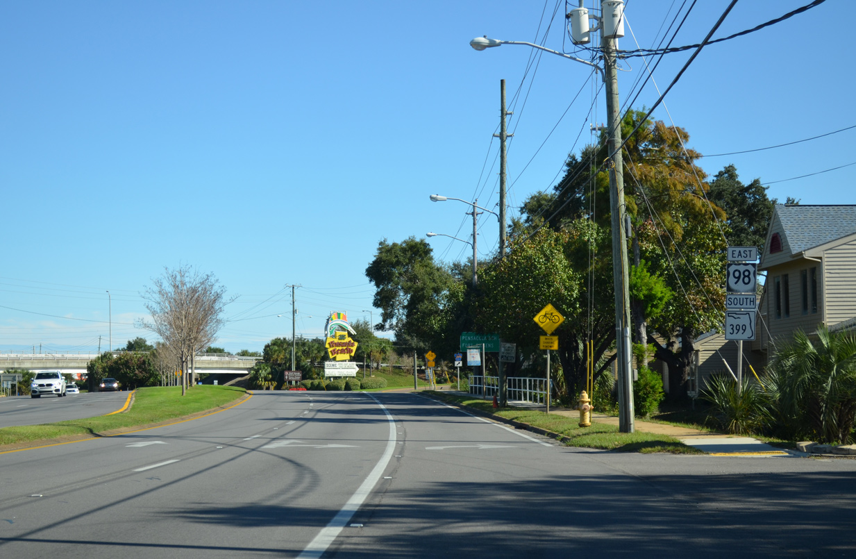
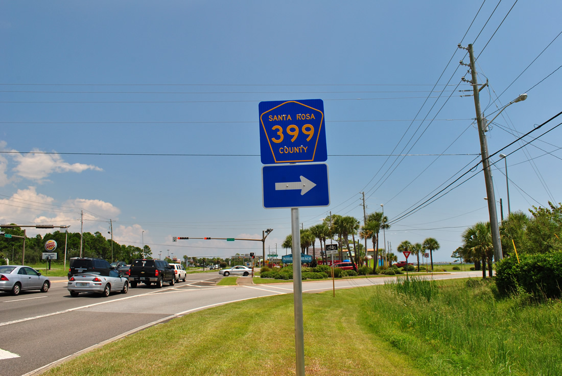
| An arrow-per-lane sign was installed for the upcoming ramp to SR 399 / CR 399 (Pensacola Beach Road) by 2015. Collectively SR 399, CR 399 and J. Earle Bowden across Gulf Islands National Seashore forms a 20.5 mile loop south from U.S. 98 between Gulf Breeze and Navarre. 11/19/15 |
|
| This scenic SR 399 shield assembly posted by Harbourtown Village shopping center is date stamped to February 2001. CR 399 is unsigned within Escambia County. 11/19/15 |
|
| Reassurance markers for U.S. 98 & SR 399 precede the trumpet interchange with Pensacola Beach Road. This assembly is erroneous, as SR 399 never overlaps with U.S. 98 (Gulf Breeze Parkway). 11/19/15 |
|
| Pensacola Beach Road becomes Via De Luna Drive east from Fort Pickens Road in Pensacola Beach. Fort Pickens Road is an unsigned branch of CR 399 spurring west to Fort Pickens in Gulf Islands National Seashore. 11/19/15 |
|
| Tolls for the Bob Sikes Bridge taking CR 399 south across Santa Rosa Sound are collected at a plaza south of the span. 11/19/15 |
|
| The famous Pensacola Beach illuminated sign appears beyond the turn-off for SR 399 (Pensacola Beach Road) south. 11/19/15 |
|
| The exchange joining SR 399 and U.S. 98 (Gulf Breeze Parkway) by McClure Drive opened to traffic in 1962. 05/16/14 |
|
| U.S. 98 (Gulf Breeze Parkway) intersects the entrance to Live Oak Village shopping center and Gulf Breeze Hospital at a traffic light adjacent to SR 399. Red light cameras were added here in August 2011. 05/16/14 |
|
| U.S. 98 travels through the Naval Live Oaks Area of Gulf Islands National Seashore to the east Gulf Breeze city line. 02/09/06 |
|
| Gulf Breeze Parkway transitions into a commercial arterial east through the community of Oriole Beach. The first of several traffic lights on the ensuing stretch is with Gondolier Boulevard south and Kelton Boulevard north. 05/16/14 |
|
| The U.S. 98 (Gulf Breeze Parkway) intersection with Whisper Bay Boulevard was reconfigured in 2010 to connect with Crane Cove Boulevard to the south. Traffic lights were also added. 05/16/14 |
|
| The advance shield for CR 191 posted ahead of Oriole Beach Road on U.S. 98 east was taken down some time after 2004. Oriole Beach Road spurs south of Gulf Breeze Parkway to the Intracoastal Waterway and Bay Street (unsigned CR 191A) in Oriole Beach. 05/09/04 |
|
| County Road 191A (Oriole Beach Road) heads south 0.763 miles from U.S. 98 to Bay Street, where unsigned County Road 191 begins and spurs west 1.28 miles to Villa Venyce. A third stretch of County Road 191A exists between Galt City and Bagdad. 05/16/14 |
|
| College Parkway connects U.S. 98 (Gulf Breeze Parkway) with adjacent residential areas. The local road ends at Santa Rosa Drive to the south and Quiet Water Lane to the north. 05/16/14 |
|
| Traffic lights were added at the intersection of U.S. 98 (Gulf Breeze Parkway) with Country Club Road south and Green Brier Parkway north in an effort to improve pedestrian and bicycle safety in the area. The signals were activated on November 8, 2012.2 05/16/14 |
|
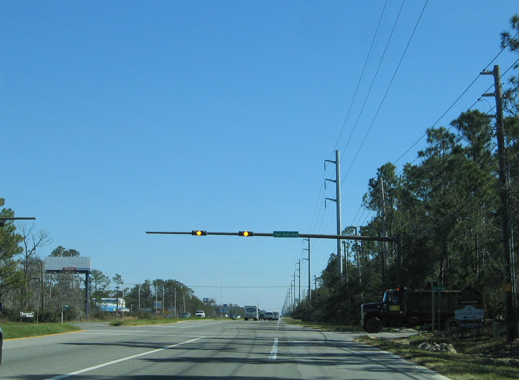
| Advancing east from Oriole Beach, U.S. 98 approaches the south end of SR 281 at Tiger Point. SR 281 travels 6.4 miles north to CR 191 (Garcon Point Road) and Avalon Boulevard via the tolled Garcon Point Bridge. 05/16/14 |
|
| The Garcon Point Bridge was constructed between 1996 and 1999 to link northern and southern Santa Rosa Counties across East Bay. The two lane toll bridge spans the bay between Redfish Point and Garcon Point. 02/09/06 |
|
| SR 281 continues north from the Garcon Point Bridge to meet Interstate 10 in 11 miles at Avalon Beach. The span is an alternative route between Pace / Milton and Gulf Breeze / Oriole Beach in lieu of Pensacola. The state road also provides a third hurricane evacuation route from Santa Rosa Island. 05/16/14 |
|
| U.S. 98 continues to a second traffic light for the shopping center adjacent to SR 281. An eastbound distance sign lists Navarre Beach (via County Road 399 south), Fort Walton Beach and Okaloosa Island (east via the Brooks Bridge). 05/16/14 |
|
| Tiger Point Park Lane and Portside Drive come together at the second shopping center area light by SR 281. 02/09/06 |
|
| Tiger Point Boulevard constitutes a loop south from U.S. 98 through the Tiger Point golf course community. 02/09/06 |
|
| Leaving the Tiger Point area, U.S. 98 next meets County Road 191B (Soundside Drive) south. County Road 191B winds 4.61 miles east along Santa Rosa Sound to the end of Soundside Drive at Woodlawn Beach. 05/16/14 |
|
| Continuing east along Gulf Breeze Parkway from Soundside Drive toward the community of Midway. 05/16/14 |
|
| Santa Rosa County Road 191C links U.S. 98 (Gulf Breeze Parkway) with County Road 191B (Soundside Drive) at Midway. 05/16/14 |
|
| County Road 191C (Nantahala Beach Road) spurs south 0.79 miles from U.S. 98 to Santa Rosa Sound. Traffic lights at this intersection were activated on November 24, 2008. 05/16/14 |
|
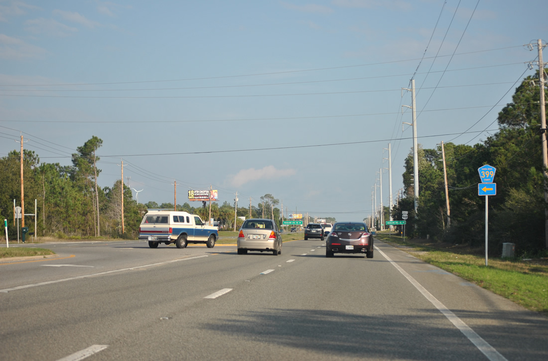
| Less than a mile further east, U.S. 98 (Gulf Breeze Parkway) meets the west end of Santa Rosa County Road 399 (East Bay Boulevard). A $321,000 project installed traffic lights at the forthcoming intersection between June 2016 and fall 2016.3 01/23/09 |
|
| The lone pentagon for CR 399 on U.S. 98 east was eliminated by 2015. County Road 399 (East Bay Boulevard) winds north and eastward along East Bay for 9.87 miles to SR 87 at Navarre. 01/01/12 |
|
| U.S. 98 eastbound shield posted after County Road 399 in Midway. Woodlawn Beach Road and Oak Drive follow as connectors between Gulf Breeze Parkway and County Road 191B at Woodlawn Beach. Historically Woodlawn Beach Road was County Road 191D and Oak Drive was County Road 191E. 10/31/08 |
|
| Gulf Breeze Parkway becomes Navarre Parkway at the signalized intersection with Edgewood Drive at Holley By The Sea. Traffic lights here became operational on January 28, 2014.4 05/16/14 |
|
| The second traffic light along U.S. 98 (Navarre Parkway) eastbound for the Holley By The Sea is with Sunrise Drive. A third traffic light was activated along this stretch at Joybrook Drive on January 9, 2018. 02/09/06 |
|
| Coral Street stems north from a fall 2009-installed traffic light with U.S. 98 (Navarre Parkway) to eastern reaches of Holly By The Sea. 05/16/14 |
|
| Navarre School Road links U.S. 98 (Navarre Parkway) with 4th Street and Avenida De Sol north to County Road 399 (East Bay Boulevard) in Navarre. 05/16/14 |
|
| The area along U.S. 98 (Navarre Parkway) between Andorra Street and Ortega Street represents the business district of the unincorporated Navarre. Andorra Street leads north into the Navarre street grid from the adjacent traffic light. 11/19/15 |
|
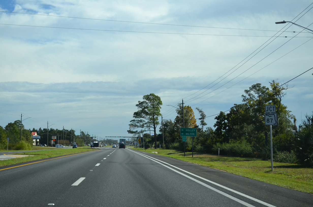
| SR 87 heads north from the ensuing intersection of U.S. 98 (Navarre Parkway) east. The state road represents the only route between the coast and Interstate 10 between the Garcon Point Bridge (SR 281) and SR 85 from Fort Walton Beach. 11/19/15 |
|
| SR 87 travels three miles north to Harper, six miles to Holley, and 19.7 miles to the overlap with U.S. 90 west to Milton. 11/19/15 |
|
| Four-lane expansion of SR 87 between U.S. 98 and Five Forks Road included the addition of a T-intersection between the original split wye. The 3.6 mile, $21.6 million project started in 2002 and took four years to complete.5 03/10/09, 11/19/15 |
|
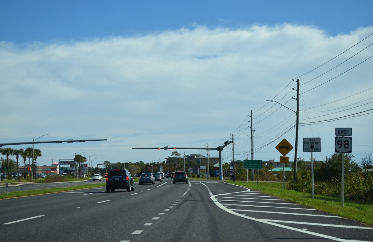
| This confirming marker for U.S. 98 stands east of SR 87 and ahead of the Navarre Beach Welcome Center. 03/10/09, 11/19/15 |
|
| U.S. 98 advances east to meet County Road 399 (Navarre Beach Causeway) south across Santa Rosa Sound to Navarre Beach. 03/10/09 |
|
| Navarre Beach Causeway was tolled until July 1, 2004 when Santa Rosa County took control of the facility from the state. During that transition, State Road 399 was downgraded to County Road 399. 11/19/15 |
|
| Navarre Beach lies directly south of Navarre, occupying a three mile or so swath of condo high rises and beach homes sandwiched between Navarre Beach County Park and the Gulf Islands National Seashore. 11/19/15 |
|
| An email from AARoads to FDOT District 2 resulted in the installation of County Road 399 shields previously missing from U.S. 98 at Navarre Beach Causeway in July 2012. 08/23/12 |
|
| Navarre Beach Causeway links U.S. 98 with Gulf Boulevard (CR 399) west through Navarre Beach to Gulf Islands National Seashore and J. Earle Bowden Way. County Road 399 pentagons were installed along the route by February 2011 after AARoads emailed Santa Rosa County. 11/19/15 |
|
| Since removed, a SR 399 shield that was posted on the southbound turn to Navarre Beach Causeway from U.S. 98 (Navarre Parkway) west. 02/09/06 |
|
| Welcome to Navarre Beach sign posted at the foot of the Navarre Beach Bridge. The high rise span across Santa Rosa Sound opened to traffic in 1974. 11/19/15 |
|
| U.S. 98 intersects Pullum Street at a fire signal and then the entrance to Islands Style shopping center just east of County Road 399. 11/19/15 |
|
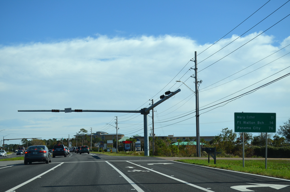
| Eastbound distance sign listing the city of Mary Esther (11 miles), Downtown Fort Walton Beach (14 miles) and Panama City (76 miles). 11/19/15 |
|
| Panhandle Trail leads north to East River Drive from U.S. 98. The local road generally serves residential areas and horse farms in east Navarre. 05/26/12 |
|
| Whispering Pines Boulevard winds northward from U.S. 98 (Navarre Parkway) to a number of subdivisions before ending at Acorn Lane. 11/19/15 |
|
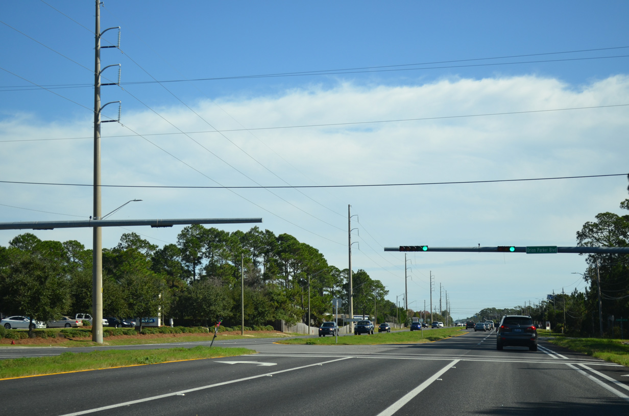
| A traffic light was installed at U.S. 98 (Navarre Parkway) and Orion Parker Boulevard in 2009. Orion Parker Boulevard spurs northward to provide access to adjacent subdivisions. 11/19/15 |
|
| U.S. 98 exits Santa Rosa County for Wynn Haven Beach in Okaloosa County. Eglin Air Force Base lands come close to the four lane highway on the corridor into Mary Esther. 11/19/15 |
05/09/04, 02/09/06, 07/15/07, 10/31/08, 01/23/09, 03/10/09, 05/29/10, 01/01/12, 05/26/12, 08/23/12, 05/15/14, 05/16/14, 11/19/15 by AARoads
Page Updated 08-29-2018.

 East
East