|
| The first traffic light along U.S. 98 (Navarre Parkway) westbound in Santa Rosa is with Orion Parker Boulevard. Added in early 2009, this signal serves a number of subdivisions to the north. 11/19/15 |
|
| Whispering Pines Boulevard follows at the succeeding traffic light, replicating Orion Parker Boulevard's function as a feeder route to adjacent residential areas. 11/19/15 |
|
| Panhandle Trail ties into U.S. 98 opposite an RV park, joining Navarre Parkway with East River Drive. 11/19/15 |
|
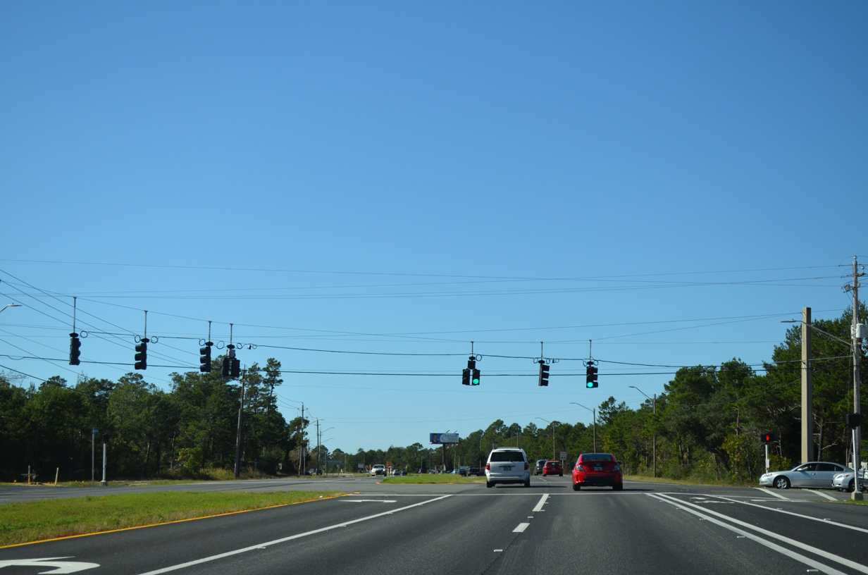
| U.S. 98 shifts southward toward the north shore of Santa Rosa Sound as it enters the heart of Navarre. Navarre is unincorporated, representing a collection of subdivisions and a large street grid spreading northward toward the East Bay River. 11/19/15 |
|
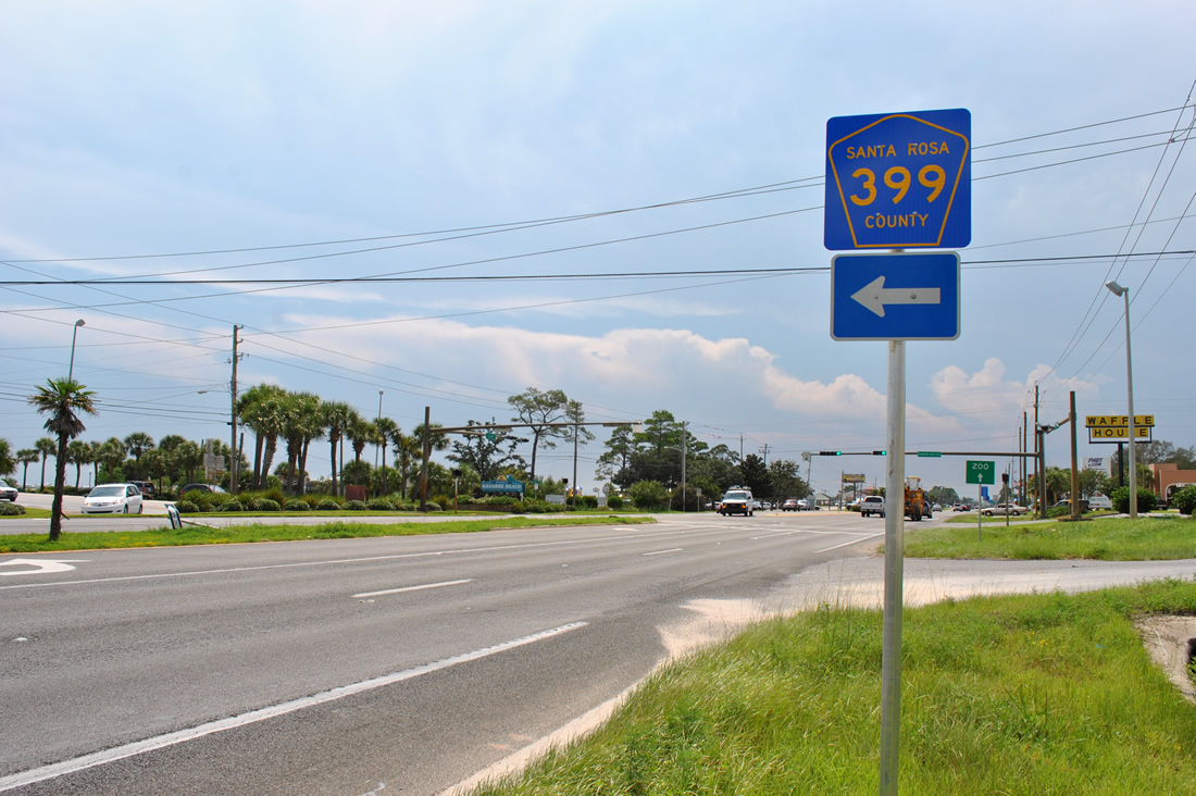
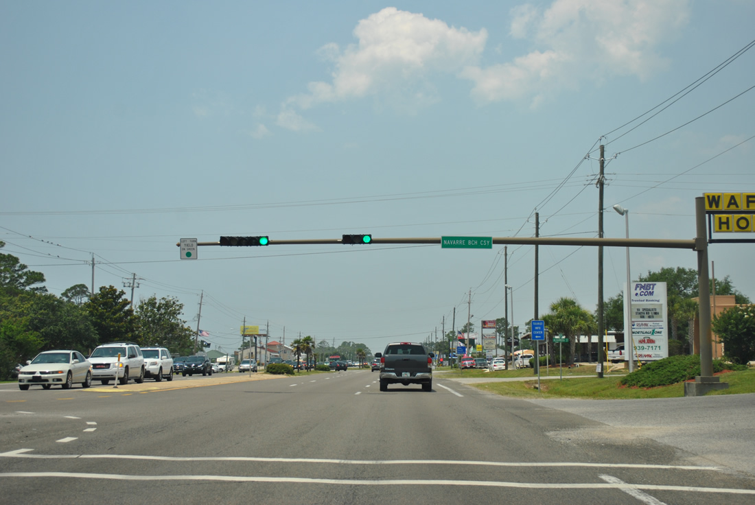
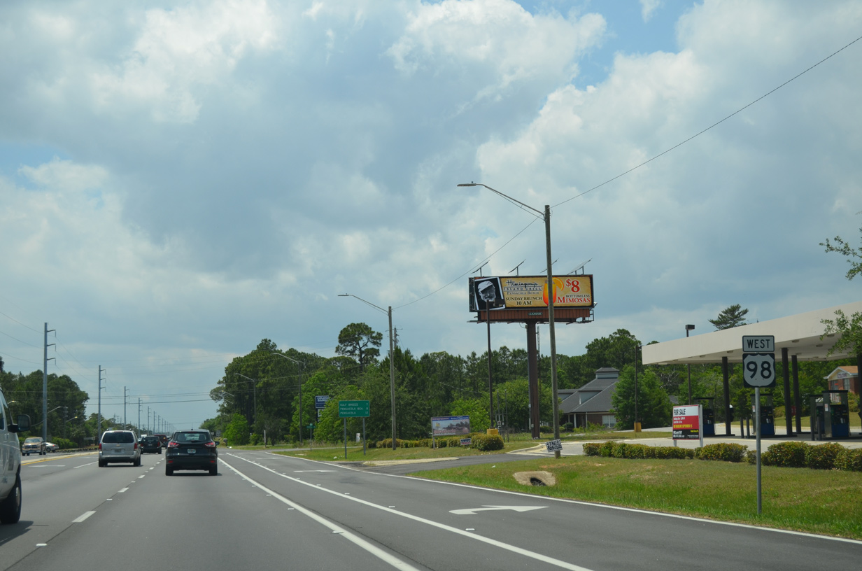
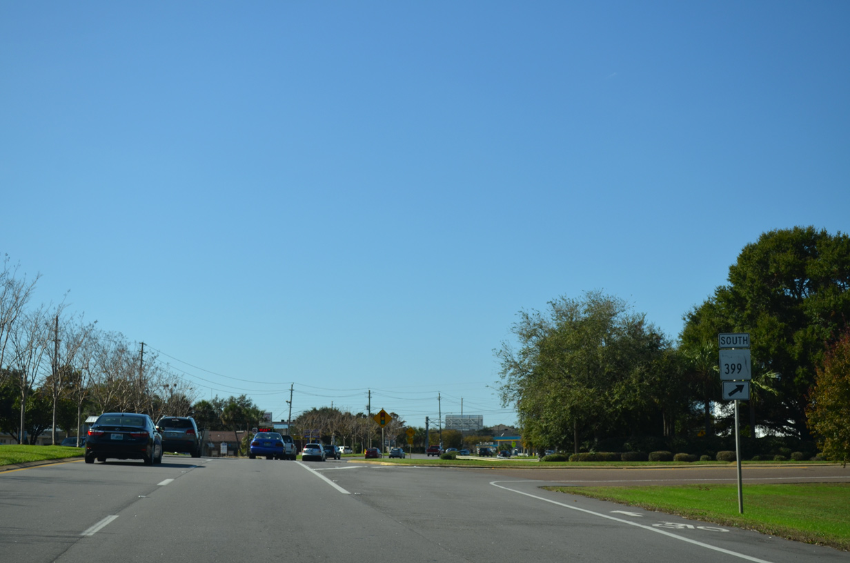
| Signs for County Road 399 were installed in July 2012 along U.S. 98 (Navarre Parkway) west at Navarre Beach Causeway. AARoads emailed FDOT in January 2012 about the lack of signs for the county road. 08/23/12, 11/19/15 |
|
| County Road 399 follows Navarre Beach Causeway south from U.S. 98 to Gulf Boulevard at Navarre Beach. Gulf Boulevard continues the county road west to Gulf Islands National Seashore and J. Earle Bowden Way. 08/23/12, 11/19/15 |
|
| Navarre Beach Causeway was tolled until July 1, 2004 when Santa Rosa County took control of the facility from the state. During that transition, State Road 399 was downgraded to a county road. 05/26/12 |
|
| U.S. 98 quickly approaches the northbound beginning of SR 87 from County Road 399 (Navarre Beach Causeway). The 47.13 mile long state road stretches northward from Santa Rosa Sound to the Alabama state line, south of Brewton. 11/19/15 |
|
| SR 87 is the main north-south route between southeastern Santa Rosa County and Interstate 10. A diamond interchange (Exit 31) joins the two routes, 18.5 miles to the north. 08/23/11 |
|
| SR 87 ventures north three miles to Harper and west six miles through Holley to a rural stretch through Eglin Air Force Base. Long term construction from 2002 to 2019 expanded the entire highway north from Navarre to U.S. 98 to four lanes. 11/19/15 |
|
| State Road 87 originally ended at U.S. 98 at a two-wye intersection. Four-laning of SR 87 north 3.7 miles to Five Forks Road finished in 2006 added the center leg and T-intersection with U.S. 98 here. 11/19/15 |
|
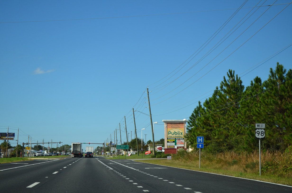
| Reassurance marker posted between SR 87 and the Shoppes of Navarre retail area. 11/19/15 |
|
| U.S. 98 advances 19 miles west from SR 87 in Navarre to the city of Gulf Breeze. 11/19/15 |
|
| Andorra Street leads north from U.S. 98 (Navarre Parkway) through the residential street grid of Navarre. The through road ends at County Road 399 (East Bay Boulevard) in 2.1 miles. 11/19/15 |
|
| Navarre School Road and Thresher Drive come together at the next westbound traffic light of U.S. 98. Navarre School Road to 4th Street provides a second through route to the street grid of Navarre. 11/19/15 |
|
| Traffic lights were installed at the intersection of U.S. 98 (Navarre Parkway) and Coral Street in fall of 2009. Coral Street provides the main entrance to eastern reaches of the sprawling Holley By The Sea community. 11/19/15 |
|
| An additional traffic light was added to U.S. 98 at Joybrook Road on January 9, 2018.1 Sunrise Drive follows at the succeeding traffic light for Holley By The Sea along U.S. 98 westbound. 11/19/15 |
|
| Traffic lights installed at U.S. 98 and Edgewood Drive were activated on January 28, 2014. Edgewood Drive leads north through Holly-by-the-Sea to CR 399 (East Bay Boulevard).2 11/19/15 |
|
| Woodlawn Beach Road leads south from U.S. 98 (Gulf Breeze Parkway) to County Road 191B (Soundside Drive) at Woodlawn Beach. Woodlawn Beach, and parallel Oak Drive, were once County Road 191D and 191E respectively. 11/23/08 |
|
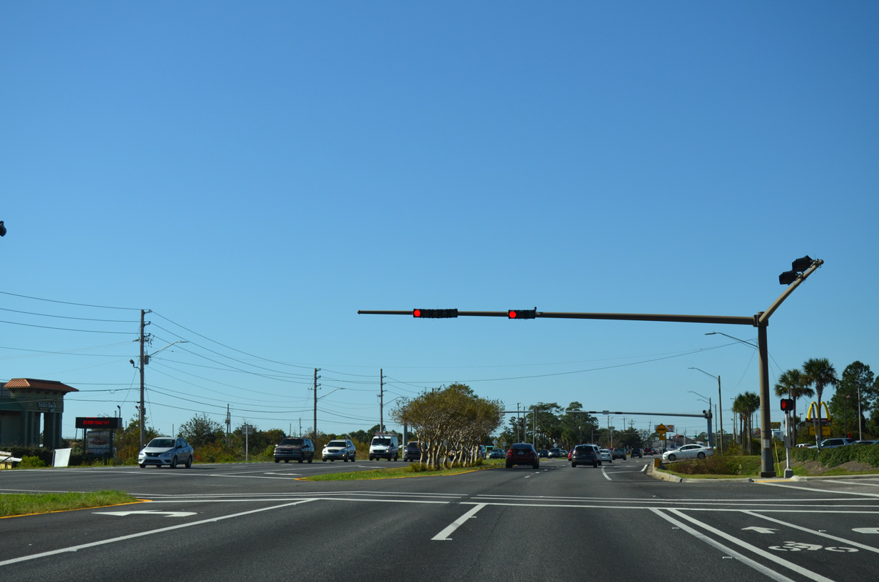
| Santa Rosa County Road 399 (East Bay Boulevard) travels west from Navarre along the East Bay to end at U.S. 98 in Midway. The county road measures 9.871 miles in length between Gulf Breeze Parkway and SR 87.
Construction from June 2016 to fall 2016 signalized the intersection with CR 399. 11/19/15 |
|
| Continuing west from East Bay Boulevard along U.S. 98 (Gulf Breeze Parkway) through unincorporated Midway. 11/17/12 |
|
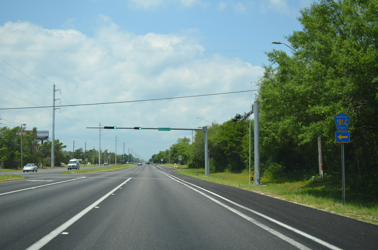
| Approaching the north end of County Road 191C (Nantahala Beach Road) on U.S. 98 west. County Road 191C comprises a 0.79 mile link between Gulf Breeze Parkway and County Road 191B (Soundside Drive) on Santa Rosa Sound. 05/13/16 |
|
| The traffic light at U.S. 98 (Gulf Breeze Parkway) and Santa Rosa County Road 191C went into operation on November 24, 2008. 05/13/16 |
|
| Westbound reassurance shield for U.S. 98 posted after Nantahala Beach Road. 05/13/16 |
|
| CR 191B (Soundside Drive) concludes westbound at U.S. 98. The county road generally follows Santa Rosa Sound from Woodlawn Beach to Soundside on a 4.61 mile course.
The county road shield posted at the intersection with Soundside Drive was removed sometime after 2006. 11/19/15 |
|
| Tiger Point Boulevard constitutes a loop south from U.S. 98 through the Tiger Point golf course community. 05/13/16 |
|
| Tiger Point Park Lane north and Portside Drive south come together at a shopping center adjacent to the south end of SR 281. 05/13/16 |
|
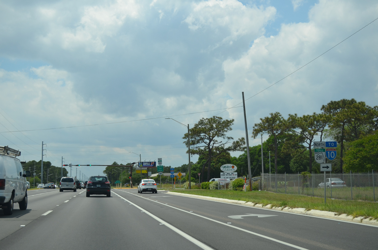
| The succeeding traffic light joins U.S. 98 (Gulf Breeze Parkway) with SR 281 north to the Garcon Point Bridge. Providing a direct route north to I-10 at Avalon Boulevard (Exit 22), the two lane toll bridge was completed in 1999. 05/13/16 |
|
| SR 281 travels 11.0 miles northward from U.S. 98 (Gulf Breeze Parkway) to a diamond interchange with Interstate 10. Garcon Point Road (Santa Rosa County Road 191) branches northeast from Avalon Boulevard in 7.1 miles to connect with I-10 east by Bagdad. 05/13/16 |
|
| SR 281 begins opposite the main shopping center entrance on U.S. 98 near Oriole Beach. The state road extends 16.0 miles north to U.S. 90 outside Milton. 05/13/16 |
|
| Tiger Point Boulevard returns to intersect U.S. 98 (Gulf Breeze Parkway) just west of SR 281. 05/13/16 |
|
| Gulf Breeze and Pensacola follow along U.S. 98 westbound in seven and 12 miles respectively. 11/19/15 |
|
| The traffic light at U.S. 98 and Green Briar Parkway north and Country Club Road south was activated on November 8, 2012 to address safety concerns with pedestrians crossing Gulf Breeze Parkway. 05/13/16 |
|
| College Parkway connects U.S. 98 (Gulf Breeze Parkway) with adjacent residential areas. The local road ends at Santa Rosa Drive to the south and Quiet Water Lane to the north. 05/13/16 |
|
| Entering the Oriole Beach community, U.S. 98 approaches the signalized intersection with Santa Rosa County Road 191A (Oriole Beach Road) south. 05/13/16 |
|
| Oriole Beach Road (CR 191A) spurs south 0.763 miles to Bay Street (unsigned CR 191A) and Santa Rosa Sound. Bay Street heads west 1.28 miles to the canal-lined neighborhood of Villa Venyce. 05/13/16 |
|
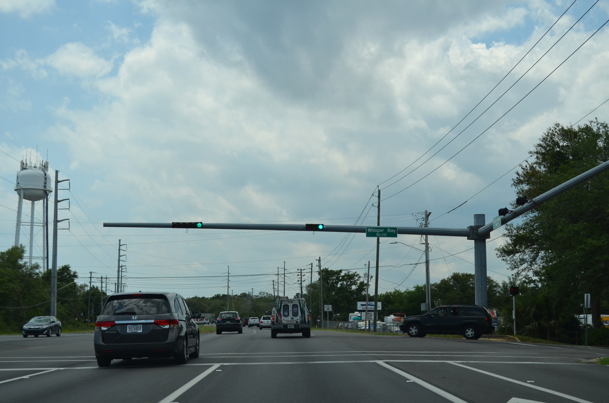
| Traffic lights were added to the realigned Crane Cove Boulevard at Whisper Bay Boulevard on U.S. 98 (Gulf Breeze Parkway) in 2010. 05/13/16 |
|
| U.S. 98 meets Gondolier Boulevard south and Kelton Boulevard north ahead of the Gulf Breeze city line and the drive through the Naval Live Oaks Area of Gulf Islands National Seashore. 05/13/16 |
|
| U.S. 98 enters Gulf Islands National Seashore for two miles after Bayshore Road. The seashore lies within the city of Gulf Breeze, where speed limits are rigidly enforced. 05/13/16 |
|
| Speed limits reduce to 35 miles per hour along U.S. 98 beyond the Naval Live Oaks area. The arterial passes south of Gulf Breeze and Baptist Hospital on the ensuing stretch. 05/13/16 |
|
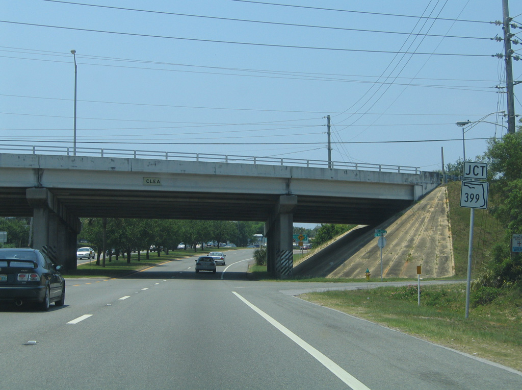
| A signalized intersection with the entrance to Live Oak Village shopping center and Gulf Breeze Hospital precedes the trumpet interchange connecting U.S. 98 (Gulf Breeze Parkway) with SR 399. Red-light cameras were activated here in August 2011. 05/13/16 |
|
| Construction of a turn lane to McClure Drive along U.S. 98 (Gulf Breeze Parkway) westbound resulted in the removal of a guide sign and shield assembly for SR 399. 05/09/04 |
|
| A loop ramp departs beyond the forthcoming overpass for SR 399 (Pensacola Beach Road) south to Pensacola Beach. State Road 399 represents the initial 0.28 miles of roadway leading to the county-maintained Bob Sikes Bridge across Santa Rosa Sound. 05/13/16 |
|
| The exchange connecting U.S. 98 (Gulf Breeze Parkway) with SR 399 south to the Bob Sikes Bridge was built in 1962. Tolls for the Bob Sikes Bridge are collected at a plaza south of the span in Pensacola Beach. 05/13/16 |
|
| County Road 399 becomes an unsigned route in Pensacola Beach, with a western branch spurring to Fort Pickens and the eastbound mainline traveling through Gulf Islands National Seashore to Navarre Beach. Fishing, sun-bathing, and wind-surfing are among the resort area attractions of Pensacola Beach on the Emerald Coast. 11/19/15 |
|
| Traffic increases along U.S. 98 west beyond the Bob Sikes Bridge. 2017 traffic counts recorded by FDOT were 45,000 vehicles per day (vpd) east of SR 399 and 59,000 vpd west of SR 399. Gulf Breeze Parkway expands to six overall lanes ahead of Daniel Drive. 11/19/15 |
|
| Shoreline Drive (SR 30A) was relocated to intersect an extension of Daniel Drive south of U.S. 98. This realignment both shifted the traffic light from Shoreline Drive northward and eliminated left turns from Shoreline Drive east to U.S. 98 west.
Red light cameras were activated at Daniel Drive in March of 2011. 05/13/16 |
|
| A signalized entrance to Gulf Breeze High, Middle and Elementary schools lies just beyond Daniel Drive on U.S. 98. 05/13/16 |
|
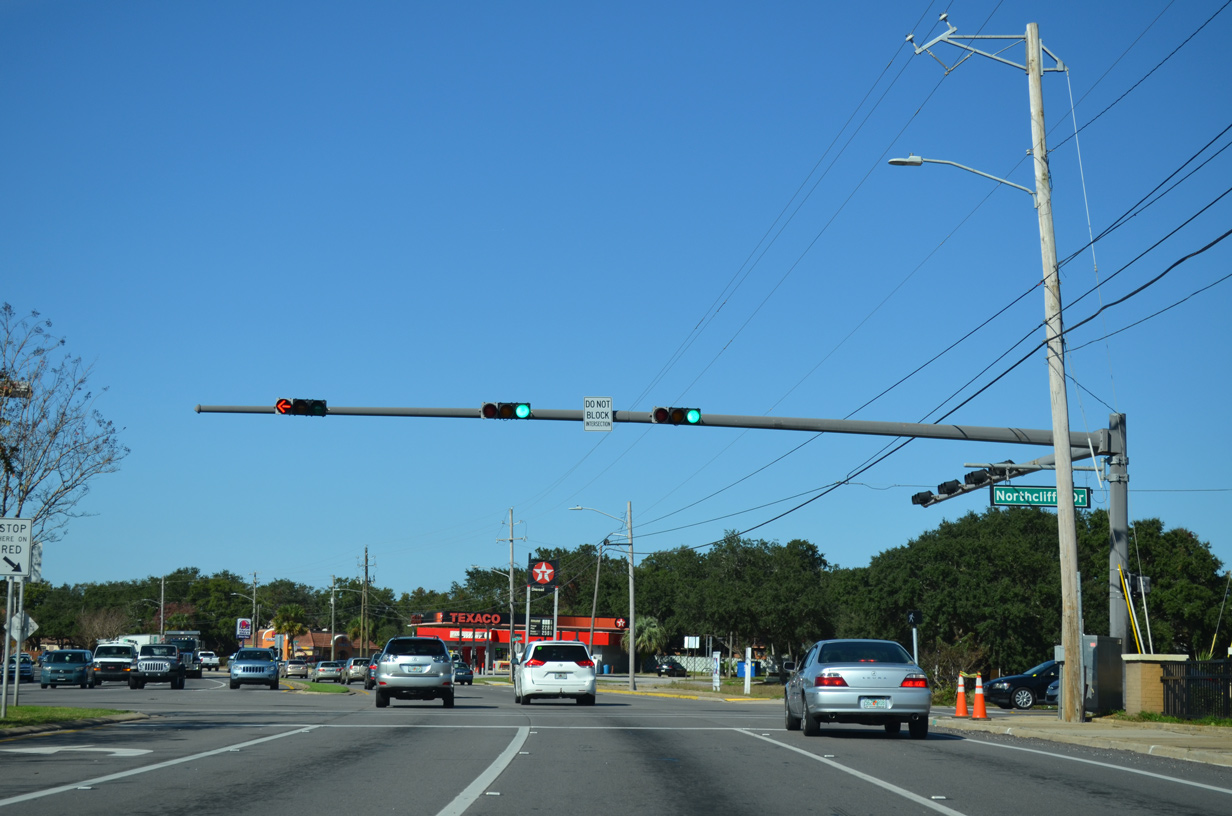
| U.S. 98 (Gulf Breeze Parkway) west at Fairpoint Drive west and Northcliffe Drive east. Fairpoint Drive forms the north part of the former County Road 30A loop with Shoreline Drive. The loop serves residential areas and marinas of Gulf Breeze along Pensacola Bay and Old Navy Cove. 11/19/15 |
|
| U.S. 98 traffic trudges northward toward Pensacola Bay Bridge. The right lane drops ahead of Wayside Park.
This reassurance shield was removed by August 2011. 03/09/09 |
|
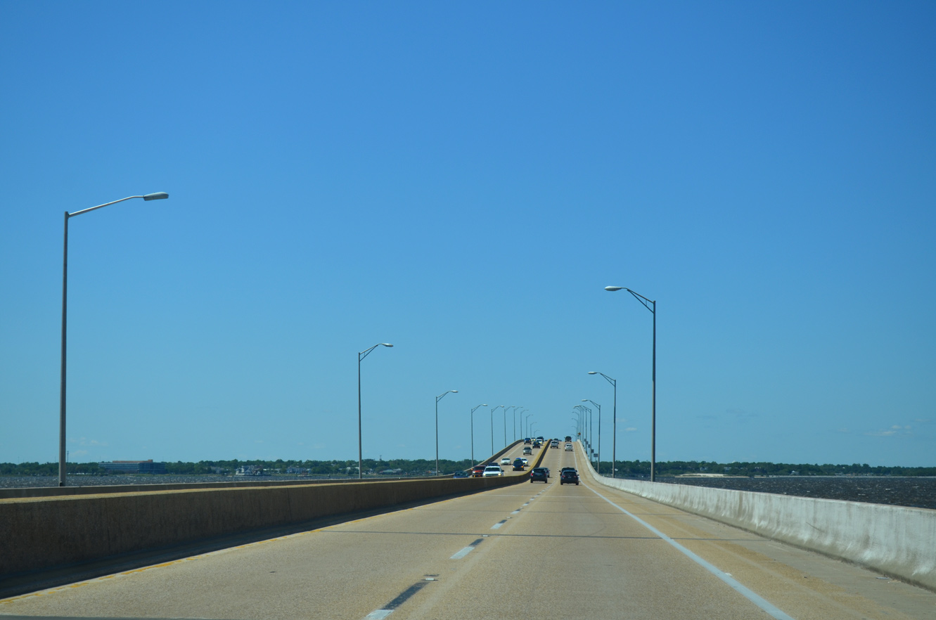
| U.S. 98 spans Pensacola Bay on the Three Mile Bridge. Warning beacons and do not enter signs were added at both ends of the crossing to prevent wrong-way drivers. 11/19/15 |
|
| The four lane Pensacola Bay Bridge carries U.S. 98 between Gulf Breeze and Pensacola. Speed limits rise to 45 mph as westbound motorists leave Gulf Breeze. 05/13/16 |
|
| Two portions of the predecessor Pensacola Bay Bridge were positioned along the east side of U.S. 98. Converted for use as fishing piers, these succumbed to storm surge from Hurricane Ivan on September 15, 2004. Subsequent work in 2009 on the Pensacola side and 2011 on the Gulf Breeze side dismantled both sets of piers. 05/15/14 |
|
| Reaching the end of its lifespan, construction underway through mid-2021 replaced the 1960-built Pensacola Bay Bridge. The initial span built to the west opened with two-way traffic on September 8, 2019. Subsequent work demolished the old span to make way for construction for the second span for westbound traffic.3 11/19/15 |
|
| The new Pensacola Bay Bridge provides 65 feet of vertical clearance, an increase of 15 feet over the older span. Additionally the navigation channel was increased from 125 to 150 feet.3 05/15/14 |
|
| U.S. 98 crosses the Escambia County line into the city of Pensacola at the apex of the Pensacola Bay Bridge. 11/19/15 |
05/09/04, 11/23/08, 03/09/09, 08/23/11, 05/26/12, 08/23/12, 11/17/12, 05/15/14, 11/19/15, 05/13/16 by AARoads
Page Updated 08-28-2018.

 West
West