U.S. 221 heads northeast 150.23 miles into Virginia from the North Carolina state line south of Independence to the city of Lynchburg. U.S. 221 overlaps with U.S. 21 north 3.86 miles to U.S. 58, and with U.S. 58 east 35.05 miles to Galax and Hillsville. Continuing east into Floyd County, U.S. 221 runs along the north side of Indian Ridge to Willis en route to Floyd.
Entering the Blue Ridge Mountains, U.S. 221 ventures north into Roanoke County and east from Bent Mountain to Cave Spring. U.S. 221 combines with U.S. 460 east from Roanoke to Bedford. Through Lynchburg U.S. 221 follows Lakeside Drive from U.S. 501 (Lynchburg Expressway) to Oakley Avenue at West Lynchburg. U.S. 220 overlaps with U.S. 460 Business on Fort Avenue and 12th Street to U.S. 501 Business on Campbell Avenue.
|
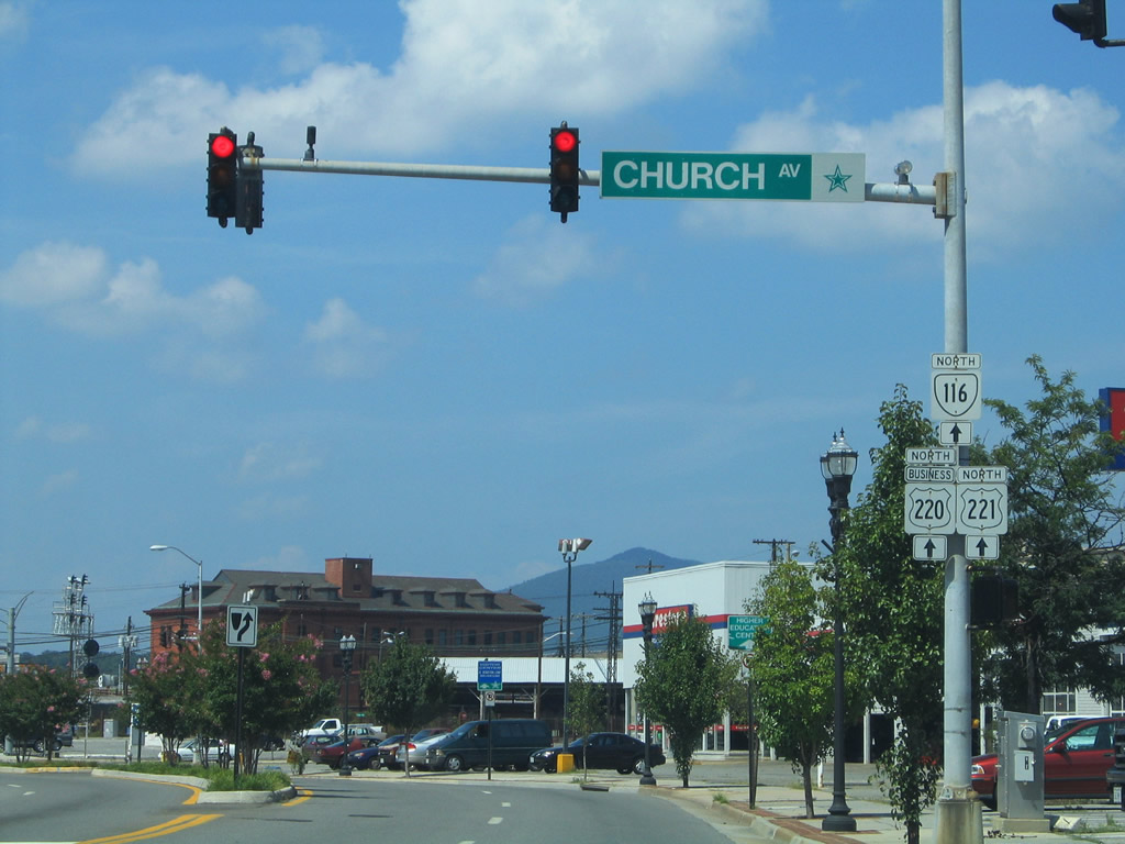
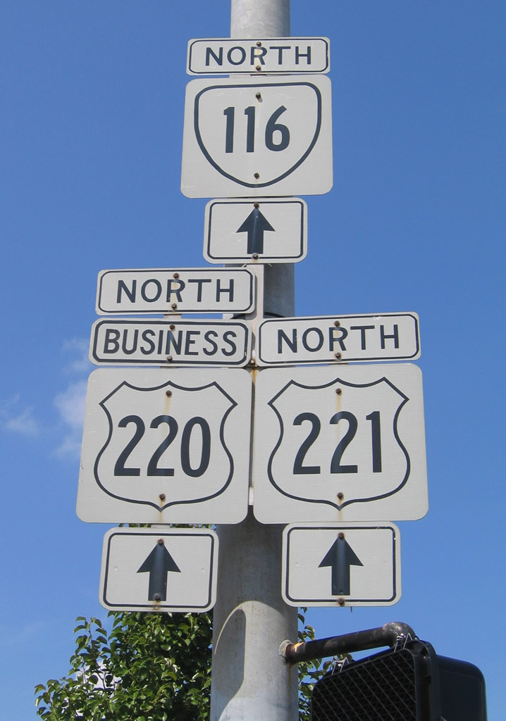
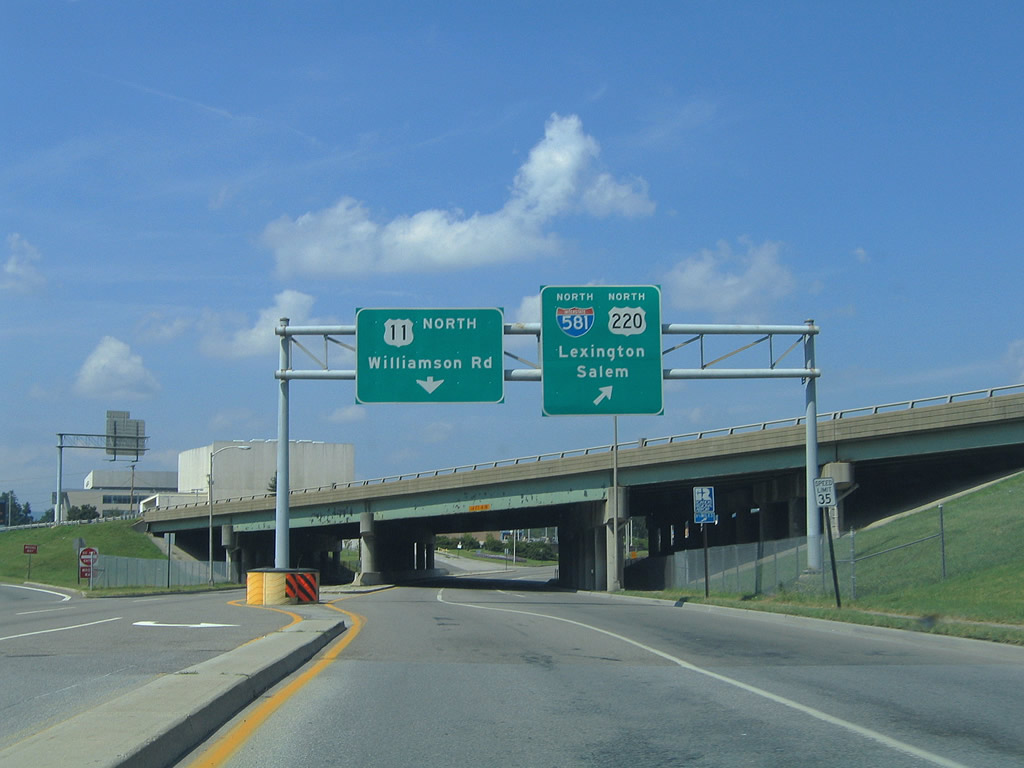
| U.S. 220 Business, U.S. 221, and SR 116 reassurance shield assembly posted on Williamson Road northbound at Church Avenue west. 07/24/04 |
|
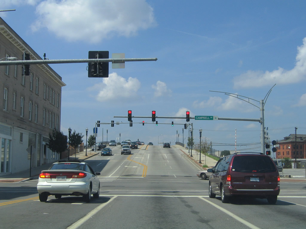
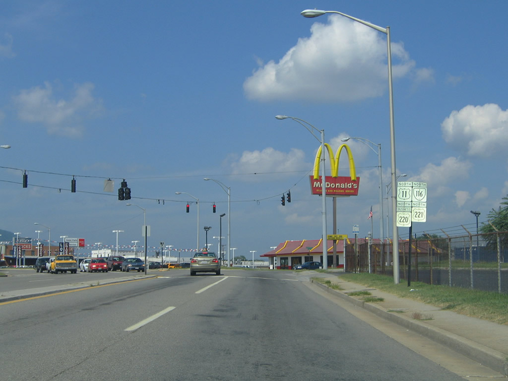
| U.S. 221/220 Business and SR 116 (Williamson Road) merge with U.S. 11 north between Campbell Avenue and U.S. 460 (Orange Avenue). U.S. 11 south follows Campbell Avenue west from central Roanoke to 13th Street and Memorial Avenue. 07/24/04 |
|
| U.S. 11/221/220 Business and SR 116 (Williamson Road) ascend onto a viaduct over Norfolk Southern Railroad tracks between Salem and Shenandoah Avenues. A loop ramp follows onto I-581/U.S. 220 north to I-81 after Kimball Avenue. 07/24/04 |
|
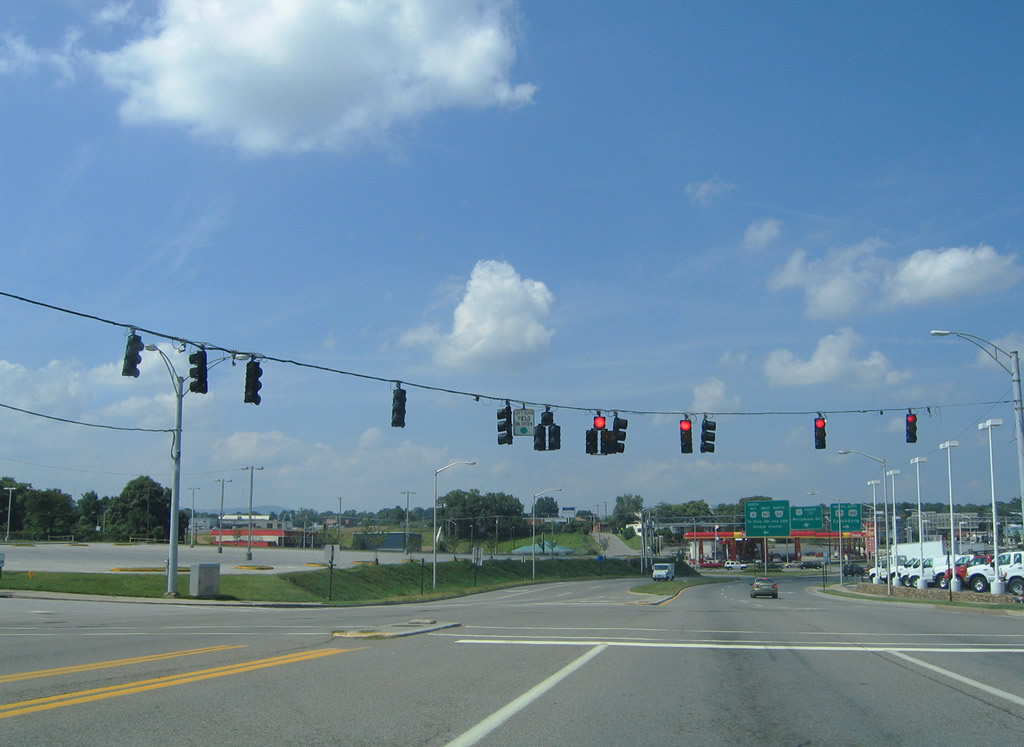
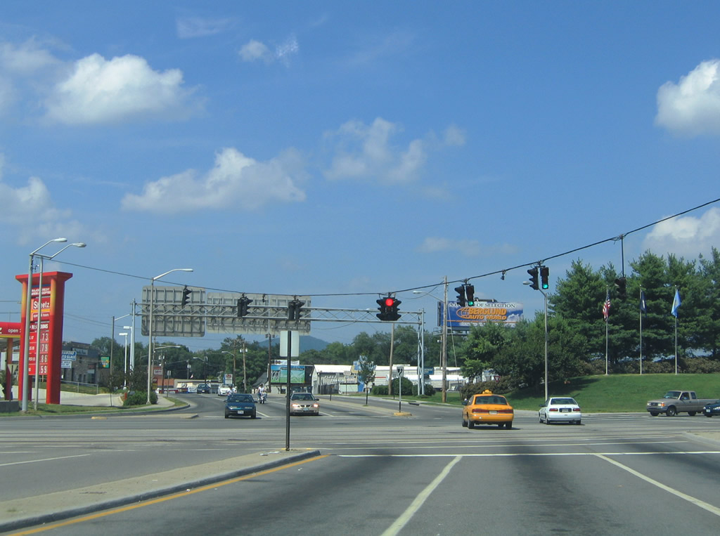
| Confirming markers for the four route overlap stand along Williamson Road at Rutherford Avenue. Rutherford Avenue heads east from Berglund Center to Kimball Avenue, which curves north to U.S. 460 (Orange Avenue). 07/24/04 |
|
| Williamson Road northbound at the entrance to Berglund Center (Roanoke Civic Center). 07/24/04 |
|
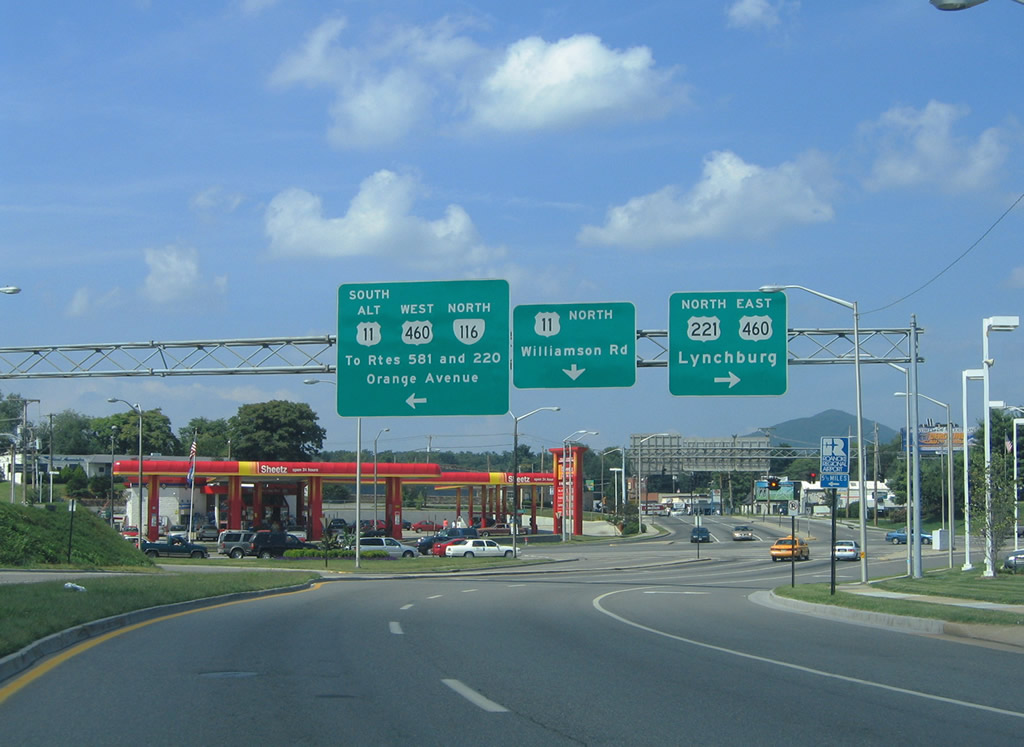
| U.S. 11 continues north along Williamson Road toward Roanoke-Blacksburg Regional Airport (ROA). U.S. 221 joins U.S. 460 (Orange Avenue) east to Bedford. U.S. 11 ALT/SR 116 north join U.S. 460 west to I-581/U.S. 220 at Exit 4, where U.S. 220 Business ends. 07/24/04 |
|
| U.S. 221/460 overlap east from Roanoke to Bonsack near the Botetourt County line. U.S. 220 ALT branches north from there to I-81 at Exit 150. U.S. 11 ALT follows U.S. 460 west to SR 419 (Electric Road) south in Salem. SR 116 connects U.S. 460 with SR 101 (Hershberger Road) via Lafayette Boulevard north. 07/24/04 |
|
| U.S. 21/221 (Independence Avenue) combine from Independence southward to Twin Oaks, North Carolina. Continuing south from Library Street, U.S. 21/221 follow New River Parkway. Sparta lies ten miles to the south beyond their split. 06/17/05 |
|
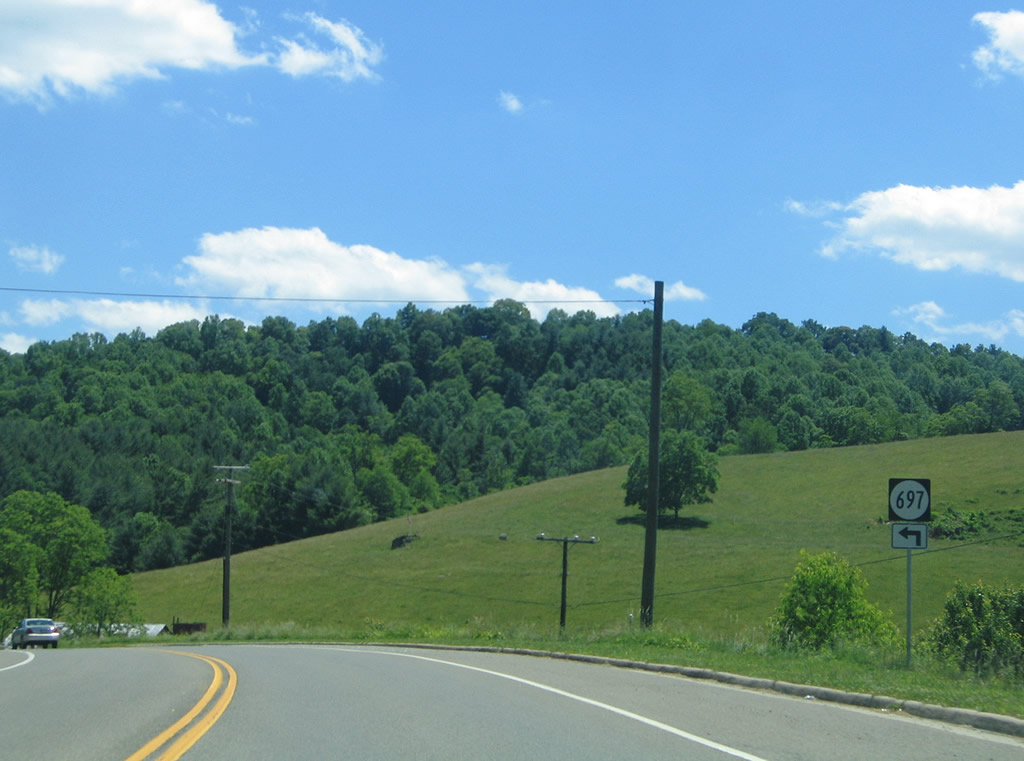
| SR 697 (Beaverdam Road) stems southeast from U.S. 21/221 (New River Parkway) along Beaverdam Creek to a rural area adjacent to the New River. 06/17/05 |
|
| U.S. 21/221 span the New River ahead of the North Carolina state line. Advancing into Alleghany County, U.S. 21/221 continue to New Haven. 06/17/05 |
Page Updated 04-12-2010.