|
| U.S. 69-96-287 (Woodworth Boulevard) travel northwestward from SH 87 (Gulfway Drive). These are the first northbound reassurance markers for the US highways. Headed in the opposite direction, there are no end signs. 11/21/10 |
|
| US 69/96/287 continues northwestward through Port Arthur and a series of traffic lights, and is locally signed through here as Memorial Blvd, so named as a Memorial to the first World War. The first state highway intersection after the route beginning comes at SH 73. 11/21/10 |
|
| The last signalized intersection for US 69/96/287 in Port Arthur comes at 39th Street. North of here the route intersects SH 73 almost immediately. 11/21/10 |
|
| US 69/96/287 meets SH 73 at a cloverleaf. This routing of the US highways was built in the 1930s to provide better access to the oil refineries and port at Port Arthur. The cloverleaf was constructed later, along with SH 73.1 11/21/10 |
|
| SH 73 runs west from here towards Winnie, where it meets IH 10. The highway provides the most direct route from Port Arthur to Houston. The intersection of US 69/96/287 and SH 73 is the most dangerous in southeast Texas. 11/21/10 |
|
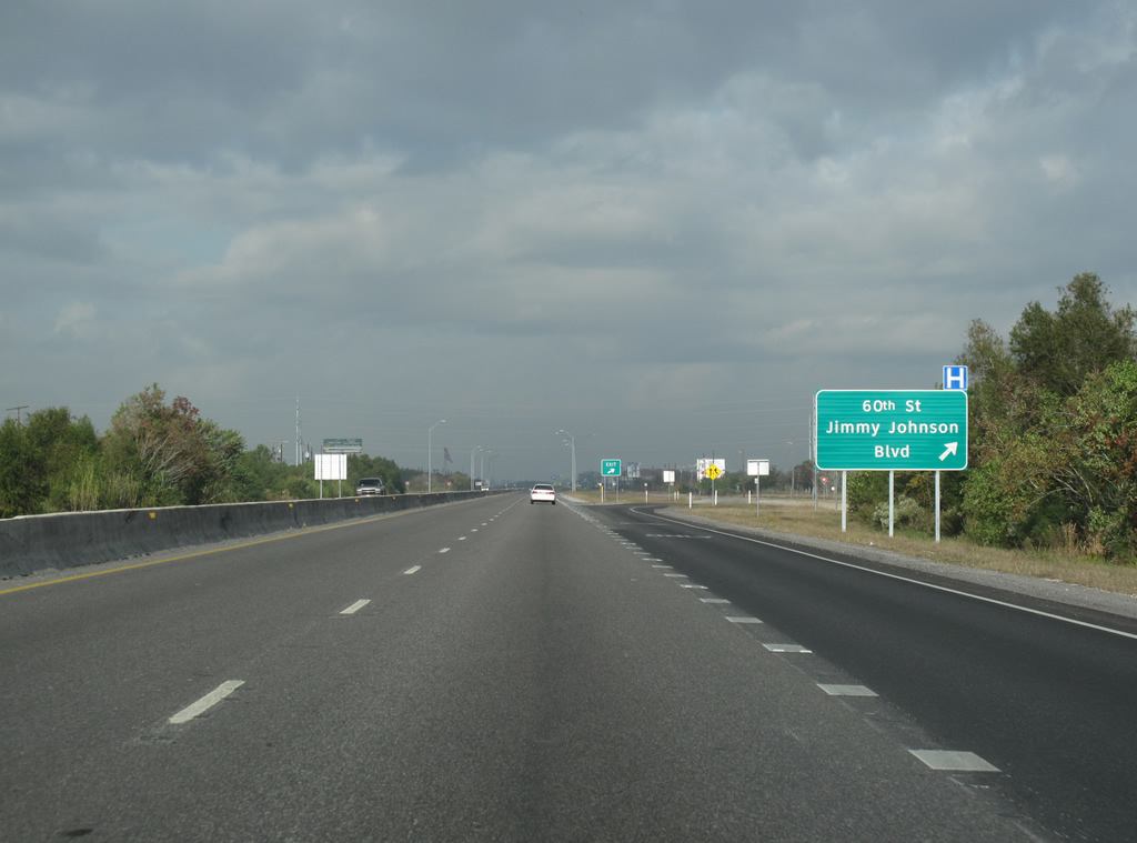
| Now a four lane freeway, US 69/96/287 continues northwestward towards Beaumont. A C/D lane connects the cloverleaf at SH 73 with the next exit at 60th Street/Jimmy Johnson Blvd. 11/21/10 |
|
| US 69/96/287 northbound at 60th Street/Jimmy Johnson. Jimmy Johnson Blvd was renamed from 75th Street in honor of the former NFL coach for the Dallas Cowboys - who is originally from Port Arthur. 11/21/10 |
|
| The freeway continues past the newer section of Port Arthur, meeting FM 365 past the 60th Street exit. 11/21/10 |
|
| US 69/96/287 reassurance marker in Port Arthur. 11/21/10 |
|
| This section of Memorial Blvd was originally a two lane highway, but was slowly upgraded throughout the 1940s and 50s to a freeway. The smaller ROW means that, unlike many freeways in Texas, the roadways are only separated by a concrete barrier instead of a grassy median. 11/21/10 |
|
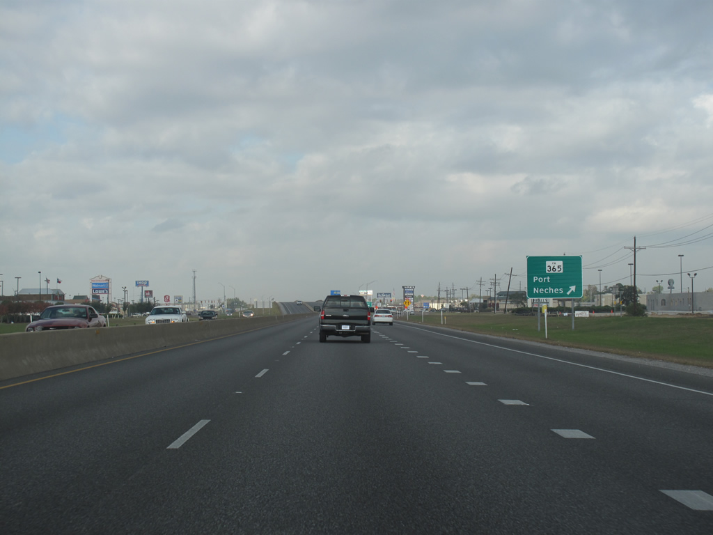
| US 69/96/287 northbound at FM 365. The city's Central Mall Shopping Center and other large businesses are located at this exit. FM 365 (technically an urban road) connects this point to the central area of Port Neches, located just to the northeast. 11/21/10 |
|
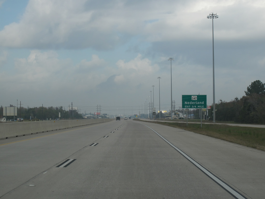
| Nederland Avenue is the next exit along US 69/96/287. Nederland, with about 18,000 residents, was unsurprisingly founded by Dutch immigrants. 11/21/10 |
|
| US 69/96/287 reassurance marker in Nederland. There are few, if any, directional banners along this stretch of freeway. 11/21/10 |
|
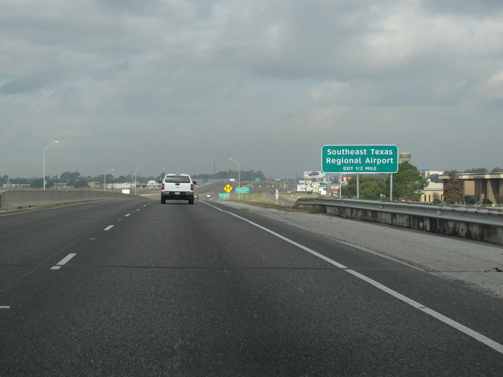
| The Southeast Texas Regional Airport (BPT) is served by the next exit. The small airport, located just to the west and visible from the freeway, connects the Beaumont-Port Arthur area to Houston with commercial air service. 11/21/10 |
|
| US 69/96/287 leaves the municipal boundaries of Port Arthur here. 11/21/10 |
|
| The next exit runs west to the regional airport. 11/21/10 |
|
| Beauxart Garden Rd runs west to the suburb of the same name, while Spurlock Rd runs northeast into Nederland to end at SH 347. This is the last exit in the continuous agglomeration of Port Arthur. 11/21/10 |
|
| US 69/96/287 begins a stretch of several miles as a concrete freeway with gratuitous high-mast lighting. 11/21/10 |
|
| The US Highways have another reassurance marker here, this time with a directional banner. This was the last stretch of road between Port Arthur and Beaumont to be upgraded to freeway standards, in the late 90s. 11/21/10 |
|
| FM 3514 is the next exit. 11/21/10 |
|
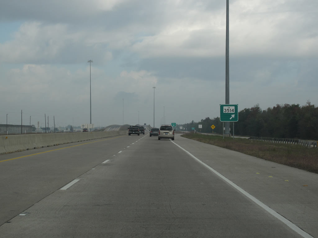
| US 69/96/287 northbound at FM 3514. Technically an urban road, FM 3514 runs southwestward only briefly to end at SH 93. 11/21/10 |
|
| Concrete and high-mast lighting continues along the US highway multiplex as it nears Beaumont. SH 347, the pre-1940 alignment of the US routes runs into the freeway just ahead and marks the next exit. 11/21/10 |
|
| US 69/96/287 enters Beaumont here, just before the SH 347 junction. Beaumont is a large port (the 4th busiest in the United States) and contains numerous oil refining and shipping facilities. Readily visible at almost any point along this freeway are the adjacent stacks and towers of petrochemical plants. 11/21/10 |
|
| Northbound at SH 347. The state highway runs south and east from here, through Nederland and back into Port Arthur. This interchange marks SH 347's northern terminus. 11/21/10 |
|
| The concrete paving and high-mast lighting ends northbound as the US routes enter the city of Beaumont. 11/21/10 |
|
| The first exit in Beaumont is for Spur 380, MLK Pkwy. Lamar University is located just past the exit. Reassurance markers here are given priority on an overhead sign, instead of standalone shields off to the side. 11/21/10 |
|
| US 69/96/287 curves towards the west as it passes MLK Pkwy. MLK is an expressway with several exits and few lights as it runs directly towards downtown Beaumont. 11/21/10 |
|
| The US highway multiplex runs west along the south side of Beaumont. At this point the freeway passes next to Spindletop, or, the point where Texas saw its first large-scale productive oil field. One of the most important places in Texas history, the spot is marked by a monument and a mildly tacky tourist village. 11/21/10 |
|
| The next exit in Beaumont is for Highland Ave/Ave A and Spur 93. 93 can be used as an alternate route south to Port Arthur and sees this junction as its northern terminus. 11/21/10 |
|
| Urban-style signage is evident here along the south side of Beaumont at the next exit for Florida Ave, Erie St. 11/21/10 |
|
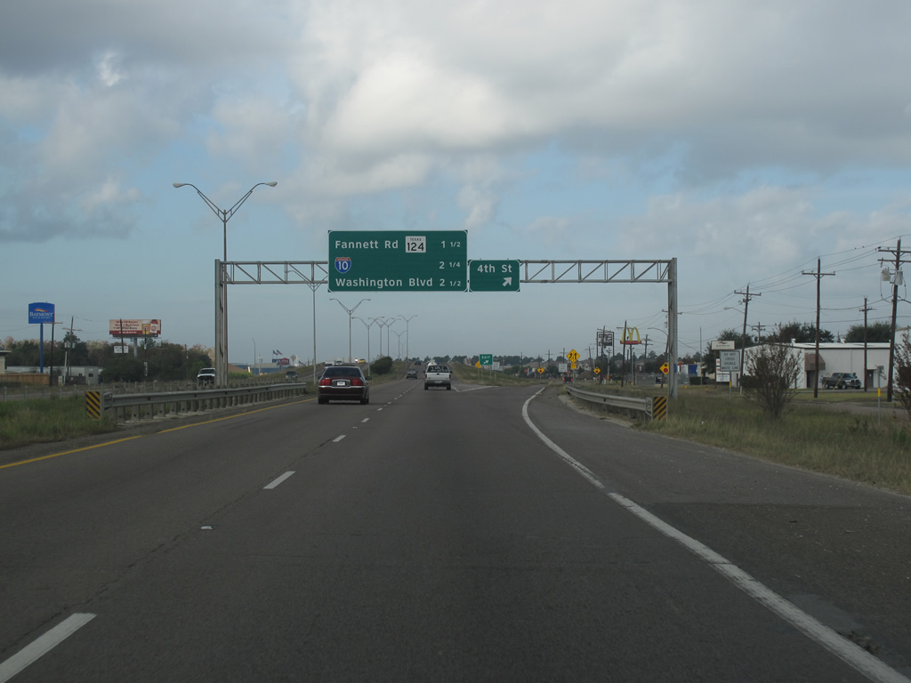
| US 69/96/287 northbound at 4th Street, along the far southwest side of Beaumont. The major intersection of IH 10 is approaching. 11/21/10 |
|
| The section of the US highway around Beaumont was built as a bypass of the city, rather than the section of highway between Beaumont and Port Arthur, which is much older. Thus, this part of US 69/96/287 feels more like a typical Texas freeway with a grassy median and more complete frontage roads. 11/21/10 |
|
| More reassurance markers at the roadside here on the southwest side of Beaumont. 11/21/10 |
|
| US 69/96/287 prepares to meet IH 10 northbound at the exit for SH 124. SH 124, which sees its northern terminus here, was originally US 90. The state highway runs southwestward and closely parallels IH 10 to Winnie. 11/21/10 |
|
| As the US Highway multiplex prepares to meet IH 10, all route numbers are well signed. 11/21/10 |
|
| US 69/96/287 northbound continues through Beaumont on IH 10. There is one final exit at Washington Blvd, before meeting the interstate mainlanes. Traffic headed west uses a left exit here and can continue to Houston, etc. 11/21/10 |
|
| Northbound at Washington Blvd, the exit ramp seems to almost have been added as an afterthought to the original three-level freeway junction. This sits on the western edge of Beaumont. 11/21/10 |
|
| Heading north after their merge, IH 10 & U.S. 96-96-287 next approach the half diamond interchange (Exit 851) with U.S. 90 (College Street). 11/21/10 |
|
| A slip ramp joins the eastbound side frontage road ahead of Milam Street and U.S. 90 (College Street). U.S. 90 follows College Street west to Beaumont Municipal Airport (BMT). 11/21/10 |
|
| Exit 851 departs the six lane freeway for U.S. 90 and Downtown Beaumont. The next exit is Exit 852B, serving Calder and Harrison Avenues. 11/21/10 |
|
| Exit 852B departs IH 10 and U.S. 69-96-287 for Calder and Harrison Avenues. 11/21/10 |
|
| Traffic to Calder and Harrison Avenues forms a c/d roadway northward to Rusk Street. Calder Avenue comprises a commercialized boulevard east to Downtown while Harrison Avenue lines the north side of Christus Hospital-St. Elizabeth. 11/21/10 |
|
| Eight lanes of Interstate 10 & U.S. 69-96-287 again rise to pass over a Southern Pacific Railroad line. 11/21/10 |
|
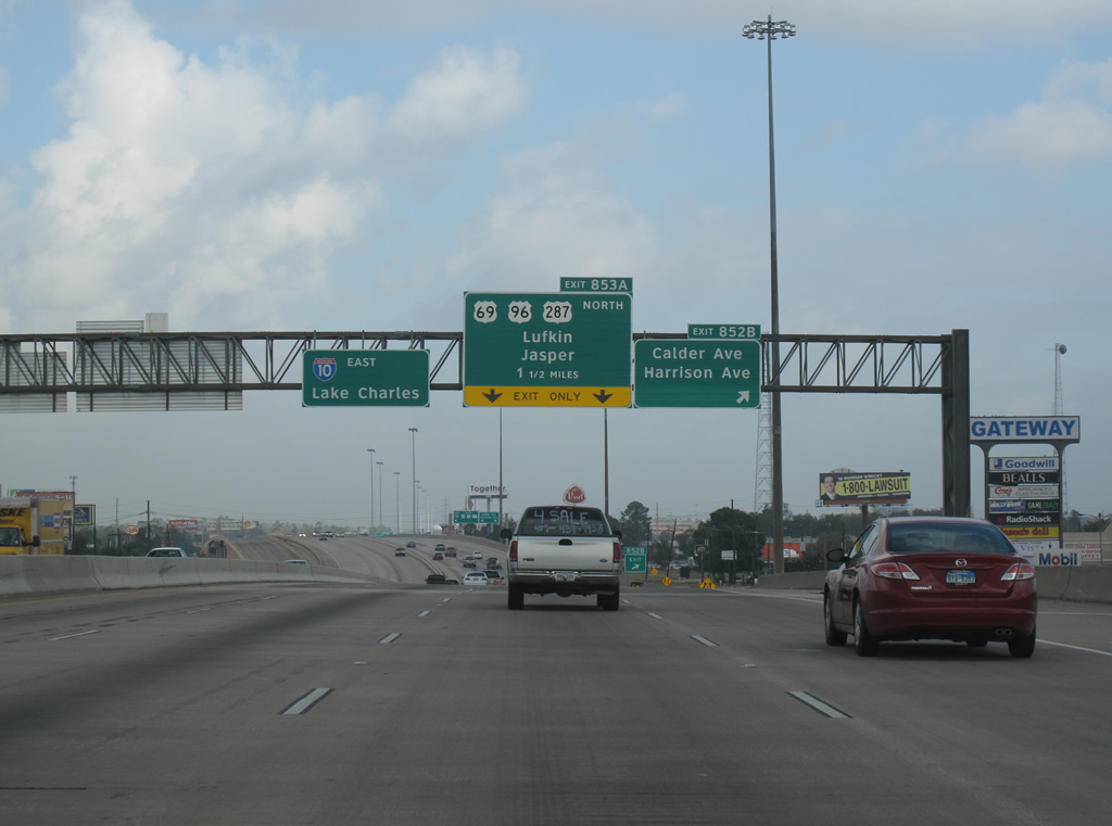
| Approaching the Liberty Avenue overpass, IH 10 and U.S. 69-96-287 separate in one half mile at a three wye interchange (Exit 853A). 11/21/10 |
|
| Interstate 10 east reduces to two through lanes at the split with U.S. 69-96-287 north (Exit 853A). 11/21/10 |
|
| Two lanes separate from IH 10 east for the continuation of US 69-96-287 north at Exit 853A. IH 10 continues east through Beaumont to Orange and Lake Charles. 11/21/10 |
|
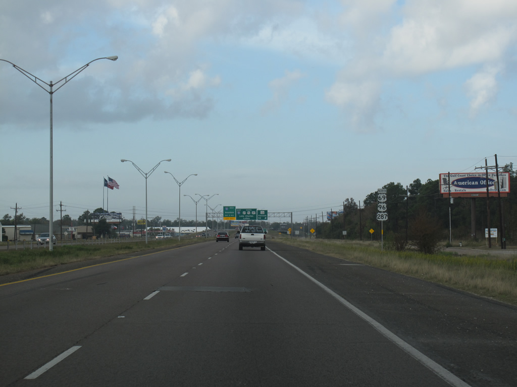
| US 69/96/287 has standalone reassurance markers just north of the split from IH 10. The concrete of the freeway stack gives way to asphalt paving almost immediately. 11/21/10 |
|
| The freeway briefly has six lanes as it continues north through the suburban areas of Beaumont. In 2001, the stretch of US 69 from IH 10 north to Lufkin was officially designated the Big Thicket National Preserve Parkway. 11/21/10 |
|
| US 69/96/287 northbound at Delaware Street in Beaumont. The highway is again reduced to two lanes through here, with a grassy median and is well lit. 11/21/10 |
|
| Reassurance markers northbound in Beaumont. 11/21/10 |
|
| Urban-style signage continues here as the US highway overlap runs past large big-box stores and strip shopping centers. Lucas Drive is a minor arterial that runs on the west and north sides of the city. 11/21/10 |
|
| US 69/96/287 northbound at Dowlen Road in Beaumont. The city's regional mall and other large shopping areas sit at this exit. 11/21/10 |
|
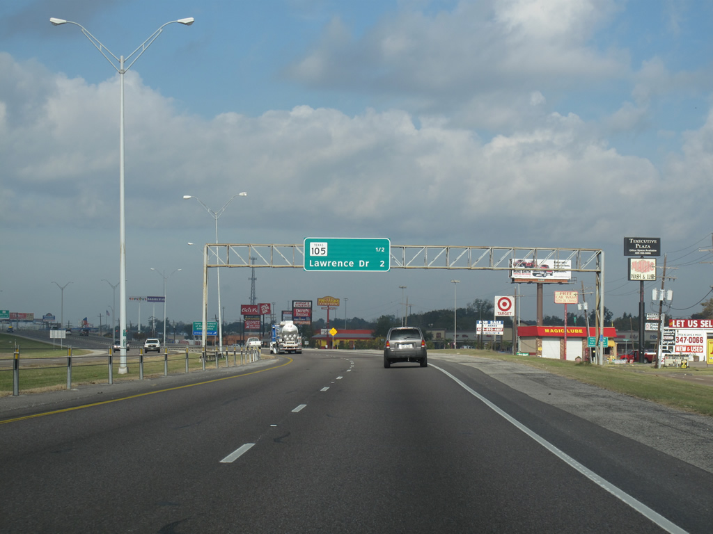
| Northbound in Beaumont before SH 105. 11/21/10 |
|
| SH 105 has its eastern terminus here, and runs west through mostly swampy forest land to Conroe and IH 45. The town of Sour Lake, just west down SH 105, is known as the birthplace of Texaco. 11/21/10 |
|
| Northbound reassurance shields for US 69/96/287. 11/21/10 |
|
| The next exit past SH 105 is Lawrence Dr. 11/21/10 |
|
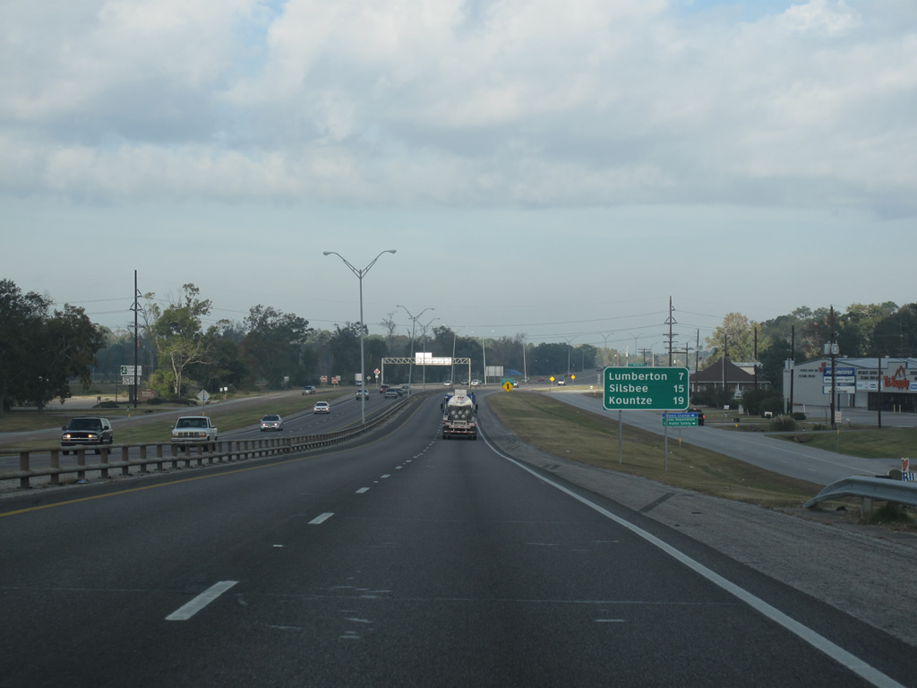
| The first large distance sign for the US highways sits just after SH 105 and contains distances to the next three major towns along the route. US 96 only runs through the first, Lumberton. 11/21/10 |
|
| Lawrence Dr is a small road but the exit is important for the TxDot district offices located adjacent to it. 11/21/10 |
|
| More northbound shields after Lawrence Dr, they are plentiful on the three-highway multiplex. 11/21/10 |
|
| Tram Rd is the last exit in Beaumont and the suburbanized area. The road runs west and south along the Pine Island Bayou back to SH 105. 11/21/10 |
|
| A newly-reconstructed section of concrete highway begins after the Tram Rd interchange. Signage for the next exit, Cooks Lake Rd, is ahead. 11/21/10 |
|
| The last northbound reassurance shields for US 69/96/287 in Jefferson County. 11/21/10 |
|
| US 69/96/287 enters Hardin County here and leaves Jefferson County and the city of Beaumont. Hardin County, founded in 1858, has a population of about 48,000. Though more than 30 miles from the gulf, the county has been heavily damaged by several hurricanes. 11/21/10 |
|
| The US highways northbound at Cooks Lake Rd, the first exit in Hardin County. 11/21/10 |
|
| A VMS sits north of the exit, likely used for hurricane evacuation purposes. 11/21/10 |
|
| US 69/96/287 northbound before Keith Rd. 11/21/10 |
|
| Continuous concrete northbound at Keith Rd, which runs west into a heavily forested rural area. 11/21/10 |
|
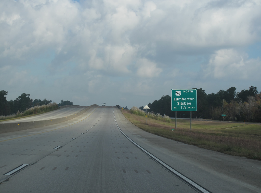
| US 96 prepares to branch off from the multiplex as the highway continues north towards the town of Lumberton. 11/21/10 |
|
| FM 3513 is the first exit in the Lumberton area, the route designation being the old routing of US 96 town. 11/21/10 |
|
| The last northbound shield assembly for US 69/96/287, as US 96 is about to split off from the multiplex. 11/21/10 |
|
| Northbound entering the Lumberton area at the exit for FM 3513 and Mitchell Rd, the two roads being separate. FM 3513 continues north parallel to the newer route of US 96 for only a few miles. 11/21/10 |
|
| US 96 runs north and east into east Texas to end only a little over 100 miles north in Tenaha, never leaving the state. 11/21/10 |
|
| The Big Thicket National Preserve, a large forest and natural area, can be accessed by continuing north along US 69/287. 11/21/10 |
|
| Northbound at the split of US 69/287 and US 96 on the south side of Lumberton, Texas. US 287 does not get its own control city here, even though it is the longest of the three. This also marks the northern end of the US 69/96/287 freeway, which began at SH 73 in Port Arthur. 11/21/10 |
Page Updated 04-27-2012.


 North
North


 East
East 


 East
East