Opened in April 2006 as an alternative gateway to the Walt Disney World Resort from Florida's Turnpike, Western Way travels 3.2 miles between Florida 429 (Daniel Webster Western Beltway) and Buena Vista Drive within the famous resort complex.
Included in a $335 million package of projects approved by Reedy Creek Improvement District on June 22, 2016 was an extension of Western Way from Flamingo Crossings Boulevard (former Hartzog Road) west to County Road 545 (Avalon Road). Expected to be completed in mid-2018, the new arterial will support future development.1
|
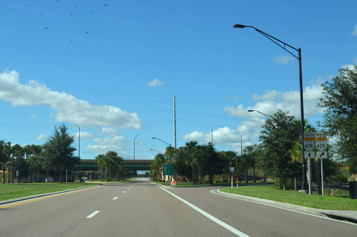
| East of Flamingo Crossings Boulevard, Western Way quickly approaches SR 429 (Daniel Webster Western Beltway). Western Way east provides access from the toll expressway to the Disney World resort. 11/23/13 |
|
| The Western Beltway takes motorists south to Tampa (via Interstate 4 west) and north to Apopka and U.S. 441 (OBT) in northwest Orange County. 11/23/13 |
|
| A ramp leaves for SR 429 south to Osceola County. Interstate 4 lies 7.3 miles to the south of Western Way. 11/23/13 |
|
| Florida's Turnpike (SR 91) lies 14.6 miles to the north from Western Way. The toll road connects travelers with I-75 north near Wildwood and South Florida. 11/23/13 |
|
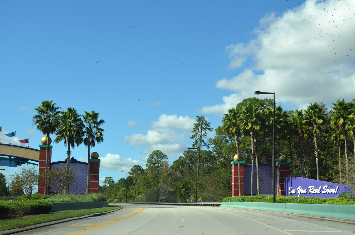
| Beyond SR 429 an archway greets motorists to the Disney World Resort along Western Way east. The entertainment destination encompasses over 25,000 acres and is home to the Magic Kingdom, Epcot, Hollywood Studios, and Animal Kingdom theme parks, as well as various resorts and other entertainment venues. 11/23/13 |
|
| On the approach to Bear Island Road drivers are directed to continue on Western Way to reach all the guest areas of the resort complex. Bear Island Road is a private-only access road for service and authorized vehicles to both Animal Kingdom and Reedy Creek Environmental Services. 11/23/13 |
|
| Interests to the Magic Kingdom, Epcot, and Downtown Disney resort areas are directed to use the left lane for the upcoming transition to Buena Vista Drive north. Buena Vista Drive provides connections to all resort areas as it stems north and east from Western Way. 11/23/13 |
|
| Western Way crosses over Reedy Creek on its final approach to Buena Vista Drive. 11/23/13 |
|
| A left turn provides access to nearby Coronado Springs Resort while motorists prepare to depart for other destinations within the Disney World resort complex. Buena Vista Drive north to links with three of the resort's major theme parks while Buena Vista Drive south connects to Animal Kingdom and Blizzard Beach, one of the resort's water parks. 11/23/13 |
|
| These axillary signs also guide drivers to other points of interest on the approach to Buena Vista Drive. 11/23/13 |
|
| Western Way ends its 3.2 mile stint to Buena Vista Drive. Two lanes carry motorists onto Buena Vista Drive north toward the Magic Kingdom, Epcot, Hollywood Studios, and Disney Springs while a single lane enters Buena Vista Drive south toward Blizzard Beach and Animal Kingdom. Buena Vista Drive connects with World Drive and Epcot Center Drive as well as providing a connection to Osceola Parkway. 11/23/13 |
|
| A slip ramp departs for Coronado Circle and the Coronado Springs Resort upon entry onto Western Way west. Otherwise, the four lane arterial continues westward toward SR 429 to Florida's Turnpike. 11/23/13 |
|
| Reedy Creek passes underneath Western Way as it makes its way northwest toward SR 429 (Daniel Webster Western Beltway). 11/23/13 |
|
| Bear Island Road is a private-only access road for service and authorized vehicles to both Animal Kingdom and Reedy Creek Environmental Services. Continue along Western Way west to reach the Western Beltway. 11/23/13 |
|
| As Western Way curves to the west as it leaves the Disney World Resort on its final approach to SR 429. 11/23/13 |
|
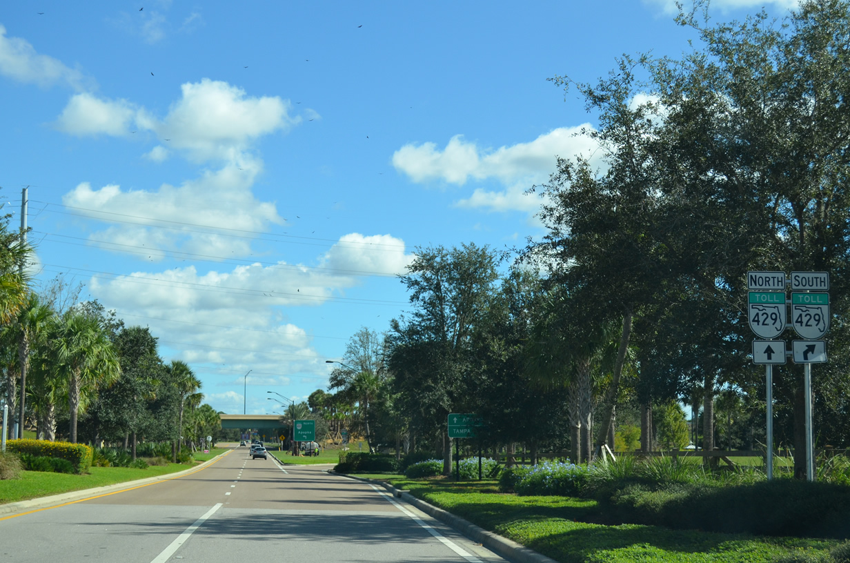
| SR 429 (Daniel Webster Western Beltway) is the western bypass of the metropolitan Orlando area providing a connection to Interstate 4, Florida's Turnpike and U.S. 441. 11/23/13 |
|
| The Western Beltway connects Western Way with Interstate 4 to the south and Florida's Turnpike (SR 91) to the north. Tampa lies in Hillsborough County at the west terminus of I-4 while Apopka lies at the Beltway north end in northwest Orange County. 11/23/13 |
|
| A ramp leaves for SR 429 north to Florida's Turnpike and Apopka. Florida's Turnpike travels 309 miles linking Homestead (near Miami) with Wildwood and Interstate 75. 11/23/13 |
|
| Western Way passes under the Western Beltway mainline as it continues west to Flamingo Crossings Boulevard. Those bound for SR 429 south and Tampa will depart next. 11/23/13 |
|
| Immediately west of SR 429, Western Way crosses Flamingo Crossings Boulevard. Flamingo Crossings Boulevard (former Hartzog Road) connects Western Way to Orange County Road 545 (Avalon Road) to the north and south. Originally part of a large-scale retail and commercial Disney development, the area along this portion of Western Way has remained mostly undeveloped. Western Way ends 0.2 miles ahead at Flagler Avenue. 11/23/13 |
Page Updated 05-03-2018.