|
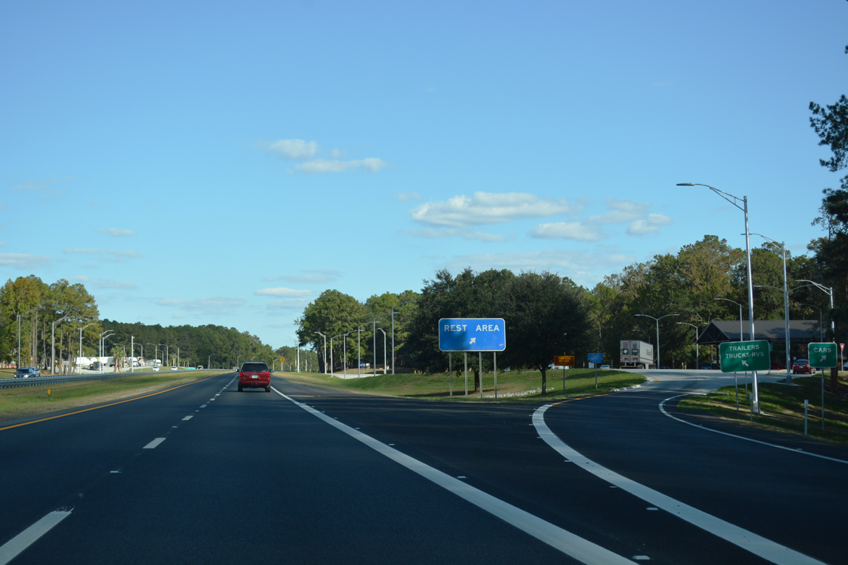
| Both rest areas in western Leon County were closed for renovations from June 1, 2015 to Winter 2015.1 10/13/16 |
|
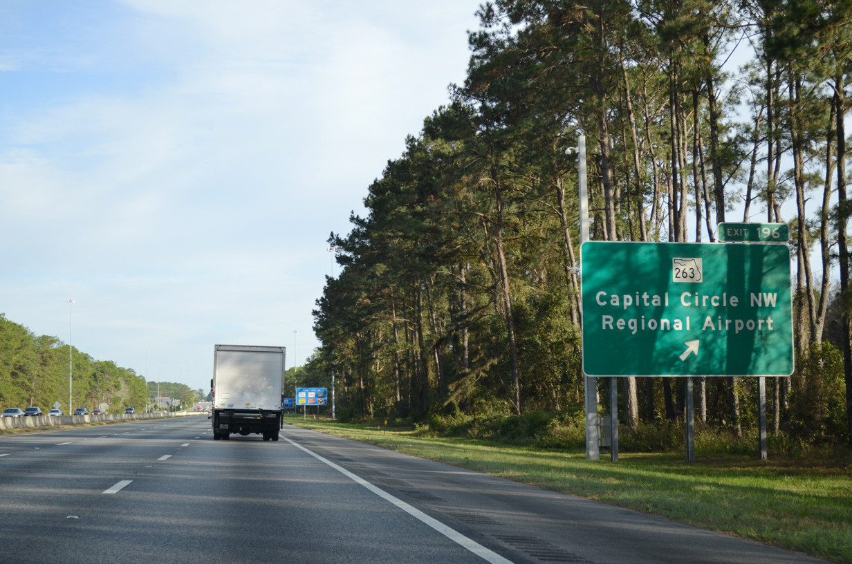
| I-10 was widened to six lanes east from ahead of Exit 196 and U.S. 319 during the 2006-09 Moving I-10 Forward project. Forthcoming SR 263 (Capital Circle) encircles the west side of Tallahassee north to U.S. 27 at Lake Jackson and south to U.S. 319/SR 61 at Lakeside. 11/24/15 |
|
| Capital Circle is a 13.7 mile long arterial beltway extending northeast along U.S. 319 to SR 61 (Thomasville Road) near Exit 203. SR 263 south connects I-10 with Tallahassee Community College, Tallahassee Regional Airport (TLH) and U.S. 319 south to Wakulla County. 11/24/15 |
|
| Ramps at Exit 196 and SR 263 (Capital Circle NW) were both expanded during the Moving I-10 Forward project. Construction from 2020-21 onward widens the remaining two lane sections of SR 263 south to U.S. 319. 11/24/15 |
|
| SR 263 (Capital Circle) travels 15.04 miles overall between SR 363 (Woodville Highway) and U.S. 27 near Lake Jackson. 11/02/08 |
|
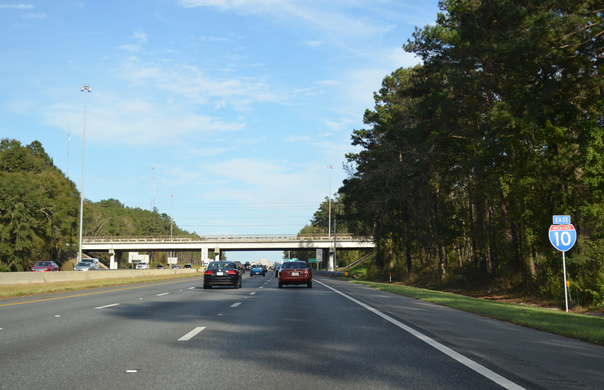
| High mast lighting is used along Interstate 10 throughout the Tallahassee area. 11/24/15 |
|
| Continuing east from the Mission Road underpass, I-10 next meets U.S. 27 (Monroe Street) at a six-ramp parclo interchange (Exit 199). Ramps at Exit 199 were realigned and improved during the Moving I-10 Forward project. 11/24/15 |
|
| Interstate 10 enters the northern reaches of the Tallahassee city limits between SR 263 and U.S. 319 (Exit 203). U.S. 27 follows Monroe Street south to Downtown Tallahassee and the State Capitol at Apalachee Parkway. 11/24/15 |
|
| U.S. 27 travels 11 miles northwest from Exit 199 to Havana. U.S. 27 runs east along Apalachee Parkway from Downtown Tallahassee to U.S. 19 at Capps. Beyond Capps, U.S. 19/27 overlap southeast to Perry. 11/24/15 |
|
| Two lanes depart I-10 east at Exit 199. U.S. 27 leads north from Tallahassee to Lake Jackson and Bainbridge, Georgia. Monroe Street constitutes a commercial boulevard south to SR 61 (Thomasville Road). SR 61 extends Monroe Street south toward Florida A & M University. 11/24/15 |
|
| Confirming marker posted ahead of the Sharer Road overpass. The speed limit remains at 70 miles per hour across Tallahassee. 11/24/15 |
|
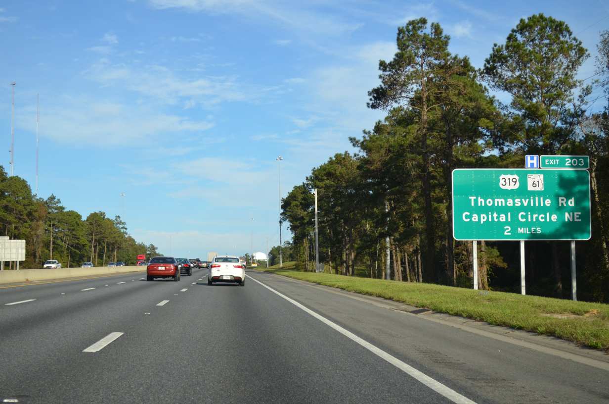
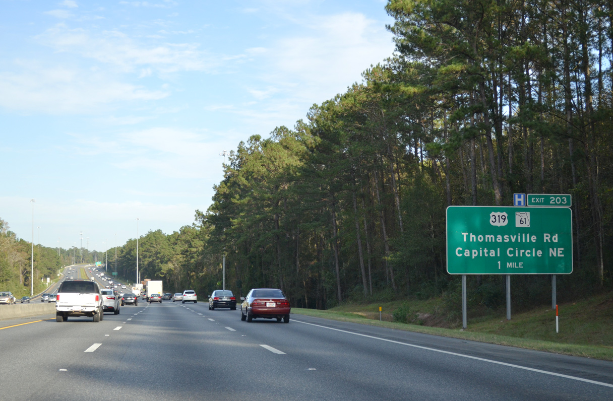
| SR 61 (Thomasville Road) branches northeast from U.S. 27 (Monroe Street) to I-10 at Exit 203. U.S. 319/SR 61 combine northward from Capital Circle NE 21 miles to Beachton, Georgia en route to Thomasville. 11/24/15 |
|
| U.S. 319 encircles Tallahassee to the east along Capital Circle south from SR 61 (Thomasville Road) to SR 61 again at Crawfordville Road and Lakeside. 11/24/15 |
|
| Exit 203 joins I-10 eastbound with SR 61 (Thomasville Road) at SR 162 (Raymond Diehl Road). An unsigned route, SR 162 constitutes a 0.292 mile connector between Thomasville Road and U.S. 319 (Capital Circle NE). 11/24/15 |
|
| Entering the parclo interchange (Exit 203) with SR 61 (Thomasville Road) and SR 162 (Raymond Diehl Road). SR 162 was designated in August 2006 during the Moving I-10 Forward project. 11/24/15 |
|
| 2006-08 improvements at Exit 203 included an expanded off-ramp from I-10 east and a distributor roadway along I-10 west with separate ramps to U.S. 319 and SR 61. A number of business parks and shopping plazas surround the exchange. 03/13/10 |
|
| A flyover ramp (Veterans Memorial Bridge) was built just north of I-10 for the continuation of U.S. 319 south from Thomasville Road in 1997. Southward, U.S. 319 travels 31.20 miles to an overlap with U.S. 98 near Medart. 03/13/10 |
|
| Interstate 10 reduces to four lanes again near the Olson Road overpass and Arbor Hills. A PD&E Study evaluates expanding 13.42 miles of I-10 to six lanes from U.S. 319 to Gamble Road in Jefferson County. 05/16/16 |
|
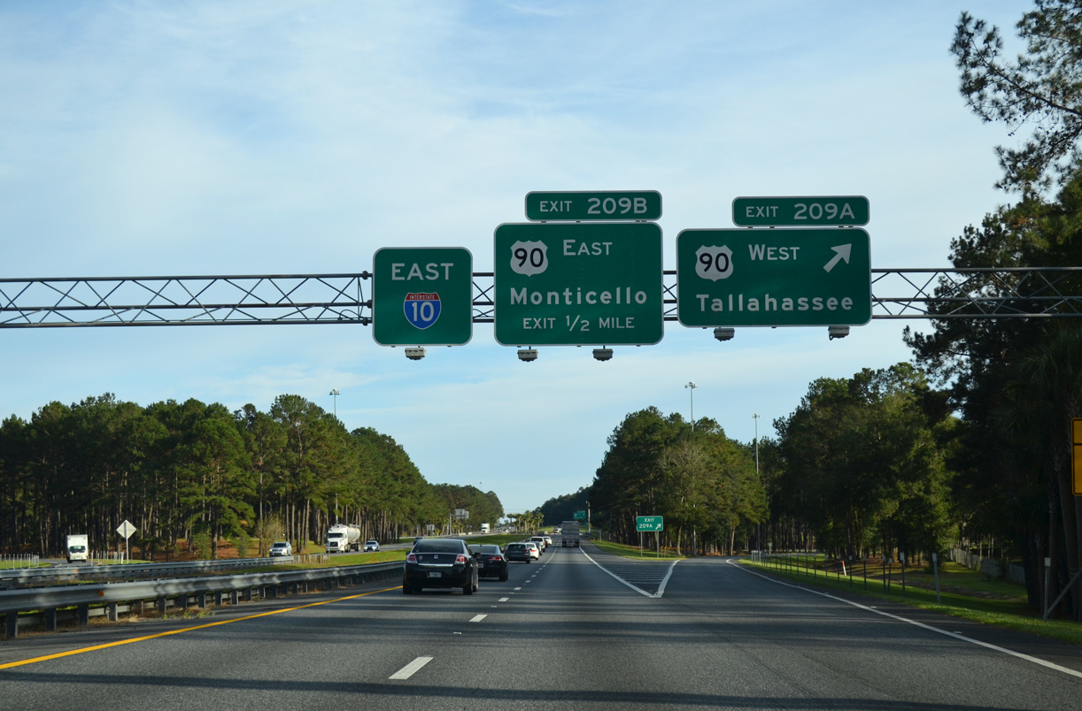
| Interstate 10 and U.S. 90 east crosses paths for the third time within the state of Florida four miles east of the Olson Road overpass at Exit 209. 05/16/16 |
|
| U.S. 90 (Mahan Drive) leads east from U.S. 319 (Capital Circle NE) as a six lane commercial arterial to Buck Lake Road (CR 1568). Mahan Drive east from Dempsey Mayo Road (CR 0353) to I-10 was expanded to four lanes during a three year $19.3 million project completed on April 18, 2013.1 11/24/15 |
|
| Exit 209A departs for U.S. 90 (Mahan Drive) west back into Tallahassee. The final exit for the capital city is a six-ramp parclo interchange. 11/24/15 |
|
| U.S. 90 travels 24 miles east from Exit 209B to U.S. 19 at the Jefferson County seat of Monticello. 11/24/15 |
|
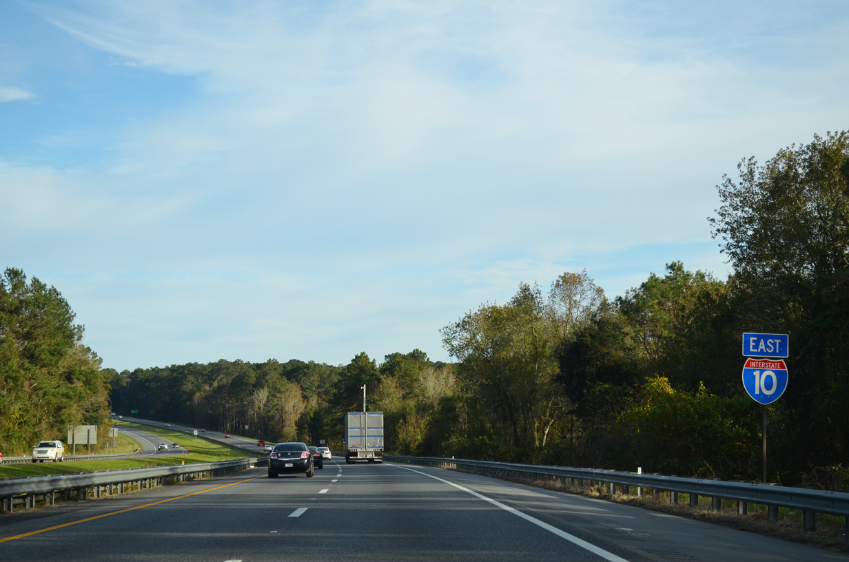
| Interstate 10 leaves the last of the Tallahassee suburbs on the ensuing stretch east. 11/24/15 |
|
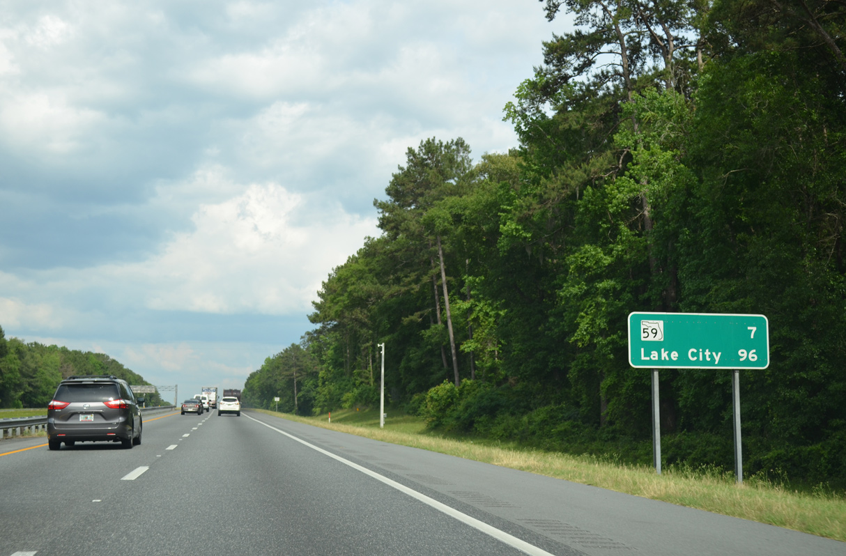
| Interstate 10 advances seven miles east to SR 59 near the community of Lloyd. Lake City is the succeeding control point in 96 miles. 05/16/16 |
|
| Interstate 10 shifts northward ahead of Still Creek and the diamond interchange (Exit 217) with SR 59 (Gamble Road). 11/24/15 |
|
| Interstate 10 crosses the Jefferson County line adjacent to CR 158 (Old Lloyd Road). 11/24/15 |
Page Updated 11-28-2020.

 East
East