


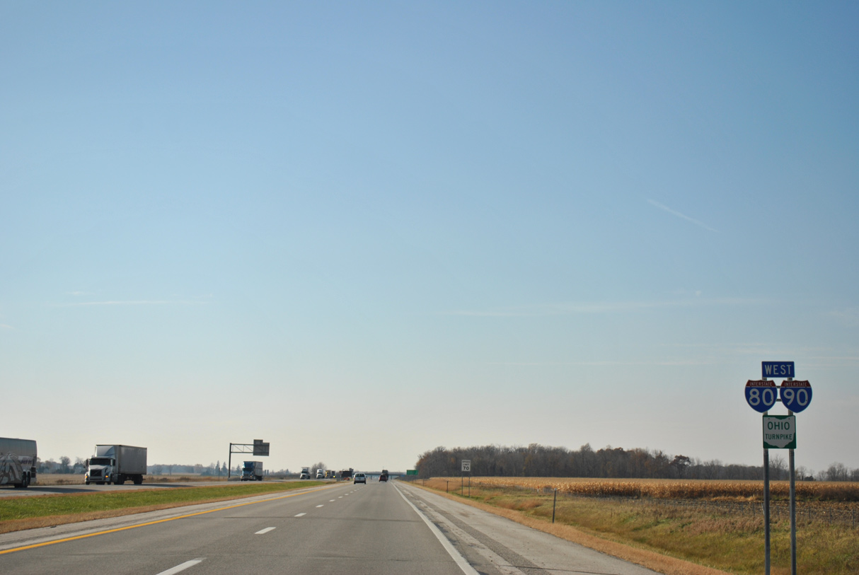
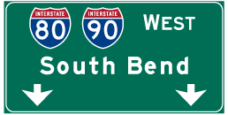
 West
West
The Ohio Turnpike was expanded to six lanes west across the Maumee River in 2013/14.
11/06/11

11/06/11

Spanning the Maumee River, the Ohio Turnpike enters Washington township in Lucas County from Perrysburg township in Wood County.
11/06/11

11/06/11

The abandoned Toledo Terminal Railroad bridge paralleling I-80/90 was removed in 2019.
11/06/11

11/06/11

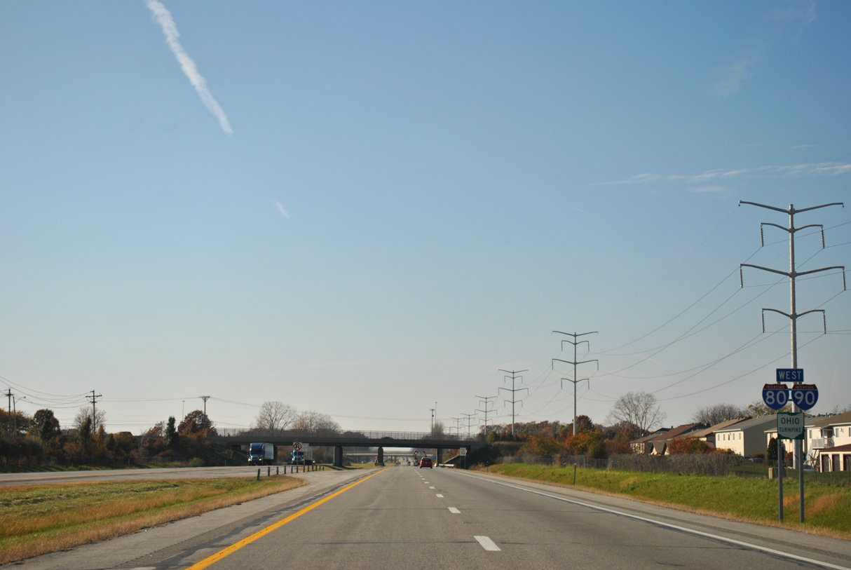
I-80/90 straddle the Toledo and Maumee city line west from the Maumee River to I-475/U.S. 23. There is no direct access between the Ohio Turnpike and the freeway loop west from Perrysburg to Sylvania.
11/06/11

U.S. 23 follows Interstate 475 from I-75 at Perrysburg to a freeway extending north from Sylvania to Ann Arbor, Michigan.
11/06/11
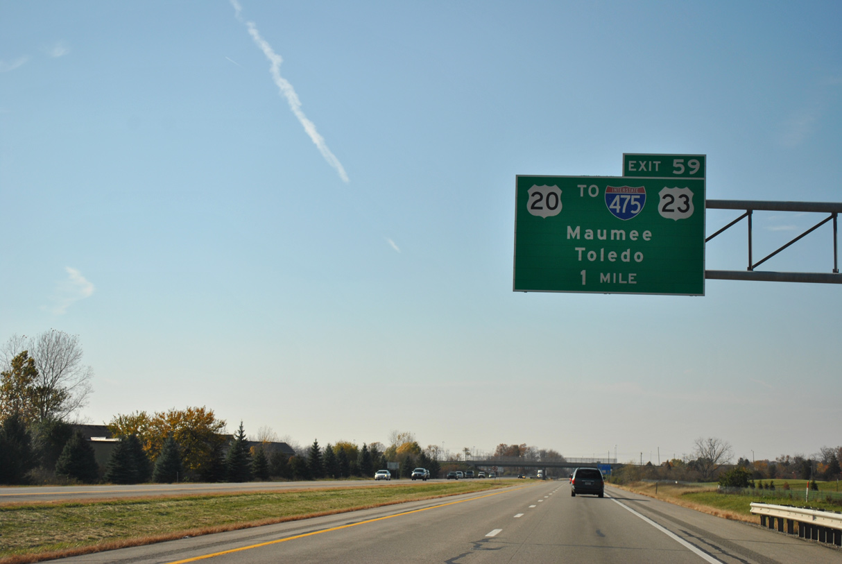
One mile from the trumpet interchange at Exit 59 with U.S. 20. U.S. 20 leads south along Conant Street into Downtown Maumee. U.S. 20 north follows Reynolds Road to Reynolds Corner west of the University of Toledo and SR 120 (Central Avenue) in Sylvania township.
11/06/11

Interstate 475 constitutes a 20.43 mile long loop southeast from Maumee to Perrysburg and northeast around Ottawa Hills to I-75 at Auburndale in central Toledo.
11/06/11

Exit 59 departs the Ohio Turnpike west for U.S. 20 east to Dussel Drive in Maumee and west to SR 2 at Johnsons Corners. Dussel Drive connects U.S. 20 with I-475/U.S. 23 while SR 2 leads west to the village of Holland.
11/06/11
The ensuing stretch of I-80/90 west of U.S. 20 runs between subdivisions and apartments in Toledo and industrial and business parks in Maumee.
11/06/11
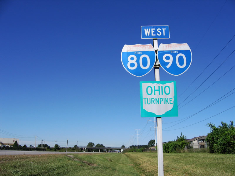
All state named shields posted along the Ohio Turnpike were replaced in 2007.
09/02/05

11/06/11

Eugene F. Kranz Toledo Express Airport (TOL) lies well west of Toledo between SR 2 and U.S. 20A, just off forthcoming Exit 52.
11/06/11

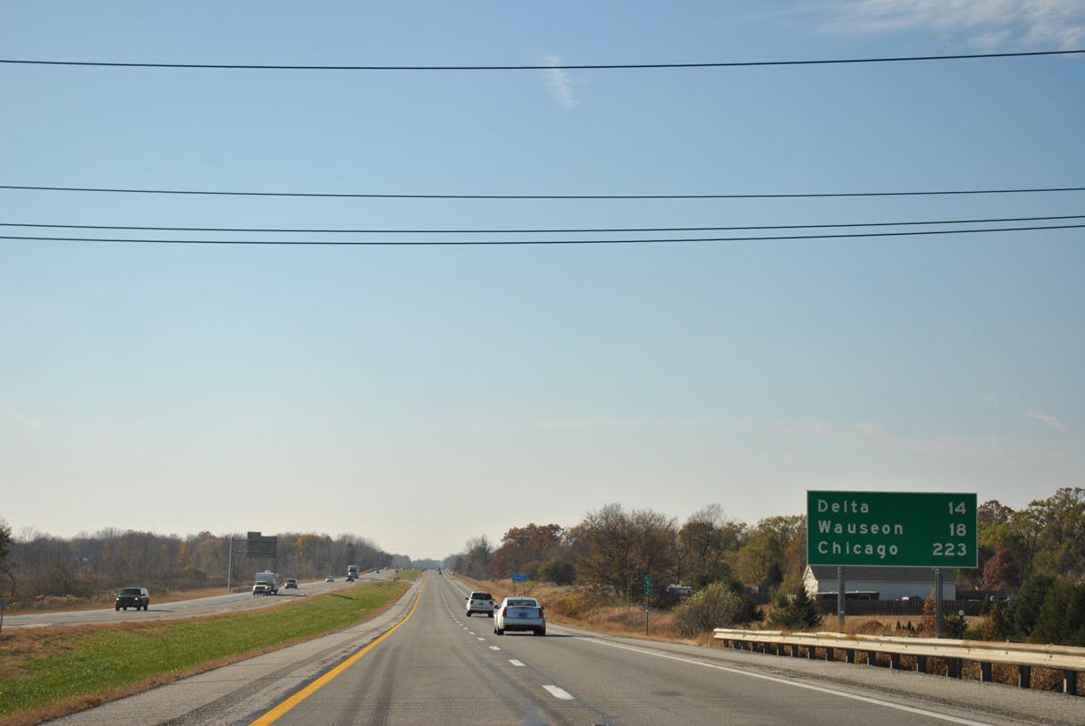
One of the longer highways in Ohio, SR 2 leads west from Painesville to Indiana near Hicksville. Meeting I-80/90 in western Lucas County, SR 2 previously overlapped with I-90 from Rocky River to Elyria.
11/06/11

Exit 52 directly connects I-80/90 with SR 2 (Airport Highway) across from the passenger terminal for TOL Airport.
11/06/11

Two lanes depart the Ohio Turnpike at Exit 52 for SR 2 (Airport Highway). SR 2 east heads back to Holland while the state route west combines with U.S. 20A (Wilkins Road) in 1.7 miles to the town of Swanton.
11/06/11

11/06/11
11/06/11

The Oak Openings and Fallen Timbers Service Areas in Swanton township permanently closed on December 1, 2011. The facilities were the oldest remaining on the Turnpike, having opened in 1955.1
11/06/11

A $30.75 million reconstruction project between milepost 50.92 and 46.50 includes building the new Toll Plaza 49. Part of the modernization of the toll collection system for the Ohio Turnpike, the mainline plaza includes Open Road Tolling lanes.1
11/06/11

Work on Toll Plaza 49 at the site of the Oak Meadows Service Plaza got underway in 2021.
11/06/11

Reassurance markers posted beyond the former Oak Openings Service Plaza at Beecher Ditch.
11/06/11

Fulton-Lucas Road (CR 1) spans the Ohio Turnpike at the Fulton County line.
11/06/11

Transmission lines tie into the adjacent Fulton Substation west of the SR 64 (N Main Street) underpass at the town of Swanton.
11/06/11

The first of three Fulton County interchanges along the Ohio Turnpike joins I-80/90 with SR 109 near the village of Delta.
11/06/11

SR 109 travels north from Exit 39 to Seward and M-52 and south along an overlap with U.S. 20A/SR 2 (Main Street) into Delta. M-52 leads northward to Adrian
11/06/11

I-80/90 pass over SR 109 one half mile east of the trumpet interchange at Exit 39. SR 109 heads ten miles north to SR 120 at Seward; SR 120 heads west to Lyons from there.
11/06/11

SR 109 travels overall between Ottawa and M-52 at the Michigan state line. South of Delta, SR 109 continues nine miles to Liberty Center.
11/06/11
The Ohio Turnpike traverses agricultural areas west through southern Pike township on the ensuing stretch.
11/06/11

The Fulton County seat of Wauseon lies six miles to the southwest.
11/06/11

CR 13 passes over I-80/90 two miles from the trumpet interchange at Exit 34 for SR 108.
11/06/11

Wauseon lies three miles south of Exit 34 along SR 108 and its overlaps with U.S. 20A (Airport Highway) and SR 2 (Shoop Avenue).
11/06/11

North from I-80/90 and the Fulton County Fairgrounds, SR 108 runs 5.17 miles to U.S. 20 at Oakshade. U.S. 20/SR 108 overlap 3.01 miles west where SR 108 resumes north 2.99 miles to the Michigan state line.
11/06/11

SR 108 continues south from Wauseon to Napoleon, Holgate and Ottawa. M-156 extends north from SR 108 at Morenci to Clayton, Michigan.
11/06/11

11/06/11

11/06/11

SR 66 branches north from U.S. 20A to meet the Ohio Turnpike at Exit 25 in Franklin township.
11/06/11

SR 66 runs north from Exit 25 to U.S. 20 in the village of Fayette and south from the overlap with U.S. 20A at Burlington to Archibold and Defiance.
11/06/11

CR 23 crosses I-80/90 a half mile from the trumpet interchange at Exit 25. SR 66 formerly followed CR 23 north from Elmira and CR J west over Mill Creek.
11/06/11

SR 66 north connects with U.S. 20 in 5.76 miles. U.S. 20 leads west from there to U.S. 127. There is no direct access to U.S. 127 from the Ohio Turnpike, which crosses I-80/90 north from West Unity en route to Jackson, Michigan.
11/06/11

11/06/11

11/06/11

11/06/11

The Indian Meadow Service Plaza west and Tiffin River Service Plaza eastbound closed in 2006 due to aging septic systems and in part of a previous plan to build new service areas in Fulton County.3
11/06/11

CR 21N spans I-80/90 just west of the Williams County line at milepost 22.0
11/06/11

The Indian Meadow and Tiffin River Service Plazas were rebuilt at a cost of $30 million. Fuel stations at the new facilities opened on June 29, 2011, followed by the restaurants the following week.4
11/06/11

11/06/11

The Indian Meadow Service Plaza is located at milepost 20.8.
11/06/11

11/06/11

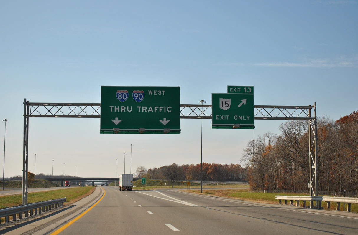
I-80/90 converges with U.S. 20A/SR 15 two miles west of Beaver Creek at the village of Holiday Creek.
11/06/11

SR 15 joins the Turnpike with Pioneer four miles to the north and Montpelier, four miles to the southwest by way of SR 107. U.S. 20A and SR 15 overlap for 3.66 miles north from SR 107.
11/06/11
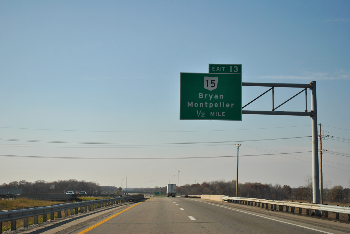
SR 15 ventures nine miles south from the trumpet interchanges at Exit 13 to the Williams County seat of Bryan, where the route joins U.S. 127.
11/06/11
Having paralleling the Ohio Turnpike from Maumee, Wauseon and West Unity, U.S. 20A branches 1.15 miles west from SR 15 in Madison township to conclude at U.S. 20. 102 miles in length, SR 15 runs between U.S. 23 at Carey and the Michigan state line near Pioneer. M-99 extends north from SR 15 to Hillsdale.
11/06/11

Proceeding west from Exit 13, I-80/90 cross the St. Joseph River along the Bridgewater / Williams township line.
11/06/11

11/06/11

The Westgate Toll Plaza precedes the exchange with SR 49. Part of the $205 million capital improvement program for the Ohio Turnpike, work from 2021-23 includes constructing a new toll plaza at milepost 4.5
11/06/11

The $67.6 million, three part project constructing the new Westgate Toll Plaza west of Exit 2 includes the demolition of the Westgate Toll Plaza. Work runs through Summer 2023.5
11/06/11

The original West Gate Toll Plaza was located west of the Williams County 1.50 overpass. It was replaced by this facility while a diamond interchange was constructed with SR 49 at Exit 2.
11/06/11

Passing through the West Gate Toll Plaza of the Ohio Turnpike. The new toll plaza under construction through 2023 incorporates Open Road Tolling.
11/06/11

11/06/11

SR 49 stems south from parallel U.S. 20 to the villages of Eden and Edgerton in southwestern Williams County.
11/06/11

Exit 2 departs I-80/90 for SR 49 in Northwest township. Forming a multi state route with M-49, SR 49 concludes 5.67 miles to the north en route to Camden, Michigan.
11/06/11

South from Exit 2, SR 49 connects with SR 34 at Edon in 5.1 miles and with U.S. 6 at Edgerton in 13.3 miles. SR 49 measures 153 miles in length to Dayton.
09/02/05

I-80/90 continue 2.06 miles west from the SR 49 underpass to the Indiana state line.
11/06/11

A 13.7 mile long exit less stretch takes I-80/90 west to the exchange with Interstate 69 near Fremont, Indiana.
11/06/11

A short access road linked the west end of the Ohio Turnpike with adjacent U.S. 20 just ahead of the state line in 1955. It closed in 1956 when the Indiana Toll Road opened.
11/06/11
Sources:
- "Swanton Turnpike Plazas Close; To Be Rebuilt." Archbold Buckeye (OH), December 21, 2011.
- "Swanton area toll plaza among Turnpike’s major 2021 projects." Fulton County Expositor (Wauseon, OH), March 28, 2021.
- "Plans for turnpike plaza in Fulton County scrapped." Toledo Blade (OH), April 11, 2007.
- "Stores to open at 2 new plazas." Toledo Blade (OH), June 28, 2011.
- "Ohio Turnpike Construction kicks off with emphasis on progress toward 2023." News from the Ohio Turnpike, March 23, 2021.
Photo Credits:
09/02/05, 11/06/11 by AARoads
Connect with:
Interstate 475
U.S. 23
Page Updated 09-01-2021.