U.S. 26 is a major highway that originates in Seaside, Oregon, and travels southeast through Oregon, Idaho, and Wyoming to Interstate 80 and N-61 at Exit 126 in Keith County. U.S. 26 generally follows the North Platte River from I-80 northwest through Scottsbluff to Torrington and Casper in Wyoming. West from there, the highway travels toward Grand Teton National Park in western Wyoming, then angles toward Idaho Falls and Boise in Idaho. After crossing the state of Oregon, U.S. 26 ends at U.S. 101 within sight of the Pacific Ocean.
Originally, U.S. 26 was a fairly short route connecting Ogallala with Interstate 25 and U.S. 87; it was extended in 1950 westward to cross Wyoming and was further extended to Astoria, Oregon, in 1952. Although U.S. 26 was retracted out of Astoria in 2004, it is still a major route in the West.
Within Nebraska, U.S. 26 travels 150.76 miles across the Panhandle from the Wyoming line at Henry to the Keith County seat of Ogallala. The highway parallels a BNSF Railway southeast into Scottsbluff, where U.S. 26 combines with N-71 and N-92 along the Heartland Expressway, a controlled access arterial bypass. U.S. 26 heads east from Scottsbluff into Morrill County, where it turns south to Bayard and a second overlap with N-92.
U.S. 26/N-92 follow the North Platte River to the south en route to U.S. 385 in Bridgeport. U.S. 26 combines with U.S. 385 northeast for 1.00 mile back across the river. U.S. 385 continues north to Alliance while U.S. 26 accompanies a Union Pacific Railroad corridor southeast to Oshkosh. N-92 joins U.S. 26 for a third overlap for 42.41 miles between Broadwater and Lewellen in Garden County.
U.S. 26 separates with N-92 to pass well south of Lake McConaughy while N-92 runs along the north side of the reservoir. N-61 combines with U.S. 26 south from outside Ogallala to U.S. 30. The two routes join U.S. 30 east for 2.00 miles to A Street in Downtown Ogallala. U.S. 26/N-61 span a Union Pacific Railroad line and the South Platte River south from Downtown to Interstate 80.
Founded in 1868, Ogallala was home to 4,737 people as of 2010 and 4,878 as of the 2020 Census. Sitting at an elevation of 3,216 feet, Ogallala is at a lower elevation than its neighbors to the west such as Sidney and Kimball. The South Platte River flows through Ogallala, and the Union Pacific Railroad separates Downtown Ogallala from the river. Named after a Sioux tribe, Ogallala can be spelled in many different manners, but "Ogallala" is correct for this city.
Sitting beneath much of Nebraska, as well as eastern Colorado, southeastern Wyoming, western Kansas, the Oklahoma panhandle, and Texas panhandle is the Ogallala Aquifer. This massive aquifer stores water underground, and it is tapped for agricultural and ranching purposes through wells. While some parts of the aquifer have seen an increase in the amount of water stored, other sections have seen a net loss, since the semi-arid region may not supply sufficient rainwater to recharge the water taken from massive underground reservoir.
|
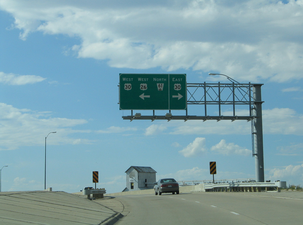
| U.S. 26/N-61 part ways with U.S. 30 (1st Street) south onto a viaduct spanning Railroad Street, the Union Pacific Railroad and Riverdale Drive. 09/05/05 |
|
| U.S. 26/N-61 lower from the viaduct over the UP Railroad into an industrial area. 09/05/05 |
|
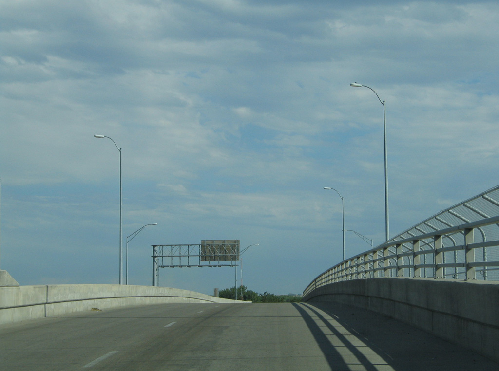
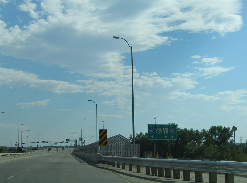
| U.S. 26/N-61 intersect Goodall Drive ahead of the South Platte River and diamond interchange (Exit 126) with Interstate 80. 09/05/05 |
|
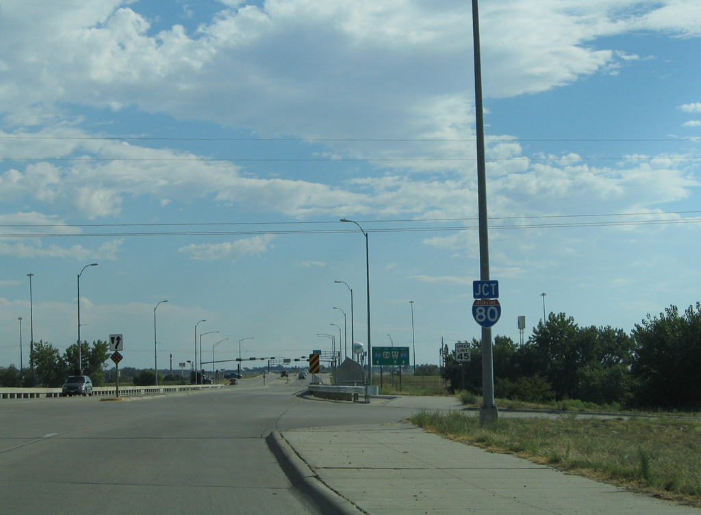
| U.S. 26 east concludes at Interstate 80 on the south side of Ogallala. I-80 parallels the South Platte River west to I-76 beyond Big Springs and east to North Platte. 09/05/05 |
|
| A Thousand Year Storm hit Keith County on July 6, 2002, resulting in major flooding. This storm dropped ten inches of rain on Ogallala between 1:00 am and 11:00 am, with rain falling at a rate of one inch an hour for ten hours. Spilling over its banks, waters from the South Platte River inundated area roads and the exchange with I-80, causing damage to bridges and culverts. 09/05/05 |
|
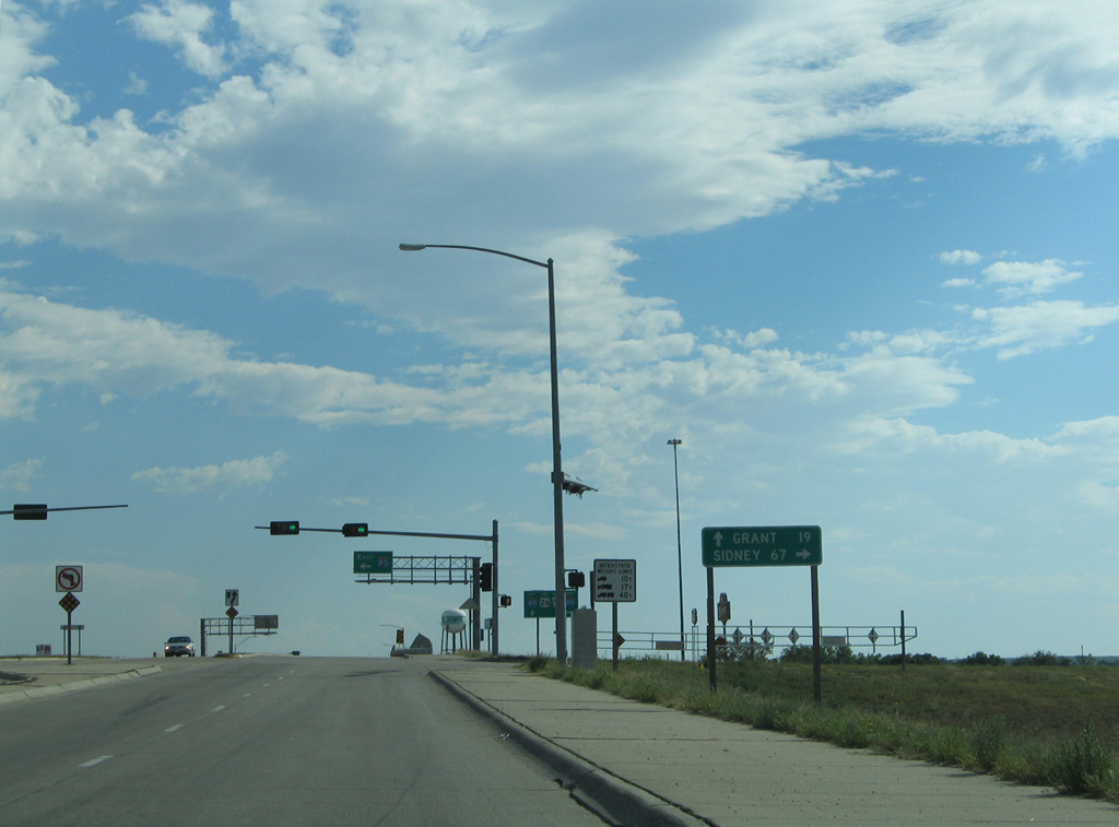
| Interstate 80, the main transcontinental highway across Nebraska, connects the Ogallala with Sidney in the Panhandle. N-61 continues 19.21 miles south to N-23 at Grant. 09/05/05 |
|
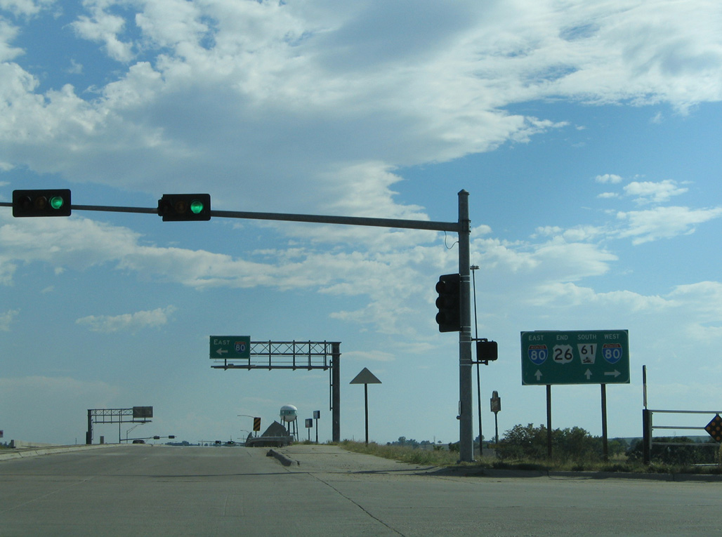
| A second end sign for U.S. 26 appears at the entrance ramp for Interstate 80 west to Sidney and Cheyenne, Wyoming. 09/05/05 |
|
| U.S. 26/N-61 intersect Stagecoach Trail north from the diamond interchange (Exit 102) with Interstate 80. 09/05/05 |
|
| U.S. 26/N-61 span the South Platte River north as the main route into the city of Ogallala from the south. 09/05/05 |
|
| The first confirming marker for U.S. 26 stands beyond the intersection with Goodall Drive after the South Platte River. 09/05/05 |
|
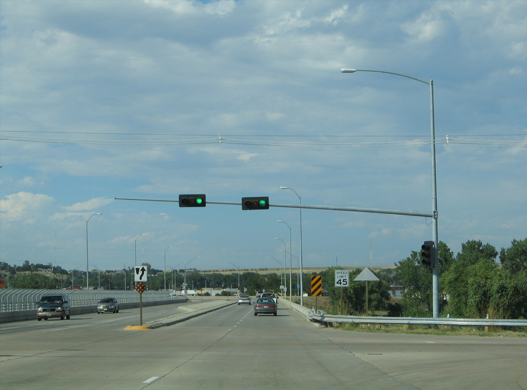
| Curving northwest between Clarice Road and Goodall Drive, U.S. 26/N-61 advance 0.4 miles to U.S. 30 (1st Street). 09/05/05 |
|
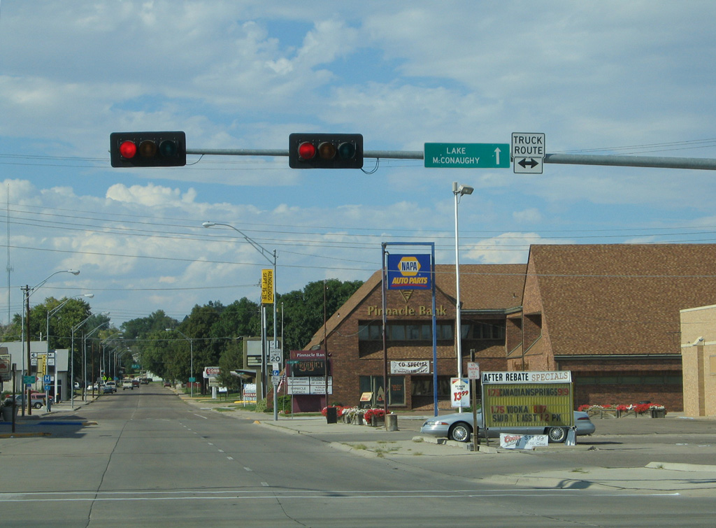
| Located north of Ogallala, Lake McConaughy is a large reservoir located along the North Platte River. With over 35,700 surface acres, Lake McConaughy is Nebraska's largest reservoir. Plenty of water-based recreational activities are available there. 09/05/05 |
|
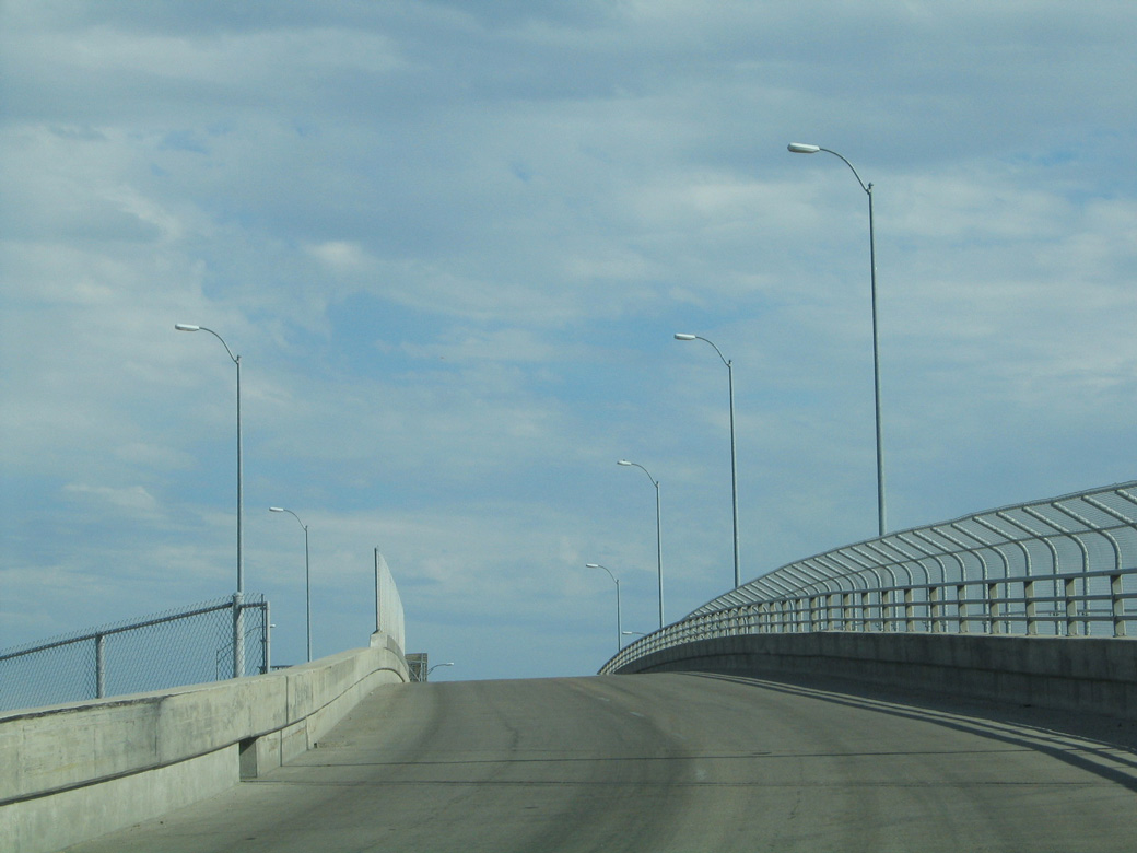
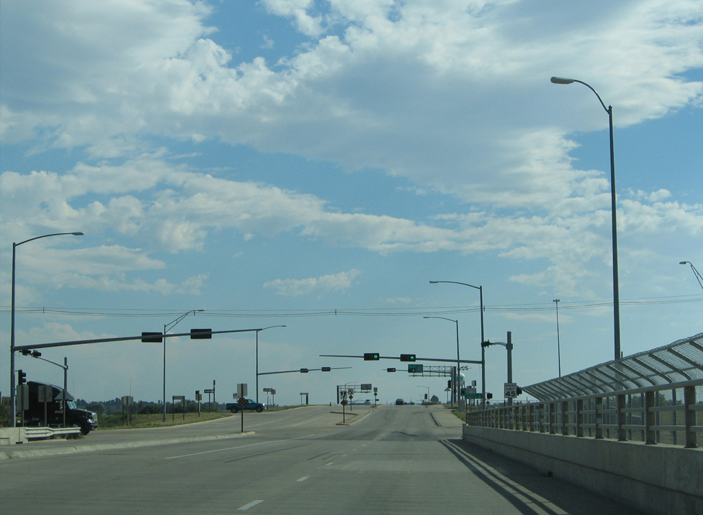
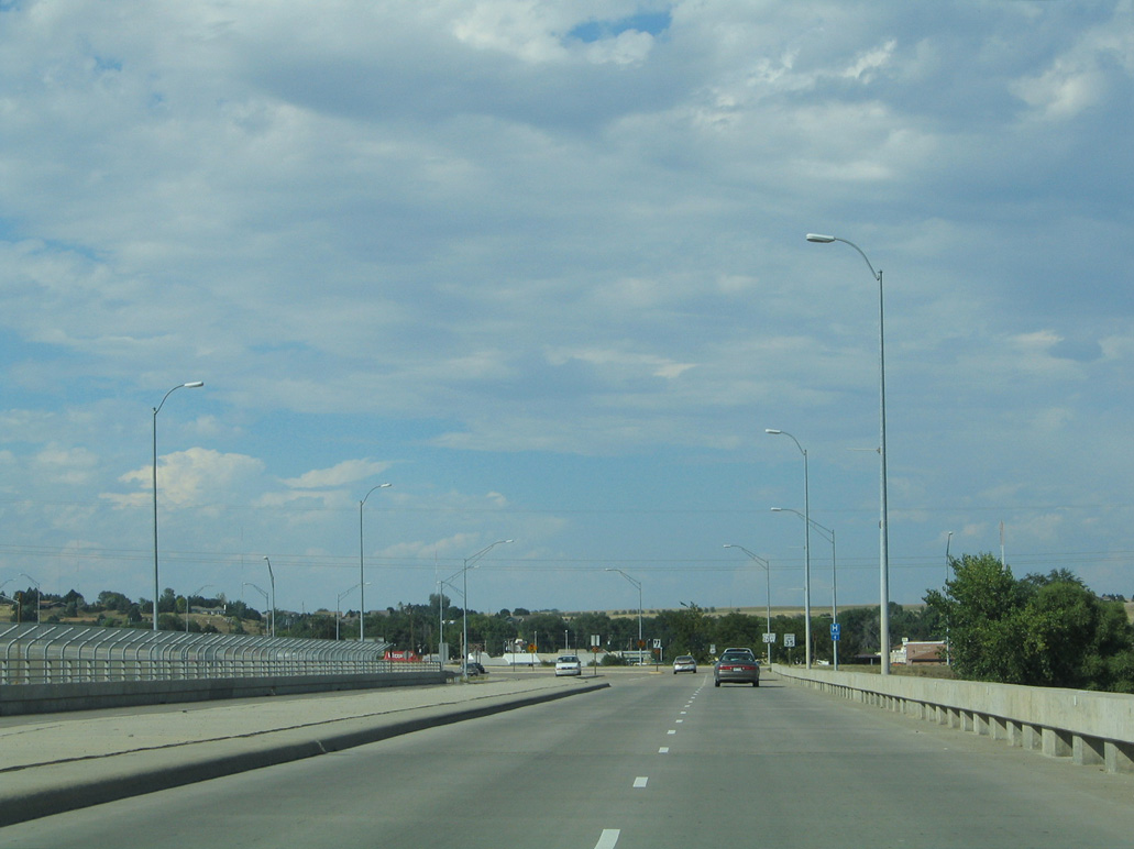
| U.S. 26/N-61 elevates onto a viaduct crossing Riverdale Drive, the Union Pacific Railroad and Railroad Street. U.S. 26/N-61 circumvent Downtown Ogallala, but the original route followed the couplet of A Street north and Spruce Street south through the business district. 09/05/05 |
|
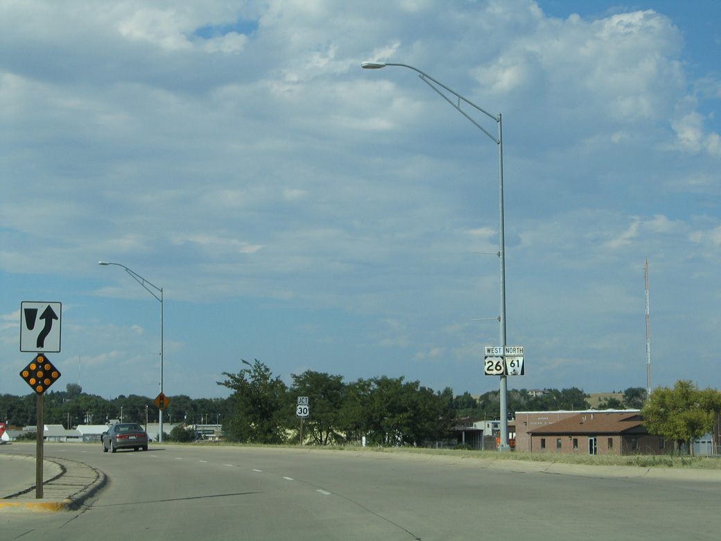
| U.S. 26/N-61 combine with U.S. 30 (1st Street) west 2.00 miles to the Ogallala bypass constructed in 2000. U.S. 30 east follows the UP Railroad and South Platte River to Paxton. 09/05/05 |
|
| U.S. 30 continues beyond the overlap with U.S. 26/N-61 to Searle Field Municipal Airport (OGA) and Brule. 09/05/05 |
|
| A Street north to Spruce Street (old U.S. 26/N-61) provides a more direct route to N-61 for Lake McConaughy. This overhead was removed however, as motorists are directed to the bypass west of the city. 09/05/05 |
Photo Credits:09/05/05 by AARoads
Connect with:
Interstate 80
Page Updated 02-14-2020.