|
| Leaving the interchange with Interstate 90 (Massachusetts Turnpike), motorists along Interstate 91 south encounter the two mile advance sign for Interstate 391 north (Exit 12). I-391 travels opposite of I-91 while serving Chicopee and the city center of Holyoke. Both of those communities lie east of the Connecticut River and north of where I-91 spans the waterway. 06/28/05 |
|
| Next in line for I-95 travelers is the "infinity" interchange (Exits 13B/A) with U.S. 5 (Riverdale Street). The interchange features a symmetrical design with movements involving circular ramps. U.S. 5 travels below the freeway along Riverdale Street, a four lane commercial arterial through West Springfield. 06/28/05 |
|
| This now removed sign advised truck interests to the Route 57 freeway spur to Agawam to use U.S. 5 (Riverdale Street) south from Exit 13B in lieu of Interstate 91 due to restrictions on the South End Bridge. The South End Bridge carries Route 57 across the Connecticut River from Interstate 91 at Exit 3. 06/28/05 |
|
| One half mile north of Exit 13B to U.S. 5 (Riverdale Street) southbound. U.S. 5 travels 2.5 miles south to the West Springfield city center where the US highway meets U.S. 20 (North End Bridge). 06/28/05 |
|
| Southbound I-91 at the off-ramp (Exit 13B) to U.S. 5 (Riverdale Street) south. Motorists departing here are greeted with big box retail and other commercial establishments between Interstate 91 and the Elm Street split. 06/28/05 |
|
| A look at the Exit 13A sign bridge from the descending ramp of Exit 13B. Exit 13A loops underneath Interstate 91 to join the northbound off-ramp to U.S. 5 north. U.S. 5 continues a short distance to its interchange with the Massachusetts Turnpike and the Elmwood section of Holyoke. 06/28/05 |
|
| Interstate 91 turns easterly from Exit 13 (U.S. 5) to span the Connecticut River. This is the only crossing of the river within Massachusetts, but not overall as the freeway again crosses the waterway near Warehouse Point, Connecticut. 06/28/05 |
|
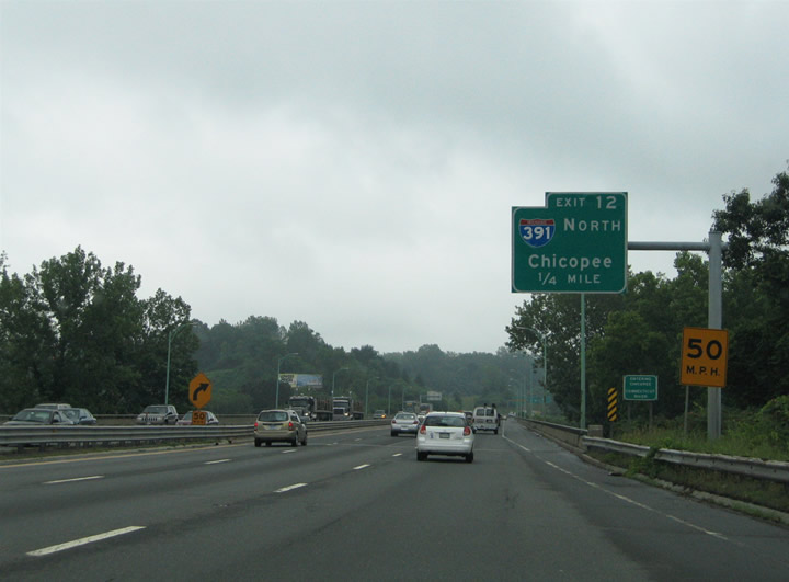
| Interstate 91 continues south to within one-quarter mile of the directional ramp onto Interstate 391 north. The Connecticut River represents the Chicopee city line, and interests to the city center should use Interstate 391 north to Exit 2 (Route 116). Exit 1 of I-391 is the southern terminus. 06/28/05 |
|
| Interstate 91 makes a nearly 90 degree turn from the Connecticut River bridge southward into Springfield at Interstate 391 (Exit 12). Exit 12 joins the freeway spur just south of Center Street, the temporary end point of I-391 from 1970 to 1982. Interstate 391 spurs 4.46 miles north overall to High Street in Holyoke. 06/28/05 |
|
| Three lanes of Interstate 91 continue south toward the city of Springfield and U.S. 20 (West Street / North End Bridge). Exit 11 joins the US highway via Birnie Avenue.
Birnie Avenue parallels the freeway south from Route 116 (Center Street) to Plainfield Street (U.S. 20 west / Route 20A east). 06/28/05 |
|
| Nearing the off-ramp (Exit 11) to Birnie Avenue south for U.S. 20 west and Route 20A east on I-91. U.S. 20 follows West Street to the North End Bridge and West Springfield city center. The US route meets U.S. 5 (Riverdale Road) at a rotary by the west banks of the Connecticut River. From there U.S. 20 continues to Westfield and Pittsfield. 06/28/05 |
|
| U.S. 20 eastbound joins the collector distributor roadway system of Interstate 91 between Exits 12 and 11. The US route uses the freeway to dogleg southward onto Interstate 291 east for Page Boulevard and Ludlow as Route 20A follows the original U.S. 20 alignment along Carew Street to the north. Route 20A begins at the intersection of Birnie Avenue and Plainfield Street nearby, following Plainfield Street southeast to Route 116 (Main Street) at Carew Street. 06/28/05 |
|
| A result of sequential-based exit numbering system is the omitting of numbers due to partial interchanges. Such is the case with Exits 10 and 9 along Interstate 91 southbound. Motorists are provided with a sign displaying "Next Exit 8" in case they wondered what happened to Exits 10 (Route 116 along I-91 north) and 9 (U.S. 20 west / Route 20A east on I-91 north). Exit 8 lies just one mile south of Exit 11 and serves Interstate 291 & U.S. 20 east. 06/28/05 |
|
| For motorists joining Interstate 91 via Interstate 391 south, a second truck restriction sign (removed by 2007) advised commercial vehicles of the restrictions applied to the South End Bridge (Route 57). Route 57 comprises a freeway spur west to Agawam from Interstate 91 at Exit 3. However truckers must were directed to Exit 7 to the Memorial Bridge and U.S. 5 south to make the connection to Route 57 west. 06/28/05 |
|
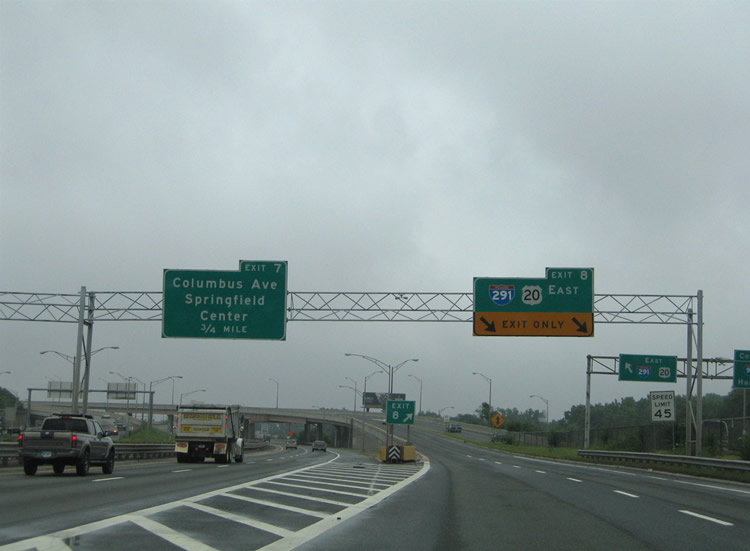
| An interchange sequence sign acts as the de facto half mile sign for Interstate 291 & U.S. 20 (Exit 8) east on Interstate 91 south. The Chestnut Street off-ramp of I-291 east (Exit 2A) or the Boland Way off-ramp (Exit 7) of I-91 south serve the Springfield central business district. 06/28/05 |
|
| Interstate 91 partitions into a two lane southbound mainline and two lane off-ramp onto Interstate 291 & U.S. 20 east. U.S. 20 itself remains separated from southbound I-91, merging onto I-291 independently to the right from West Street. U.S. 20 follows Interstate 291 east four miles to the East Springfield neighborhood of the city. The urban loop joins Downtown Springfield with the Massachusetts Turnpike near Chicopee Falls. 06/28/05 |
|
| The eastbound beginning of Interstate 291 departs Interstate 91 south at Exit 8. U.S. 20 joins I-291 from the adjacent on-ramp. Use Interstate 291 east for the McKnight and Bay and Athol Junction neighborhoods of Springfield. 06/28/05 |
|
| Merging onto Interstate 91 south from Interstate 291 west in Downtown Springfield. A tri-level stack interchange joins the two freeways and U.S. 20 adjacent to Pynchon Park and the Connecticut River. Attached to the U.S. 20 westbound on-ramp to I-91 north is an Exit 4 overhead for the National Basketball Hall of Fame. 08/09/04 |
|
| With I-291 traffic added, Exit 7 follows for Columbus Avenue, Boland Way and the Memorial Bridge to West Springfield. Columbus Avenue travels a one way couplet alongside Interstate 91 from Boland Way south to U.S. 5 at the South End Bridge. 08/09/04 |
|
| Exit 7 leaves Interstate 91 southbound for Columbus Avenue at Boland Way. The Memorial Bridge spans the Connecticut River between Downtown Springfield and the U.S. 5 & Route 146 (Memorial Avenue) traffic rotary. E. Columbus Avenue continues alongside Interstate 91 north from Boland Way to U.S. 20 and Route 20A (Plainfield Street) in the North End community.
A greenout added by 2011 changed Columbus Avenue to Hall of Fame Avenue. 08/09/04 |
|
| Interstate 91 hugs the east banks of the Connecticut River by the central business district of Springfield. Unobstructed views are afforded to southbound drivers of the city skyline. 08/09/04 |
|
| The Exit 5 off-ramp onto W. Columbus Avenue at Broad Street was permanently closed and replaced with a new off-ramp (Exit 6) to the north ahead of Union Street. The half diamond interchange here previously served Broad Street and nearby Main Street in south Springfield. 08/09/04 |
|
| Interstate 91 passes by the National Basketball Hall of Fame 0.75 miles north of the directional T interchange (Exit 4) with U.S. 5 and the South End Bridge. U.S. 5 ties into the freeway briefly between Exits 2 and 5. The US route branches west across the Connecticut River to Route 57 in the city of Agawam. 08/09/04 |
|
| Exit 4 leaves Interstate 91 south ahead of the merge with U.S. 5 at the South End Bridge. The off-ramp merges onto W. Columbus Avenue ahead of its intersection with Main Street. A u-turn ramp carries drivers onto E. Columbus Avenue north for Broad Street. Main Street loops north to intersect Mill Street one block west of Belmont Avenue. 08/09/04 |
|
| Southbound at the ramp departure of Exit 4 onto W. Columbus Avenue south for Mill Street east and Main Street north. Use Belmont Avenue east from Mill Street to Route 83 (Sumner Avenue) at The X in southeast Springfield. Route 83 travels east from Exit 2 of I-91 to East Longmeadow and Somers, Connecticut. 08/09/04 |
|
| Exit 3 merges with the ending W. Columbus Avenue ahead of the South End Bridge and U.S. 5. U.S. 5 crosses the river and turns north at Route 57 while Route 57 spurs west as a freeway between the US route and Route 187 in Agawam. U.S. 5 straddles the west banks of the Connecticut River from Agawam north to West Springfield and Holyoke. 08/09/04 |
|
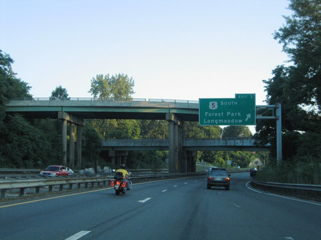
| U.S. 5 south ties into Interstate 91 between the South End Bridge and a wye interchange at Exit 1. The US highway departs the freeway for Columbus Avenue and Longmeadow Street south within Forest Park. Beyond there, U.S. 5 continues south to Longmeadow before crossing paths again with Interstate 91 at Exit 49 in Connecticut. 08/09/04 |
|
| A tri-level stack interchange joins Route 83 and E. Columbus Avenue with Interstate 91 and U.S. 5. Access to Route 83 is only available from the adjacent U.S. 5 on-ramp along southbound. Exit 1 otherwise departs Interstate 91 south for the departure of U.S. 5 (Columbus Avenue) here. 08/09/04 |
|
| Traffic from Route 83 north merges onto Interstate 91 south ahead of the Connecticut state line. Pictured here is the final southbound reassurance shield for Interstate 91 in the Bay State. 08/09/04 |
|
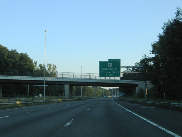
| The first guide sign for Exit 49 in Connecticut uses Massachusetts signing standards for the upcoming folded-cloverleaf interchange with U.S. 5 (Enfield Street) in Enfield. Interstate 91 crosses the state line one mile south of the Emerson Street over crossing in Longmeadow. 08/09/04 |
|
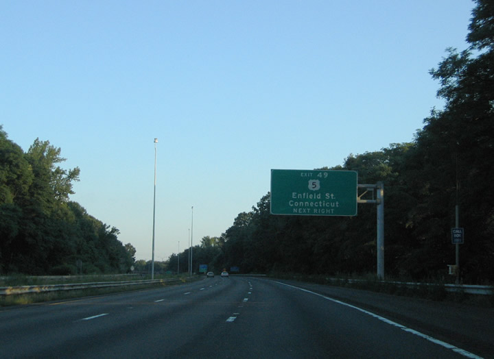
| Interstate 91 and U.S. 5 (Longmeadow Street) cross into Enfield, Connecticut ahead of their interchange at Exit 49. U.S. 5 travels to the west of I-91 through Enfield between Exits 49 and 46. 08/09/04 |
Page Updated 09-23-2006.

 South
South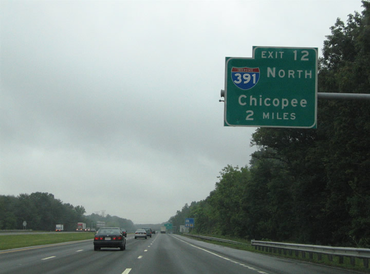


 South
South