|
| Interstate 95 enters the Greenwich neighborhood of Byram at the southwestern corner of Connecticut from the New England Thruway at Port Chester, New York. Exit 1 constitutes the Connecticut Turnpike gateway. 05/31/22 |
|
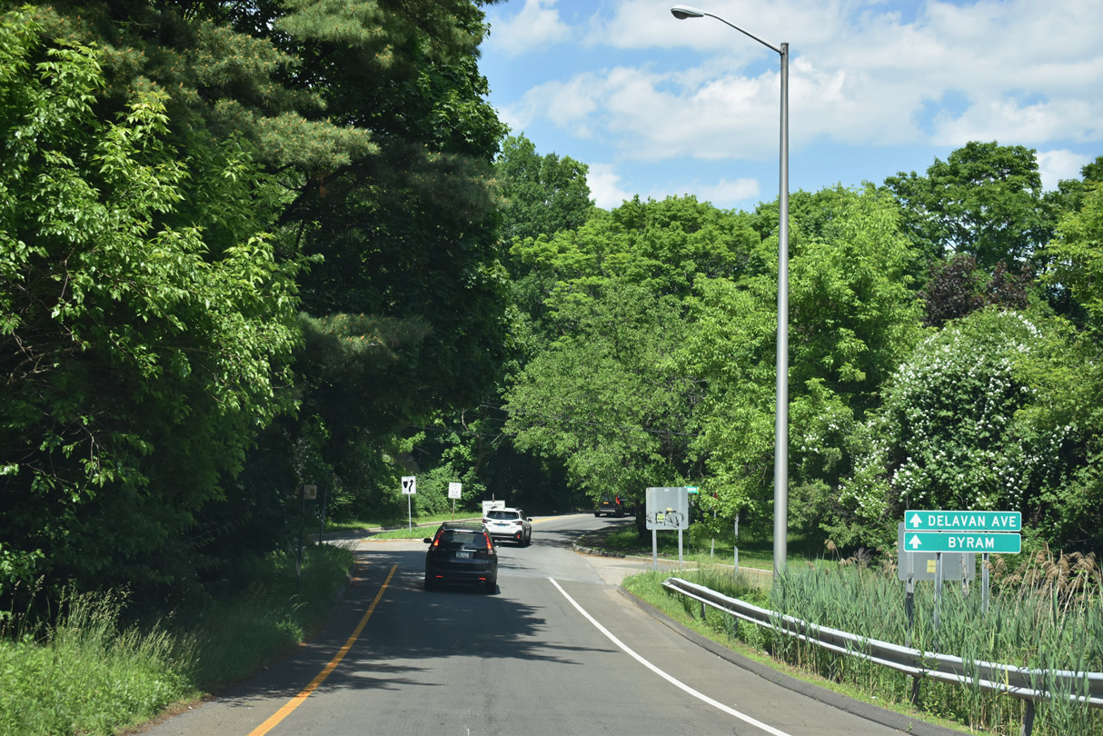
| A Connecticut welcome sign precedes the split diamond interchange (Exit 2) with Delavan Avenue. Delavan Avenue continues Mill Street east from U.S. 1 (Main Street) in Port Chester, New York to Ritch Avenue in Byram. 05/30/22 |
|
| Byram Road stems northwest from Delavan Avenue to U.S. 1 (Putnam Avenue). Byram Shore Road spurs southward to Byram Harbor. 05/30/22 |
|
| Exit 2 departs I-95 north to Delavan Avenue and Ritch Avenue. Ritch Avenue travels north alongside Byram Park to Hamilton Avenue in the city of Greenwich. 05/30/22 |
|
| Exit 2 ties into the intersection of Doran Street at Eugene Street, 0.06 miles from Byram Shore Road to Delavan Avenue and Ritch Avenue. The Byram business district lies west of I-95 along Mill Street and the Byram River. 05/31/22 |
|
| The city of Stamford follows Greenwich along Interstate 95. Connecticut's most populous city is 28 miles away. 05/30/22 |
|
| The first northbound reassurance shield for Interstate 95 in Connecticut. 05/30/22 |
|
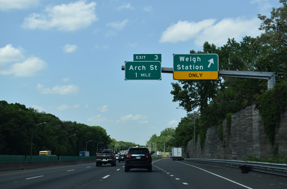
| The northbound side weigh station in Greenwich was constructed in the place of the original Connecticut Turnpike main line toll plaza. 05/30/22 |
|
| The truck weigh station lies just north of Byram Harbor and the community of Belle Haven. Arch Street next meets I-95 one mile to the east by Greenwich Harbor. 05/30/22 |
|
| Tieing into the diamond interchange at Exit 3, Arch Street loops northwest from Steamboat Road / Museum Drive by Roger Sherman Baldwin Park to Railroad Avenue by the Greenwich Train Station. 05/30/22 |
|
| Exit 3 east from Exit 3, Arch Street to Museum Drive leads toward Bruce Park and the Bruce Museum. Arch Street extends north to Sound View Drive to Greenwich Town Hall and Greenwich Avenue south of Downtown. 05/30/22 |
|
| The succeeding exit along northbound Interstate 95 is for Indian Field Road and the community of Cos Cob. 05/30/22 |
|
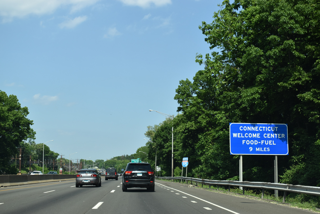
| Located nine miles to the east, The Darien Service Plaza houses a Connecticut Welcome Center. 05/30/22 |
|
| Interstate 95 passes north of parallel Davis Avenue, Indian Harbor and Bruce Park on the ensuing stretch. 05/30/22 |
|
| With six overall lanes, I-95 advances a half mile to the diamond interchange (Exit 3) with Indian Field Road. Indian Field Road runs north from Captain Harbor to Bruce Park Drive before meeting Governor John Lodge Turnpike. 05/30/22 |
|
| Indian Field Road continues 0.7 miles north from Exit 4 by The Millbrook Club golf course to U.S. 1 (Putnam Avenue) in Cos Cob. 05/30/22 |
|
| Shifting northward at Cos Cob, Interstate 95 parallels U.S. 1 south of the Mianus neighborhood in Greenwich. 05/30/22 |
|
| The viaduct along Interstate 95 spans Sound Shore Drive adjacent to the Cos Cob Train Station. 05/30/22 |
|
| Interstate 95 and U.S. 1 (Putnam Avenue) cross paths for the first of many times in Connecticut east of the Mianus River at the community of Riverside. 05/30/22 |
|
| Interstate 95 angles across the Mianus River south of Mianus Pond by a pair of marinas. 05/30/22 |
|
| Long Island appears along the southern horizon beyond Captain Harbor. 07/27/07 |
|
| Looking south at the nearby AMTRAK bridge across Cos Cob Harbor. 07/27/07 |
|
| Riverside Avenue spans Interstate 95 between the Mianus River and U.S. 1 at Exit 5. A trumpet interchange joins the Connecticut Turnpike with adjacent U.S. 1 (Putnam Avenue) near Sound Beach Avenue. 05/30/22 |
|
| Distance sign posted two miles from Stamford and 24 miles from Bridgeport. 05/30/22 |
|
| U.S. 1 (Putnam Avenue) east to Sound Beach Avenue south leads to the neighborhood of Old Greenwich. Sound Beach Avenue connects with Shore Road near Stamford Harbor and Greenwich Point Park, 1.81 miles from U.S. 1. 05/30/22 |
|
| A split diamond interchange joins I-95 with Harvard and West Avenues at Exit 6 via Baxter Avenue and Grenhart Road. This is the first of four exits for the city of Stamford. 05/30/22 |
|
| Harvard and West Avenues travel between Selleck Street and U.S. 1 (W. Main Street) in Stamford. 05/30/22 |
|
| Baxter Avenue continues east from Exit 6 and West Avenue to Fairfield Avenue via Waverly Place. Harvard Avenue ties to Selleck Street in an industrial park area. West Avenue extends north beyond U.S. 1 (Main Street) to a roundabout with Stillwater Avenue at Lione Park. 05/30/22 |
|
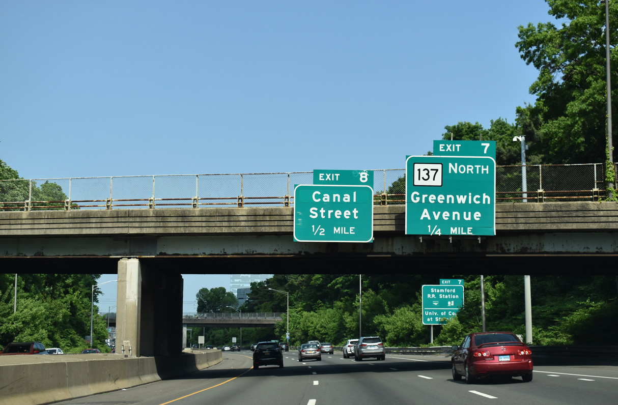
| Interstate 95 continues 0.75 miles east to Greenwich Avenue and Washington Boulevard at Exit 7. Washington Boulevard (Route 493) leads 0.34 miles north to become Route 137 at U.S. 1 (Tresser Boulevard). 05/30/22 |
|
| Wilson Street and Fairfield Avenue span I-95 ahead of Exit 7. State Street forms a frontage road system between Greenwich Avenue and the entrance ramp at Elm Street. 05/30/22 |
|
| I-95 crosses Route 137 (Washington Boulevard) ahead of the half diamond interchange (Exit 8) with Atlantic Street. 05/30/22 |
|
| Greenwich Avenue stems north from Selleck Street and Southfield Avenue to U.S. 1 at W Main Street and Tresser Boulevard in Stamford. Route 137 (Washington Boulevard) heads 9.33 miles northward to NY 137 through Newfield-Turn of River, North Stamford and High Ridge. 05/30/22 |
|
| Atlantic Street runs north from the South End neighborhood in Stamford to Broad and Bedford Streets by Stamford Town Center mall. Points of interest in Downtown Stamford include the Rich Forum and Palace Theatre entertainment venues. 05/30/22 |
|
| The last Stamford exit from I-95 north is a parclo interchange with U.S. 1 (E Main Street) and the south end of Route 106 (Courtland Avenue). 05/30/22 |
|
| Route 106 (Courtland Avenue) runs 14.37 miles northeast from U.S. 1 (Main Street) adjacent to I-95 through Glenbrook in Stamford to Route 15 (Merritt Parkway), New Canaan and Route 53 in the town of Wilton. 05/30/22 |
|
| Exit 9 leaves I-95 north to Seaside Avenue south of U.S. 1 (Main Street). U.S. 1 loops south to Noroton before meeting Interstate 95 again at Exit 11. Seaside Avenue leads 0.69 miles south from Main Street to Cove Road near Cove Island park. 05/30/22 |
|
| The corporate headquarters of WWE lies one block east of Seaside Avenue along U.S. 1 (E Main Street). 05/30/22 |
Page Updated 03-12-2023.

 North
North