05/09/05 & 07/01/05 photos taken by Alex Nitzman.
| Interstate 390 North |
|
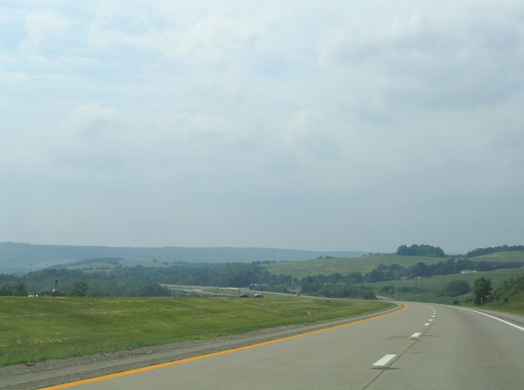
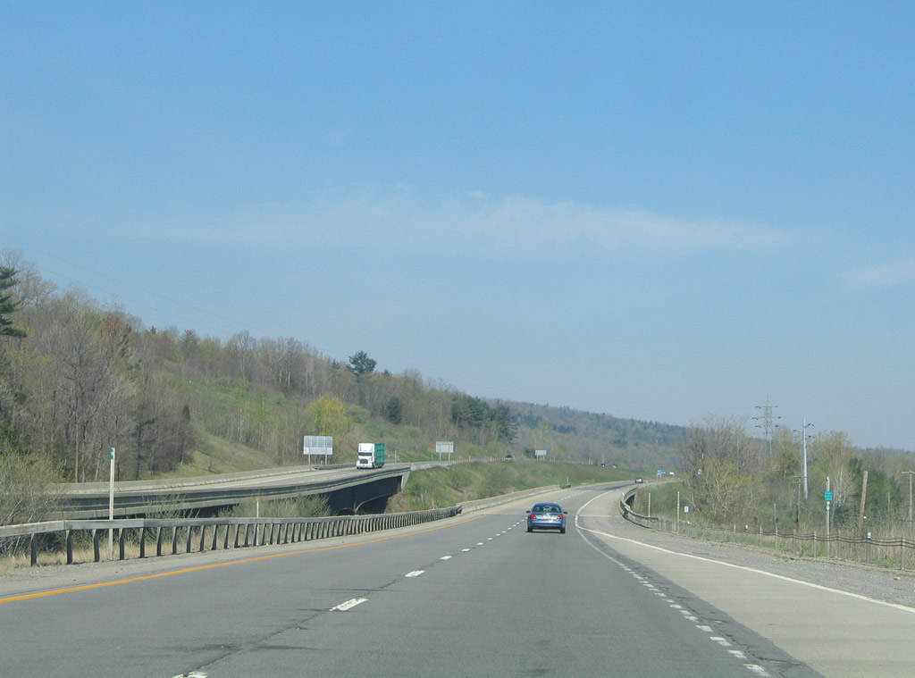
Interstate 390 departs Interstate 86 & New York 17 west between Kanona and Avoca. Two pairs of reassurance shields line the freeway beginning ahead of the westbound Southern Tier Expressway over crossing. Photo taken 07/01/05. |
|
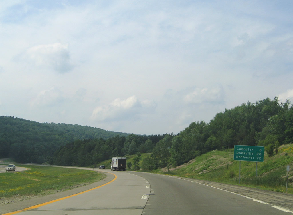
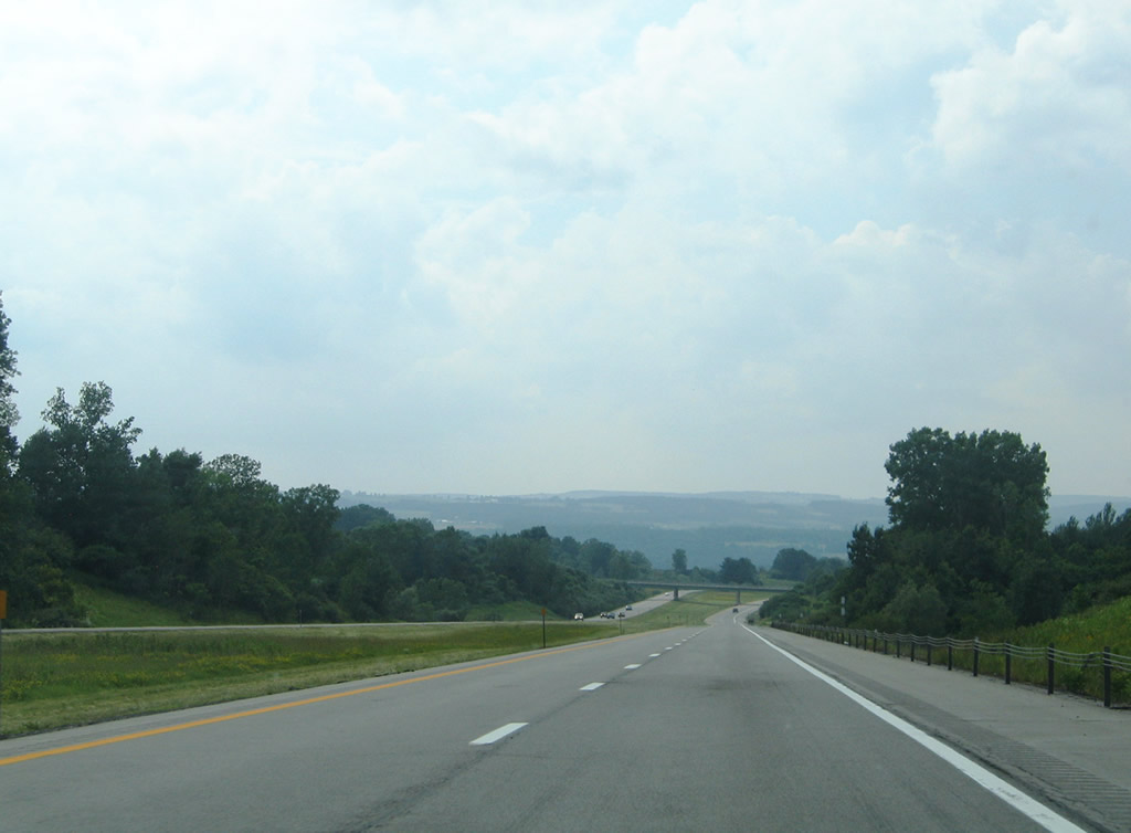
Interstate 390 heads ten miles northwest to Cohocton, 22 miles to Dansville, and 74 miles to Rochester. Photo taken 07/01/05. |
|
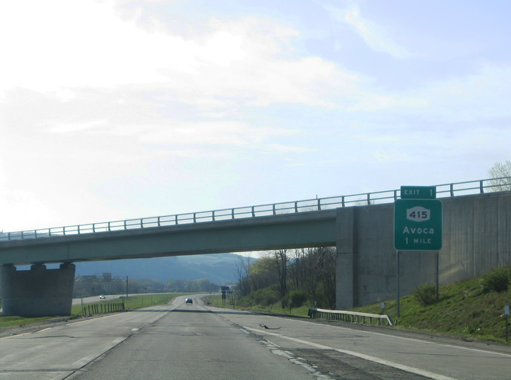
A loop ramp carries eastbound Southern Tier Expressway traffic onto Interstate 390 north ahead of the I-86 westbound overpass. The freeway otherwise continues north one mile to Michigan Hollow Road (Exit 1). Michigan Hollow Road connects the Interstate 390 with parallel New York 415 outside Avoca. Photo taken 05/07/05. |
|
|
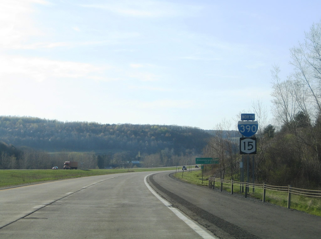
A rare state-named shield, the remaining northbound entry as of 2005, posted for Interstate 390 with New York 15 after Interstate 86 & New York 17. New York 15 was removed officially from its overlap with Interstate 390 by 2004. Signs for New York 15 were to come down along the freeway in 2009. Photos taken 05/07/05. |
|
Exit 1 departs Interstate 390 north for Michigan Hollow Road. New York 415, the former alignment of U.S. 15, follows the Cohocton River northwest from Kanona toward the village of Avoca. The state route straddles the west side of town. Photo taken 07/01/05. |
|
|
|
|
| Interstate 390 lines the hillside east of Avoca. Wagner Hill rises to the north. Photos taken 05/07/05 & 07/01/05. |
|
|
|
Interstate 390 passes over New York 415 near Wallace and widen along the west side of the Cohocton River. Brown and Waterbury Hills rise to the west of Wallace. Photos taken 05/07/05 & 07/01/05. |
|
|
|
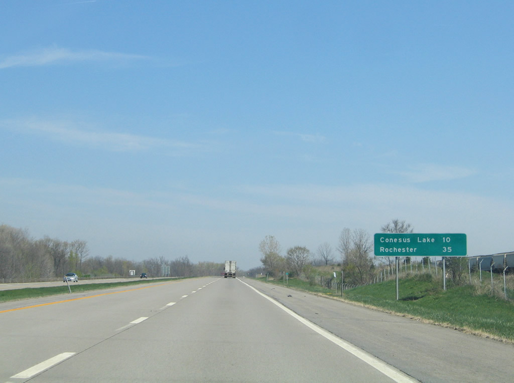
A scenic pull off lies along the northbound side of Interstate 390 after the Wentworth Road overpass. The rest area provides views of the Cohocton River valley at Cohocton and Potter Hill to the west. Photos taken 05/07/05 & 07/01/05. |
|
New York 415 enters Cohocton from the south along Main Street north, turning onto Maple Avenue west to Loon Lake Road. Loon Lake Road (Steuben County 121) connects Interstate 390 (Exit 2) with the state route. Photo taken 07/01/05. |
|
Interests to Canandaigua Lake should use New York 371 (North Main Street) north from New York 415 (Maple Avenue) in Cohocton. Photo taken 05/07/05. |
|
Interstate 390's Exit 1 diamond interchange lines the hillside west of Cohocton. Loon Lake Road leads west from New York 415 (Maple Avenue) to New York 21 at Loon Lake. New York 415 remains in close proximity from Cohocton northward to its end at New York 15 & 21 near Exit 3. Photo taken 07/01/05. |
|
|
Interstate 390 turns northwesterly on the six mile drive to Wayland. Photos taken 05/07/05 & 07/01/05. |
|
|
More of the scenery along the freeway as it traverses Hinkle Hollow. Photos taken 07/01/05. |
|
Nearing the Kiefers Corners-Orchard Comfort Road underpass within the town of Wayland. Hemmer Hill fronts the north side of the freeway. Photo taken 07/01/05. |
|
New York 15 begins at Interstate 390 (Exit 3) and enters a 1.7-mile overlap with New York 21 north into Wayland. The state route follows the pre-1974 alignment of U.S. 15 from New York 415 north to downtown Rochester. Photo taken 07/01/05. |
|
|
New York 21 enters the Exit 3 diamond interchange from Hornell and Patchinville to the south. The state route connects Wayland with North Cohocton and Naples to the northeast. Photos taken 05/07/05 & 07/01/05. |
|
|
Interstate 390 continues away from New York 15 and Wayland westward to Perkinsville. Photos taken 05/07/05 & 07/01/05. |
|
|
Descending toward the Steuben County 46 overpass and Livingston County line along Interstate 390 north (west). Photos taken 05/07/05 & 07/01/05. |
|
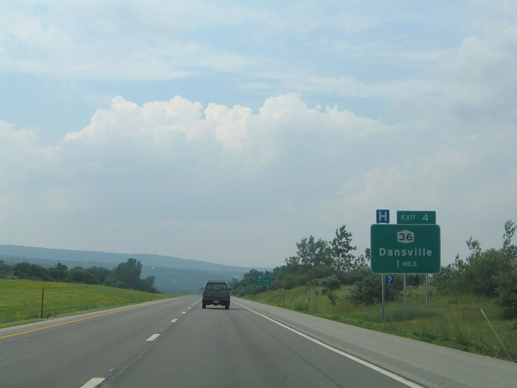
The first of two interchanges for Dansville joins Interstate 390 with New York 36 (Clara Barton Street) on the southwest side of town. Photo taken 07/01/05. |
|
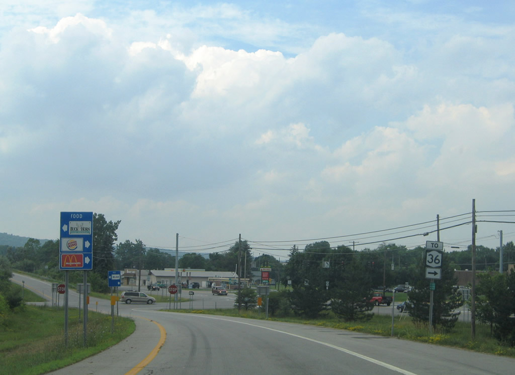
New York 36 enters Dansville from Hornell, Arkport, and Stoney Brook State Park to the southwest. After a brief overlap with New York 63 along Dansville's Main Street, the state route turns back west to meet Interstate 390 again at Exit 5. Travelers bound for New York 36 north should remain on the freeway to the second New York 36 exit. Photo taken 07/01/05. |
|
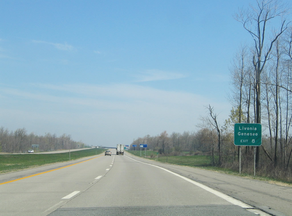
Exit 4 departs Interstate 390 north for New York 36 (Clara Barton Street). New York 36 follows Clara Barton Street north to Nicholas Noyes Memorial Hospital and New York 63 (Main Street) in downtown Dansville. Stoney Brook State Park is a short drive south via Hornell Road across the county line. Photo taken 07/01/05. |
|
Interstate 390 follows the western boundary of Dansville between Exits 4 and 5. New York 36 follows Ossian Street west to New York 436 from New York 63 (Main Street); New York 436 connects the village with Nunda to the west. Photo taken 07/01/05. |
|
Northbound reassurance shield posted for Interstate 390 at Dansville. Photo taken 07/01/05. |
|
A diamond interchange with McWhorter Road facilitates movements onto parallel New York 36 (Airport Road) opposite Dansville Municipal Airport. New York 36 follows a combination of Franklin and Dock Streets to Ossian Street in town and Dansville-Mount Morris Road northwest to Exit 6 and Mt. Morris. Photo taken 05/07/05. |
|
Descending upon the Exit 5 off-ramp, drivers bound for New York 36 turn right onto McWhorter Road for its signalized intersection with Airport Road. McWhorter Road spurs west to a truck plaza otherwise. Photo taken 07/01/05. |
|
|
Interstate 390 spans Canaseraga Creek immediately after the McWhorter Road northbound on-ramp. Beyond the crossing, the freeway climbs on the adjacent hillside into the town of West Sparta. Photos taken 05/09/05. |
|
|
|
|
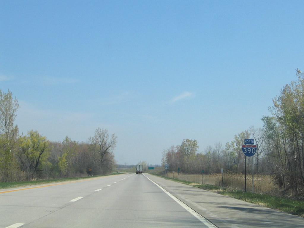
| An eight mile exit less stretch carries northbound drivers on the 13-mile drive to Mt. Morris. Photos taken 05/09/05. |
|
Trucks bound for Buffalo are advised to remain along Interstate 390 north to the New York Thruway in lieu of New York 36 north. Photo taken 05/09/05. |
|
New York 36 (Sonyea Road) meets Interstate 390 for the third time at a diamond interchange (Exit 7) southeast of Sonyea. Photo taken 05/09/05. |
|
New York 36 leaves the immediate Interstate 390 corridor on its northwest drive to Mt. Morris and Letchworth State Park. The state route continues north to New York 31 at Adams Basin at the end of its 95.17 mile alignment. Photo taken 05/09/05. |
|
|
|
Interstate 390 bends northeast into the Canaseraga Creek valley from Sonyea to Groveland. Photos taken 05/09/05. |
|
New York 408 (Mt. Morris Geneseo Road) interchanges with Interstate 390 at the next exit. The state route connects New York 63 with Mt. Morris to the west. Photo taken 05/09/05. |
|
|
Rest areas line both sides of Interstate 390 east of the Canaseraga Creek. Photos taken 05/09/05. |
|
Northbound at the folded-diamond interchange with New York 408 (Mt. Morris Geneseo Road). New York 408 totals 15.95 miles between New York 63 nearby and New York 70 at Dalton. Photo taken 05/09/05. |
|
Departing Interstate 390 for New York 408. New York 63 travels just east of the freeway, meeting the east end of New York 408 to the right. New York 63 continues north to Geneseo and U.S. 20A & New York 39. Interests to SUNY Geneseo should use Exit 8. Photo taken 07/02/05. |
|
Mileposts along Interstate 390 feature small I-390 shields. Photo taken 05/09/05. |
|
|
Interstate 390 turns northeast and bypasses the Livingston County seat of Geneseo on the 10-mile drive to Conesus Lake. Photos taken 05/09/05. |
|
|
A pair of carriageway splits occur along the freeway between Exits 7 and 8. The second separation occurs north of the Reservoir Road overpass. Photos taken 05/09/05. |
|
U.S. 20A travels east from Geneseo to meet Interstate 390 at the Exit 8 diamond interchange at Lakeville. The U.S. route continues east to a merge with New York 15 at Livonia. Photo taken 05/09/05. |
|
Exit 8 departs Interstate 390 northbound for U.S. 20A (Lakeville Road) at Lakeville. U.S. 20A straddles the north end of Conesus Lake at Sand Point. The highway overall travels 83.59 miles between Orchard Park and Bloomfield. Photo taken 05/09/05. |
|
|
Next in line for northbound travelers is the town of Avon in seven miles. Photos taken 05/09/05. |
|
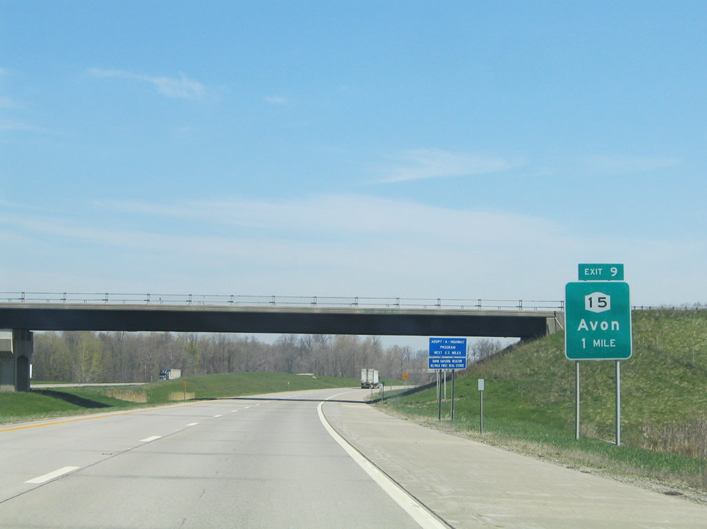
New York 15 (Lakeville Road) heads north from Lakeville and crosses paths with Interstate 390 at the Exit 9 diamond interchange. Photo taken 05/09/05. |
|
Drivers span Conesus Creek on the approach to Exit 9 for the town of Avon. Photo taken 05/09/05. |
|
New York 15 (Lakeville Road) continues north from Interstate 390 into Avon. The state route will meet the freeway again at Exits 11 and 16. Photo taken 05/09/05. |
|
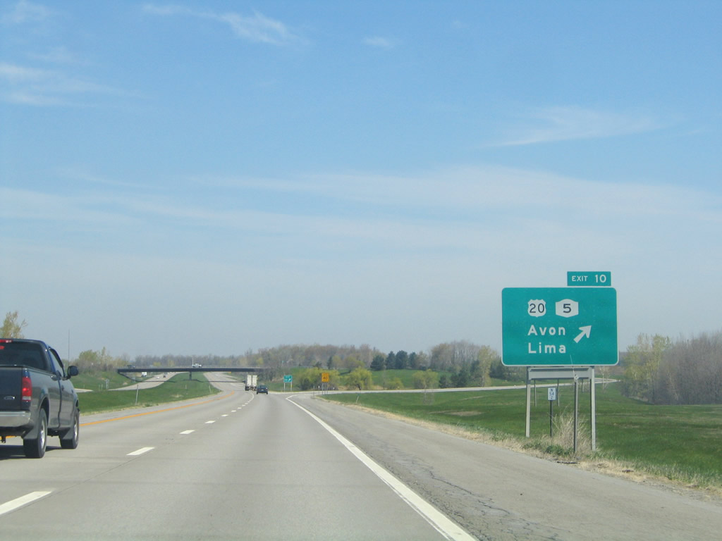
One mile south of the Exit 10 parclo interchange with U.S. 20 & New York 5 (Avon-Lima Road) at the Sutton Road overpass. Photo taken 05/09/05. |
|
U.S. 20 & New York 5 head west to East Avon nearby and their split at Avon. Eastward, the two share pavement through Lima to the city of Auburn. The two routes represent the third and fourth longest touring routes in the state respectively. Photo taken 05/09/05. |
|
|
Commuters bound for the city of Rochester join Interstate 390 northbound on the 20-mile drive from Avon to the Monroe County seat. Photos taken 05/09/05. |
|
The stretch of freeway between Exits 10 and 11 is designated the 87th Infantry Division, Patton's 3rd US Army - WW II, Memorial Highway. Photo taken 05/09/05. |
|
Interstate 390 enters Monroe County beyond the North Avon Road overpass. Photo taken 05/09/05. |
Page Updated October 23, 2009.