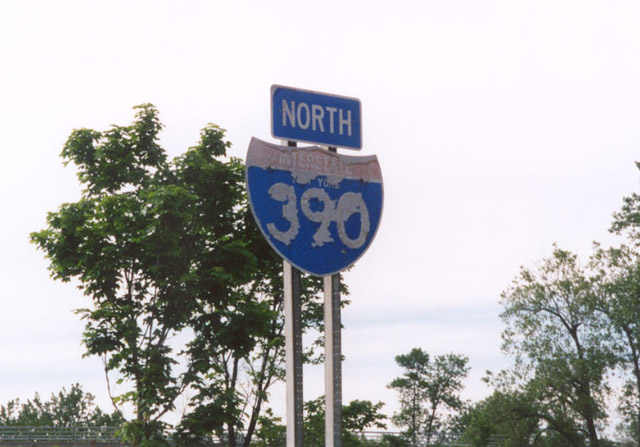
Interstate 390 North - Monroe County
05/09/05 & 05/10/05 photos taken by Alex Nitzman.
| Interstate 390 North | ||
|---|---|---|
 |
 |
Interstate 390 sweeps northward from the Livingston County line into the town of Rush. Photos taken 05/09/05. |
 |
Exit 11 joins the freeway with New York 251 (Scottsville-Rush Road) and New York 15 (West Henrietta Road) via a split-diamond interchange. Photo taken 05/09/05. |
 |
New York 15 travels north from Rush to West Henrietta along the west side of Interstate 390, meeting the freeway again at Exit 16. New York 251 travels 17.85 miles east-west between New York 383 in Scottsville and New York 96 at Victor. Photo taken 05/09/05. |
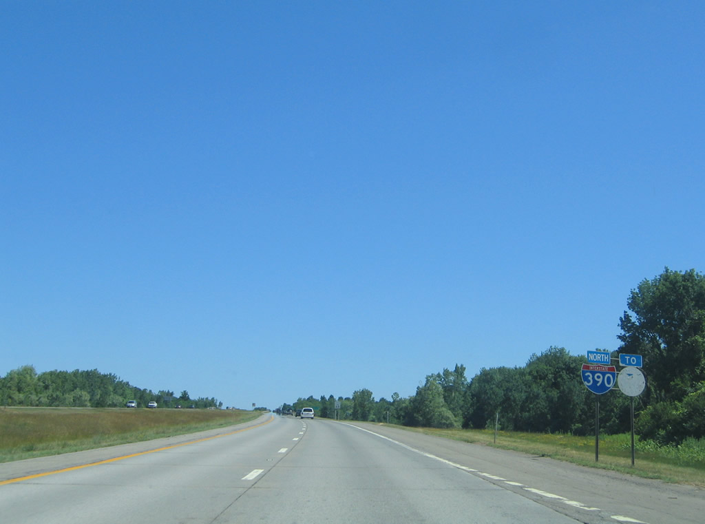 |
A New York Thruway trailblazer joins this northbound Interstate 390 shield assembly as the freeway leaves Exit 11. Photo taken 07/02/05. |
 |
The city of Rochester, the lone control point of Interstate 390 north, remains 12 miles to the north. Photo taken 05/09/05. |
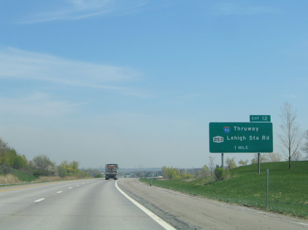 |
Interstate 90 (New York Thruway) meets Interstate 390 at Exit 12. The trumpet interchange complex with the Thruway also connects with the nearby diamond interchange with New York 253 (Lehigh Station Road). Photo taken 05/09/05. |
 |
The Rochester skyline comes into view as Interstate 390 sinks toward the Erie Station Road overpass. Photo taken 05/09/05. |
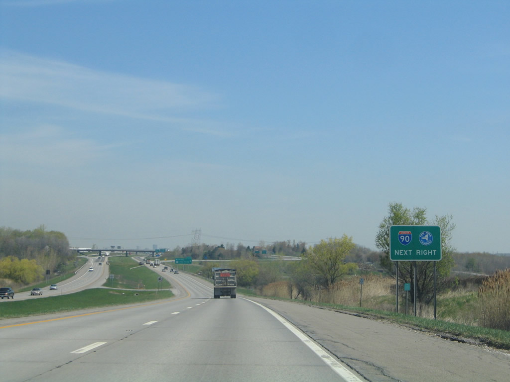 |
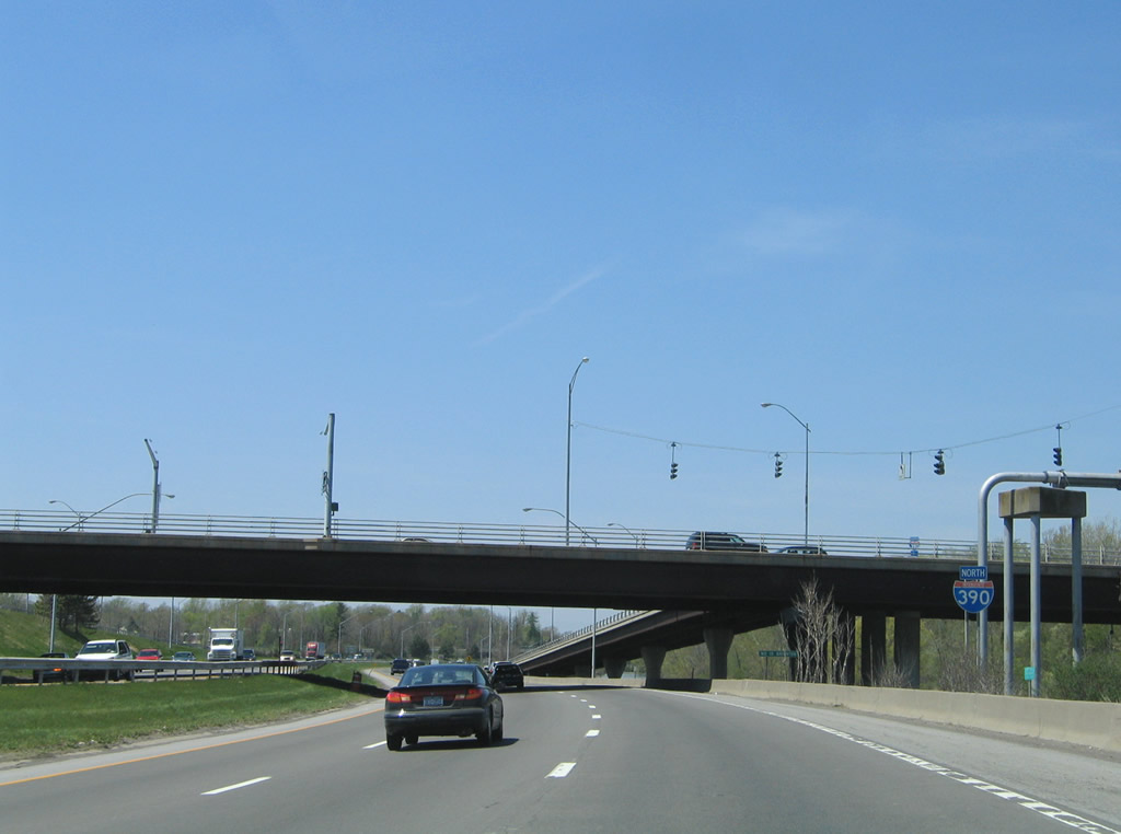
Interstate 390 passes over the Thruway ahead of the Exit 12 ramp departure for Interstate 90 and New York 253. The Thruway is a 496-mile facility linking Buffalo, Syracuse, Albany, and New York City via the Interstate 90 and 87 main lines. Photo taken 05/09/05. |
 |
Exit 12 leaves Interstate 390 north for Interstate 90 and New York 253. New York 253 travels west to New York 15 (West Henrietta Road) nearby and east to Henrietta and its terminus at New York 65 (Clover Street). Photo taken 07/02/05. |
 |
Exit 12 partitions into ramps for the Thruway and Lehigh Station Road. New York 253 shares pavement with New York 15 south to Erie Station Road west to Scottsville. Photo taken 07/02/05. |
 |
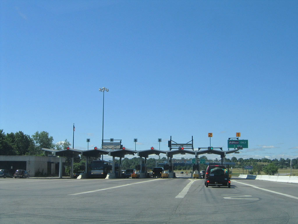 |
Entering the Exit 46 toll plaza of the New York Thruway from Interstate 390. Both on-ramps to Interstate 90 combine ahead of the facility. Photos taken 07/02/05. |
 |
 |
After the toll plaza, drivers partition into respective ramps to Interstate 90 (New York Thruway). Westbound motorists continue to Batavia, Buffalo, and Erie, Pennsylvania. Eastbound travelers head toward Syracuse, Utica, and Albany. Photos taken 07/02/05. |
 |
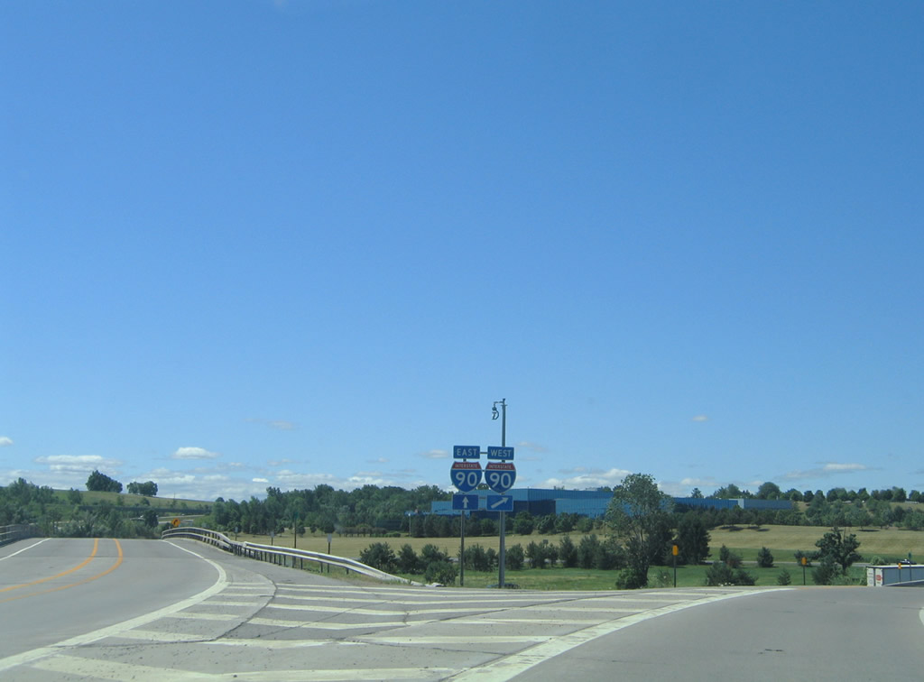
A loop ramp carries drivers from Interstate 90 to a split for Interstate 390 to Rochester and New York 253 (Lehigh Station Road) to Henrietta. Photo taken 05/09/05. |
 |
Interstate 390 passes over Lehigh Station Road after seeing this northbound shield. Photo taken 05/09/05. |
 |
Exit 13 joins Interstate 390 with Hylan Drive near the Marketplace Mall shopping district. Photo taken 05/09/05. |
 |
Downtown Rochester remains eight miles to the north via Interstate 390 and connecting roads. Photo taken 05/09/05. |
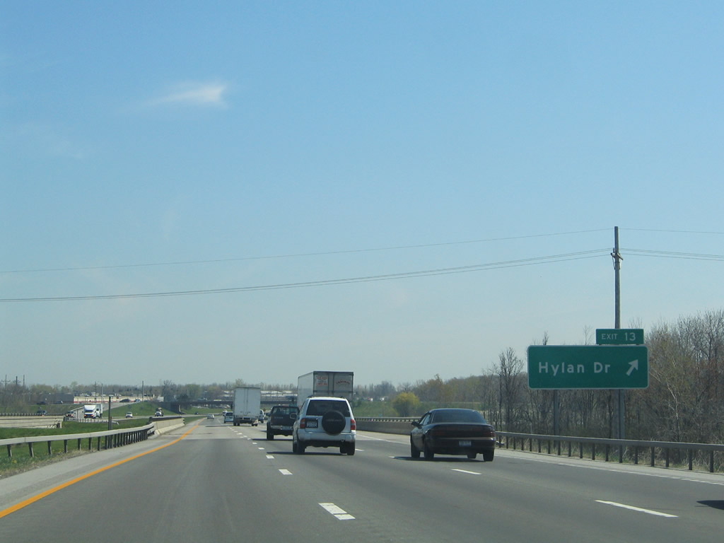 |
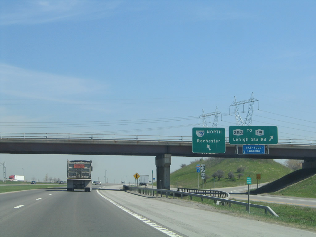
Northbound drivers span a CSX Railroad line ahead of the Exit 13 off-ramp to Hylan Drive. Hylan Drive curves southward to Calkins Road and northward to the mall and New York 252 (Jefferson Road). Photo taken 05/09/05. |
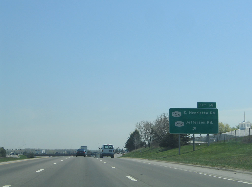 |
New York 15A (East Henrietta Road) enters an interchange with Interstate 390 from Henrietta to the south. The state route intersects New York 252 (Jefferson Road) south of Monroe Community College and just west of the freeway. Photo taken 05/09/05. |
 |
Interstate 390 continues with six lanes through Pease Industrial Park and under a CSX Railroad overpass. Photo taken 05/09/05. |
 |
Nearing the Brighton-Henrietta Town Line Road overpass on Interstate 390 north. Photo taken 05/09/05. |
 |
The northbound freeway widens to four lanes in anticipation of the tri-level stack interchange with Rochester's Outer Loop freeway. Interstate 390 turns northwest toward Greater Rochester International Airport and west Rochester; Interstate 590 travels the loop northeast to Brighton and Irondequoit Bay. Photo taken 05/09/05. |
 |
Interstate 590's northbound beginning is signed as Exit 15 from Interstate 390 north. The freeway travels 5.31 miles to Interstate 490 and New York 590 on the east side of Rochester. Photo taken 05/09/05. |
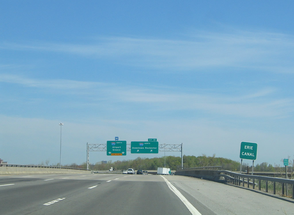 |
Drivers cross the Erie Canal on the entrance to the Outer Loop Freeway. Photo taken 05/09/05. |
 |
Interstate 390 turns northwest to the airport and Interstate 490 / New York 390 at Gates. New York 390 continues the Outer Loop to Greece. Interstate 590 meanwhile is signed as the most direct route to downtown. Had the Genesee Expressway been constructed as envisioned, Interstate 390 would end at the Mt. Hope Avenue ramps with Interstate 490 in downtown. Photo taken 05/09/05. |
 |
Interstate 390 next meets New York 15A (East Henrietta Road) and New York 15 (West Henrietta Road) at a combination diamond wye interchange (Exit 16). Photo taken 05/10/05. |
 |
Passing over the Erie Canal, Interstate 390 west splits with the Exit 16 off-ramp to New York 15A (East Henrietta Road). New York 15A serves interests to Monroe Community Hospital and Monroe Community College. Photo taken 05/10/05. |
 |
Ascending the Exit 16 off-ramp, drivers may either turn onto New York 15A (East Henrietta Road) or continue straight to the wye interchange with New York 15. New York 15A ends at New York 15 (Mt. Hope Avenue) at Elmwood Avenue near Strong Memorial Hospital to the north. Southward the route meets Exit 14 of Interstate 390 in Henrietta. Photo taken 05/10/05. |
 |
Continuing across the signalized intersection with East Henrietta Road, drivers either merge onto Interstate 390 north or depart the on-ramp for New York 15 (West Henrietta Road). New York 15, the pre-1974 U.S. 15 alignment, heads north to the University of Rochester and Downtown and south to Marketplace Mall and West Henrietta. Photo taken 05/10/05. |
 |
New York 15 (West Henrietta Road) sees a half-diamond interchange with Interstate 390 north at this reassurance shield. The state route crosses Erie Canal on the north side of the freeway. Photo taken 05/10/05. |
 |
Kendrick Road and a rail to trail path pass over Interstate 390 beyond the next northbound shield. Photo taken 05/10/05. |
 |
This battered Interstate 390 New York shield was replaced by the one pictured above. Originally this stretch of Interstate 390, along with Interstate 590, was signed as New York 47. Photo taken 05/28/00. |
 |
Interstate 390 enters the city of Rochester briefly at the rail trail overpass ahead of Moore Drive and Genesee Valley Park. Photo taken 05/10/05. |
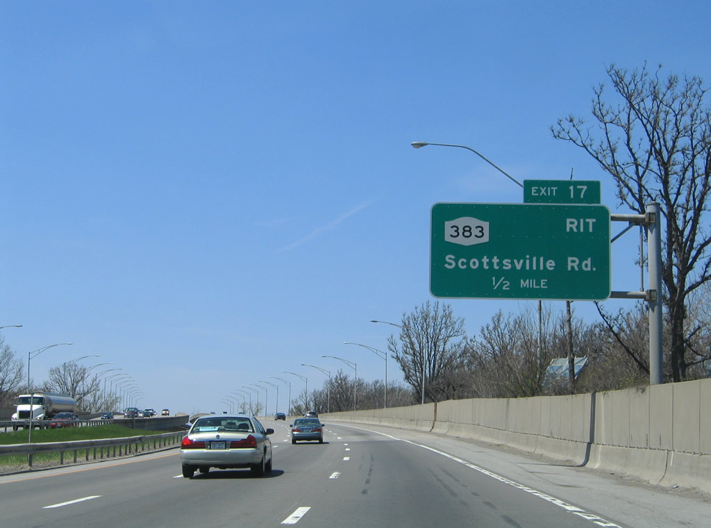 |
Sound walls line Interstate 390 through the park as the freeway nears its viaduct over the Genesee River. New York 383 (Scottsville Road) interchanges with the Outer Loop next at Exit 17. Photo taken 05/10/05. |
 |
New York 383 follows the south side of Greater Rochester International Airport to the west and follows the Genesee River to the northeast, ending at New York 31. Interests to Rochester Institute of Technology (RIT) should use the state route south to New York 252 (Jefferson Road). Photo taken 05/10/05. |
 |
Street lights are posted lower in height due to diminish their interference with the Rochester Airport landing lights. Photo taken 05/10/05. |
 |
Brooks Avenue stems west from New York 383 (Plymouth Avenue) to a six-ramp partial cloverleaf interchange with Interstate 390 (Exits 18A) and New York 204's westbound beginning. Photo taken 05/10/05. |
 |
Interstate 390 travels just east of the Rochester Airport terminal on the approach to New York 204 (Exit 18). Photo taken 05/10/05. |
 |
Exit 18A departs Interstate 390 north for residential areas along Brooks Avenue east. Photo taken 05/10/05. |
 |
A loop ramp follows for New York 204 (Brooks Avenue) west to Greater Rochester International Airport and New York 33A (Chili Avenue). New York 204 is significant historically in that it was intended to be built as a full freeway between Interstates 390 and 490. Only the Airport Expressway spur from Chili Avenue (New York 33A) west to Exit 6 of I-490 was constructed. Photo taken 05/10/05. |
 |
Interstate 390 north briefly swells to four overall lanes between New York 204 and Exit 19, New York 33A (Chili Avenue). Photo taken 05/10/05. |
 |
Northbound reassurance shield posted ahead of the Buell Road underpass. Photo taken 05/10/05. |
 |
A folded diamond interchange joins Interstate 390 and New York 33A (Chili Avenue) just west of the Erie Canal. New York 33A constitutes a 17.15-mile route between New York 33 in Rochester and New York 33 in Bergen. The route connects southwest portions of the city with Chili Center. Photo taken 05/10/05. |
 |
Attached to a CSX Railroad are overheads for the symmetrical directional stack interchange with Interstate 490, Interstate 390's north terminus. Photo taken 05/10/05. |
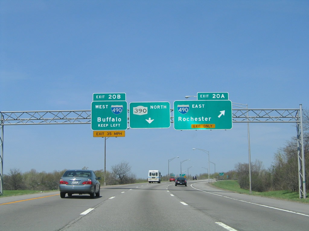 |
Exit 20A connects Interstate 390 north with Interstate 490 east (Western Expressway) to downtown Rochester. Exit 20B consists of a left-hand ramp to Gates. Photo taken 05/10/05. |
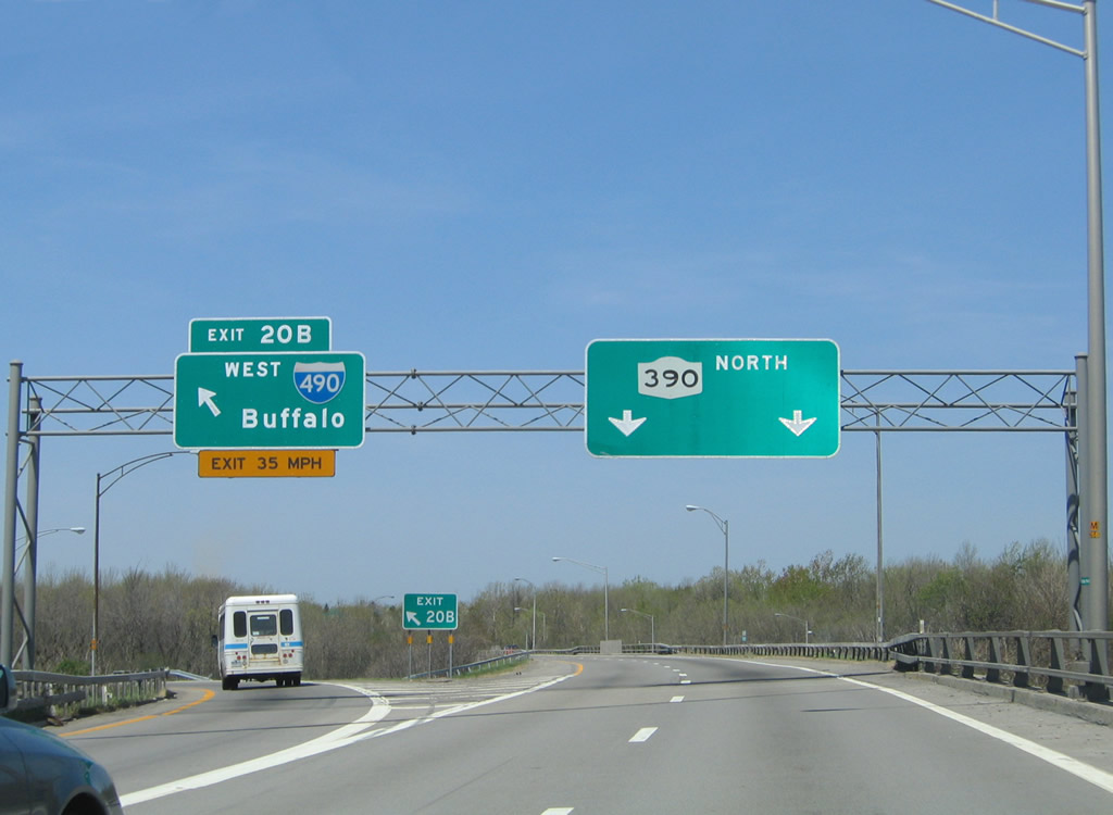 |
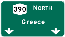
New York 390 continues the Outer Loop freeway north to Greece as Interstate 390 ends. Interstate 490 heads west to a nearby split with New York 531 (Spencerport Expressway) before turning southwest through Chili to Churchville and Interstate 90 (New York Thruway). Photo taken 05/10/05. |
 |
 |
Page Updated August 24, 2009.
|
About Contact Glossary |
In The News Testimonials Interstate Guide |
Social Media:
 |
|
© 2000-23 AARoads.com | All Rights Reserved | Privacy Policy / Terms of Use
|
||