|
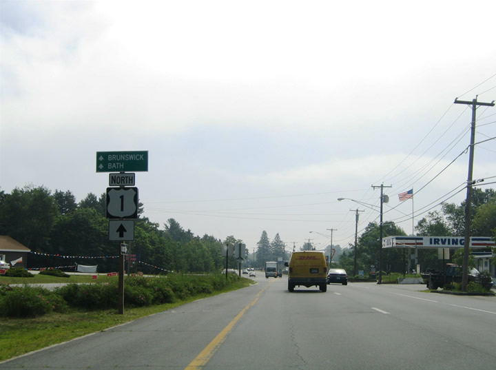
| U.S. 1 combines with Maine 5 along Main Street through Downtown Saco. North of Downtown, the pair approach Interstate 195 and split at Ocean Park Road. Maine 5 turns east toward Ocean Park and Old Orchard Beach while U.S. 1 enters a three-quarter cloverleaf interchange with the freeway. 06/27/05 |
|
| A loop ramp carries motorists onto Interstate 195 west from U.S. 1 north to Industrial Park Road and Interstate 95 (Maine Turnpike). 06/27/05 |
|
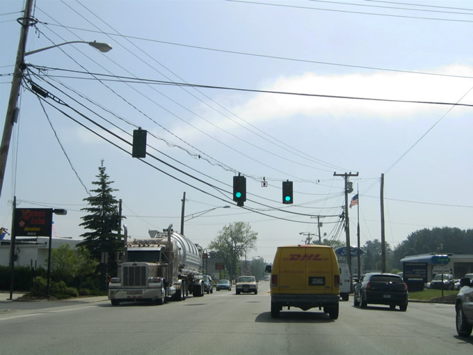
| U.S. 1 northbound within the vicinity of Yarmouth at an overpass of Interstate 295. U.S. 1 and Interstate 295 parallel one another closely from Falmouth and Brunswick. A parclo interchange joins the two at Exit 15 of the freeway.
The forthcoming junction was reconstructed as part of a $6.1 million project to include a new northbound on-ramp for I-295, a realigned southbound on-ramp and a 300-space park and ride lot. Work ran from mid-February to July 2013.1 06/27/05 |
|
| Approaching the former southbound on-ramp to Interstate 295 bound for Portland. This ramp was relocated in 2013 to leave U.S. 1 opposite the southbound on-ramp from I-295.
I-295 otherwise travels four miles south to the junction with unsigned Interstate 495 (Maine Turnpike - Falmouth Spur). 06/27/05 |
|
| Drivers bound for Interstate 295 south used to depart from U.S. 1 north here. Portland lies eight miles south of U.S. 1 at Yarmouth. 06/27/05 |
|
| Until 2013, motorists along U.S. 1 north bound for I-295 north were directed through Yarmouth to Exit 17. Within Yarmouth is the U.S. 1 junction with Maine 115 (Main Street). Maine 115 arcs westward from Maine 88 in Yarmouth to U.S. 202 at Gray and U.S. 302 at North Windham. 06/27/05 |
|
| U.S. 1 heads north from Yarmouth into the town of Freeport. Meeting the US route there is the south end of Maine 125 and 136. SR 125 & 136 venture 1.2 miles north through an interchange with I-295 before separating on respective paths to Durham. 06/30/11 |
|
| North of Freeport, Interstate 295 and U.S. 1 converge at a pair of northbound side ramps (Exit 25). 06/30/11 |
|
| U.S. 1 veers east beyond the I-295 on-ramp at Exit 25 toward Brunswick while the freeway bypasses the city to the west en route to Topsham and Gardiner. 06/30/11 |
|
| U.S. 1 (Old Portland Road) merges with the U.S. 1 connector to become Pleasant Street through west Brunswick. The U.S. 1 connector provides a direct connection west to Interstate 295 (Exit 28) nearby. Pictured here is the u-turn ramp onto the connector westbound from U.S. 1 north (east). 06/28/05 |
|
| Traveling east along Pleasant Street into Brunswick. Pleasant Street constitutes a four lane commercial strip between the U.S. 1 connector and the Mill Street freeway of U.S. 1. 06/28/05 |
|
| Northbound reassurance shield posted ahead of the intersection with Church Road. Church Road comprises a north-south route between Pleasant Hill Road and U.S. 1. 06/30/11 |
|
| Eastbound Pleasant Street at the signals for Church Road. Church Road enters the area from Growstown southwest of Brunswick. 06/28/05 |
|
| U.S. 1 (Pleasant Street) north ahead of River Road and the turn from Pleasant Street onto Mill Street. This sign and the adjacent set of traffic lights were replaced by 2013. 06/30/11 |
|
| Pleasant Street continues east from U.S. 1 to Maine 24 (Maine Street), providing access to Maine Street north to U.S. 201 and south to Maine 123. U.S. 201 begins at the overpass of the U.S. 1 Mill Street freeway, joining Maine 24 across the Androscoggin River into Topsham. Maine 123 begins in Brunswick and ventures southward to South Harpswell. 06/28/05, 06/30/11 |
|
| Pleasant Street becomes one way east from Mill Street toward Downtown Brunswick. Interests to both U.S. 201 and Maine 24 must use Pleasant Street to reach the pair north to Topsham. 06/30/11 |
|
| A modified diamond interchange joins U.S. 1 with Maine 24 (Maine Street) south at Downtown Brunswick. Left turns onto U.S. 201 & Maine 24 north into Topsham are prohibited from the off-ramp to Main Street. Beyond that interchange, U.S. 1 continues along a depressed freeway toward Maine 196. 06/28/05 |
|
| Maine 196 provides a direct route through Topsham between U.S. 1 and Interstate 295 to the northwest. Crossing the Androscoggin River immediately after departing U.S. 1, the state route meets Maine 24 and then turns westward to U.S. 201. Maine 196 follows a commercial arterial between U.S. 201 and Exit 31 with Interstate 295. Overall the 19.41 mile route travels westward to Lewiston. 06/28/05 |
|
| Once in Houlton, U.S. 2 merges with U.S. 1 at the intersection of Military and Court Streets south of Downtown. The two follow Military Street west one block to Kendall Street. A leg of U.S. 2A follows Military Street west one block to Bangor Street. 06/27/05 |
|
| Kendall Street carries U.S. 1 north & 2 west one block north to the westbound beginning of U.S. 2A at Bangor Street. Bangor Street continues Market Square west out of Downtown to Carys Mills. U.S. 2A loops southwest to Linneus, Haynesville and Macwahoc east of the U.S. 2 mainline through Island Falls and Golden Ridge. 06/27/05 |
|
| U.S. 1 north & 2 west span the Meduxnekeag River between U.S. 2A (Bangor Street) and Mill Street. Kendall Street becomes North Street. 06/27/05 |
|
| Ascending northward from the Meduxnekeag River, an I-95 trailblazer directs motorists to the diamond interchange at Exit 302 with the freeway ahead. 06/27/05 |
|
| North Street northbound at the U.S. 1 & 2 split. U.S. 2 turns onto Smyrna Street for its western exit from Houlton. The US highway parallels Interstate 95 westward to Ludlow and Smyrna Mills. U.S. 1 extends north beyond I-95 to Caribou, Fort Kent and Presque Isle. 06/27/05 |
|
| Continuing northward along U.S. 1 (North Street) toward Houlton Regional Hospital. 06/27/05 |
|
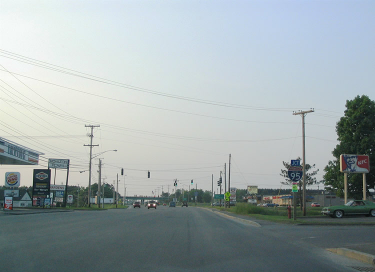
| Junction Interstate 95 shield posted along North Street near the hospital. An array of services line the frontage of U.S. 1 within the vicinity of Interstate 95's second to last exit. 06/27/05 |
|
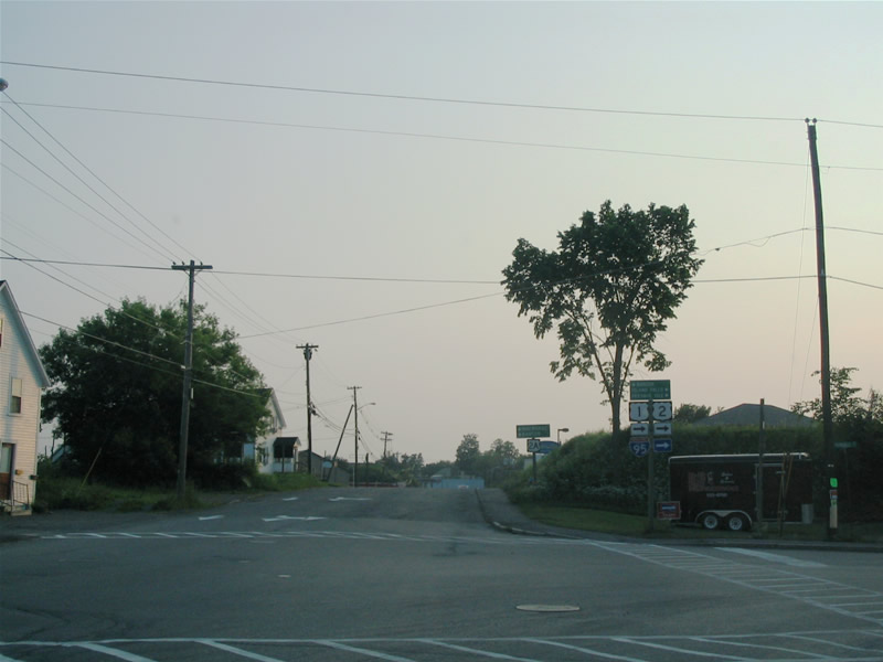
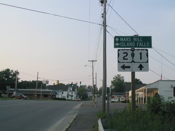
| A traffic signal governs the movements of U.S. 1 at North Court for adjacent Houlton Plaza shopping center. A small guide sign directs motorists to the Interstate 95 control cities of Bangor (south) and Woodstock, New Brunswick (north). Mars Hill represents the next significant town of interest along U.S. 1 north. 06/27/05 |
|
| Entering the diamond interchange (Exit 302) with Interstate 95 on U.S. 1 (North Street) north. I-95 continues three miles east to U.S. 2 and the Canadian port of entry. I-95 becomes New Brunswick 95 en route to Trans Canada Highway 2 at Woodstock. 06/27/05 |
|
| Drivers bound for New Brunswick depart U.S. 1 (North Street) onto Interstate 95 north. U.S. 1 provides one of two routes to the far northern Maine towns of Presque Isle, Caribou and Fort Kent. Maine 11 represents the other northerly route and is accessible via Interstate 95 south to Oakview Road (Exit 286) and Maine 202, northwest from Smyrna Mills. 06/27/05 |
|
| A pair of bridges over U.S. 1 (North Street) carry Interstate 95. The commercial strip of U.S. 1 continues a short distance north to Access Road. U.S. 1 otherwise continues through rural environs to Littleton, Monticello, Bridgewater and Mars Hill. 06/27/05 |
Page Updated 02-02-2015.


 North
North


 West
West