|
| IH 35W enters Tarrant County with six lanes through the city of Burleson. Every kind of retail establishment available lines the freeway frontage along this stretch. 03/11/08 |
|
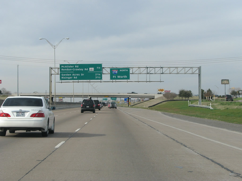
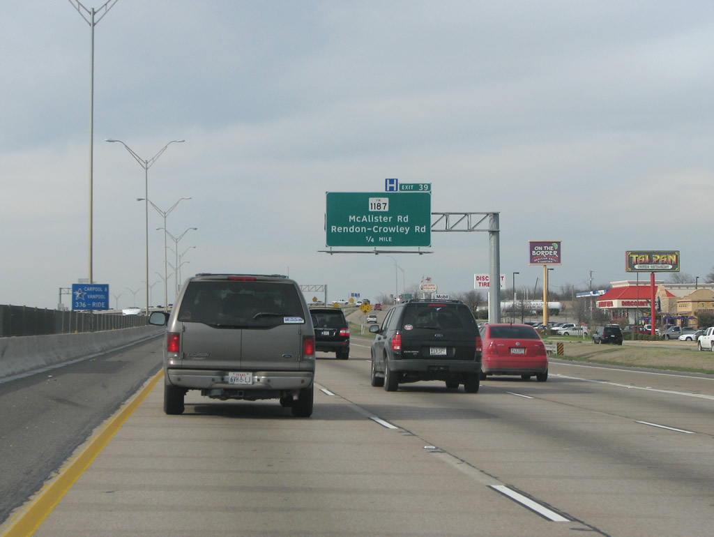
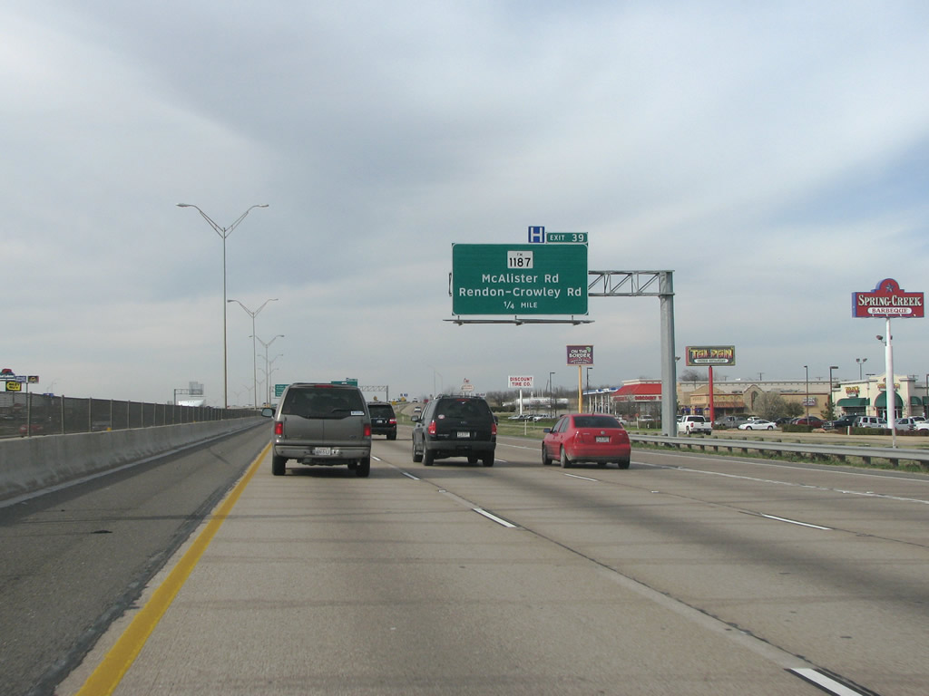
| IH 35W maintains a very busy but fast pace as it nears the diamond interchange (Exit 39) with FM 1187. 03/11/08 |
|
| IH 35W northbound at FM 1187. The FM road is the most important east/west route in southern Tarrant County. Just to the west it provides the main road into Crowley. A bypass FM route was constructed with the old 1187 redesignated as a business FM. 03/11/08 |
|
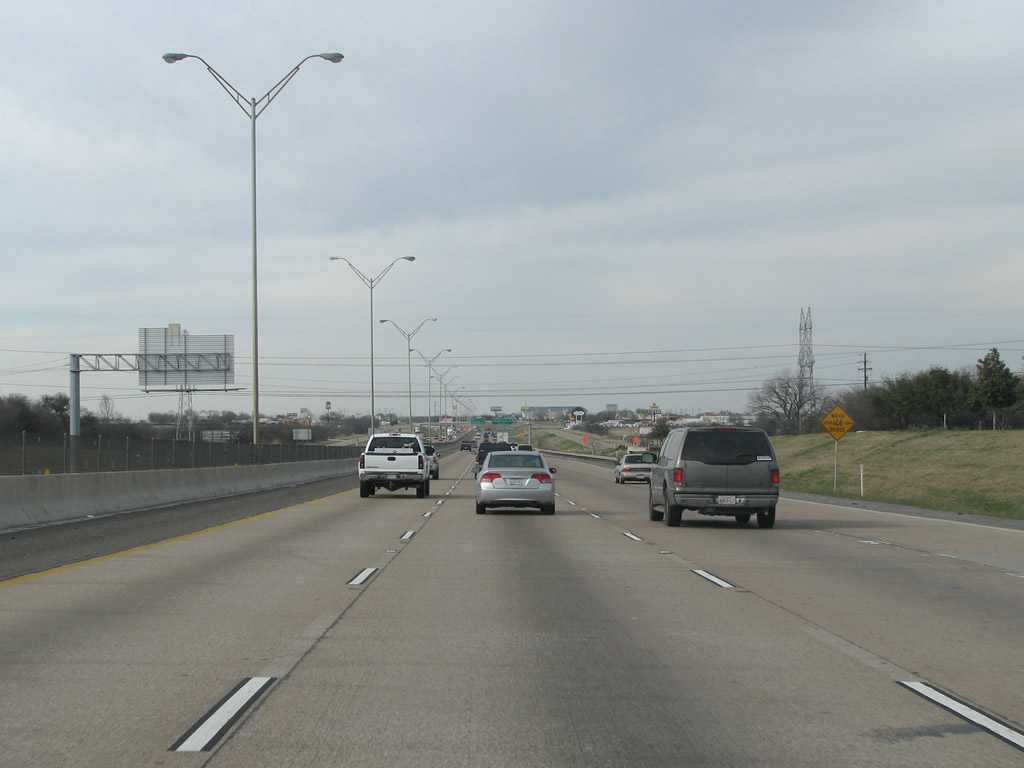
| IH 35W stays east of the Crowley city limits through south Fort Worth. Crowley was named for a railroad executive. 03/11/08 |
|
| IH 35W northbound crosses Deer Creek ahead of Exit 40 to Garden Acres Drive. 03/11/08 |
|
| Garden Acres Dr is a short connector that runs into residential areas on the south side of Fort Worth. 03/11/08 |
|
| The next northbound exit is for Risinger Road. 03/11/08 |
|
| IH 35W northbound at Risinger Road. Risinger runs west to Crowley Road and through an array of newer suburban development from there toward Benbrook Lake. 03/11/08 |
|
| IH 35W was built directly on top of the right of way of the old US 81 highway, which had been upgraded to a four lane expressway in the 1950s. This section of freeway opened in 1967. It was widened in the early 90s when the median was filled in with an extra lane. 03/11/08 |
|
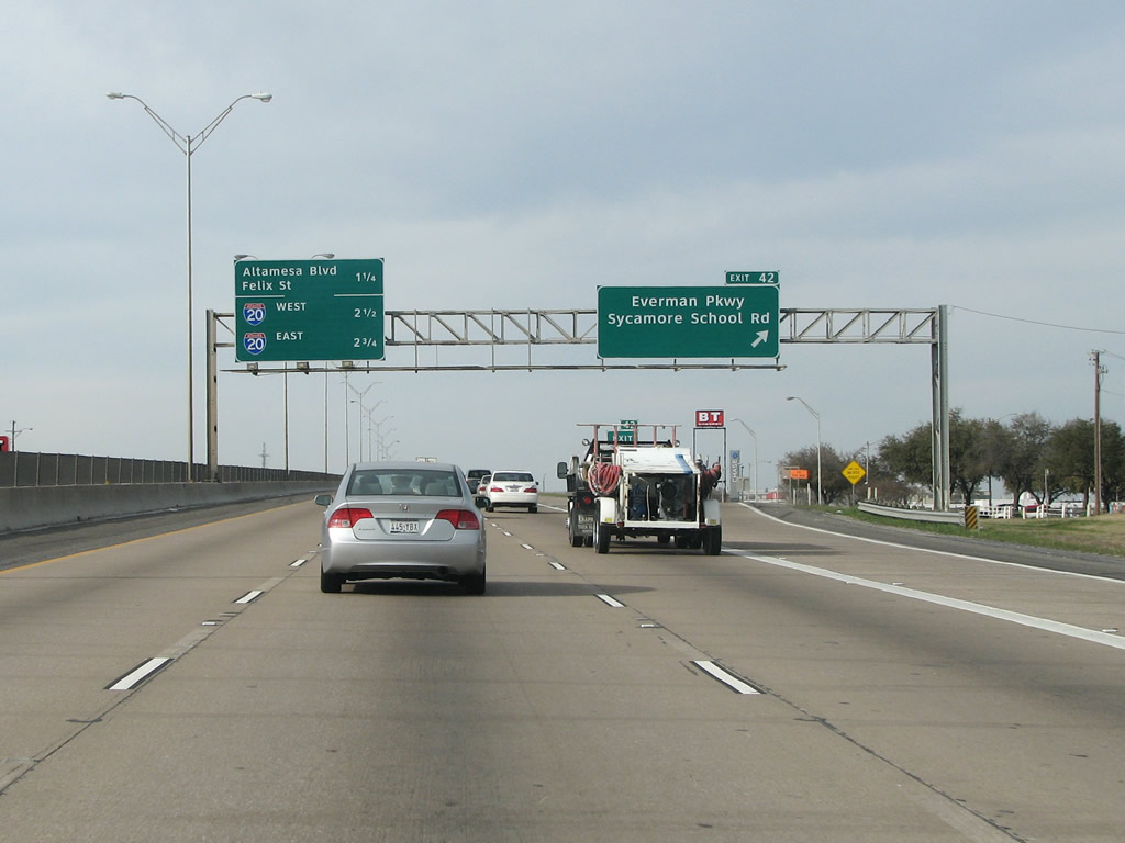
| IH 35W northbound at Exit 42 for Everman Parkway / Sycamore School Road. This exit was not in the original plans for the freeway and was added in the 70s. 03/11/08 |
|
| The succeeding exit connects the freeway with Altamesa Boulevard and Felix Street. The city's Miller Coors beer distribution center sits on the east side of the freeway here. 03/11/08 |
|
| Altamesa Boulevard was designed in 1969 specifically to parallel IH 820. Completed in the early 70s, Altamesa Boulevard forms an important arterial along the south side of Fort Worth. 03/11/08 |
|
| Downtown Fort Worth becomes visible in the distance beyond the forthcoming systems interchange with Interstate 20. 03/11/08 |
|
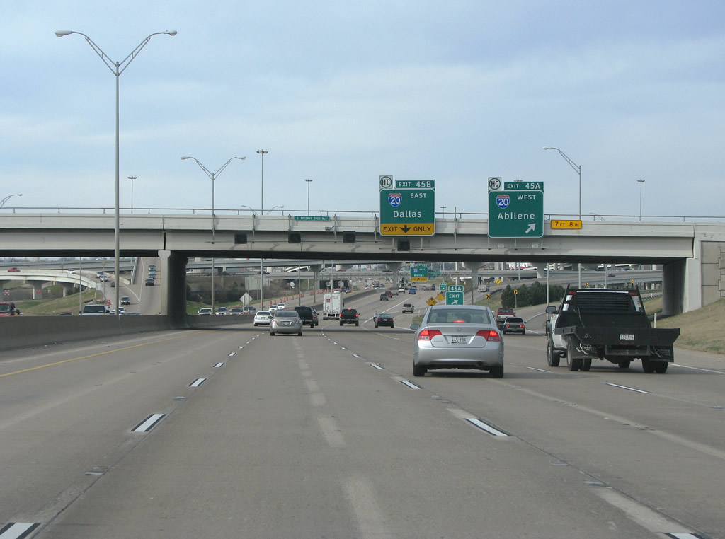
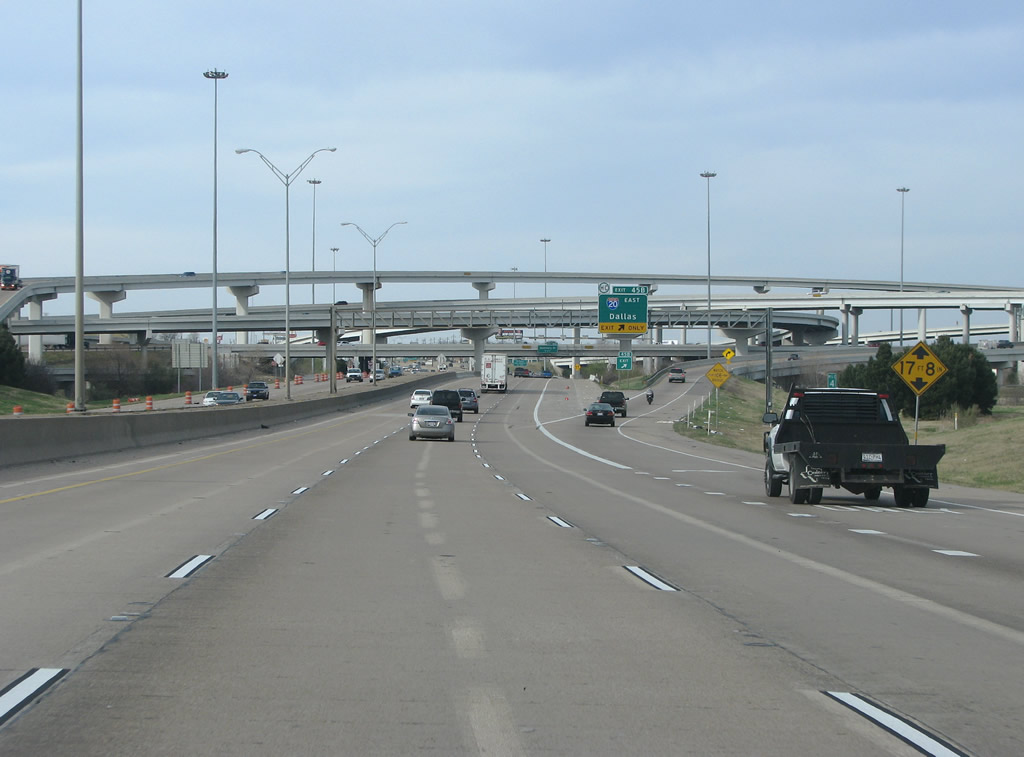
| Exit 45A is one of the farthest east locations that Abilene is a control point; it sits approximately 2.5 hours west along IH 20. The furthest east location with Abilene is at the IH 20/U.S. 287 interchange in Arlington.1 03/11/08 |
|
| The Dallas ramp (Exit 45B) follows the Abilene ramp along IH 35W north. Dallas is around 30 miles east of Fort Worth. IH 20 never goes into the central part of Dallas, but enters the city limits on the far south side of the city. 03/11/08 |
|
| The IH 35W/20 interchange was originally built as a cloverleaf. Construction began in May of 1987 to rebuild the interchange. Work was finished in 1991. 03/11/08 |
|
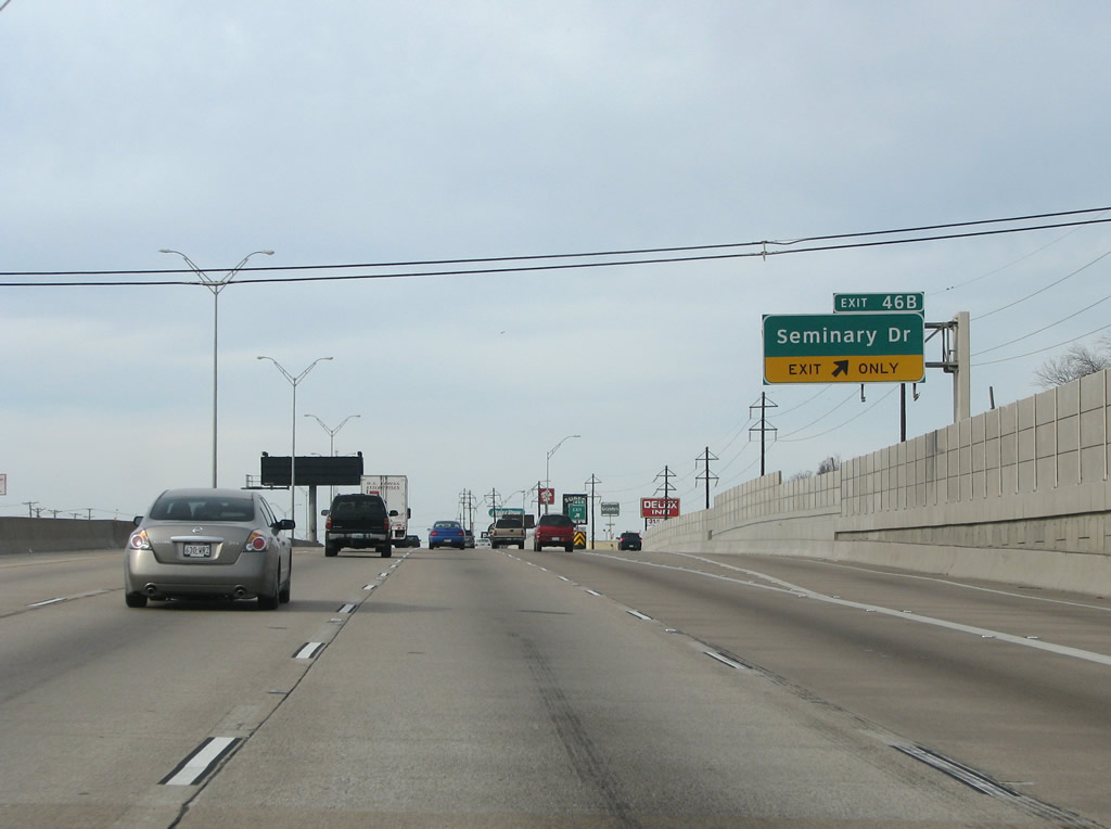
| The ensuing exit north of IH 20 along IH 35W is with Seminary Drive at La Gran Plaza regional shopping mall and the Carter Park neighborhood. 03/11/08 |
|
| Seminary Drive was named because it runs west to the Southwest Baptist Theological Seminary nearby. One of the two lanes gained north from IH 20 drops at Exit 46B. 03/11/08 |
|
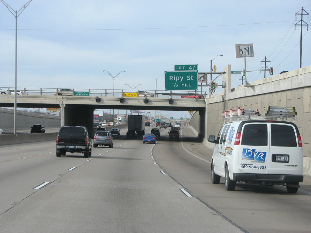
| IH 35W lowers into a trench below Seminary Drive on the approach to Ripy Street (Exit 47). 03/11/08 |
|
| A short street running through older residential areas, Ripy Street was named for confederate Colonel James T. Ripy of Kentucky. 03/11/08 |
|
| IH 35W maintains eight lanes as it heads north through South Fort Worth. The freeway opened around 1960 through here, and it was reconstructed in 1992. 03/11/08 |
|
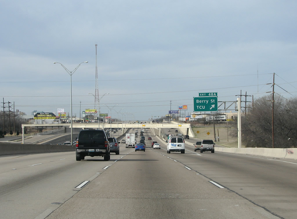
| Beyond Ripy Street, Berry Street and Texas Christian University are the next interchanges. 03/11/08 |
|
| Installed along IH 35W in 1992, lights over each lane indicate closures or blockage with bright red Xs. 03/11/08 |
|
| IH 35W northbound at Exit 48A to Berry Street. Texas Christian University (TCU) sits just to the west of the freeway here. 03/11/08 |
|
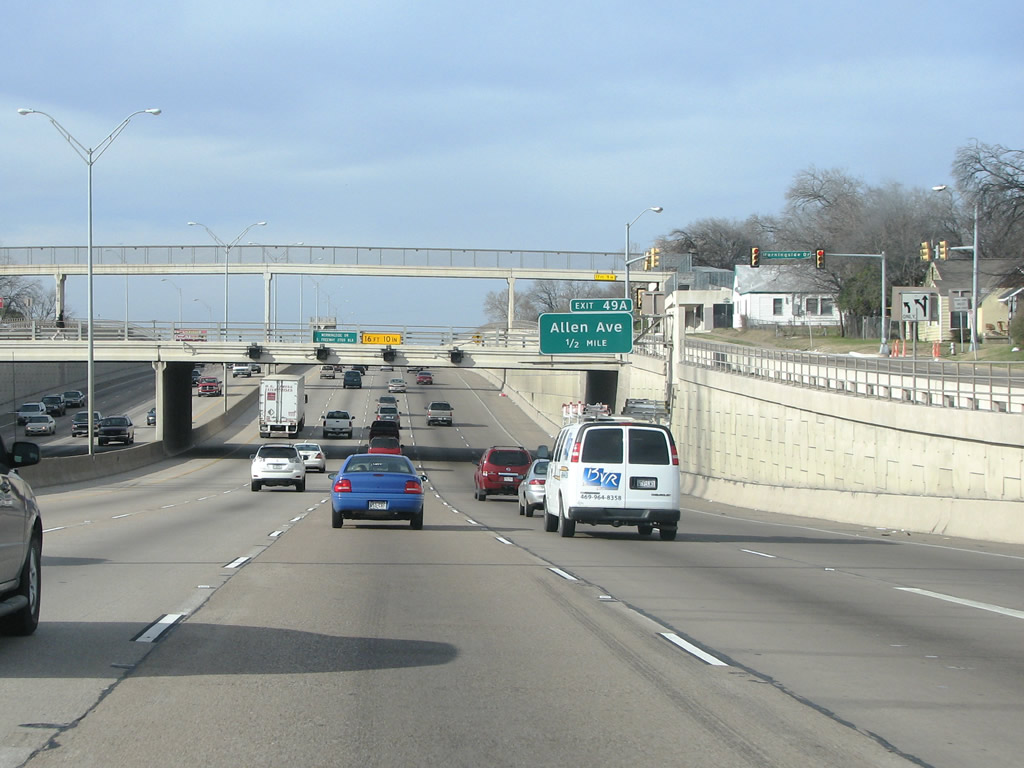
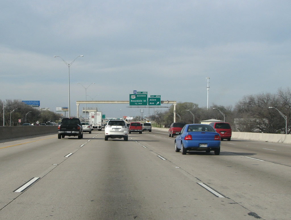
| Allen Avenue, and a very tall pedestrian overpass are just to the north of Berry Street. 03/11/08 |
|
| IH 35W northbound at Allen Avenue (Exit 49A). The freeway passes over Jessamine Street between the trenched sections at Morningside Drive and Allen Avenue. 03/11/08 |
|
| Approaching IH 30, IH 35W remains very busy. This portion of the South Freeway was rebuilt in 1998. 03/11/08 |
|
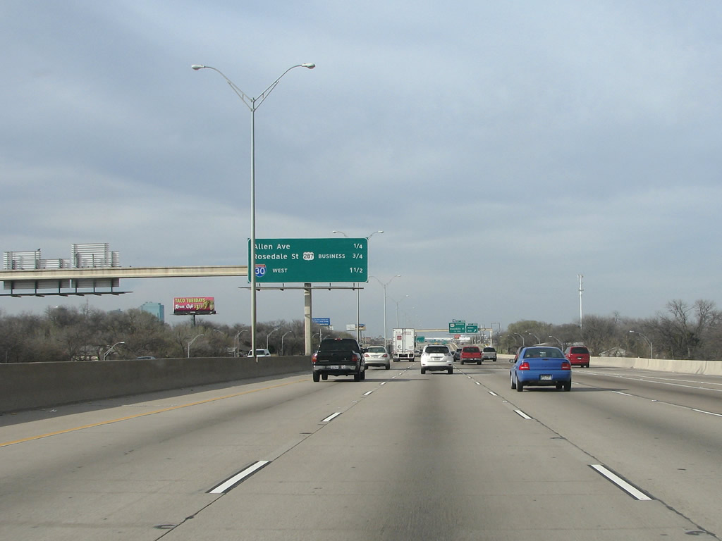
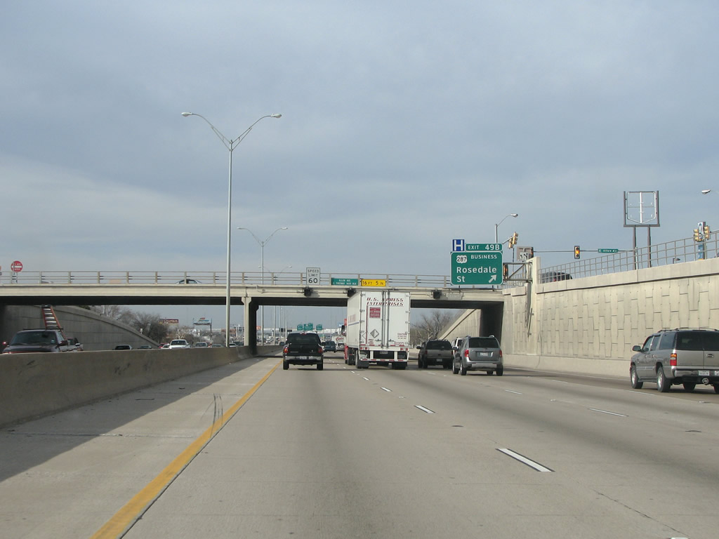
| Rosedale Street runs east/west along the southern side of Downtown, and it forms the business loop for U.S. 287, which is otherwise a freeway through Fort Worth. 03/11/08 |
|
| Continuing north from U.S. 287 Business (Rosedale Street), IH 35W advances to the systems interchange (Exit 51) with IH 30. 03/11/08 |
|
| Interstate 35W drops below grade again at the Hattie Street overpass. IH 30 (Exit 51C) east from Downtown Fort Worth represents the historic Dallas-Fort Worth Turnpike, a toll road opened 1957. West of IH 35W (Exit 51A), IH 30 was completed in 1964 and later rebuilt onto a new alignment west to Henderson Street in 2000. 03/11/08 |
|
| The first exit in Downtown Fort Worth is for westbound IH 30. Exit 51A parts ways with IH 35W north at the Hattie Street overpass. 03/11/08 |
|
| The ramp to Lancaster Avenue (Exit 51B) departs within the multi level interchange joining IH 35W and IH 30. Originally, IH 30 was built directly on top of Lancaster, which was one of Fort Worth's great drives. The previous IH 30 viaduct was relocated south and subsequently torn down and Lancaster, the old route of U.S. 80, was returned to its former glory in 2002. 03/11/08 |
|
| Exit 51C follows within the Downtown Fort Worth interchange for IH 30 east toward Arlington and Dallas. The former Dallas-Fort Worth Turnpike was made a free highway in 1978. 03/11/08 |
|
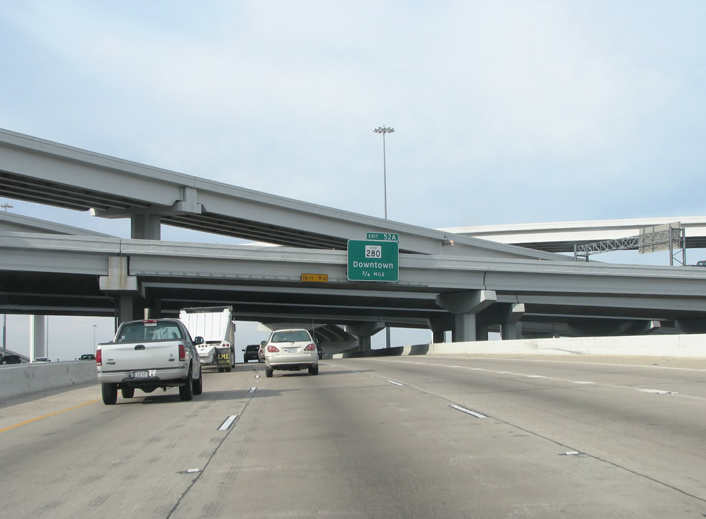
| The stack interchange with IH 30 marks the end of the South Freeway, which is IH 35W's name south of IH 30. North of IH 30, IH 35W is the North Freeway. 03/11/08 |
|
| The Downtown interchange in Fort Worth was originally built from 1956-1958. The old stack was torn down in 1999 and rebuilt. The new interchange spans 17 acres and was fully complete in 2002. 03/11/08 |
Page Updated 04-04-2009.


 North
North