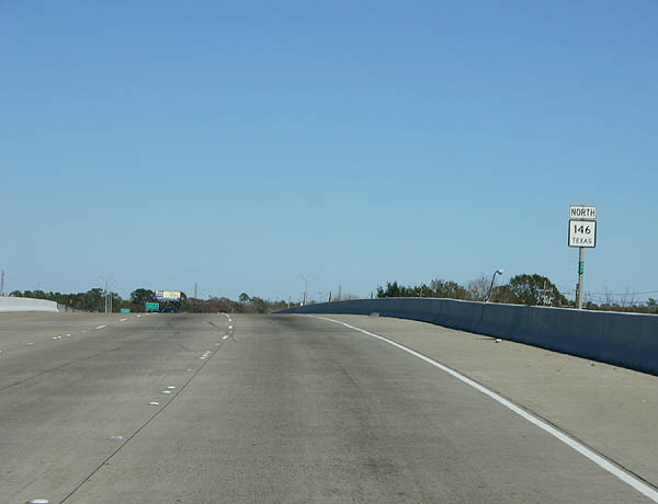
SH 146 travels 105.97 miles overall, from Interstate 45 at coastal Texas City, to the north end of the U.S. 59 bypass around Livingston. The state highway runs along the west side of Galveston Bay between League City and Seabrook. North through La Porte, SH 146 upgrades to a freeway, connecting with the east end of the La Porte Freeway (SH 225) and spanning the San Jacinto River across the Fred Hartman Bridge.
SH 146 Business splits from SH 146 and the Fred Hartman Bridge approach across Black Duck Bay to the Waterfront District of Baytown. SH 146 encircles the city center north by the Exxon Mobil Baytown Olefins Plant to the SS 330 freeway, and east to Baytown Loop and Ferry Road. SH 146 Business connects with the southeastern extent of SH 99 (Grand Parkway), the partially complete, 182 mile long outer loop of Houston.
The remainder of SH 146 north from Baytown to Mont Belvieu, Dayton, Liberty and Hardin varies between a four lane boulevard and rural two lane highway. The state highway overlaps with U.S. 90 east from Dayton 7.5 miles across the Trinity River into Liberty on this stretch.
Historically, SH 146 crossed the Houston Ship Channel / San Jacinto River through the Baytown-La Porte Tunnel. Opened in 1953, the 4,600 foot long tunnel replaced the Morgans Point ferry. The two lane tunnel reached capacity by the 1970s, coinciding with efforts to deepen and expand the shipping channel for larger vessels. The Texas Department of Transportation (TxDOT) planned a replacement for the Baytown-La Porte Tunnel and work on a new cable stayed bridge commenced in the late 1980s. Following the opening of the eight-lane 146 Bridge in 1995, the old tunnel was removed in segments. Since renamed the Fred Hartman Bridge, the 2,475-foot long span has a capacity of 200,000 vehicles per day.1
|
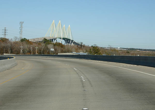
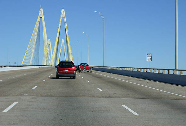
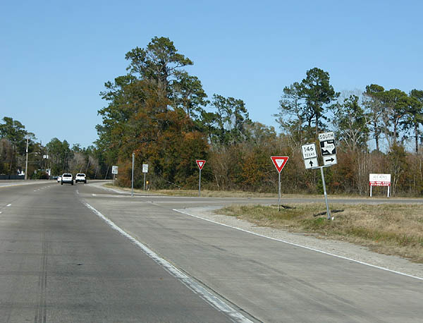
| The Fred Hartman Bridge comes into view as SH 146 leads away from the directional T interchange with SH 225 (Pasadena Freeway). 12/24/05 |
|
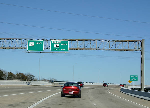
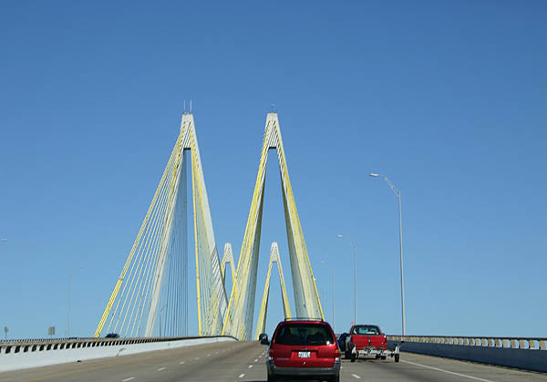
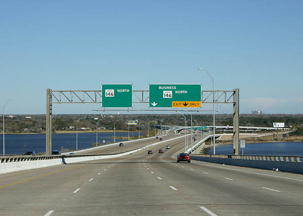
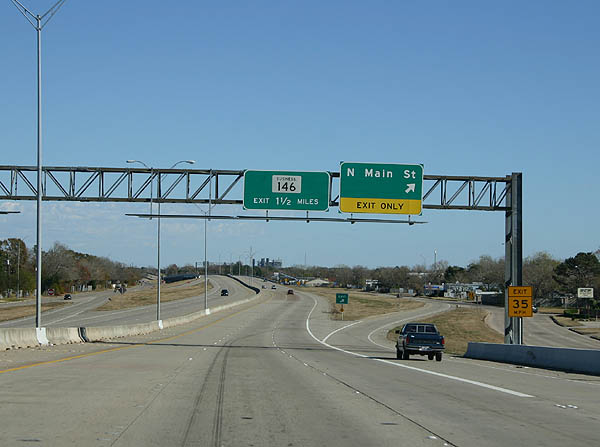
| The next exit along SH 146 northbound is with SH 146 Business, two miles across the Fred Hartman Bridge. 12/24/05 |
|
| The Hartman Bridge replaced the previous Houston Ship Channel crossing, the Baytown Tunnel that had become traffic-choked. 12/24/05 |
|
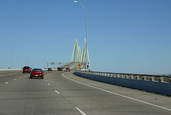
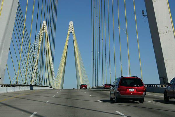
| The twin four lane cabled stayed bridges taking SH 146 across the San Jacinto River / Houston Ship Channel opened for traffic on September 30, 1995. 12/24/05 |
|
| Construction of the bridge towers began in the late 1980s, but the bridge deck was not completed due to construction difficulties until 1995. 12/24/05 |
|
| The Fred Hartman Bridge was was the second longest cable-stayed bridge in the United States when it opened. 12/24/05 |
|
| Replacing Loop 201, SH 146 was realigned onto a freeway around Baytown in 1996. The former route of SH 146 was redesignated Business 146-E. 12/24/05 |
|
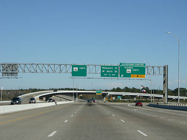
| SH Business 146 branches east to Downtown Baytown along a 3.18 mile course. 12/24/05 |
|
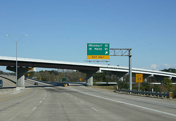
| The next exit serves Missouri Street and West Main Street along Goose Lake. 12/24/05 |
|
| Navigating along a winding course adjacent to Goose Creek, SH 146 is six lanes through Baytown. 12/24/05 |
|
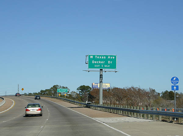
| Advance signage for West Texas Avenue and Decker Drive. SH 146 is a designated Hurricane Evacuation route. 12/24/05 |
|
| Texas Avenue is a local street through residential areas between oil refineries along Airhart Drive and Goose Creek. Decker Drive is an arterial route angling northwest from Downtown Baytown to the SS 330 freeway. 12/24/05 |
|
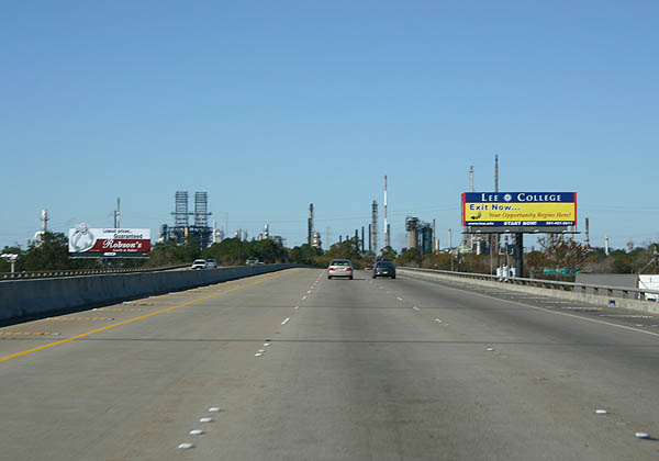
| One of the many petrochemical plants around Baytown comes into view along the SH 146 viaduct over Market Street and Union Pacific Railroad lines. 12/24/05 |
|
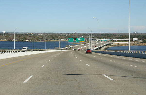
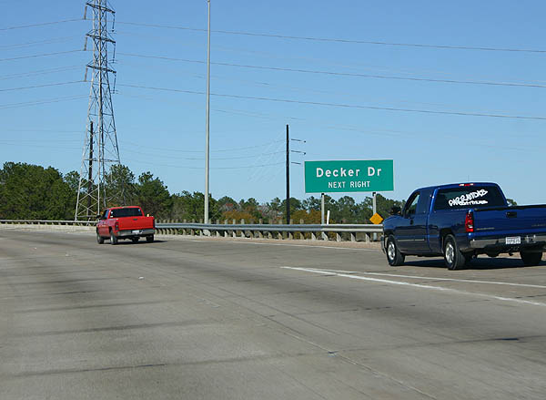
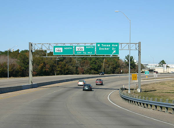
| The slip ramp for West Texas Avenue and Decker Drive departs 0.75 miles from the directional T interchange with SS 330 west. 12/24/05 |
|
| Spur 330 constitutes a 5.92 mile long connection between SH 146 and IH 10. 12/24/05 |
|
| The Spur 330 interchange was initially partially constructed, with only the flyover ramp from SH 146 north to Spur 330 west. Remaining ramps were completed by 2015. 12/24/05 |
|
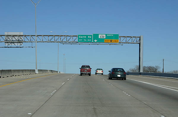
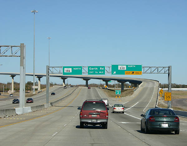
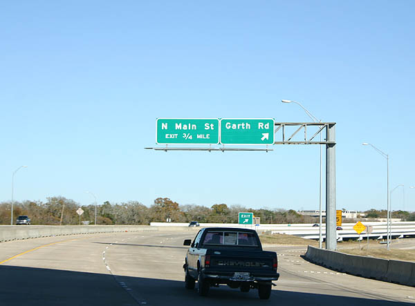
| Turning east across Goose Creek within the exchange at SS 330, SH 146 separates with the exit for Garth Road via the Baytown Loop frontage road system. 12/24/05 |
|
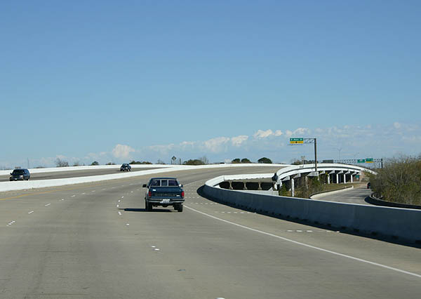
| The ensuing ramp departs SH 146 northbound for Main Street. 12/24/05 |
|
| Main Street extends north from Downtown Baytown to IH 10 and FM 1942 through northern reaches of the city. 12/24/05 |
|
| This section of SH 146 between the two crossings of BS 146-E was added to former Loop 201 in 1976. 12/24/05 |
|
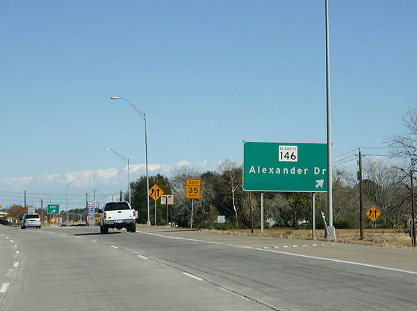
| The final exit from the SH 146 freeway is with SH 146 Business along Alexander Drive. 12/24/05 |
|
| SH 146 transitions from a freeway to a four lane arterial beyond the Alexander Drive underpass (SH 146 Business). 12/24/05 |
|
| Roadway stubs for a grade separation with the east end of SH 146 Business at Ferry Road appear within the Baytown Loop median. 12/24/05 |
|
| SH 146 Business (Alexander Drive) and Ferry Road north converge with SH 146 ahead of the frontage road system end ahead of Cedar Bayou. 12/24/05 |
|
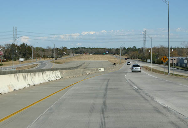
| The SH 146 frontage road system (Baytown Loop) ends as the state highway overtakes Ferry Road northeast toward Cedar Bayou. 12/24/05 |
|
| As SH 146 crosses Cedar Bayou, it enters Chambers County and approaches FM 565. FM 565 forms a 15.46 mile loop east from Baytown to Cove, north to Old River-Winfree and west to SL 207 at Mont Belvieu. 12/24/05 |
|
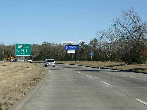
| SH 146 intersects the north end of FM 1405 a short distance beyond FM 565. 12/24/05 |
|
| Paralleling Cedar Bayou, FM 1405 leads 8.48 miles south to FM 2354 near Houston Point off Trinity Bay. 12/24/05 |
|
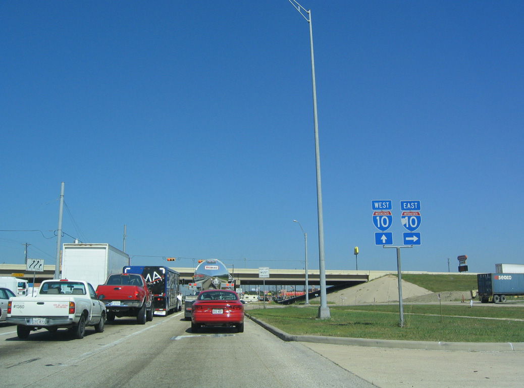
| Highway 146 enters a diamond interchange with IH 10 along the Baytown and Mont Belvieu city line. 10/22/03 |
Sources:
- "What ever happened to the old Baytown tunnel?" Beaumont Enterprise (TX), August 7, 2012.
10/22/03 by AARoads. 12/24/05 by Kevin Trinkle.
Connect with:
Interstate 10
Interstate 45
U.S. 59
U.S. 90
Spur 330
Page Updated 07-12-2019.