
U.S. Highway 62 East - Seminole to Lubbock
| U.S. 62 east | |
|---|---|
 |
This view looks eastbound along US 62 / 180 at their intersection with US 385 in Seminole. US 180 continues due eastward here, while US 62 takes a long northern jog up to Lubbock. Seminole, with about 6,000 people, is the county seat of Gaines County. Hobbs, New Mexico is about 20 minutes to the west. Photo taken 09/23/07. |
 |
US 62/385 northbound in Seminole. The town is the birthplace of country singer Tanya Tucker, and its where radio legend Randi Rhodes got her start. Photo taken 09/23/07. |
 |
Upon leaving town, the mileage sign indicates that it is 18 miles to the next populated place, Seagraves. Here in West Texas, towns can be few and far between - and the landscape between them can be quite repetitive! Photo taken 09/23/07. |
 |
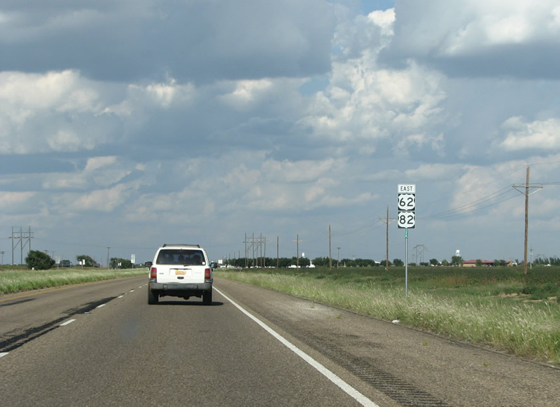
US 62/385 reassurance markers pop up a few miles north of Seminole. The road here is divided and accessible. The landscape is gently rolling and is dotted by herds of cattle and oil wells. Oil plays a huge part in the economy of Gaines County, between 1936 and 1991 over 1.6 billion barrels of oil were taken from wells here. While that industry is on the decline, energy still plays a huge part of the economy as wind power farms are popping up everywhere. Photo taken 09/23/07. |
 |
The next town north of Seminole is Seagraves. Seagraves was the largest town in Gaines County until the 1950s, when Seminole surpassed it in population. Photo taken 09/23/07. |
 |
SH 83 is the main cross-road in Seagraves. The town has a very dead look to it, and is mostly used as a service area for the oil and agriculture industries in the area. Photo taken 09/23/07. |
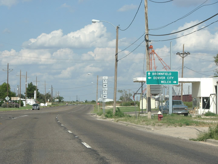 |
Directional markers point towards Denver City and Welch along SH 83. This state highway runs east/west towards Lamesa in one direction, and the New Mexico state line in the other. At New Mexico, it becomes NM 83 as it rolls into Lovington. Photo taken 09/23/07. |
 |
US 62/385 at SH 83. Seagraves was founded by the Santa Fe (Railroad) land company in 1905. Originally called Blythe, it was renamed for a railroad official in 1918 after the railroad noted that it already had a station called Blythe, in California. The population of Seagraves reached its zenith of almost 4,000 people in the 1950s as the town became the "caged egg capital of the world", a title not so politically correct today! Photo taken 09/23/07. |
 |
Reassurance markers just out of Seagraves. Abandoned farming and ginning equipment, as can be seen in the background of this photo, populates most of the towns in this region. Photo taken 09/23/07. |
 |
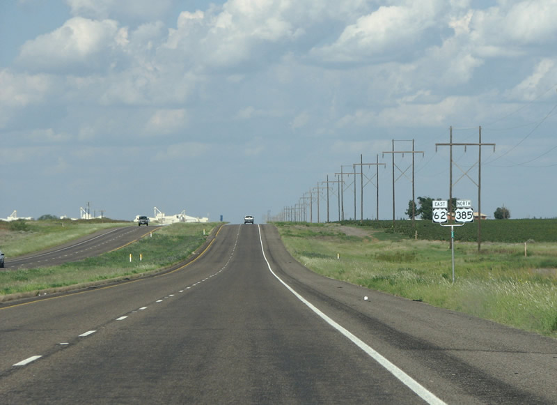
US 62/385 enters Terry County. The highway has a "kink" here as it is routed around an older, slab concrete, section of the old road and a farm. Terry County was named for a Confederate Colonel who commanded a Texas regiment (Terry's Texas Rangers) in the Civil War. Photo taken 09/23/07. |
 |
Still multilane and divided, a US 62/385 reassurance marker in Terry County. Cotton gins are big business here, and Terry County is one of the leaders in the state's cotton production. Many sunny days and a good aquifer water source for irrigation mean that cotton grows extremely well out here. Photo taken 09/23/07. |
 |
The seat of Terry County is Brownfield, located near the center of the county. The town's population of 10,000 is 50% hispanic. Despite the demographics, the town was not named for its population or for the color of the fields in the area, but for an early settler. This view looks north at SH 137, which runs just to the west of town. Photo taken 09/23/07. |
 |
SH 137 has a brief overlap with the two US highways through town. Photo taken 09/23/07. |
 |
SH 137 leaves US 62/385 to continue its journey southward to IH 20 at Stanton and eventually to Ozona and IH 10. Photo taken 09/23/07. |
 |
US 62/385 northbound in Brownfield. Photo taken 09/23/07. |
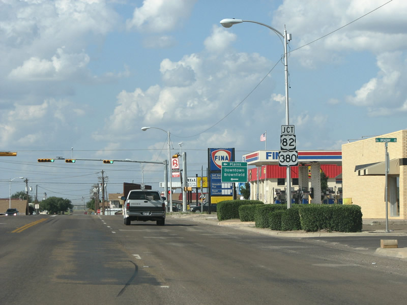 |
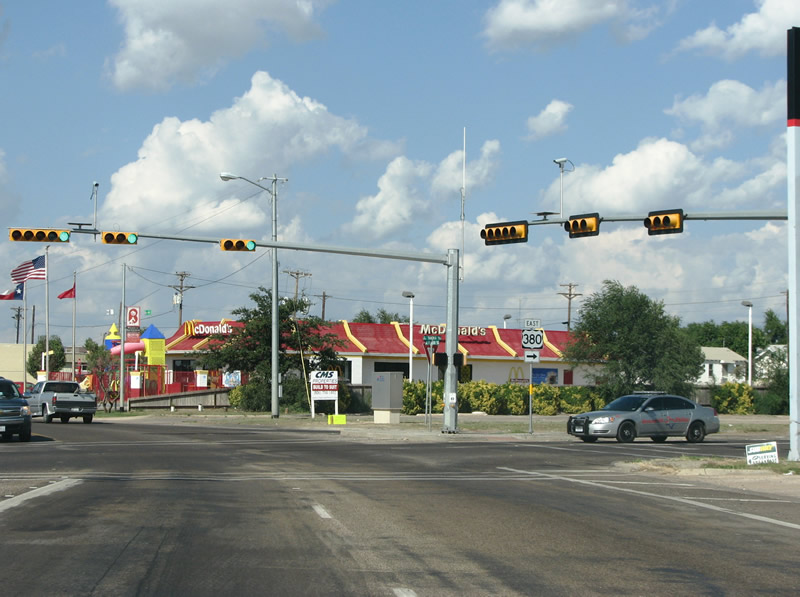
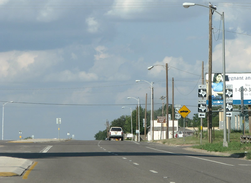
Junction 82/380 in downtown Brownfield. US 82 is a major east/west US highway and runs eastward all the way to the Atlantic Ocean at Brunswick, Georgia. Photo taken 09/23/07. |
 |
Here, just east of downtown Brownfield, US 82 and US 380 continue their westward journeys into New Mexico, just a short jog down the road. US 380 connects IH 30 at Greenville, Texas with IH 25 near Socorro, New Mexico. The route never intersected with its parent, US 80, in favor of a connection with US 180 at Albany, Texas. Today US 380 does not connect to any x80 route, but still provides an important thoroughfare through West Texas. Photo taken 09/23/07. |
| U.S. 62 & 82 east | |
|---|---|
 |
For a short time, all of Brownfield's 4 US highway routes overlap through town. The markers along the section omit US 380 in favor of the other three, unfortunately. Photo taken 09/23/07. |
 |
US 380 leaves Brownfield headed east. Brownfield is trying very hard to diversify its economy away from oil and cotton. The town was among the first in the state to pass the half-cent sales tax hike to fund economic growth. However, population growth remains stagnant. Photo taken 09/23/07. |
 |
Now headed north out of town, the three US highways 62/82/385 run through Brownfield's retail strip. Most major fast food restaurants and big box retailers are available here in town, and are located on this stretch of road. Photo taken 09/23/07. |
 |
US 385 breaks away from US 62 here, finally, and resumes a northern trek through Colorado to meet its parent US 85, in the Black Hills of South Dakota. The author wishes very much to turn left here and follow it, but we'll stick to US 62 today. Brownfield is the hometown of WNBA star and Olympic Gold Medalist Sheryl Swoopes. With that, we will bid the town adios. Photo taken 09/23/07. |
 |
US 62/82 at FM 2066, north of Brownfield. This 9-mile FM road runs through cotton country to the north to meet FM 211. Photo taken 09/23/07. |
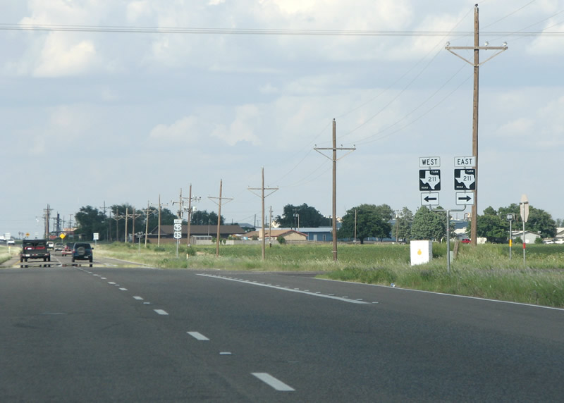 |
FM 211 itself meets the US highway just south of Meadow, in Terry County. At 60 miles in length, FM 211 is fairly long for a secondary state highway, and runs eastward all the way to Post and US 84. Photo taken 09/23/07. |
 |
US 62/82 reassurance markers at Meadow. Photo taken 09/23/07. |
 |
A forest of FM signs here in the center of Meadow, along with one of the ubiquitous rural-America pregnancy hotline billboards. Meadow, with about 650 people, is now in it's third location. The town was moved several times to be closer to projected railroad rights of way. At one point in 1908, the post office in Meadow had the distinction of being the furthest from any railroad in the US. In 1917 the railroad was completed through town and assured its survival. Photo taken 09/23/07. |
 |
US 62/82 along with an FM road overlap north of Meadow. The area here is flat, spread out, and devoid of much human activity for much of the time. The author notes that while this can be refreshing, it can also be scary at the same time. Photo taken 09/23/07. |
 |
Another US 62/82 reassurance marker north of Meadow. The road through here runs through cotton fields, and makes a brief pass through the corner of Hockley County. Several small farming settlements and FM roads are passed as well. Photo taken 09/23/07. |
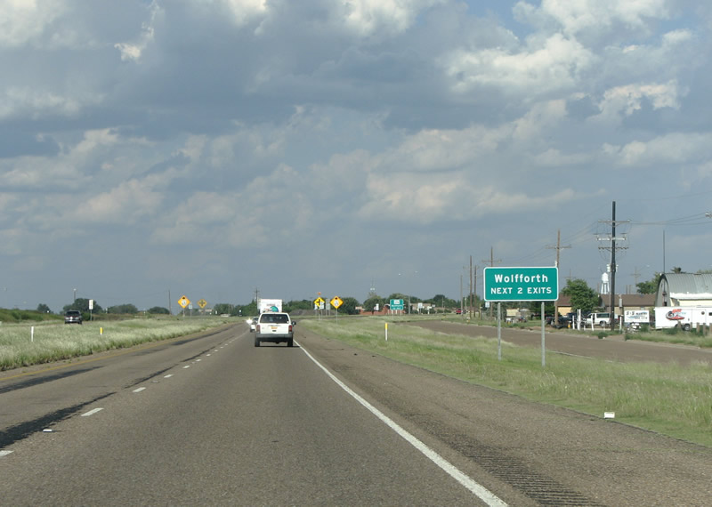 |
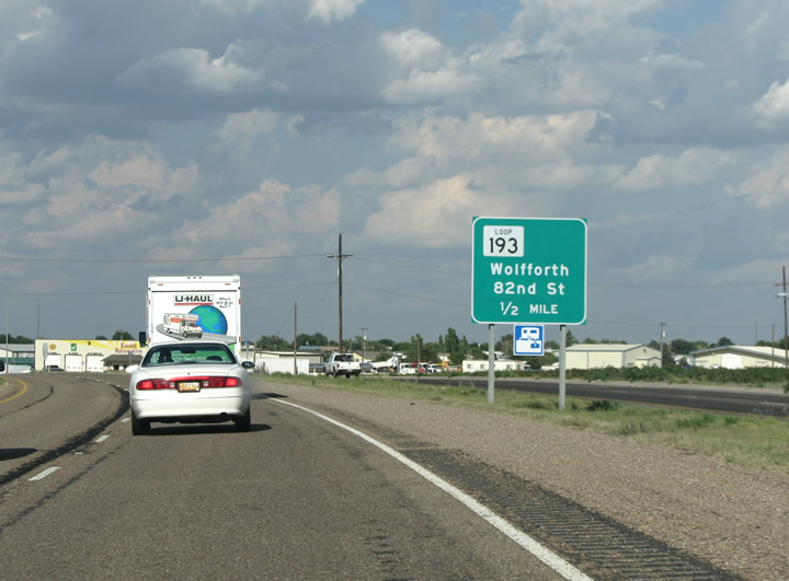
As it nears the regional center of Lubbock, US 62/82 passes the suburb of Wolfforth with a freeway bypass. The bypass begins on the southwest side of town and is noted here for the first time with an advance sign for exits ahead. Photo taken 09/23/07. |
 |
Advance signage for Loop 193 at Wolfforth, the loop is the old route of the US highway through the center of town. Photo taken 09/23/07. |
 |
More signage for Loop 193 and advanced signage for the first exit along the bypass freeway, FM 179. Photo taken 09/23/07. |
 |
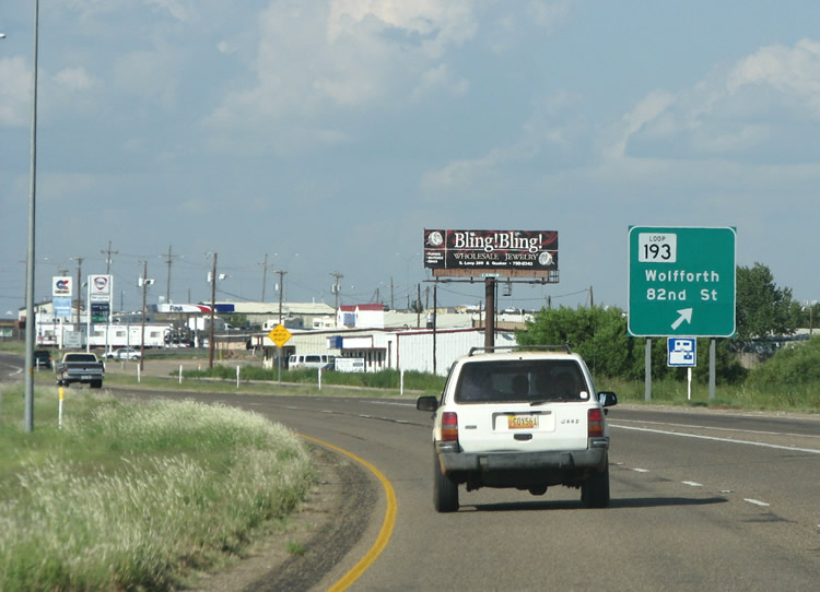
Turn left here to take the old route through town. Wolfforth was named after two brothers who were early settlers. They had the last name of Wolffarth, but the post office misspelled the name and it's stuck ever since. The town, as a suburb of Lubbock, is experiencing very fast growth and several large, new subdivisions have appeared on the north end of town. Photo taken 09/23/07. |
 |
The short section of bypass freeway has begun with this reassurance marker. Photo taken 09/23/07. |
 |
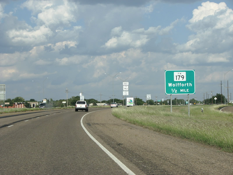
US 62/82 bypass freeway at FM 179 in Wolfforth. At over 100 miles, FM 179 is extremely long for an FM road. It runs southward into Lamesa and north to near Plainview and IH 27. Photo taken 09/23/07. |
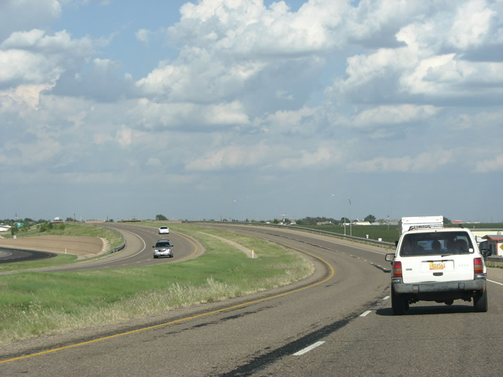 |
A view of the graceful curve in the bypass freeway at Wolfforth. This freeway section is being extended all the way into Lubbock, and will eventually connect to IH 27 north of downtown. Photo taken 09/23/07. |
 |
Advance signage for Loop 193. The route of Loop 193 was designated in 1960, when early interstate planning indicated that this stretch of US 62/82 might become IH 27 at some point. When that failed to occur, and the routing of IH 27 south of Lubbock was moved eastward to US 87, the Loop designation remained stale until the bypass freeway was built in 1977. Photo taken 09/23/07. |
 |
US 62/82 at Loop 193 on the east side of Wolfforth. Photo taken 09/23/07. |
 |
Another look of the bypass freeway on the east side of town, and a reassurance marker. Photo taken 09/23/07. |
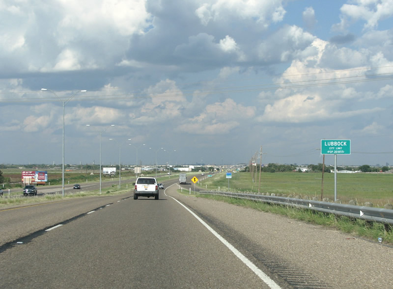 |
Immediately after leaving Wolfforth, US 62/82 enters Lubbock. The skyline of the city can be seen far in the distance, as well as the stack under construction at the Loop 289 freeway and the new US 62/82 freeway section. Photo taken 09/23/07. |
 |
As Loop 193's traffic enters on to the road here from the right, US 62/82 ceases its short journey as a bypass and briefly becomes another rural highway passing through cotton fields. This area is ripe for spawl, however, and already a new SuperTarget and large new homes are being built along the road. Construction is planned but not funded to connect this short stretch of road as a freeway to the Loop 289 freeway, and the new US 62/82 freeway section. Photo taken 09/23/07. |
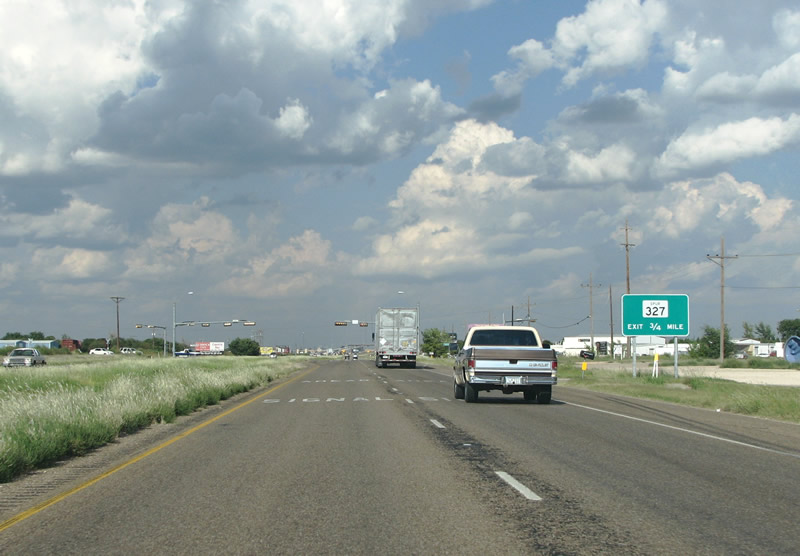 |
Looking northeast along US 62/82 before Spur 327. The Spur is a short route to connect to Loop 289 and the east. While not a freeway, Spur 327 can be easily upgraded as it has two fully free-flowing interchanges on each end and a very wide median in the interim. Photo taken 09/23/07. |
 |
U.S. 62 & 82 eastbound reassurance markers postead ahead of the three-ramp "Y" interchange with Texas Spur 327 east. Texas Spur 327 provides a direct route onto the outer loop of Loop 289 to Interstate 27 & U.S. 87. Photo taken 01/25/08. |
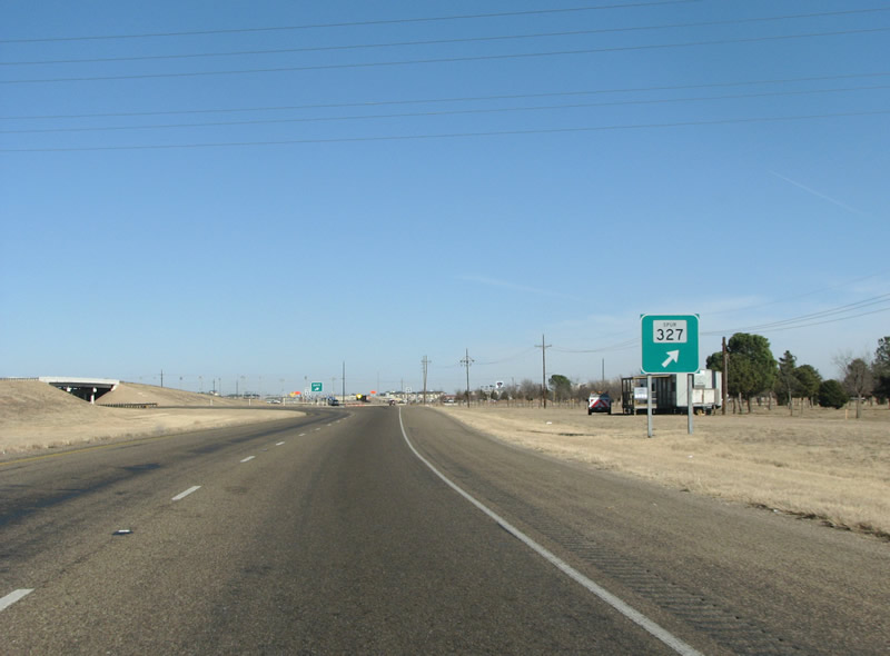 |
US 62/82 headed northeast at Spur 327. Photo taken 01/25/08. |
 |
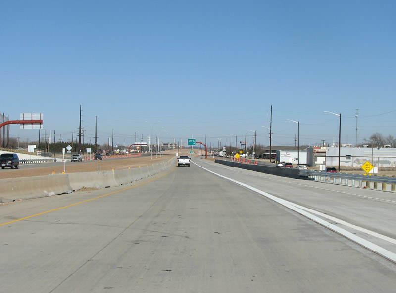
A large sign indicates this as the future location of the Marsha Sharp freeway. The Sharp Freeway is currently under construction in Lubbock with some portions open. With the new freeway, US 62/82 will get a new routing and the old road will become a business loop. Photo taken 09/23/07. |
 |
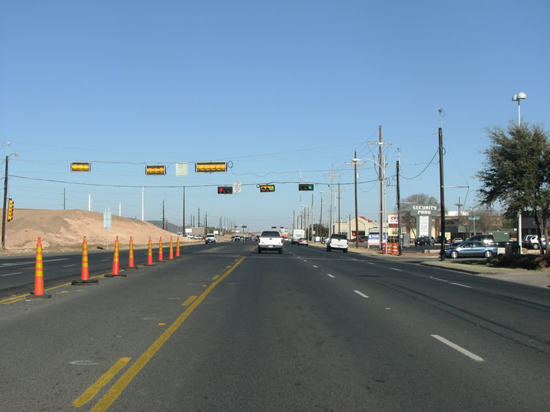
A lone signalized intersection with Milwaukee Avenue remains between the Texas Spur 328 and Loop 289 interchanges. Milwaukee Avenue spurs north to 50th Street west as sprawling businesses are already lining the north side frontage at U.S. 62 & 82. Photo taken 01/25/08. |
 |
Before reaching Loop 289, this sign warns of the upcoming Marsha Sharp Freeway. Photo taken 01/25/08. |
 |
Loop 289, marking the beginning of the denser part of Lubbock, is seen ahead at the new stack at US 62/82. Photo taken 01/25/08. |
 |
Traffic exiting on to Loop 289 must go to the right here. Motorists wishing to enter Lubbock and the Marsha Sharp freeway can continue straight ahead onto the new flyover structure. Photo taken 01/25/08. |
 |
A US 62/82 reassurance marker at Loop 289. Photo taken 01/25/08. |
 |
As the freeway begins, advance signage marks the first exit at 34th St / Slide Rd. Photo taken 01/25/08. |
 |
View of the new interchange at Loop 289 and US 62/82. The entire interchange was the first portion of the new Marsha Sharp freeway to be constructed, and opened in late 2007. The first land acquisition for the project took place way back in 1996. Photo taken 01/25/08. |
 |
The Lubbock skyline can be seen on the right here, as US 62/82 flies over Loop 289 on the far southwest side of town. Photo taken 01/25/08. |
 |
As US 62/82 runs into Lubbock, another sign for the exit at 34th street emerges. Photo taken 01/25/08. |
 |
All traffic is forced to exit at 34th/Slide, and the mainline is reduced to one lane in each direction. Construction on the mainlanes here continues. Photo taken 01/25/08. |
 |
For a new freeway construction project, US 62/82 is very well signed through here, with several sets of reassurance markers on this short stretch. Photo taken 01/25/08. |
 |
US 62/82/Marsha Sharp freeway traffic must exit at the 34th Street/Slide Rd. Parts of the Texas Tech campus can be seen in the background. Photo taken 01/25/08. |
 |
The good reassurance markers dry up, as US 62/82 continues back on to its old route on the Brownfield Highway. Freeway construction is very evident along the route, and there is plenty of time to look at it as the lights along this road are notoriously long. Photo taken 01/25/08. |
 |
This view looks northeastward on the Brownfield Highway towards Texas Tech. Photo taken 01/25/08. |
 |
Several miles north, US 62/82 traffic runs onto new frontage road alignments, while more freeway lanes are being constructed in the median. Photo taken 01/25/08. |
 |
This view looks northeastward near Quaker Avenue in west Lubbock at a temporary reassurance marker along the new frontage road. Photo taken 01/25/08. |
 |
At 19th Street, US 62 and 82 split through town. US 62 continues east along 19th St, while US 82 runs north to 4th St and along the new freeway alignment. Photo taken 01/25/08. |
 |
19th St runs along the south side of Texas Tech University, and forms a major arterial weighing in at 10 lanes wide. Photo taken 01/25/08. |
 |
As this reassurance marker shows, US 62 follows SH 114 through Lubbock. Photo taken 01/25/08. |
Page Updated February 6, 2008.
|
About Contact FAQ |
Spotlights Testimonials Interstate Guide |
Social Media:
 |
|
© 2000-23 AARoads.com | All Rights Reserved | Privacy Policy / Terms of Use
|
||