|
| The first main junction in Comal County is with FM 1863 at the city of Bulverde. 09/01/08 |
|
| Bulverde was settled by German immigrants in the 1850s, and named for an early Mexican landowner. The city was almost a ghost town until the 1980s when San Antonio's sprawl crept in. FM 1863 runs east from here towards New Braunfels, connecting with SH 46 ahead of IH 35. 09/01/08 |
|
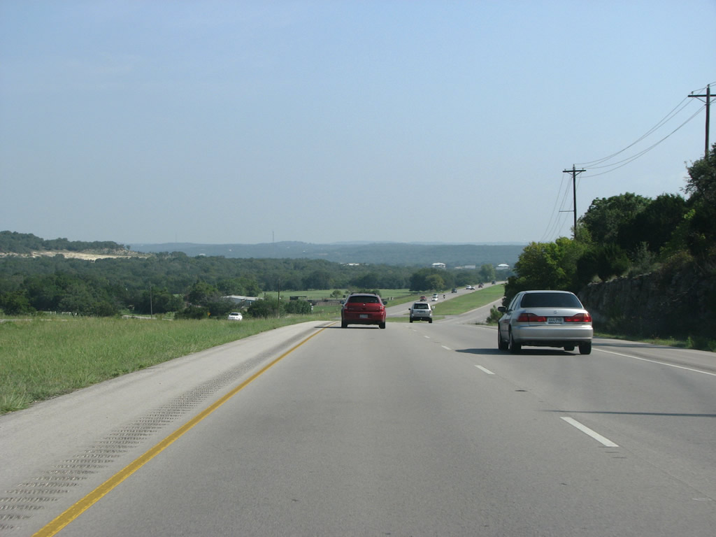
| Most of Comal County is located along the Balcones Escarpment, which separates the Edwards Plateau of the Great Plains with the flat coastal plain. The junction of the two is characterized by deep eroded valleys and hills - which paints the portrait for the motorist heading north along U.S. 281 through here. 09/01/08 |
|
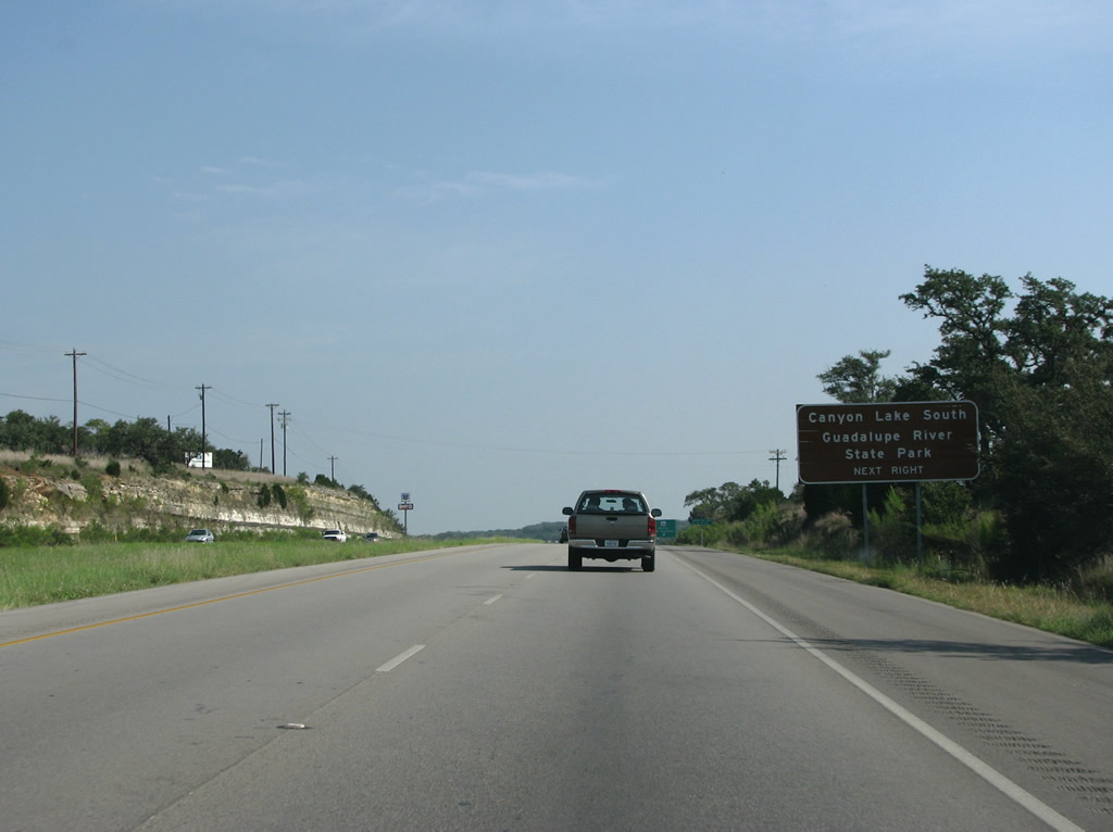
| A diamond interchange joins U.S. 281 with SH 46 next. SH 46 comprises a 71.99 mile long highway west to Boerne and southeast to New Braunfels and Seguin. This also marks the far northern boundary of Metro San Antonio. Canyon Lake, built in the 1950s, is a popular recreational area for people from Central Texas. Its southern shore can be reached by heading east on SH 46. 09/01/08 |
|
| Boerne, along IH 10, and New Braunfels, on IH 35 are the control points for SH 46. Both cities were founded by German immigrants and retain their German names and identities. German was spoken widely in Comal County until World War 2, when English took over. 09/01/08 |
|
| This view looks north along U.S. 281 just past SH 46. 09/01/08 |
|
| The Guadalupe River is popular among Texans for tubing and other activities, and U.S. 281 crosses it here. The truss bridge on the west side dates back to 1935. 09/01/08 |
|
| Beyond the Guadalupe River, U.S. 281 approaches the community of Spring Branch. A two year, $30.5 million expansion projected widening U.S. 281 from the Guadalupe River north to the Blanco County line started in January 2014.1 09/01/08 |
|
| U.S. 281 northbound at FM 311. FM 311 meanders 7.90 miles southeast to Smithson Valley and SH 46. 09/01/08 |
|
| The next population center, Blanco, sits 16 miles north of U.S. 281 at Spring Branch Road. 09/01/08 |
|
| 2014-16 widening of U.S. 281 through western Comal County added a new southbound roadway separated by a wide enough median to accommodate a potential expressway. 09/01/08 |
|
| FM 306 stems east from U.S. 281 just north of the Comal Hills, Indian Hills and Indian Hills Estates subdivisions to northern reaches of Canyon Lake. 09/01/08 |
|
| Continuing north from FM 306, U.S. 281 enters Blanco County by the Lake of the Hills neighborhood. The county was formed in 1858 and unlike many other nearby areas, was settled mainly by farmers from Tennessee and Alabama. The county surpassed 10,000 residents by 2010. 09/01/08 |
|
| U.S. 281 combines with RM 473, which comes in from IH 10 in the west, 1.84 miles north to Twin Sisters. The Ranch-to-Market road forms an important route towards Austin for drivers headed east from El Paso. 09/01/08 |
|
| U.S. 281 & RM 473 lower into the Little Blanco River valley. Blanco County is fairly hilly, and there are some very large hills to the west including Twin Sisters at elevations of 1,762 and 1,779 feet above sea level. 09/01/08 |
|
| The eastern branch of RM 473 heads 5.66 miles from U.S. 281 at Twin Sisters along the Little Blanco River to RM 32. 09/01/08 |
|
| This view looks northbound at a U.S. 281 reassurance marker just past RM 473's turnoff. 09/01/08 |
|
| SL 163 separates from U.S. 281 north along Chandler Street into the city of Blanco. SL 163 provides a cut off to RM 165 east to Payton and Henly. 09/01/08 |
|
| U.S. 281 enters Blanco at SL 163. Blanco was founded along with the county in 1858 as the county seat. Blanco lost its county seat status in 1890 to the only other town in the county, Johnson City. The rivalry between the two cities is still around. 09/01/08 |
|
| Park Road 23 runs into Blanco State Park, which follows the river of the same name. The city is an important tourist spot for Austin area residents, and the Blanco River is a popular tubing and swimming destination. 09/01/08 |
|
| U.S. 281 (Main Street) widens to a five land boulevard through the Blanco business district north from PR 23. 12/31/02 |
|
| Within Downtown Blanco, SL 163 returns via 4th Street. The 1.78 mile loop follows the older route of U.S. 281 along the east side of town. RM 1623 ties in from Albert and U.S. 290 near Stonewall to the northwest. 09/01/08 |
|
| The 12 mile stretch along U.S. 281 north between Blanco and Johnson City passes east of Brushy Top and across a valley fed by Turkey Creek. 09/01/08 |
|
| The first US highway junction north of San Antonio is with U.S. 290 at Boardhouse. 09/01/08 |
|
| The intersection with U.S. 290 is fairly large with sweeping turn lanes. Heading east, U.S. 290 is an important divided highway and freeway through the Austin area. It also forms the main route between Austin and Houston, with many expressway and freeway sections. 09/01/08 |
|
| U.S. 290 west combines with U.S. 281 north for 5.49 miles to Johnson City. 09/01/08 |
|
| U.S. 281/290 lower 290 feet in elevation from Brock Hollow to Johnson City and the grand Colorado River Valley. 09/01/08 |
|
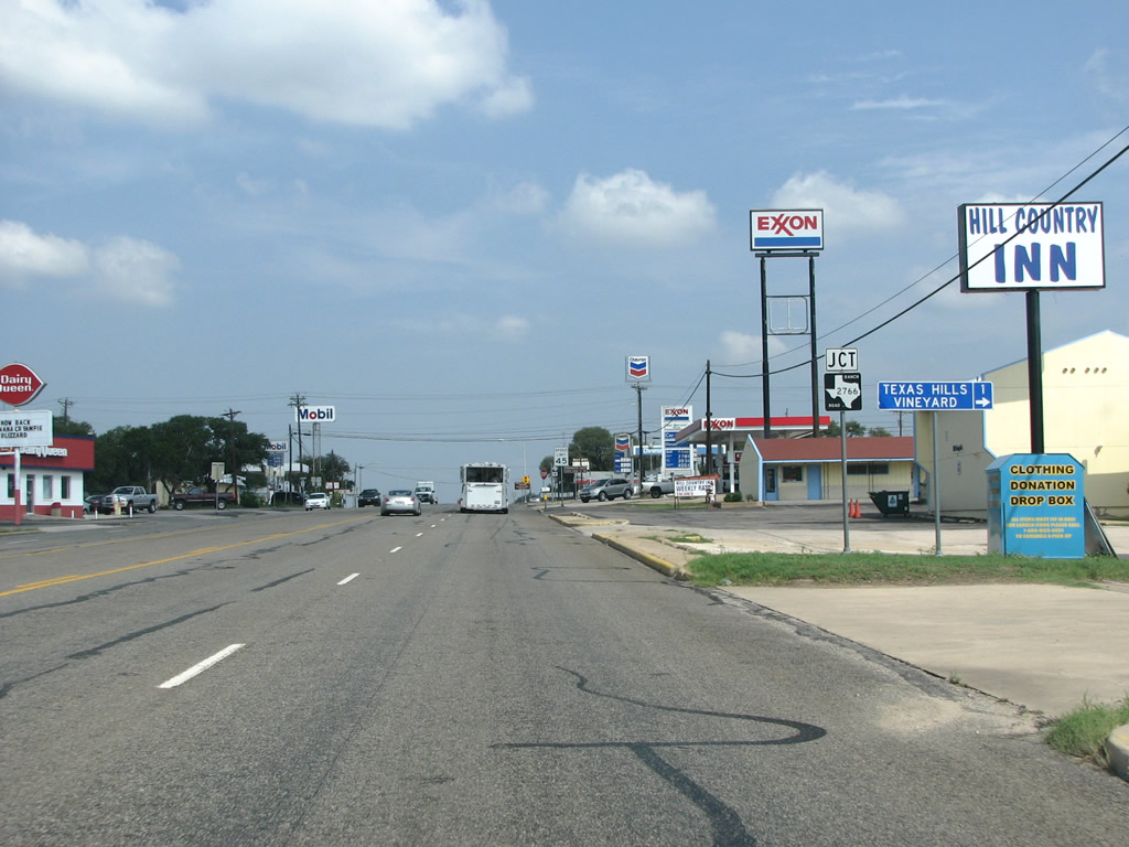
| Arriving at Johnson City, U.S. 281 north & 290 west narrow onto a five lane commercial boulevard leading to RM 2766 (Robinson Road). 09/01/08 |
|
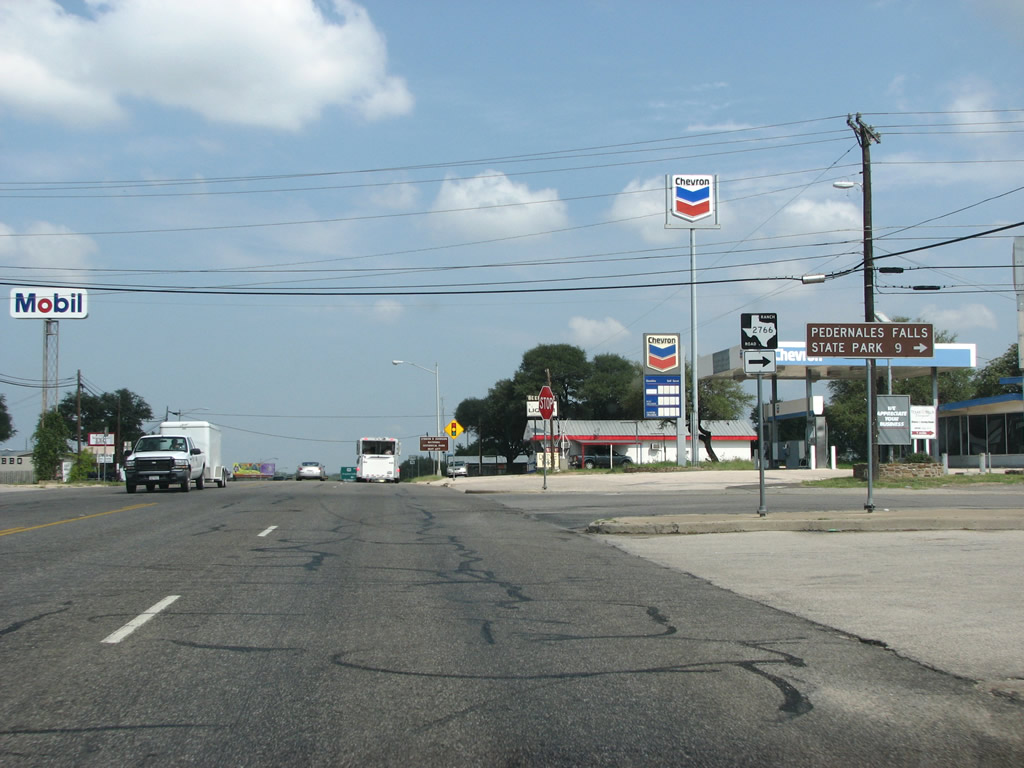
| RM 2766 runs 9.18 miles east towards Pedernales Falls State Park. The Pedernales (pronounced "Perdenaluhs" by Texans) River was named in 1750 by the Spanish for the flint rocks that line its shores. 09/01/08 |
|
| Johnson City was not named for President Lyndon B. Johnson but for one of his ancestors. LBJ himself lived in town when he was young. When he died, he gave his lands to the federal government who turned the area into a national historic site. The LBJ home and lands sit 11 miles west along U.S. 290. 09/01/08 |
|
| Johnson City, the county seat, is slightly larger than Blanco but not by much. Featuring many hotels, the area is an important tourism destination. Extremely popular with Texans, but not by many people from outside the state, the Hill Country forms both the geographic and historic center of the state. 09/01/08 |
|
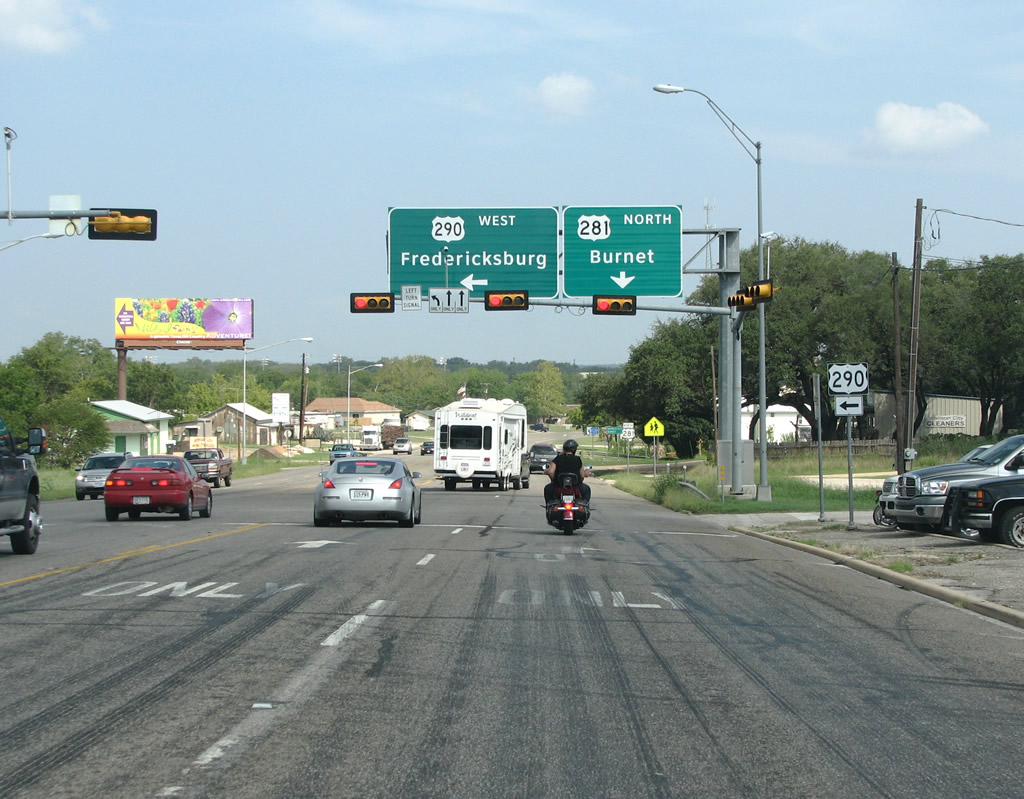
| A large overhead sign marks the northbound split of U.S. 290 and U.S. 281 in Johnson City. U.S. 290 heads west from here to the German town of Fredericksburg and overall 71.65 miles to IH 10 in Kimble County. 09/01/08 |
|
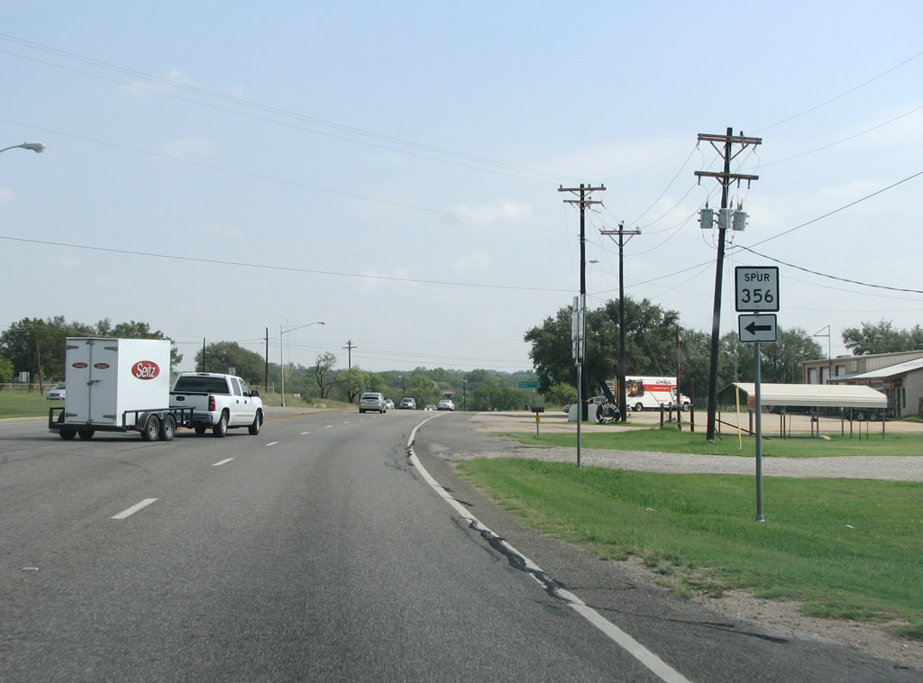
| SS 356 (Nugent Avenue) converges with U.S. 281 north of Town Creek. 09/01/08 |
|
| Spur 356 arcs 0.923 miles southwest, forming a bypass of Johnson City between U.S. 290 (West Main Street) and U.S. 281 near the Pedernales River. 09/01/08 |
|
| U.S. 281 heads north out of Johnson City across a four lane span over the popular Pedernales River. The river is full of tourists and swimmers on the many hot days in Central Texas. 09/01/08 |
|
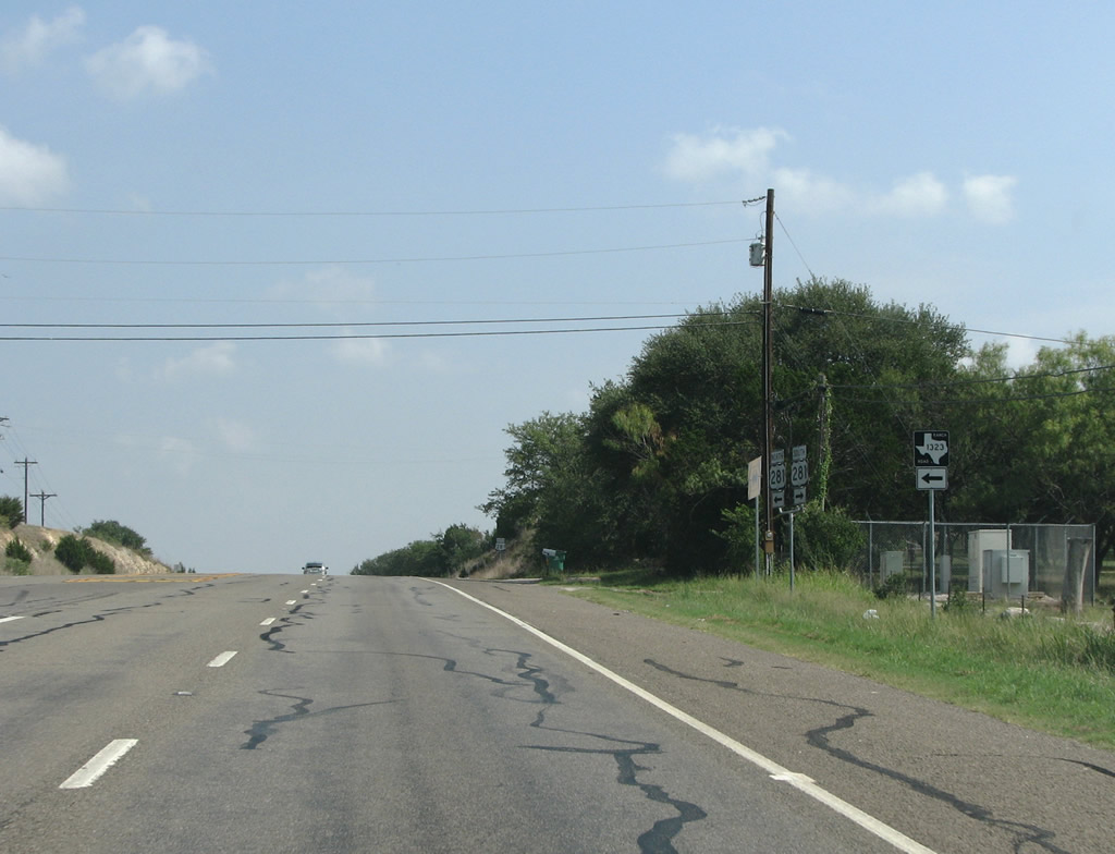
| RM 1323 ties into U.S. 281 in northern Blanco County. The Ranch Road meanders 26.44 miles west through rural areas to Sandy, Willow City and SH 16 at Eckert. 09/01/08 |
|
| Continuing north into the rural town of Round Mountain, U.S. 281 next intersects RM 962. RM 962 spurs 22.92 miles east to the Travis County line outside the Austin metro area. Austin is less than 30 miles eastward but U.S. 281 remains rural because much of the land is protected from development. 09/01/08 |
|
| The western leg of RM 962 leads 10.45 miles northwest from Round Mountain to SH 71 in Llano County. U.S. 281 forms the nominal western boundary of the central Texas urban conglomeration, which includes both Austin and San Antonio. 09/01/08 |
|
| Burnet County, named for Republic of Texas President David Burnet, was formed in 1852. The county is always pronounced like "Burn it", rather than the more romantic "Burn-ette". 09/01/08 |
Page Updated 07-27-2019.

 North
North