|
| U.S. 287 ceases to be a freeway as it enters Wilbarger County. A pair of large warning signs precede the staggered intersection with County Road 125 and the unincorporated community of Harrold. 05/24/08 |
|
| Traffic must slow to 55 miles per hour ahead of the intersection with CR 125 at a large travel plaza. 05/24/08 |
|
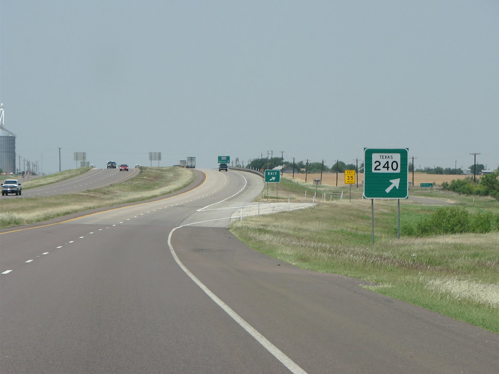
| U.S. 287 upgrades to a short freeway through Harrold with companion frontage roads connecting to SH 240 east and FM 1763. 05/24/08 |
|
| SH 240 runs 26.14 miles eastward to SL 267 near IH 44 in the city of Burkburnett. 05/24/08 |
|
| FM 1763 meets U.S. 287 for the first time at Harrold. The 31.86 mile loop concludes at U.S. 287 outside Vernon. Harrold was founded when the railroad was built here in 1884, and named for the owner of the Bar-X ranch. 05/24/08 |
|
| Through Wilbarger County U.S. 287 is generally wide open with few cross roads. 05/24/08 |
|
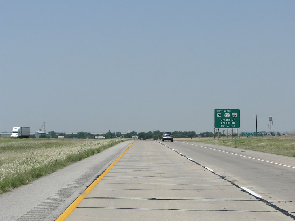
| Approaching the community of Oklaunion, U.S. 287 converges with SL 404 (old U.S. 287) U.S. 70, U.S. 183 and SL 145 (old U.S. 70/183) along a freeway bypass. 05/24/08 |
|
| U.S. 70 enters Oklaunion alongside U.S. 183 from Davidson, Oklahoma to the northeast. Representing one of the most important US highways in the country, U.S. 70 extends east all the way to coastal North Carolina and was formerly known as the "Broadway of America". 05/24/08 |
|
| U.S. 70 west & 183 south combine with U.S. 287 along the Oklaunion bypass. Oklaunion was named in the hopes that the Frisco railroad would meet with the Fort Worth and Denver railroad here. That honor instead went to nearby Vernon which prospered. 05/24/08 |
|
| U.S. 287 reassurance marker posted at CR 109 midway between Oklaunion and Vernon. 05/24/08 |
|
| U.S. 70-183-287 upgrade to a freeway ahead of the west end of FM 1763 and the city of Vernon. 05/24/08 |
|
| U.S. 287 bypasses the north side of Wilbarger while U.S. 287 Business follows the former route along Wilbarger Street to Downtown. 05/24/08 |
|
| Grain elevators in Vernon come into view as U.S. 287 Business leaves U.S. 70-183-287 via a left exit. 05/24/08 |
|
| US 287/70/183 are all signed here entering Vernon. 05/24/08 |
|
| FM 1949 links the freeway with U.S. 287 Business nearby before branching southeast along a 4.13 mile course across oil fields and ranchland to FM 433. 05/24/08 |
|
| The first of three exits along U.S. 287 northbound for Mt. Vernon is with Laurie Street. Although history is ambiguous, Vernon was either named for George Washington's Mount Vernon estate or after a traveling whiskey salesman. 05/24/08 |
|
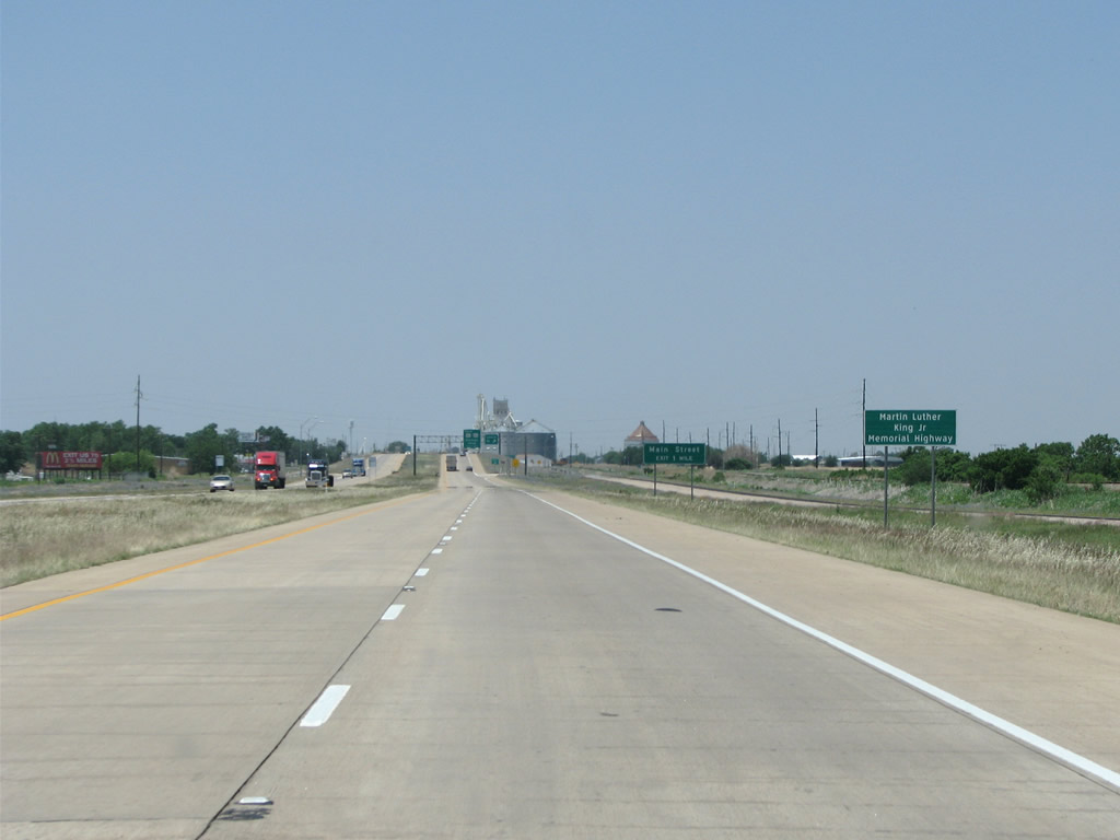
| Vernon's freeway section of U.S. 287 is named for Martin Luther King, Jr. 05/24/08 |
|
| Laurie Street is a 0.42 mile city street that runs south to U.S. 287 Business (Wilbarger Street). 05/24/08 |
|
| U.S. 70-287 diverge from the adjacent BNSF Railroad line ahead of a split diamond interchange with U.S. 283 at Main Street. U.S. 183 parts ways with the freeway here to accompany U.S. 283 south through Downtown Vernon. 05/24/08 |
|
| U.S. 183/283 in Vernon forms the main drag Downtown. Vernon is home to around 11,000 people and is notable for being the birthplace of singer Roy Orbison. 05/24/08 |
|
| Overall U.S. 183 travels from Refugio in South Texas to Interstate 90 outside Presho, South Dakota. U.S. 283 runs from U.S. 87 in Central Texas to U.S. 30 at Lexington Nebraska. 05/24/08 |
|
| Built in the early 1940s, Vernon's grain elevators are on the north side of the freeway and the tallest buildings in the county. Bentley Street is the main route toward them. 05/24/08 |
|
| U.S. 70 separates from U.S. 287 northbound on the west side of Vernon and continues to the Foard County seat of Crowell. Vernon is the largest town between Wichita Falls and Amarillo, and has many conveniences that cannot be found elsewhere on this stretch. 05/24/08 |
|
| FM 925 runs 3.61 miles east from this diamond interchange to U.S. 283. 05/24/08 |
|
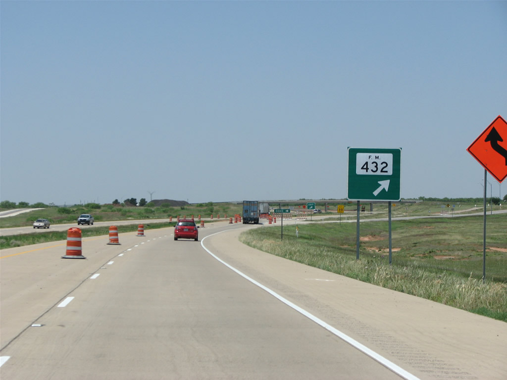
| FM 432 heads 7.60 miles north to FM 91, which connects with the unincorporated community of Odell near the Red River. 05/24/08 |
|
| Entering the diamond interchange with FM 432 north along U.S. 287 northbound. 05/24/08 |
|
| U.S. 287 shifts sides with the parallel BNSF Railroad through an S-curve preceding the Hardeman County line. Organized in 1884, Hardeman County was named for legislator Thomas Jones Hardeman. 05/24/08 |
|
| Chillicothe lies inside Hardeman County along U.S. 287 northbound. The small city is the most notorious speed trap in the entire state. In addition to its police force, the town regularly puts out fake police cars with mannequins in them. 05/24/08 |
|
| Chillicothe's grain elevators are the tallest buildings in the city. When fire destroyed the town in 1890, residents rebuilt it on the other side of the railroad. 05/24/08 |
|
| The first traffic light encountered along U.S. 287 since Fort Worth is found in Chillicothe at the main street, FM 91 (Avenue H). 05/24/08 |
|
| A U.S. 287 reassurance marker on the west side of Chillicothe. 05/24/08 |
|
| Beyond Chillicothe, the land opens up again with wheat fields and a 75 mph speed limit. FM 2006, a 16.95 mile loop north from Chillicothe, ties into U.S. 287 at Dam Site Road. 05/24/08 |
|
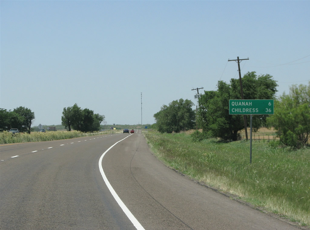
| Quanah sits about nine miles west of Chillicothe. U.S. 287 proceeds northwest to the county seat six miles from FM 1167. 05/24/08 |
|
| FM 2568 marks the eastern boundary of Quanah. The FM road forms a 7.04 mile loop around the south end of town. 05/24/08 |
|
| Like Chillicothe, U.S. 287 through Quanah includes a traffic light at SH 6, the main north/south road in town. 05/24/08 |
|
| SH 6 is one of the most important and longest state highways in Texas. It runs from the Houston area to Oklahoma. 05/24/08 |
|
| Continuing west along 11th Street from SH 6 (Main Street) on U.S. 287 in Quanah. 05/24/08 |
|
| Acme, hardly a blip in the road, is the next control point along U.S. 287 beyond Quanah. 05/24/08 |
|
| FM 2568 returns to U.S. 287 north from Quanah Municipal Airport (F01) along Airport Road. Quanah was named for Indian Quanah Parker. 05/24/08 |
|
| SL 285 branches northwest from U.S. 287 (11th Street) along the former alignment of the US highway. Measuring 4.63 miles in length, SL 285 travels through remote areas west to the railroad siding of Acme. 05/24/08 |
|
| U.S. 287 traverses open ranch land along an expressway between Quanah and the folded diamond interchange with SL 285 east at Acme. 05/24/08 |
|
| SL 275 converges with U.S. 287 beyond South Groesbeck Creek at a grade separation with the BNSF Railroad. Acme developed around a cement plant and gypsum mine, but today has no permanent residents. 05/24/08 |
Page Updated 07-08-2019.

 North
North


 West
West  South
South