
 West
West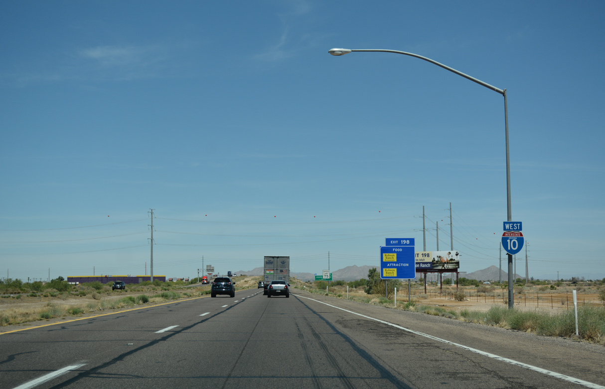
Turning north, Interstate 10 proceeds around the east side of Casa Grande.
04/26/17

Part of SR 84 until 1997, Frontier Street in Eloy continues northwest as Jimmie Kerr Boulevard to Exit 198, Arizola and Casa Grande.
04/26/17

The folded diamond interchange (Exit 198) with Jimmie Kerr Boulevard lies opposite a Union Pacific Railroad line. SR 84 was still signed for Exit 198 until 2003. The state route remains 22.83 miles from SR 387 in Casa Grande to I-8 west of Stanfield.
04/26/17

04/26/17

Casa Grande was formerly served by Business Loop I-10 west along Florence Boulevard (SR 287) and north along SR 387 (Pinal Avenue). Decommissioned after 2005, the loop was 12.8 miles long.
04/26/17

SR 287 runs 10.15 miles east from a point just west of Exit 194 to SR 87 at La Palma. Florence Boulevard west 3.93 miles to SR 84/387 outside Downtown Casa Grande was relinquished from state control.
04/26/17

Casa Grande Ruins National Monument lies north of Coolidge along SR 87/287, 18 miles to the northeast of Exit 194.
04/26/17

04/26/17

04/26/17

04/26/17

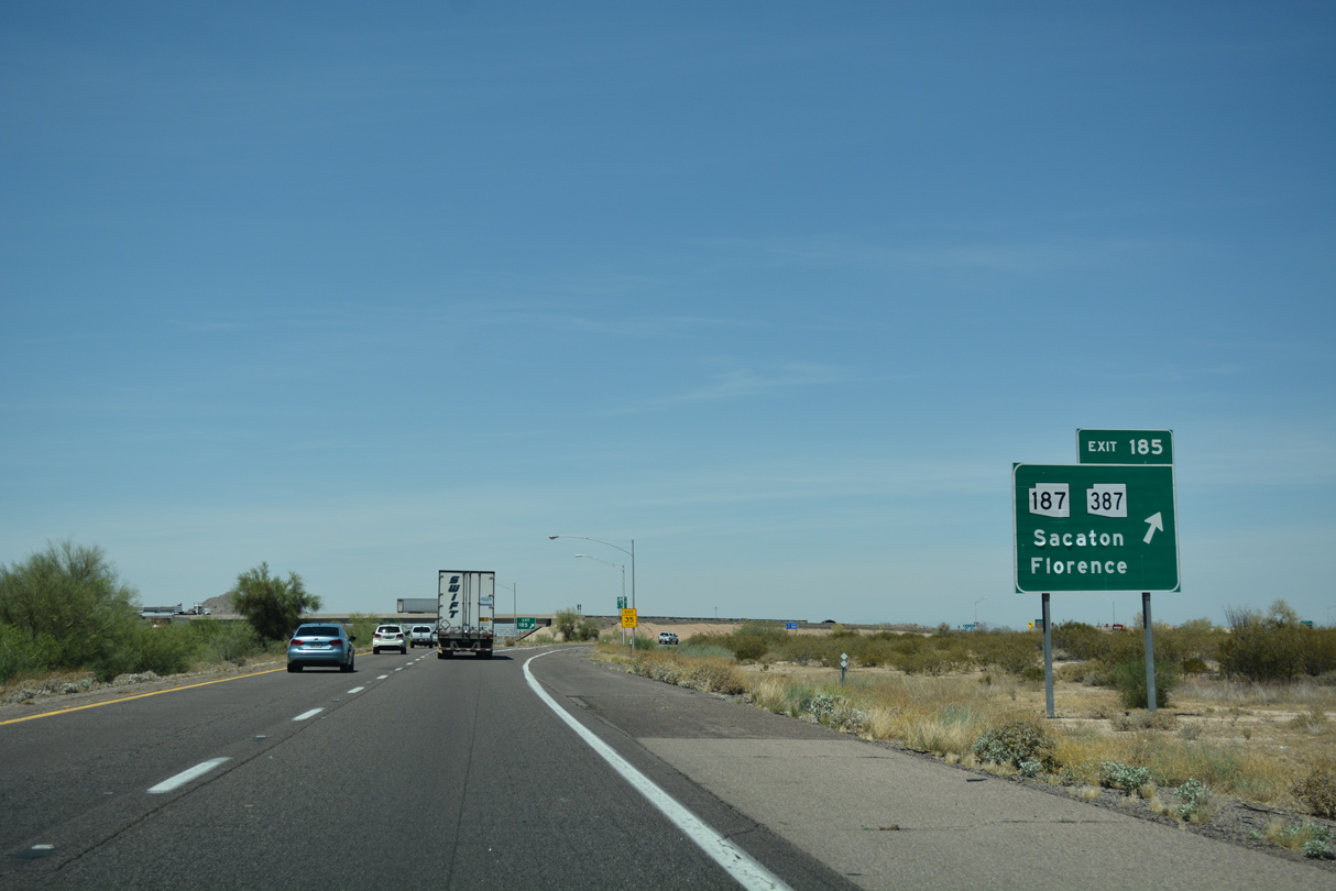
SR 387 meets I-10 just south of SR 187 at Exit 185 in eight miles. The ensuing exit for McCartney Road lies 2.75 miles north of the Cottonwood Lane overpass.
04/26/17

04/26/17

04/26/17

04/26/17

04/26/17

Downtown Phoenix lies 44 miles to the northwest. Suburban areas of the metropolitan area are 27 miles away.
04/26/17

The last four lane section remaining between Phoenix and Tucson is the stretch between north Casa Grande and the exchange with SR 347. The ADOT Wild Horse Pass Corridor study through Winter 2023 focuses on the 26 mile segment of I-10 from SR 287 to Loop 202.
04/26/17

SR 387 heads 8.79 miles north from SR 84 and Florence Boulevard (old SR 287) in Casa Grande to the diamond interchange at Exit 185.
04/26/17

SR 387 turns east from nearby SR 187 and continues 6.92 miles across the Sacaton Mountains to SR 87. SR 87 south and SR 287 east lead to Florence from the end of SR 387.
04/26/17

04/26/17
SR 187 angles 5.43 miles northeast between Agency Peak and Hayden Peak to SR 87 south of Sacaton. SR 387 was formerly the northern extent of Business Loop I-10 from Casa Grande.
04/26/17

04/26/17

Continuing northwest through the Gila River Indian Reservation.
04/26/17

The Sacaton Rest Area precedes mile marker 183 next along Interstate 10 westbound.
04/26/17

The Sacaton Rest Area is the lone facility along I-10 between Tucson and Phoenix.
04/26/17

The succeeding facility along Interstate 10 westbound is the Burnt Well Rest Area 97 miles to the northwest.
04/26/17

04/26/17

Lowering from the Sacaton Mountains, interstate 10 crosses a wide agricultural plain west of Sacaton.
04/26/17

04/26/17

SR 587 stems 6.10 miles north from the parclo B2 interchange with Casa Blanca Road to SR 87 at Chandler.
04/26/17

SR 587 north ties into SR 87 at the Maricopa County and community of Sun Lakes.
04/26/17

Santan Road provides a cut off from SR 587 north to SR 87 south at Lower Santan Village. Casa Blanca Road heads 10.28 miles west from the exchange at Exit 175 to Bapchule and SR 347 (Maricopa Road) and southeast 6.45 miles to Sacaton.
04/26/17

Arizona Avenue extends north from SR 87/587 to Loop 202 south of Downtown Chandler. The town of Gilbert lies northeast along the Santan Freeway.
04/26/17

Interstate 10 passes just west of Gila Butte on the succeeding stretch.
04/26/17

U.S. 60 ties into Interstate 10 west from the Superstition Freeway in 20 miles. Downtown Phoenix is 29 miles away.
04/26/17

I-10 passes over the wide yet nearly dry Gila River just ahead of milepost 173. Constructed in 1964, the quarter mile long bridges are narrow with no shoulders. The spans were comprised in 1983 due to monsoonal flood waters, and nearly again in 1994. The I-10 Bridge Project study addresses repairing or replacing the bridges.
04/26/17

During flood events during the monsoon season, the Gila River may fill with massive amounts of water cascading northwest through the Gila River Indian Reservation. The Gila River merges with the Salt River (Rio Salado) southwest of Downtown Phoenix, and the Gila River turns southwest toward Gila Bend and Yuma, where it joins the Colorado River.
04/26/17

Interstate 10 runs between Hohokam Pima National Monument and Goodyear Village northwest to the diamond interchange (Exit 167) with Riggs Road.
04/26/17

Riggs Road extends 8.57 miles east from at SR 347 to Sun Lakes and SR 87 (Arizona Avenue) in Chandler.
04/26/17

Interstate 10 enters Maricopa County, home to the sixth largest city in the nation, Phoenix, 0.92 miles ahead of the Riggs Road exit.
04/26/17

04/26/17

04/26/17

SR 347 converges with Interstate 10 northeast from the city of Maricopa at Exit 164 in two miles.
04/26/17

SR 347 constitutes an expressway north from Maricopa to I-10. Loop 202 (Santan Freeway) and U.S. 60 (Superstition Freeway) ties into I-10 over the ensuing 12 miles.
04/26/17

SR 347 turns east from Maricopa Road onto Queen Creek Road 2.04 miles to the diamond interchange at Exit 164.
04/26/17

Queen Creek Road continues east from SR 347 and I-10 as a locally maintained arterial into Chandler at the master planned community of Ocotillo.
04/26/17

SR 347 measures 28.67 miles overall from Queen Creek Road just east of Exit 164 to SR 84 west of Stanfield.
04/26/17
04/26/17

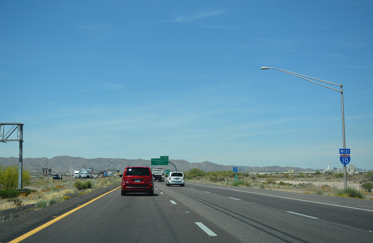
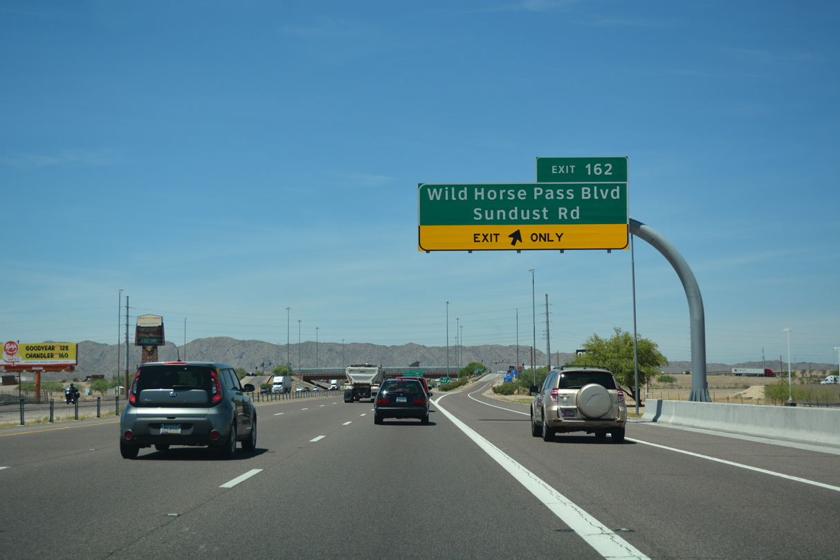
Wild Horse Pass Boulevard east and Sundust Road west come together at a diamond interchange (Exit 162) with Interstate 10 in one mile.
04/26/17

Loop 202 is the first major freeway meeting Interstate 10 in the Phoenix metropolitan area. Exit 162 is the first of three exchanges joining the two routes.
04/26/17

Originally Exit 162 was a parclo B2 interchange joining I-10 with Maricopa Road. Maricopa Road was severed with construction of Wild Horse Pass Road.
04/26/17

04/26/17
04/26/17

Photo Credits:
04/26/17 by AARoads
Connect with:
State Route 347
Page Updated 04-14-2022.