Interstate 25 Northbound - Natrona County
| Interstate 25 North | |
|---|---|
 |
Now entering Natrona County, this sign indicates that travelers en route to Independence Rock should use Exit 188B, Wyoming 220 (Poplar Avenue) west. Follow Wyoming 220 west through Casper; Independence Rock is located 13 miles west of Alcova. Nathaniel Burt in his Discover America: Wyoming travel guide describes Independence Rock as "rounded, pink, and isolated, it juts out of the flat valley like a miniature Australian Ayers Rock" (page 122, 1991, first edition). In addition to its unique geological history, Independence Rock is also a significant site from the pioneer days when various settlers passed the rock en route to various points west, including California (1849 Gold Rush), Utah (Mormon Trail), and Oregon (Oregon Trail). Picnicking and hiking are available at the site, which is a Wyoming state historic site. Photo taken 09/01/04. |
 |
A pair of wooden, H-frame power lines merge onto this single metal pole as they travel toward the Dave Johnson Power Plant near Glenrock. These power lines form part of the power transmission system that interconnects the Mountain West. Photo taken 09/01/04. |
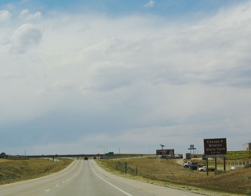 |
The succeeding exit along northbound Interstate 25 is for WYO 253/WYO 256, Hat Six Road (Brooks). WYO 256 north connects I-25 with Edness K. Wilkins State Park. A former rock quarry, the park was created in 1981 and today has a pond and offers fishing and hiking activities.1 09/01/04 |
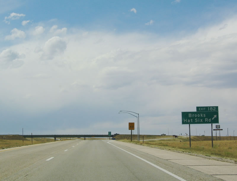 |
Northbound (westbound) Interstate 25 reaches Exit 182, Wyoming 253/Hat Six Road south toward the Laramie Mountains and Medicine Bow-Routt National Forest. To the north, Wyoming 256/Hat Six Road meets U.S. 20-26-87, then follows Cole Creek Road north toward oil fields and ranch access. Photo taken 09/01/04. |
 |
Interstate 25 enters the Casper metropolitan area. The next exit along westbound is Exit 185, Wyoming 258, Wyoming Boulevard. Use Exit 188B to Fort Caspar National Historic Place, one of several such places recognized as historically significant by the National Register of Historic Places. Photo taken 09/01/04. |
 |
The city of Casper is home to 49,644 people (per the 2000 Census). The second largest city in Wyoming, Casper was at one time the largest city in the Equality State. A variety of industries, including the state's largest newspaper (the Casper Star-Tribune), television programming (ABC affiliate K2 TV), Casper College, tourism, and mining activities including coal and oil. The Gas Hills west of Casper are rich with uranium. Photo taken 09/01/04. |
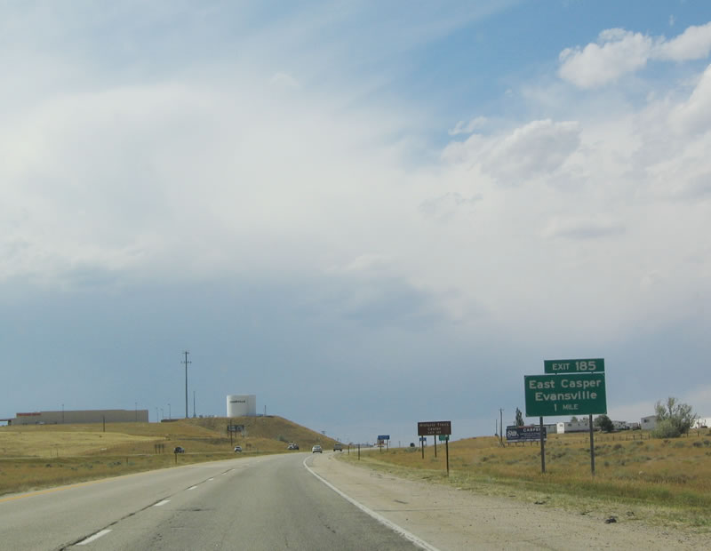 |
The next five exits serve the city of Cheyenne: Exit 185, Wyoming 258/Wyoming Boulevard (East Casper and Evansville); Exit 186, Junction Business Loop I-25 and U.S. 20-26-87, North Beverly Street/Bryan Stock Trail; Exit 187, McKinley Street; Exit 188A, Junction Business Loop I-25, Business U.S. 87, and Wyoming 255, Center Street; Exit 188A, Wyoming 220, Poplar Street; and Exit 189, U.S. 20-26 West. Photo taken 09/01/04. |
 |
Westbound Interstate 25 reaches Exit 185, Wyoming 258. The Casper Outer Belt Route, Wyoming 258 follows Wyoming Boulevard on a loop that travels south, west, and then north to connect Interstate 25, Wyoming 251, Wyoming 252, Wyoming 220, and Business U.S. 20-26. Additional funds for the Casper Outer Belt were secured in the 2005 transportation reauthorization bill SAFETEA-LU. Note the reduction in speed limit to 60 miles per hour. Photo taken 09/01/04. |

 |
Now on the offramp, turn left (south) to follow Wyoming 258 south to Casper College and Casper Mountain. Turn right (north) to connect to U.S. 20-26-87, the Yellowstone Highway. Photo taken 09/01/04. |
 |
An Interstate 25 reassurance shield is posted immediately after the Wyoming 258 interchange. The freeway changes in character -- the rural highway squeezes into a tight configuration between Exits 186 and 189, as it is located between the North Platte River, the railroad, and downtown Casper. Photo taken 09/01/04. |
 |
At the Wyoming 258/Wyoming Boulevard underpass, Interstate 25 changes from asphalt to concrete pavement. The frontage road to the north of the freeway is U.S. 20-26-87, which is preparing to rejoin Interstate 25 for the journey through downtown Casper. Photo taken 09/01/04. |
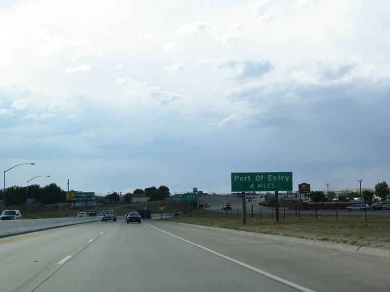 |
A weigh station (port of entry) is located north of downtown Casper on Interstate 25 via U.S. 20-26 west. Photo taken 09/01/04. |
 |
The next exit along northbound Interstate 25 is Exit 186, Junction Business Loop I-25 and Business U.S. 20-26-87 west via Yellowstone Highway to downtown Casper. The connection to the business route is made via Beverly Street southbound. To the north, Bryan Stock Trail crosses the river. Photo taken 09/01/04. |
 |
Yellowstone Street is the designation that carries the business route through town. It is an offshoot of the Yellowstone Highway designation, which connects Cheyenne and Yellowstone National Park. Interstate 25 and the Yellowstone Highway part ways permanently at Exit 189, when U.S. 20-26 travel west toward Shoshoni. Photo taken 09/01/04. |
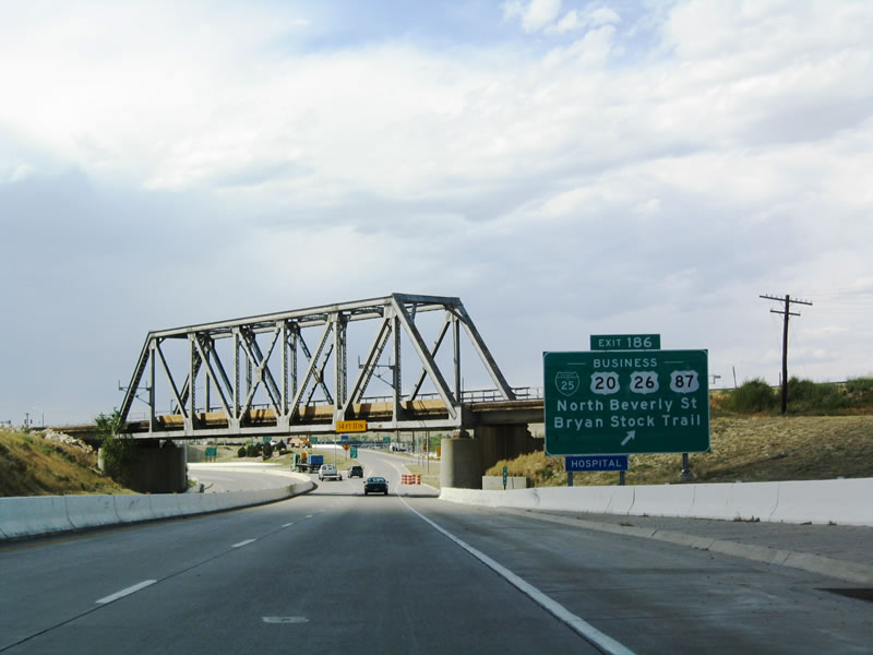 |
Westbound Interstate 25 reaches Exit 186, Junction Business Loop I-25 and Business U.S. 20-26-87, Beverly Street, Bryan Stock Trail, and Yellowstone Street. The freeway passes under a railroad truss bridge; both the Burlington Northern and Santa Fe Railroad and the Chicago and Northwestern Railroad serve the Casper area. Photo taken 09/01/04. |
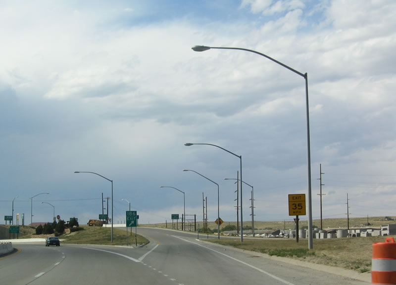 |
After the truss bridge is the offramp for Exit 186, Junction Business Loop I-25. Follow Beverly Street south to Yellowstone Street west to continue west on the business route. Photo taken 09/01/04. |
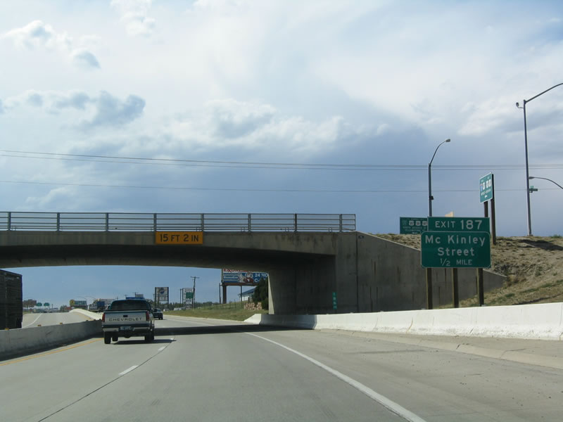 |
The next exit along westbound Interstate 25 is Exit 187, McKinley Street. Photo taken 09/01/04. |
| Interstate 25/U.S. 87 Northbound and U.S. 20-26 Westbound | |
|---|---|
 |
A slip ramp from the frontage road (F Street) transfers through traffic on westbound U.S. 20-26-87 back onto the freeway. The four routes remain merged for about two miles. Photo taken 09/01/04. |
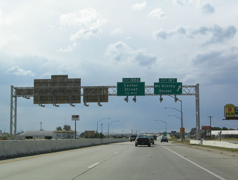 |
The next exit is Exit 187, McKinley Street. The next exit is Exit 188B, Junction Business Loop I-25, Business U.S. 87, and Wyoming 255, Center Street. The Casper Business Loop is very short, covering only a mile or two at most. Photo taken 09/01/04. |
 |
Westbound Interstate 25 and U.S. 20-26-87 reaches Exit 188A, Junction Business Loop I-25, Business U.S. 87, and Wyoming 255 (Center Street). Center Street carries the three routes about six blocks south into downtown. Wyoming 255 is generally not signed, but the Business Loop I-25 and Business U.S. 87 are well signed. Photo taken 09/01/04. |
 |
The four routes are signed together again after the Center Street offramp. This is the last time that they are all signed together on northbound. Photo taken 09/01/04. |
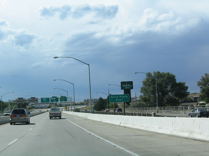 |
For the final time, Interstate 25 crosses the North Platte River. The old bridge can be seen carrying the frontage road (F Street) over the river. Interstate 25, meanwhile, crosses on a newer bridge. From here, the North Platte River travels west through Casper toward Independence Rock and Devils Gate. Much of the river is impounded by three reservoirs between Casper and Fort Steele (where Interstate 80 and the North Platte River meet). Photo taken 09/01/04. |
 |
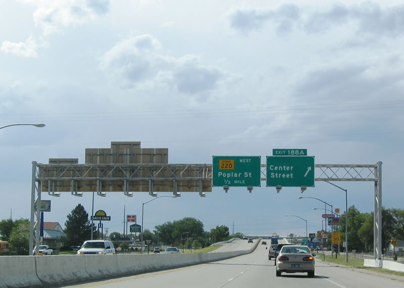
Northbound Interstate 25 and U.S. 20-26-87 reach Exit 188B, Wyoming 220/Poplar Street. Wyoming 220 follow the North Platte River generally until near Independence Rock and Alcova; the highway ultimately connects to U.S. 287 at Muddy Gap. Wyoming 220 is the former route of U.S. 87E, an original 1926 route that was eliminated around 1938 after the massive U.S. 87 in Wyoming and Montana was eliminated. Prior to 1936, U.S. 87 began in Rawlins and split at Muddy Gap. U.S. 87E turned northeast to Casper, then followed today's Interstate 25 north to Buffalo and Sheridan. U.S. 87W followed U.S. 287 northwest to Yellowstone National Park. Photo taken 09/01/04. |
 |
At the bottom of the ramp is this sign, which points the way to Wyoming 220/Poplar Street to CY Avenue. Wyoming 220 travels west to Fort Caspar, Independence Rock, Alcova Reservoir, Pathfinder Reservoir, Seminoe Reservoir, and Muddy Gap. It generally follows the North Platte River until it reaches U.S. 287 near Jeffrey City. Photo taken 09/01/04. |
 |
Several routes connect northbound Interstate 25 with Yellowstone-Grand Teton National Parks: U.S. 20-26 west, U.S. 16 west (at Buffalo), and U.S. 14/Alternate U.S. 14 (north of Sheridan). Use Exit 189 to follow U.S. 20-26 west to Shoshoni, then follow U.S. 20 west to Yellowstone National Park via Cody or U.S. 26 west to Grand Teton National Park via Riverton and Dubois. Photo taken 09/01/04. |
 |
A diagrammatical sign shows the connection between Interstate 25/U.S. 87 and U.S. 20-26. After being merging with U.S. 20 and/or U.S. 26 for just shy of one hundred miles, the east-west routes separate from the Interstate 25 corridor for the final time. This interchange is not a freeway to freeway connection. Photo taken 09/01/04. |
 |
Many of the Great Western Trails in Wyoming converge in Casper, and the museum at Exit 189 offers insight on the meaning and history of many of the trails. The trails that have crossed Wyoming during the 1800s include (1) Oregon Trail, (2) California Trail, (3) Mormon Trail, (4) Pony Express Trail, (5) Overland Trail, (6) Cherokee Trail, (7) Bozeman Trail, (8) Jim Bridger Trail, (9) Native American Trail, (10) Mountain Man Trail, and (11) Trapper Trail. Most of these trails are mapped on the official Wyoming state map. Photo taken 09/01/04. |
 |
The right two lanes become exit only for U.S. 20-26, while the left lanes continue north on Interstate 25 and U.S. 87. Photo taken 09/01/04. |
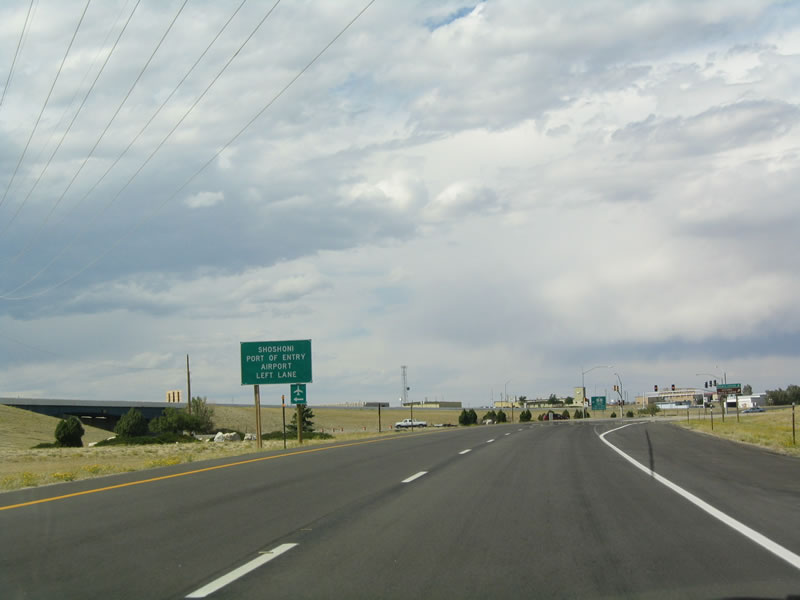 |
This is the transition ramp from Interstate 25 north to U.S. 20-26. Photo taken 09/01/04. |
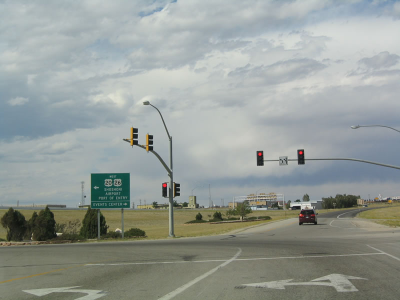 |
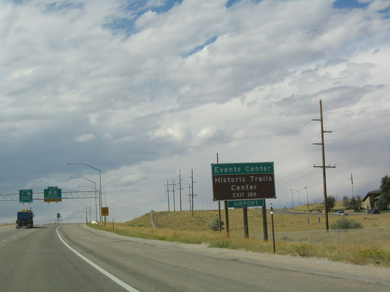
A traffic signal governs the flow of traffic at the base of the U.S. 20-26 exit ramp. Turn left (west) to follow U.S. 20-26 to the airport and port of entry. Use the right lane to connect to the Casper Events Center. Photo taken 09/01/04. |
| Interstate 25 and U.S. 87 Northbound | |
 |
The next exit along northbound Interstate 25 and U.S. 87 is Exit 191, Wyoming 254, Wardwell Road to Bar Nunn. Photo taken 09/01/04. |
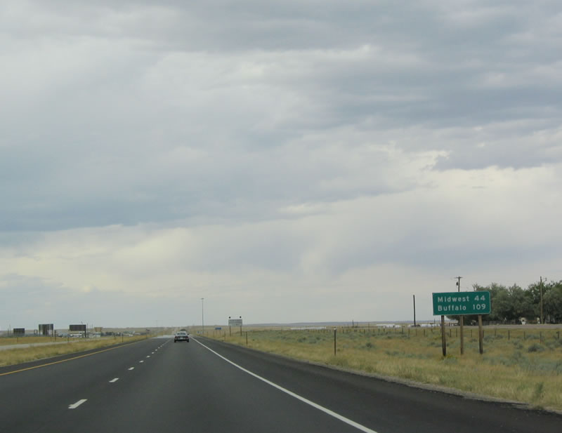 |
This mileage sign provides the distance to Midwest (44 miles) and Buffalo (109 miles). Photo taken 09/01/04. |
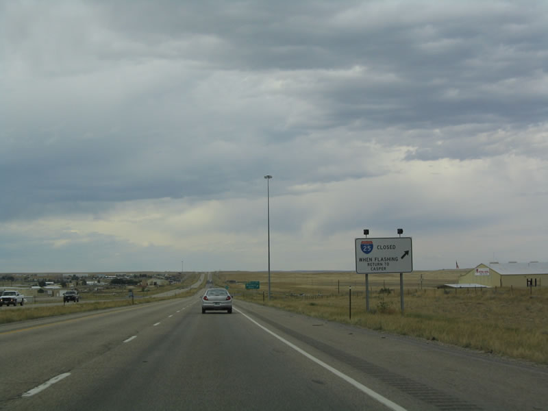 |
During periods of inclement weather, traffic alerts, and other advisories, the freeway may be closed, and the lights on this sign are illuminated. During these times, all traffic must turn around at Exit 191. Photo taken 09/01/04. |
 |
Northbound Interstate 25/U.S. 87 reach Exit 191, Wyoming 254 South/Wardwell Road. Follow Wardwell Road west to Salt Creek Highway, which carries Wyoming 254 (old U.S. 87) south toward Mills. Bar Nunn, a northern suburb of Casper, is also available at this exit. Photo taken 09/01/04. |
 |
The next exit along northbound Interstate 25/U.S. 87 is Exit 197, Junction Natrona County Route 705, Ormsby Road. Ormsby Road travels northeast into the Sand Hills. Photo taken 09/01/04. |
 |
Northbound Interstate 25/U.S. 87 reaches Exit 197, Junction Natrona County Route 705, Ormsby Road. Traffic counts along Interstate 25 have fallen off substantially since leaving Casper, and the freeway carries some of the lowest amounts of traffic of any Interstate highway in the country. Photo taken 09/01/04. |
 |
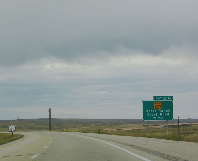
The next exit along northbound Interstate 25 and U.S. 87 is Exit 210, Wyoming 259/Horse Creek Road north to Midwest and Edgerton. Wyoming 259 is old U.S. 87; the US route was aligned onto the freeway when this section of Interstate 25 was completed in 1982. Photo taken 09/01/04. |
 |
The town of Midwest is home to 408 people as of the 2000 Census. It is located at the intersection of Wyoming 259 and Wyoming 387 in the northeastern corner of Natrona County. Photo taken 09/01/04. |
 |
Northbound Interstate 25/U.S. 87 reaches Exit 210, Wyoming 259 north to Midwest and Edgerton. Wyoming 259 passes by Teapot Dome, an oil field owned by the federal government that was the focus of a scandal that dates back to 1922, when Warren Harding was president of the United States. Photo taken 09/01/04. |
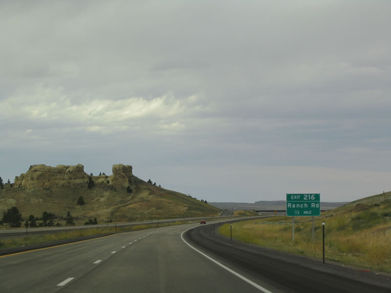 |
A curious rock formation rests alongside Interstate 25 and U.S. 87 as the freeway approaches Exit 216, which provides ranch access. Photo taken 09/01/04. |
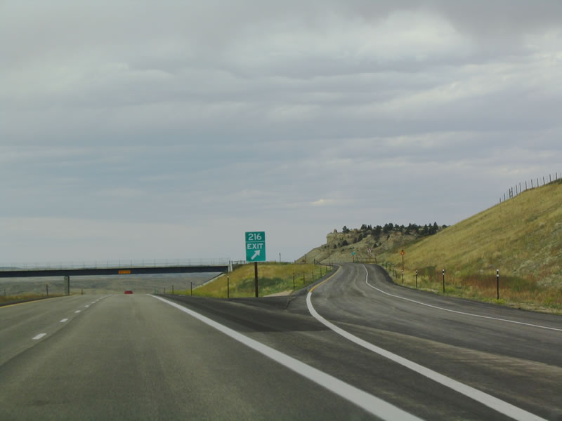 |
Northbound Interstate 25 and U.S. 87 reach Exit 216, Ranch Access. Photo taken 09/01/04. |
 |
A parking area is located near Milepost 219. There is virtually no development along Interstate 25 through here; the freeway will not see much of any development until reaching Kaycee in Johnson County. Photo taken 09/01/04. |
 |
Northbound Interstate 25 and U.S. 87 reach the parking area. Note the fences designed to keep wildlife off of the freeway. Photo taken 09/01/04. |
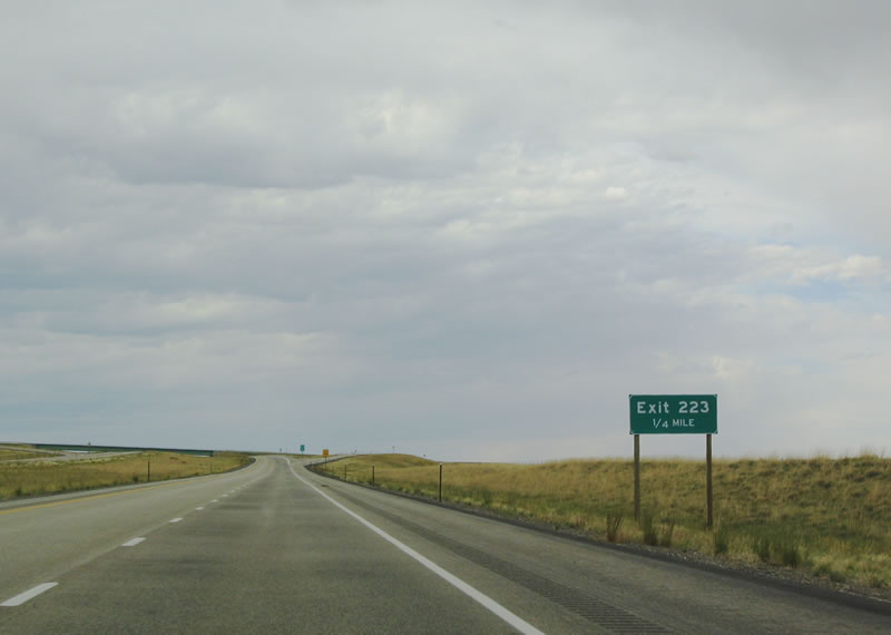 |
Exit 223 is another no-name interchange that also offers ranch access. There are no services here. Photo taken 09/01/04. |
 |
The next exit is Exit 227, Wyoming 387 east to Midwest and Edgerton. Wyoming 387 follows Old U.S. 87 east to Midwest (Wyoming 259), then follows its own route east to Wright (Wyoming 59 in Campbell County). Wyoming 387 clips southeastern Johnson County en route to southern Campbell County. After this interchange, Interstate 25 leaves Natrona County and enters Johnson County. Photo taken 09/01/04. |
 |
 |
Sources:
- Edness K. Wilkins State Park. Wikipedia.
Page Updated October 27, 2005.
|
About Contact FAQ |
Spotlights Testimonials Interstate Guide |
Social Media:
 |
|
© 2000-23 AARoads.com | All Rights Reserved | Privacy Policy / Terms of Use
|
||