Interstate 25 Northbound - Johnson County
| I-25/U.S. 87 North | |
|---|---|
 |
Continuing north into Johnson County, Interstate 25 and U.S. 87 approaches Exit 235, Junction Johnson County Route 210, Long Canyon Road/Dead Horse Road. Photo taken 09/01/04. |
 |
This mileage sign provides the distance to Kaycee (17 miles) and Buffalo (64 miles). Interstate 25 only that distance left in its northbound mileage. Photo taken 09/01/04. |
 |
As Interstate 25 and U.S. 87 north meander through southern Johnson County, another strong thunderstorm was brewing in the Bighorn Mountains. This storm offered an unparalleled vista of the empty Powder River Basin. Photo taken 09/01/04. |
 |
The first exit along northbound Interstate 25 and U.S. 87 in Johnson County is Exit 246, Powder River Road. Interstate 25 is traveling in a northwesterly direction here, and Powder River Road is a north-south road. Use Powder River Road south to the old alignment of U.S. 87, which parallels Interstate 25 to the west of the freeway through here. Photo taken 09/01/04. |
 |
Northbound Interstate 25 and U.S. 87 reaches Exit 246, Powder River Road. Not much traffic uses this stretch of Interstate 25 (between Casper and Buffalo); it has among the lowest traffic counts of any section of Interstate Highway in the nation. Photo taken 09/01/04. |
 |
The next exit along northbound Interstate 25 and U.S. 87 is Exit 249, TTT Road. Use TTT Road to connect to Old U.S. 87 for ranch access. There are no services at this exit. Photo taken 09/01/04. |
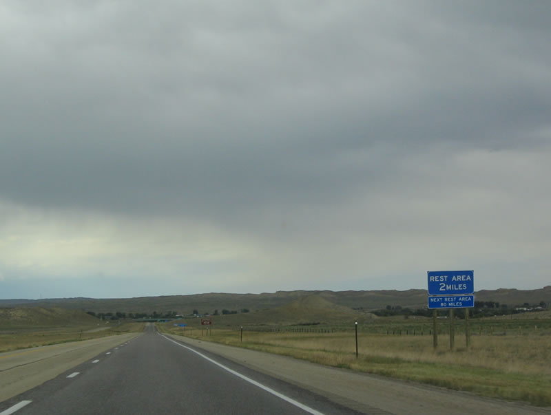 |
The next exit along northbound brings Interstate 25 into Kaycee, the first town since leaving Bar Nunn north of Casper. A total of 249 people lived in Kaycee during the 2000 Census; it is one of two towns located within Johnson County (the other is Buffalo). A rest area with tourist information center is located at Exit 254. Photo taken 09/01/04. |
 |
With rest areas few and far between, the next rest area will be 80 miles north of here, along westbound Interstate 90 and northbound U.S. 87 south of Sheridan. The tourist center focuses on attractions in the Bighorn Mountains, which rise to the west of Interstate 25 and grow gradually more prominent as the freeway continues north toward Buffalo. Photo taken 09/01/04. |
 |
Northbound Interstate 25 and U.S. 87 approach Exit 254, Wyoming 192 (Sussex Highway) east; Wyoming 191 (Mayoworth Road) northwest to Mayoworth; and Wyoming 190 (Barnum Road) west to Barnum. The exit also connects to Wyoming 196, which follows Old U.S. 87 from Kaycee to Buffalo. Photo taken 09/01/04. |
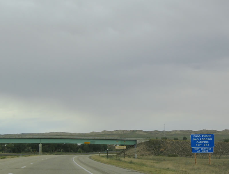 |
Food, phone, gas, lodging, and camping are all available at Exit 254; however, this is the last exit for services for 45 miles ... all the way to Buffalo! Photo taken 09/01/04. |
 |
Use Exit 254 to reach the rest area, which features restrooms, phone, and picnic tables. Photo taken 09/01/04. |
 |
Northbound Interstate 25 and U.S. 87 reach Exit 254, Wyoming 190-191-192-196, Kaycee. Turn right to Wyoming 192 and 196; turn left to Wyoming 190 and 191. Photo taken 09/01/04. |
 |
This mileage sign provides the distance to Buffalo (44 miles) and Sheridan (80 miles) via Interstate 90 and U.S. 87. Photo taken 09/01/04. |
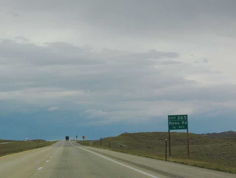 |
The next exit is Exit 265, Junction Johnson County Route 208, Reno Road. Photo taken 09/01/04. |
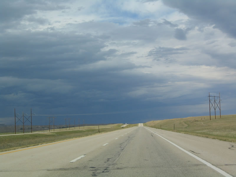 |
A major north-south power transmission corridor crosses over Interstate 25 after the Reno Road interchange. Photo taken 09/01/04. |
 |
The next exit along northbound is Exit 280, Junction Johnson County Route 255, Middle Fork Road. Middle Fork Road travels west to Wyoming 196 near the Billy Creek Oil Field on a route parallel to the Middle Fork of Crazy Woman Creek. Use Middle Fork Road east to Johnson County Route 13, Trabing Road. Photo taken 09/01/04. |
 |
The freeway crosses over the Middle Fork of the Crazy Woman Creek. Photo taken 09/01/04. |
 |
Eleven miles north of the Middle Fork of the Crazy Woman Creek is Exit 291, Junction Johnson County Route 13, Trabing Road. Photo taken 09/01/04. |
 |
The next three exits serve the city of Buffalo. The city of Buffalo is home to 3,900 people as of the 2000 Census, and it is the gateway to the Bighorn Mountains. U.S. 16 follows the Cloud Peak Skyway west over the Powder River Pass in the southern Bighorn Mountains. Buffalo serves as the northern terminus of Interstate 25 at its junction with Interstate 90. Buffalo, like most of the cities in northern Wyoming, rests at a lower elevation (4,645 feet above sea level) than the cities along the Interstate 80 corridor. Photo taken 09/01/04. |
 |
Historic Downtown Buffalo is located along Business Loop I-25 (Main Street). Some of the sights here include the Occidental Hotel, Johnson County Court House, and the Jim Gatchell Museum. Passing through downtown Buffalo is Clear Creek, which drains from the Bighorn Mountains. Photo taken 09/01/04. |
 |
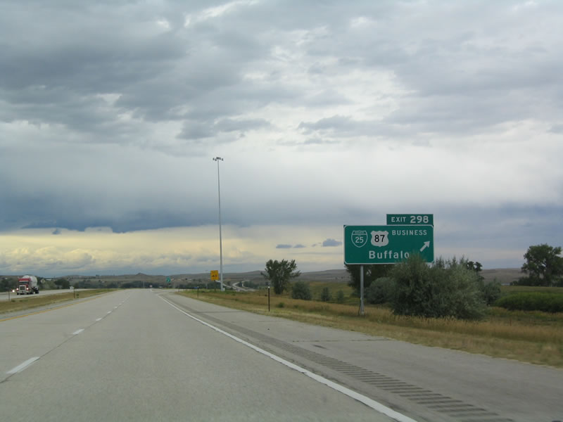
The next exit along northbound Interstate 25 and U.S. 87 is Exit 298, Junction Business Loop I-25 and Business U.S. 87 (Main Street) north to Buffalo. Use this exit to Wyoming 196 south to return to Kaycee. Photo taken 09/01/04. |
 |
To Yellowstone National Park and Grand Teton National Park via U.S. 87 north, use either Exit 298 to connect to U.S. 16/Cloud Peak Skyway west over the Bighorn Mountains or follow Interstate 90 northwest to Sheridan, then follow U.S. 14 to the Bighorn National Recreation Area. Photo taken 09/01/04. |
 |
Northbound Interstate 25 and U.S. 87 reaches Exit 298, Junction Business Loop I-25 and Business U.S. 87 (Main Street) north to Buffalo. Photo taken 09/01/04. |
 |
On days when Interstate 90 is closed, all traffic must exit into Buffalo and wait for the traffic advisory to end. Photo taken 09/01/04. |
 |
Northbound Interstate 25 and U.S. 87 are cosigned again after the business loop interchange. Photo taken 09/01/04. |
 |
The next exit is Exit 299, Junction Business Loop I-90 and U.S. 16, Hart Street. Most motorist services are available at this interchange, but there are no services for another 34 miles along northbound Interstate 90 and U.S. 87. Photo taken 09/01/04. |
 |
U.S. 16 follows the Cloud Peak Skyway west over the Powder River Pass (elevation 9,666 feet) in the southern Bighorn Mountains. It is a beautiful drive with plenty of beautiful sights along the way. U.S. 16 then travels west to Worland, Basin, and Greybull. Photo taken 09/01/04. |
 |
Use U.S. 16 west to the Big Horn Ski Area. A hospital is also located at this interchange. Photo taken 09/01/04. |
 |
To Yellowstone National Park and Grand Teton National Park via U.S. 16 west, use Exit 299 to connect to U.S. 16/Cloud Peak Skyway west over the Bighorn Mountains. Photo taken 09/01/04. |
 |
Northbound Interstate and U.S. 87 reach Exit 299, Junction Business Loop I-90 and U.S. 16 west to Buffalo and east to Ucross and Gillette. For a faster connection to eastbound, continue north to Interstate 90. Photo taken 09/01/04. |
 |
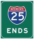
Interstate 25 is signed with an end shield as the freeway prepares to merge with Interstate 90 northeast of Buffalo. Photo taken 09/01/04. |
 |
The right lane transitions from northbound Interstate 25 to eastbound Interstate 90 to Gillette, Sundance, Sturgis, and Rapid City. Photo taken 09/01/04. |
 |
The left lane transitions onto northbound Interstate 90 and U.S. 87 to Sheridan and Billings. Interstate 90 continues west from there toward Butte, Spokane, and ultimately Seattle. Photo taken 09/01/04. |
 |
Northbound Interstate 25 reaches Exit 300, Interstate 90 east to Gillette (right exit) and west to Sheridan (left exit). Photo taken 09/01/04. |
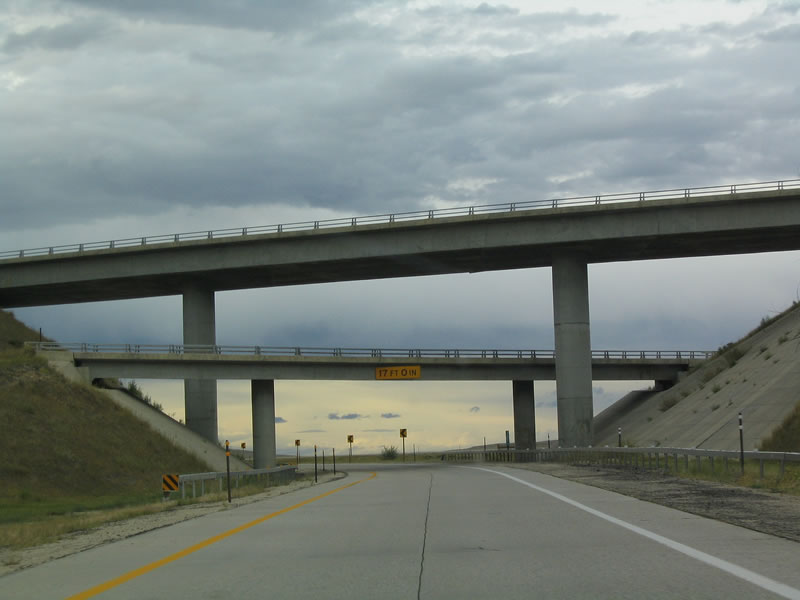 |
The interchange between Interstate 25 and Interstate 90 is a tri-level stack, unlike the cloverleaf between Interstate 25 and Interstate 80 in Cheyenne. U.S. 87 follows the ramp connecting northbound Interstate 25 to westbound Interstate 90. Photo taken 09/01/04. |
 |
At the top of this grade, traffic from northbound Interstate 25 transitions onto westbound Interstate 90 and northbound U.S. 87. Photo taken 09/01/04. |
 |
 |
Page Updated October 27, 2005.
|
About Contact FAQ |
Spotlights Testimonials Interstate Guide |
Social Media:
 |
|
© 2000-23 AARoads.com | All Rights Reserved | Privacy Policy / Terms of Use
|
||