
 East
East
04/27/17

04/27/17

04/27/17

The shuttered Parks Rest Area lies east of mile marker 181.
04/27/17
04/27/17

04/27/17

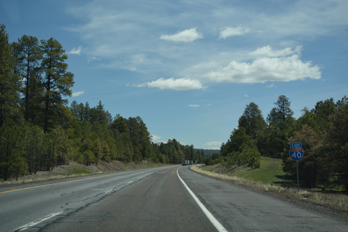
Interstate 40 arcs southeast across Bellemont Flat to the diamond interchange (Exit 185) with Transwestern Road.
04/27/17

04/27/17

Suburban development including the subdivisions of Flagstaff Meadows and Shadow Mountain Village spread east from the exchange at Exit 185 along Shadow Mountain Drive.
04/27/17
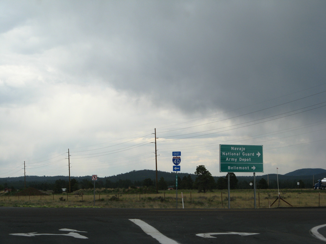
The U.S. Army built the Navajo Army Depot in 1942 for weapons storage. The former depot was transferred to the Arizona National Guard and renamed to Camp Navajo.
06/29/08

04/27/17

04/27/17
04/27/17

04/27/17
04/27/17

04/27/17

The Arizona divide marks where the watershed of the Little Colorado River breaks away from Verde River. This is the highest point on Interstate 40, and after a 1941 realignment, was the highest point on old U.S. 66 at 7,335 feet.
04/27/17
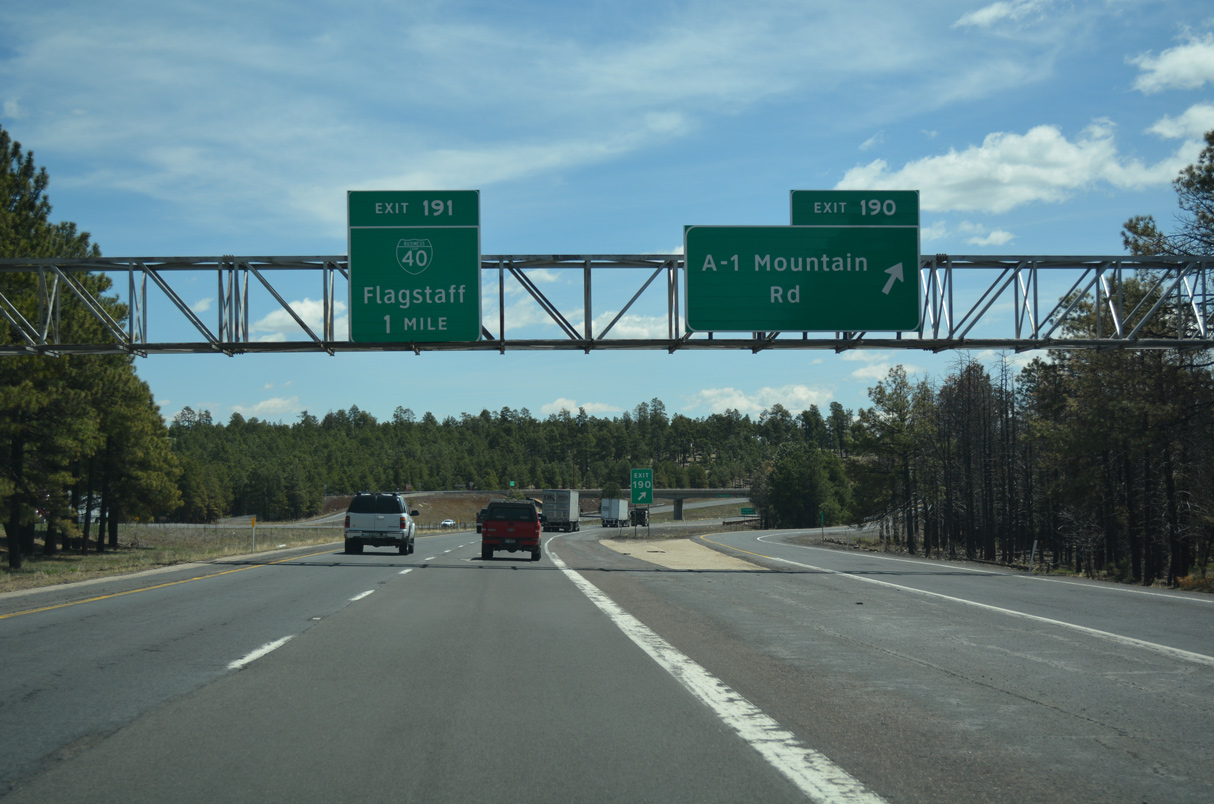
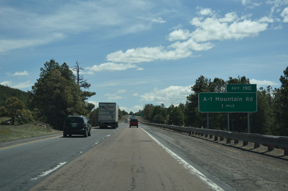
A-1 Mountain Road spurs north from Exit 190 to the A-1 Ranch development and unpaved roads to A-1 Mountain.
04/27/17

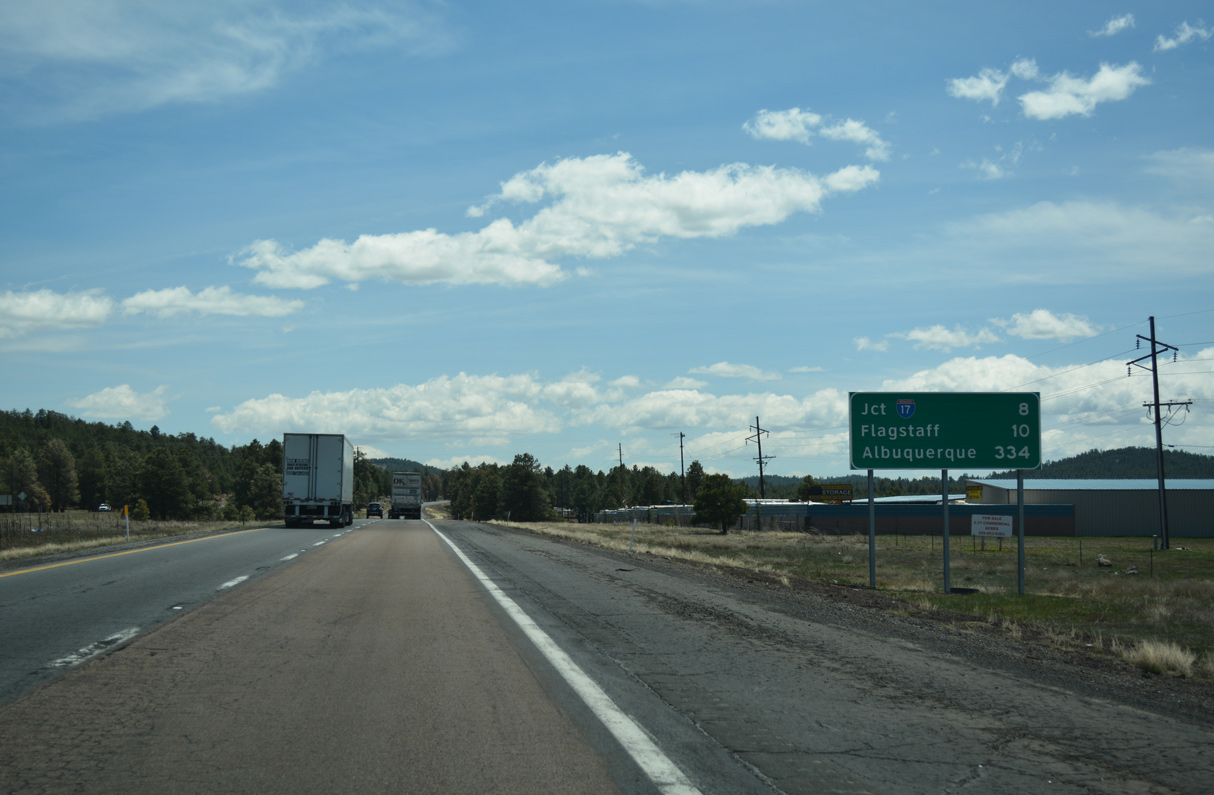
Business Loop I-40 heads 5.10 miles east from the folded diamond interchange at Exit 191 to connect with U.S. 180 west to the Grand Canyon.
04/27/17

Business Loop I-40 is the first of five exits from Interstate 40 to the city of Flagstaff.
04/27/17

Interstate 40 takes a southerly course around Flagstaff while Business Loop I-40/Historic U.S. 66 lead east directly to Downtown.
04/27/17
04/27/17

04/27/17
04/27/17

04/27/17

04/27/17

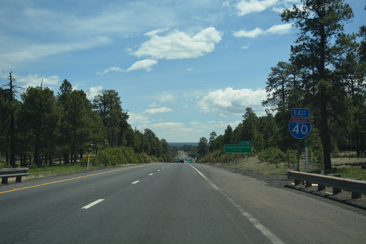
I-40 converges with the SR 89A and the north end of Interstate 17 at a cloverstack interchange (Exit 195) in two miles.
04/27/17

SR 89A separates with I-17 south at the succeeding exit to Sedona.
04/27/17

Interstate 17 travels 145.97 miles south to I-10/U.S. 60 at Downtown Phoenix.
04/27/17
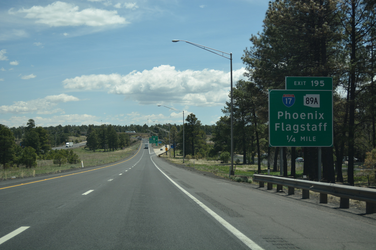
SR 89A extends 1.23 miles north from Interstate 17 along Milton Road to Historic U.S. 66/Business Loop I-40 ahead of Downtown Flagstaff.
04/27/17
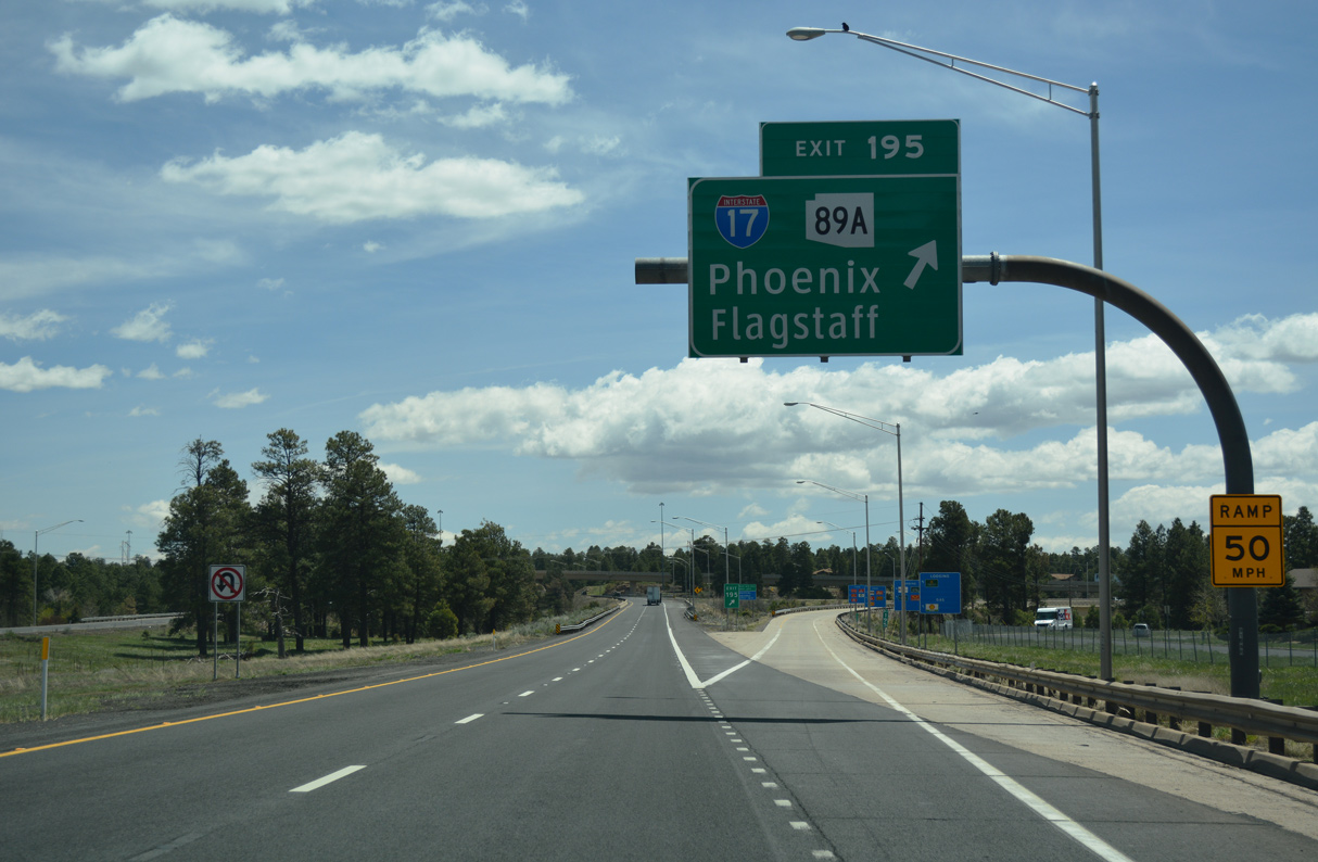
Exit 195 departs I-40 east for I-17/SR 89A south to Phoenix and SR 89A north to Northern Arizona University and U.S. 180 for the Grand Canyon.
04/27/17
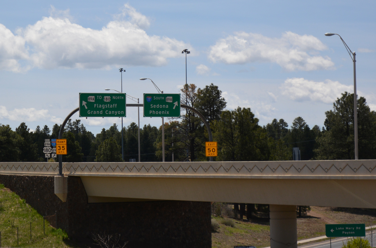
The original cloverleaf interchange joining I-40/17 was rebuilt in 1998-2000.
04/27/17

04/27/17
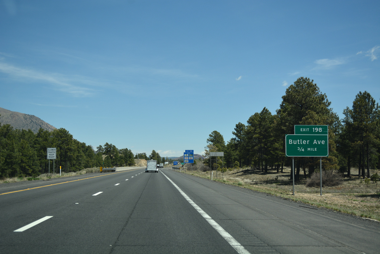
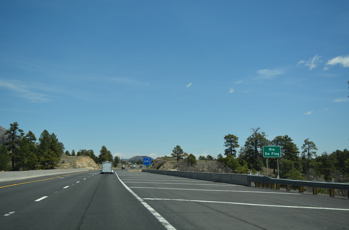
Butler Avenue heads east from the Southside Neighborhood in Flagstaff to a diamond interchange with Interstate 40 at Exit 198.
04/27/17
04/27/17

04/27/17

04/27/17

04/27/17

04/27/17

Continuing by the Aspen Valley Golf Club community, I-40 converges with the east end of Business Loop I-40 from Flagstaff in 1.25 miles at Exit 201. U.S. 89 was truncated northward to Flagstaff in 1992, with signage removed south of the city by 1993.
04/27/17

Exit 201 connects with Business Loop I-40 (Country Club Drive) west over the BNSF Railroad to the south end of U.S. 89 at Historic U.S. 66. Constructed in 1968 as a trumpet interchange, the exchange at Exit 201 was reconfigured into a diamond in 2006-07.
04/27/17

U.S. 89 travels 137.99 miles north from Business Loop I-40/Historic U.S. 66 in Flagstaff to the Utah state line north of Page. Unsigned at Exit 201, U.S. 180 also combines with Interstate 40 east here for a long overlap to Holbrook.
04/27/17

Exit 201 departs Interstate 40 east for Business Loop I-40 west to U.S. 89 north for Page and Glen Canyon Dam and U.S. 180 northwest to the Grand Canyon.
04/27/17
 East
East
U.S. 180 combines with Interstate 40 east for 84.02 miles between Flagstaff and Business Loop I-40 at Holbrook.
04/27/17

Albuquerque, New Mexico is 318 miles east from Flagstaff along Interstate 40.
04/27/17

The diamond interchange at Exit 204 connects I-40 with Walnut Canyon Road south and the east end of the continuous segment of Historic U.S. 66 through Flagstaff.
04/27/17

Located three miles south of Exit 204, Walnut Canyon is a small monument that preserves unique Sinagua cliff dwellings.
04/27/17

04/27/17

04/27/17

Advancing east past Wildcat Canyon, I-40/U.S. 180 meet Cosnino Road at Exit 207 in one mile.
04/27/17
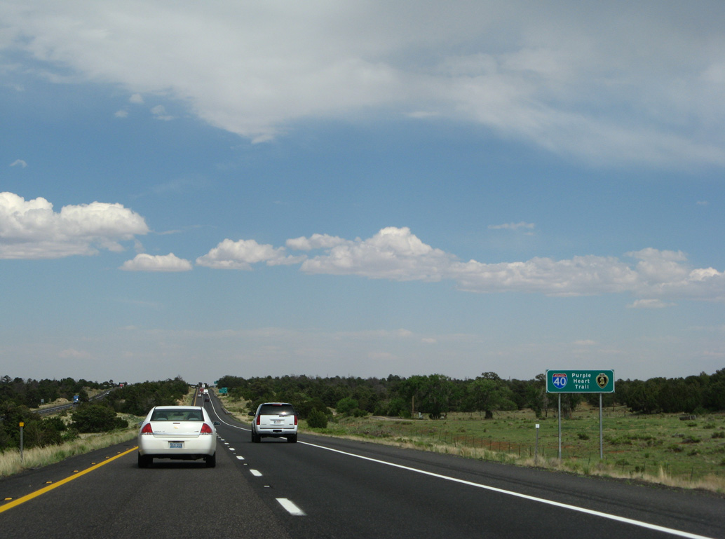
Interstate 40 remains signed as the Purple Heart trail throughout Arizona.
06/28/08

Cosnino Road is County Route 510C north 2.20 miles to Townsend-Winona Road (CR 510).
04/27/17

Restricted to trucks under 13 tons, a parclo interchange joins Interstate 40 and Cosnino Road (CR 510C) at Exit 207.
04/27/17

The former Walnut Canyon Rest Area is located beyond these confirming markers posted east of Cosnino Road. The facility closed in 1997.
04/27/17

Distance sign to Winona (3 miles), Winslow (46 miles) and Albuquerque (312 miles).
04/27/17

Photo Credits:
06/28/08, 06/29/08, 04/27/17 by AARoads
Connect with:
Interstate 17
Business Loop I-40 - Flagstaff
U.S. 89
U.S. 180
State Route 89A
Page Updated 03-31-2022.