|
| Interstate 76 branches north from I-70 at a wye interchange. I-70 stays east into Denver, while I-76 curves north to meet SH 95 (Sheridan Boulevard) at Exit 1B. 08/11/16 |
|
| The first confirming marker stands by the Marshall Street underpass as I-76 reduces to two eastbound lanes. 08/11/16 |
|
| The initial stretch of I-76 parallels Clear Creek to unincorporated areas of Adams County. 08/11/16 |
|
| SH 95 (Sheridan Boulevard) leads north from the diamond interchange (Exit 1B) with Interstate 76 to Westminster, where it ends at U.S. 36 (Denver Boulder Turnpike). South from Exit 1B, the principal arterial straddles the Denver city and Jefferson County line to U.S. 285. 08/11/16 |
|
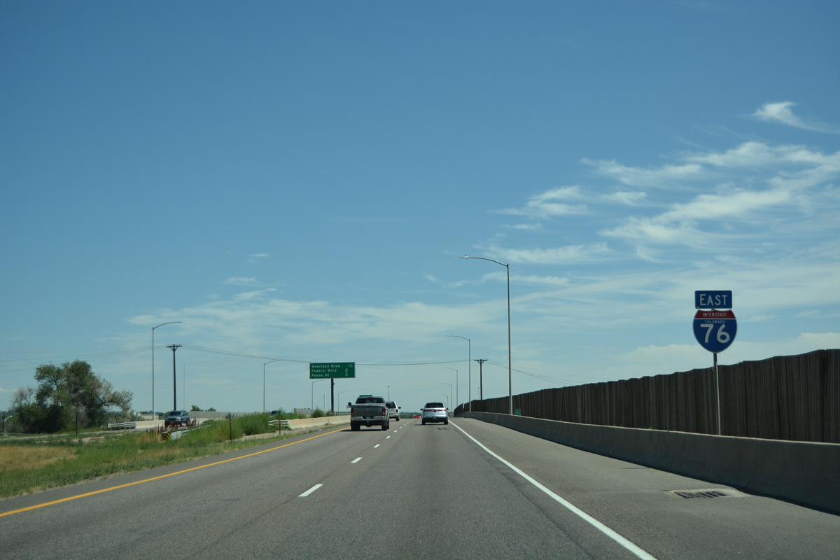
| Passing over Tennyson Street, motorists on Interstate 76 east next reach Exit 3 with U.S. 287 (Federal Boulevard) in 1.25 miles. 08/11/16 |
|
| The freeway traverses the Lowell Ponds State Wildlife Area alongside Clear Creek ahead of U.S. 287 (Exit 3). 08/11/16 |
|
| Interchange sequence sign outlining the forthcoming diamond interchange (Exit 3) with U.S. 287 and Exit 5 with Interstate 25. 08/11/16 |
|
| U.S. 287 (Federal Boulevard) constitutes an arterial from Business Loop I-70/U.S. 40 (Colfax Avenue) in west Denver north to Westminster, Federal Heights and SH 128 (120th Avenue) near Broomfield. 08/11/16 |
|
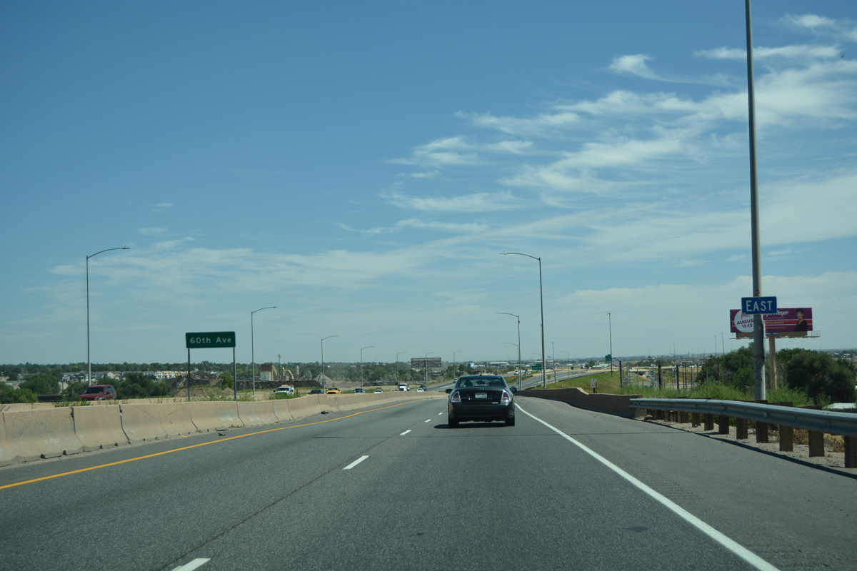
| Advancing northeast, I-76 enters an industrial area at Pecos Street (Exit 4) in one half mile. Directional cloverleaf interchanges with I-25 and I-270 follow. 08/11/16 |
|
| The freeway spans Union Pacific Railroad tracks, 60th Street, and a BNSF Railroad line on the northern shift between Exits 3 and 4. 08/11/16 |
|
| Pecos Street leads north from the diamond interchange (Exit 4) with Interstate 76 to U.S. 36 (Denver Boulder Turnpike) and the city of Thornton and south to Chaffee Park and Sunnyside in Denver. 08/11/16 |
|
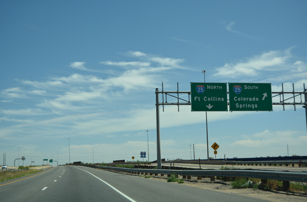
| Interstate 25 heads north from the Globeville neighborhood of Denver to converge with I-76 in unincorporated Adams County. The busy commuter freeway is ten lanes wide plus two tolled express lanes. 08/11/16 |
|
| Eastbound reassurance marker posted ahead of the 62nd Avenue overpass. Industrial businesses and junk yards line both sides of the freeway to I-25. 08/11/16 |
|
| The Pecos Street on-ramp forms an auxiliary lane to Interstate 25. All traffic bound for I-25 north to Fort Collins and south through Denver to Colorado Springs departs in unison in one half mile. 08/11/16 |
|
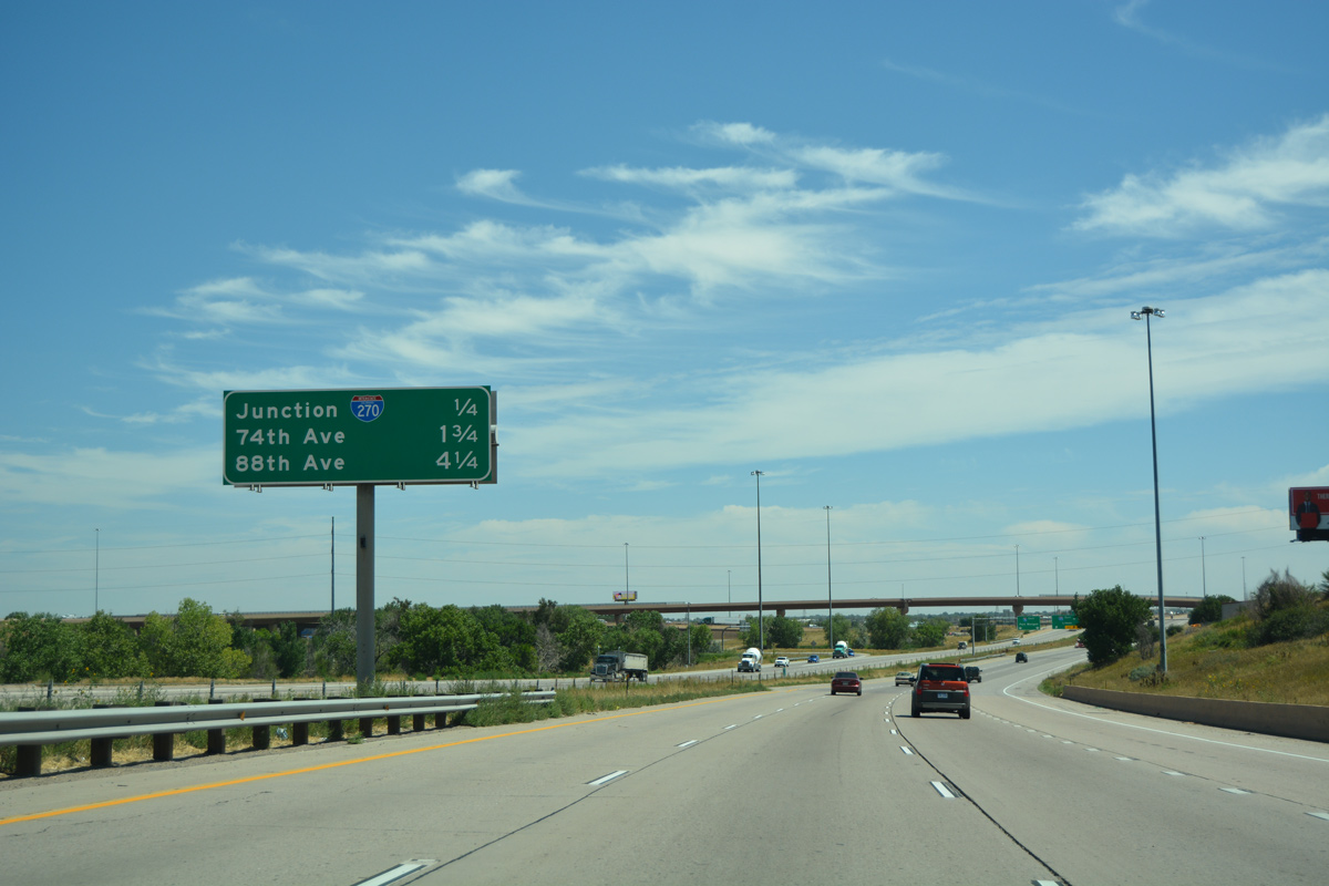
| Interstate 270 begins from I-25 and U.S. 36 (Denver Boulder Turnpike) to the immediate north of I-76. The urban loop crosses Interstate 76 at the ensuing exchange en route to southwest Commerce City. 08/11/16 |
|
| Prior to 1989 construction to complete I-76 east to I-25, a trumpet interchange joined the two freeways. Interstate 76 fully opened to traffic at Exit 5 on September 15, 1993.1 08/11/16 |
|
| Traffic from I-76 east separates for Interstate 25 south through the North Washington industrial area toward the Denver Central Business District and north to the suburbs of Thornton, Northglenn and Westminster. 08/11/16 |
|
| Interstate 270 travels 7.09 miles southeast to I-70 at Stapelton in east Denver. U.S. 36 overlays the route, but is unsigned. 08/11/16 |
|
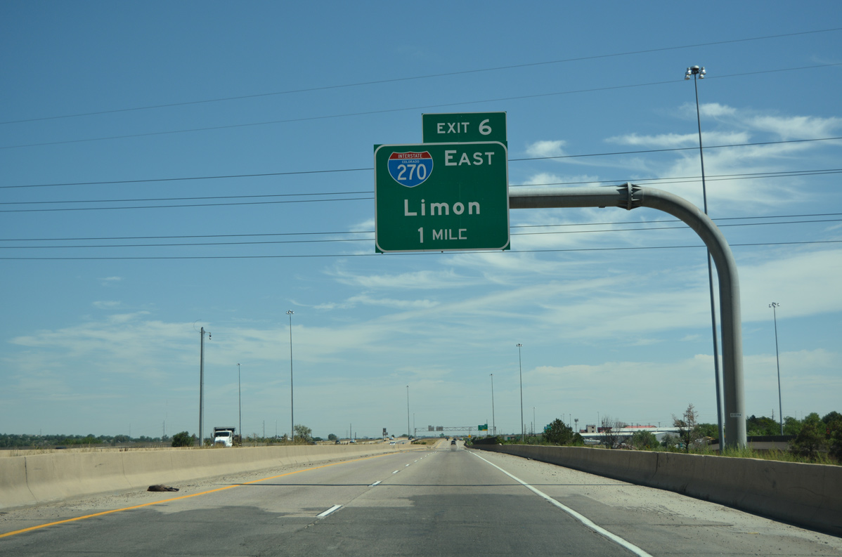
| The eastbound freeway expands to four lanes ahead of Exit 6 for I-270 east. Limon is the control point for the continuation of Interstate 70 beyond Aurora and the Denver metropolitan area. 08/11/16 |
|
| Interests to Denver International Airport (DEN) are directed along I-270 and I-70 east to Pena Boulevard. Pena Boulevard is a locally maintained freeway connecting I-70 north through the Gateway/ Green Valley Ranch area to the airport passenger terminal. 08/11/16 |
|
| Beyond I-270, Interstate 76 shifts northward again between Thornton and Commerce City, meeting SH 224 and U.S. 6-85. 08/11/16 |
|
| Exit 6 departs for Interstate 270 east through Commerce City. There is no access to westbound as the movement is counter intuitive. When I-270 was completed in 1970, a trumpet interchange joined the two freeways here. Construction of the extension west to I-25 between June 2000 and August 2003 included a $21 million revamp of the exchange.2 08/11/16 |
|
| Continuing east from I-270, Interstate 76 crosses the South Platte River as it flows north to Brighton. 08/11/16 |
|
| An auxiliary lane opens along eastbound to the half diamond interchange (Exit 8) with SH 224 (74th Street). 04/22/17 |
|
| Interstate 76 combines with U.S. 6-85 beyond 74th Street ahead of 88th and 96th Avenues to Commerce City. 04/22/17 |
|
| Passing over a Union Pacific Railroad line, Exit 8 leaves I-76 east for SH 224 (74th Street). SH 224 travels just 3.63 miles as a minor arterial west to SH 53 (Broadway) and east to U.S. 6-85 (Vasquez Boulevard). 04/22/17 |
|
| Exit 8 partitions for SH 224 (74th Street) west across the South Platte River into unincorporated Welby and east into Commerce City. 08/11/16 |
|
| Interstate 76 traverses an area of wetlands west of Burlington Ditch and east of Thornton Lakes beyond SH 224. 04/22/17 |
|
| A wye interchange brings U.S. 6/85 north onto I-76 east. 04/22/17 |
|
| Interstate 76 expands to six overall lanes east to Exit 10 with 88th Avenue. 04/22/17 |
|
| Entering the diamond interchange (Exit 10) with 88th Avenue. 88th Avenue leads east to SH 2 at Rocky Mountain Arsenal National Wildlife Refuge and west across Thornton. 04/22/17 |
|
| Forthcoming 96th Avenue follows the northern boundary of Rocky Mountain Arsenal National Wildlife Refuge by suburban areas of north Commerce City to Buckley Road. The road connects with the E-470 beltway at Exit 31 outside Denver International Airport (DEN). 04/22/17 |
|
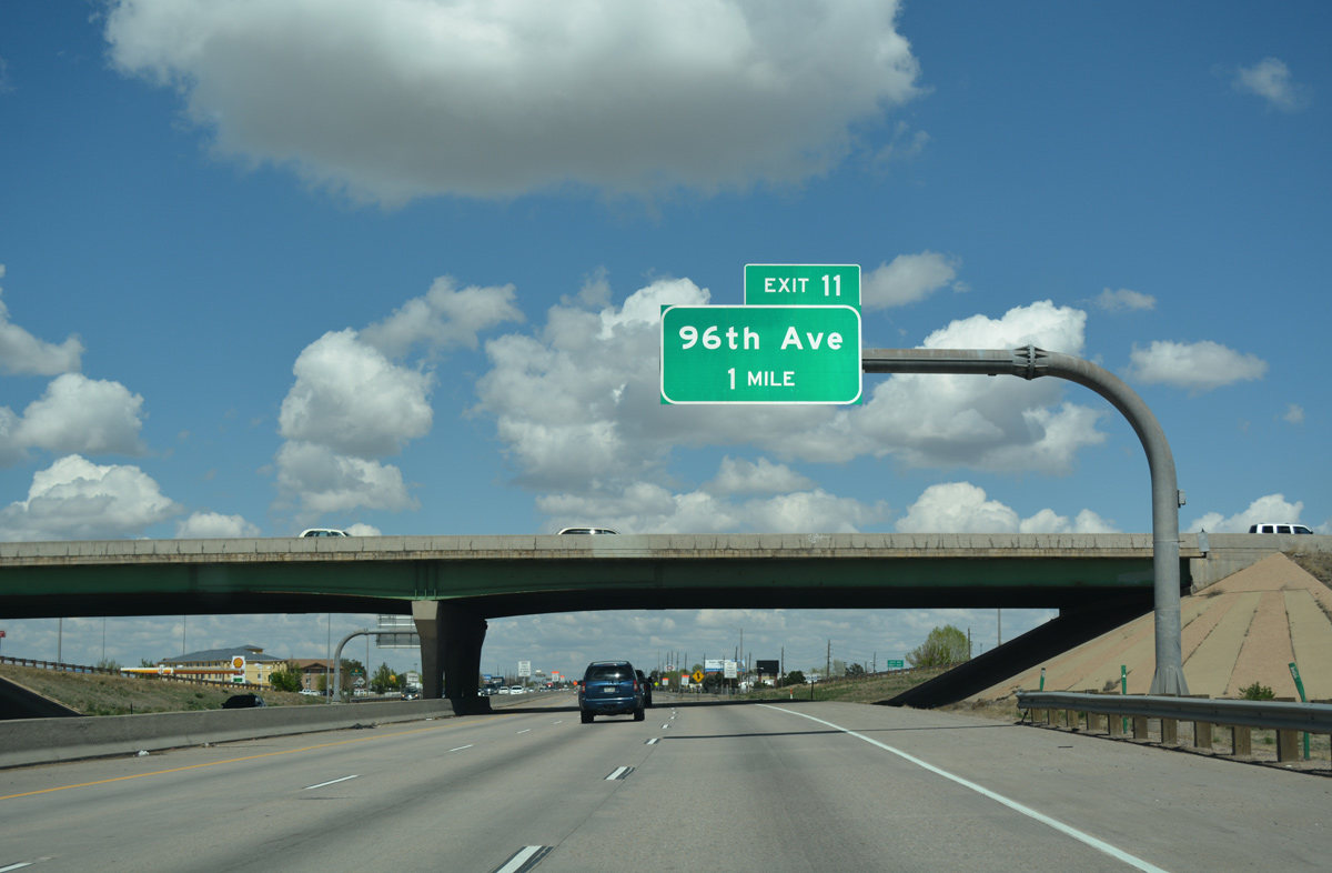
| Interstate 76 and U.S. 6-85 advance north one quarter mile to 96th Avenue (Exit 11). 04/22/17 |
|
| 96th Avenue ties into Monaco Street just to the west of Exit 11. Monaco Street spans the South Platte River to McKay Road in east Thornton. 08/29/04 |
|
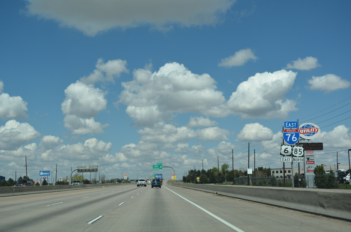
| U.S. 85 emerges from I-76/U.S. 6 east at the succeeding exit after 96th Avenue. U.S. 85 is a major route through Northern Colorado. Beyond Brighton, U.S. 85 travels to Fort Lupton, Ione, Platteville, Greeley, Eaton and Ault as an expressway-grade facility. Business routes serve the downtown areas of most cities and towns along the way. This changes north of Ault, where traffic thins substantially, and U.S. 85 narrows to two lanes. 04/22/17 |
|
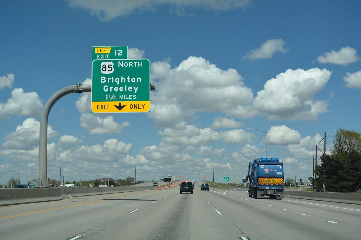
| Advancing to the wye interchange (Exit 12) with Canam Highway and the continuation of U.S. 85 north through Brighton. Construction underway from October 2016 to late 2017 / early 2018 improved the geometry of the westbound curve along I-76 where it combines with U.S. 85 south. Resurfacing with new concrete, drainage improvements and lighting changes were included in the $10 million project.3 04/22/17 |
|
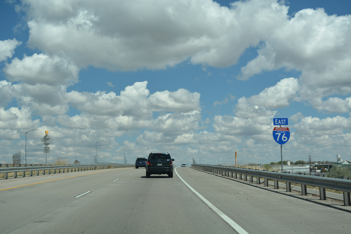
| I-76 spans a Union Pacific Railroad line east of U.S. 85. I-76 separates from the South Platte River between the split with U.S. 85 at north Commerce City and Fort Morgan. The South Platte River follows U.S. 85 north to Greeley, then turns east along U.S. 34 and SH 144 to Fort Morgan. 04/22/17 |
|
| I-76/U.S. 6 become more rural as they parallel Burlington Ditch and O'Brian Canal. Several subdivisions still appear along the corridor through Brighton. Long distance travelers reach Fort Morgan in 66 miles and Sterling in 114 miles. A previous sign here listed Brush at 76 miles in place of Sterling. 04/22/17 |
|
| The speed limit on eastbound Interstate 76 increases to 75 miles per hour just ten miles east of I-25. 08/29/04 |
|
| SH 44 (104th Avenue) crosses over I-76/U.S. 6 ahead of milepost 14. SH 44 runs 4.96 miles from Colorado Boulevard in Thornton to SH 2 in Commerce City. 04/22/17 |
|
| A diamond interchange joins I-76/U.S. 6 with Sable Boulevard at the ensuing exit. Sign changes made at Exit 16 greened out SH 2, as only a 0.44 mile segment of the route remains between O'Brian Canal and the exchange with I-76. SH 2 previously ran south through Commerce City to Denver. 04/22/17 |
|
| There is no direct connection from Interstate 76 east to the E-470 toll road. Motorists are directed to follow Sable Boulevard north from Exit 16 to 120th Avenue east. 04/22/17 |
|
| 120th Avenue extends east to E-470 at Exit 34 in north Commerce City and west across Thornton and North Glenn to become SH 128 and U.S. 287 through north Westminster. 04/22/17 |
|
| Previously there were two trumpet interchanges here: Exit 16 to SH 2 south and Exit 17 for SH 51 (Sable Boulevard) north. SH 2 overtook SH 51 along Sable Boulevard north to SH 7 (Bridge Street) in Brighton. The extension was later turned back north of I-76. 04/22/17 |
|
| I-76/U.S. 6 pass below E-470 at milepost 18. The outer beltway loops west to I-25 at Northwest Parkway at Broomfield and south by Denver International Airport (DEN) to Aurora and I-25 at C-470 at Lone Tree. 04/22/17 |
|
| The flyover from northbound E-470 to I-76 east was completed in 2003. A loop ramp also provides direct access to E-470 south from I-76 west. 04/22/17 |
Page Updated 05-10-2017.

 East
East


 East
East  North
North