|
| With the pavement change, Interstate 80 departs Utah and enters Wyoming. This line also marks the departure from Utah's Summit County and entrance into Wyoming's Uinta County. With its seat of Evanston, Uinta County had a population of 21,118 as of the 2010 census and predates Wyoming statehood, as the territorial legislature created the original (and much larger) Uinta County in 1869 (statehood for Wyoming occurred in 1890). It shrunk to its current size in 1911, when Lincoln County was carved away from Uinta County. 08/05/13 |
|
| U.S. 189, which was previously unsigned where concurrent with Interstate 80 in Utah until 2018, resumed as a signed route at the state line. This had been the case at least since 1990 and likely earlier. Interstate 80 and U.S. 189 overlap past Evanston and part ways near Piedmont at Exit 18. 08/05/13 |
|
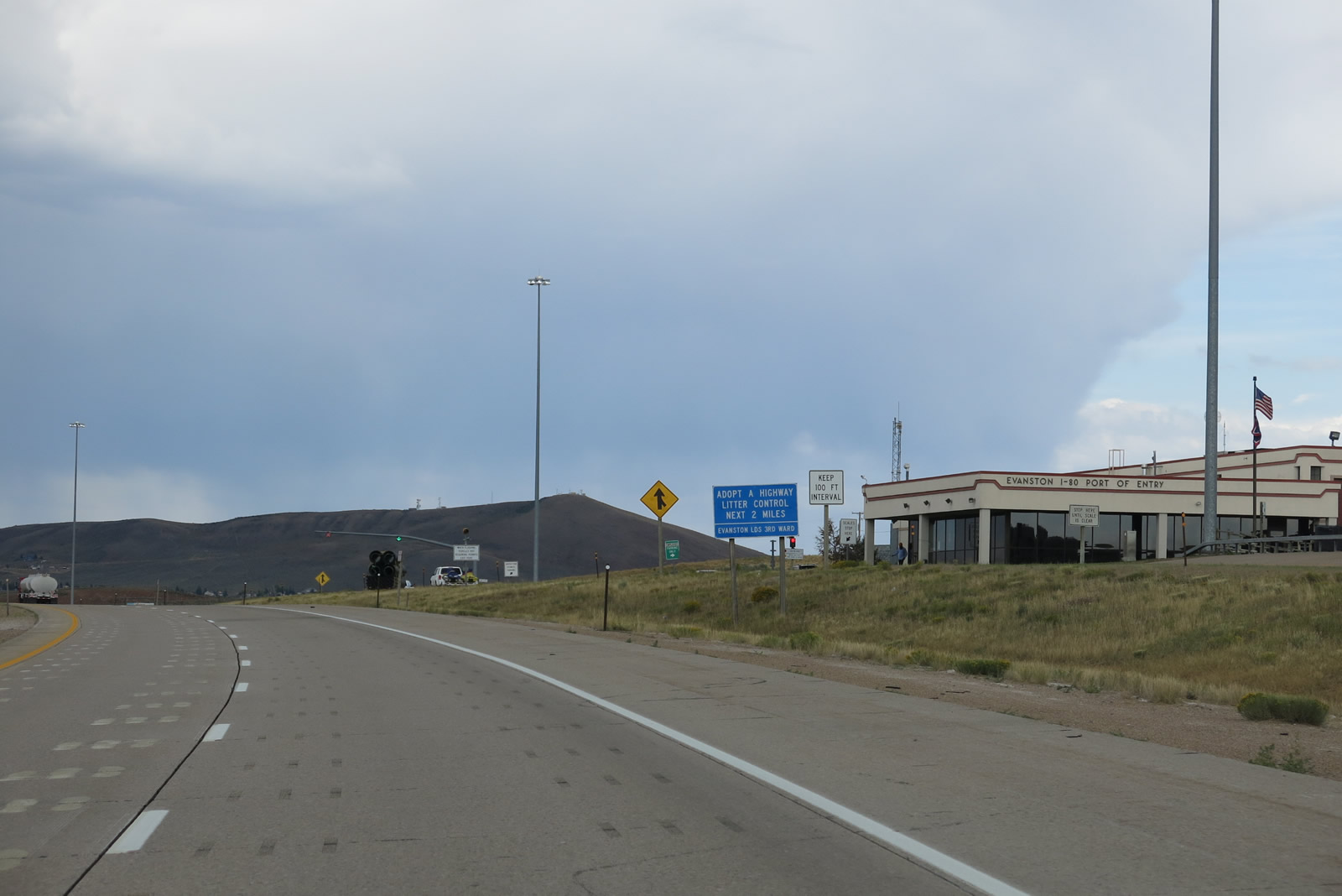
| The Evanston Port of Entry lies beyond the entrance into Wyoming and is a weigh station for commercial vehicles only. 08/05/13 |
|
| 'Forever West' is the standard slogan affixed to welcome signs throughout the Equality state. 07/30/16 |
|
| This distance sign along Interstate 80 east and U.S. 189 north provides the distance to Evanston (four miles) and Rock Springs (106 miles). 08/05/13 |
|
| The next three exits along Interstate 80 east and U.S. 189 north serve the city of Evanston. Evanston incorporated initially in 1868 (to coincide with the arrival of the Union Pacific Railroad) and again in 1888. The city had a population of 12,359 as of the 2010 census. It is named in honor of James Evans, a surveyor for the Union Pacific Railroad (see more here). The city sits at an elevation of 6,749 feet above sea level, which is comparable to the high elevation of many cities and towns along I-80 across the southern tier of Wyoming. 08/05/13 |
|
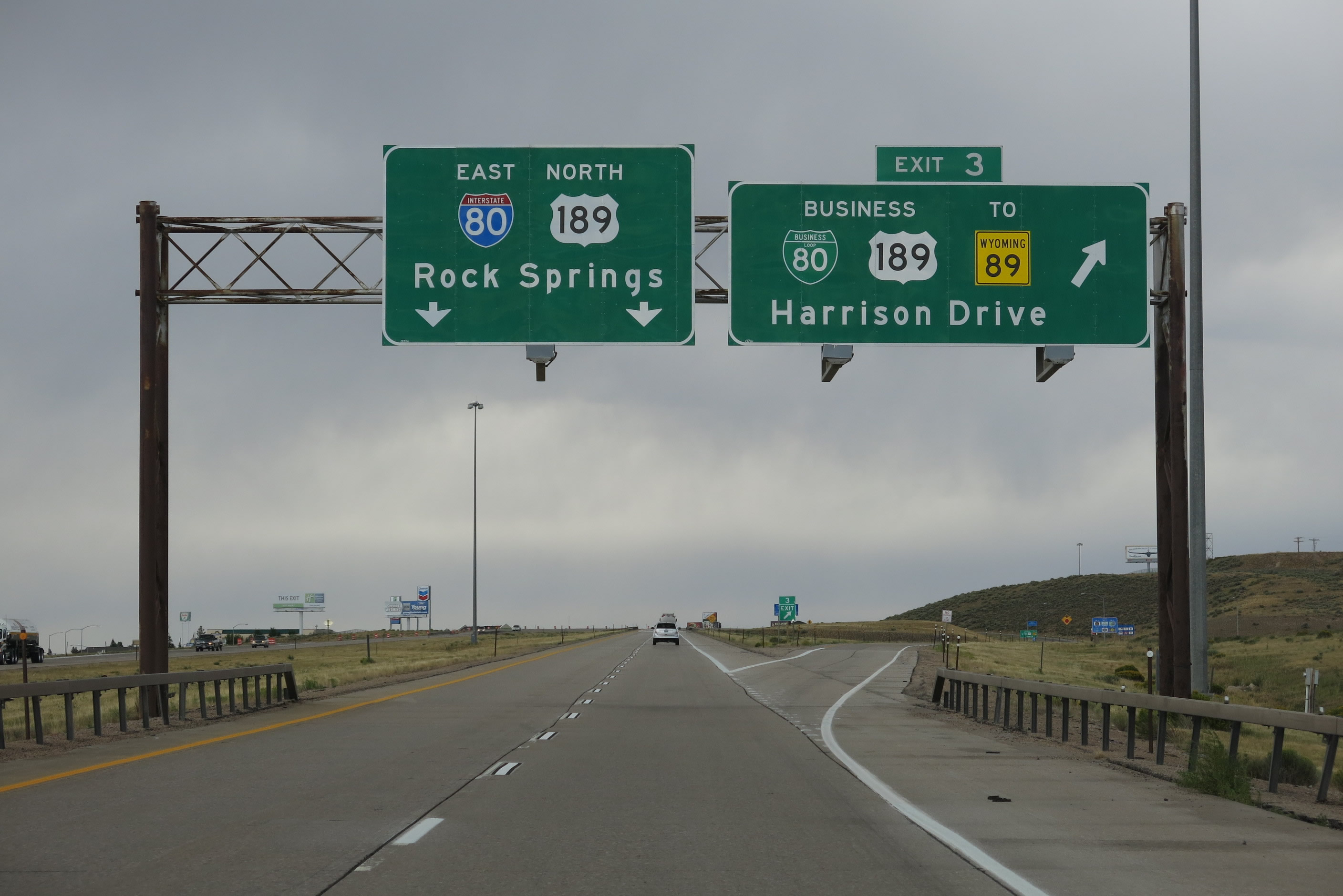
| Exit 3 is the western terminus of the business route that loops from Interstate 80 east and U.S. 189 north through the city of Evanston via Harrison Street, Front Street, Sixth Street, and Bear River Drive. While these two routes are signed continuously together along the business route, they briefly overlap a short segment of Wyoming 89 along Sixth Street. 08/05/13 |
|
| Use Overthrust Road south to the Western Wyoming College outreach center. 08/05/13 |
|
| Use Exit 3 for all motorist services (food, gas, and lodging) via Business Loop 80 and Business U.S. 189 in Evanston. 08/05/13 |
|
| Included within the National Registry of Historic Places, Downtown Evanston, located along Business 80-U.S. 189 along Front Street, is notable for its many older buildings, including several that date to the 1880s through 1930s. An economy based on coal and oil helped fuel the development of Evanston downtown. Today, many of the original buildings are being preserved to keep these assets intact for future generations to enjoy. 08/05/13 |
|
| WYO 89 is signed as one of several routes from I-80 north to Jackson, Grand Teton National Park, and Yellowstone National Park. Other routes signed in a similar manner along the I-80 corridor include the combination of U.S. 30 and WYO 89, U.S. 189, U.S. 191, and U.S. 287. WYO 89 travels north along Front Street toward Bear River. Northwest of Bear River, it cuts into Utah (becoming SR 16 and SR 30) before reentering Wyoming and following U.S. 30 north to Cokeville. Just before U.S. 30 crosses into Utah, WYO 89 proceeds north before crossing into Idaho. Near Geneva, the highway links with U.S. 89, which proceeds north to Jackson. 08/05/13 |
|
| Eastbound I-80 and U.S. 189 meet Exit 3 for Business Loop I-80 and Business U.S. 189 (Harrison Drive) east to downtown Evanston. Although the guide sign points to Wyoming 89, one can continue east along Interstate 80 to Exit 5 for a direct connection to Wyoming 89 north and Wyoming 150 south. Many hotels and motels are clustered around this interchange, more than the eastern business loop interchange (Bear River Drive). 08/05/13 |
|
| Business Loop 80 and Business U.S. 189 follow Harrison Drive east from I-80 toward downtown Evanston. Overthrust Street extends south from the freeway to Yellow Creek Road. Eventually, Yellow Creek Road connects with Chalk Creek Road, which travels to Coalville, Utah along a road that is not entirely paved.
It is arguable whether Exit 3 or 5 is a better path to WYO 89 north to Bear River, Afton (Star Valley), and Jackson. This sign was replaced in 2014. 08/05/13 |
|
| Here is the replacement sign for the offramp at Exit 3. The green business loop shield was replaced with a "Business Interstate 80" tricolor shield. 08/01/16 |
|
| The next interchange serves WYO 150, which follows the Mirror Lake Scenic Byway south into Utah and Uinta-Wasatch-Cache National Forest. This scenic route offers stunning views of the High Uinta Mountains, but it is only open in summer south of the Wyoming-Utah state line. The route passes by Mirror Lake and other alpine lakes as it ascends to an elevation of 10,687 feet above sea level at Bald Mountain Pass. From there, SR 150 travels southwest toward Kamas, where it meets SR 32. 08/01/16 |
|
| A confirming route assembly is posted after the onramp from Harrison Drive (Business 80) and Overthrust Road. Unlike Utah, both Interstate 80 and U.S. 189 are signed together on their shared alignment. 08/01/16 |
|
| One half mile ahead of Exit 5 for Wyoming 89-150 (Front Street) north to downtown Evanston and Jackson, and Wyoming 150 (Mirror Lake Scenic Byway) to Bald Mountain Pass and Kamas, Utah. WYO 89 and WYO 150 overlap for the five blocks between I-80 and Business 80 (Sixth Street). At Sixth Street, WYO 150 ends and WYO 89 proceeds northeast along with Business 80 and Business U.S. 189 toward Bear River. 08/01/16 |
|
| Wyoming became a state on July 10, 1890. As the former territory began to identify services necessary for a nascent state, state leaders plotted out locations for necessary services. In that effort, Cheyenne became the state capital, Laramie became the home of the University of Wyoming, Rawlins received the state penitentiary, Douglas became the home of the state fairgrounds, and state miner's hospital at Rock Springs. Evanston became home to the state "insane asylum," which later became the "state hospital" listed on this auxiliary sign on Exit 5.1 The state hospital is located just south of the interchange on the east side of WYO 150. 08/05/13 |
|
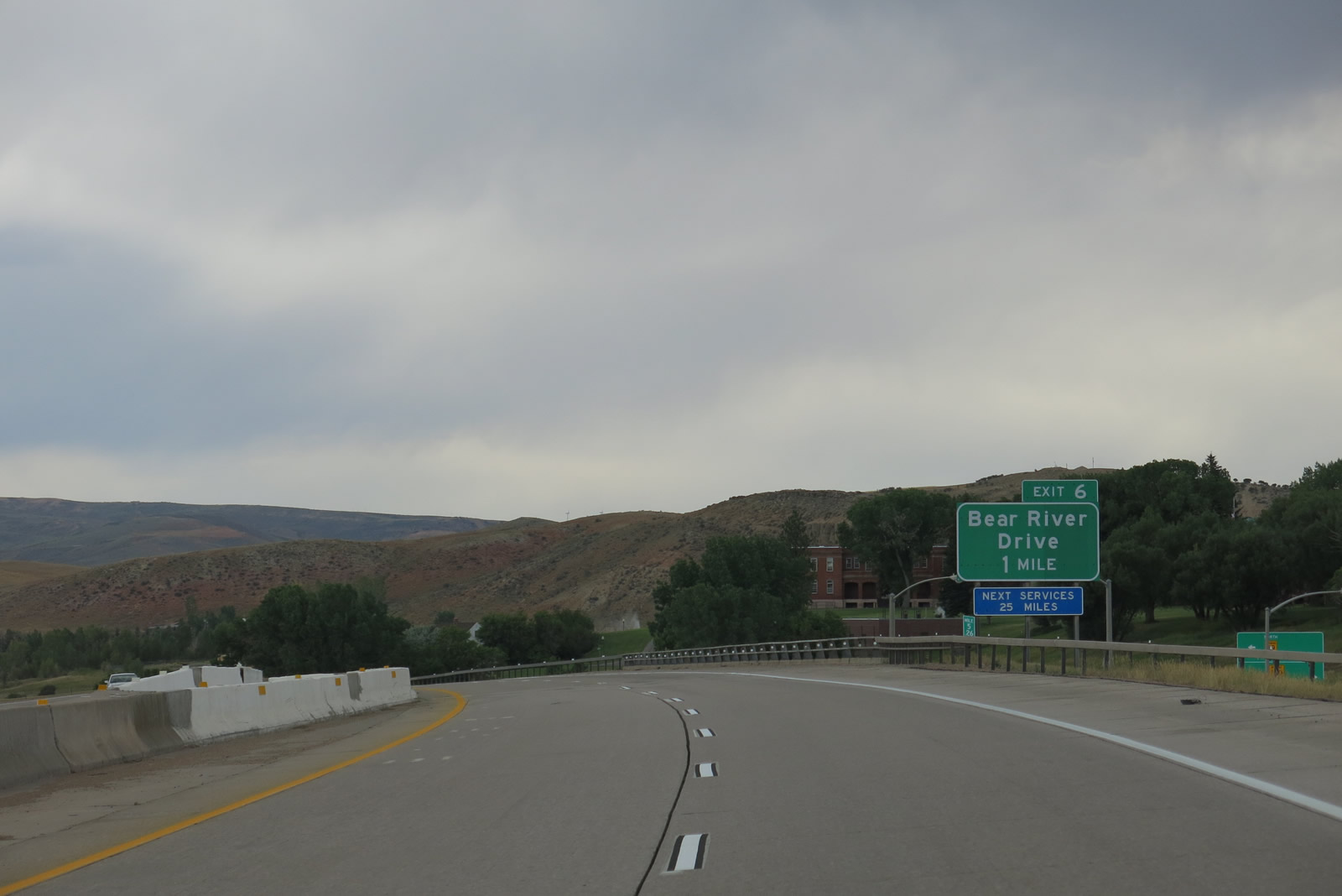
| The third and final Evanston interchange (Exit 6) provides access to Bear River State Park. This state park offers a trail system located alongside the scenic Bear River, as well as a penned area for bison viewing, a recreational play area for children, and restrooms. 08/05/13 |
|
| Entering the diamond interchange (Exit 5) with Wyoming 89-150 (Front Street) north and Wyoming 150 (Mirror Lake Scenic Byway) south on I-80 east & U.S. 189 north. All motorist services are available at Exit 5, especially on the north side of the freeway. 08/01/16 |
|
| The exit sign for Wyoming 89-150 was replaced between 2013 and 2016, with the newer sign utilizing Clearview font. 08/05/13 |
|
| Business Loop I-80 east and Business U.S. 189 south return to I-80 at forthcoming Exit 6 via Bear River Drive. 08/01/16 |
|
| Replaced guide sign for Bear River Drive (Exit 6) on I-80 east. 08/05/13 |
|
| This is a rare glimpse of no traffic in either direction along Interstate 80 at the point where it crosses over Front Street in Evanston. 08/05/13 |
|
| Another reassurance shield assembly for Interstate 80 east and U.S. 189 north is posted after the onramp from Front Street in Evanston. 08/05/13 |
|
| Exit 6 serves the State of Wyoming Information Center (welcome center). With a flurry of maps, brochures, and friendly travel advice, the visitor information center is a good stopping point for out of state travelers coming into Wyoming. 08/05/13 |
|
| Exit 6 joins I-80 & U.S. 189 with Business Loop I-80 west & Business 189 (Bear River Drive) south just across the Bear River.
The Bear River flows north from the High Uinta Mountains through the southwestern corner of Wyoming, arcs north and then west through southeastern Idaho, and bends south again to drain into the Great Salt Lake in Utah. At a length of around 350 miles, the river is the largest in the United States not to travel to the ocean. With its odd course through three states, it is shaped like an upside-down "U." 08/01/16 |
|
| A Clearview font based panel replaced this assembly at Exit 6 by 2015.
A bridge deck project over the Bear River was underway in 2016. 08/05/13 |
|
| Bear River State Park is located to the immediate south of Exit 6. Bear River Drive leads motorists west to the Uinta County Fairgrounds ahead of WYO 89. 08/01/16 |
|
| Downtown Evanton lies 1.6 miles to the west via Business Loop I-80 (Bear River Drive) and WYO 89. 08/01/16 |
|
| Leaving Evanston, Interstate 80 and U.S. 189 proceed northeasterly toward Lyman and Bridger Valley. The major feature along the way are the Three Sisters, which are low mountain ranges that separate the Bear River watershed from the Green River watershed.
The Union Pacific Railroad turns southeast around this point, and it will travel more circuitously through the Three Sisters area due to the significant mountain grades. The railroad more closely aligns with I-80 again once near the trona mines of eastern Sweetwater County. 08/01/16 |
|
| A dynamic message sign advises motorists of weather conditions and travel restrictions along Interstate 80. On this day, the sign posted a safety warning about an increased number of motorcycles traveling through Wyoming en route to the annual Black Hills Motor Classic (Sturgis Motorcycle Rally). 08/01/16 |
|
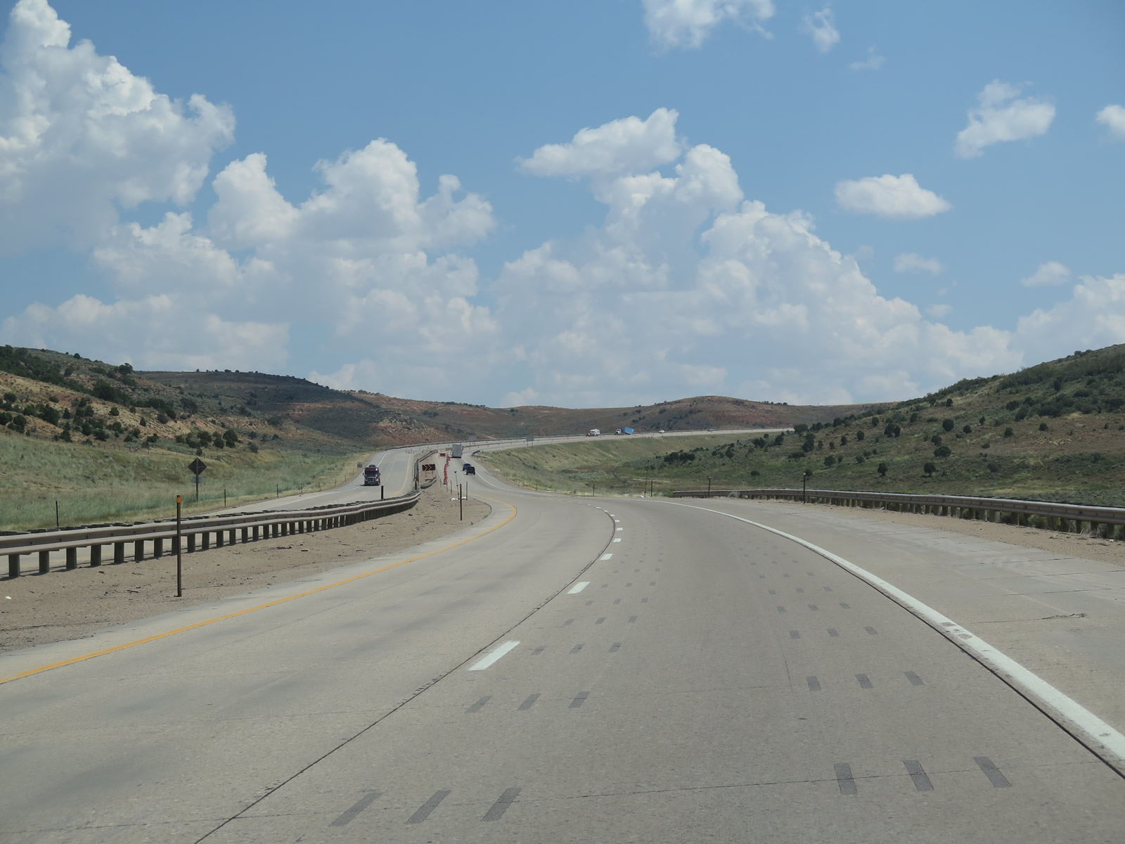
| Over the next 30 miles, Interstate 80 travels through the Three Sisters ranges, which requires significant grades up and down over the next several miles. Winter weather can be severe through the these ranges. Truck parking and a chain installation area provide a staging area for drivers eastbound at Exit 7. 08/01/16 |
|
| When the freeway ahead is closed, a turnaround allows traffic to return back to Evanston until the freeway reopens. Closures most typically happen during inclement winter weather that impedes visibility with snow and ice fog, limits roadway traction with ice, and/or produces strong winds. 08/01/16 |
|
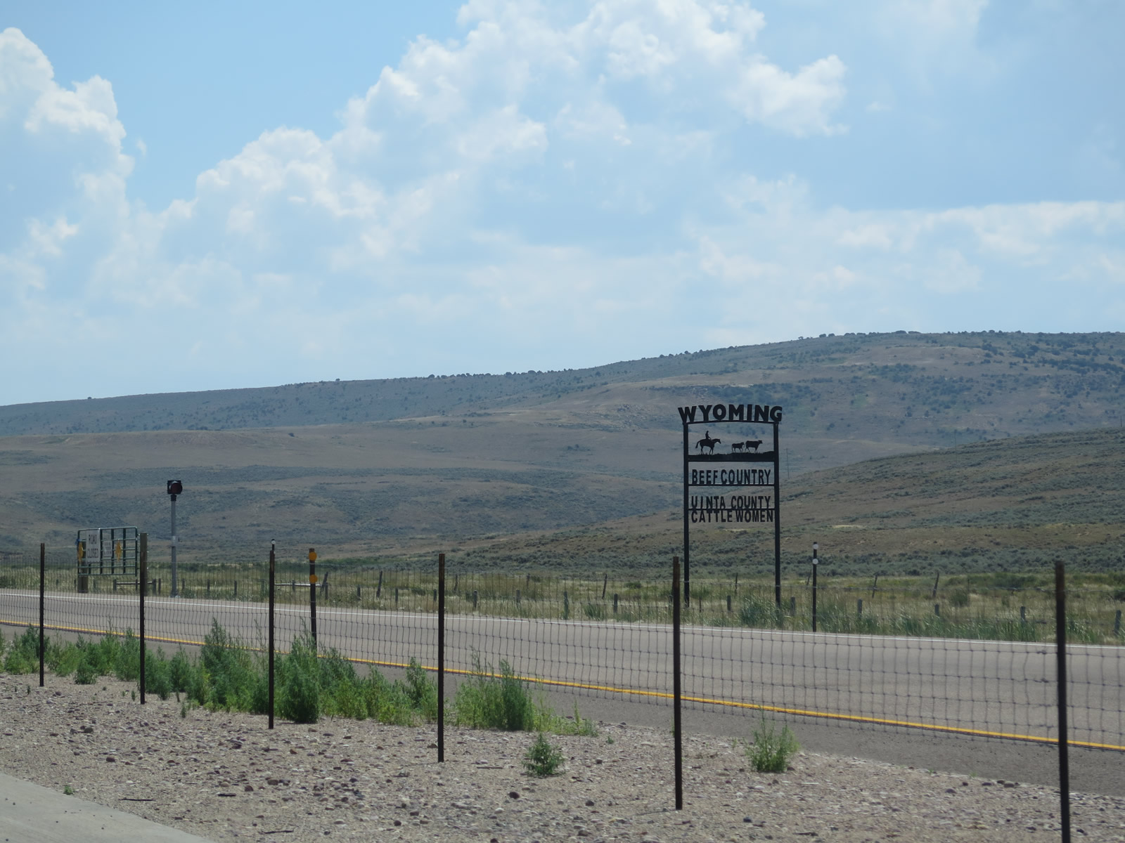
| Wyoming and Uinta County are beef country as noted by this roadside sign, which the Wyoming Cattlewomen placed. This organization supports the livestock industry and supports education about beef. Visitors can find signs like this elsewhere in Wyoming. 08/01/16 |
|
| This distance sign along Interstate 80 east and U.S. 189 north provides the distance to Lyman (35 miles) and Rock Springs (97 miles). Omitted is Green River, which is about 80 miles from here. 08/01/16 |
|
| Sinclair Oil turned 100 in 2016, and several billboards announced its birthday on I-80 across the state. While it was incorporated in 1916, company leadership reincorporated it as a Wyoming corporation in 1976. The company is currently headquartered in Salt Lake City. Motorists can find Sinclair gas stations in many major cities and towns across Wyoming. Sinclair also owns the Little America hotels found in Little America and Cheyenne in Wyoming as well as Salt Lake City and Flagstaff. 08/01/16 |
|
| The freeway remains relatively flat even as the surrounding landscape again becomes hilly. This remains the case until around Exit 10. 08/01/16 |
|
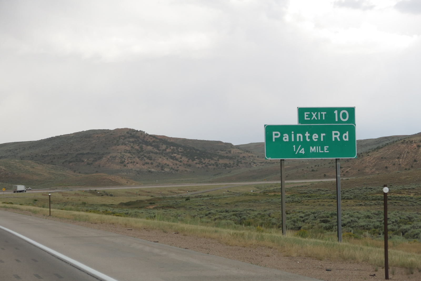
| This is the only advance sign along I-80 east for Exit 10 and Painter Road. The diamond interchange serves local, BLM and ranch access. 08/05/13 |
|
| Exit 10 departs from I-80 east & U.S. 189 north. No motorist services are available here. Connecting from the ranch exit to the south is a vintage, and popular, stretch of Old Lincoln Highway along Uinta County Route 180. 08/01/06 |
|
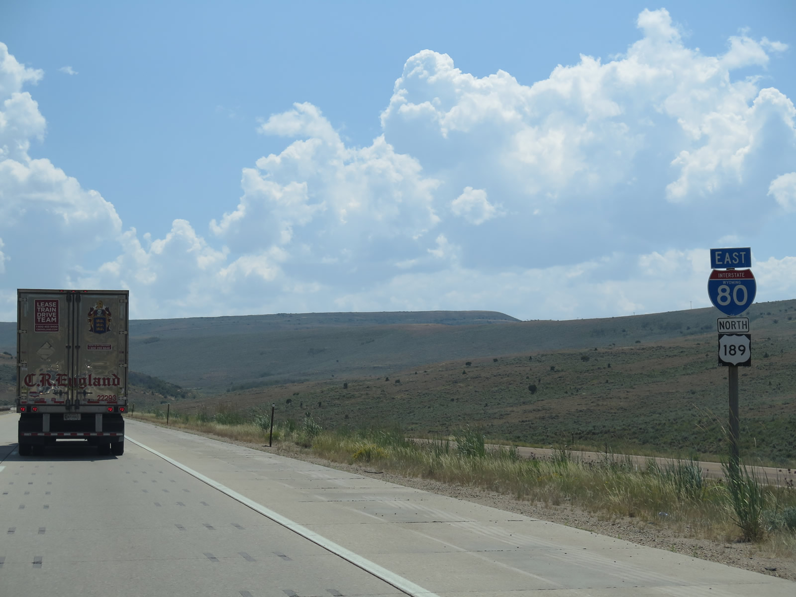
| Beyond the Painter Road interchange are reassurance confirming route markers for both Interstate 80 east and U.S. 189 north. Ahead, the freeway begins to gain elevation to ascend the first of the Three Sisters. 08/01/06 |
|
| U.S. 189 separates from I-80 east at Exit 18 and travels north to Kemmerer, Big Piney, and ultimately Jackson. Fossil Butte National Monument and its many preserved aquatic fossils, lies west of U.S. 189 along U.S. 30 west. 08/01/06 |
|
| Interstate 80 ascends the first of the Three Sisters. This grade seems to be the shortest and gentlest through the Three Sisters range. 08/01/06, 08/05/13 |
|
| I-80 eastbound expands with a truck climbing lane toward the summit of the first Sister. 08/05/13 |
|
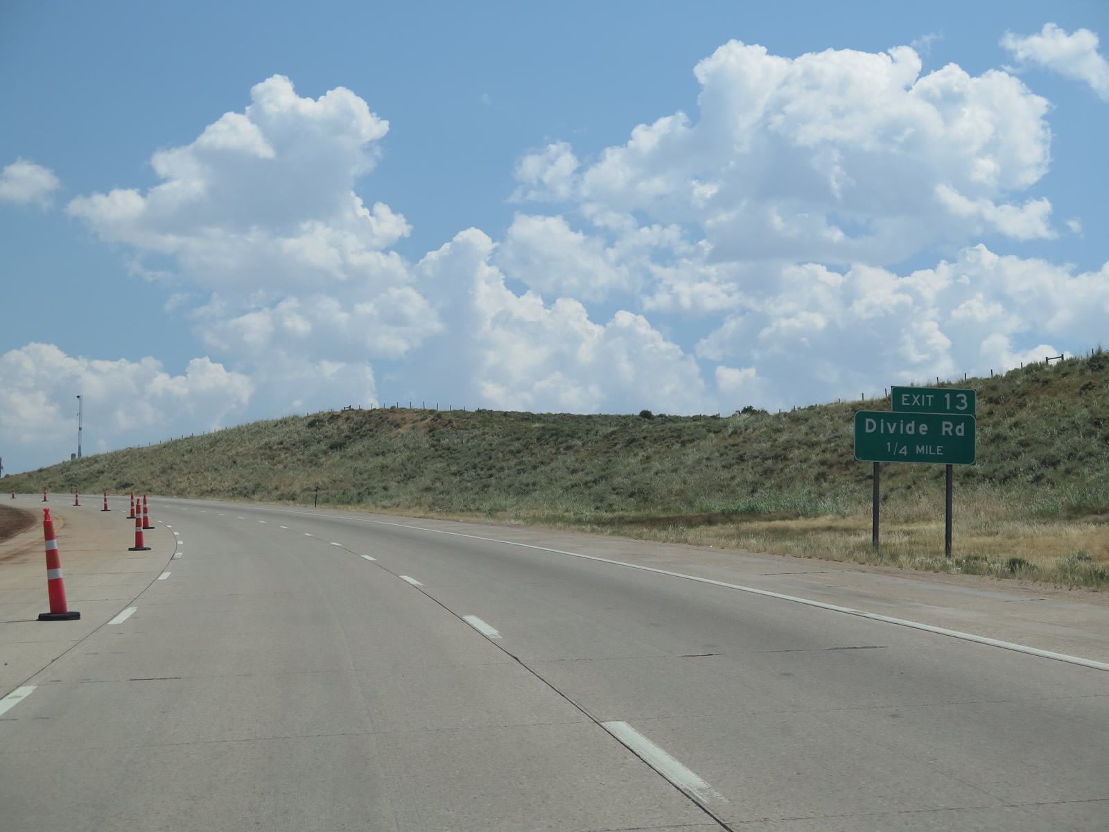
| Divided Road ties into I-80 east & U.S. 189 at Exit 13. Several wind energy farms line Interstate 80 across the southern tier of Wyoming; one of them is accessible via Divide Road north to the Wyoming Wind Energy Center. 08/05/13 |
|
| Exit 13 leaves I-80 east & U.S. 189 north for Divide Road. Areas south of this diamond interchange include BLM land, private ranches and additional industrial facilities, such as Silver Eagle Refinery. This mix of land use is fairly common for rural areas along Interstate 80 in Wyoming. 08/05/13 |
|
| The climbing lane Interstate 80 along east ends as the freeway reaches the first summit of the Three Sisters. 08/01/16 |
|
| The final shield assembly for the I-80 east and U.S. 189 northbound overlap. 08/01/16 |
|
| Interstate 80 and U.S. 189 travel downhill in tight formation with a narrow median that separates traffic with a guardrail. Due to the topography of the area, the two directions of I-80 stay close to each other. 08/01/16 |
|
| U.S. 189 parts ways with I-80 east in one mile. The US Highway currently exists in two signed segments, one in Utah between Provo and Heber City via Provo Canyon, and the other traveling from the Utah-Wyoming state line north to Jackson, where it ends near the town square (intersection of Cache Street and Broadway). An implied connection is made via U.S. 40 (Heber City to Silver Creek Junction) and I-80 (Silver Creek Junction to Wyoming), but this segment is not actively signed as part of U.S. 189. 08/01/16 |
|
| Although it does not travel all the way north to Grand Teton-Yellowstone National Parks, U.S. 189 is one of several corridors that lead north from I-80 to connect to the national parks. Beyond the U.S. 189 end in Jackson, U.S. 26-89-191 continues north to Grand Teton National Park, and U.S. 89-191-287 extends from there into Yellowstone National Park. 08/01/16 |
|
| As noted previously, U.S. 189 travels north to Fossil Butte National Monument, which is located just west of Kemmerer along U.S. 30. 08/01/16 |
|
| U.S. 189 travels north from Exit 18 to Kemmerer, Big Piney and Jackson, with a connection to Pinedale via U.S. 191. Uinta County 181 travels south from this interchange, connecting with Old Lincoln Highway (Uinta County 180). Old Lincoln Highway through here is not paved. 08/01/16 |
|
| The gore point signage for Exit 18 is notable for several reasons. First, the year of sign origin is posted in the lower left corner of the sign (the small "16," indicates a fabrication and installation in 2016). Second, since this sign was posted right after federal officials revoked prior approvals for the use of Clearview font, it is one of the first to be installed after Clearview signs stopped being installed in Wyoming. Finally, the sign is mounted on a metal pole, which is a change for Wyoming. Most gore point signs have historically been installed on wooden posts. 08/01/16 |
Page Updated 03-31-2017.

 East
East  North
North