|
| Advancing through the city of Hood River, Interstate 84 converges with U.S. 30 and OR 35 (Cascade Avenue) at Exit 62 with Westcliff Avenue. 04/24/05 |
|
| Wineries are an attraction in the Hood River Valley. Other points of interest at Hood River include the historic Columbia Gorge Hotel and the International Museum of Carousel Art. 04/24/05 |
|
| Entering the diamond interchange (Exit 62) with U.S. 30/OR 35 (Cascade Avenue) east and Westcliff Drive, the north side frontage road, on I-84 westbound. 04/24/05 |
|
| U.S. 30 rejoins Interstate 84 west from Exit 62 to Exit 44 at Cascade Locks. 04/24/05 |
|
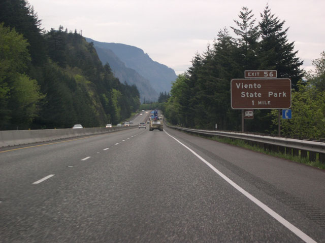
| A pair of service road exits precede Exit 56 at Viento State Park. They connect with Morton Road north and Mitchell Point Drive south, local roads otherwise inaccessible beyond Interstate 84. 04/24/05 |
|
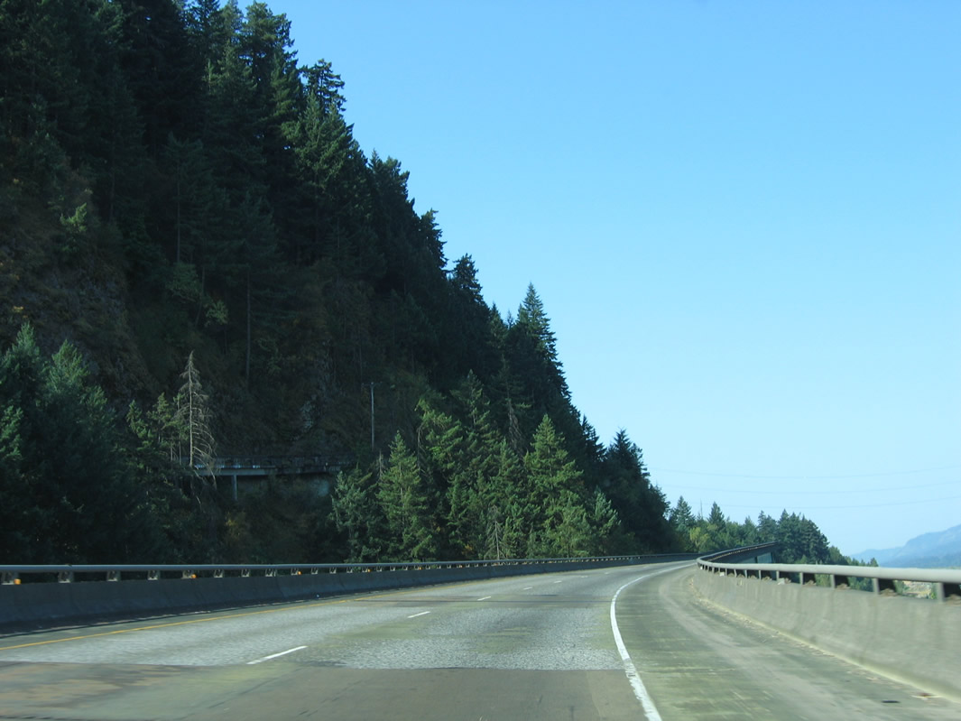
| Leaving the Hood River Valley, westbound I-84/U.S. 30 travels through one of the most scenic stretches of the Columbia River Gorge. High rocky bluffs loom above the freeway's south side nearly all the way to Troutdale. 04/24/05 |
|
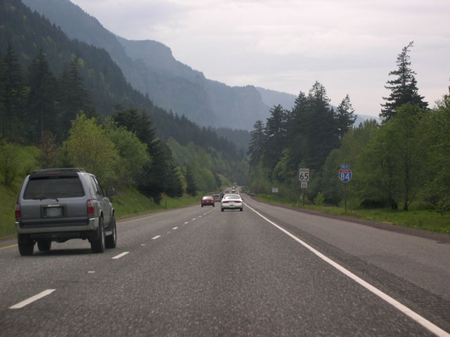
| 58 miles remain via Interstate 84 west to Portland. 04/24/05 |
|
| Approaching Exit 56, the Union Pacific Railroad, which runs along a sliver of land between the westbound lanes of I-84 and the Columbia River, comes into view. 04/24/05 |
|
| One mile ahead of the diamond interchange (Exit 56) with Viento Road along I-84/U.S. 30 west. Viento State Park is one of a near unbroken string of Oregon State Parks that line the river through the gorge. 04/24/05 |
|
| Because the gorge is a near sea-level break in the Cascade range, plant and tree species from both sides of the Cascade Divide mingle here. Ponderosa pines, such as the dark evergreens here, usually associated with dry east side forests mix with west side species like western red-cedar and hemlock. 04/24/05 |
|
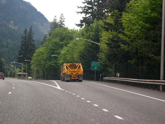
| A weigh station operates along Interstate 84 westbound between mile markers 55 and 54. 04/24/05 |
|
| Advancing west from the weigh station by Lindsey Pond, I-84/U.S. 30 run along the north side of Shellrock Mountain to a diamond interchange (Exit 51) with Wyeth Road. Exit 51 joins I-84 with Wyeth campground, which overlooks the Columbia River. Wyeth is a Union Pacific Railroad sidling to the north. 04/24/05 |
|
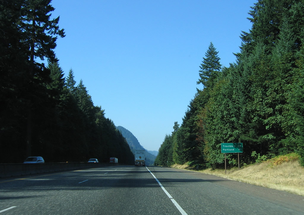
| Posted just ahead of Anderson Point and Lang Forest State Park is a distance sign for Cascade Locks, Troutdale and Portland. 04/24/05 |
|
| Interstate 84 follows a thin strip of land between the Columbia River and the bluffs for most of the way to Troutdale. 04/24/05 |
|
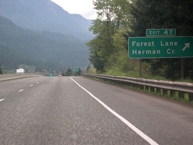
| The succeeding interchange along westbound Interstate 84 and U.S. 30 is Exit 47 for Forest Lane, Herman Creek and Herman Creek campground. 04/24/05 |
|
| Exit 47 is a half diamond interchange with access to Forest Lane and Herman Creek from I-84 westbound only. Forest Lane parallels the freeway by Government Cove before turning toward the Columbia River into the city of Cascade Locks. 04/24/05 |
|
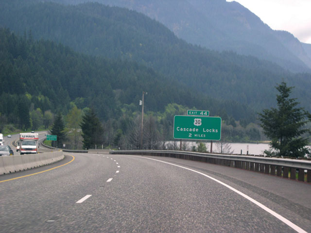
| Government Cove appears along the north side of I-84 and U.S. 30 two miles ahead of their separation at Exit 44. 04/24/05 |
|
| This diagrammatic sign shows that U.S. 30 loops through the city of Cascade Locks from Exit 44. U.S. 30 is signed in lieu of a business loop, which is more typically found in western states where the U.S. highway shares alignment with an Interstate highway. 04/24/05 |
|
| U.S. 30 (Wa Na Pa Street) connects Interstate 84 with Cascade Locks Marine Park, a National Historic Site, and the Bridge of the Gods to Stevenson, Washington. 04/24/05 |
|
| The 2.40 mile section of U.S. 30 (Wa-Na-Pa Street) through Cascade Locks branches north from I-84 between partial interchanges at Exit 44. The tolled Bridge of the Gods crosses the Columbia River northward to SR 14. The third oldest bridge spanning the Columbia River, the steel truss cantilever span was built in 1926.1 04/24/05 |
|
| Leaving Cascade Locks, U.S. 30 returns at a wye interchange across from Sheridan Point. 04/24/05 |
|
| I-84/U.S. 30 continue west from Cascade Locks 26 miles to the Portland suburb of Troutdale. 08/28/06 |
|
| Westbound Interstate 84 enters Multnomah County at milepost 42. 04/25/05 |
|
| The westbound lanes of I-84/U.S. 30 span the Union Pacific Railroad at the county line. The UP Railroad runs between the I-84 roadways on the ensuing stretch across Eagle Creek. 08/28/06 |
|
| The succeeding exit along Interstate 84 and U.S. 30 west is with Tanner Creek Road to Bonneville Dam. Built by the U.S. Army Corps of Engineers and completed in 1938, the dam is used primarily for hydroelectric power generation. The damming of the Columbia here inundated the locks at Cascade Locks, but a new set of locks was built at the dam site. 08/28/06 |
|
| Interstate 84 partitions with the westbound roadway passing over southern reaches of the Columbia River along the Eagle Creek Viaduct and the eastbound roadway passing through Toothrock Tunnel. Built in 1969, the westbound viaduct measures 2,752 feet in length at a height of 29.9 feet.2 08/28/06 |
|
| The Bonneville Dam complex has several attractions, including the Bonneville Dam Fish Hatchery. The site features a free visitor center as well. 08/28/06 |
|
| The diamond interchange (Exit 40) with Bonneville Way also connects with a segment of Historic Columbia River Highway and the Wahclella Falls Trailhead to the south. 08/28/06 |
|
| Munra and Wauneka Points rise from the northern slopes of Mt. Talapus south of Bonneville. 08/28/06 |
|
| Leading away from Bonneville, Saint Peters Dome and Yeon Mountain rise to the southwest alongside I-84/U.S. 30. 04/24/05 |
|
| Westbound Interstate 84 and U.S. 30 reach Exit 37 for Warrendale. Once the site of a salmon cannery and a Post Office (until 1942), Warrendale comprises an array of private homes.3 04/24/05 |
|
| A diagrammatic guide sign precedes the folded diamond interchange (Exit 35) with Historic U.S. 30 (Historic Columbia River Highway) at Ainsworth State Park. The Historic Columbia River Highway branches south from I-84 and returns to the freeway at Exit 18. 04/24/05 |
|
| Exit 35 leaves I-84/U.S. 30 west for Dodson Frontage Road east and the Historic Columbia River Highway west. Formerly known as the Crown Point Highway, this section of the historic landmark highway winds its way along the bluffs overlooking the Columbia River. Scenic attractions abound along the route, including six state parks, several waterfalls including famous Multnomah Falls, and Crown Point among others. 04/24/05 |
|
| I-84/U.S. 30 cross over Historic Columbia River Highway and the UP Railroad on a 562 foot long bridge built in 1949.4 08/27/06 |
|
| Traversing an area of wetlands north of Oneonta Gorge and Broughton Reach along the Columbia River, I-84 advances west 18 miles to Troutdale and 33 miles to Portland. 08/27/06 |
|
| The succeeding exit along Interstate 84 and U.S. 30 west is for Multnomah Falls. At 620 feet in height, the falls are the second highest in the U.S. The freeway parallels the UP Railroad and south banks of the Columbia River along this stretch. 04/24/05 |
|
| Multnomah Falls Lodge, another National Historic Site in the Columbia River Gorge, lies just south of Exit 31 along the Historic Columbia River Highway. 08/27/06 |
|
| Exit 31 utilizes left side ramps in both directions of I-84 to the Multnomah Falls Car Park located within the freeway median. Visitors may use the parking lot for the lodge, Multnomah Falls Visitor Center and the 1.2 mile Multnomah Falls Trail. 08/27/06 |
|
| Confirming marker posted west of Multnomah Falls on the strip of land separating the Columbia River from Benson Lake. 08/27/06 |
|
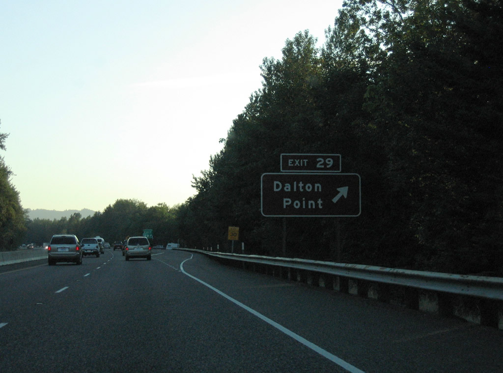
| Exit 29 departs in one mile for Dalton Point State Park. 08/27/06 |
|
| Exit 29 consists of RIRO (right in right out) ramps with Dalton Point. The adjacent site includes a boat launch. 08/27/06 |
|
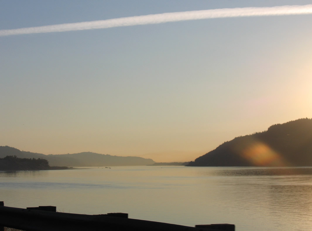
| Looking west at the Columbia River between Mt. Pleasant in Washington and Sand Island in Oregon. 08/27/06 |
|
| Constructed in 1960, the Bridal Veil Connector links Bridal Veil Road westbound with I-84. The wye interchange (Exit 28) connects I-84 east with Bridal Veil Falls and Shepperds Dell State Park. 08/27/06 |
|
| Continuing west from the Bridal Veil Connector, Interstate 84 reaches Troudale in 11 miles and Portland in 26 miles. 08/27/06 |
|
| Interstate 84 and U.S. 30 proceed west to Rooster Rock State Park and Exit 25. 04/24/05 |
|
| The Lewis and Clark expedition camped at a site within what is now Rooster Rock State Park in November 1805.5 04/24/05 |
|
| Entering the trumpet interchange (Exit 25) with the Rooster Rock State Park access road along I-84/U.S. 30 westbound. 04/24/05 |
|
| West of Rooster Rock is another Interstate 84 reassurance shield without a companion U.S. 30 marker. 04/24/05 |
|
| Portland lies 22 miles west of Interstate 84 at Mirror Lake and Rooster Rock. 08/27/06 |
|
| A westbound view point overlooks the Columbia River at Tunnel Point by mile marker 23. 04/24/05 |
|
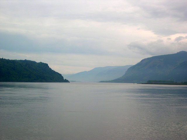
| Easterly view of the Columbia River Gorge from the I-84 view point at Tunnel Point. 04/24/05 |
|
| A diamond interchange (Exit 22) with Corbett Hill Road follows Tunnel Point along I-84/U.S. 30 westbound. 04/24/05 |
|
| Corbett Hill Road climbs southward from Exit 22 to Historic Columbia River Highway at Corbett. Historic U.S. 30 leads east from there to Crown Point State Park and the Vista House at Crown Point. 04/24/05 |
|
| Westbound Interstate 84 reaches Exit 22 at Corbett Station. Corbett is an unincorporated community located at the junction of Corbett Hill Road and the Historic Columbia River Highway. 04/24/05 |
|
| Nearing the end of the Gorge, 20 miles remain to Portland. I-84 enters the city of Troutdale in four miles at the Sandy River. 04/24/05 |
|
| High-voltage power lines crossing the freeway northwest from Chamberlain Hill at mile marker 19. The Bonneville Power Administration's Troutdale substation is about three miles northwest of this location. 04/24/05 |
|
| Lewis and Clark State Park and Oxbow Regional Park round out the parks in the Columbia River Gorge along Interstate 84. 04/24/05 |
|
| Leaving the Columbia River Gorge National Scenic Area, the landscape along I-84 west flattens out and becomes more urban on the ensuing stretch through Troutdale. 04/24/05 |
|
| With the approval of the Oregon Transportation Commission (OTC) in 2004, ODOT raised the speed limit from 55 to 60 miles per hour along certain stretches of urban interstates in the Portland, Salem and Eugene areas. 04/24/05 |
|
| Jordan Road ties into I-84/U.S. 30 at a folded diamond interchange (Exit 18) along the Sandy River. A short road once a part of Crown Point Highway, Jordan Road leads through Lewis and Clark State Park just south of the freeway en route to Historic Columbia River Highway. Oxbow Regional Park is located southeast of Springdale along the Sandy River via Historic U.S. 30 and Hurlburt Road. 04/24/05 |
|
| Spanning the Sandy River, I-84/U.S. 30 advance to the split diamond interchange (Exit 17) with Marine Drive and NW 257th Avenue in the city of Troutdale. 04/24/05 |
|
| Exit 17 leaves I-84/U.S. 30 west for Portland-Troutdale Airport (TTD), Graham Road south to NE 257th Avenue and Marine Drive west to Blue Lake Regional Park. 04/24/05 |
Page Updated 04-10-2019.

 West
West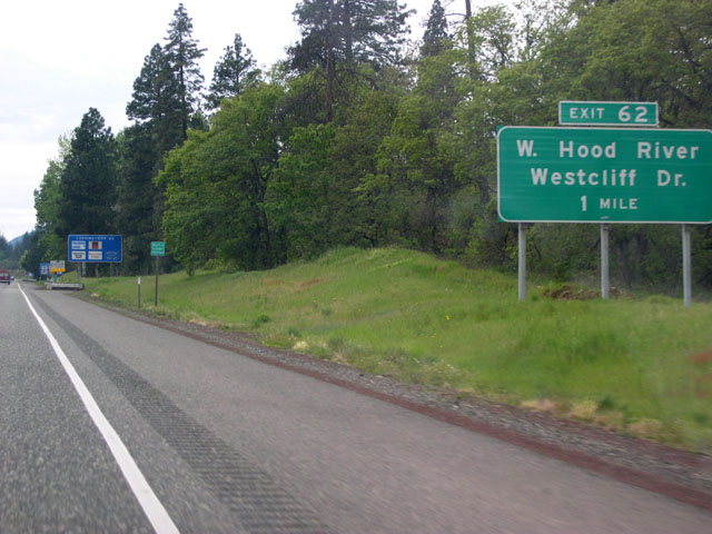


 West
West