|
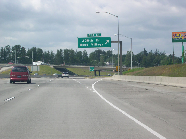
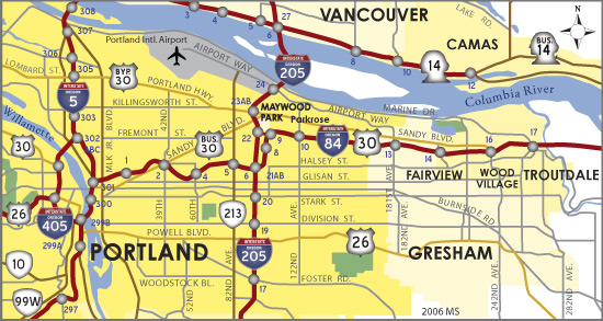
| Angling southwest below the UP Railroad, Interstate 84 and U.S. 30 west enter the city of Wood Village ahead of Exit 16 with 238th Drive. 238th Drive leads south from Wood Village to Gresham. 06/18/06 |
|
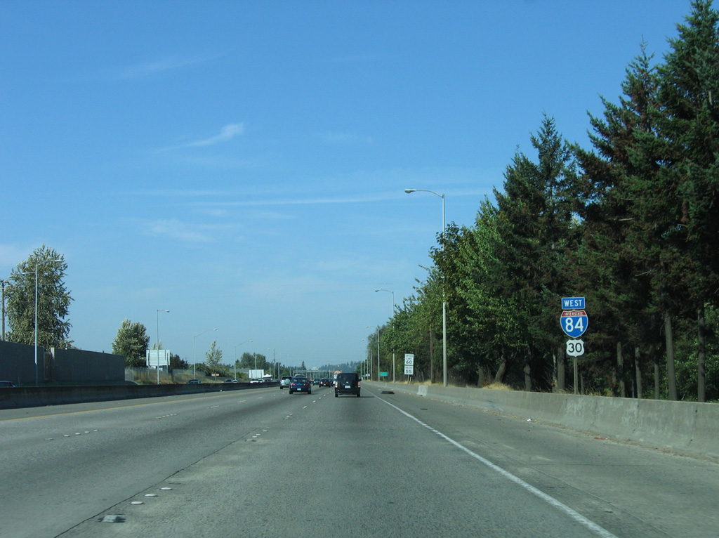
| As in the Columbia River Gorge, Interstate 84 and U.S. 30 are co-signed in the Portland metro area. 06/18/06 |
|
| The diamond interchange at Exit 16 marks the east end of the former U.S. 30 Bypass Route. Northbound 238th Drive leads to Sandy Boulevard, where Bypass U.S. 30 previously traveled west through northern Portland. 06/18/06 |
|
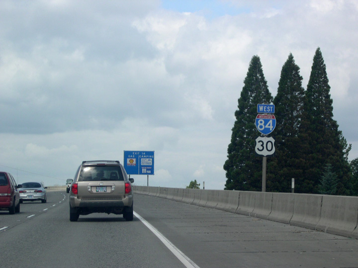
| Interstate 84 passes quickly through Wood Village and enters Fairview, a city of around 9,000, where it runs above grade and crosses over 223rd Avenue (Fairview Avenue). 06/18/06 |
|
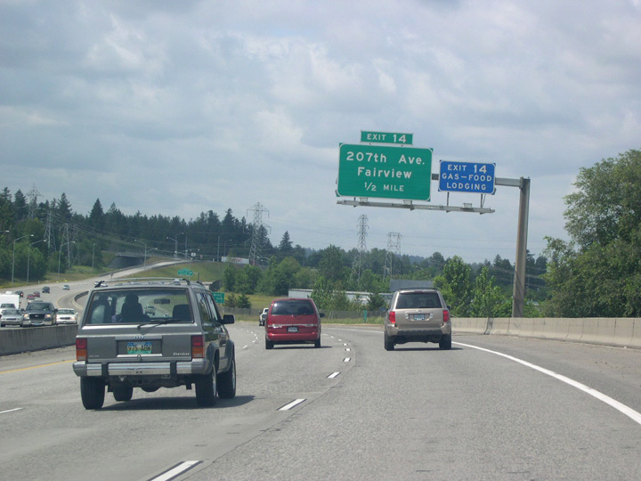
| A parclo interchange (Exit 14) connects Interstate 84 with 207th Avenue in Fairview, a newer road that intersects with Sandy Boulevard (old U.S. 30 Bypass) to the north and Halsey Street to the south. Blue Lake Park, popular with anglers and swimmers alike, can be reached by heading east on Sandy to Fairview Avenue / Blue Lake Road. 06/18/06 |
|
| The succeeding exit for westbound Interstate 84 lies one half mile ahead with 181st Avenue to Airport Way. 06/18/06 |
|
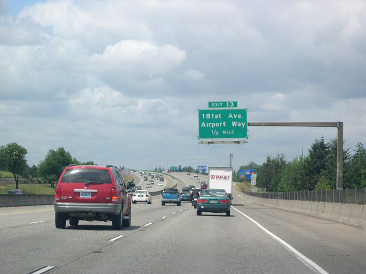
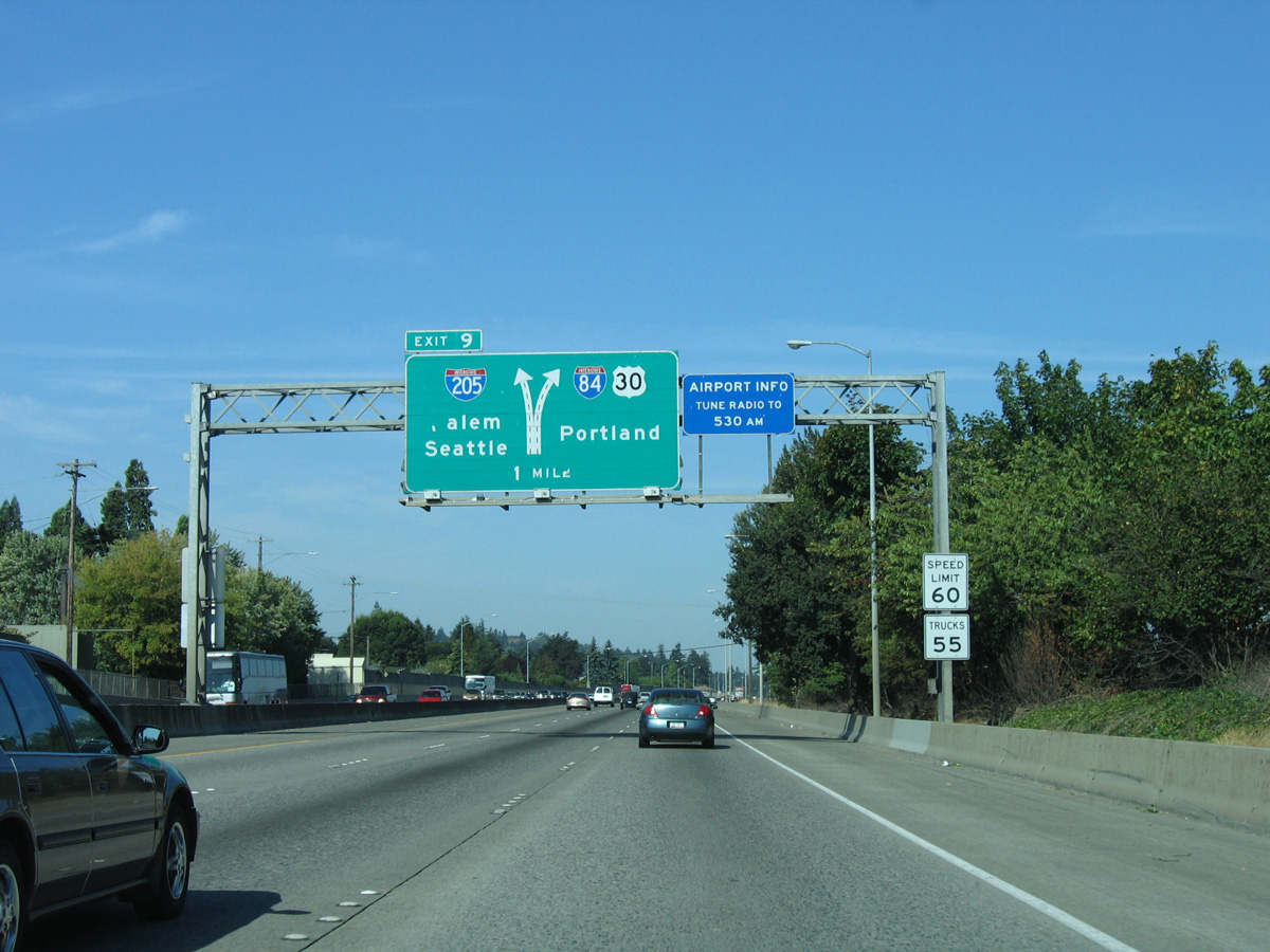
| The speed limit along I-84 west remains at 60 miles per hour to the Portland city line. The freeway now moves into the city of Gresham, a growing city of over 100,000. 06/18/06 |
|
| Once again, Interstate 84 travels above grade, meeting 181st Avenue at Exit 13. 181st Avenue, though technically part of the Portland street grid system, became a Gresham city street when that city pushed its boundary westward into unincorporated Multnomah County during the 1980s. 181st Avenue becomes Airport Way beyond parallel Sandy Boulevard. 06/18/06 |
|
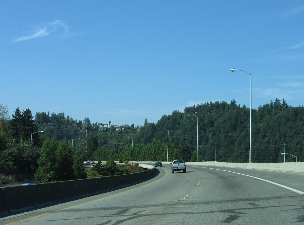
| Beyond 181st Avenue, westbound I-84/U.S. 30 enter a long exit less stretch. The next departure point to city streets is not until Exit 2 for 43rd Avenue. 09/02/06 |
|
| Interstate 84 westbound enters the Rose City just before crossing over 162nd Avenue. With an increase in over 100,000 residents between 2005 and 2016, Portland is roughly the size of Seattle, though the greater metro area is quite a bit smaller than that of Seattle-Tacoma. 09/02/06 |
|
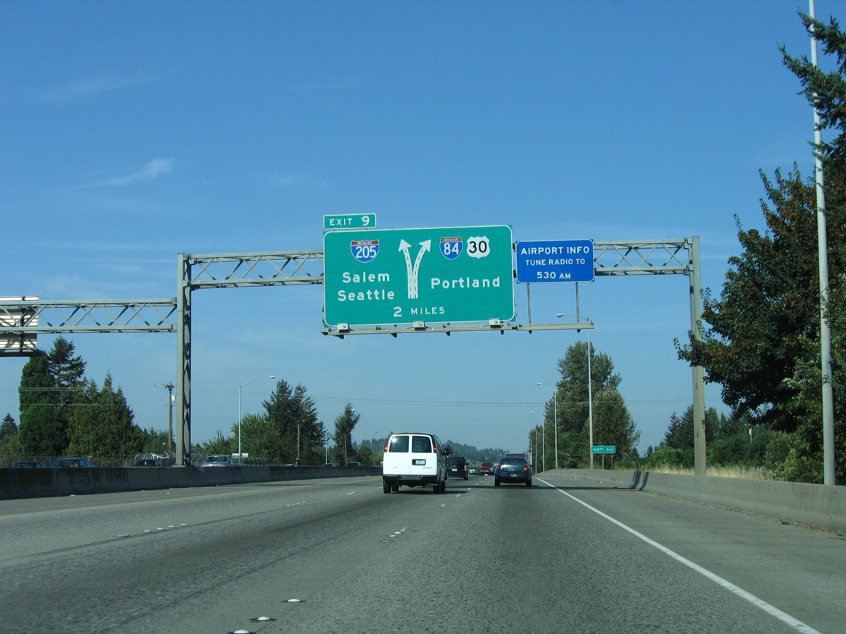
| I-84/U.S. 30 meet Interstate 205 (War Veterans Memorial Freeway / West Portland Freeway) two miles beyond the 148th Avenue overpass. 09/02/06 |
|
| I-205 bypasses Portland south to I-5 at Tualatin for regional traffic headed to the capital city of Salem. 09/02/06 |
|
| Westbound I-84/U.S. 30 cross over another east Portland arterial at 122nd Avenue. RIRO ramps link the eastbound roadway with 122nd Avenue here. 06/18/06 |
|
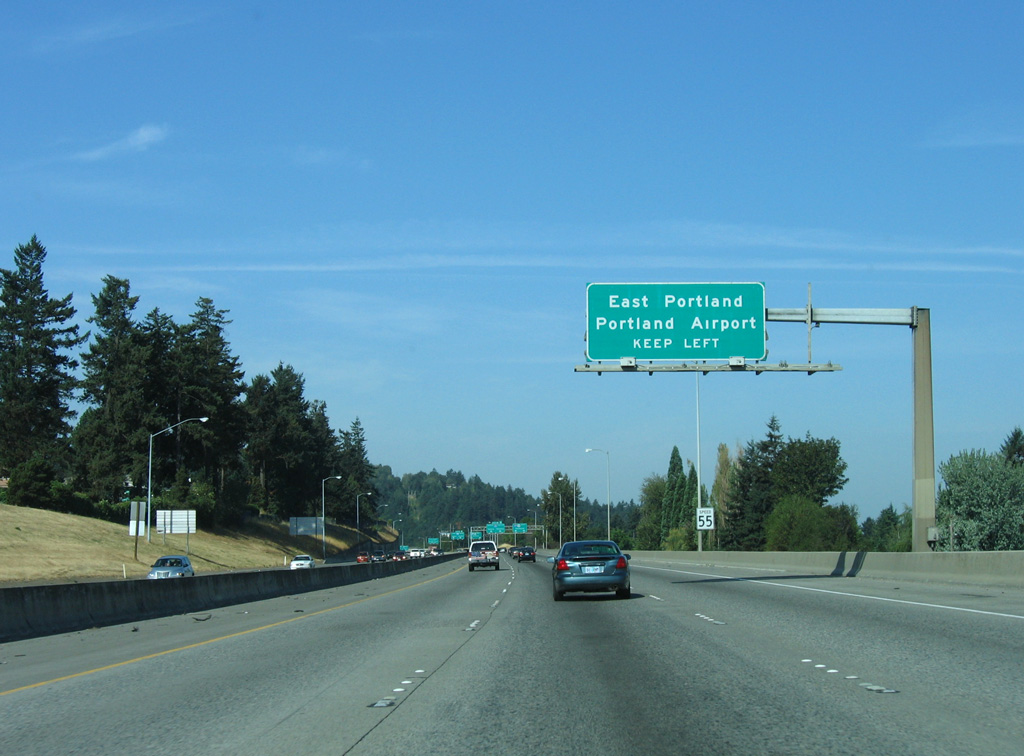
| This somewhat cryptic sign advises drivers to keep left for upcoming I-205 north to east Portland and Portland International Airport (PDX). Exit 9 provides the lone opportunity to access the East Portland street grid via off-ramps from I-205. 09/02/06 |
|
| I-84/U.S. 30 makes a turn off to stay on (TOTSO) movement at Left Exit 9 ahead of the directional T interchange connecting with I-205 (East Portland Freeway). 09/02/06 |
|
| Left Exit 9 partitions with the right lane joining northbound I-205 toward PDX Airport and the left lane navigating through a tunnel underneath the East Portland Freeway to I-205 south. 09/02/06 |
|
| Continuing on Interstate 84 west, traffic crosses over the lanes (Left Exit 9) extending west to I-205. 09/02/06 |
|
| I-84/U.S. 30 curve south from a wye interchange to run between adjacent lanes for I-205 north and NE 102nd Avenue. 09/02/06 |
|
| An interchange sequence sign references the final 6.75 miles of I-84 west at the NE 102nd Avenue overpass. An entrance ramp joins the four lane boulevard at the Parkrose Heights neighborhood with the westbound roadway. 09/02/06 |
|
| A confirming marker for Interstate 84 west stands beyond the on-ramp from NE 102nd Avenue. U.S. 30 remains paired with the freeway. 06/18/06 |
|
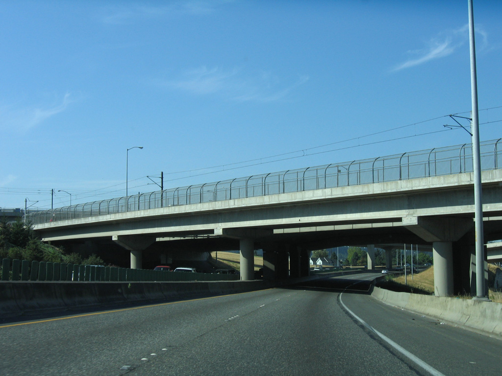
| A second directional T interchange completes the movements between I-84/205 south of Halsey Street. Two light rail lines accompany the respective freeways across their exchange. 06/18/06, 09/02/06 |
|
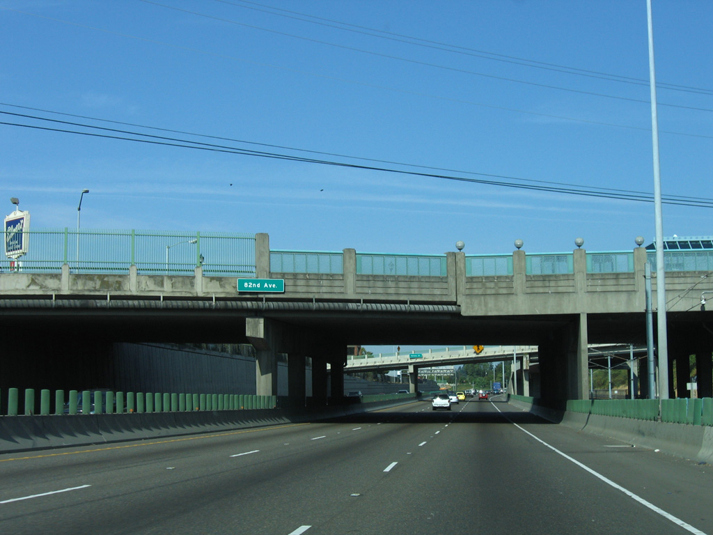
| Traffic from northbound Interstate 205 and Glisan Street combines with I-84/U.S. 30 westbound ahead of the OR 213 (82nd Avenue) over crossing. The light rail line to Downtown Portland parallels the north side of the freeway westward from here. 09/02/06 |
|
| This stretch of Interstate 84 is known locally as the "Banfield Freeway" or simply "The Banfield." Exit 5 joins I-84 east with OR 213 (82nd Avenue) while a westbound entrance ramp lowers from Halsey Street. 09/02/06 |
|
| Interstate 84 curves west between the Madison South and Montavalla neighborhoods at the 74th Avenue overpass. 09/02/06 |
|
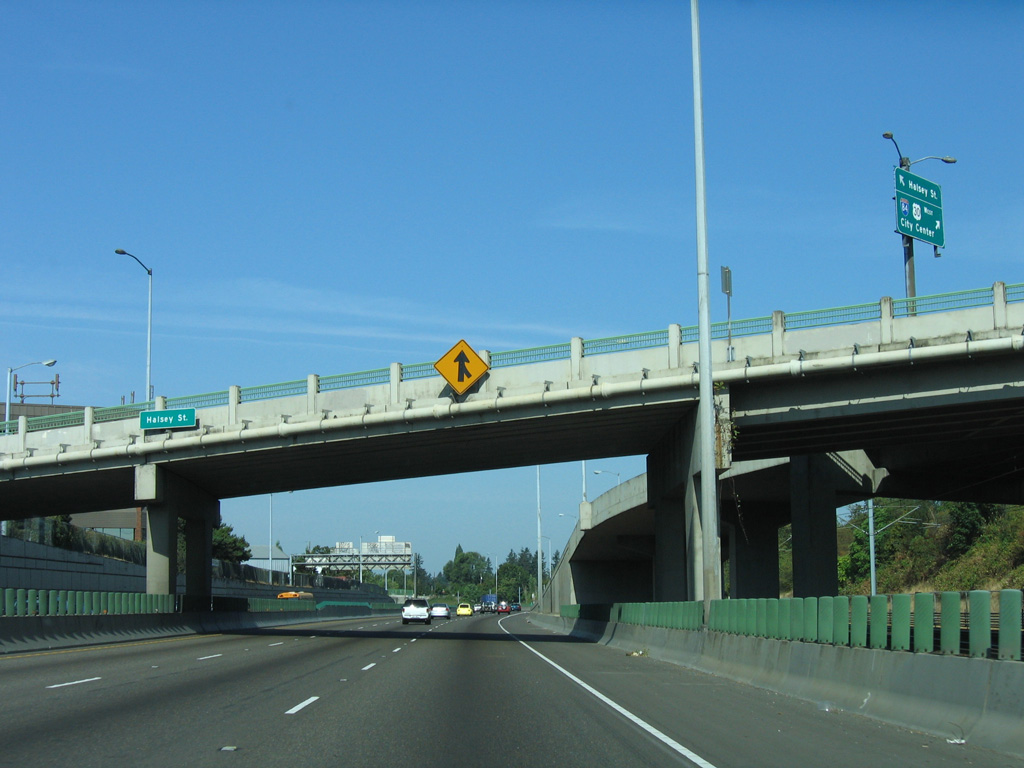
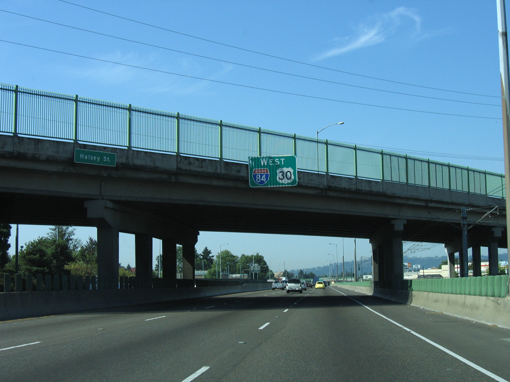
| Halsey Street spans I-84 for a third time leading west into the Rose City Park neighborhood. A lone eastbound exit connects the Banfield Freeway with the Montavilla area. 09/02/06 |
|
| Interstate 84 makes a number of S-curves leading west to Exit 2 for 43rd Avenue and the Portland street grid. 09/02/06 |
|
| A wye interchange adds traffic from parallel Glisan Street as the freeway curves northward toward Portland's Hollywood District from the 53rd Avenue overpass. 09/02/06 |
|
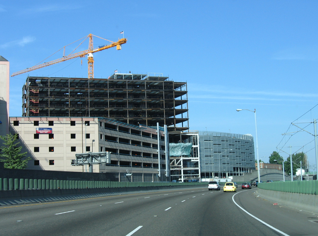
| Staying below grade, I-84 (Banfield Expressway) advances northwest with three overall lanes by Providence Portland Medical Center. 09/02/06 |
|
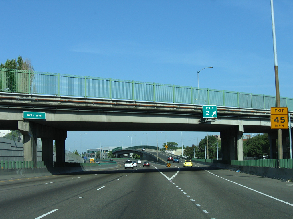
| I-84 west concludes a 4.2 mile mile long exit less as Exit 2 departs for 43rd Avenue. Although signed for 43rd Avenue, the off-ramp actually connects with Halsey Street midway between Sandy Boulevard and NE 47th Avenue at the Hollywood District. 09/02/06 |
|
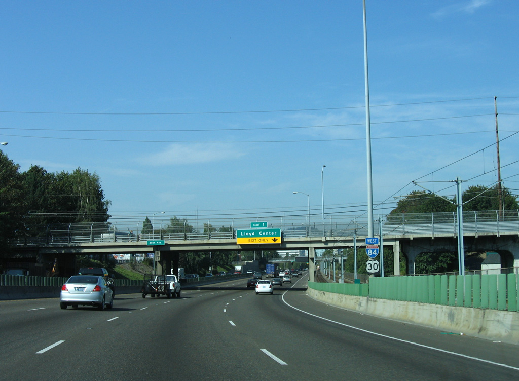
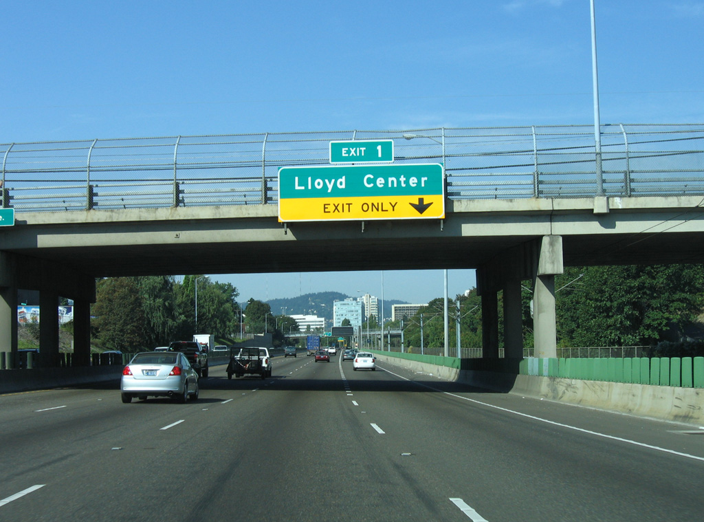
| The Banfield Freeway navigates through another S-curve on the 1.25 miles preceding Exit 1 for the Lloyd Center. 09/02/06 |
|
| Nearing the west end of Interstate 84, an overhead references the Rose Quarter for Exit 1. The district is home of the Moda Center (formerly the Rose Garden Arena), where the NBA Portland Trailblazers play. 06/18/06 |
|
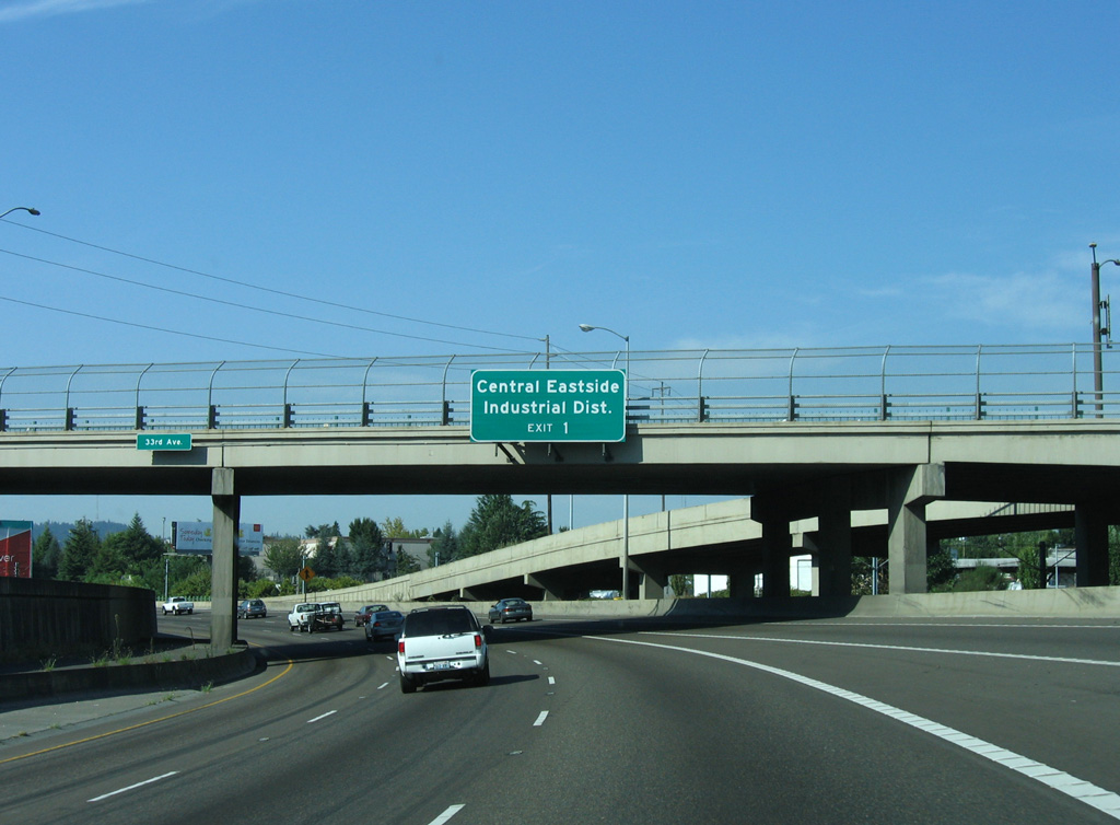
| A half diamond interchange (Exit 1 from I-84 east) links the Banfield Freeway with NE 33rd Avenue. 09/02/06 |
|
| Exit 1 also serves the Central Eastside Industrial District. 09/02/06 |
|
| Trending southward, the Banfield Expressway heads through "Sullivan's Gulch" ahead of Exit 1. This broad gulch has long been a right-of-way in Portland: first for the Union Pacific, then for the Banfield Expressway (U.S. 30, I-80N, I-84), and finally for the downtown light rail. 06/18/06 |
|
| The last reassurance marker for Interstate 84 west stands ahead of the NE 28th Avenue overpass. 09/02/06 |
|
| The 33rd Avenue on-ramp forms a westbound auxiliary lane to the half diamond interchange (Exit 1) for Lloyd Center. 09/02/06 |
|
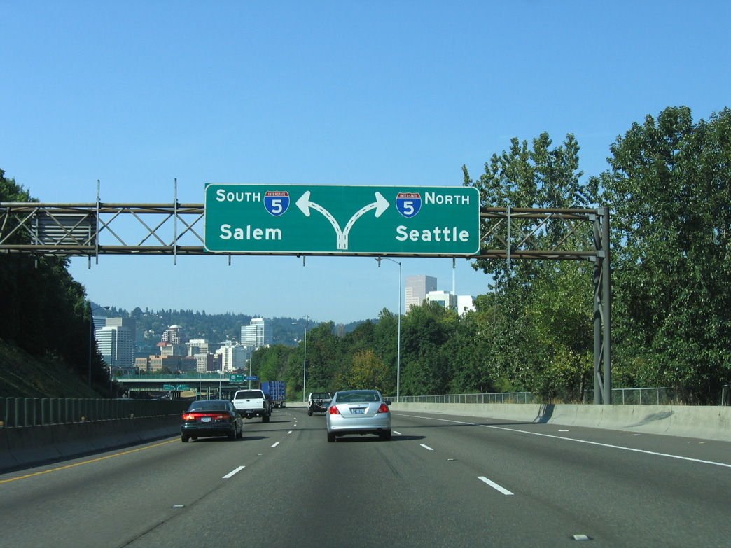
| Interstate 84 ends one mile ahead at a directional T interchange with I-5. The exchange lies just south of the Oregon Convention Center and east of the Steel Bridge across the Willamette River. 09/02/06 |
|
| Exit 1 separates from I-84/U.S. 30 west to span the adjacent Union Pacific Railroad line and NE 16th Drive. The ramp connects with both Lloyd Boulevard west and NE 13th Avenue north to Lloyd Center mall. 09/02/06 |
|
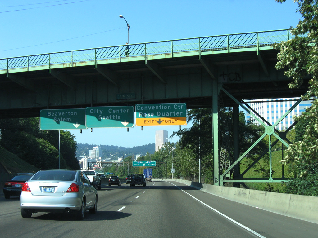
| Separate overheads at the 12th Avenue overpass were removed by 2014. Replacing them is a single panel for the Oregon Convention Center and Moda Center via the ramp for I-5 (Pacific Highway) northbound. 06/18/06 |
|
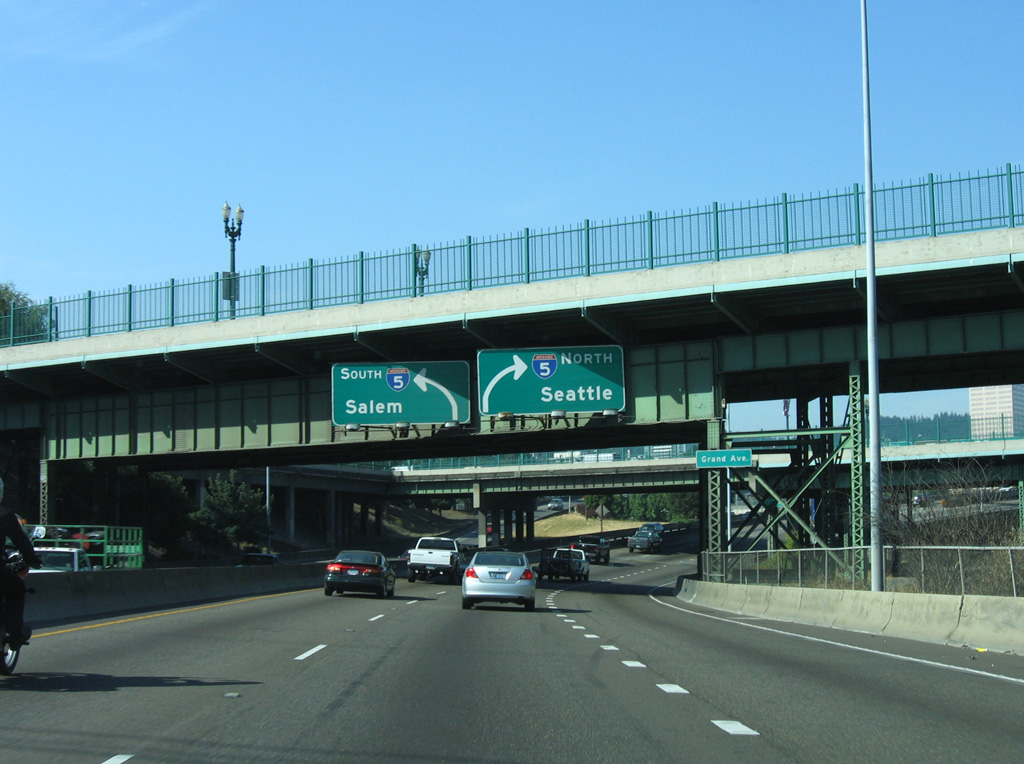
| With the Downtown skyline coming into view, a second diagrammatic sign references the upcoming two lane ramps for Interstate 5 north and south. 09/02/06 |
|
| U.S. 30 circumvents the Portland city center north alongside Interstate 5 to I-405 south across the Fremont Bridge. Beyond the Portland area, U.S. 30 extends northwest along the Columbia River to U.S. 101 in Astoria on the coast. 09/02/06 |
|
| The Grand Avenue and Martin Luther King, Jr. Boulevard one way couplet span Interstate 84 just ahead of the ramp split for I-5 and U.S. 30 west. 09/02/06 |
|
| Flyover ramps partition from the end of I-84 for Interstate 5 north to north Portland and Vancouver, Washington and I-5 south to Downtown Portland and the city's western and southern suburbs. 09/02/06 |
|
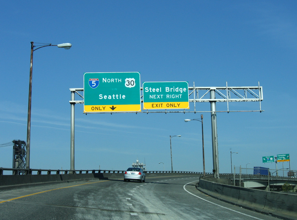
| Towers from the Steel Bridge appear along the flyover taking U.S. 30 west onto I-5 north. Prior to merging with Interstate 5 north, a local off-ramp lowers onto NE 1st Avenue ahead of Multnomah Street west to the Steel Bridge. 09/02/06 |
|
| Moda Center in the Rose Quarter rises along the west side of Interstate 5 beyond at Multnomah Street. U.S. 30 overlaps with I-5 north for 0.9 miles to I-405. 09/02/06 |
Page Updated 10-22-2006.


 West
West