
Interstate 90 West - Crook County
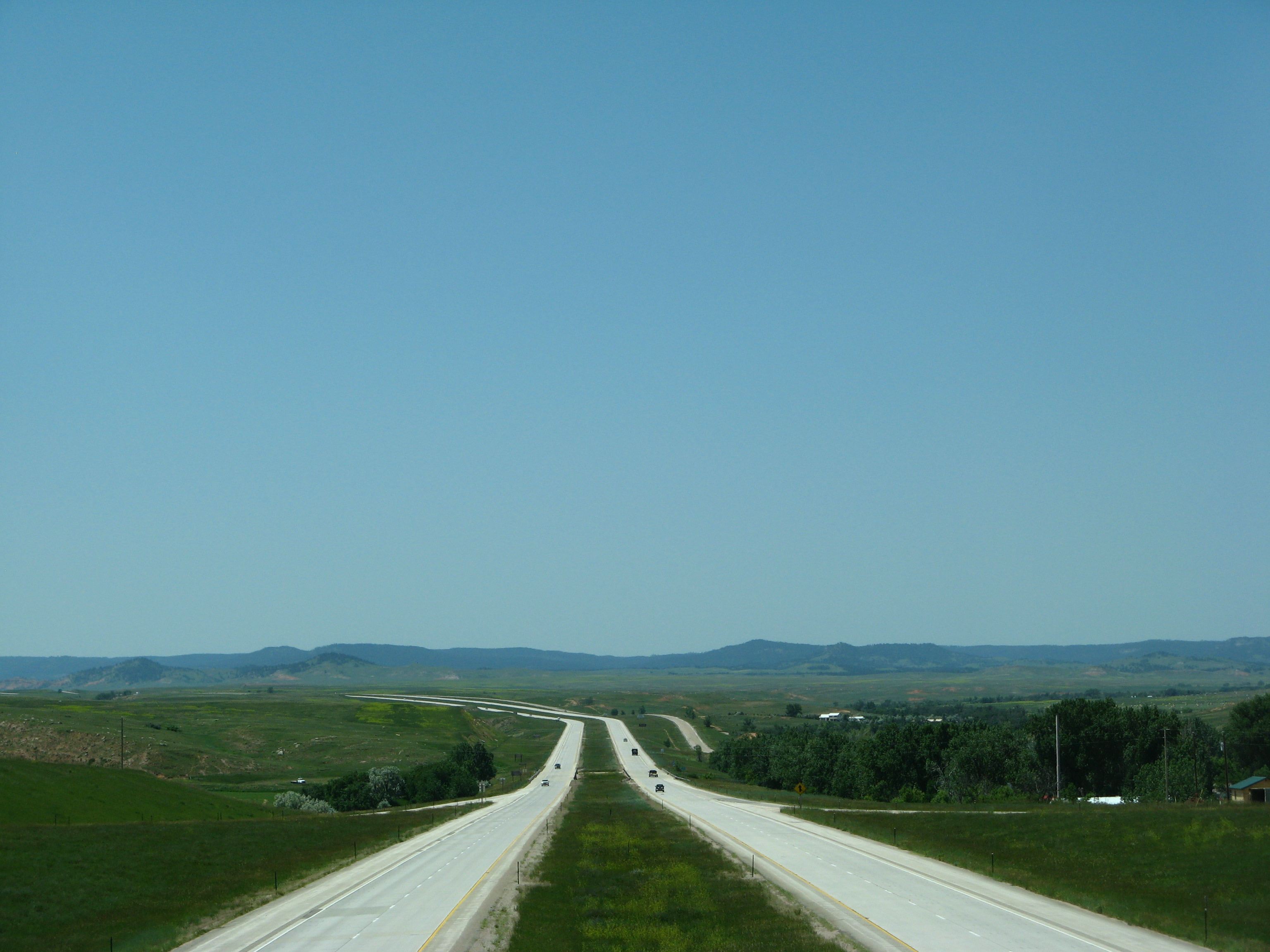
This view looks west on I-90/U.S. 14 from the Beulah Interchange (Exit 205) near the Wyoming-South Dakota State Line. The freeway crosses Sand Creek before continuing through the rolling Black Hills of Wyoming. 07/05/08
| Interstate 90 and U.S. 14 west | |
|---|---|
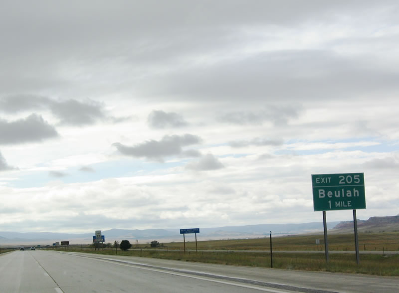 |
Upon leaving South Dakota and entering Wyoming, the Equality State, the first exit along westbound Interstate 90 is Exit 205, Sand Creek Road (Crook County Route 129) south to Sand Creek and north to Beulah and Old U.S. 14 (frontage road). Photo taken 09/03/04. |
 |
Eastbound Interstate 90 and U.S. 14 reach Exit 205, Junction Crook County Route 129/Sand Creek Road. Take Sand Creek Road north to Old U.S. 14, then turn north to reach Lower Water Creek Road north. The community of Beulah sits on both sides of Interstate 90, including the gas station on the north side of the freeway. Old U.S. 14 closely parallels Interstate 90 on the north side of the freeway between Exit 205 and Exit 189 (Junction Business Loop I-90 west to Moorcroft). Use Sand Creek Road south to reach the Wyoming section of the Black Hills National Forest. Photo taken 09/03/04. |
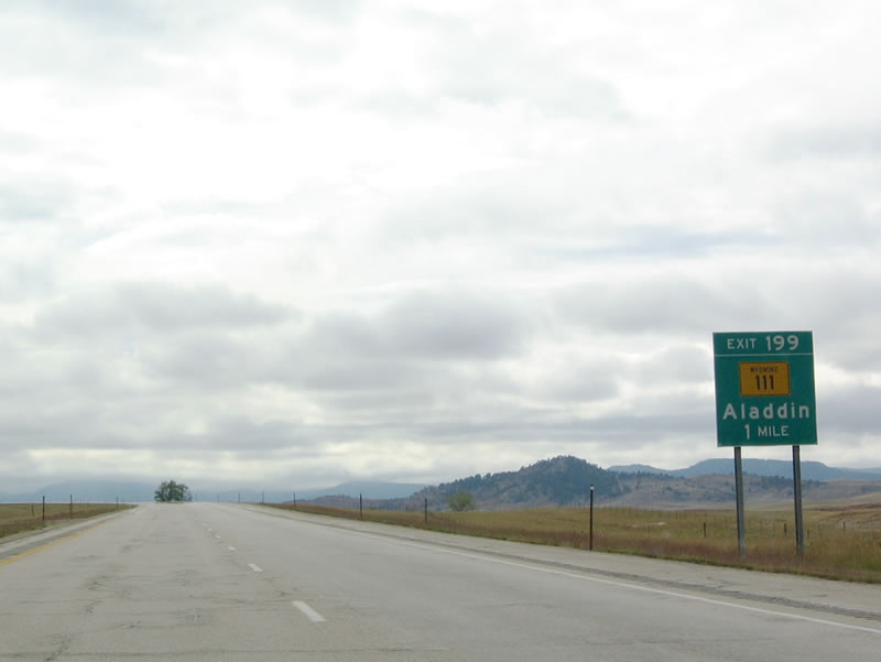 |
The next exit along westbound Interstate 90 and U.S. 14 is Exit 199, Wyoming 111 north to Aladdin, which is where Wyoming 111 meets Wyoming 24. In addition to using U.S. 14 west to Devils Tower National Monument, travelers may also use Wyoming 111 north to Wyoming 24 west via Hulett. Photo taken 09/03/04. |
 |
Westbound Interstate 90 and U.S. 14 meet Exit 199, Wyoming 111 north to Aladdin. On July 16, 2010, the Northeast Wyoming Information Center was dedicated and opened for public use.1 This facility not only provides restrooms and tourist information, but it also provides museum-quality exhibits about the region. To access the center, follow Wyoming 111 north to Old U.S. 14 east to the visitors center driveway. This exit also connects to the Interstate 90 Service Road, which parallels the freeway to the north along the path of old U.S. 14. The Vore Buffalo Jump is a major archaeological site located between Old U.S. 14 and Interstate 90 on the north side of the freeway. Discovered when the Interstate 90 freeway was being constructed in the early 1970s, the Vore Buffalo Jump is "a natural sinkhole that was used as a bison trap from about 1500 to 1800 A.D. Buffalo were driven over the edge of the sink hole as a method for the Native American tribes to procure the large quantities of meat and hides needed to survive the harsh prairie winters." Students and scholars frequent the site to excavate old bones and continue to find the remains of animals. A visitors center and excavation site building (opened in July 2011) are available on site for visitors for a nominal fee. Photo taken 09/03/04. |
 |
The next exit along westbound Interstate 90 and U.S. 14 is Exit 191, Moskee Road. Photo taken 09/03/04. |
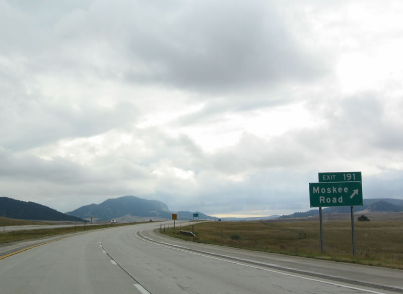 |
Westbound Interstate 90 and U.S. 14 reach Exit 191, Moskee Road. There are no services at this interchange. Photo taken 09/03/04. |
 |
The next three exits along westbound Interstate 90 serve the city of Sundance, the seat of Crook County. Located at an elevation of 4,750 feet, Sundance is considered the hub of tourist activities for the Wyoming Black Hills. According to the 2000 Census, 1,161 people called Sundance home. Photo taken 09/03/04. |
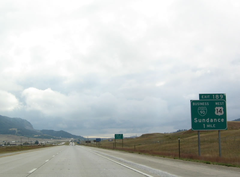 |
At Exit 189, Business Loop I-90 and U.S. 14 depart from the freeway via Cleveland Street. This exit provides the most direct route into downtown Sundance. U.S. 14 will remain separated from Interstate 90 until Moorcroft, as the US route provides the most direct route to Devils Tower National Monument. Photo taken 09/03/04. |
 |
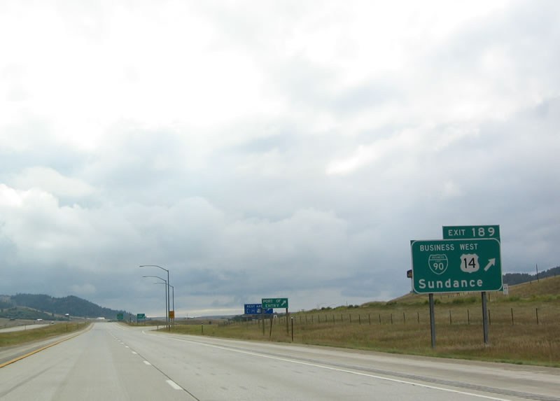
Any of the next three exits provide a connection to U.S. 14 west en route to Devils Tower National Monument: Exit 189, Junction Business Loop I-90 and U.S. 14/Cleveland Street; Exit 187, Wyoming 585/Sixth Street; and Exit 185, Junction Business Loop I-90, U.S. 14, and Wyoming 116. For the most direct route to Devils Tower without passing through Sundance, use the third exit: Exit 185. Photo taken 09/03/04. |
 |
Use Exit 189 to Black Hills National Forest recreation areas and the Sundance Kid and Old West Museum. Sundance is the site for a particularly famous arrest and trial during the Wild West Days. The Sundance Kid (Harry Alonzo Longabaugh) was arrested for stealing a horse in 1887; Longebaugh gained his nickname as the Sundance Kid while in jail for 18 months. He was popularized in the 1969 film Butch Cassidy and the Sundance Kid, in which he was played by actor Robert Redford. A museum about the history of Crook County, including the Sundance Kid's visit, is located in the basement of the Crook County Courthouse in downtown Sundance off Business Loop I-90. Photo taken 09/03/04. |
 |
Westbound Interstate 90 and U.S. 14 meet Exit 189, Junction Business Loop I-90 and U.S. 14/Cleveland Street west into Sundance. Interstate 90 bypasses the town to the south. The town sits at an elevation of 4,750 feet above sea level. Sundance is the seat of Crook County; motorist services are available in Sundance (including gas, food, and lodging). Photo taken 09/03/04. |
| Interstate 90 west | |
|---|---|
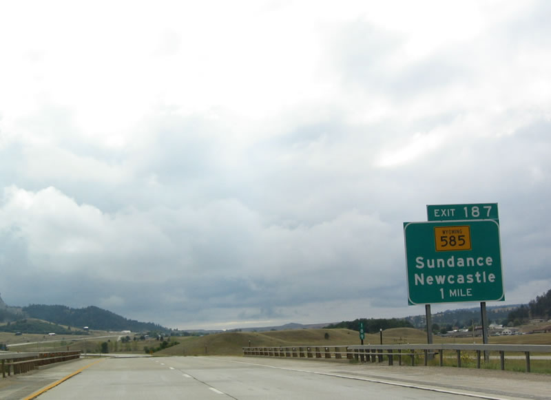 |
The next exit along westbound Interstate 90 is Exit 187, Wyoming 585/Sixth Street. Use Wyoming 585 south to Horton and Four Corners; the route ends at its parent route, U.S. 85. U.S. 85 continues south to Newcastle. Photo taken 09/03/04. |
 |
Westbound Interstate 90 reaches Exit 187, Wyoming 585. Take Wyoming 585/South 6th Street north into downtown Sundance, where the state highway meets the business route at Cleveland Street. Photo taken 09/03/04. |
 |
The next exit is Exit 185, Junction Business Loop I-90, U.S. 14, and Wyoming 116. This interchange marks the western terminus of the Sundance business loop; U.S. 14 continues northwest toward Devils Tower National Monument. Wyoming 116 also emanates from this interchange; it travels south to Upton, where it meets U.S. 16. Photo taken 09/03/04. |
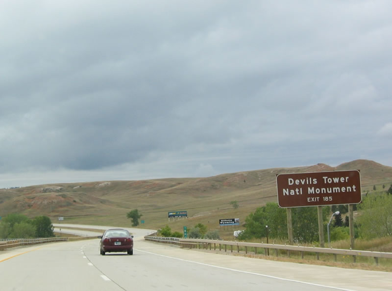 |
Use Exit 185, U.S. 14 northwest, to travel to Devils Tower National Monument. Photo taken 09/03/04. |
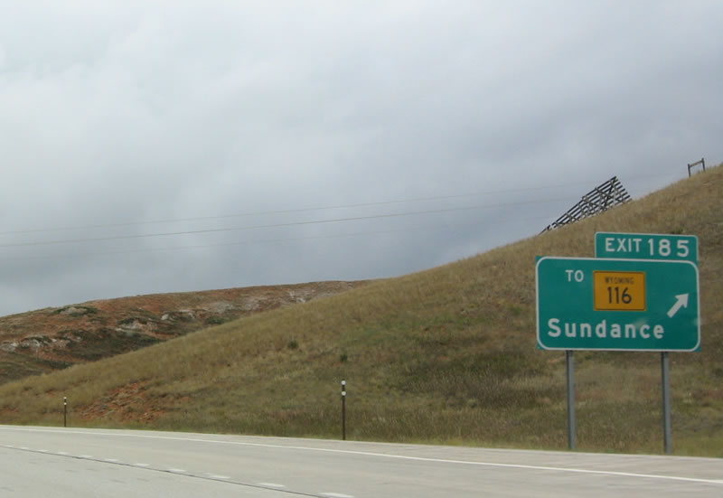 |
Westbound Interstate 90 reaches Exit 185, Junction Business Loop I-90 east, U.S. 14 east/west, and Wyoming 116 south. This is final Sundance exit and the last services until Moorcroft. Photo taken 09/03/04. |
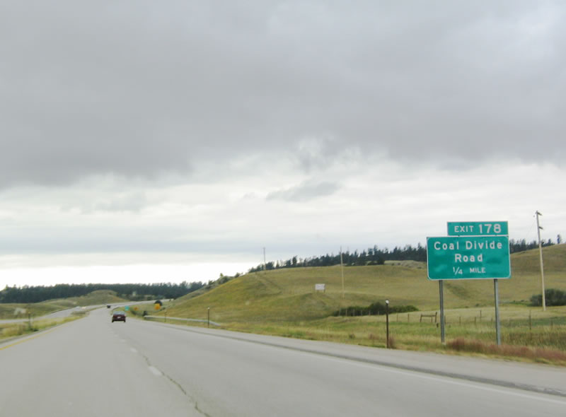 |
The next exit along westbound is Exit 178, Coal Divide Road. Photo taken 09/03/04. |
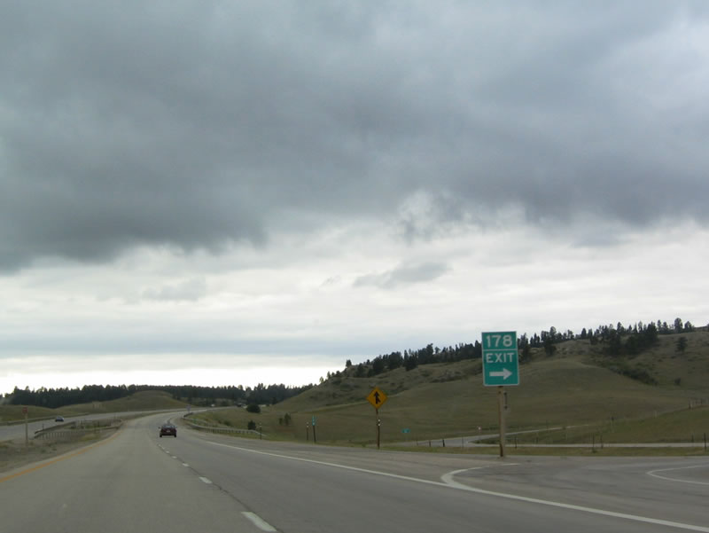 |
Westbound Interstate 90 reaches Exit 178, Coal Divide Road. There are no services at this exit; it is another local access interchange. Photo taken 09/03/04. |
 |
The next exit along westbound Interstate 90 is Exit 172, Inyan Kara Road. Photo taken 09/03/04. |
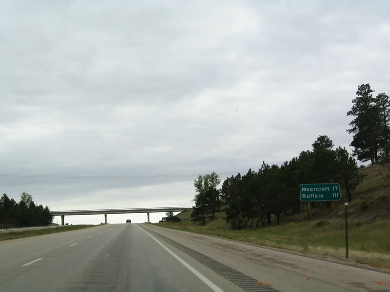 |
This mileage sign provides the distance to Moorcroft (17 miles) and Buffalo (111 miles). Gillette is omitted from this sign. Photo taken 09/03/04. |
 |
Now descended from the brief summit after Inyan Kara Road, the next exit along westbound Interstate 90 is Exit 165, Pine Ridge Road north to Pine Haven Reservoir. Use Pine Ridge Road north to Wyoming 113 and Keyhole State Park, which is situated around the Pine Haven Reservoir. Photo taken 09/03/04. |
 |
Westbound Interstate 90 approaches Exit 165, Pine Ridge Road. Keyhole State Park offers water-based recreational opportunities on the approximately 14,720 square foot reservoir. Fishing, swimming, camping, hiking, and picnicking are among the available activities. Photo taken 09/03/04. |
 |
Looking to the north, Devils Tower appears no larger than a thimble on the horizon, but it is almost 20 miles north of here as the eagle flies. Photo taken 09/03/04. |
 |
The next exit is Exit 160, Wind Creek Road. This is another local access interchange with no services. Photo taken 09/03/04. |
 |
Continuing west, Interstate 90 next approaches the town of Moorcroft. Exit 154 connects to Business Loop I-90 and U.S. 14-16 en route to downtown Moorcroft. The town of Moorcroft (elevation 4,206 feet above sea level) in western Crook County is home to 807 people (per the 2000 Census), the town has an economy based on ranching and tourism. Mine workers also drive from Moorcroft to energy-rich Campbell County to the west. Photo taken 09/03/04. |
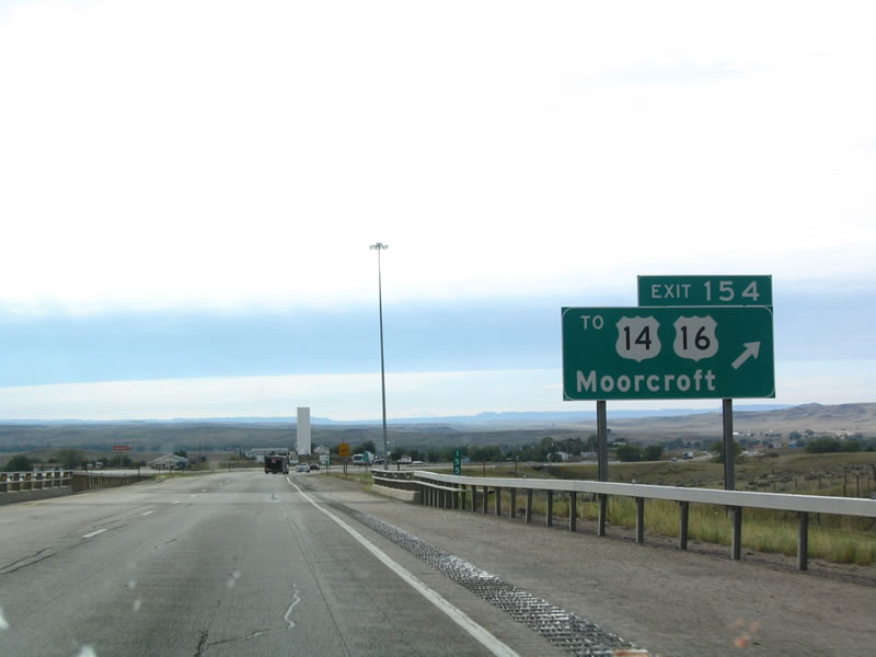 |
Westbound Interstate 90 reaches Exit 154, Junction Business Loop I-90 west to U.S. 14 east and U.S. 16 east. To U.S. 14-16 west to Arvada, continue west on Interstate 90 to Gillette. Photo taken 09/03/04. |
 |
One mile ahead is the second and final Moorcroft interchange, Exit 153, Junction Business Loop I-90 and U.S. 14-16. Photo taken 09/03/04. |
 |
Westbound Interstate 90 meets Exit 153, Junction Business Loop I-90 and U.S. 14-16 east to Moorcroft. U.S. 14-16 west merge onto Interstate 90 between here and Gillette. Photo taken 09/03/04. |
Sources:
- "A Grand Opening for the Northeast Wyoming Welcome Center." press release dated July 7, 2010 by Diane Shober, which states, "The newest gateway to Wyoming will be on display for its grand opening at 3:00 p.m. on July 16, 2010; located off I-90 at exit 199. Governor Dave Freudenthal will lead the ribbon cutting ceremony for the new state-of-the-art welcome center that is expected to greet millions of visitors traveling from Mount Rushmore and the Black Hills of South Dakota to Wyoming's national parks and monuments."
 |
 |
Page Updated August 29, 2011.
|
About Contact FAQ |
Spotlights Testimonials Interstate Guide |
Social Media:
 |
|
© 2000-23 AARoads.com | All Rights Reserved | Privacy Policy / Terms of Use
|
||