Nevada State Route 164
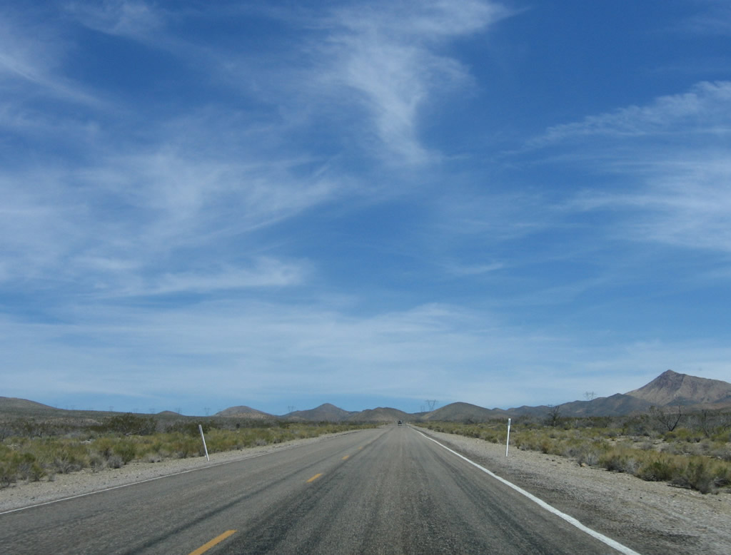
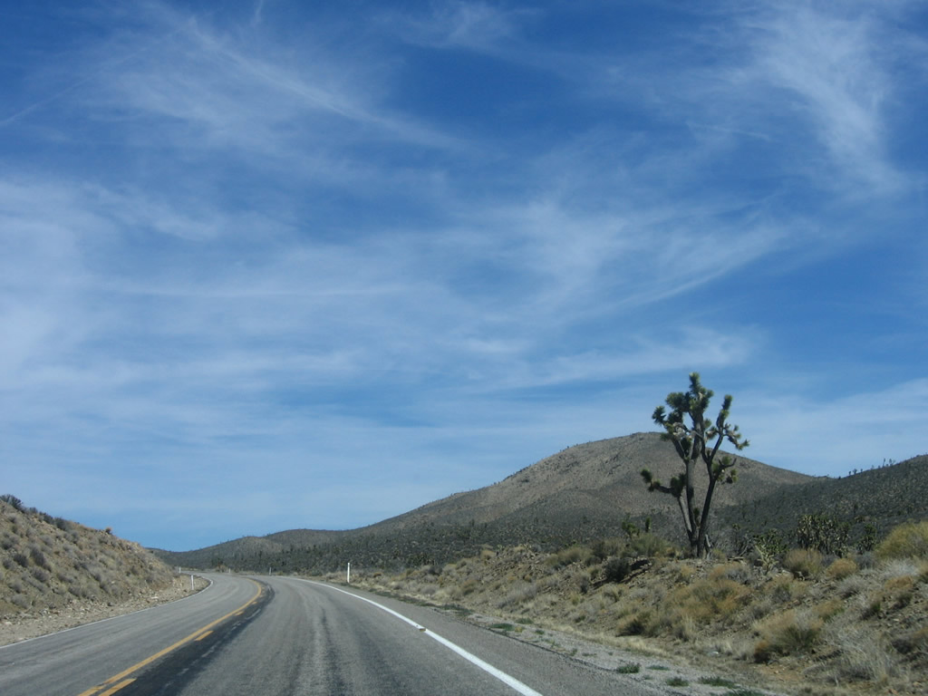
Leaving the California-Nevada state line, eastbound Nevada 164/Joshua Tree Highway ascends toward the pass formed between the McCullough Mountains to the north and New York Mountains to the south. Photo taken 04/02/06.
Nevada 164, along with Nipton Road in California, forms an east-west corridor connecting Interstate 15 Exit 286 with U.S. 95 at Searchlight via Nipton through the Mojave National Preserve. The route is maintained by San Bernardino County in California and by the state of Nevada in Nevada. A locally maintained highway extends east from Searchlight to Cottonwood Cove on Lake Mohave.
Nevada 164 was formerly part of Nevada 68. The designations were changed as part of a statewide renumbering effort in 1976; signage changed in the years thereafter.
| Nevada 164/Joshua Tree Highway east | |
|---|---|
 |
Leaving California, Nipton Road transitions from a San Bernardino County-maintained highway into Nevada 164, which carries traffic from the state line east into Nevada. Nevada 164 continues east througt the site of Crescent and continues into the unincorporated community of Searchlight. Photo taken 04/02/06. |
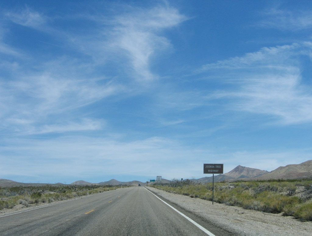 |
While there is no initial reassurance shield for Nevada 164, the highway is identified as the Joshua Tree Highway. Photo taken 04/02/06. |
 |
This mileage sign provides the distance to Searchlight (U.S. 95, 18 miles) and Cottonwood Cove at Lake Mohave (within the larger Lake Mead National Recreation Area, 32 miles). Photo taken 04/02/06. |
|
Leaving the California-Nevada state line, eastbound Nevada 164/Joshua Tree Highway ascends toward the pass formed between the McCullough Mountains to the north and New York Mountains to the south. Photo taken 04/02/06. |
 |
 |
 |
Nevada 164/Joshua Tree Highway passes under a set of Southern California Edison power lines. The 500kV power line is part of the massive Path 46 (West of Colorado River) and extends from the Eldorado power substation southwest to the Lugo substation in Hesperia, California. A second 500kV line leads from the Mohave Generation Station to the Lugo substation; Nevada 164 pass under that line prior to entering Searchlight (see below). South of Lugo, several Southern California Edison 500kV power lines lead south through Cajon Pass/Cajon Summit area (visible from Interstate 15) into Fontana and points south. The two single-circuit 230kV power lines also make the connection from the Lugo to Eldorado substations. Photos taken 04/02/06. |
 |
 |
 |
 |
 |
 |
Nevada 164/Joshua Tree Highway continues to gain elevation and sees Joshua trees along its route for the first time on its eastbound journey. Crescent Peak rises in the distance and a bit to the right (south) of the highway. At the end of this set of photos, Nevada 164 passes through Crescent and between the two mountain chains (north and south). Photos taken 04/02/06. |
 |
 |
 |
|
 |
 |
 |
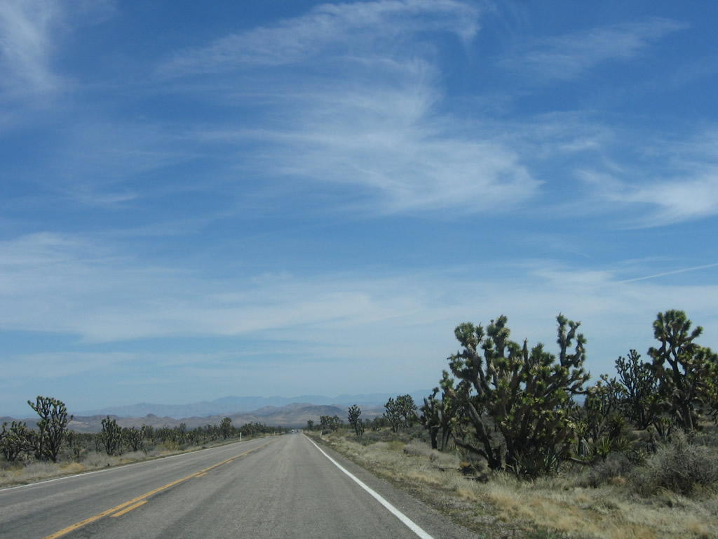
Continuing east, Nevada 164 sees a wealth of Joshua trees on both sides of the highway. Photos taken 04/02/06. |
 |
 |
 |
|
 |
 |
 |
 |
A Nevada 164 east reassurance shield. Photo taken 04/02/06. |
 |
The next intersection along Nevada 164 east is with Walking Box Ranch Road. Photo taken 04/02/06. |
 |
Continuing east, Nevada 164 sees fewer Joshua trees and more sagebrush. In the distance is the community of Searchlight and the junction with U.S. 95. Photo taken 04/02/06. |
 |
Some distance ahead, eastbound Nevada 164 approaches the limits of Searchlight. A second 500kV power line (likely owned by Southern California Edison), which is also part of Path 46, connects the Mohave Generation Station near Laughlin (to the southeast) and Eldorado Substation (to the north). Companion 230kV power lines also follow this power corridor. Photo taken 04/02/06. |
 |
Two of the companion 230kV are the same power lines that cross Interstate 40 at Water Road in the Mojave Desert. Power lines tend to travel great distances to connect power generating facilities with population areas. These lines are likely to be owned by the Los Angeles Department of Water and Power. A third 230kV power line (single circuit, not shown) is likely owned by Nevada Power. Photo taken 04/02/06. |
 |
After passing under the power lines, eastbound Nevada 164 approaches the unincorporated town of Searchlight. Most motorist services (food, gas, lodging) are available in Searchlight. Photo taken 04/02/06. |
 |
The speed limit along Nevada 164 east reduces to 35 miles per hour. Searchlight was home to 576 people as of the 2000 Census; it was first explored in 1897 by gold prospector George Frederick Colton; gold was mined in the area between 1907 and 1910. Initially Searchlight was on the main route from Las Vegas to Los Angeles, but this changed when U.S. 91 was routed onto what is now the modern Interstate 15 alignment through Primm. Population declined as mining activity diminished (the last mine closed in 1953), but population has held on with the location on U.S. 95 between Las Vegas and Laughlin and the proximity of Lake Mead National Recreation Area. Photo taken 04/02/06. |
 |
Eastbound Nevada 164 approaches its junction with U.S. 95 in downtown Searchlight. At this intersection, turn left for U.S. 95 north to Boulder City, Henderson, and Las Vegas. Turn right for U.S. 95 south to Laughlin (via Nevada 163 and Needles. Continue straight ahead to Cottonwood Cove on Lake Mohave in Lake Mead National Recreation Area. Photo taken 04/02/06. |
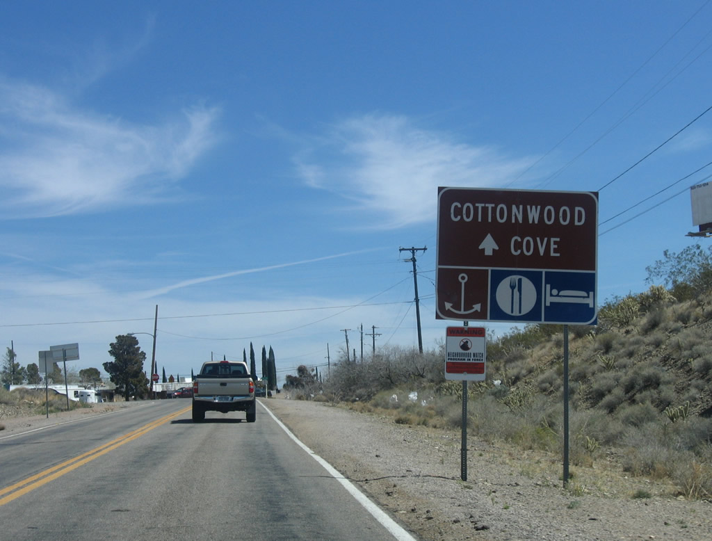 |
A secondary sign advises of a boat launch ramp, lodging, and food at Cottonwood Cove. Photo taken 04/02/06. |
 |
Nevada 164 ends at the intersection with U.S. 95. Cross-traffic on U.S. 95 does not stop. No end shield is posted here. Photo taken 04/02/06. |
Page Updated February 27, 2010.
|
About Contact FAQ |
Spotlights Testimonials Interstate Guide |
Social Media:
 |
|
© 2000-23 AARoads.com | All Rights Reserved | Privacy Policy / Terms of Use
|
||