Nevada State Route 592
Flamingo Road is designated as Nevada 592 from Nevada 595/Rainbow Boulevard east to Nevada 582/Boulder Highway. This major east-west arterial serves the University of Nevada at Las Vegas (UNLV) and the Las Vegas Strip, when it intersects Las Vegas Boulevard. At this busy intersection, the major casino-resorts include the Flamingo (NE corner), Bally's (SE corner), Bellagio (SW corner), and Caesar's Palace (NW corner). A route gap exists between Interstate 15 and former Nevada 605/Paradise Road; otherwise, the rest of Flamingo Road between these two points is state maintained.
| Nevada 592/Flamingo Road east | ||
|---|---|---|
 |
This view looks east along Flamingo Road from the pedestrian overpass on the east side of Las Vegas Boulevard. Bill's casino and the towering Flamingo resort are on the left (north) side of the street, while Bally's and Paris are on the south side. Photo taken 02/21/10. | |
 |
Flamingo Road is designated as Nevada 592 from Nevada 595/Rainbow Boulevard east to Nevada 582/Boulder Highway. This reassurance shield was posted on eastbound Nevada 592/Flamingo Road after the intersection with Nevada 604 (Las Vegas Boulevard). The shield was gone by 2008. Photo taken 04/01/06. | |
 |
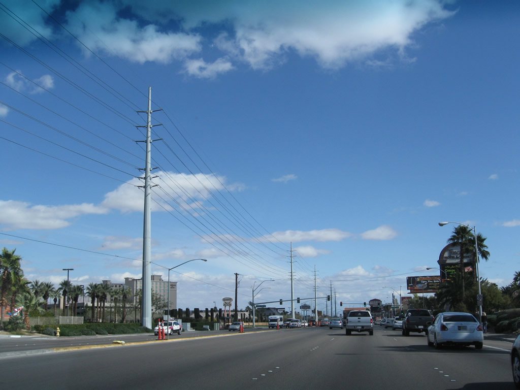
Leaving the Las Vegas Strip prior to the Koval Lane intersection, eastbound Flamingo Road sees less development as it proceeds east. Photo taken 02/21/10. | |
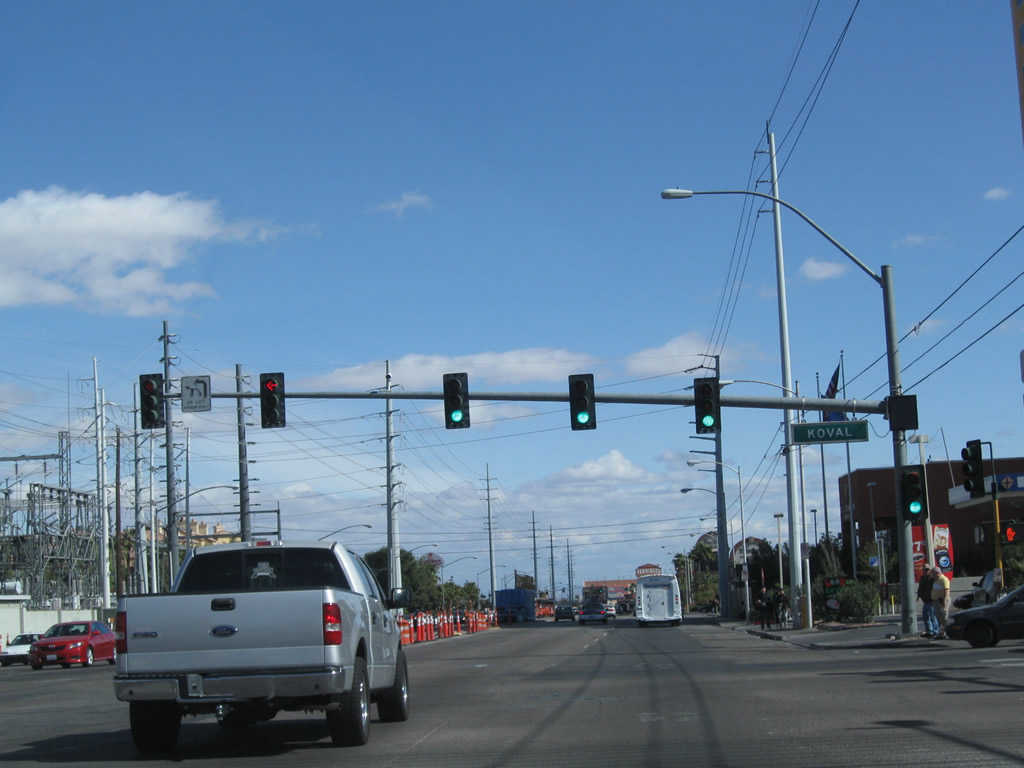 |
Eastbound Flamingo Road meets Koval Lane at this traffic signal. Koval Lane provides access to the back of the casino-resorts on the east side of Las Vegas Boulevard, including Bally's, Paris, Planet Hollywood, and MGM Grand. A large Nevada Power substation is located at the north side of the intersection. Photo taken 02/21/10. | |
 |
A quad-circuit Nevada Power line (likely 138kV/69kV) parallels Flamingo Road as we leave the Strip. Photo taken 02/21/10. | |
 |
After the traffic signal leading into the Tuscany resort-casino, eastbound Flamingo Road approaches Paradise Road (former Nevada 6050). Turn left to follow Paradise Road into downtown Las Vegas or south to McCarran International Airport. Photo taken 02/21/10. | |
 |
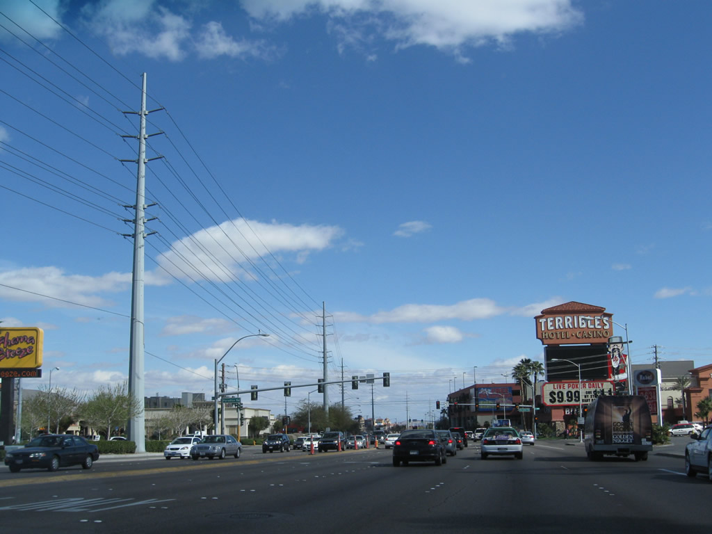
At the southeast corner of Flamingo Road and Paradise Road is Terrible's Hotel and Casino. At this point, state maintenance resumes for Flamingo Road (per the 2008 list of Nevada's state maintained highways), although there are no obvious signs that show the current beginning of Nevada 592. Photo taken 02/21/10. | |
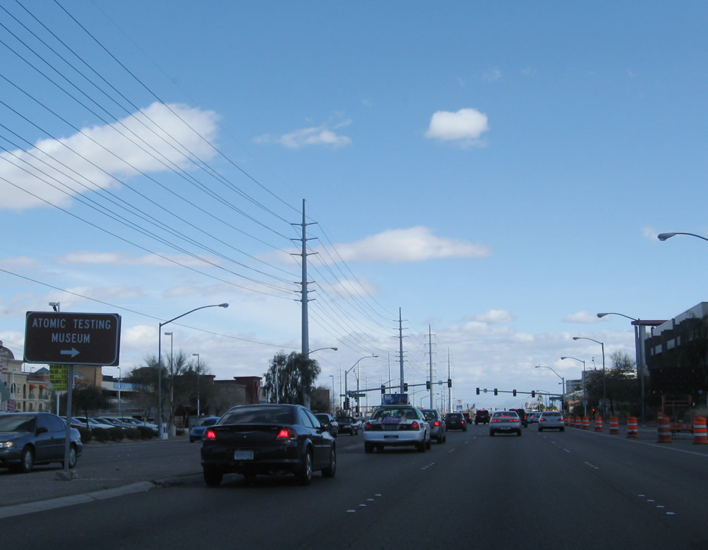 |
After the Paradise Road intersection, eastbound Flamingo Road (Nevada 592) approaches the turnoff to the Atomic Testing Museum. Photo taken 02/21/10. | |
 |
Eastbound Flamingo Road (Nevada 592) approaches the intersection with Swenson Street. Photo taken 02/21/10. | |
 |
Another Nevada Power substation is located on the north side of Flamingo Road prior to the Claymont Street intersection. Photo taken 02/21/10. | |
 |
Eastbound Flamingo Road (Nevada 592) meets Claymont Street at this traffic signal. Photo taken 02/21/10. | |
 |
The next traffic signal along eastbound Flamingo Road (Nevada 592) is with Maryland Parkway. Photo taken 02/21/10. | |
 |
Eastbound Flamingo Road (Nevada 592) meets Escondido Street at the Clark County Public Library. Nevada 592 next approaches the traffic signal intersection with Algonquin Drive and Viking Road north and Tamarus Street south. Photo taken 02/21/10. | |
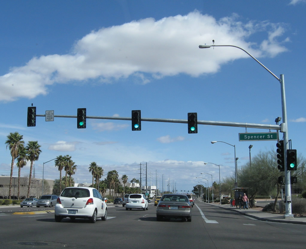 |
Eastbound Flamingo Road (Nevada 592) meets Spencer Street at this signalized intersection. Photo taken 02/21/10. | |
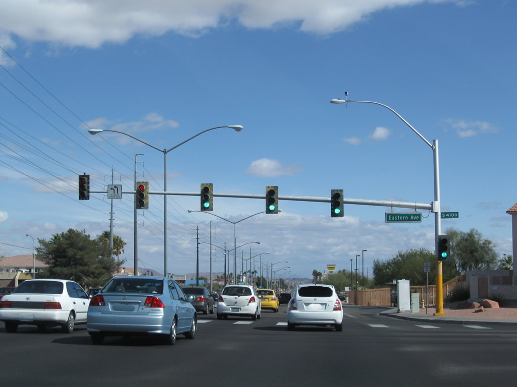 |
After the signalized intersection with Burnham Avenue, eastbound Flamingo Road (Nevada 592) approaches Eastern Avenue. Photo taken 02/21/10. | |
 |
Palm trees and power lines follow Flamingo Road (Nevada 592) east after Eastern Avenue. Photo taken 02/21/10. | |
 |
Eastbound Flamingo Road (Nevada 592) meets McLeod Drive at this traffic signal. Photo taken 02/21/10. | |
 |
Continuing east, Flamingo Road (Nevada 592) meets Pecos Road at this intersection. Follow Pecos Road south to Interstate 215 and Nevada 146/St. Rose Parkway. Photo taken 02/21/10. | |
| Nevada 592/Flamingo Road west | ||
|---|---|---|
 |
We begin our westbound journey on Nevada 592/Flamingo Road after the intersection with Paradise Road (Former Nevada 605). The towers of the Platinum Resort and Bally's Resort are visible ahead; Bally's is located at the intersection between Flamingo Road and Las Vegas Boulevard. Photo taken 04/02/06. | |
 |
Westbound Nevada 592/Flamingo Road meets Howard Hughes Parkway at this signalized intersection. Photo taken 04/02/06. | |
 |
 |
Power lines that have paralleled Nevada 592 turn north in preparation for entering a substation. The substation can be seen on the north side of Flamingo Road. Photos taken 04/02/06. |
|
Westbound Nevada 592/Flamingo Road next meets Koval Lane at this signalized intersection. Photo taken 04/02/06. |
 |
The Las Vegas Monorail skirts around Bally's Resort, then crosses Flamingo Road. A monorail station is located at Bally's Resort, and the monorail travels south to MGM Grand resort (at Tropicana Avenue) and north to Sahara Avenue near the Stratosphere. Photo taken 04/02/06. |
 |
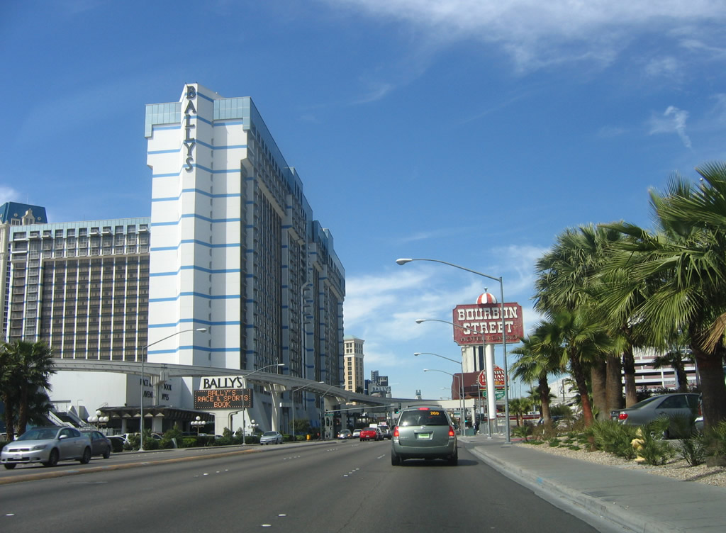
Prior to the intersection with Las Vegas Boulevard, this view shows westbound Nevada 592/Flamingo Road as the state route passes by Bally's resort on the south and the Flamingo resort on the north. Caesar's Palace is located on the northwestern corner of this intersection. Photo taken 04/01/06. |
 |
 |
Westbound Flamingo Road (former Nevada 592) meets Las Vegas Boulevard at this traffic signal. Like the intersection between Las Vegas Boulevard and Tropicana Avenue (former Nevada 593), pedestrian traffic is routed onto skybridges that pass over the intersection. On the southwest corner is the Bellagio; on the northwest corner is the Caesar's Palace. Photos taken 02/21/10. |
 |
 |
Page Updated February 28, 2010.
|
About Contact FAQ |
Spotlights Testimonials Interstate Guide |
Social Media:
 |
|
© 2000-23 AARoads.com | All Rights Reserved | Privacy Policy / Terms of Use
|
||