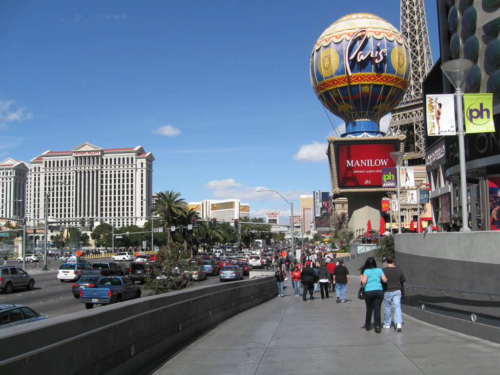
Northward vista of Las Vegas Boulevard from the replica Eiffel Tower located at the Paris resort and casino. The eight-lane arterial aims slightly northeast toward the northern Las Vegas Strip en route to Downtown Las Vegas. 02/21/10
|
| Las Vegas Boulevard northbound meets SR 146 (St. Rose Parkway) at this traffic signal. SR 146 west ends at parallel Interstate 15 nearby. The state route angles northeast along a four lane, divided highway to I-215 and Henderson. The Las Vegas Strip comes into view in the distance ahead. 02/21/10 |
|
| The famous "Welcome to Fabulous Las Vegas" sign is located within a landscaped median along Las Vegas Boulevard south of the intersection with Russell Road. 03/31/08 |
|
| It is common for the median to have tourists huddled around the sign for a photo to memorialize their visit to the world-famous city. As such, a parking area was created to the south and fencing installed around the welcome sign grounds by 2009. 03/31/08 |
|
| An I-15 trailblazer stands between the north and south roadways of Las Vegas Boulevard ahead of Russell Road west to the freeway and Mandalay Bay resort. 03/31/08 |
|
| No hazardous materials vehicles or through trucks are permitted on Las Vegas Boulevard beyond Russell Road. 03/31/08 |
|
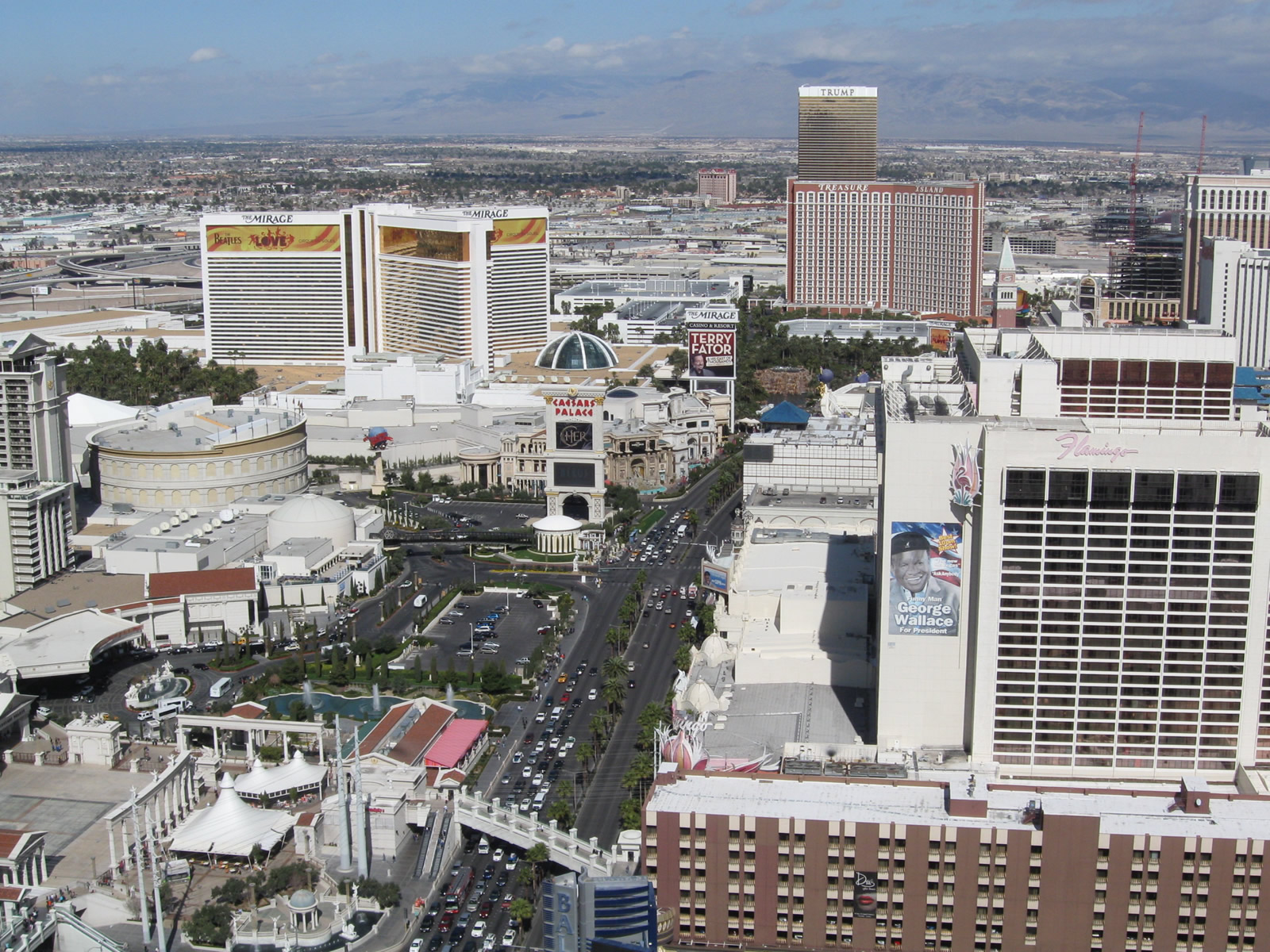
| SR 604 previously ended from the south at Russell Road. The gleaming Mandalay Bay resort on the west side of the Las Vegas Strip is more indicative of modern Las Vegas while the older developed east side along this stretch is populated by wedding chapels, restaurants, and motels. 03/31/08 |
|
| Las Vegas Boulevard is a scenic route through the Las Vegas Strip. The Strip is generally considered to extend from Russell Road near the Mandalay Bay resort to Baltimore Avenue near Stratosphere Las Vegas resort, just north of the Las Vegas city limits. 03/31/08 |
|
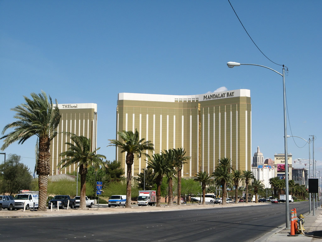
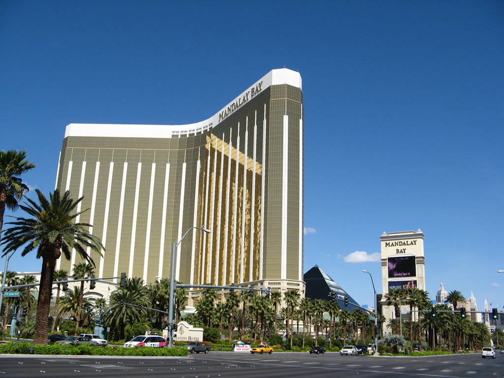
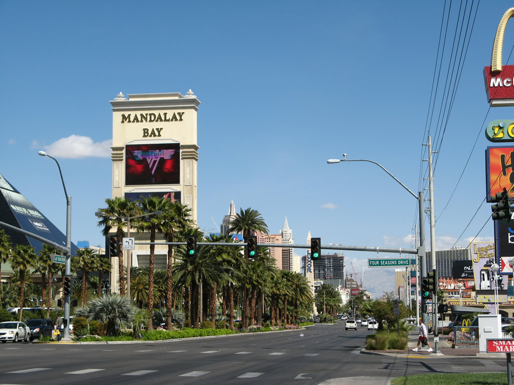
| Las Vegas Boulevard intersects Four Seasons Drive, a local street east to Haven Street, across from Mandalay Bay resort. 03/31/08 |
|
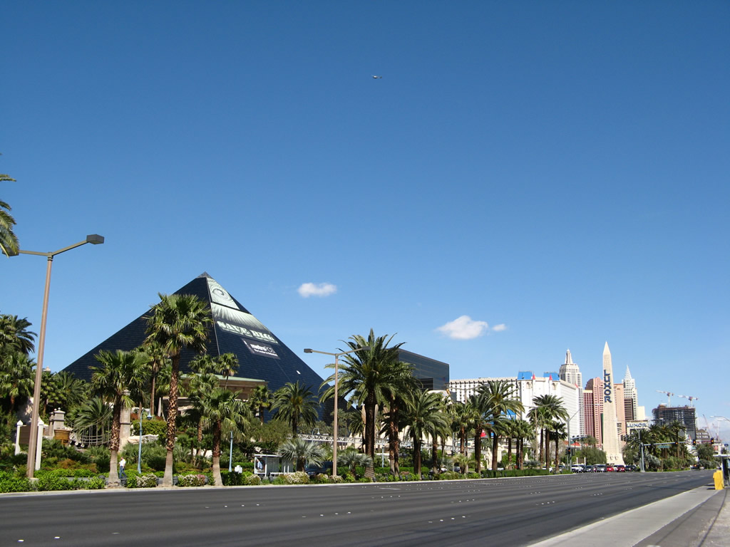
| The Luxor pyramid, obelisk, and hotel buildings line the west side of Las Vegas Boulevard between Russell Road and Tropicana Avenue (SR 593). 03/31/08 |
|
| Northbound Las Vegas Boulevard meets Mandalay Bay Road at this signalized intersection. This boulevard separates the Mandalay Bay from the Luxor resort and spans I-15 west to become Hacienda Avenue by the new Las Vegas Stadium site for NFL's Raiders. 03/31/08 |
|
| Passing by the Luxor, Las Vegas Boulevard north next intersects Reno Avenue. The Tropicana resort and the MGM Grand resort marquees are visible on the east side of the boulevard. 03/29/08 |
|
| The left three lanes turn west onto SR 593 (Tropicana Avenue) while the right lane connects to the state route east to McCarran International Airport (LAS) and the University of Nevada at Las Vegas (UNLV). 03/29/08 |
|
| A dozen lanes come together at the massive intersection between Las Vegas Boulevard and Tropicana Avenue (SR 593). A pedestrian bridge connects the Excalibur and Tropicana resorts over Las Vegas Boulevard. Other pedestrian spans cross over the remaining quadrants of the intersection. 03/29/08 |
|
| There are no at-grade crosswalks at the busy intersection with SR 593 (Tropicana Avenue). Las Vegas Boulevard within the intersection is still state maintained as snippet of SR 604. 03/29/08 |
|
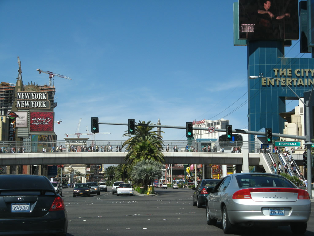
| Looking from the pedestrian bridge between the New York New York and MGM Grand resorts, this view shows Las Vegas Boulevard with eight general travel lanes and three left turn lanes. These pedestrian bridges were all built in 1994, followed by construction of the adjacent New York New York casino, which opened on January 3, 1997. 03/29/08 |
|
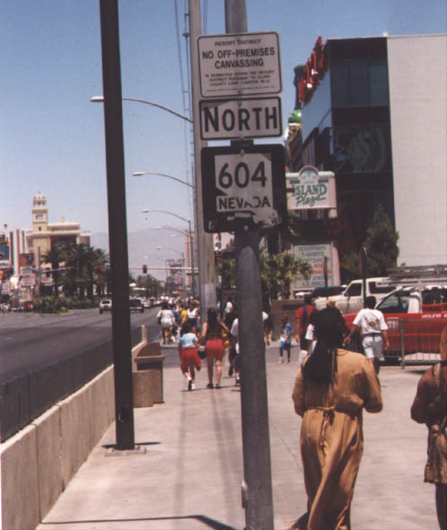
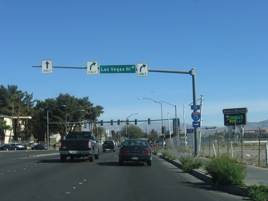
| A confirming marker for SR 604 north was previously posted beyond SR 593 (Flamingo Avenue) by the MGM Grand resort. It was removed following the 2004 relinquishment of Las Vegas Boulevard between Russell Road and SR 593 (Sahara Avenue). 11/12/00, 01/20/02 |
|
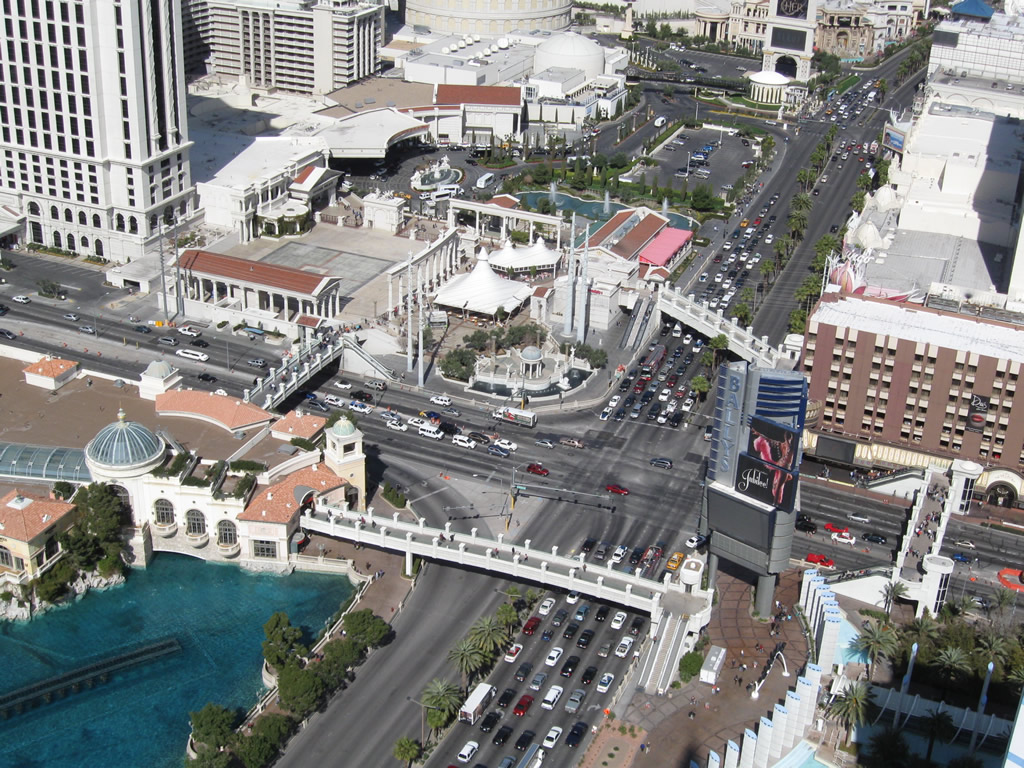
| Las Vegas Boulevard passes between City Center on the west side of the Strip to Harmon Avenue. Cosmopolitan-Las Vegas and Planet Hollywood Resort & Casino occupy the northern quadrants of the Harmon Avenue intersection. 02/21/10 |
|
| Bellagio Drive loops west to the Bellagio resort opposite the Planet Hollywood and Paris resorts on the east side of Las Vegas Boulevard. 02/21/10 |
|
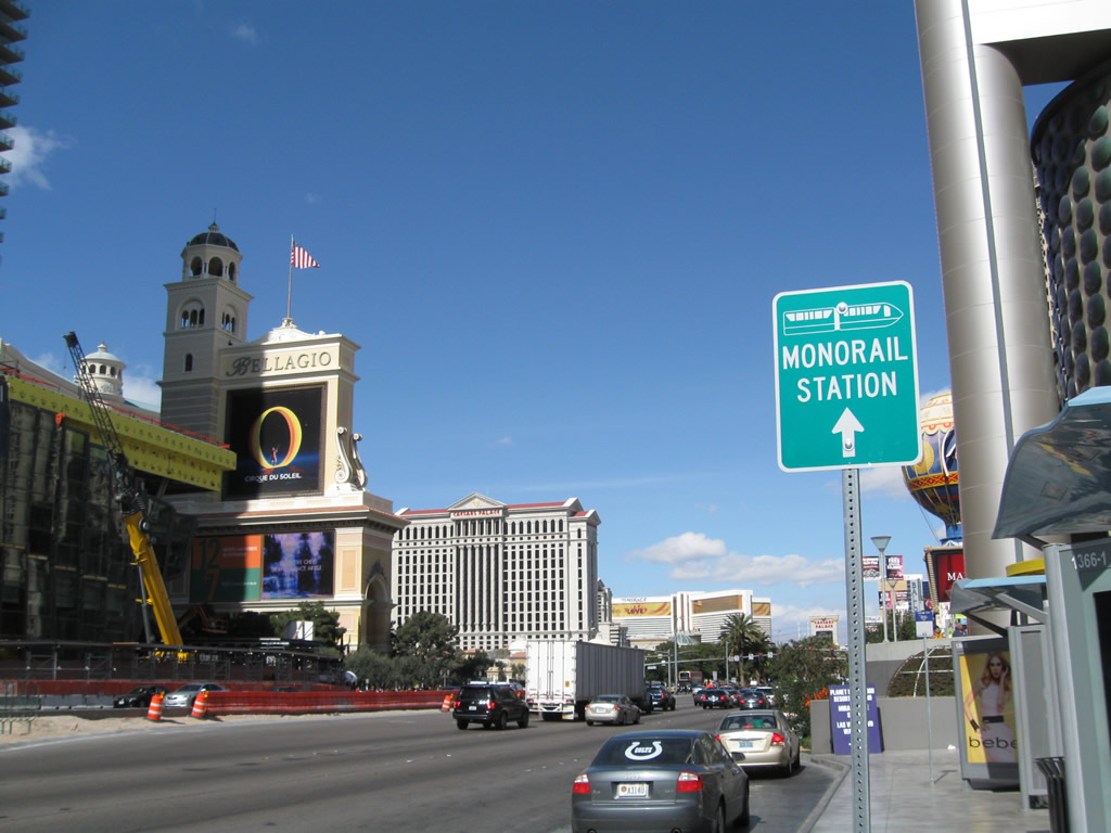
| Bally's Las Vegas Hotel & Casino lies at the southeast corner of Las Vegas Boulevard and Flamingo Road (SR 592). The entrance to the Las Vegas Monorail is located at the rear of Bally's casino. 02/21/10 |
|
| This view shows Las Vegas Boulevard at the intersection with Flamingo Road (former SR 592) from the replica Eiffel Tower at the Paris resort. Pedestrian bridges span all points of this intersection. 02/21/10 |
|
| Viewing the intersection of Las Vegas Boulevard and Flamingo Road from the pedestrian bridge joining the Bellagio with Bally's Las Vegas. Flamingo Road is a part of SR 592 west of I-15 and east of Paradise Road (former SR 605). 02/21/10 |
|
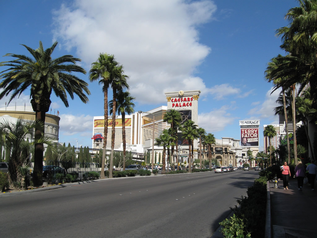
| North of Flamingo Road (former SR 592), Las Vegas Boulevard passes between the Flamingo to the east and Caesar's Palace to the west. 02/21/10 |
|
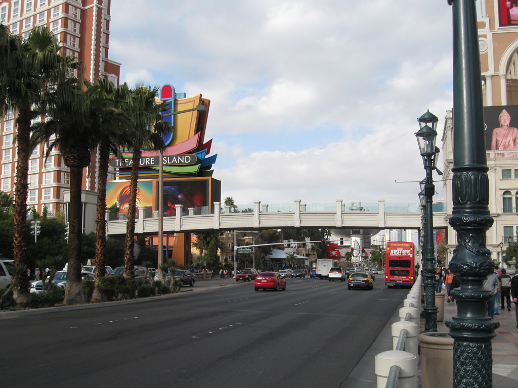
| Beyond Caesar's Palace resort and casino, Las Vegas Boulevard north approaches the Mirage and Treasure Island casinos on the left and the Linq, and Harrah's casinos on the right. 02/21/10 |
|
| The next signal along northbound Las Vegas Boulevard regulates traffic exiting the Mirage resort resort and casino. 02/21/10 |
|
| A pedestrian bridge crosses over Las Vegas Boulevard; it connects the Venetian resort with the Mirage and Treasure Island resorts. 02/21/10 |
|
| Looking north from the pedestrian bridge that connects the Venetian resort with the Mirage and Treasure Island resorts, this view shows the Palazzo, Wynn, Encore, and distant Stratosphere on Las Vegas Boulevard. 03/30/08 |
|
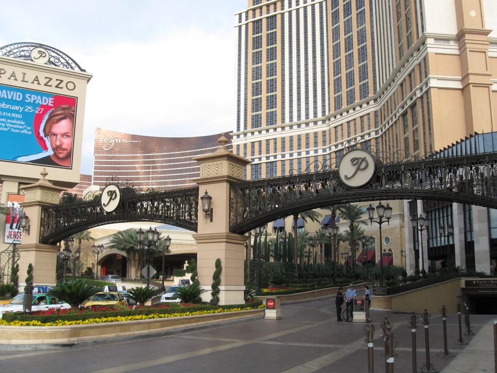
| Traffic lights operate along Las Vegas Boulevard at Siren's Cove Boulevard west to Treasure Island and the entrance to Palazzo. 02/10/10 |
|
| Looking north from Siren's Cove Boulevard and the Palazzo entrance at Las Vegas Boulevard toward Fashion Show mall. 02/10/10 |
|
| Las Vegas Boulevard intersects Spring Mountain Road (former SR 591) at the southeast corner of Fashion Show mall. Spring Mountain Road connects with I-15 via a pair of high speed flyovers nearby. 02/10/10 |
|
| The Wynn Las Vegas resort faces the intersection of Las Vegas Boulevard and Spring Mountain Road from the northeast. 03/30/08 |
|
| A pedestrian bridge spans Las Vegas Boulevard to connect the Wynn Las Vegas resort and Fashion Show Mall just beyond Spring Mountain Road west / Sands Avenue east. 03/30/08 |
|
| Northbound Las Vegas Boulevard at Fashion Show Drive west. The Frontier hotel and casino previously stood at the northwest corner of this intersection. It was demolished on November 13, 2007, after being continuously operated since 1942. 03/30/08 |
|
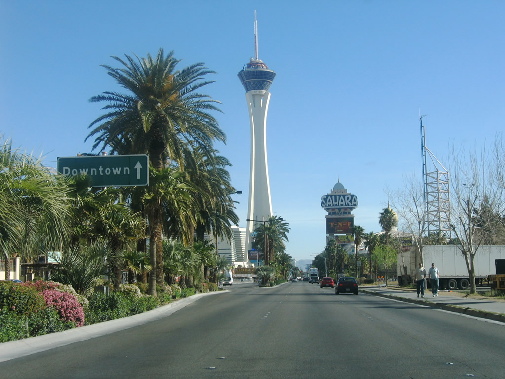
| A button copy sign references Downtown within the median of Las Vegas Boulevard north of the Circus Circus resort. The vintage sign dates back to when U.S. 91 & 466 were still designated along The Strip. 04/01/06 |
|
| Las Vegas Boulevard enters the Las Vegas city limits at the intersection with Sahara Avenue (SR 589). The adjacent SLS Las Vegas resort represents the north end of the Las Vegas Monorail, which extends south toward MGM Grand via the Las Vegas Hilton, Las Vegas Convention Center, and Bally's resort. 04/01/06 |
|
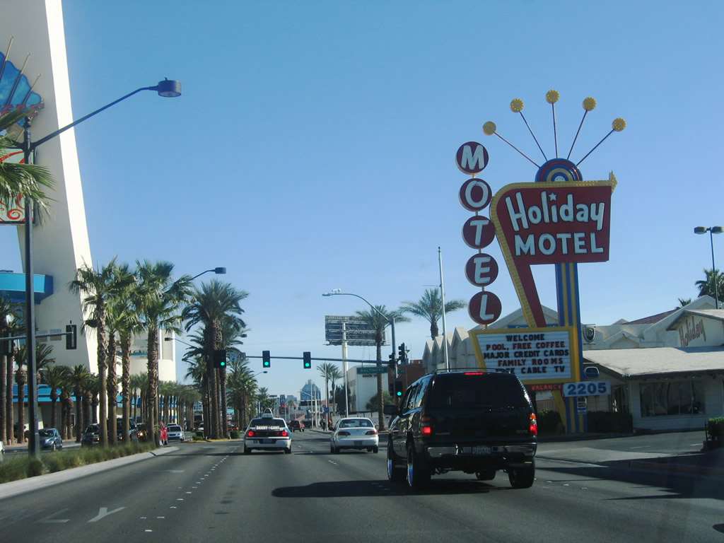
| Las Vegas Boulevard intersects Bob Stupak Avenue (former Baltimore Avenue) west at the Stratosphere Las Vegas resort across from the vintage Holiday Motel. The Stratosphere opened on April 30, 1996. 04/01/06 |
|
| St. Louis Avenue west and Main Street south come together at the ensuing northbound traffic light along Las Vegas Boulevard (former SR 604). Main Street was historically a part of U.S. 91 Alternate and later SR 601 north into Downtown Las Vegas. Paradise Road (former SR 605) stems south from St. Louis Avenue nearby to McCarron International Airport (LAS). 04/01/06 |
|
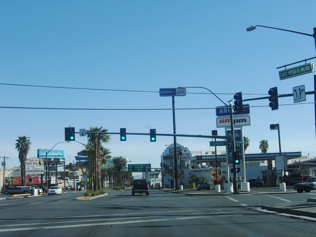
| Northbound Las Vegas Boulevard meets Oakey Avenue at this traffic signal. 04/01/06 |
|
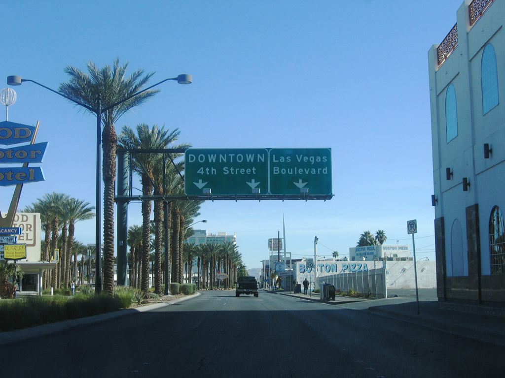
| Las Vegas Boulevard prepares to split with Fourth Street north into Downtown Las Vegas after the signal at Wyoming Avenue. Fourth Avenue is a one way street that parallels Las Vegas Boulevard northward to near Interstate 515 and U.S. 93-95. 04/01/06 |
|
| A "Welcome to Fabulous Downtown Las Vegas" sign stands at the split between Fourth Street and Las Vegas Boulevard. 04/01/06 |
|
| Unmarked from Las Vegas Boulevard, Charleston Boulevard is SR 159 across the city of Las Vegas east to Nellis Boulevard (SR 612) and west toward Red Rock Canyon. 04/01/06 |
|
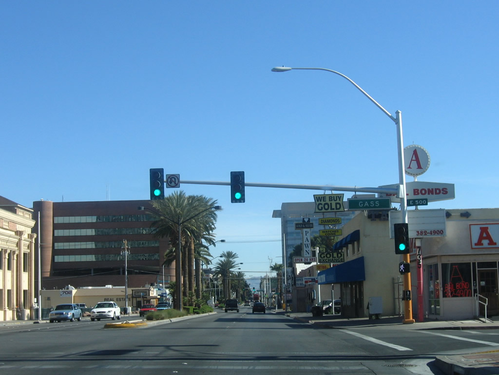
| Continuing in a northeasterly direction, Las Vegas Boulevard intersects Gass Avenue at this traffic signal. 04/01/06 |
|
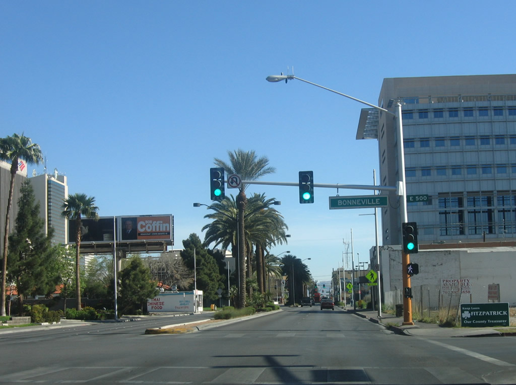
| The succeeding traffic signal along northbound is with Bonneville Avenue, a one way street traveling eastbound. 04/01/06 |
|
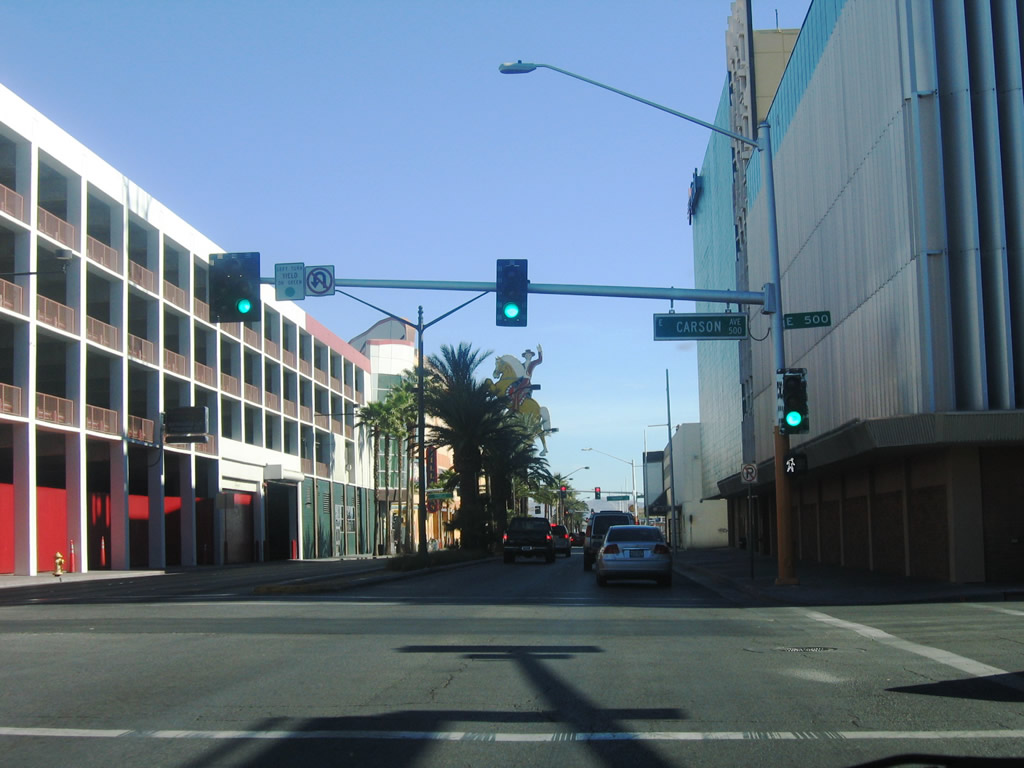
| Northbound Las Vegas Boulevard intersects Carson Avenue one block ahead of the Fremont Street Experience. 04/01/06 |
|
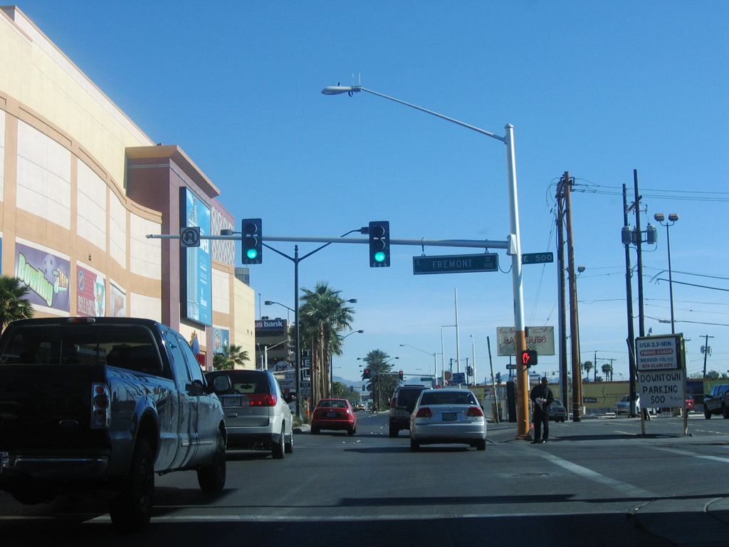
| Northbound Las Vegas Boulevard at Fremont Avenue southeast to SR 582 at 7th Street. No left turn is permitted since the Fremont Street Experience is closed to traffic. This intersection is notable historically for the place where U.S. 466 turned southeast toward Kingman, Arizona, and U.S. 93 merged onto U.S. 91 north toward North Las Vegas. 04/01/06 |
|
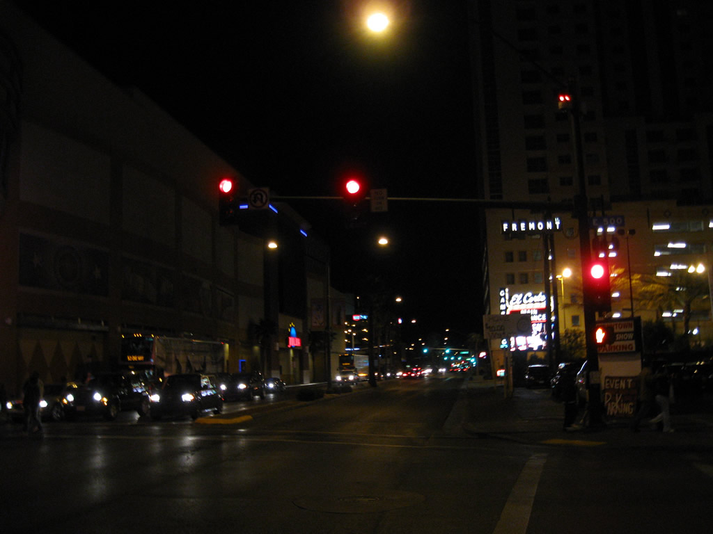
| The Fremont Street Experience opened on December 13, 1995. The northernmost five blocks of Fremont Street were converted to a pedestrian mall covered by a large canopy. The canopy displays a light show / music video during the evening, while music stages and zip lines are among the attractions below. 02/20/10 |
|
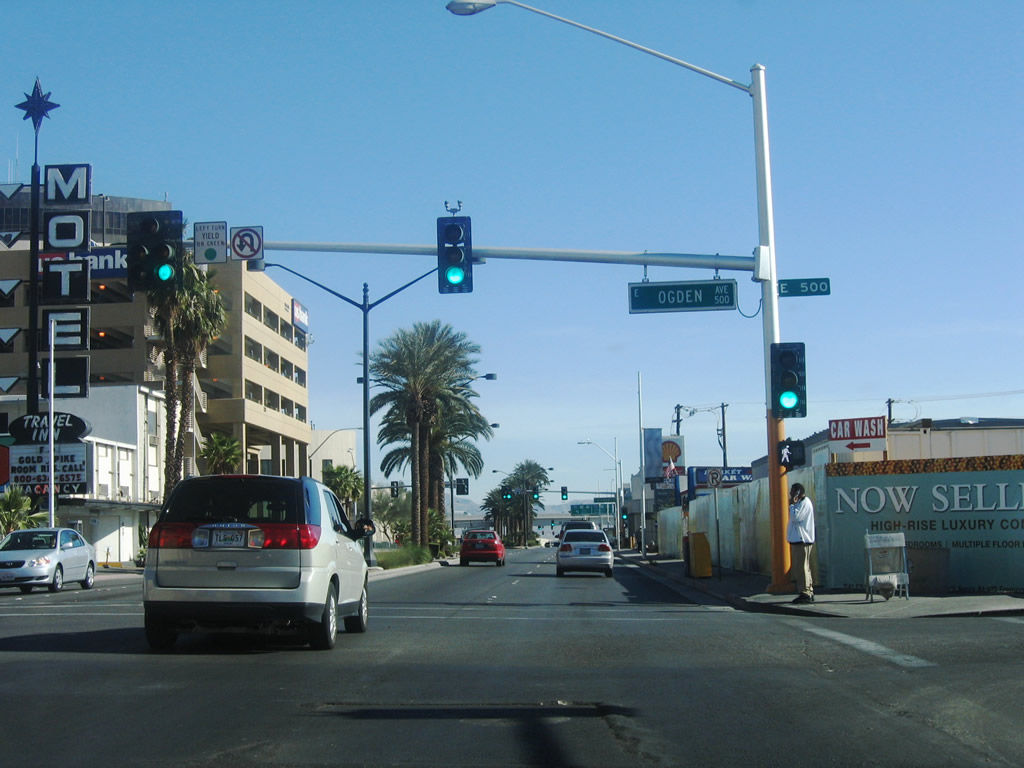
| Northbound Las Vegas Boulevard meets Ogden Avenue at the succeeding traffic signal. 04/01/06 |
|
| Operating since 2013, the Zappos Downtown Las Vegas Headquarters stands at the northwest corner of Las Vegas Boulevard and Stewart Avenue. The building was formerly Las Vegas City Hall. 04/01/06 |
|
| Interstate 515 & U.S. 93-95 (Oran K. Gragson Freeway) line the north side of Downtown Las Vegas. Las Vegas Boulevard meets the elevated freeway at a diamond interchange. 04/01/06 |
|
| Freeway entrance assembly for the I-515 southbound on-ramp to Henderson and I-11 to Boulder City. Street signs on the mast arm assemblies reference the freeway as U.S. 95 alone. 04/01/06 |
|
| Las Vegas Boulevard passes under Interstate 515 & U.S. 93-95 and intersects the northbound on-ramp to Summerlin, Ely (via U.S. 93) and Reno (via U.S. 95). 03/29/08 |
|
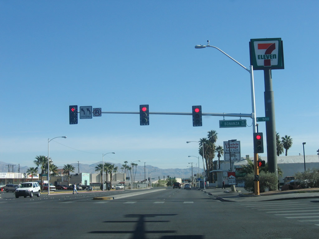
| Bonanza Road intersects Las Vegas Boulevard (former SR 604) just north of I-515 & U.S. 93-95. Bonanza Road parallels the Oran K. Gragson Freeway west as SR 579 to SR 599 (Rancho Drive). 04/01/06 |
|
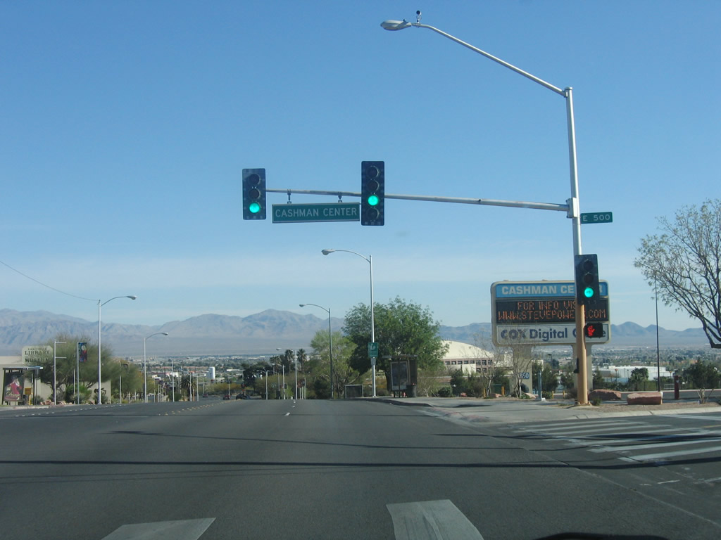
| Northbound Las Vegas Boulevard at the driveway to the Cashman Center and Cashman Field ball park. 04/01/06 |
|
| Between the Cashman Center and Washington Avenue, Las Vegas Boulevard passes by Heritage Park, Old Las Vegas Mormon Fort State Historic Park, Las Vegas National History Museum, and the Las Vegas Library. 04/01/06 |
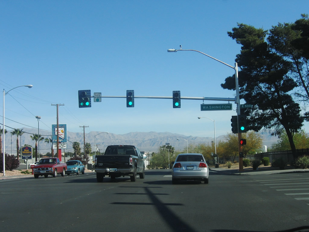
|
| Washington Avenue constitutes a four lane, divided arterial or five lane boulevard as it connects Las Vegas Boulevard with I-15 to the west and residential areas including Washington and College Park to the east. 04/01/06 |
|
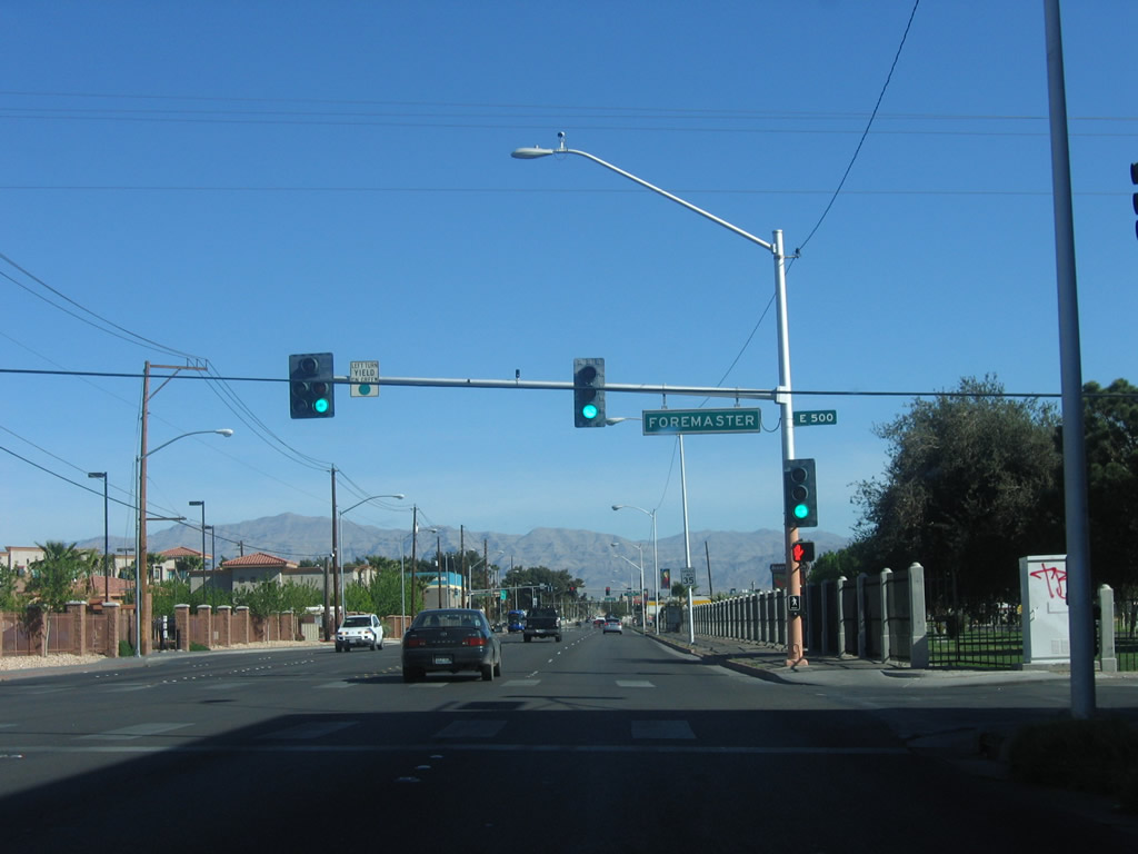
| Las Vegas Boulevard turns due north from Washington Avenue to run alongside Woodlawn Cemetery beyond the signal with Foremaster Lane. 04/01/06 |
|
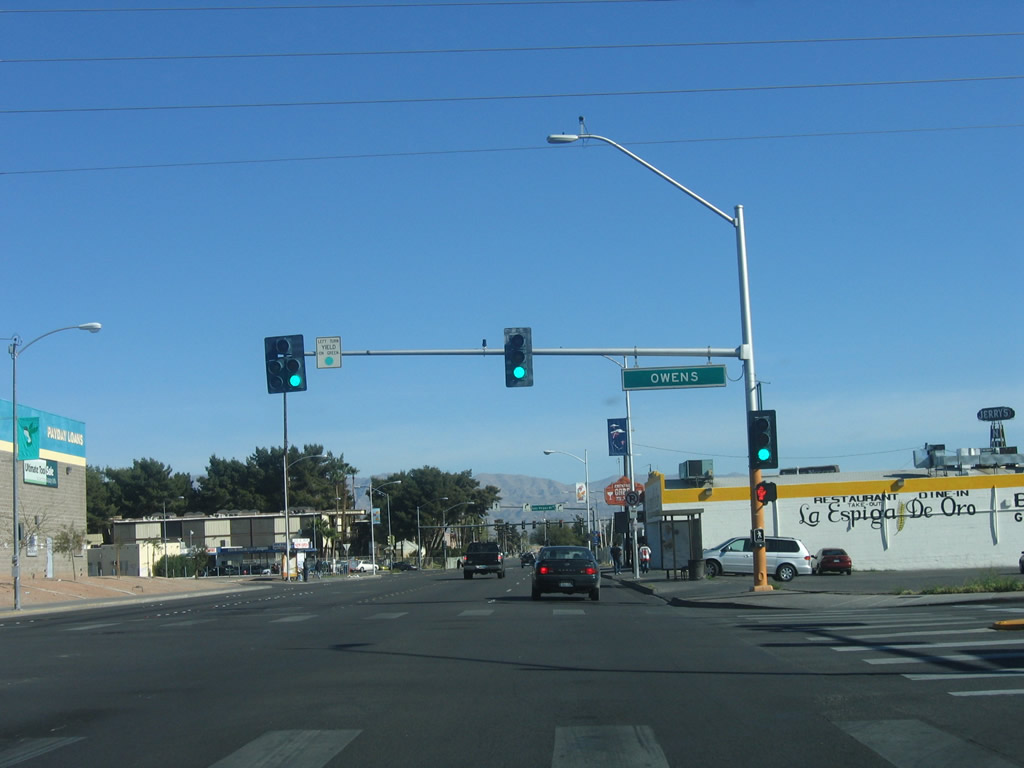
| Las Vegas Boulevard leaves the city of Las Vegas and enters north Las Vegas at Owens Avenue. Owens Avenue is an east-west arterial between I-15 and Hollywood Boulevard in unincorporated Sunrise Manor. 04/01/06 |
|
| Main Street (old SR 601) reconvenes with Las Vegas Boulevard just beyond Owens Avenue. The intersection between the two roads with North 5th Street was reconfigured to use a rotary by 2011. 04/01/06 |
|
| Prior to 2018, state maintenance along Las Vegas Boulevard commenced north of Tonopah Avenue and the junction with 5th and Main Streets. The state route now begins beyond the intersection with SR 147 (Lake Mead Boulevard) at Carey Avenue. SR 147 ends at I-15 to the west and connects the Las Vegas area with Lake Mead National Recreation Area to the east. 04/01/06 |
11/12/00, 01/20/02, 04/01/06, 03/29/08, 03/30/08, 03/31/08, 02/10/10, 02/20/10, 02/21/10 by AARoads
Page Updated 07-02-2018.