| U.S. 6-50 west / U.S. 93 north |
|
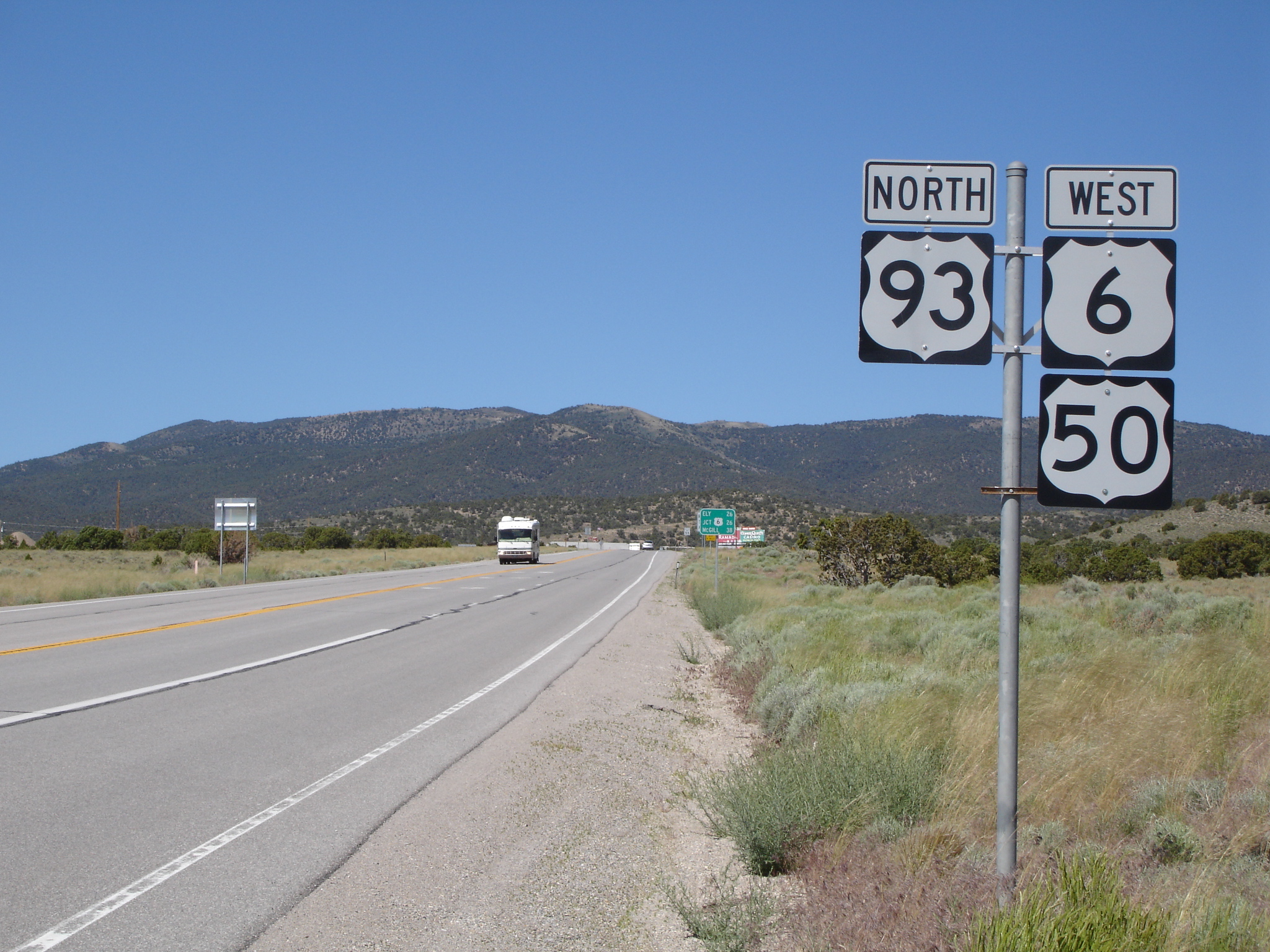
After Majors Junction (where U.S. 6, U.S. 50, and U.S. 93 meet west of Baker and southeast of Ely) is this reassurance shield assembly, which marks all three routes on this stretch of rural highway. Photo taken 06/20/10 by Mark Galbreath. |
| U.S. 50 West |
|
In Silver Springs, westbound U.S. 50/Lincoln Highway meets U.S. 50 Alternate-95 north to Fernley (right turn) and U.S. 95 Alternate south to Yerington (also Hawthorne, Tonopah, and Las Vegas via U.S. 95 south). U.S. 50 proceeds west to Dayton, Carson City, and Lake Tahoe. Photo taken 07/31/12. |
|
U.S. 50 is an official scenic route on Spooner Grade, as evidenced by this sign along westbound after leaving Carson City. Photo taken 1/99. |
|
|
This series of photos shows westbound U.S. 50 as it approaches Spooner Summit, which is the junction of U.S. 50 and Nevada 28 just east of Lake Tahoe. U.S. 50 leads to the south shore destinations, while Nevada 28 leads to the north shore destinations and provides the most direct route to Interstate 80 via California 28, California 89, and California 267. Photos taken 1/99. |
|
|
|
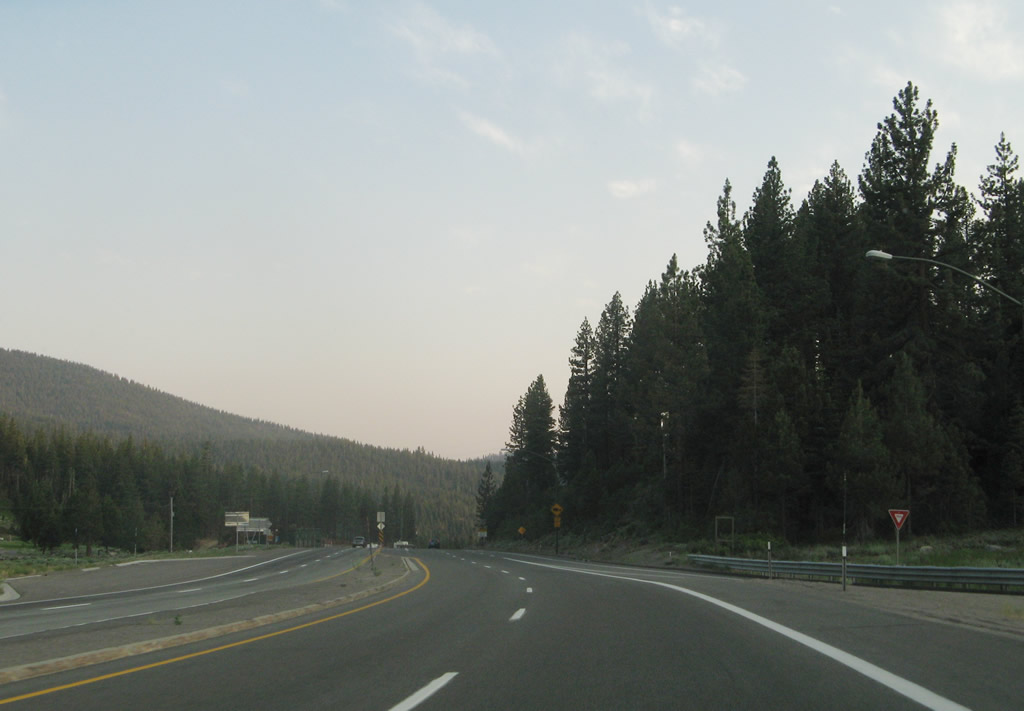
Passing through Spooner Junction, U.S. 50 now becomes part of the circle tour that loops around Lake Tahoe. U.S. 50 is the most heavily traveled of the roads that surround the lake (the others begin California 89, California 28, and Nevada 28). The highway continues to have an expressway feel through Spooner Junction southwest to Cave Rock, Zephyr Cove, and Stateline. Photo taken 07/08/07. |
|
A Lincoln Highway marker is posted on U.S. 50 after the Spooner Junction intersection. While Lincoln Highway is generally assumed to follow U.S. 50 between Utah and California, it also had an alternate route along U.S. 40 between Wadsworth and Sacramento. A similar Lincoln Highway trailblazer is posted on nearby Nevada 206 over Kingsbury Grade, so it is possible that Nevada 206 might have served as an older Lincoln Highway alignment too. Photo taken 07/08/07. |
|
This mileage sign along U.S. 50 west provides the distance to Glenbrook (three miles), Zephyr Cove (eight miles), and Sacramento (115 miles via Echo Summit). Photo taken 07/08/07. |
|
|
|
|
This series of photos follows U.S. 50 west as it wends its way from Spooner Junction to Cave Rock via Glenbrook. Photos taken 07/08/07. |
|
|
|
|
U.S. 50 approaches and passes through the Cave Rock Tunnels between Glenbrook and Zephyr Cove. The tunnels consists of two separate bores, one for eastbound and the other for westbound traffic. The original tunnel is the westbound tunnel, and it was built in 1931. The eastbound tunnel was built in 1957.2 Photos taken 07/08/07. |
|
U.S. 50 leaves the Cave Rock tunnels behind and approaches a turn off for viewing Cave Rock. This area is part of the Lake Tahoe Nevada State Park. Photo taken 07/08/07. |
|
A boat launch and picnic area are among the attractions at the Cave Rock turnoff. Photo taken 07/08/07. |
|
Entering Zephyr Cove, eastbound U.S. 50 approaches the Zephyr Cove Lodge (right turn at traffic signal). A fee is charged for parking at the lodge for beach access. Photo taken 07/08/07. |
|
This mileage sign along U.S. 50 east provides the distance to Nevada 207 (three miles), Stateline (four miles), and Sacramento (107 miles). Photo taken 07/08/07. |
|
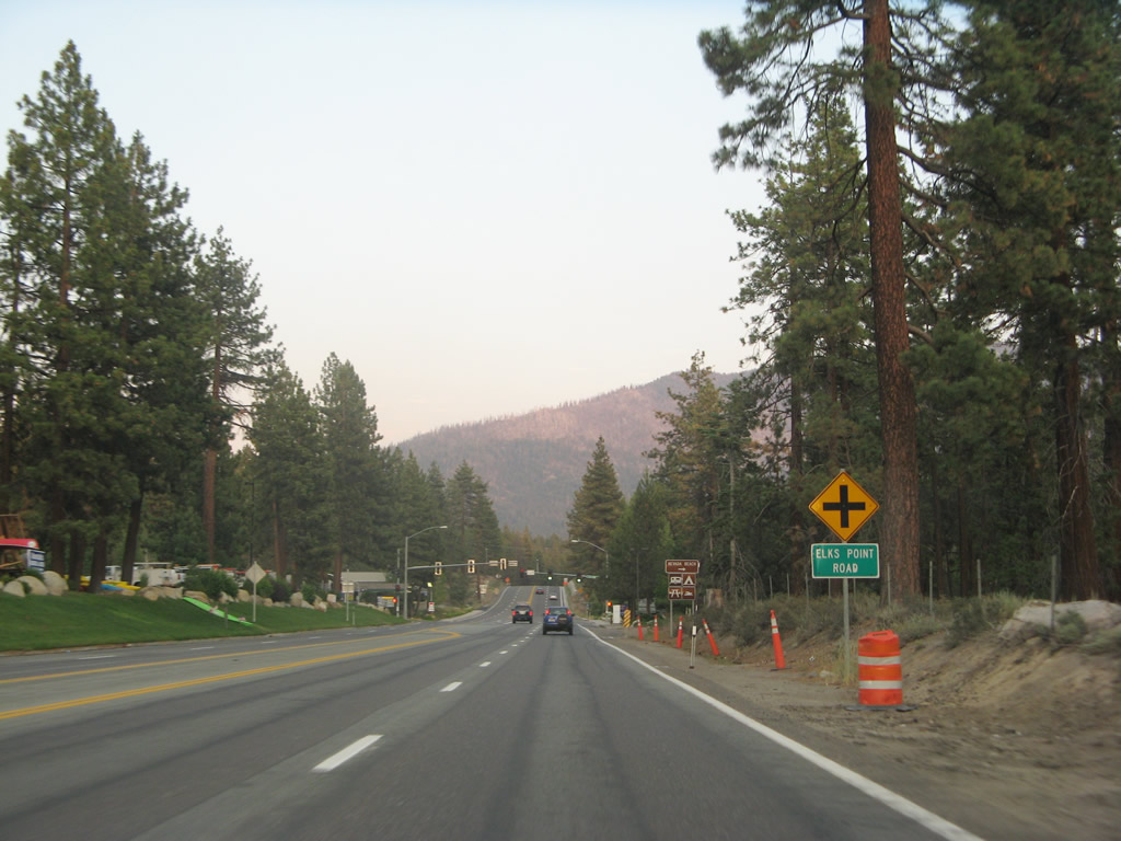
Eastbound U.S. 50 approaches Nevada 760/Elks Point Road west to Nevada Beach. Photo taken 07/08/07. |
|
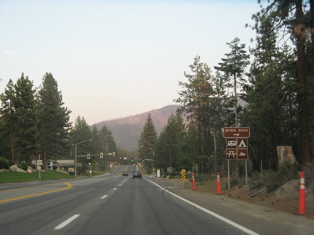
Nevada Beach offers a variety of recreational opportunities, including camping, picnicking, and swimming. Photo taken 07/08/07. |
|
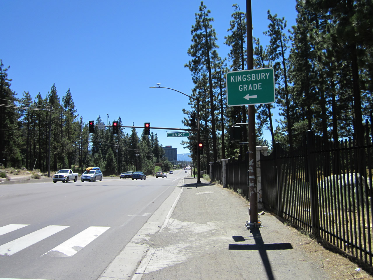
Eastbound U.S. 50 approaches Nevada 207/Kingsbury Grade east to Carson Valley. Photo taken 07/08/07. |
|
Prior to Nevada 207, the next traffic signal is with Kahle Drive to the county sheriff and Kahle Park. Photo taken 07/08/07. |
|
Eastbound U.S. 50 meets Kahle Drive at this traffic signal. Photo taken 07/08/07. |
|
|
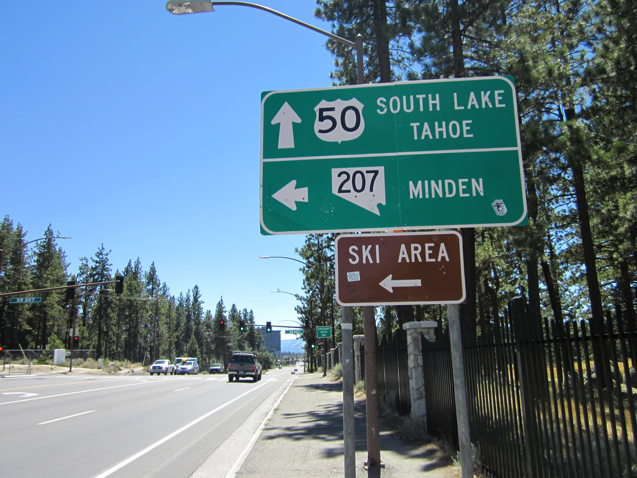
Nevada 207 is a winding, twisting road with steep mountain grades. It leads from this intersection to Daggett Pass, then descends rapidly to the floor of the Carson Valley. Photos taken 07/08/07 and 07/31/12. |
|
Westbound U.S. 50 meets Nevada 207 east at this intersection. Turn left here for Kingsbury Grade east to the Carson Valley. Photo taken 07/31/12. |
|
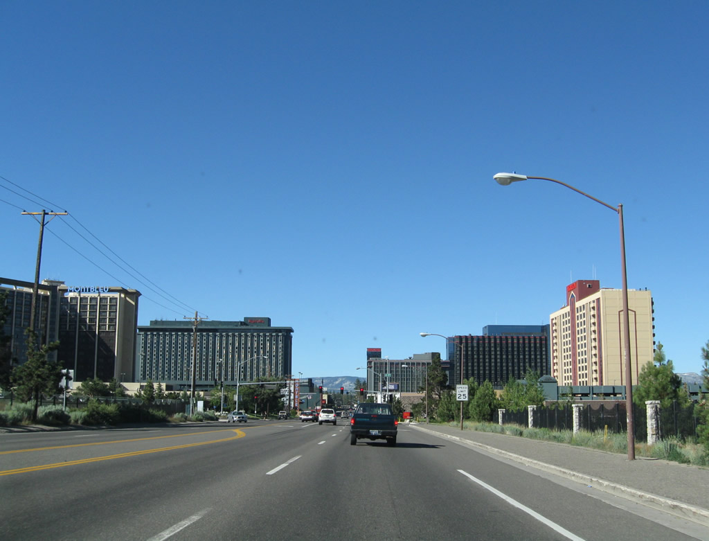
After the Nevada 207 intersection, westbound U.S. 50 proceeds toward Stateline and its resort-casinos and South Lake Tahoe, California. Stateline, which has a population of 1,215 people as of the 2000 Census is best known for its clubs and casinos: Bill's, Harrah's Lake Tahoe, Harvey's Lake Tahoe, Horizon, Lakeside Inn, and MontBleu. Photo taken 07/21/09. |
|
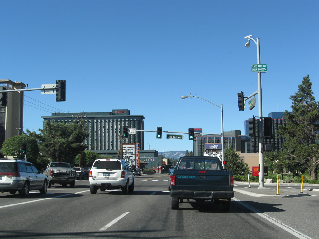
Westbound U.S. 50 meets Lake Parkway at this traffic signal. Due to anticipated improvements in traffic through between South Lake Tahoe and Stateline, Nevada, plans call for realigning U.S. 50 onto Lake Parkway so it would no longer pass between the two high rise hotel-casinos (Harvey's and Harrah's). This realignment would move U.S. 50 south of its current route and would allow the route to bypass the casinos and Heavenly Village to the south.3 This means that U.S. 50 will eventually turn left here rather than proceed straight between the casinos. Photo taken 07/21/09. |
|
Towering marquees, high rise hotels, and casinos become the theme for the final mile of U.S. 50 in Nevada. Traffic increases and slows, especially during tourist-filled weekends and holidays (both summer and winter, as Tahoe is a year-round destination for vacationing due to its many ski resorts). Photo taken 07/21/09. |
|
U.S. 50 passes between Harvey's Lake Tahoe Hotel and Casino and Harrah's Lake Tahoe. Although these two casinos were built as competitors, today they are both owned by Harrah's. Harvey and Llewellyn Gross opened Harvey's in 1944, built the first high-rise tower in 1961, and were bought by Harrah's in 2001. The neighboring Harrah's opened in 1955, and its high-rise tower (with 18 stories with top-level restaurant with lake views) opened in 1973. Photo taken 07/22/09. |
|
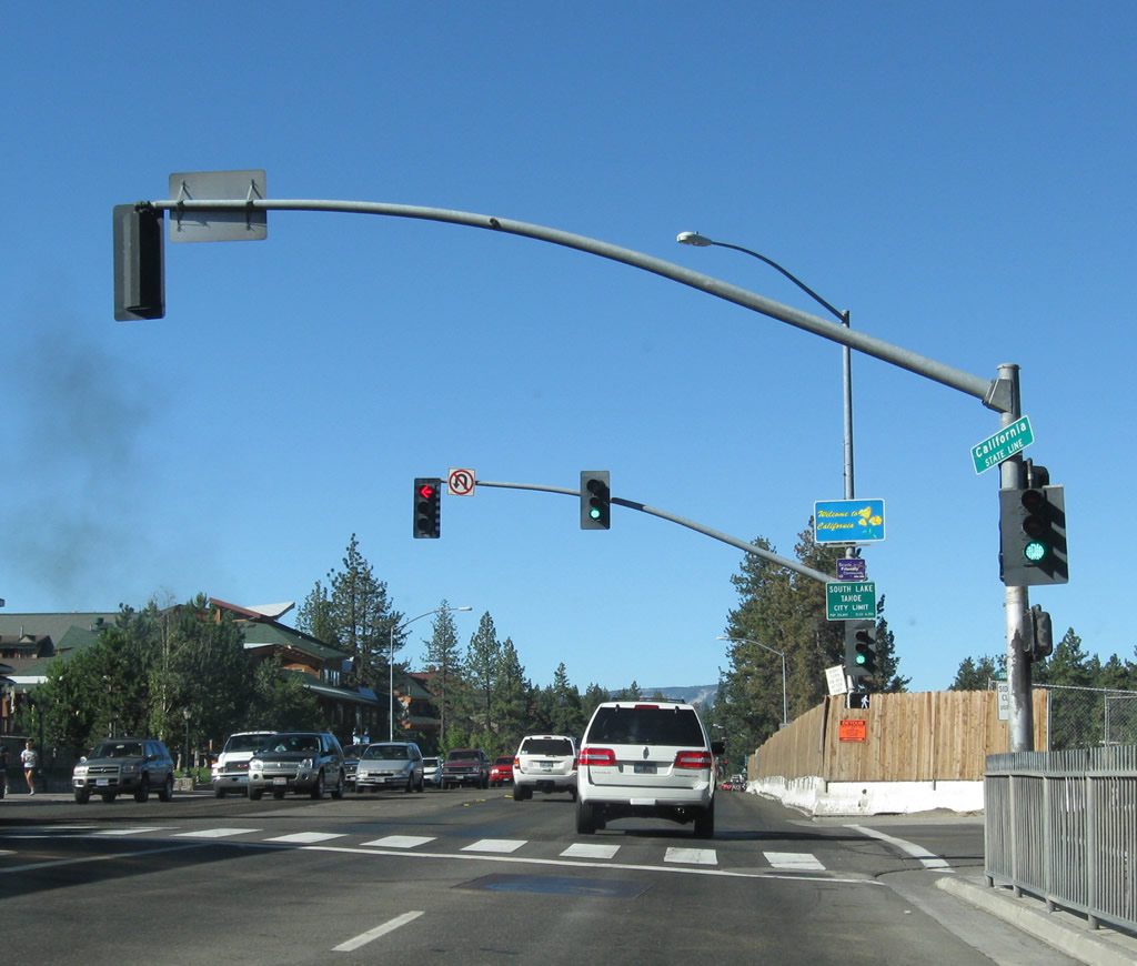
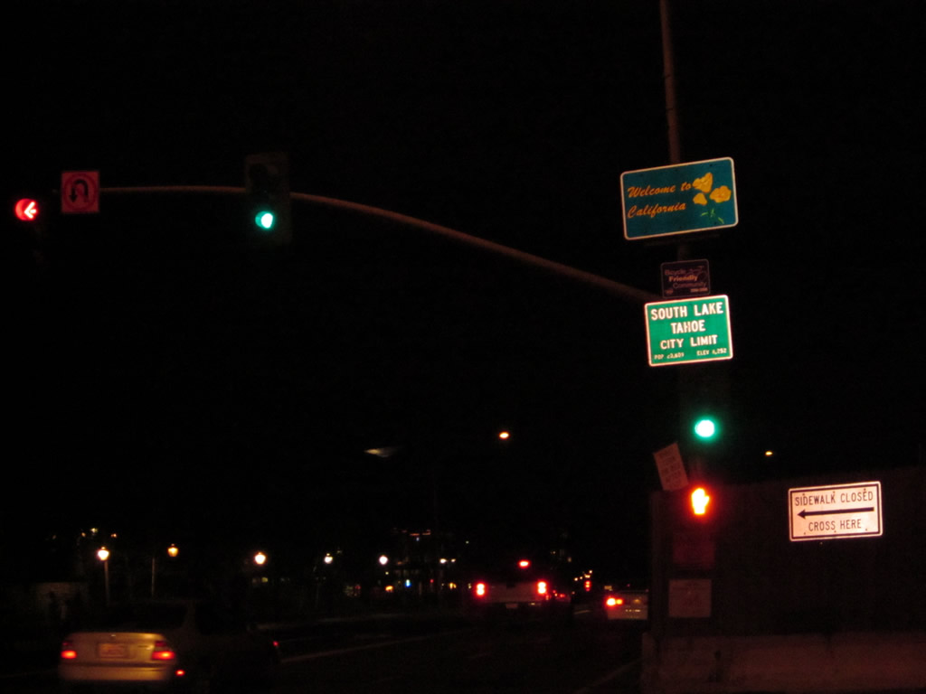
Leaving the Silver State of Nevada, U.S. 50 enters the Golden State of California (El Dorado County). The state line is conveniently located at the western edge of the massive casino-hotel towers, and Stateline Avenue (next traffic signal) serves as the actual state line. After passing by the state line, look on the north side of U.S. 50/Lake Tahoe Boulevard for the tramway up to Heavenly resort and associated shops. Between the state line and the Pioneer Trail intersection, U.S. 50 generally travels southwest; it will turn more westerly after Pioneer Trail. Due to anticipated improvements in traffic through between Stateline, Nevada, and South Lake Tahoe, California, plans call for realigning U.S. 50 onto Lake Parkway. This realignment would move U.S. 50 south of its current route and would allow the route to bypass the casinos and Heavenly Village to the south.4 Photo taken 07/21/09. |
|
Westbound U.S. 50 meets Stateline Avenue, leaves Nevada, and enters California. Photo taken 07/28/12. |
Page Updated August 16, 2012.