

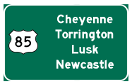
U.S. 85 Junction List
Most of the information contained herein is derived from the Wyoming Department of Transportation 1997 Wyoming Reference Marker System. That guide lists highways by their state inventory control number. Since these inventory numbers are not featured on the highways, this list is designed to provide mileposting information for individual, signed highways.
The following table lists all of the major towns, geographical features, highway junctions, and points of interests along the route. Each of the signed routes (including multiplexes) are shown in the first column for each entry. The second column shows the actual milepost marker as found on the highway; note that the mileposts rarely reset at zero at the start of new highways. In the third column is the description of the town or geographical feature. "CL" refers to "City" or "Corporate" Limits. The fourth column lists the state control inventory route, and the fifth column provides the distance between each geographical feature. If there are multiple features that require several lines to explain, then the distance in this column would be zero. Finally, the last column shows the cumulative mileage of the route. The last, bold-faced number in the column provides the total mileage for the signed route.
| Signed Route | Milepost Number | Description | State Control Route | Distance | Overall Mileage |
|---|---|---|---|---|---|
 |
0.00 | Colorado State Line; Continue |
25 | 0.00 | 0.00 |
| 3.80 | Begin Divided Section | 25 | 3.80 | 3.80 | |
| 4.12 | Junction  South SouthTo   Port of Entry Port of Entry |
25 | 0.32 | 4.12 | |
| 5.76 | End Divided Section | 25 | 1.64 | 5.76 | |
  |
7.31 | Junction South |
25 | 1.55 | 7.31 |
| 7.31 | Junction  College Drive College Drive |
25 | 0.00 | 7.31 | |
| 8.34 | Junction  Fox Farm Road East Fox Farm Road EastBegin Divided Section |
25 | 1.03 | 8.34 | |
 |
8.50 | Junction  BEGIN |
25 | 0.16 | 8.50 |
| 8.51 | SCL Cheyenne | 25 | 0.01 | 8.51 | |
| 8.67 | Deming Drive Separation | 25 | 0.16 | 8.67 | |
| 8.98 | Pedestrian Overpass | 25 | 0.31 | 8.98 | |
| 9.37 | Union Pacific Railroad Separation | 25 | 0.39 | 9.37 | |
| 9.60 | 9.60BK=9.74AH | 25 | 0.23 | 9.60 | |
|
Bus |
9.74 | Junction   (Lincolnway) (Lincolnway) |
25 | 0.00 | 9.60 |
| 9.74 | Split into Central Ave SB and Warren Ave NB | 25 | 0.00 | 9.60 | |
| 9.74 |
END |
25 | 0.00 | 9.60 | |
| 10.76 | 10.76BK=10.80AH | 25 | 1.02 | 10.62 | |
| 10.80 | Rejoin Central Ave SB and Warren Ave NB | 25 | 0.00 | 10.62 | |
| 11.49 | 11.49BK=11.40AH | 25 | 0.69 | 11.31 | |
| 11.79 |
Junction  North NorthOld
Yellowstone Highway North |
25 | 0.39 | 11.70 | |
|
|
12.61 |
Junction (MP 12.70) |
25 | 0.82 | 12.52 |
| 12.61 |
Junction  West To WyoDOT Headquarters West To WyoDOT HeadquartersEND  Bus
Bus |
25 | 0.00 | 12.52 | |
| 12.61 |
Concurrent Section between SCN 25 and |
25 | 0.00 | 12.52 | |
| 17.08 | 17.08BK=16.94AH | 25 | 4.47 | 16.99 | |
|
|
16.94 |
Junction (MP 17.24) |
25 | 0.00 | 16.99 |
| 17.29 | End Divided Section | 25 | 0.35 | 17.34 | |
| 17.65 |
Junction South Old  |
25 | 0.36 | 17.70 | |
| 23.76 | Lodgepole Creek | 25 | 6.11 | 23.81 | |
| 43.02 |
Junction  East East |
25 | 19.26 | 43.07 | |
| 53.80 | Meriden Rest Area | 25 | 10.78 | 53.85 | |
| 56.64 | Laramie-Goshen County Line | 25 | 2.84 | 56.69 | |
| 62.75 | Junction  East East |
25 | 6.11 | 62.80 | |
| 69.50 | Junction  West West |
25 | 6.75 | 69.55 | |
| 72.04 | 72.04BK=72.05AH | 25 | 2.54 | 72.09 | |
| 72.51 | Railroad at grade crossing | 25 | 0.46 | 72.55 | |
| 72.57 | Hawk Springs | 25 | 0.06 | 72.61 | |
| 81.54 |
Junction  West West  East East |
25 | 8.97 | 81.58 | |
| 82.23 | Railroad at grade crossing | 25 | 0.69 | 82.27 | |
| 90.83 |
Junction  East To Scottsbluff, Nebraska East To Scottsbluff, Nebraska |
25 | 8.60 | 90.87 | |
| 91.01 |
Junction  West West |
25 | 0.18 | 91.05 | |
| 91.87 | Railroad at grade crossing | 25 | 0.86 | 91.91 | |
| 92.02 |
Junction  SCL Torrington |
25 | 0.15 | 92.06 | |
| 92.56 | North Platte River | 25 | 0.54 | 92.60 | |
| 93.15 | Railroad at grade crossing | 25 | 0.59 | 93.19 | |
 |
93.20 |
Junction East |
25 | 0.05 | 93.24 |
| 93.46 |
Junction  North North |
25 | 0.26 | 93.50 | |
| 93.63 | WCL Torrington | 25 | 0.17 | 93.67 | |
| 95.33 | Torrington Port of Entry | 25 | 1.70 | 95.37 | |
| 101.62 | Lingle Rest Area | 25 | 6.29 | 101.66 | |
| 102.64 | SCL Lingle | 25 | 1.02 | 102.68 | |
| 102.89 |
Junction East To  West West |
25 | 0.25 | 102.93 | |
|
|
103.07 |
Junction West |
25 | 0.18 | 103.11 |
| 103.26 | NCL Lingle | 25 | 0.19 | 103.30 | |
| 139.00 | Goshen-Niobrara County Line | 25 | 35.74 | 139.04 | |
| 148.99 | SCL Lusk | 25 | 9.99 | 149.03 | |
  |
149.27 |
Junction West; Lusk |
25 | 0.28 | 149.31 |
| 149.27 | State Control Route 25 and 40 overlap MP 149.27-149.77 | 25/40 | 0.00 | 149.31 | |
|
|
149.77 |
Junction East |
25 | 0.50 | 149.81 |
| 150.01 | C&NW Railroad Separation | 25 | 0.24 | 150.05 | |
| 150.08 | Niobrara River | 25 | 0.07 | 150.12 | |
| 150.32 | NCL Lusk | 25 | 0.24 | 150.36 | |
| 170.95 |
Junction  West West |
25 | 20.63 | 170.99 | |
| 175.31 | 175.31BK=175.42AH | 25 | 4.36 | 175.35 | |
|
|
196.04 |
Junction East; Mule Creek Junction |
25 | 20.62 | 195.97 |
| 196.04 | Mule Creek Rest Area | 25 | 0.00 | 195.97 | |
| 199.76 | Cheyenne River | 25 | 3.72 | 199.69 | |
| 205.05 | Niobrara-Weston County Line | 25 | 5.29 | 204.98 | |
| 222.05 | 222.05BK=222.09AH | 25 | 17.00 | 221.98 | |
| 228.99 | Burlington Northern Railroad Separation | 25 | 6.90 | 228.88 | |
| 229.01 | SCL Newcastle | 25 | 0.02 | 228.90 | |
| 229.09 | NCL Newcastle | 25 | 0.08 | 228.98 | |
| 229.30 |
Junction  |
25 | 0.21 | 229.19 | |
| 232.04 | 232.04BK=232.44AH | 25 | 2.74 | 231.93 | |
| 240.55 | Red Butte Creek | 25 | 8.11 | 240.04 | |
| 247.11 | 247.11BK=247.51AH | 25 | 6.56 | 246.60 | |
| 247.60 |
Junction  North (Four Corners) North (Four Corners) |
25 | 0.09 | 246.69 | |
| 253.53 | Black Hills National Forest Boundary | 25 | 5.93 | 252.62 | |
| 253.93 | Black Hills National Forest Boundary | 25 | 0.40 | 253.02 | |
| 256.56 |
South Dakota State Line; Continue |
25 | 2.63 | 255.65 |
 |
 |
Page Updated June 8, 2012.
|
About Contact FAQ |
Spotlights Testimonials Interstate Guide |
Social Media:
 |
|
© 2000-23 AARoads.com | All Rights Reserved | Privacy Policy / Terms of Use
|
||