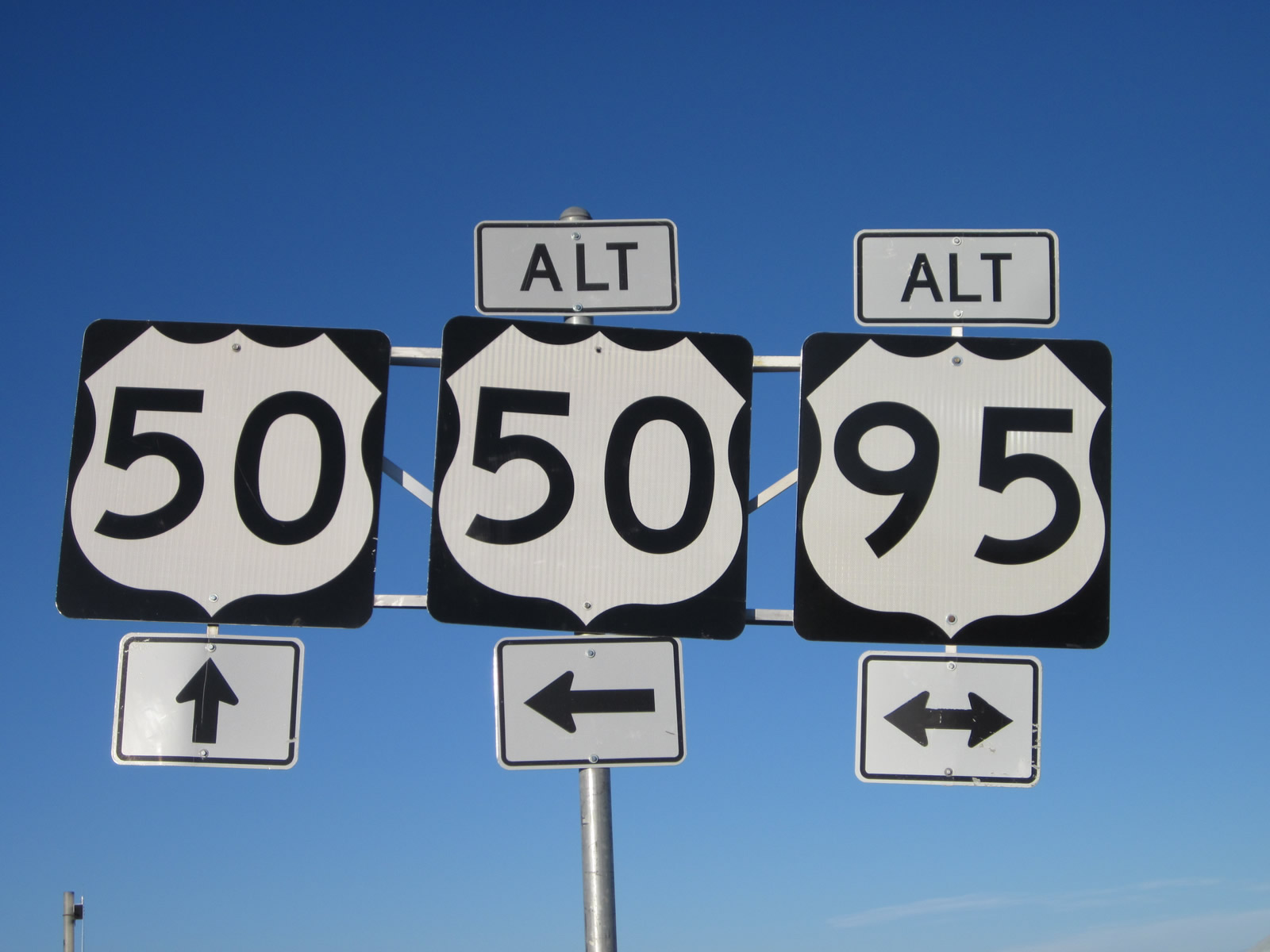
Site Navigation
Arizona
California
Colorado
Idaho
Montana
Nevada
New Mexico
Utah
Wyoming


Alternate U.S. Highway 95 - Nevada

Routing

Alternate U.S. 95 begins at U.S. 95 at Schurz and reconnects with U.S. 95 at Interstate 80 Exit 83, serving Yerington, Silver Springs, and Fernley along the way. The section of Alternate U.S. 95 between Silver Springs and Fernley is technically part of Alternate U.S. 50 (per the mileposts along this segment of the route) and is fully cosigned with that route along their shared alignment.

History

Alternate U.S. 95 owes its past to the history of the local routing of U.S. 95. Much of the routing of U.S. 95 in the state of Nevada has remained the same since the mid-1940s and today, with a few notable exceptions, including its routing near Fallon and Fernley. Originally, U.S. 95 north of Fallon followed U.S. 50A northwest to Fernley, then followed Interstate 80 northeast to Winnemucca. During this time, what is now U.S. 95 between these two points was designated as Nevada 1A. Then in 1960s or 1970s, once Nevada 1A was improved to modern standards, U.S. 95 was rerouted to replace Nevada 1A, and U.S. 50A was commissioned to replace the original U.S. 95. Alternate U.S. 95 was also in place here to allow for a less direct routing via Yerington and Silver Springs to Fernley. When U.S. 95 was relocated to its present alignment, U.S. 95A was briefly rerouted onto current U.S. 50A and later moved to Interstate 80.

U.S. 95 Nevada Highway Guides

Guide

Alternate U.S. 95 north
Northbound Alternate U.S. 95 approaches its junction with U.S. 50/Lincoln Highway. Proceed straight ahead for Alternate U.S. 95 north and Alternate U.S. 50 east to Fernley. Turn left for U.S. 50 west to Carson City and Lake Tahoe. Turn right for U.S. 50 east to Fallon, Austin, Eureka, and Ely. Photo taken 07/31/12.
To Virginia City National Historic Landmark, follow U.S. 50 west to Nevada 341 north. Photo taken 07/31/12.
Northbound Alternate U.S. 95 meets U.S. 50/Lincoln Highway at this four-way stop (at least as of July 2012). Proceed straight ahead for Alternate U.S. 95 north and Alternate U.S. 50 east to Fernley. Turn left for U.S. 50 west to Carson City and Lake Tahoe. Turn right for U.S. 50 east to Fallon, Austin, Eureka, and Ely. Photos taken 07/31/12.
Alternate U.S. 95 and Alternate U.S. 50 will proceed north from the U.S. 50 intersection to Fernley. The Nugget Casino is located on the left side of the highway after the four-way stop. Photo taken 07/31/12.
Alternate U.S. 95 north and Alternate U.S. 50 east
Alternate U.S. 95 and Alternate U.S. 50 begin their shared alignment as they proceed north from Silver Springs to Fernley. The two-lane highway will proceed almost due north to Fernley to join with Interstate 80 and Business Loop I-80. Photo taken 07/31/12.
A BEGIN banner is positioned above the Alternate U.S. 50 shield. Officially, Nevada DOT considers the road from Silver Springs to Fernley to be U.S. 50A and uses U.S. 50A mileposts, since U.S. 50A is the lower of the two route numbers (as compared to U.S. 95A). However, U.S. 95A traffic need only continue straight through the U.S. 50, and to average motorists, it still feels like (and is) a continuation of U.S. 95A. Photo taken 07/31/12.
The shared alignment of U.S. 50A and U.S. 95A is designated as Veterans Memorial Highway. Photo taken 07/31/12.
This view looks due north on U.S. 50A-95A after the U.S. 50 intersection in Silver Springs. Photo taken 07/31/12.
A mileage sign along U.S. 50A-95A provides the distance to Fernley (13 miles), Reno (49 miles via Interstate 80 west), and Lovelock (73 miles via U.S. 95A north and Interstate 80 east). Photo taken 07/31/12.
Looking east from northbound U.S. 95A, we see this view of the northern outskirts of Silver Springs and a distant view of U.S. 50 traveling east toward Fallon. Photo taken 07/31/12.
A daytime headlights section is in effect along northbound U.S. 50A-95A between Silver Springs and Fernley. Photo taken 07/31/12.
This series of pictures follows U.S. 50A east and U.S. 95A north between Silver Springs and Fernley. No motorist services are available along this fairly desolate route, which is notable for the scenic emptiness of the terrain. Photos taken 07/31/12.
Northbound U.S. 50A-95A approaches Speedway Road. Photo taken 07/31/12.
Soon thereafter, northbound U.S. 50A-95A approaches Quarry Road (right turn). The daytime headlight safety section ends near this intersection. Ahead, we enter the outskirts of Fernley. Photo taken 07/31/12.
Northbound U.S. 50A-95A approaches Tiger Field Airport. Photo taken 07/31/12.
A set of power lines turns to follow U.S. 50A and U.S. 95A near the intersection with Big Oaks Drive and Desert Shadows Lane. The next right connects to Fernley High School. Photo taken 07/31/12.
Here is another shot of the same power lines near Fernley High School. Photo taken 07/31/12.
The speed limit of U.S. 50A-95A reduces as the highway enters the developed areas of Fernley. Photo taken 07/31/12.
An irrigation canal passes below U.S. 50A-95A. This canal is operated by the Truckee-Carson Irrigation System, which conveys water throughout the region with connections to Lahontan Reservoir near Silver Springs. Photo taken 07/31/12.
Northbound U.S. 95A and eastbound U.S. 50A enter the city of Fernley, which sits at an elevation of 4,153 feet above sea level, was incorporated on July 1, 2001, and had a population of 19,368 as of the 2010 Census. The city is located in Lyon County, but used to straddle Lyon and Washoe Counties before a boundary line adjustment was made in 2005. Photo taken 07/31/12.
The speed limit reduces to 25 miles per hour, which is fairly typical for urban routes through Nevada cities. Photo taken 07/31/12.
Northbound U.S. 95A and eastbound U.S. 50A enter downtown Fernley. A looming traffic signal ahead represents the pending junction with Main Street, which is designated as Business Loop I-80 (Historic U.S. 40) and Nevada 427. There is no junction sign for the approaching intersection with Business Loop I-80; in fact, when we visited in 2012, there were no green signs to be found on the approach to this intersection when traveling north on U.S. 50A-95A. Photo taken 07/31/12.
Alternate U.S. 50 and Alternate U.S. 95 turn will right (east) onto Business Loop I-80/Main Street. Business Loop I-80, Alternate U.S. 50, and Alternate U.S. 95 will share pavement for a few miles, then separate at a roundabout at the Farm District Road intersection. At that point, Business Loop I-80 and Alternate U.S. 95 will curve north to join Interstate 80, while Alternate U.S. 50 will travel southeast toward Fallon. Photo taken 07/31/12.
A second sign advises that traffic for Interstate 80 east should turn right on Business Loop I-80/Main Street to travel to Lovelock, Winnemucca, Battle Mountain, and Elko. Turn left for Business Loop I-80 west to Reno-Sparks, Truckee, and Sacramento. Although not signed here with a trailblazer, Nevada 427 travels west from this intersection to follow Historic U.S. 40 west to Wadsworth and also to connect to Nevada 447 north to Pyramid Lake and Gerlach. Photo taken 07/31/12.
Northbound U.S. 95A and eastbound U.S. 50A meet Business Loop I-80, Historic U.S. 40, and Nevada 427 at this traffic signal. Turn left for Business Loop I-80, U.S. 40, and Nevada 427 west to Wadsworth and Reno. Turn right for Business Loop I-80, U.S. 40, Alternate U.S. 50, and Alternate U.S. 95 east to Fallon, Lovelock, and Elko. The only signed route to end at this intersection is Nevada 427. Photo taken 07/31/12.
Alternate U.S. 95 north, Business Loop I-80 east, and Alternate U.S. 50 east
Northbound U.S. 95A, eastbound U.S. 50A, and eastbound Business Loop I-80 proceed east along Historic U.S. 40/Main Street in downtown Fernley. A reassurance route marker assembly here would be nice but is missing. Photo taken 07/31/12.
Shops, restaurants, and commercial establishments line this stretch of Main Street. A Fourth of July patriotic banner was posted on this street light. Photo taken 07/31/12.
Next to a fire station, we find another Fernley banner referencing its role as the gateway to the Black Rock Desert, located north of here along Nevada 447. The Black Rock Desert is home to the annual Burning Man festival held in late August/early September each year. Photo taken 07/31/12.
Approaching the intersection with Silver Lace Boulevard, eastbound Business Loop I-80, U.S. 50A, and U.S. 95A approach Western Nevada College and Fernley City Hall, both located on the south of Main Street. Photo taken 07/31/12.
The three routes prepare to divide at the Farm District Road roundabout in eastern Fernley. Once in the roundabout, the first right connects to Nevada 828/Farm District Road southeast; a second signed turnoff connects to Alternate U.S. 50 east to Fallon; and a signed left turn carries Alternate U.S. 95 north and Business Loop I-80 east over to a railroad viaduct to a junction with Interstate 80. Photo taken 07/31/12.
Traffic should slow to 15 miles per hour once in the roundabout. This type of traffic control device was rarely found in the Mountain West until recent projects have added them in several areas around northern Nevada. Photo taken 07/31/12.
An Interstate 80 trailblazer and Business Loop I-80 reassurance route marker are posted side-by-side prior to the roundabout. Stay left and exit left for the connection to Interstate 80. Photo taken 07/31/12.
A fairly complicated diagrammatical sign attempts to explain the lane allocation and directions to take for Nevada 828/Farm District Road east, Alternate U.S. 50 east to Fallon, and Business Loop I-80 east and Alternate U.S. 95 north to Interstate 80 en route to Lovelock, Winnemucca, and Elko (the last of which is the official control city for Interstate 80 east). Photo taken 07/31/12.
A full moon was waxing above the Farm District Road roundabout; this view was taken from the north sidewalk along Main Street looking east. Photo taken 07/31/12.
Entering the roundabout, the first right turn connects to Nevada 828/Farm District Road east. This state route serves eastern Fernley and connects to several residential areas. Nevada 828 eventually curves east and reconnects with Alternate U.S. 50. Photo taken 07/31/12.
Alternate U.S. 95 north and Business Loop I-80 east
Eastbound Business Loop I-80 and northbound Alternate U.S. 95 cross over the Union Pacific Railroad tracks on this viaduct. Photos taken 07/31/12.
This view looks east along the railroad tracks toward the horizon late on a summer day. Photos taken 07/31/12.
While crossing over the Union Pacific Railroad tracks, we find a trailblazer shield for Interstate 80 and a reassurance marker for Alternate U.S. 95. Business Loop I-80 is omitted. These signs have seen some vandalism through the years, with some remnant paintball attacks and previously removed graffiti. Photos taken 07/31/12.
Coming downhill from the railroad viaduct, plenty of motorist services (gas, food, lodging) are available at the interchange between Alternate U.S. 95 and Interstate 80 northeast of downtown Fernley. For those traveling northeast on Interstate 80 and Alternate U.S. 95, there are precious few services between Fernley and Lovelock. Photos taken 07/31/12.
Northbound Alternate U.S. 95 and eastbound Business Loop I-80 meet Chisholm Trail and Fremont Street at this traffic signal. Photo taken 07/31/12.
The next traffic signal along northbound Alternate U.S. 95 and eastbound Business Loop I-80 is with Newlands Drive; turn right here for Wal-Mart. Photo taken 07/31/12.
Northbound Alternate U.S. 95 and eastbound Business Loop I-80 immediately approach Interstate 80 after the Newlands Drive intersection. Turn right for Interstate 80 east and Alternate U.S. 95 north to Lovelock, Winnemucca, and Elko. There are no route markers used on this sign, and the freeway entrance signs don't include the continuation of Alternate U.S. 95. Continue straight ahead for Interstate 80 west to Reno and Sacramento. Photos taken 07/31/12.
A two-lane roadway passes under the freeway to make the final connection to Interstate 80 west as well as link to businesses on the north side of the freeway. Photos taken 07/31/12.
Now passing under Interstate 80, turn left for Interstate 80 west to Reno. Photo taken 07/31/12.
Alternate U.S. 95 north and Interstate 80 east
Alternate U.S. 95 south and Interstate 80 west
Alternate U.S. 95 south and Business Loop I-80 west
We begin looking at southbound U.S. 95A and westbound Business Loop 80 as they pass under Interstate 80. Turn left for Interstate 80 east to Lovelock, Winnemucca, and Elko. Ahead, U.S. 95A and Business Loop I-80 will enter the city of Fernley, which sits at an elevation of 4,153 feet above sea level, was incorporated on July 1, 2001, and had a population of 19,368 as of the 2010 Census. The city is located in Lyon County, but used to straddle Lyon and Washoe Counties before a boundary line adjustment was made in 2005. Photo taken 07/31/12.
Proceed straight ahead for Alternate U.S. 95 south and Business Loop 80 west en route to Fernley. Turn left for Interstate 80 east to Lovelock, Winnemucca, and Elko. Photo taken 07/31/12.
Most motorist services are available at the Business Loop I-80/East Fernley Interchange. Food, gas, lodging, and even a Wal-Mart are available here, along with plenty of other services. Photo taken 07/31/12.
The first Alternate U.S. 95 reassurance route marker is found shortly thereafter. Nevada uses the abbreviation "ALT" for "Alternate." Business Loop I-80 is not signed here. Photo taken 07/31/12.
Southbound Alternate U.S. 95 and westbound Business Loop I-80 approach Newlands Drive (next traffic signal). Photo taken 07/31/12.
The following traffic signal along Alternate U.S. 95 south and Business Loop I-80 west is with Fremont Street and Chisholm Trail. Photo taken 07/31/12.
Alternate U.S. 95 and Business Loop I-80 begin to ascend a viaduct that will carry the highway over the Union Pacific Railroad, then link to Alternate U.S. 50 at the East Fernley Roundabout. In preparation for the roundabout, an early sign advises of a left turn to follow Alternate U.S. 50 east to Great Basin National Park. Photo taken 07/31/12.
A detailed diagrammatical sign shows the linking of Alternate U.S. 50 and Alternate U.S. 95. Omitted from the sign is a Business Loop I-80 shield. The business route will curve west along with U.S. 50A and U.S. 95A toward downtown Fernley. Photo taken 07/31/12.
From the upcoming roundabout, Alternate U.S. 50 travels southeast to Fallon and west into downtown Fernley. Alternate U.S. 50-95 proceed west along with Business Loop I-80 and Old U.S. 40 to downtown Fernley. U.S. 50A-95A turn south in downtown Fernley to travel south to Silver Springs and Yerington, with a connection to U.S. 50 west to Dayton and Carson City. Photo taken 07/31/12.
An overhead sign warns of the East Fernley roundabout after crossing over the railroad tracks on an elevated viaduct. Upon crossing the tracks, Business Loop I-80 and Alternate U.S. 95 will curve onto westbound Main Street (Old U.S. 40). Photo taken 07/31/12.
Crossing the Union Pacific Railroad on a high viaduct, southbound Alternate U.S. 95 and westbound Business Loop I-80 will merge onto westbound Alternate U.S. 50/Main Street en route to downtown Fernley. Photos taken 07/31/12.
Southbound Alternate U.S. 95 and westbound Business Loop I-80 enter the East Fernley Roundabout. Stay right to follow U.S. 95A and Business I-80 and U.S. 50A west to downtown Fernley and south to Silver Springs, Carson City, and Yerington. Stay left to enter the roundabout to link to Nevada 828/Farm District Road and U.S. 50A east to Fallon. Photo taken 07/31/12.
This view of the roundabout is taken from the northwestern quadrant sidewalk, looking south. A "free right" movement allows traffic to transition easily from southbound Alternate U.S. 95 and westbound Business 80 onto westbound Alternate U.S. 50. Traffic to Nevada 828/Farm District Road southeast or Alternate U.S. 50 east should enter the roundabout to make those connections. Photo taken 07/31/12.
Alternate U.S. 95 south, Business Loop I-80 west, and Alternate U.S. 50 west
Leaving the roundabout in eastern Fernley, this route marker assembly includes Alternate U.S. 50 west, Alternate U.S. 95 south, and Business Loop I-80 west. From here, Alternate U.S. 50 and Alternate U.S. 95 will share pavement together south to Silver Springs. Photo taken 07/31/12.
This mileage sign along Business Loop I-80 west, Alternate U.S. 50 west, and Alternate U.S. 95 south (Main Street) provides the distance to Reno (36 miles via Business Loop I-80 and Interstate 80 west), Yerington (48 miles via Alternate U.S. 95 south), and Carson City (51 miles via Alternate U.S. 50 and U.S. 50 west). Photo taken 07/31/12.
Coming into downtown Fernley, Business Loop I-80 west, Alternate U.S. 50 west, and Alternate U.S. 95 south follow Main Street to the main traffic signal. Turn left here for Alternate U.S. 50 and Alternate U.S. 95 south to Silver Springs, Yerington, and Carson City. Photo taken 07/31/12.
At this traffic signal, the routes divide. Business Loop I-80, Nevada 427, and Historic U.S. 40 proceed west along Main Street, while Alternate U.S. 50 west and Alternate U.S. 95 south turn south here to connect to Silver Springs, Yerington, and Carson City. Photo taken 07/31/12.
Alternate U.S. 95 south and Alternate U.S. 50 west
Skipping ahead to about 13 miles south of Fernley, westbound Alternate U.S. 50 and southbound Alternate U.S. 95 approach the junction with U.S. 50/Lincoln Highway in Silver Springs. Photo taken 07/31/12.
Turn left (east) on U.S. 50 to Lahontan State Recreation Area for a wildlife viewing area. Photo taken 07/31/12.
Westbound Alternate U.S. 50 and southbound Alternate U.S. 95 meet U.S. 50/Lincoln Highway at this stop sign in Silver Springs. Turn left for U.S. 50 east to Fallon and Ely, or turn right for U.S. 50 west to Dayton, Carson City, and Lake Tahoe. Photo taken 07/31/12.
While Alternate U.S. 95 will proceed south through this intersection to continue to Ft. Churchill State Historic Park and Yerington, this intersection marks the western terminus of Alternate U.S. 50. Although Alternate U.S. 50 does not provide a direct through route between Fallon and Silver Springs (main U.S. 50 is much better), Alternate U.S. 50 offers a good route to connect U.S. 50 with Interstate 80 and Fernley. Photo taken 07/31/12.
Alternate U.S. 95 south
Leaving the intersection with U.S. 50, we find this Alternate U.S. 95 south reassurance route marker posted, along with a milepost for U.S. 95A Mile 44.25 in Lyon County. The trip from here south to U.S. 95 in Schurz via Yerington (seat of Lyon County) is 54.93 miles from here, with the final 10.68 miles in Mineral County. Photo taken 07/31/12.

Return to U.S. 95 Return to the Nevada Gateway

Page Updated July 31, 2012.