
U.S. 95 South - Amargosa to Las Vegas
| U.S. 95 south | |
|---|---|
 |
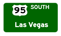
The next major intersection along U.S. 95 south is with Nevada 160, one-half mile. Use Nevada 160 south to Pahrump, the most populous community in Nye County. Nevada 160 loops to the east after leaving Pahrump, meeting Interstate 15 south of Las Vegas near Paradise. Photo taken 01/20/02. |
 |
 |
 |
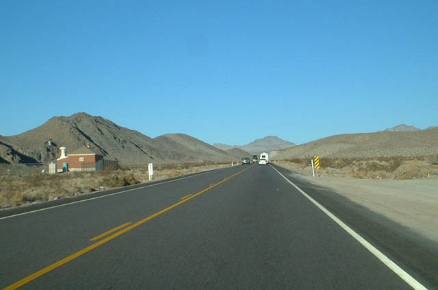
This suite of photos shows southbound U.S. 95 between the Nevada 160 intersection and the Mercury interchange. The middle photo features a switching house for telecommunications on the left (northeast) side of U.S. 95. Photos taken 1/20/02. |
 |
U.S. 95 shifts into an expressway/divided highway configuration. The first exit is Mercury. Photo taken 01/20/02. | ||
 |
The Mercury interchange marks the northern terminus of the divided highway for U.S. 95, which extends from here south through Indian Springs, Las Vegas, and Henderson. It reverts to a two-lane highway south of U.S. 93 near Boulder City. U.S. 95 is planned for expansion to four lanes from U.S. 93 south to Nevada 163 at the California State Line, so eventually the Mercury exit may mark the northernmost end of the divided highway for the entire route of U.S. 95 in Nevada (including all of Clark County). Photo taken 01/20/02. |
 |
U.S. 95 will remain an expressway from Mercury south until it shifts to a freeway configuration in Las Vegas. Photo taken 01/20/02. |
 |
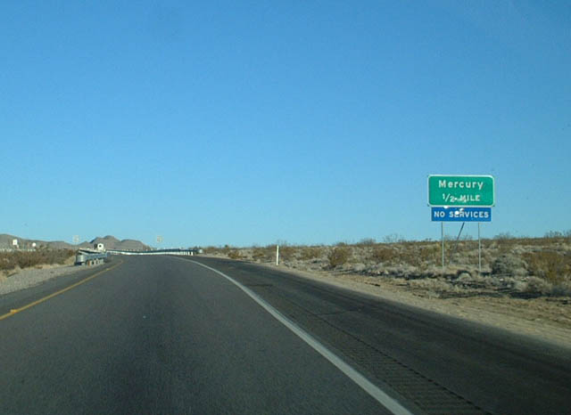
U.S. 95 south approaches the Mercury exit in one-quarter of a mile. The divided highway begins at this point. Notably, the speed limit remains at 70 mph rather than increasing to 75 mph. Photo taken 01/20/02. |
 |
A full interchange connects U.S. 95 south with Mercury. This exit is not numbered for some reason, but could be easily identified. This exit, although it has no services, is extremely important. This is a military access exit for restricted areas as part of the Nevada Test Site. Tests of the atomic bomb were conducted in this stark desert area, and the Yucca Mountain Radioactive Storage Facility is proposed to be located in this region. The Mercury exit leads to the outstation facilities related to these activities. In the Spring of 2002, the State of Nevada proposed a license plate that featured an atomic explosion on the background of the plate. Due to public outcry and concerns over sensitivity related to the conflict between India and Pakistan have prompted the state not to issue the atomic testing license plate. Photo taken 01/20/02. |
 |
This scene shows the U.S. 95 expressway between Mercury and Indian Springs. Photo taken 01/20/02. |
 |
This mileage sign is located eighteen miles northwest of Indian Springs along U.S. 95 south. Photo taken 01/20/02. |
 |
Soon thereafter, U.S. 95 leaves Nye County and enters Clark County. Photo taken 01/20/02. |
 |
This view shows U.S. 95 southbound prior to entering Indian Springs. Photo taken 01/20/02. |
 |
U.S. 95 south approaches the small community of Indian Springs. Gas, food, and lodging are available here. Photo taken 01/21/02. |
 |
 |
 |
Page Updated February 15, 2010.
|
About Contact FAQ |
Spotlights Testimonials Interstate Guide |
Social Media:
 |
|
© 2000-23 AARoads.com | All Rights Reserved | Privacy Policy / Terms of Use
|
||