| U.S. 95 south |
|---|
|
|
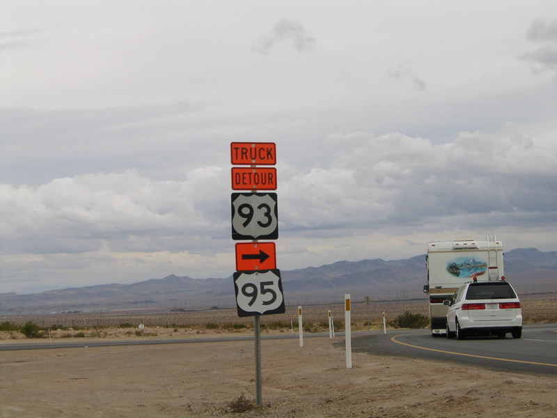
Leaving the U.S. 93 (Future Interstate 515 and Interstate 11 corridor), a pair of trailblazer shields awaits southbound travelers: U.S. 93 Detour and U.S. 95 south. The U.S. 93 detour provides the bypass route for trucks and buses in lieu of Hoover Dam. Photos taken 02/16/04 and 10/19/04. |
|
|
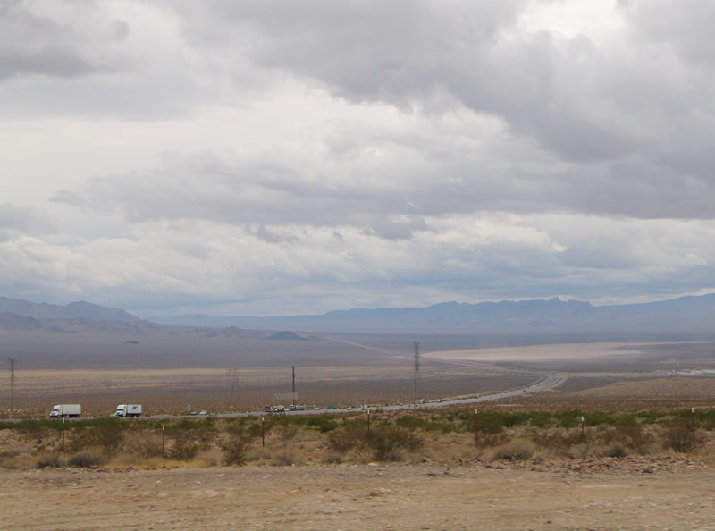
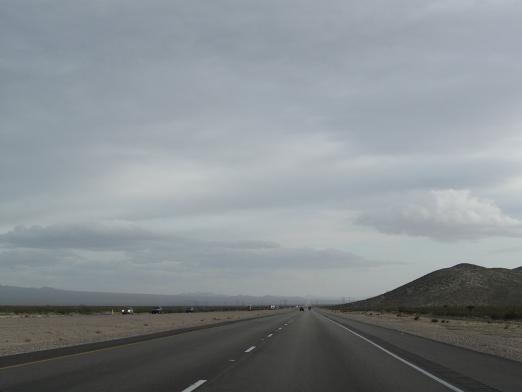
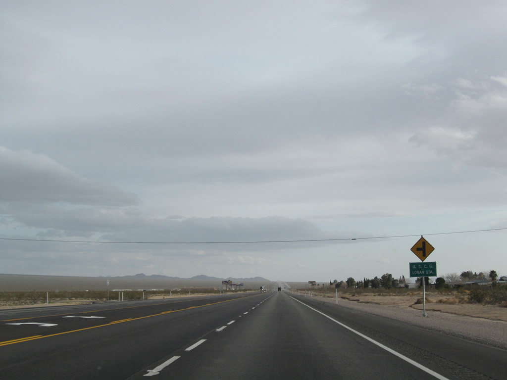
View of the vast Mojave Desert along southbound U.S. 95 after the U.S. 93 interchangein Boulder City. U.S. 95 never enters any populated areas in Boulder City; instead, the highway begins a busy trek south toward Searchlight, Cal-Nev-Ari, and Needles, with connections via Nevada 163 to Laughlin and Bullhead City. Photos taken 02/16/04 and 10/19/04. |
|
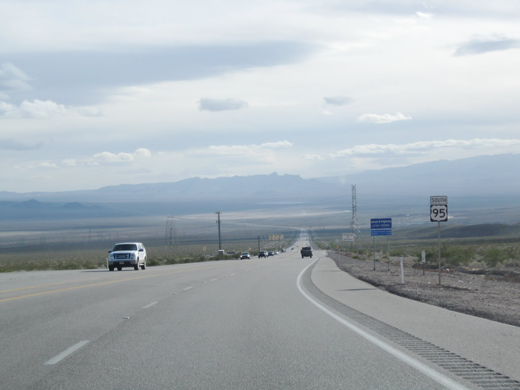
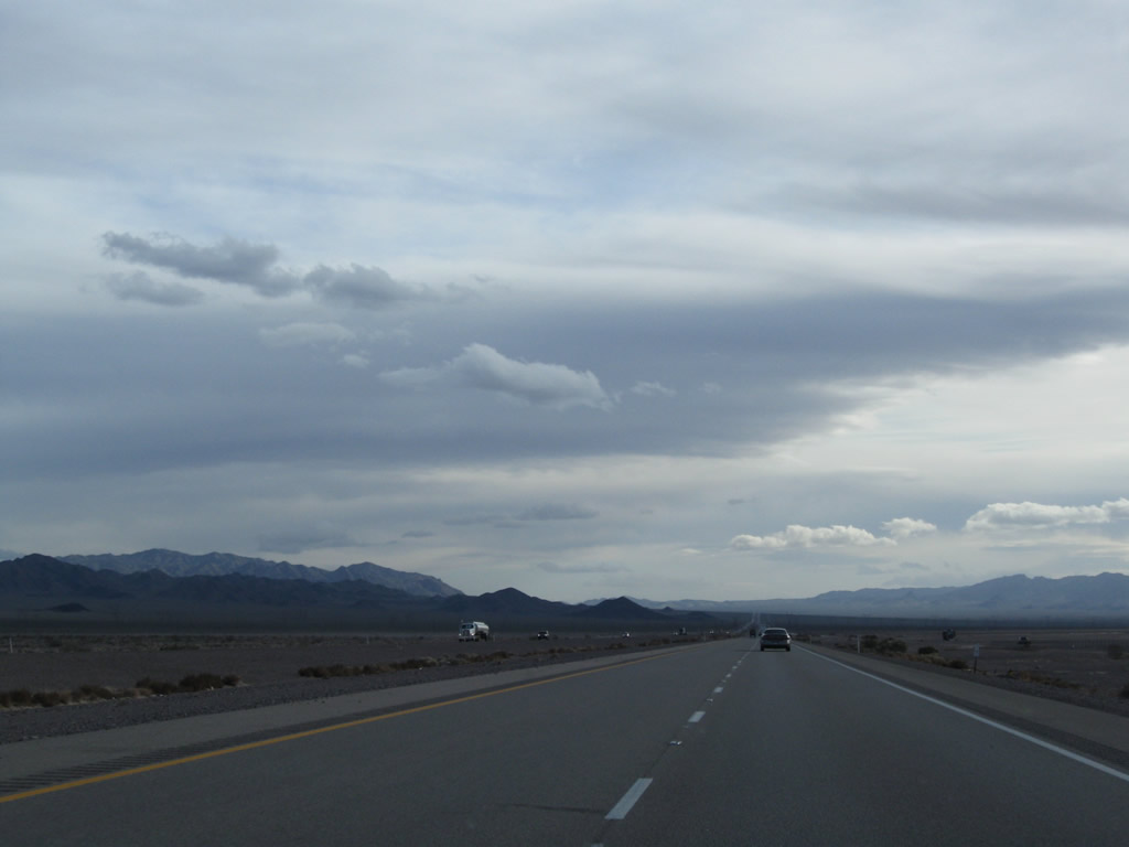
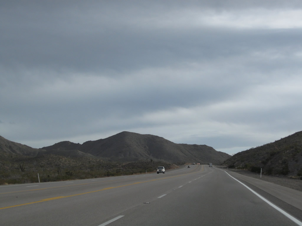
Six years later, U.S. 95 functions as a four-lane expressway for most of its path from the U.S. 93 interchange south to the Nevada-California state line. With the expansion to four lanes, the first U.S. 95 south reassurance shield was replaced, and daytime headlights were no longer required. Photo taken 02/21/10. |
|
Prior to the completion of the four-lane expressway, traffic using U.S. 95 in southern Clark County had to use their headlights for safety. This stretch of highway, with its extensive sight distances and relatively flat character, combine with heavy traffic and impatient drivers to form a potentially lethal mix. Plans call for U.S. 95 between Laughlin and Boulder City to be upgraded to a four-lane highway, and parts of this new highway are already in place near Searchlight. Photo taken 02/16/04. |
|
|
This mileage sign along southbound U.S. 95 provides the distance to the next three points of interest: Searchlight, 36 miles; Laughlin, 75 miles; and Needles, 88 miles. The next intersection is with Silver Line Road. Photos taken 02/21/10 and 02/16/04. |
|
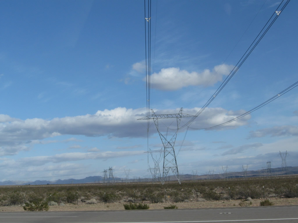
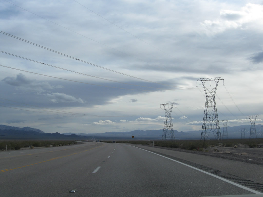
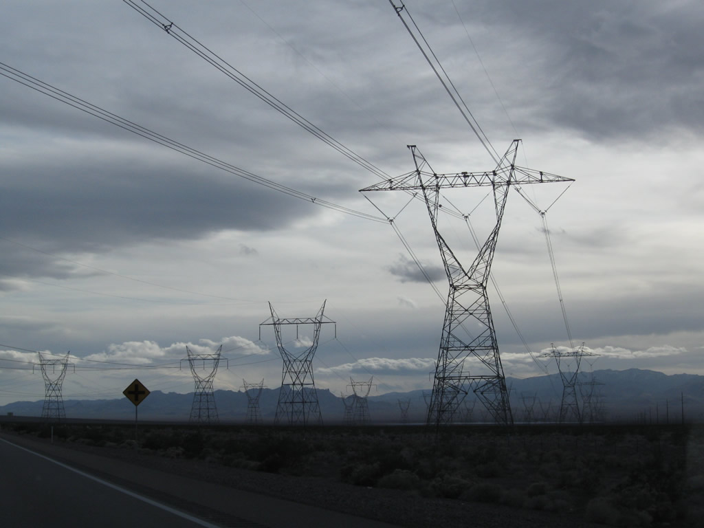
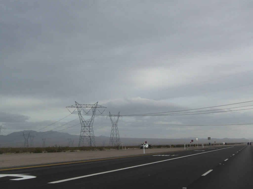
A pair of power lines cross U.S. 95; these lines travel east toward a power substation located southwest of Boulder City. The taller tower was erected and placed into service in the late 1990s. Photo taken 02/21/10. |
|
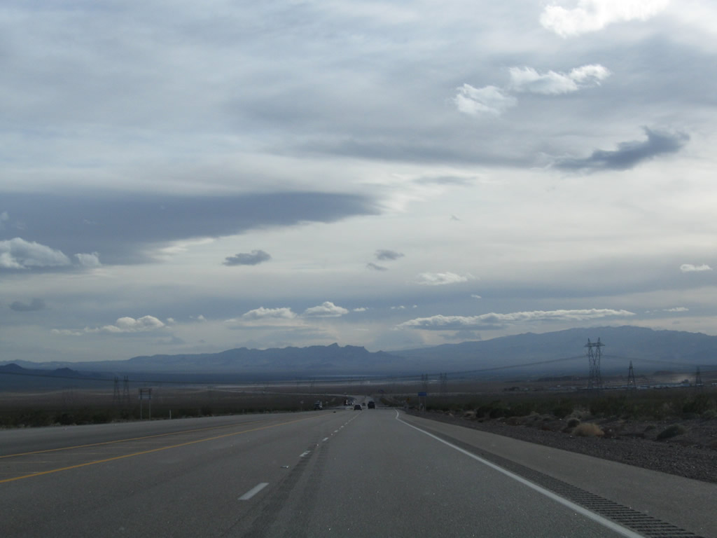
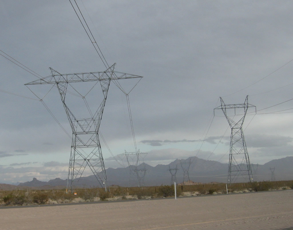
This basin is criss-crossed by several sets of power lines, most of which originate from the power plants and substations surrounding Hoover Dam and the Colorado River dam network south of Hoover Dam. Photo taken 02/21/10. |
|
|
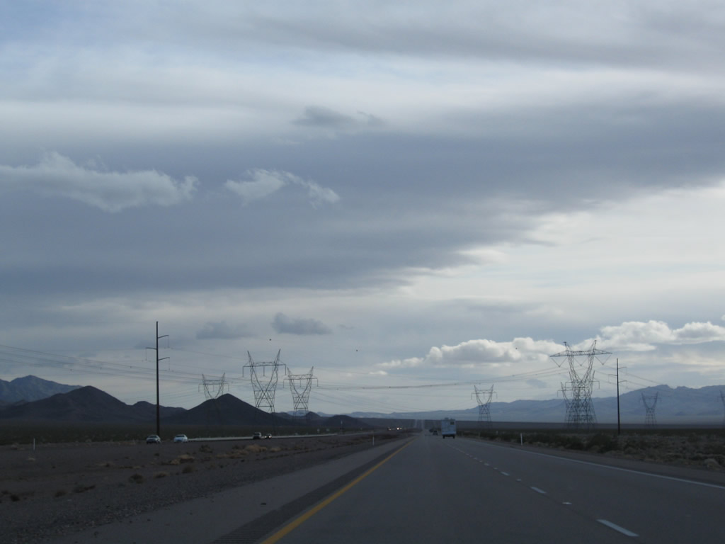
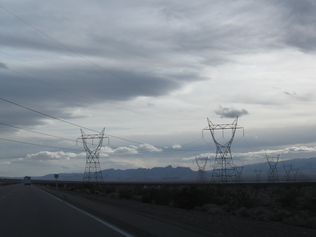
The next set of major power lines to cross U.S. 95 is the Centennial Project (owned by Nevada Power), which connects the Mead substation with the Harry Allen substation via a 500kV power line. This line also crossed U.S. 93-95 just west of Railroad Pass in Henderson. Photos taken 02/21/10. |
|
|
|
A pair of single-circuit power lines cross over U.S. 95. These lines also originate in the Mead substation south of Boulder City and extend west over the McCullough Range to a substation off McCullough Hills Parkway in Henderson. The tower design for these lines shift from steel lattice "Y" shape to wooden pole "H" frame west of here. To the east, these lines follow along with many others that originate from the Mead substation. Photos taken 02/21/10. |
|
Two Southern California Edison single-circuit, 230kV power lines cross over U.S. 95 next. These long-range power lines travel southeast from the Mead substation to the Eldorado substation, then continue southeast all the way to the Lugo substation in Hesperia, California, as part of the support network for Path 46, West of Colorado River. Photo taken 02/21/10. |
|
The U.S. 95 divided highway finally begins after cross the last set of power lines. The divided highway continues from here south to the outer limits of Searchlight. Photo taken 02/21/10. |
|
|
|
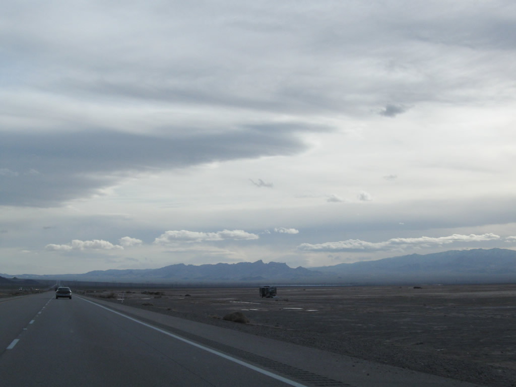
Reaching its lowest point in Eldorado Valley, U.S. 95 passes through the northeastern corner of a sprawling dry lake bed (Eldorado Valley Dry Lake Bed). From here, U.S. 95 will gradually ascend toward Searchlight. Photos taken 02/21/10. |
|
|
|
Another of major power transmission lines crosses U.S. 95. The 500kV power line connects the Mead Substation with the Marketplace Substation. From the Marketplace Substation, this 500kV power line connects directly to Path 64, which travels southeast from Marketplace substation to Adelanto substation. Path 64 is owned by the Los Angeles Department of Water and Power. The other three power lines (likely 287kV) link to the Hoover substation. Two of the lines terminate at McCullough substation, while the third travels all the way southwest to Victorville, California. Photos taken 02/21/10. |
|
|
|
|
Continuing south, U.S. 95 passes under the Hoover-Adelanto 287kV power line. To the southwest of here are the Marketplace Substation, McCullough Substation (Los Angeles Dept of Water and Power), Eldorado Substation (Southern California Edison), and Nevada Solar One project. Photo taken 02/21/10. |
|
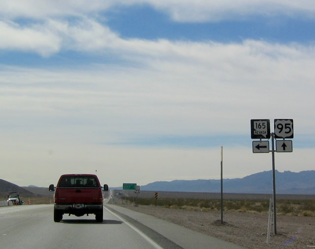
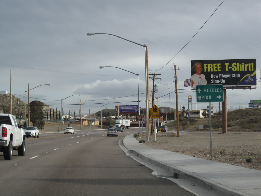
Southbound U.S. 95 meets Nevada 165, which travels southeast to the settlement of Nelson. Nevada 165 is not a through route, and it ends upon entering Nelson. A highway (not state maintained) extends east from Nelson to Nelson Landing on Lake Mohave along the Colorado River. Photo taken 02/16/04. |
|
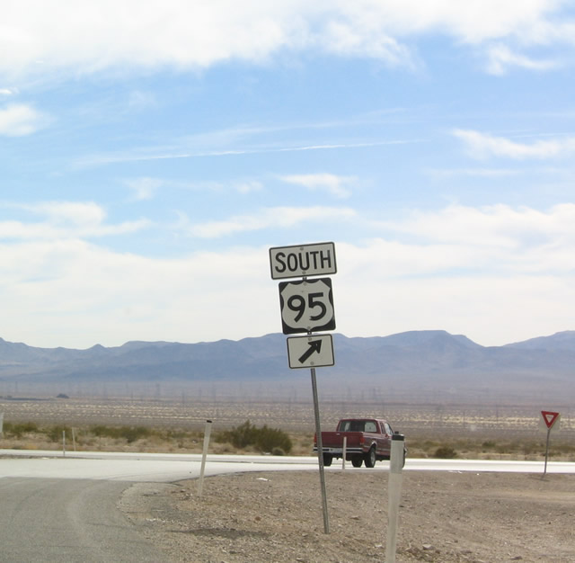
A U.S. 95 south reassurance shield is posted shortly after the Nevada 165 intersection. Photo taken 02/21/10. |
|
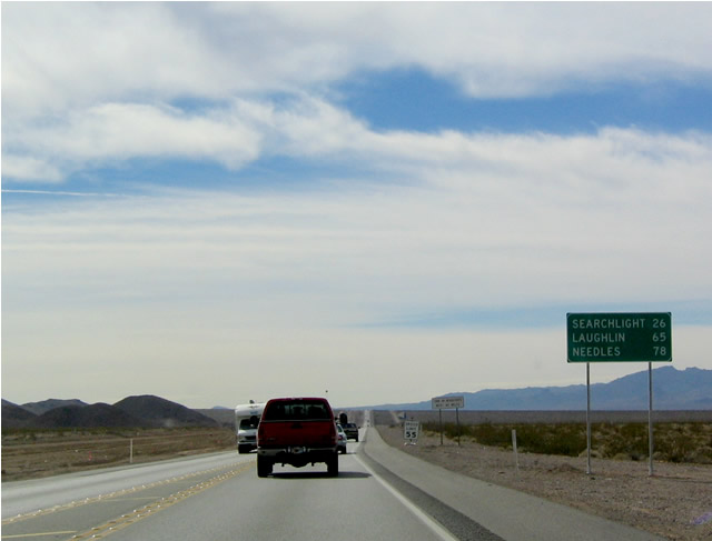
This mileage sign is found along southbound U.S. 95 and provides the distance to the following places: Searchlight, 26 miles; Laughlin, 65 miles; and Needles, 78 miles. Photo taken 02/16/04. |
|
|
View of the cleared area for future construction of companion northbound lanes adjacent to existing U.S. 95. Photos taken 02/16/04. |
|
After a break in the median is this U.S. 95 south reassurance shield. The divided highway continues to gain elevation as we leave Eldorado Valley. U.S. 95 passes through some remote territory; motorist services are limited. Photo taken 02/21/10. |
|
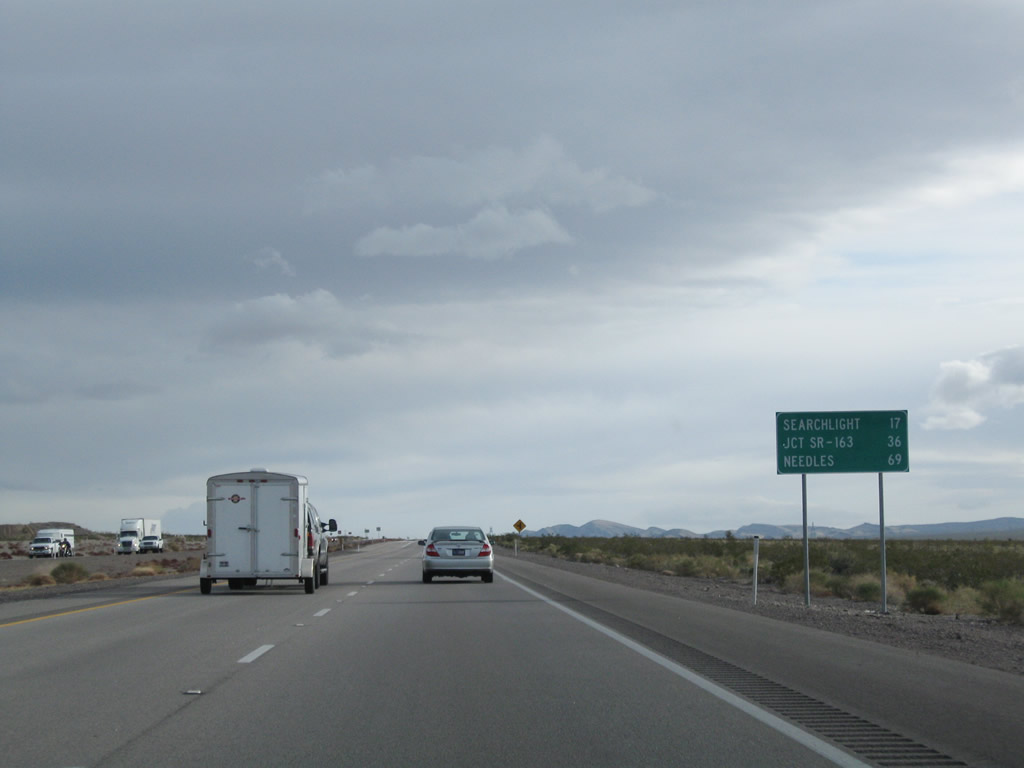
This mileage sign along southbound U.S. 95 provides the distance to the next three points of interest: Searchlight, 17 miles; Nevada 163, 36 miles; and Needles, 69 miles. Photo taken 02/21/10. |
|
|
Another 500kV power line crosses over U.S. 95. Owned by Southern California Edison, this particular line conveys electricity from the Eldorado Substation east over the Colorado River into Arizona, traveling toward the Four Corners and the various power generating plants in that region. As the line crosses the Colorado River, it is likely to be part of Path 21, East of Colorado River. Photos taken 02/21/10. |
|
|
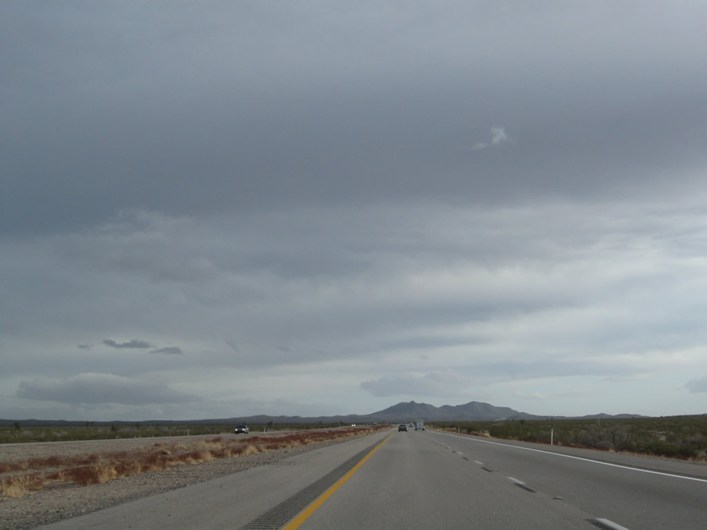
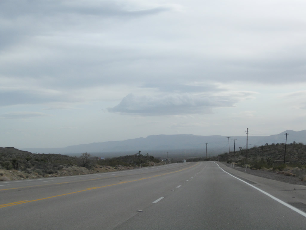
Most of the side roads that connect to U.S. 95 lead into the area around the Highland Range Crucial Bighorn Habitat Area. The next major intersection is not until Searchlight, where U.S. 95 will meet Nevada 164. Photos taken 02/21/10. |
|
|
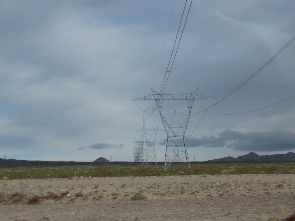
U.S. 95 passes under yet another set of power lines. These lines, owned by the Los Angeles Department of Water and Power, travel north to the Hoover Substation. Photos taken 02/21/10. |
|
|
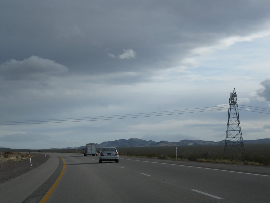
Continuing south, U.S. 95 retains four lanes as it continues toward Searchlight. Photos taken 02/21/10. |
|
|
|
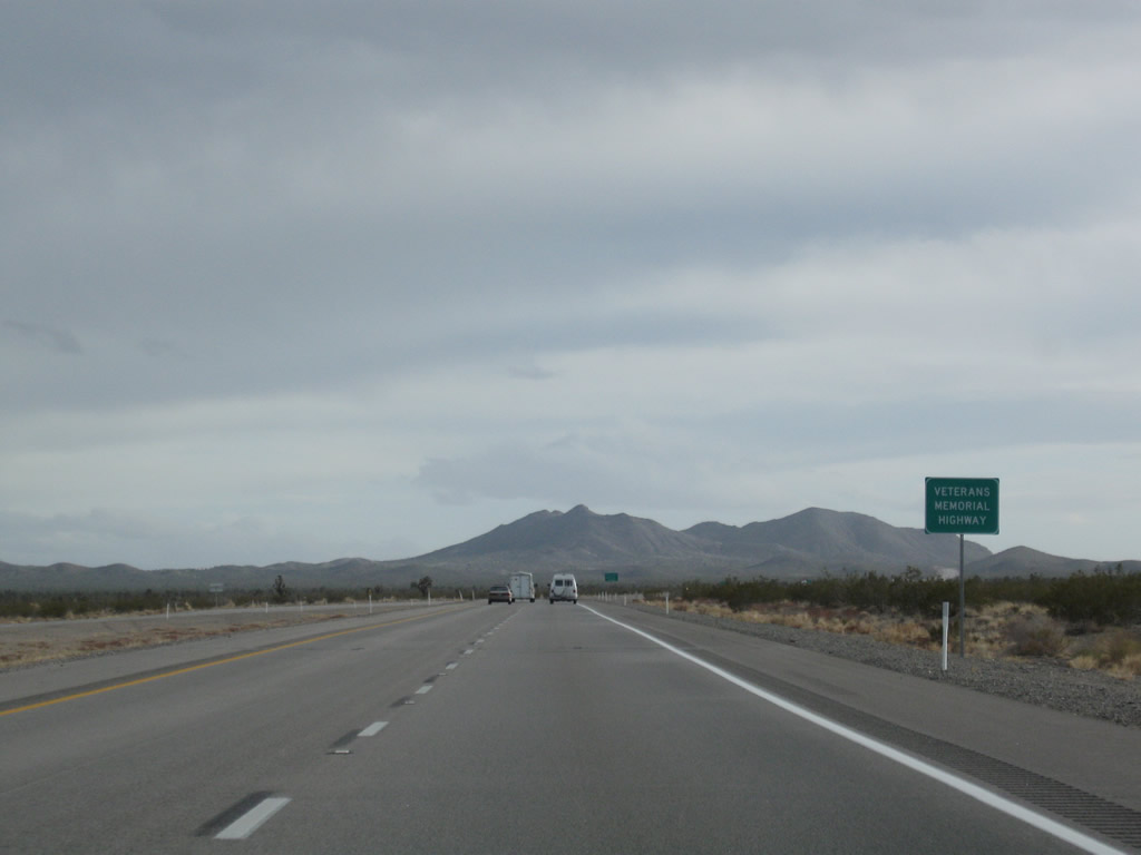
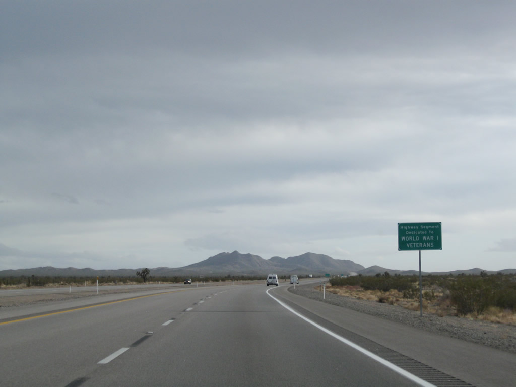
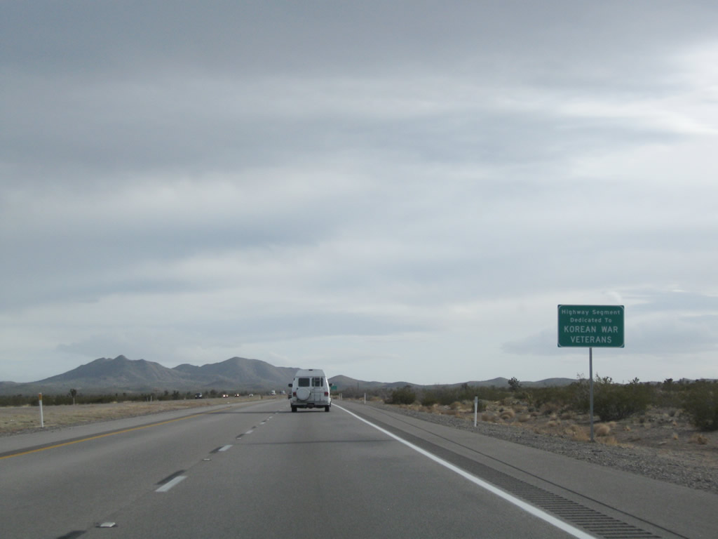
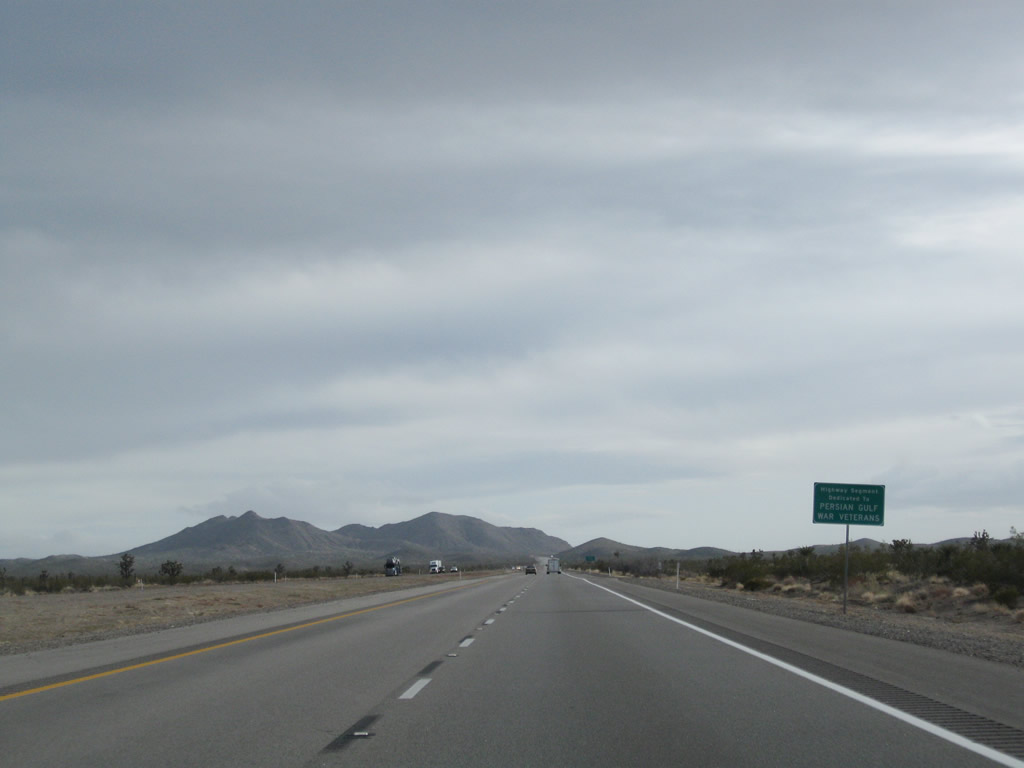
Continuing south, U.S. 95 becomes known as the Veterans Memorial Highway. Subsequent signage honors veterans from specific wars from the 20th and 21st century. In sequence, the signs are: World War I, World War II, Korean War, Vietnam War (not shown - missed the sign), Persian Gulf War, and Global War on Terror. Photos taken 02/21/10. |
|
|
|
|
The next intersection along U.S. 95 south is with Grandpas Road (left turn). Photo taken 02/21/10. |
|
|
|
Soon thereafter, the divided ends. Entering Searchlight, U.S. 95 will still have two lanes in each direction but will also gain a middle turn lane. Photos taken 02/21/10. |
|
|
|
|
|
|
|
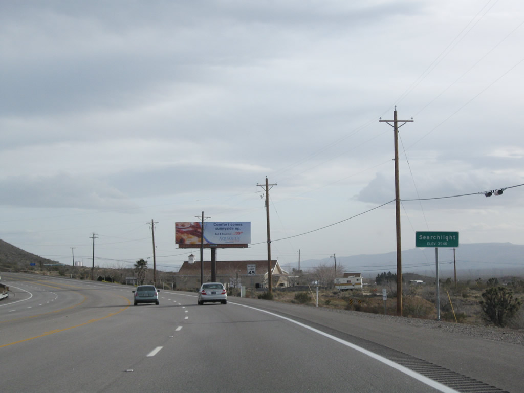
U.S. 95 enters Searchlight (elevation 3,540 feet above sea level). Searchlight was home to 576 people as of the 2000 Census; it was first explored in 1897 by gold prospector George Frederick Colton; gold was mined in the area between 1907 and 1910. Initially, Searchlight was on the main route from Las Vegas to Los Angeles, but this changed when U.S. 91 was routed onto what is now the modern Interstate 15 alignment through Primm. Population declined as mining activity diminished (the last mine closed in 1953), but population has held on with the location on U.S. 95 between Las Vegas and Laughlin and the proximity of Lake Mead National Recreation Area. Photo taken 02/21/10. |
|
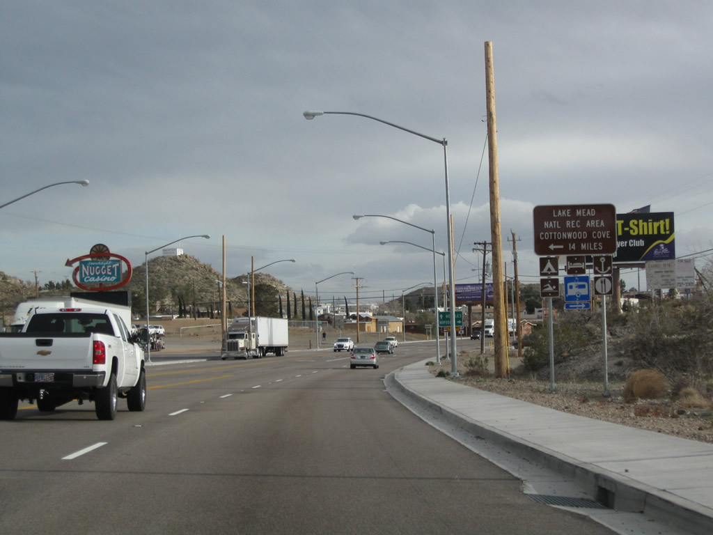
Entering the urban area of Searchlight, southbound U.S. 95 approaches its junction with Nevada 164 in Searchlight. Nevada 164 travels west to Nipton and Interstate 15 southwest of Primm. To the east is Cottonwood Cove Road en route to Laek Mohave, which is part of Lake Mead National Recreation Area. Photo taken 02/21/10. |
|
|
|
Nevada 164 leads west from Searchlight to Nipton in California, then onward as a locally maintained route to Interstate 15 at the Nipton Road interchange. To the left is Cottonwood Cove Road (not part of Nevada 164). A Truck Detour U.S. 93 trailblazer shield is posted just prior to the intersection with Nevada 164. Turn left to the Searchlight Town Park (one block south of Cottonwood Cove Road between Lincoln Street and Nevada Street). Photos taken 02/21/10 and 02/16/04. |
|
|
|
|
A U.S. 95 south reassurance shield is posted after the Nevada 164 intersection in Searchlight. Most motorist services (food, gas, lodging, gambling) are available in Searchlight. Photo taken 02/21/10. |
|
Southbound U.S. 95 meets Hobson Street in Searchlight. Turn left here to the Searchlight Post Office. Photo taken 02/21/10. |
|
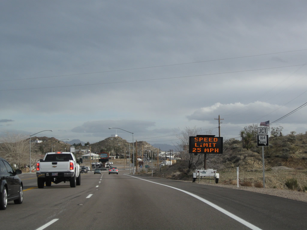
At the top of the hill are a few more services, including restaurant and gas. After this, U.S. 95 will begin its descent out of Searchlight and continue toward Cal-Nev-Ari and Needles. Photo taken 02/21/10. |
|
The speed limit gradually increases from 25 miles per hour to 65 miles per hour in increments. Photo taken 02/21/10. |
|
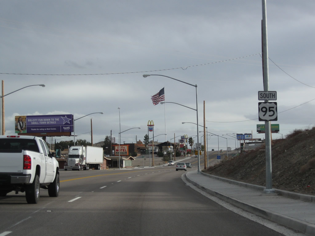
Prior to the expansion of U.S. 95 to four lanes, a mileage sign used to be posted along southbound for Needles, 51 miles and Blythe, 147 miles. As of 2010, this sign was gone. Photo taken 04/02/06. |
|
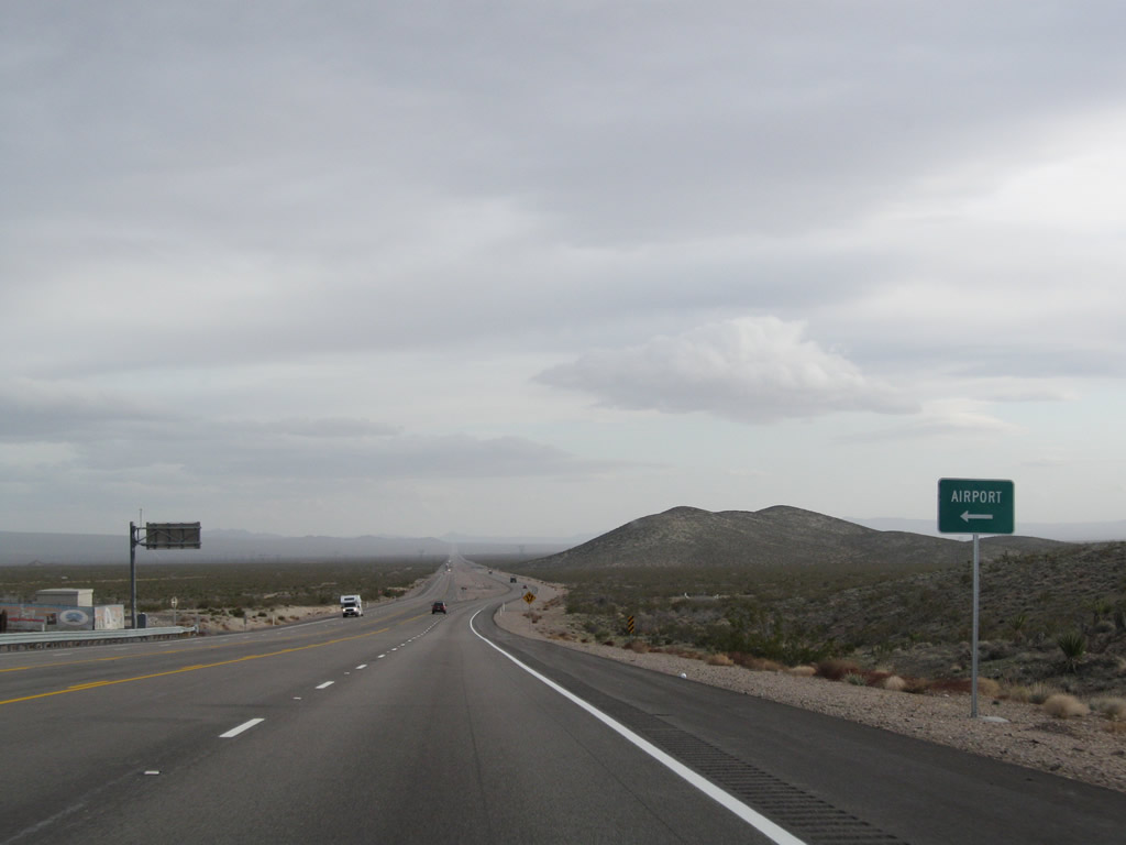
The next left connects U.S. 95 with the Searchlight Airport. Photo taken 02/21/10. |
|
Once again, U.S. 95 widens into a four-lane expressway configuration after the airport turnoff. Photo taken 02/21/10. |
|
|
Southbound U.S. 95 again passes under a set of power lines. The 500kV power line, owned by Southern California Edison, brings power from the defunct Mohave Generating Station near Laughlin to the SCE Eldorado Substation northwest of here. The smaller power transmission line (likely 230kV) brings electricity to the grid from the hydroelectric facility at Davis Dam located north of Laughlin and Bullhead City. These lines interconnect with the Eldorado, McCullough, and Marketplace Substations in the eastern Eldorado Valley near Nevada Solar One; from there, electricity is transmitted throughout Southern Nevada into Southern California. Photos taken 02/21/10. |
|
|
|
|
Continuing south, U.S. 95 continues as an expressway between Searchlight and Cal-Nev-Ari. The unincorporated community of Cal-Nev-Ari had a population of 278 as of the 2000 Census and sits at an elevation of 2,550 feet above sea level. A casino is located here by making the next right. Once in Cal-Nev-Ari, U.S. 95 assumes a four-lane highway configuration with center turn lane. Photos taken 02/21/10. |
|
|
|
|
Leaving Cal-Nev-Ari, southbound U.S. 95 resumes its expressway configuration. A U.S. 95 south reassurance shield is posted just south of Cal-Nev-Ari, and the highway meets Christmas Tree Pass Road. The next major intersection will be with Nevada 163/Laughlin Highway. Photos taken 02/21/10. |
|
|
|
|
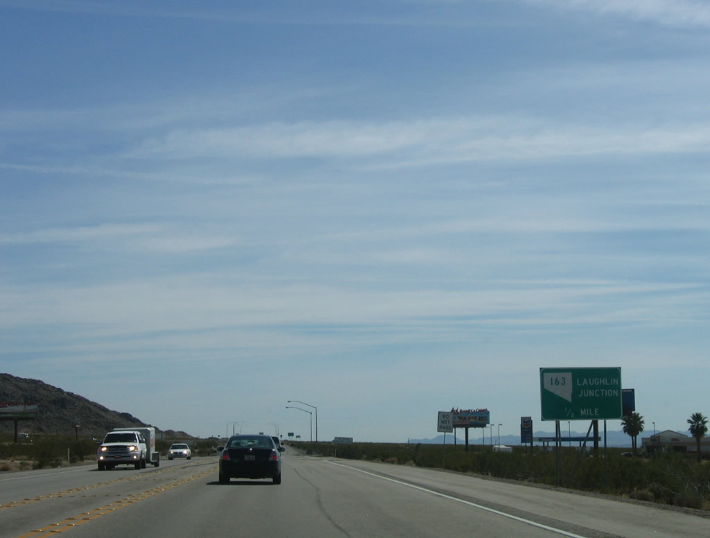
After passing through Cal-Nev-Ari, U.S. 95 southbound finally approaches Nevada 163, the last intersection before U.S. 95 enters California. Nevada 163 leads due east toward Laughlin; U.S. 95 heads south to Interstate 40 and Needles. Photos taken 02/21/10 and 04/02/06. |
|
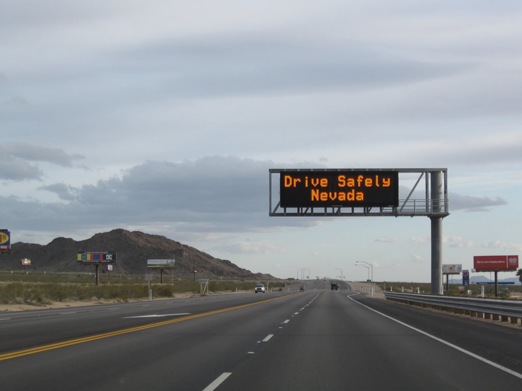
A changeable (variable) message sign advises travelers to drive safely. A gas station is located on the west side of this intersection. Photo taken 02/21/10. |
|
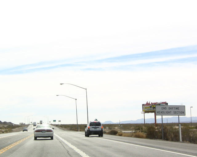
Prior to the widening project's completion, the daytime headlight section of U.S. 95 used to end just prior to the Nevada 163 intersection. Now that U.S. 95 is four lanes, daytime headlights are not required. Photo taken 02/16/04. |
|
|
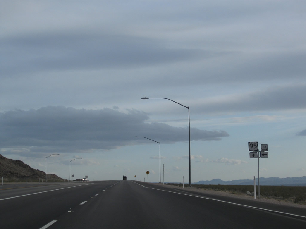
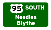
U.S. 95 south continues straight ahead to Needles, Blythe, and Yuma; Nevada 163 leads east to Laughlin and Davis Dam, with a connection to Arizona 95 south to Bullhead City and Arizona 68 east to Kingman. The Truck Detour U.S. 93 trailblazer shield shown in 2004 was gone by 2010. The best route back to U.S. 93 from here is via Nevada 163 east, Arizona 95 south, and Arizona 68 east. Photos taken 02/21/10 and 04/02/06. |
|
|
Southbound U.S. 95 meets Nevada 163 at this intersection. Shortly after this intersection, U.S. 95 will exit the Silver State of Nevada and enter the Golden State of California. U.S. 95 has the unique distinction of being the only highway to enter and leave the Golden State without ending in the Golden State. Photos taken 02/21/10 and 04/02/06. |
|
|
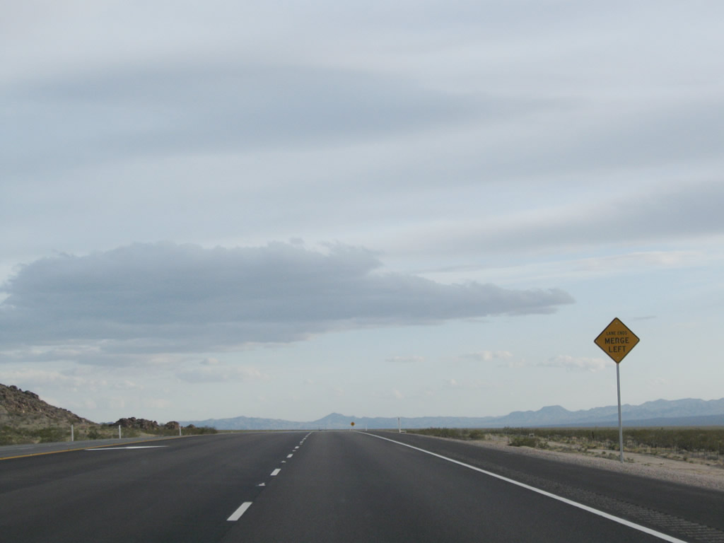
After the Nevada 163 junction, U.S. 95 south immediately narrows from four lanes to two lanes (one lane in each direction). Photos taken 02/21/10. |
|
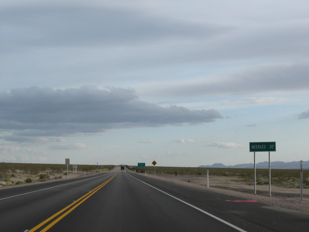
A final mileage sign provides the distance to Needles (33 miles). (This sign was moved about a mile south of here as seen below.) As the highway is now only two-lanes and has more curves and dips once in California, don't expect to be able to drive the upcoming segment as quickly as the expressway segment seen in southern Clark County. Photo taken 04/02/06. |
|
Immediately thereafter is the last U.S. 95 south reassurance marker within Nevada. Photo taken 02/21/10. |
|
The mileage sign with the distance to Needles (now 32 miles from this point) was moved to this location after the four-lane project was completed. Photo taken 02/21/10. |
|
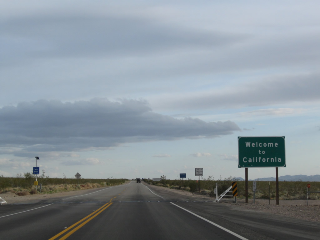
U.S. 95 leaves the Silver State of Nevada and enters the Golden State of California. Photo taken 02/21/10. |
Page Updated March 6, 2010.