Although not signed beyond guide signs along Interstate 15, Business Loop I-15 overlays the southern most 6.33 miles of SR 130 along Cross Hollow Road and Main Street through Cedar City. The majority of the five lane boulevard follows old U.S. 91 as it joins the city center with Interstate 15 at Exits 57 and 62. Utah State Route 130 proceeds north from Cedar City to Enoch and upper reaches of Cedar Valley. Traversing the Black Mountains, the state route crosses into Beaver County and then gradually lowers into Minersville. The 43.154 mile long highway concludes just north of the Minersville town limits at SR 21.
Founded in 1851 and incorporated on February 18, 1868, Cedar City ("Festival City USA") had a population of 35,235 as of the 2020 Census. Situated at an elevation of 5,846 feet above sea level, Cedar City is positioned near a variety of scenic areas within an easy drive of the city center. Markagunt Plateau, and its spectacular vistas including Cedar Breaks National Monument, lies to the east via SR 14. Cedar City is also home to Southern Utah University. Founded as Branch Normal School in 1897, Southern Utah University became a four-year school in 1991.
The exchange connecting Interstate 15 with the south end of Business Loop I-15 and SR 130 was converted to a diverging diamond interchange (DDI). Costing $10.4 million, the two phase project started on March 3, 2014.1,2 The DDI opened initially on August 25,3 with construction formally completed with a ribbon cutting ceremony held on the morning of October 24, 20143
|
| Forming a belt route around the west side of Cedar City, Cross Hollow Road enters the diverging diamond interchange with Interstate 15 from an adjacent cluster of traveler services and big box retail. 07/15/17 |
|
| Proceeding through the DDI along SR 130 (Cross Hollow Road) to the left turn for I-15 north to Parowan, Beaver and Fillmore. 07/15/17 |
|
| Old Highway 91 ties into Cross Hollow Road just east of I-15. The former U.S. 91 comprises a frontage road for the freeway leading south toward Hamiltons Fort. 07/15/17 |
|
| The Red Hill and the Hurricane Cliffs rise to the east of Cedar City. SR 14 stems east from Downtown through Cedar Canyon en route to Cedar Breaks National Monument and U.S. 89 west of Bryce Canyon National Park. 07/15/17 |
|
| Business Loop I-15 and SR 130 remain unposted as Cross Hollow Road becomes South Main Street ahead of 600 South. 07/15/17 |
|
| Main Street turns due north along a commercial strip leading to the Downtown Cedar City. 200 South leads three blocks west to become part of the SR 289 loop encircling Southern Utah University. 07/15/17 |
|
| Business Loop I-15/SR 130 (Main Street) intersect the west end of SR 14 and the east end of unsigned SR 289 at Center Street in the Cedar City center. SR 14 commences a 50 mile long route east to U.S. 89 at Long Valley Junction. SR 289 measures 1.92 miles west to 1150 West, 200 South and 300 West. 07/15/17 |
|
| Continuing three blocks north on Main Street, Business Loop I-15/SR 130 meet the east end of SR 56 (200 North). 07/15/17 |
|
| SR 56 travels 61.50 miles west from SR 130 at Main Street Park in Cedar City to Newcastle, Beryl Junction, Modena and the Nevada state line. SR 319 extends west from the border to Panca and U.S. 93. 07/15/17, 10/25/03 |
|
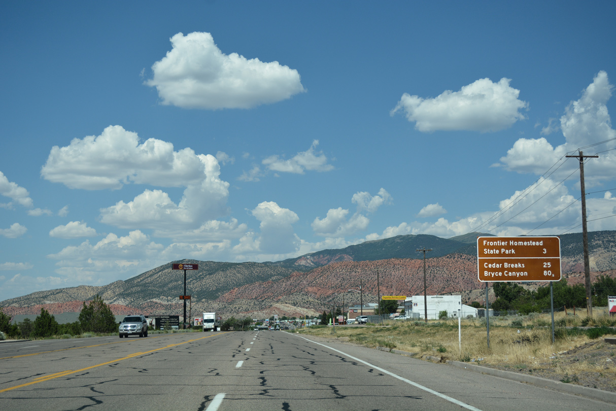
| Coal Creek Road stems northwest from Main Street along Coal Creek to Bicentennial Park. Frontier Homestead State Park follows on the west side of Business Loop I-15/SR 130. 07/15/17 |
|
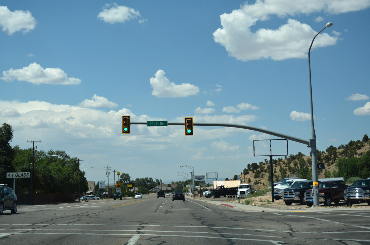
| 1045 North arcs east from Cedar Creek Road and Bicentennial Park to intersect Business Loop I-15/SR 130 at the succeeding northbound signal. 1045 North connects with Knoll Street to a golf course community to the northeast. 07/15/17 |
|
| The traffic light at 1325 North serves adjacent Cedar City Hospital. 1325 North links Main Street with parallel Northfield Road otherwise. 07/15/17 |
|
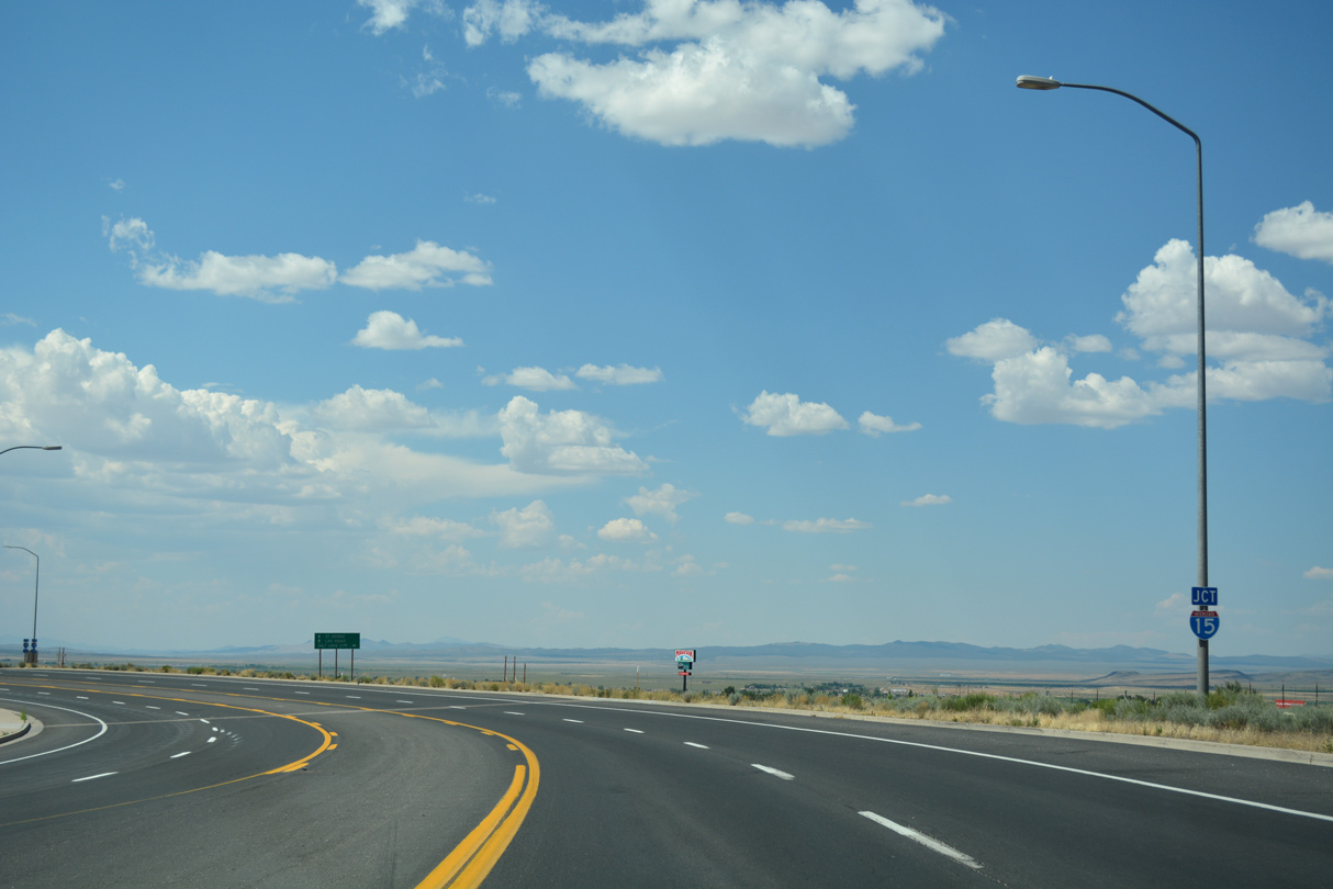
| Advancing beyond the residential north side of Cedar City, Business Loop I-15/SR 130 loop eastward to Interstate 15. Main Street originally met I-15 just to the northwest of Nichols Canyon Road at a diamond interchange. 07/15/17 |
|
| Canyon Ranch Drive forms an east side service road for the adjacent exchange with Interstate 15. 07/15/17 |
|
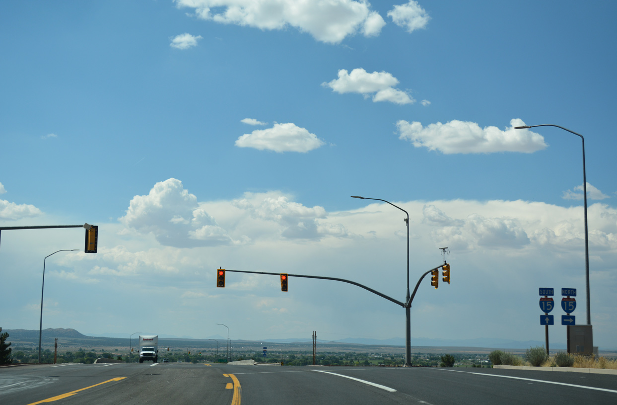
| Business Loop I-15/SR 130 remain five lanes wide leading into the diamond interchange (Exit 62) with Interstate 15. 07/15/17 |
|
| An older distance sign precedes the northbound on-ramp for I-15 to Provo and Salt Lake City. 07/15/17 |
|
| The Cottonwoods of Cedar Valley spread into view as Business Loop I-15 concludes at I-15. 07/15/17 |
|
| SR 130 continues north from Interstate 15 through western reaches of Enoch and across agricultural areas of Cedar Valley. Rising far to the northwest are The Three Peaks. 07/15/17 |
|
| Shield and guide sign for the southbound entrance ramp to I-15 removed after 2014. 08/20/11 |
|
| Business Loop I-15 begins a concurrency with SR 130 at Exit 62 north of Cedar City and south of Enoch. Southbound SR 130 meets the on-ramp to Interstate 15 north to Salt Lake City at this traffic signal. 08/20/11 |
|
| Absent a Business Loop I-15 route marker, a SR 130 shield is posted after the diamond interchange with I-15. 08/20/11 |
|
| Southbound Business Loop I-15 and SR 130 intersect SR 14 (Center Street) in Downtown Cedar City. SR 14 travels east from Cedar City toward Markagunt Plateau and Cedar Breaks National Monument. SR 14 leads to Long Valley Junction, the Sevier River, and U.S. 89 on the other side of the mountains. Unsigned at this intersection is SR 289, which spurs west via Center Street toward Southern Utah University and the Shakespeare Festival. 10/25/03 |
Photo Credits:10/25/03, 08/20/11, 07/15/17 by AARoads
Connect with:
Interstate 15
Page Updated 06-28-2018.


 North
North