Alex

About Alex

Cofounder of AARoads.com. Webmaster of both AARoads and Interstate-guide.com. Former cartographer for Mapsource, Inc. and Universal Map Group, LLC. Map specialist for GIS Cartography & Publishing Services.

Bobwhite Manatee Transmission Line Analysis – Final Project

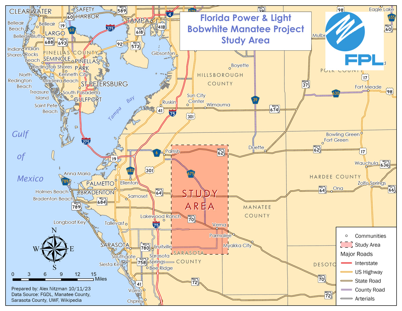
The final project for GIS4043/Intro to GIS conducts analysis on the Bobwhite Manatee Transmission Project in Southwest Florida. Part of the Florida Power & Light (FPL) infrastructure, the 24.5 mile long transmission corridor was developed to serve growing areas of eastern Manatee and Sarasota Counties, including Lakewood Ranch. Additionally the new line offers redundancy during hurricanes, something tested since it was completed with Hurricane Irma in 2017 and Hurricane [...]

By |2023-11-03T16:57:19-04:00October 13th, 2023|GIS|0 Comments

Georeferencing UWF aerials for Eagles nest easement analysis

The sixth lab for Intro to GIS introduces Georeferencing, which transforms raster data such as an aerial photo or a scan of a subdivision plat, to closely match vector data within GIS. I am familiar with Georeferencing from my cartography jobs, where we often acquired subdivision and other development plats and digitized them for updating map products. Georeferencing utilizes control points, which match features on the raster image without any [...]

By |2023-11-03T16:29:37-04:00October 3rd, 2023|GIS|0 Comments

Geocoding Data – Manatee County Schools

This week's lab project introduced me to Geocoding within ArcGIS Pro and some Excel spreadsheet tactics used to prepare the data for it. The focus of this project is to extract the geographic location for Manatee County Schools from the list posted on the Florida Department of Education web site. Started the lab with a simple copy and paste of the schools list, which includes 84 entries ranging from [...]

By |2023-11-03T16:25:09-04:00September 22nd, 2023|GIS|0 Comments

Buffer Analysis with Desoto National Forest data

This week's GIS Lab introduced spatial analysis and more specifically, the concept of buffers. Buffers in GIS can be applied to spatial data to conduct analysis on a specifically defined area surrounding the data in question. My last experience with buffers was back in 1998 at the University of Delaware. Our final project then used buffers as part of the analysis for the White Clay Creek Watershed in northern [...]

By |2023-11-03T16:21:48-04:00September 17th, 2023|GIS|0 Comments

Map Projection Variation with Florida County data

This week's GIS lab delved into map projections, the manipulation of attribute data and the creation of a feature class out of selected data. We were tasked with taking a polygon shapefile of Florida's County Boundaries and reprojecting it from the original Albers Conical Equal Area (Albers) coordinate system to both the State Plane Coordinate System (State Plane Florida North) and the Universal Transverse Mercator (UTM 16 North) [...]

By |2023-11-03T16:12:01-04:00September 14th, 2023|GIS|0 Comments

ArcGIS Field Maps – Tampa area route markers

Three weeks into GIS4043, we were introduced to a package including data collection, ArcGIS Online, Story Maps and ArcGIS Field Maps. While I have worked with ArcGIS Online creating state maps with data from various Departments of Transportation for research and write-ups for pages on AARoads, a lot of this was new to me.   The purpose of this week's lab is to create a Feature Class with data [...]

By |2023-11-03T16:02:56-04:00September 11th, 2023|GIS|0 Comments

Cartography Overview – University of West Florida Map

Following several days of anxiousness following the formation and movement of Hurricane Idalia, I finally was able to resume work on the second Lab assignment for GIS4043. This week's focus is on cartographic basics and design, something I have familiarity with having worked for three map companies. However my experience goes back to ArcMap, and the ArcGIS Pro system definitely requires some time investment to acclimate. The general purpose [...]

By |2023-11-03T15:48:12-04:00August 31st, 2023|GIS|0 Comments

ArcGIS Pro Overview and a basic World Map

Well it's been awhile since I completed a formal assignment such as the Lab 1 for GIS4043! While I have partaken in some ESRI Training, which included exercises, this is the first time working on a GIS project with a grade in mind. 😬 The bulk of this Lab was pretty much a rehash of my existing skill set with GIS from my days using ArcMap... But with that [...]

By |2023-11-03T16:12:50-04:00August 23rd, 2023|GIS|0 Comments

17 Years of GIS

I am not new to the GIS world, but have been out of practice for quite some time. First worked with GIS as a researcher and cartographer for Mapsource, Inc. out of St. Petersburg, Florida. Later worked for Universal Map Group, LLC out of DeLand, using GIS exclusively as part of my job as map researcher. Followed those jobs by joining GIS Cartography and Publishing Services, LLC, where I [...]

By |2023-11-03T15:43:54-04:00August 22nd, 2023|GIS|0 Comments

Alaska – 50th State Added to the site

23 years after AARoads was started, we finally added coverage of Alaska, the 50th State and the last not previously covered on the site. Our initial updates includes photos taken in May 2023 south to Soldotna, north to Fairbanks and Fox and east to Yukon at Alcan Border. Also scanned a number of [...]

By |2023-07-31T11:59:49-04:00July 31st, 2023|Alaska, Updates|0 Comments
Go to Top