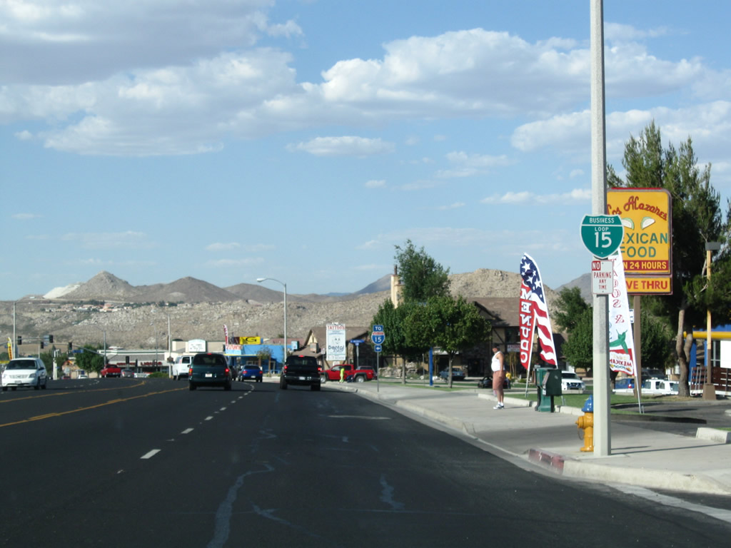
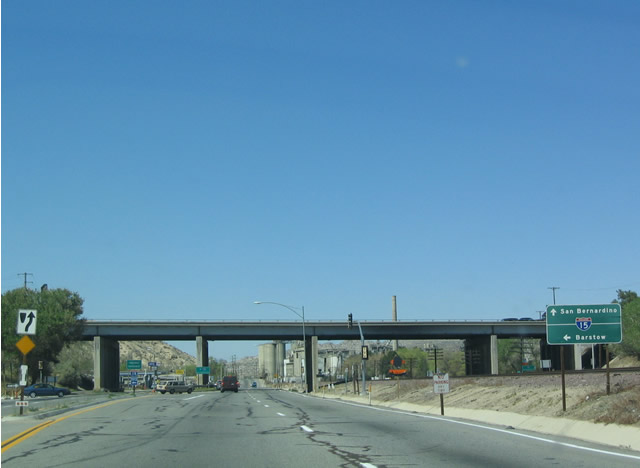
I-15 south at the Victorville business loop (Exit 153A). Photo taken 08/08/13.
Business Loop I-15 follows a 3.6 mile alignment east from Interstate 15 through Victorville. Known as the "Key City of the High Desert", Victorville had an estimated population of 122,265 in 2016. Incorporated on September 21, 1962, the city derived its name from the California Southern Railroad siding of Victor.1 The route branches east from I-15 at Exit 150, lining 7th Street along a heavily developed retail corridor to Downtown. 7th Street is a part of Historic U.S. 66 and 91.
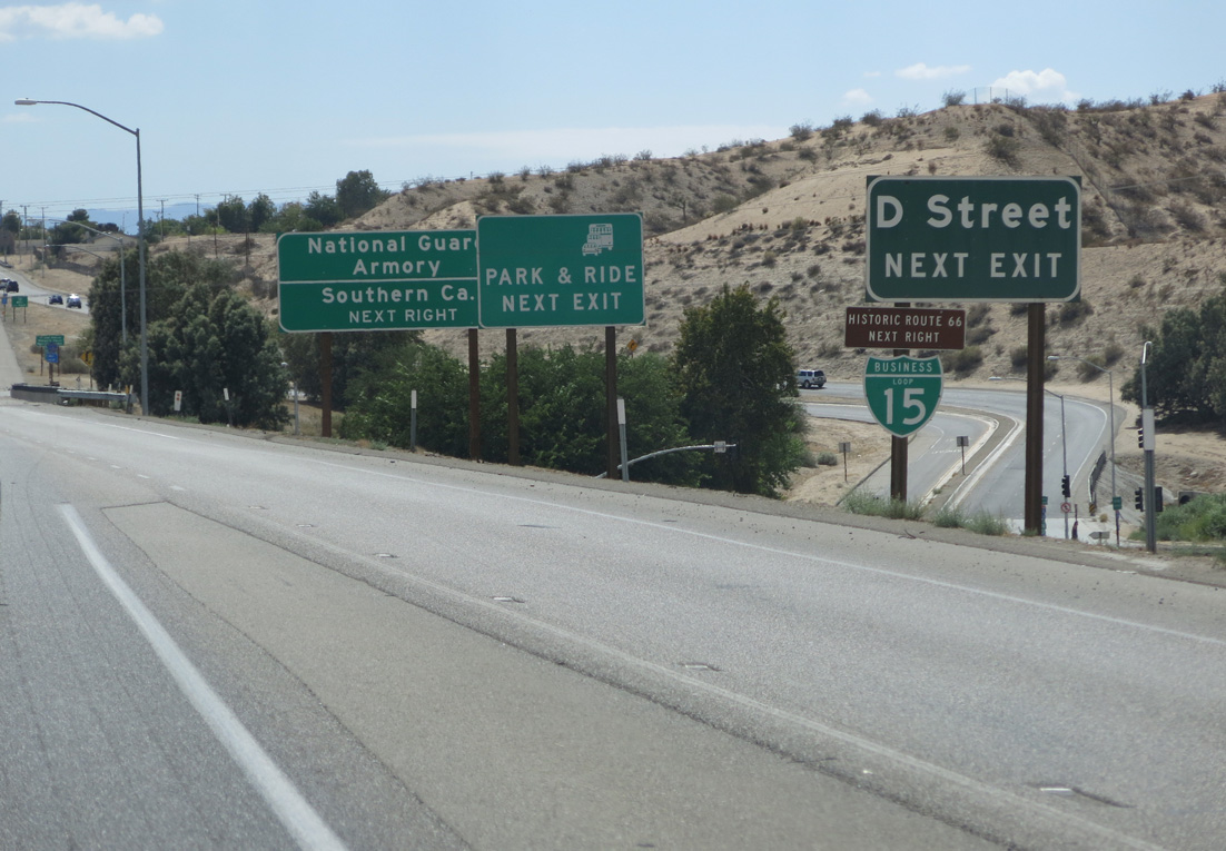
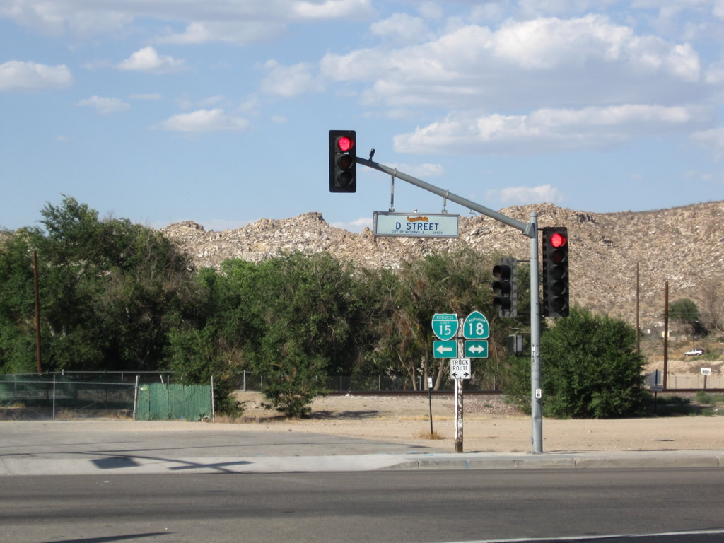
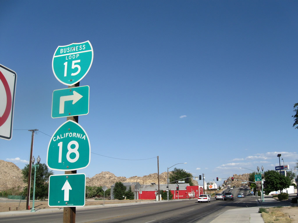
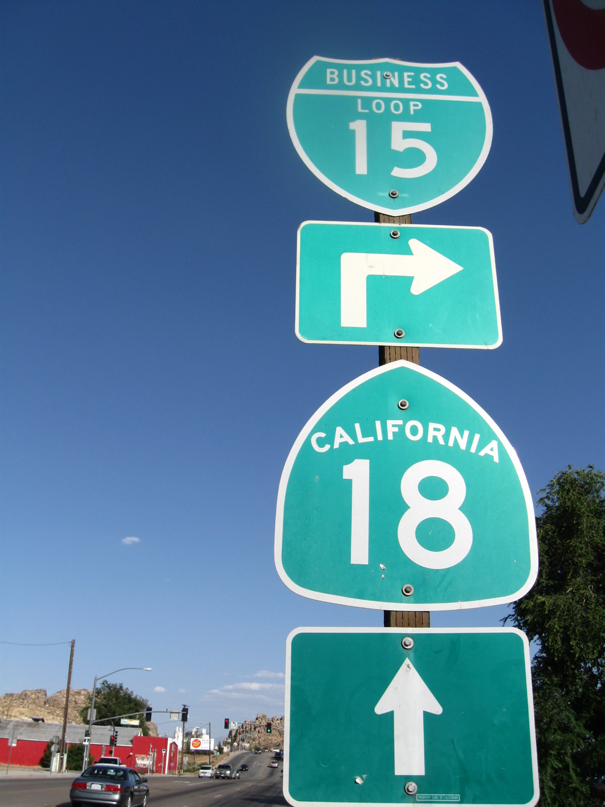
Combining with California 18, Business Loop I-15 turns northwest along D Street parallel to a BNSF Railroad line out from the Victorville city center. The two routes meet I-15 at a folded diamond interchange (Exit 153) opposite County Road 66 (Historic U.S. 66-91 / National Trails Highway).
A $76 million project started in 2016 upgrades 4.1 miles of Interstate 15 through Victorville, including redesigning the interchanges with D Street, E Street and Stoddard Wells Road (Exit 154). Ramp geometry will be improved at the ramps with Business Loop I-15 and California 18, with a northbound collector distributor roadway added to link with the adjacent exchange at E Street. Work runs through the end of 2018.2,3
|
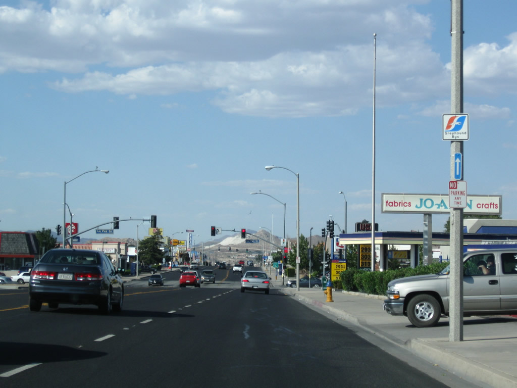
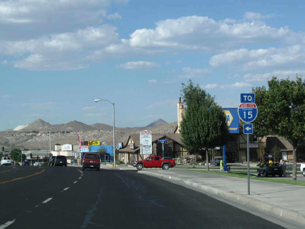
| Eastbound Seventh Street transitions from SR 18 east to Business Loop I-15 after crossing through a six-ramp parclo interchange with I-15. Seventh Street northeast was formerly also a part of Californa 18, until the state route was realigned along I-15 and D Street. 06/27/09 |
|
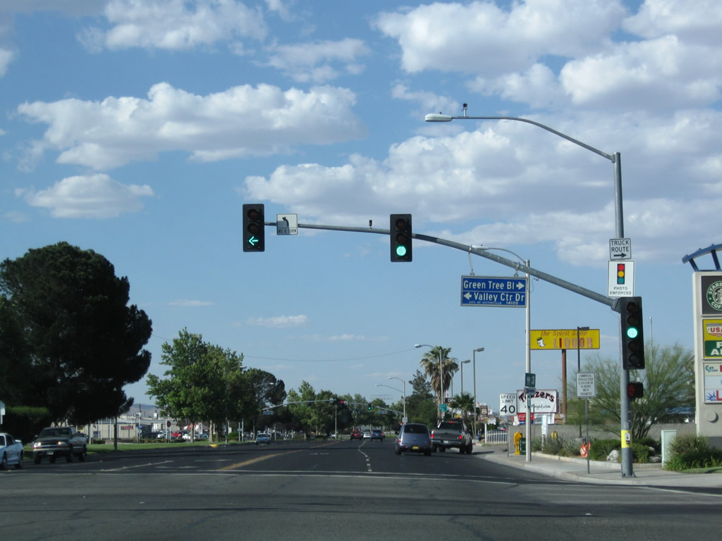
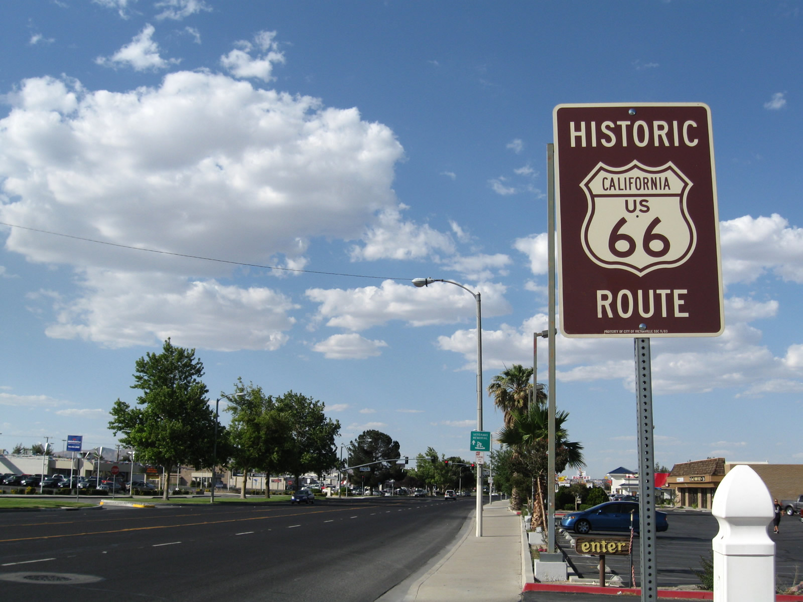
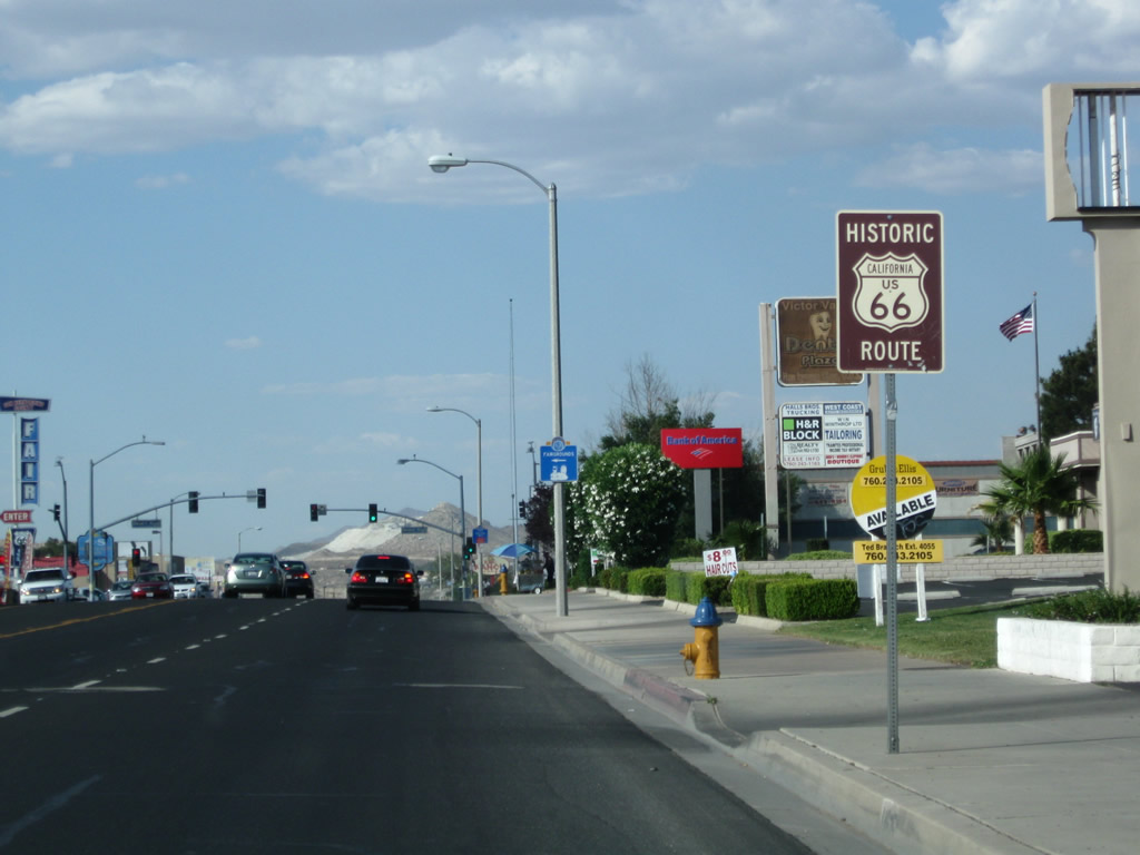
| A Historic U.S. 66 route marker stands just beyond the signalized intersection with Valley Center Drive north and Green Tree Boulevard east. 06/27/09 |
|
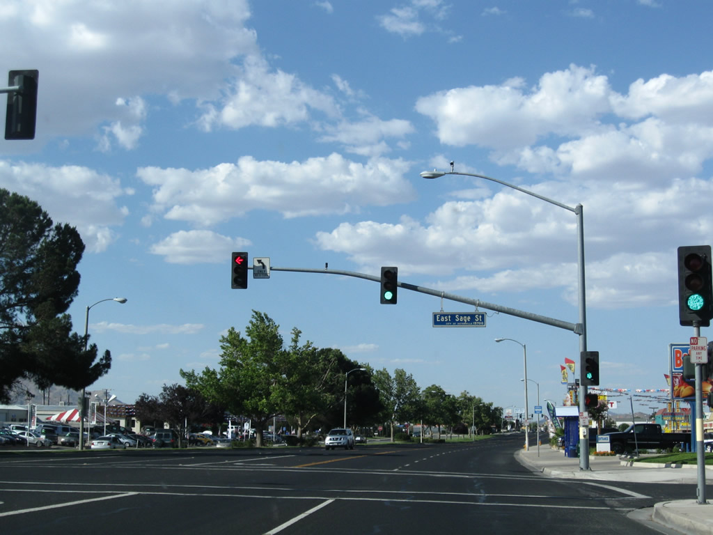
| Northbound Business Loop I-15 and Historic U.S. 66 east meet Sage Street. 06/27/09 |
|
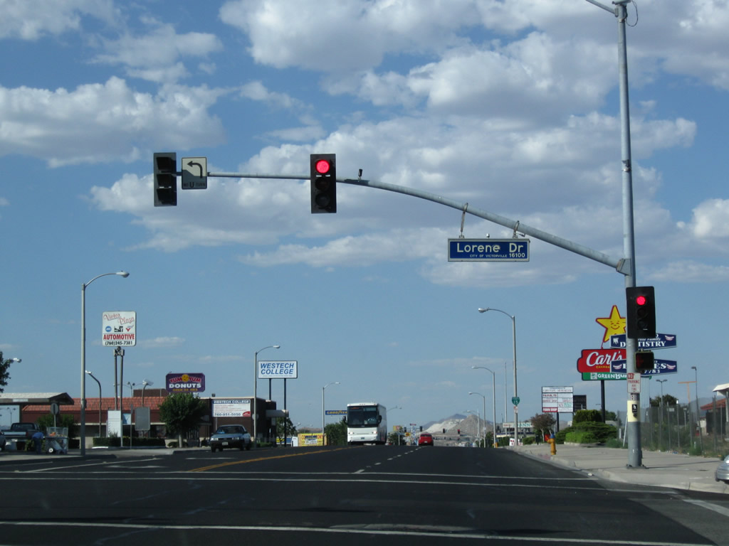
| Seventh Street proceeds northeast through Victorville. A frontage road (Seventh Outerhighway) accompanies the north side of the five lane boulevard though to the signal at Lorene Drive. 06/27/09 |
|
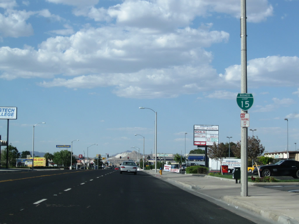
| Big box retail lines the north side of Seventh Street between Lorene Drive and Hook Road. Affixed to a light post, this reassurance marker for Business Loop I-15 was replaced after 2012 with a new assembly closer to Lorene Drive. 06/27/09 |
|
| La Paz Drive originates in residential areas south of Seventh Street and intersects Business Loop I-15 at the next northbound signal. Expanding to a five lane boulevard, La Paz Drive extends northwest to the Roy Rogers Drive interchange (Exit 151A) with I-15 & SR 18. 06/27/09 |
|
| Another Historic U.S. 66 route marker is posted after the La Paz Drive intersection. 06/27/09 |
|
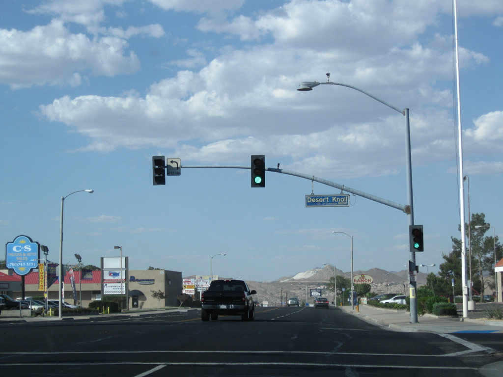
| Business Loop I-15 (Seventh Street) meets Desert Knoll Drive at the ensuing traffic light northbound. 06/27/09 |
|
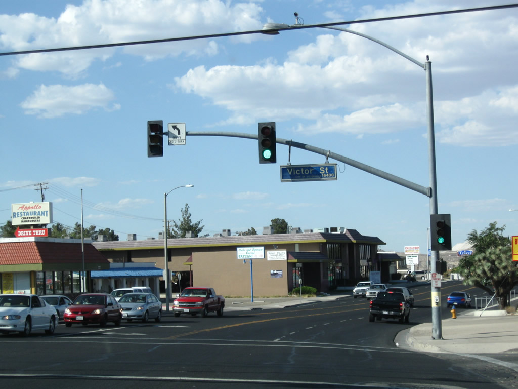
| The business route begins to descend along Seventh Street toward the Mojave River, which passes near Downtown Victorville adjacent to the BNSF Railroad. Victor Street circles southeast across Seventh Street toward Irwin Elementary School. 06/27/09 |
|
| The reassurance marker for Business Loop I-15 north at Lacy Street was relocated northward a short distance by 2017. 06/27/09 |
|
| This trailblazer for I-15 directed traffic returning to the freeway via forthcoming Mojave Drive west. It was replaced with a business route shield by 2017. 06/27/09 |
|
| Mojave Drive leads north from neighborhoods east of 7th Street to become a four lane boulevard west to Victor Valley High School and a diamond interchange (Exit 151B) with I-15. 06/27/09 |
|
| Another Historic U.S. 66 marker appears along Business Loop I-15 north at Union Street. 06/27/09 |
|
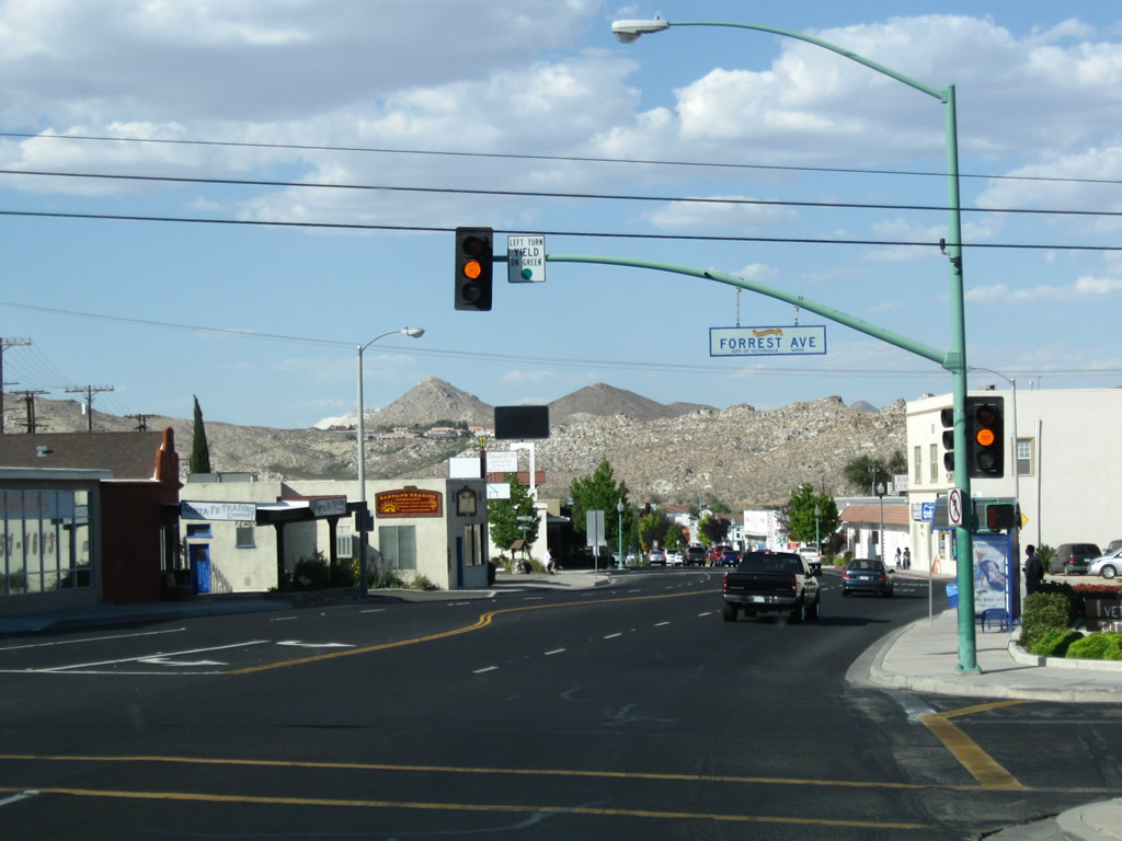
| Hills separating Downtown Victorville from Apple Valley come into view as the commercial boulevard along 7th Street intersects Forrest Avenue. 06/27/09 |
|
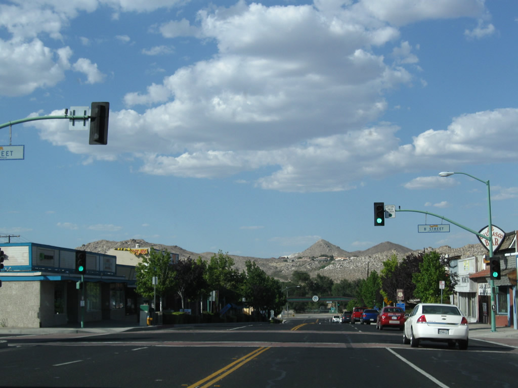
| Entering Downtown Victorville, Business Loop I-15 advances three blocks north to meet SR 18 (D Street). 06/27/09 |
|
| A more classically styled U.S. 66 shield appears on this historic marker at 7th and C Streets in Downtown Victorville. 06/27/09 |
|
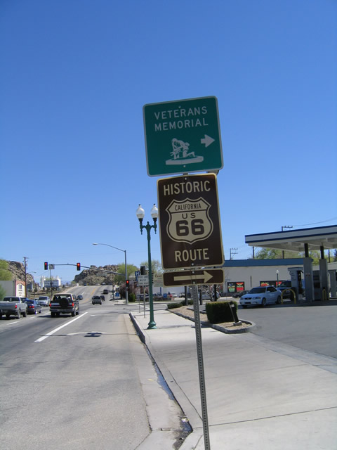
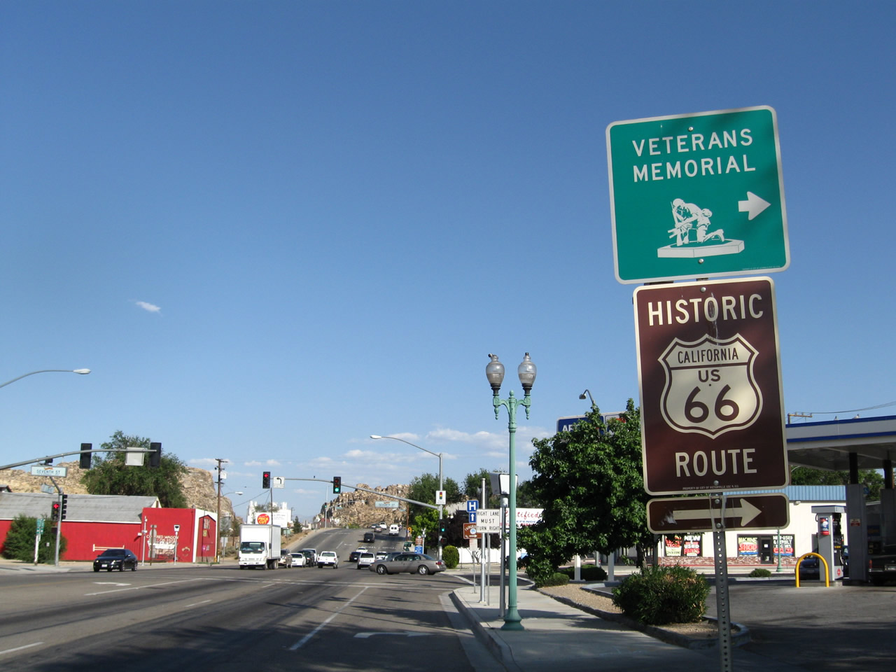
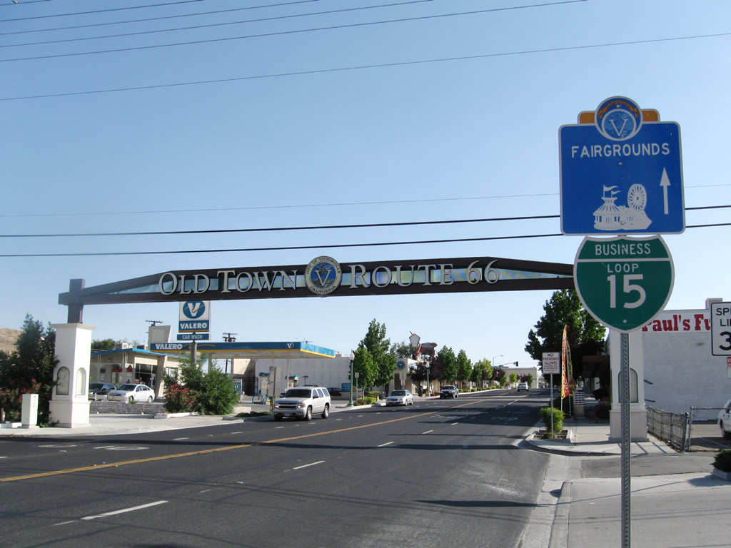
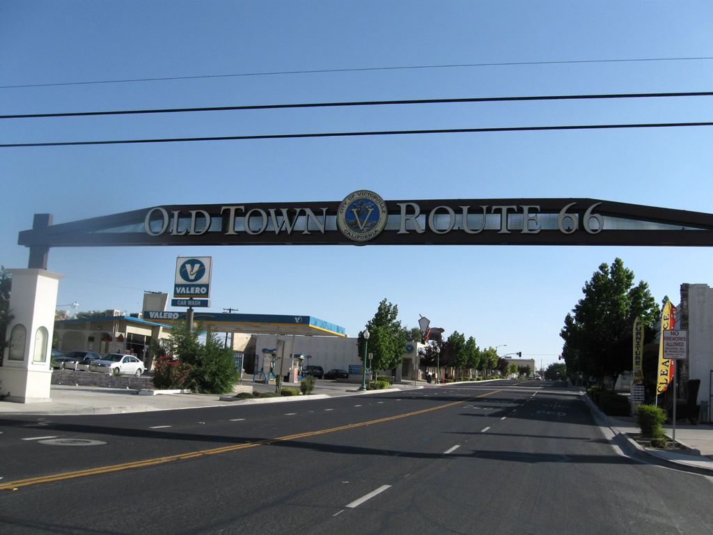
| An arch sign spans the north end of Seventh Street just ahead of the intersection with SR 18. Lettering ("Old Town - Route 66") only faces traffic entering Downtown from D Street. The Route 66 Museum lies one block to the west. 06/27/09 |
|
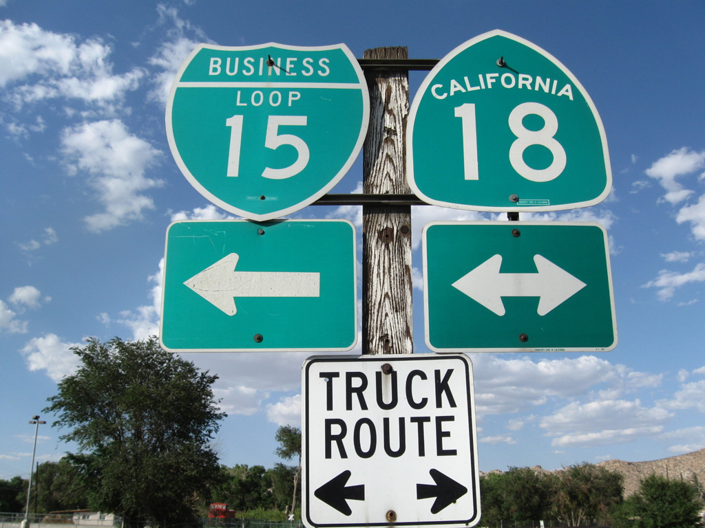
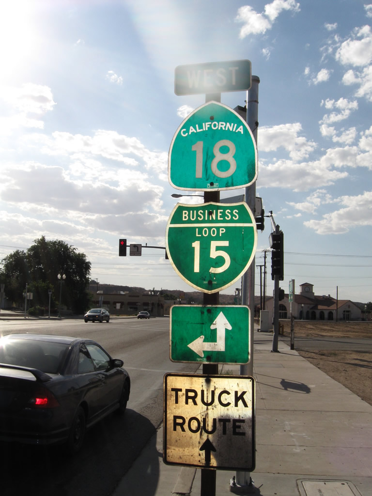
| Business Loop I-15 combines with SR 18 (D Street) northwest. SR 18 east leads to Apple Valley and Lucerne Valley and south to Big Bear Lake. An old arch bridge on Old Mineral Road crosses over the Mojave River along SR 18 east of here as well. 06/27/09 |
|
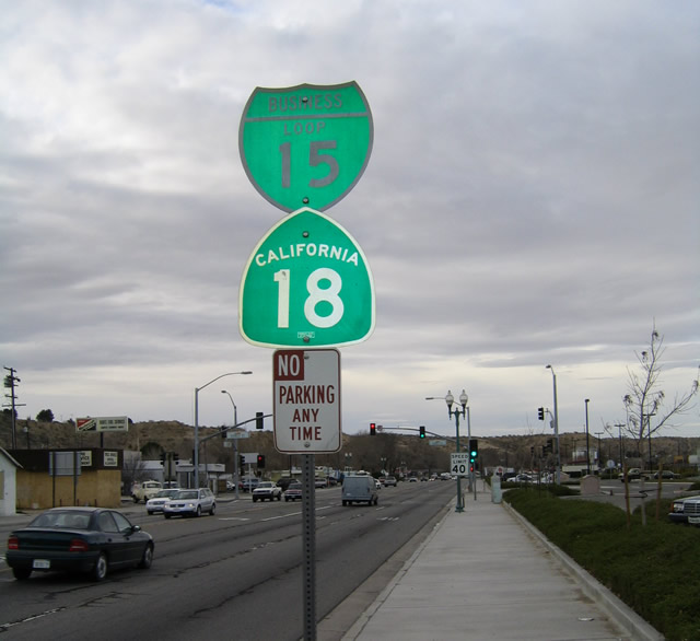
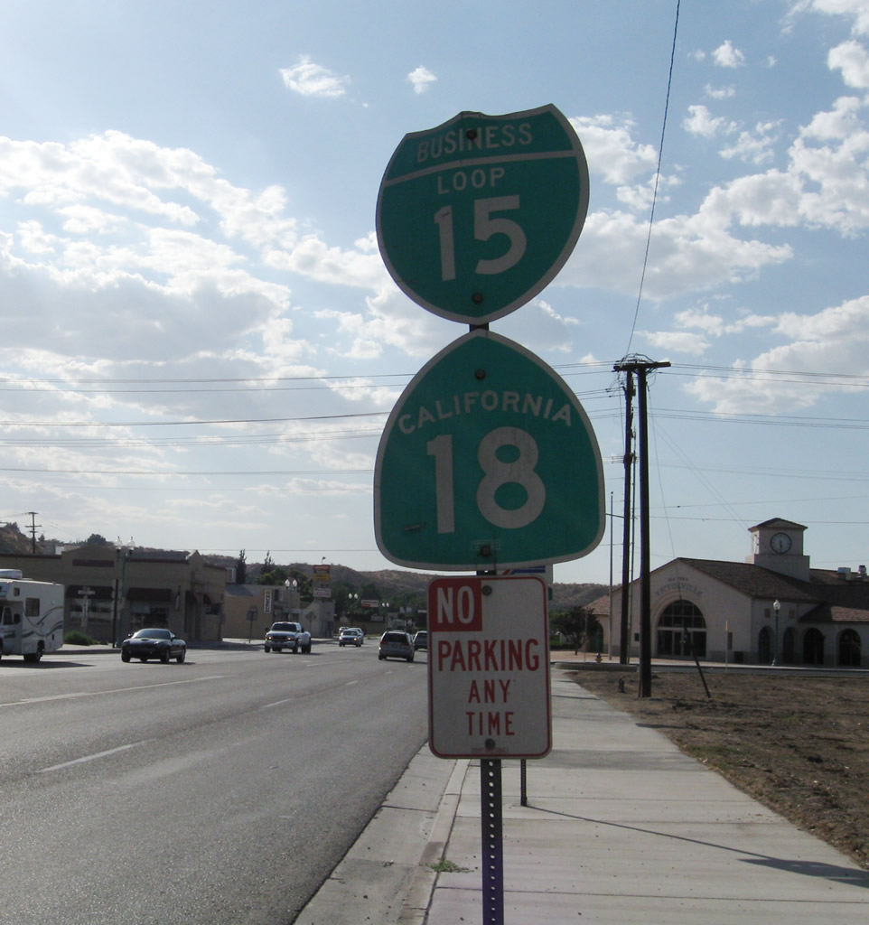
| Business Loop I-15 & SR 18 travel north along the historic route of U.S. 66 and 91. Confirming shields for the two routes were previously posted by the railroad station at Downtown Victorville. These were removed by 2016, with replacement markers erected one block further north. 02/16/04, 06/27/09 |
|
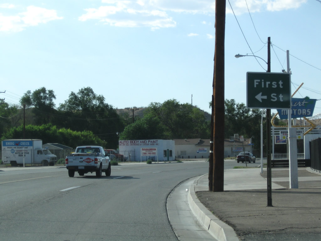
| Leaving Old Town Victorville behind, Business Loop I-15 north, Historic U.S. 66-91, and SR 18 approach First Street. 06/27/09 |
|
| Business Loop I-15 concludes at a folded diamond interchange with I-15 adjacent to the BNSF Railroad line. Old U.S. 66-91 continues north toward Oro Grande, Hodge, Helendal, and Lenwood. 03/20/04 |
|
| Interstate 15 spans D Street and the BNSF Railroad from adjacent ramps with parallel E Street. SR 18 westbound combines with I-15 south for three miles south to Palmdale Road. 03/20/04 |
|
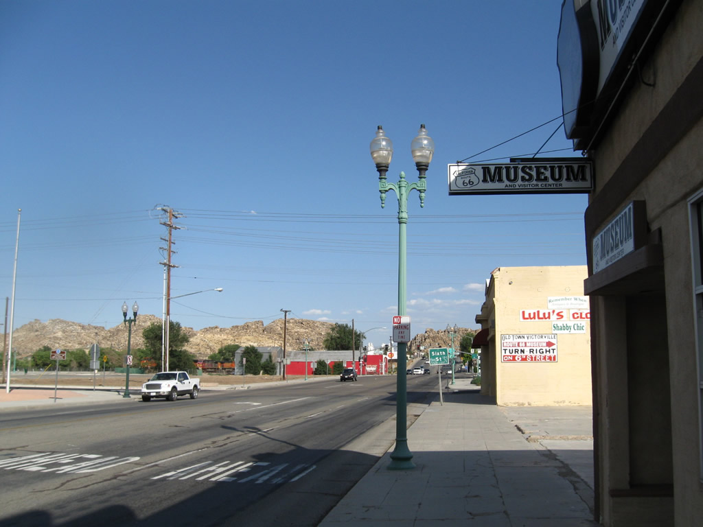
| D Street passes by the Historic U.S. Route 66 Museum between 5th and 6th Streets outside Downtown Victorville. This museum hosts an array of Route 66 memorabilia, including books, maps, pictures, essays and artifacts. 06/27/09 |
|
| Business Loop I-15 south and SR 18 part ways at 7th Street in Downtown Victorville. SR 18 connects the city with neighboring Apple Valley and the Big Bear/Lake Arrowhead resorts to the south. 06/27/09 |
|
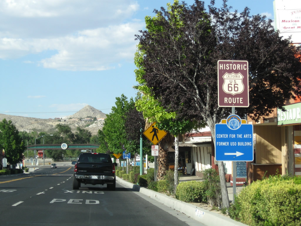
| Historic U.S. 66 also turns from D Street south onto Seventh Street in Old Town Victorville. 03/20/04, 06/27/09 |
|
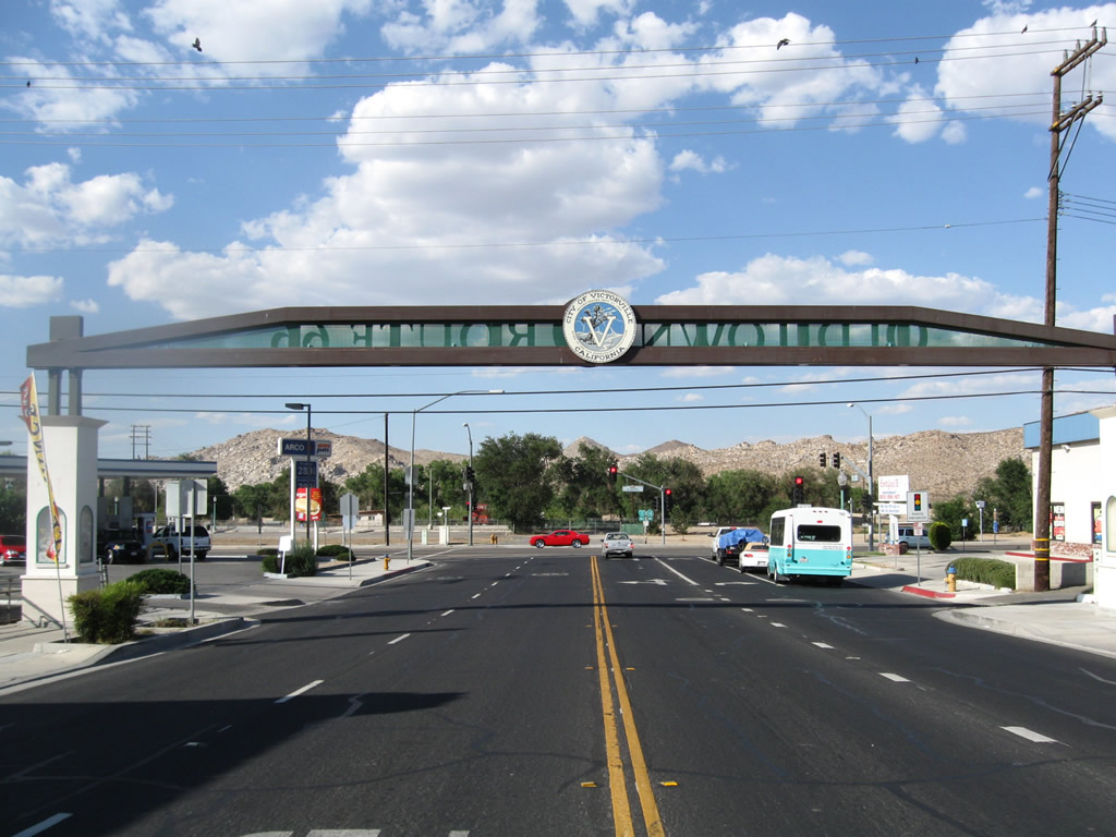
| Business Loop I-15, historic U.S. 66 and old U.S. 91 (Seventh Street) pass under the Old Town Victorville arch. This area was revitalized in 1995, and the arch sign was in place by November 10, 2001. 06/27/09 |
|
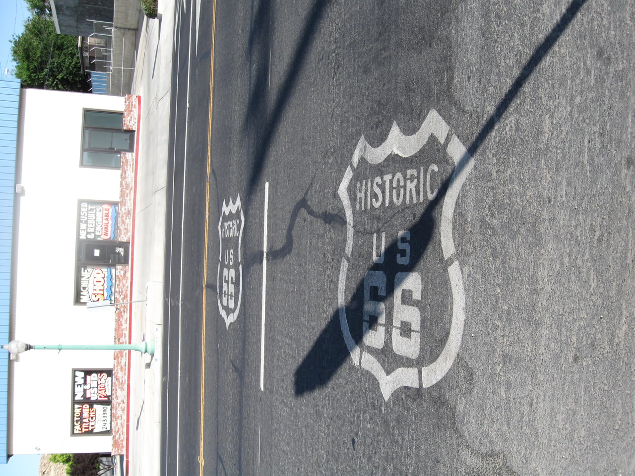
| Stencils for Historic U.S. 66 mark the route through Downtown Victorville after the signalized intersection between D and Seventh Streets. 06/27/09 |
|
| Westbound SR 18 (D Street) intersects Business Loop I-15 (Seventh Street) at Downtown Victorville. Also known as Historic U.S. 66, Business Loop I-15 travels southwest on Seventh Street and northwest alongside SR 18 parallel to the Mojave River. 06/27/09 |
Photo Credits:02/16/04, 03/20/04, 06/27/09 by AARoads
Connect with:
Interstate 15
Page Updated 06-29-2018.