|
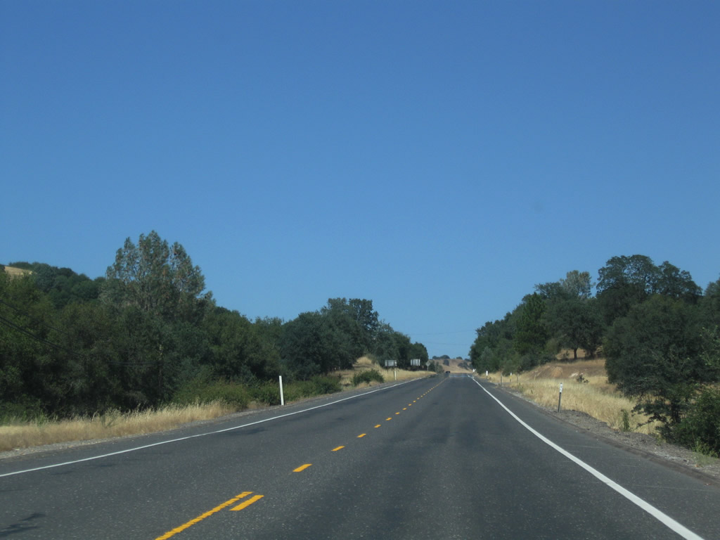
| Traveling east from the merge of Angels Camp Bypass and Valecity Road (old SR 4) along SR 4 toward the unincorporated communities of Vallecito and Murphys. 07/18/09 |
|
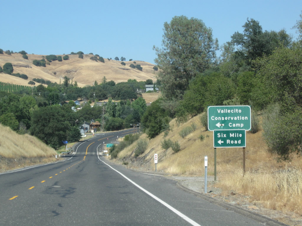
| Six Mile Road loops north from SR 4 to Vallecito Conversation Camp and Scott Street at Murphys. 07/18/09 |
|
| Spanning Sixmile Creek, SR 4 enters back to back intersections with Golden Creek Drive, a former alignment of the state route, east and Ponderosa Way north to a neighborhood. 07/18/09 |
|
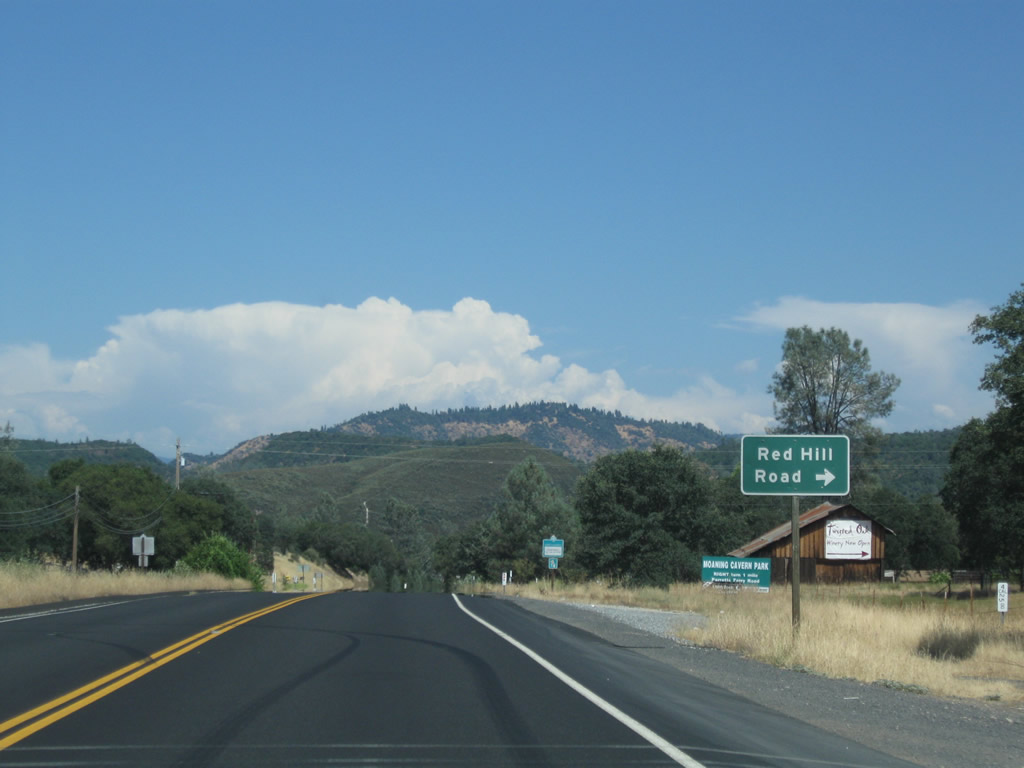
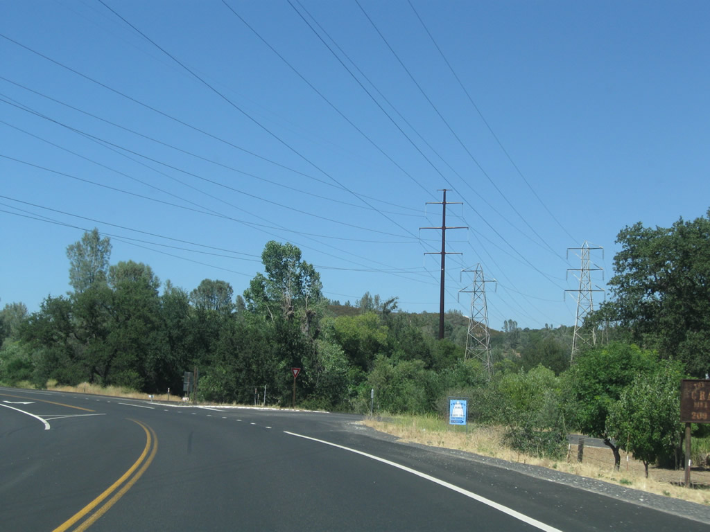
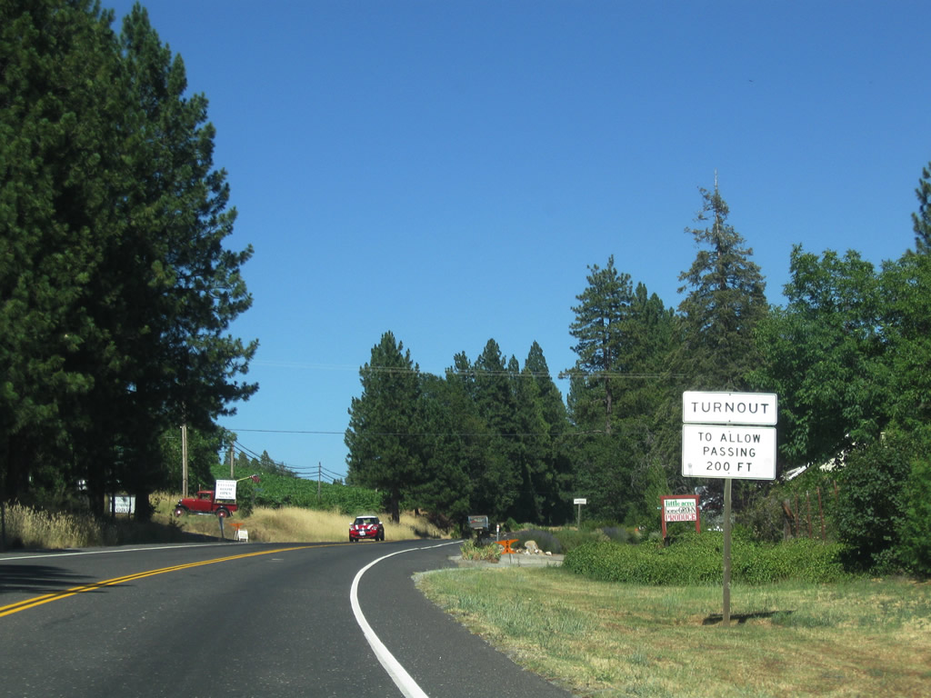
| Bald and Table Mountains rises to the east of Valecito in this scene along SR 4 east at Red Hill Road southwest to SR 49 near Carson Hill. 07/18/09 |
|
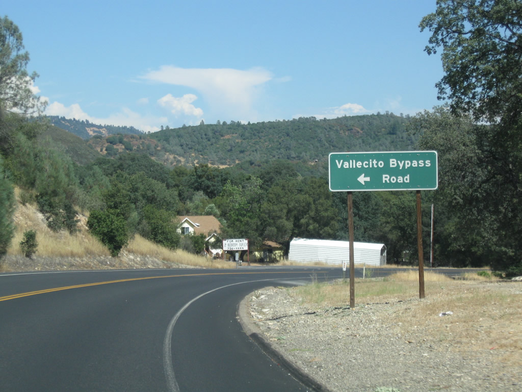
| Vallecito Bypass Road is a narrow road linking with SR 4 north of central Vallecito. 07/18/09 |
|
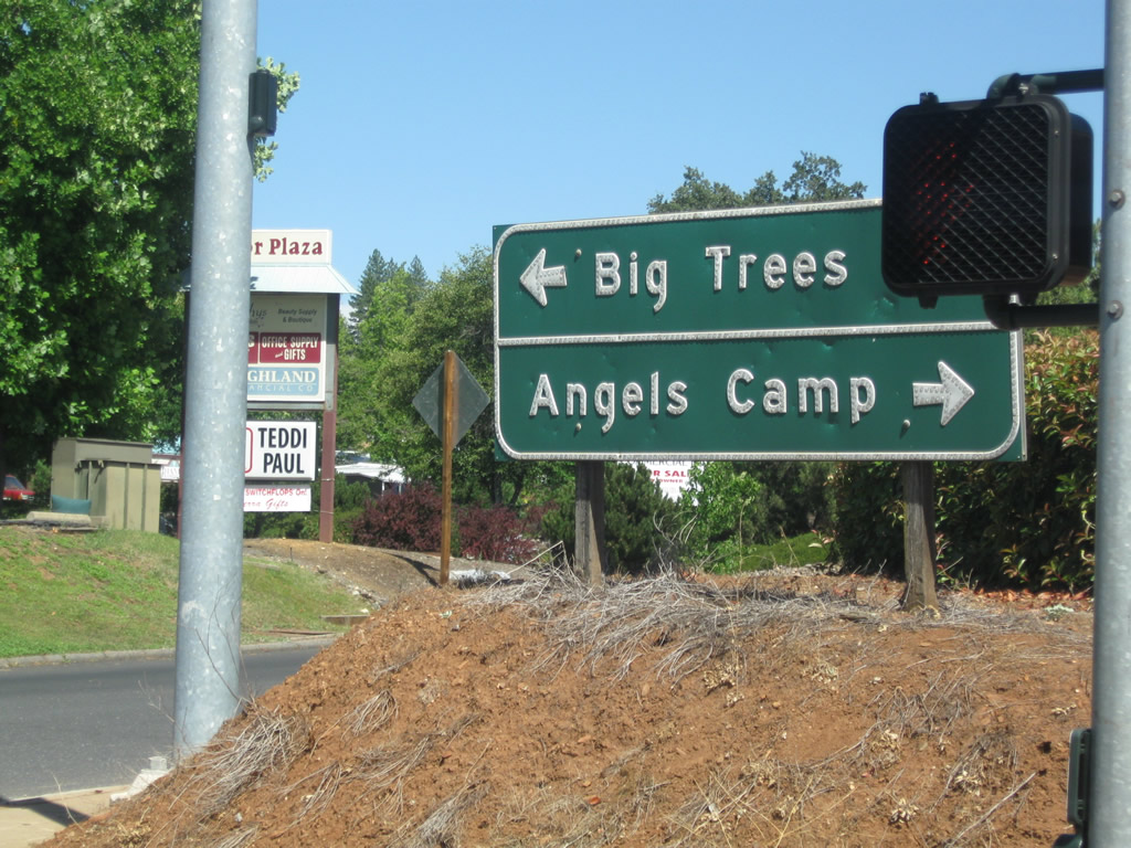
| Looping south into Valecito, SR 4 splits with Angels Road, the historic alignment of the state route south to Main Street. 07/18/09 |
|
| Curving northward, SR 4 merges with Main Street below a set of power lines. Main Street was the east leg of former SR 4 north from the business district and Vallecito State Historic Landmark. 07/18/09 |
|
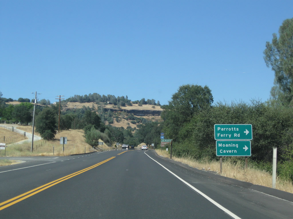
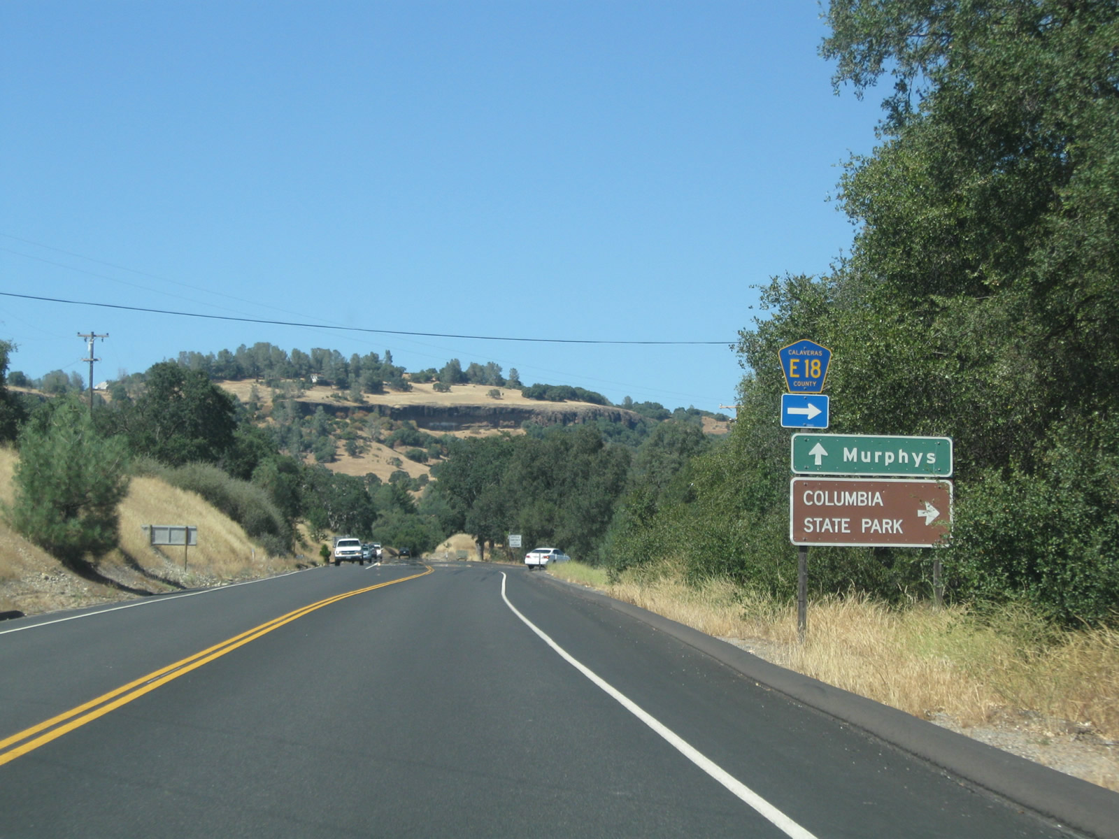
| SR 4 meets Calaveras County Route E-18 (Parrots Ferry Road) just beyond the east end of Vallecito Bypass Road. 07/18/09 |
|
| Calaveras County Route E-18 travels south to Moaning Cavern and then crosses over the Stanislaus River into Tuolumne County. The route continues from there toward Columbia, Columbia State Historic Park and its south end at SR 49 just north of Sonora. 07/18/09 |
|
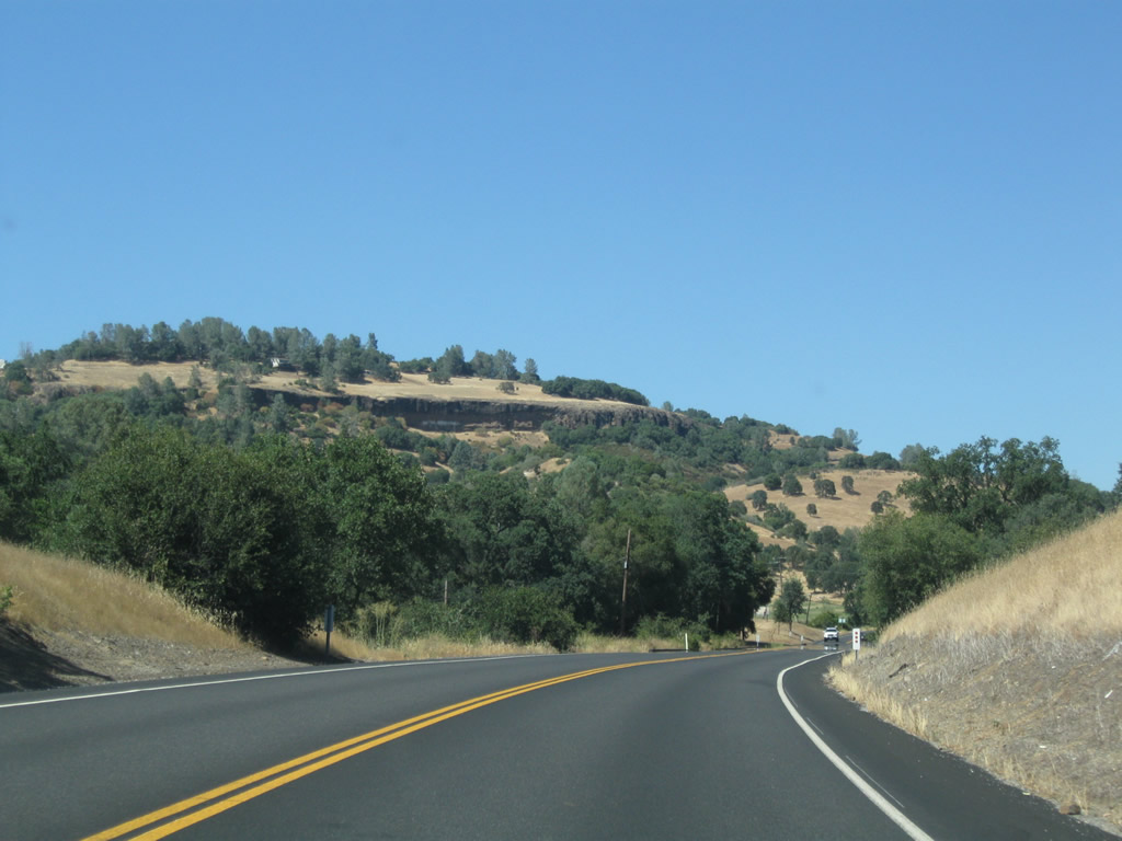
| Heading north, SR 4 passes below Dead Horse Flat. Batten Road, another former alignment of the route, ties in from the east on this section. 07/18/09 |
|
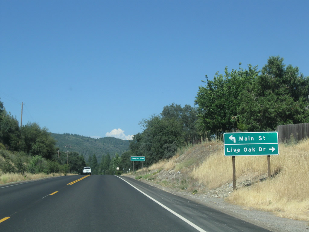
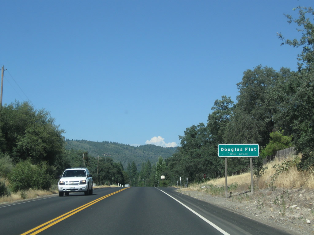
| Live Oak Drive ties into SR 4 from a manufactured home community ahead of Main Street (former SR 4) through unincorporated Douglas Flat. 07/18/09 |
|
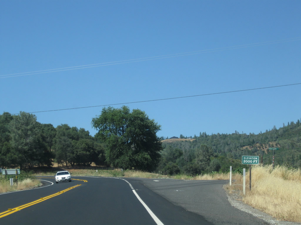
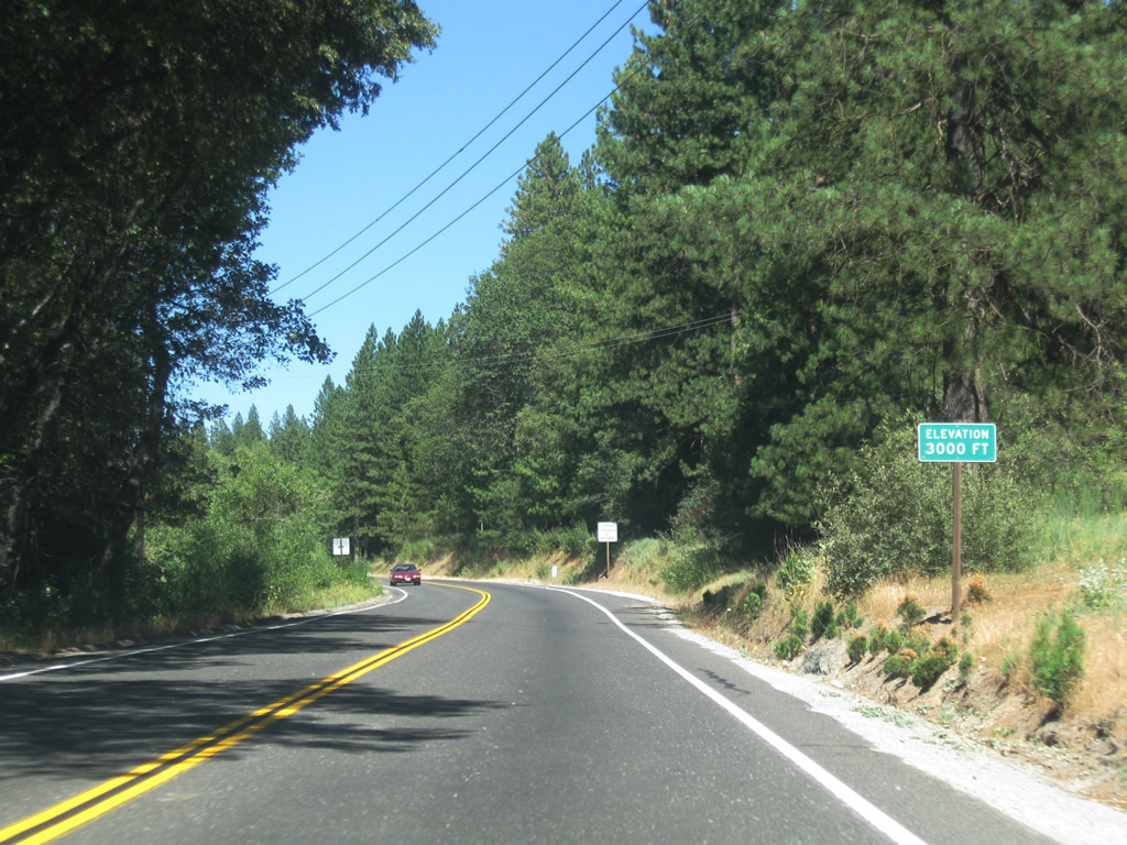
| A handful of businesses line the northwest side of SR 4 through Douglas Flat. Green Meadow Drive intersects the state route just north of the community at the point where SR 4 reaches 2,000 feet in elevation. 07/18/09 |
|
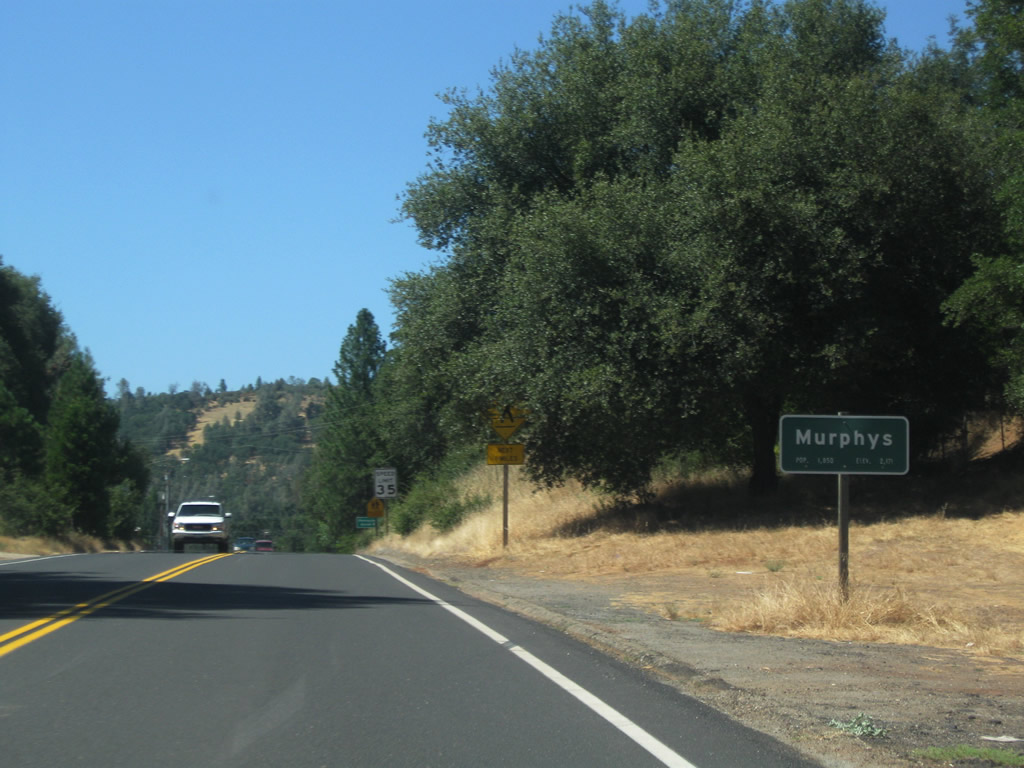
| Continuing northeast, SR 4 enters the unincorporated community of Murphys, the "Queen of the Sierra." With a population over 2,200, Murphys is a base for tourists visiting Moaning Caverns, Mercer Caverns, the historic Murphys Hotel, Big Trees State Park, wine tasting rooms, and gold rush era historical areas. 07/18/09 |
|
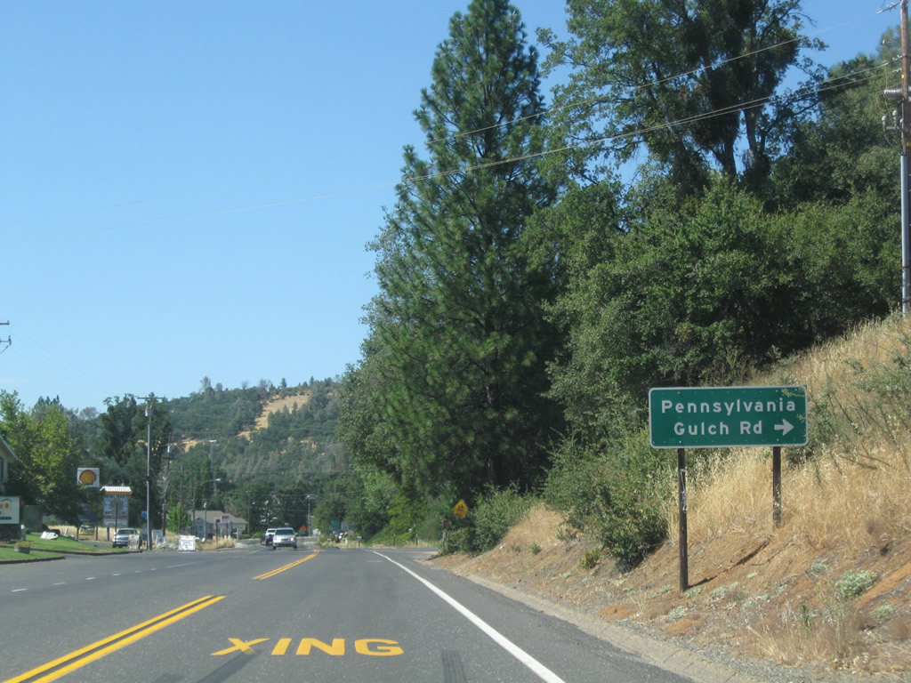
| Pennsylvania Gulch Road angles southeast from SR 4 in Murphys to agricultural areas south of Pennsylvania Gulch and the Big Valley community. 07/18/09 |
|
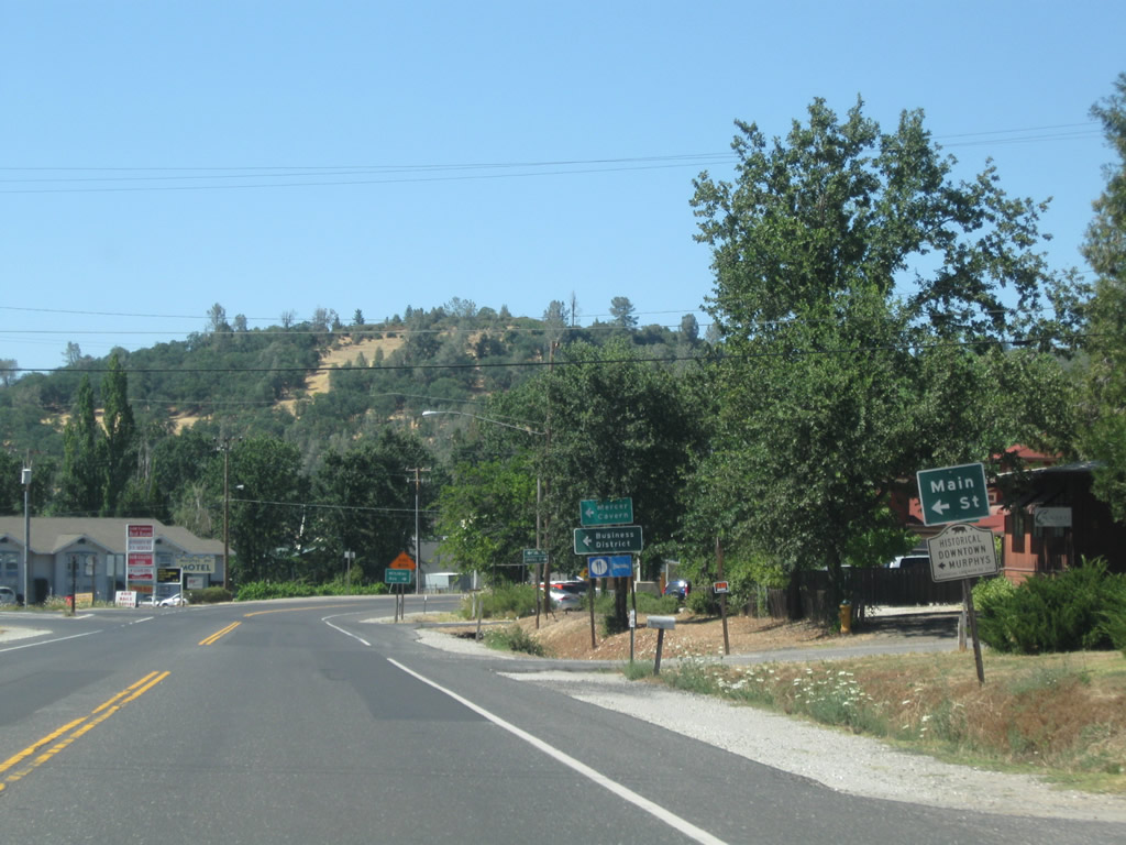
| The next major intersection along eastbound SR 4 is with Main Street west to Downtown Murphys. Stevenot Winery, Murphys State Historic Landmark, and Murphys Hotel are located west of here on Main Street. Beyond the business district, Main Street changes into Murphys Grade Road, which loops west back to Angels Camp. 07/18/09 |
|
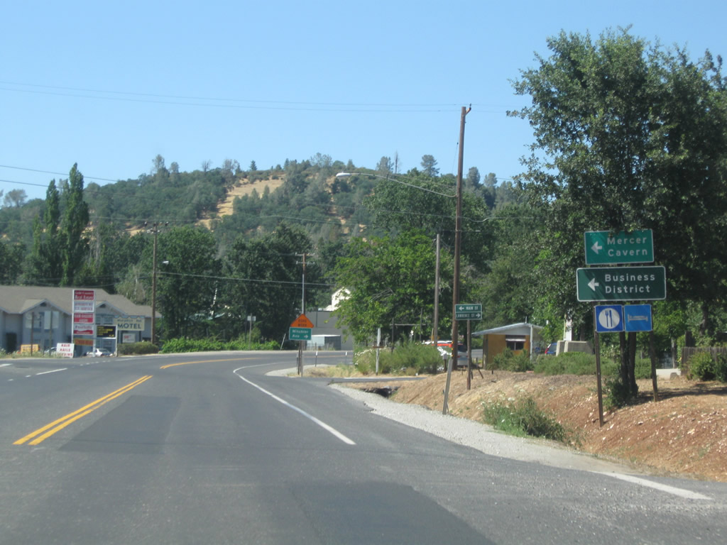
| Main Street west to Big Trees Road represents a historic alignment of SR 4. Mercer Caverns lies north of Main Street via San Domingo Road (Sheep Ranch Road). 07/18/09 |
|
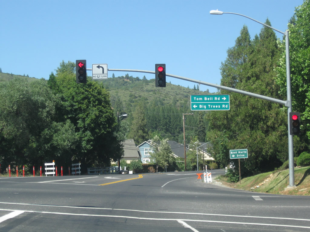
| Big Trees Road east and Tom Bell Road west come together at a traffic light with SR 4 in Murphys. 07/18/09 |
|
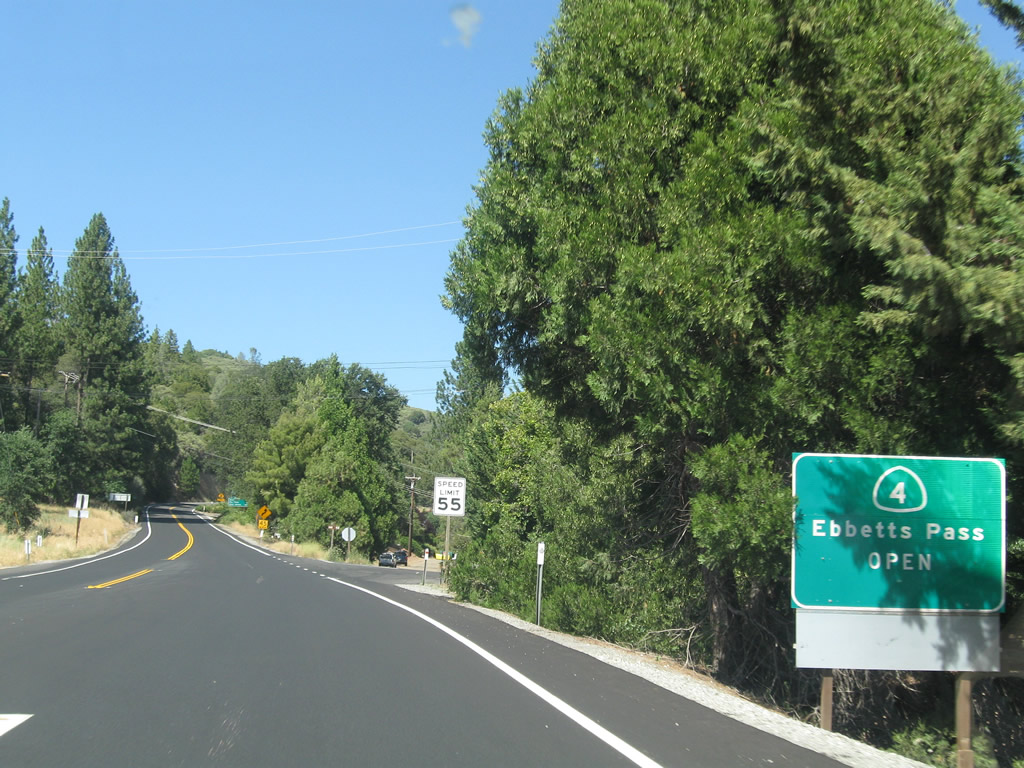
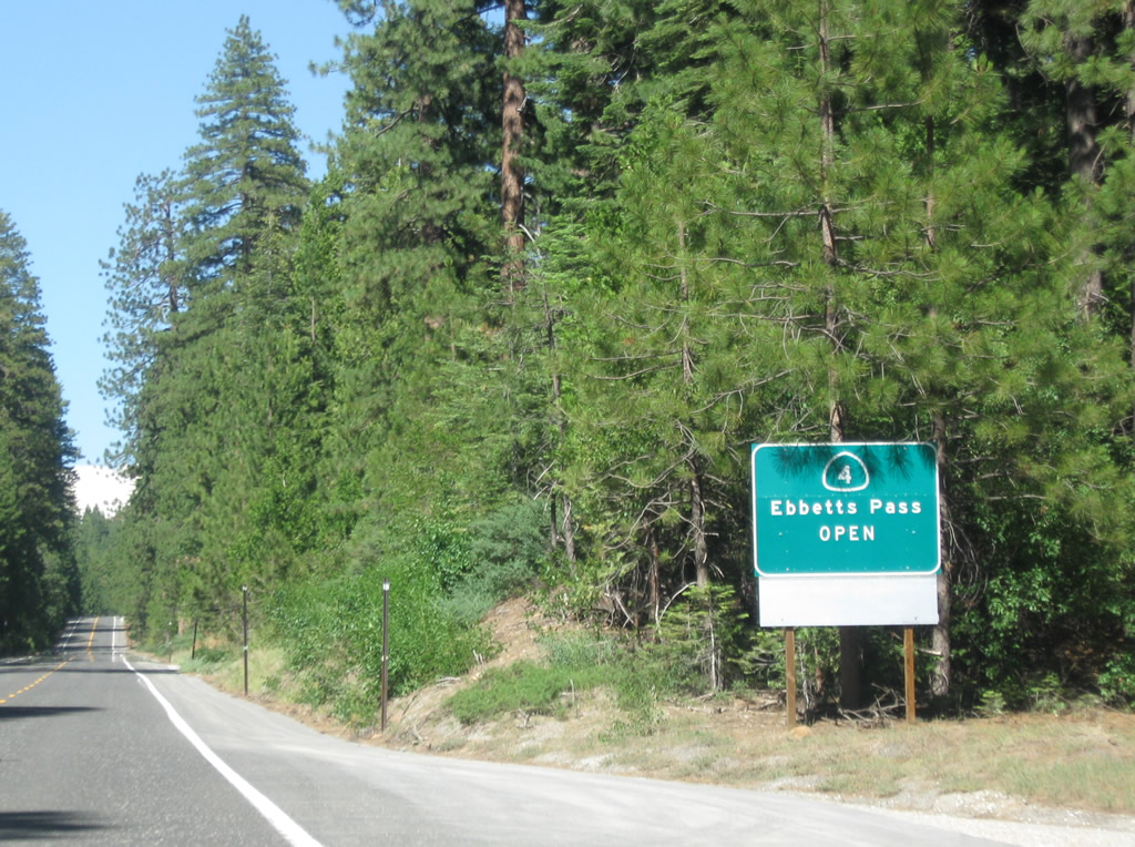
| A sign displaying the open/closed status of Ebbetts Pass stands by the SR 4 intersection with Apple Blossom Drive. 07/18/09 |
|
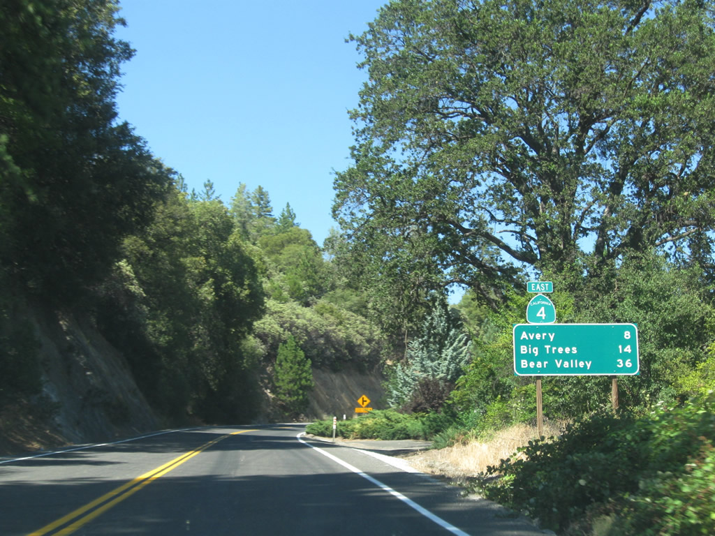
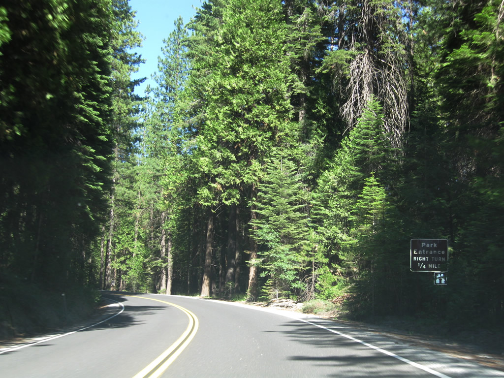
| Leaving Murphys, a distance sign posted ahead of Utica Powerhouse Road references Avery (eight miles) and Big Trees State Park (14 miles). SR 207 to Bear Valley-Mt. Reba Ski Area lies 36 miles to the northeast. 07/18/09 |
|
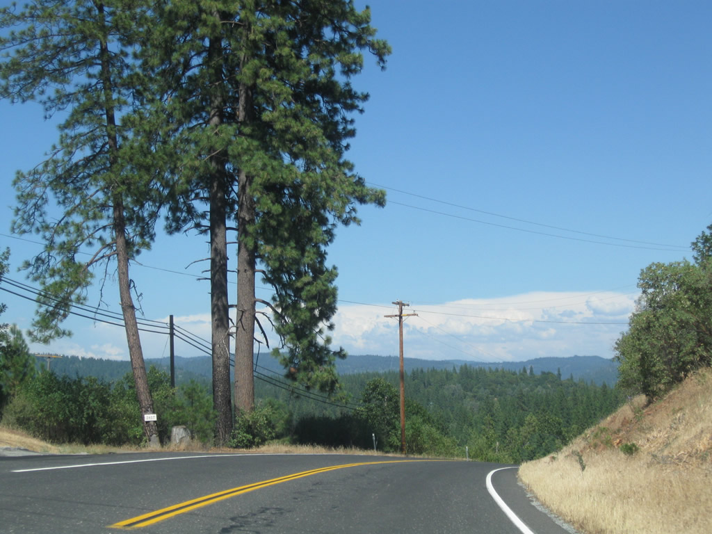
| SR 4 proceeds northeast between Murphys and Avery and continues to gain elevation across Table Mountain. As annual precipitation increases, the trees increase in height. 07/18/09 |
|
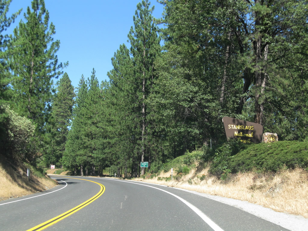
| SR 4 (Ebbetts Pass Highway) enters the Stanislaus National Forest. While the state route stays in the forest for most of the way through the foothills toward Ebbetts Pass, it will enter and leave the forest several times, notably around Arnold. 07/18/09 |
|
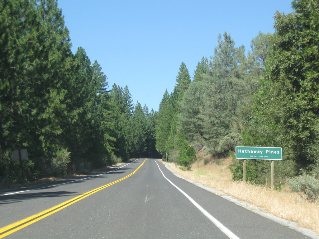
| SR 4 advances north through Hathaway Pines (el. 3,415 feet, population 791 per the Caltrans entry sign). 07/18/09 |
|
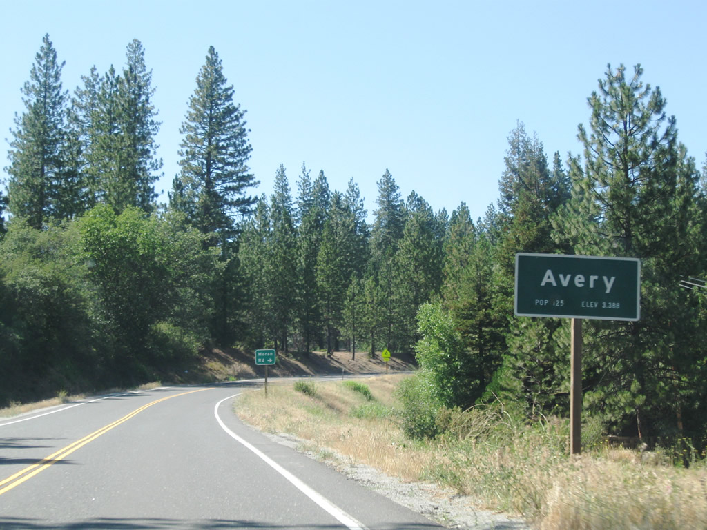
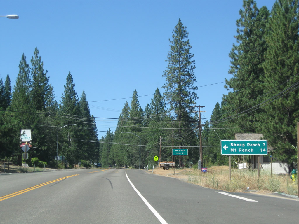
| Winding north by Hunter Reservoir, SR 4 enters the unincorporated community of Avery (el. 3,388 feet, population 125 per the Caltrans entry sign). 07/18/09 |
|
| Avery Sheep Ranch Road travels west from SR 4 at Avery seven miles to Sheep Ranch and 14 miles to Mountain Ranch. 07/18/09 |
|
| Traveling north from Avery, SR 4 reaches Arnold in four miles and Big Trees State Park in seven miles. A pair of local roads to the west represent the historic alignment of the highway in this vicinity. 07/18/09 |
|
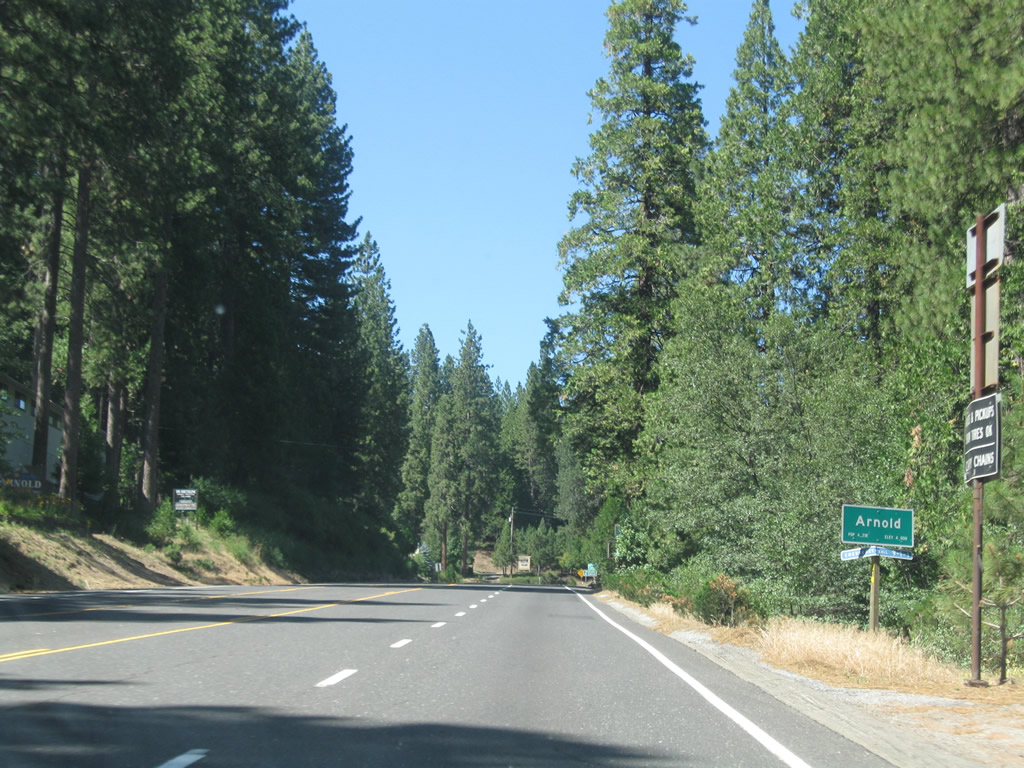
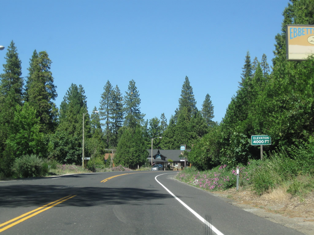
| Eastbound SR 4 (Ebbetts Pass Highway) enters the unincorporated community of Arnold at an elevation of 4,000 feet. Home to 3,843 as of the 2010 census, tourism is year round in Arnold, with its location on the way to the Bear Valley/Mt Reba Ski Resort and Big Trees State Park. 07/18/09 |
|
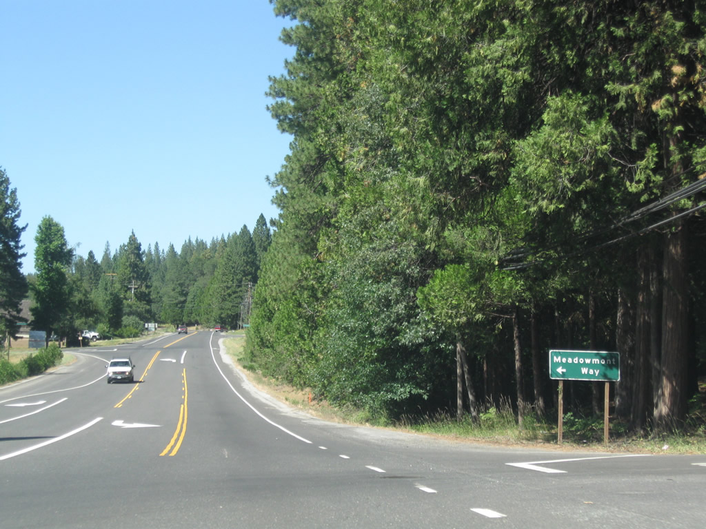
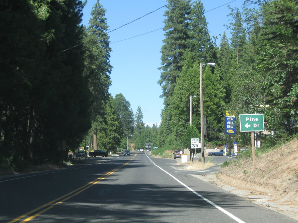
| SR 4 expands into a three-lane boulevard through Arnold. Meadowmont Way ties into the state route from an adjacent shopping center and Pine Drive. 07/18/09 |
|
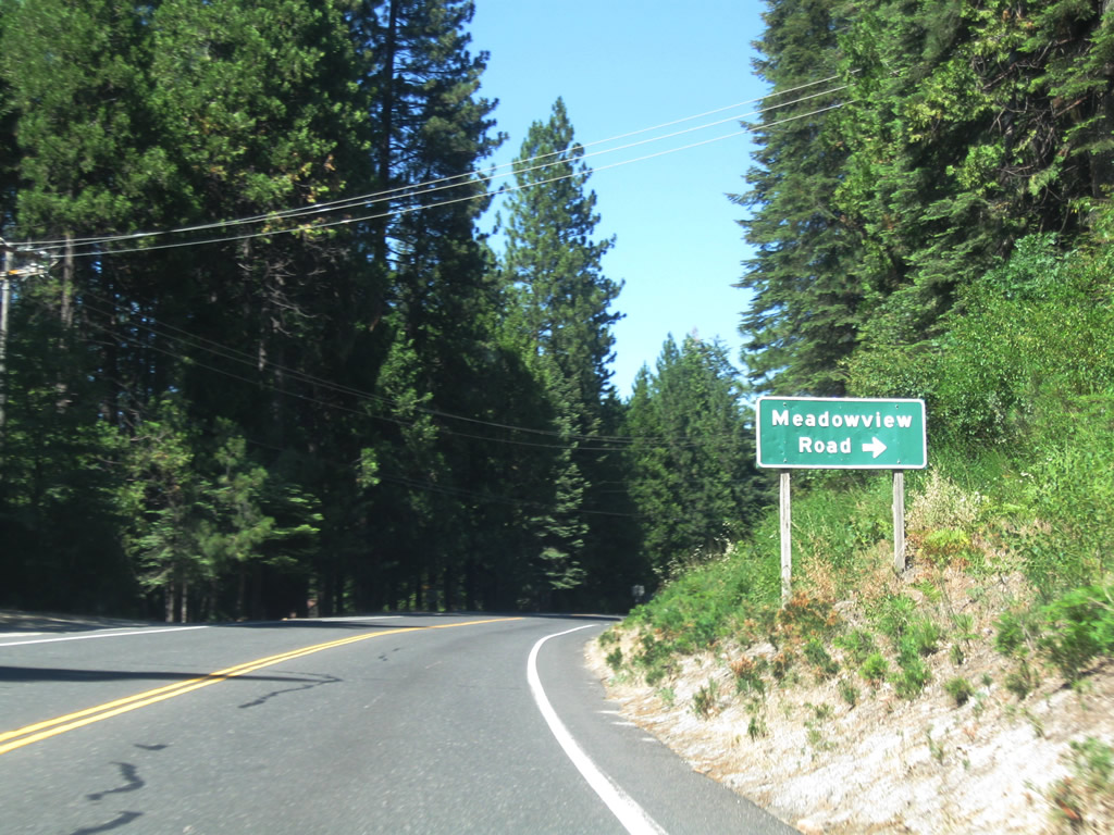
| Meadowview Road converges with SR 4 north from adjacent residential areas. 07/18/09 |
|
| Eastbound SR 4 approaches Pine Drive ahead of the Arnold business district. 07/18/09 |
|
| SR 4 reaches 4,000 feet in elevation at Oak Circle in Arnold. 07/18/09 |
|
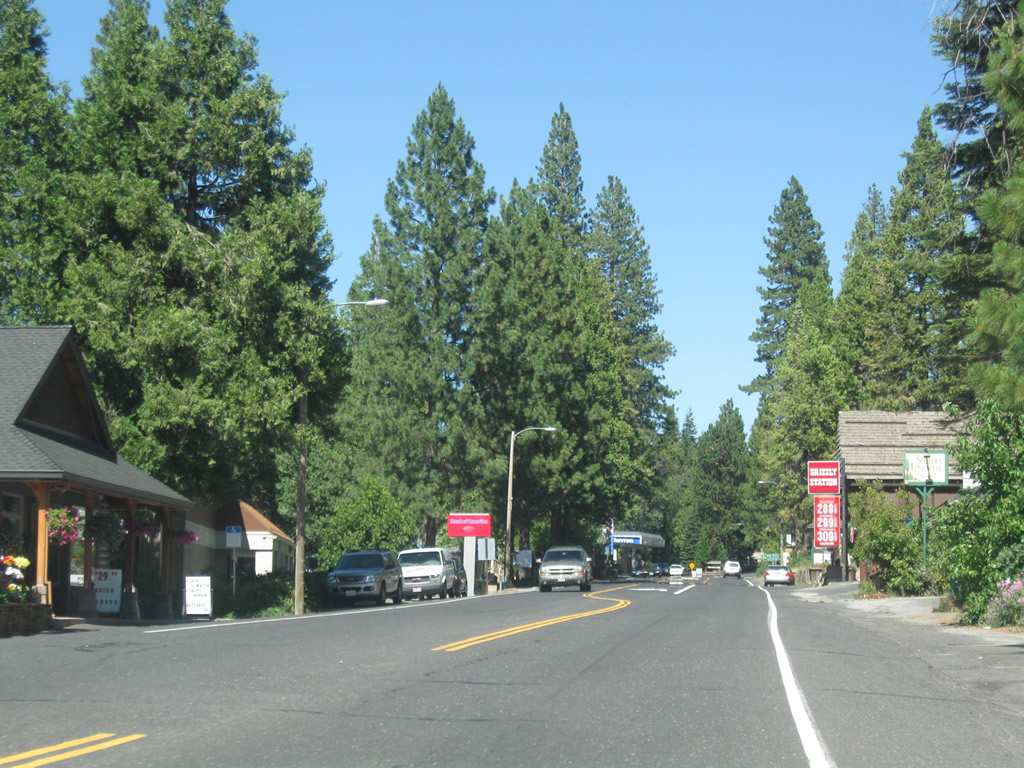
| Progressing northeast through the Arnold business along SR 4 at Willow Street. 07/18/09 |
|
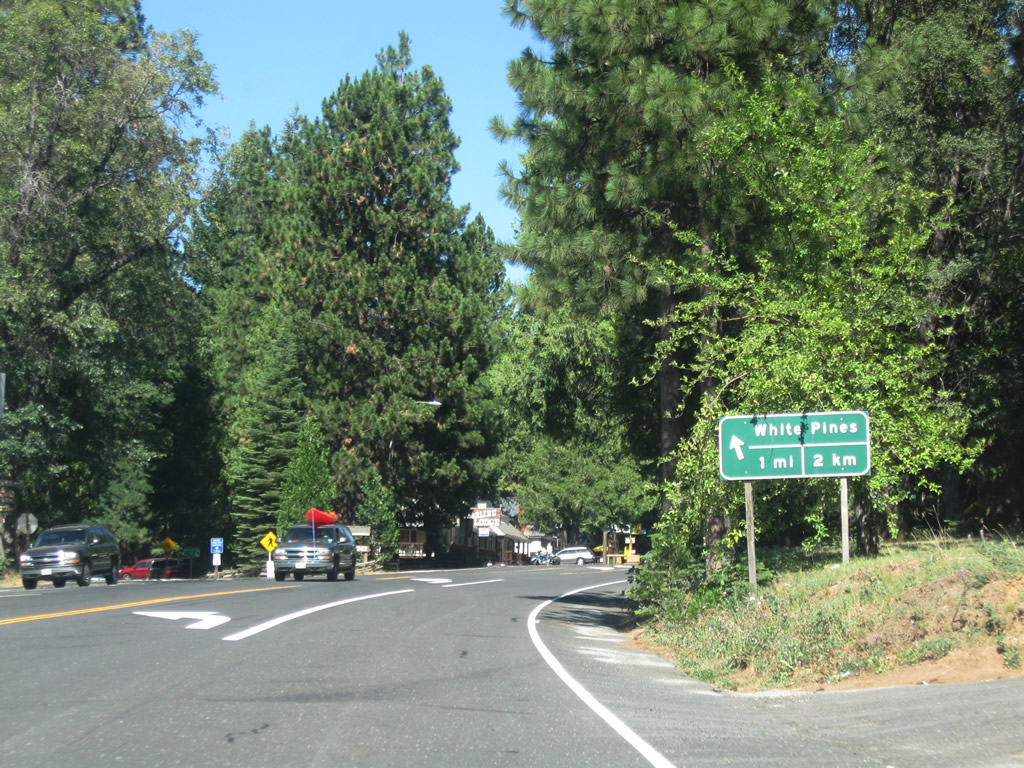
| Eastbound SR 4 meets Dunbar Road north and Blagen Road northeast to the unincorporated community of White Pines and nearby White Pines Lake. 07/18/09 |
|
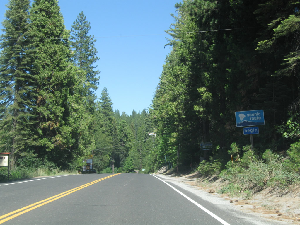
| SR 4 becomes an official state scenic highway for the route from Arnold to Lake Alpine. 07/18/09 |
|
| SR 4 again gains a climbing lane and leaves Arnold beyond the intersection with Arnold Byway (another old alignment of SR 4). Big Trees State Park lies four miles ahead. 07/18/09 |
|
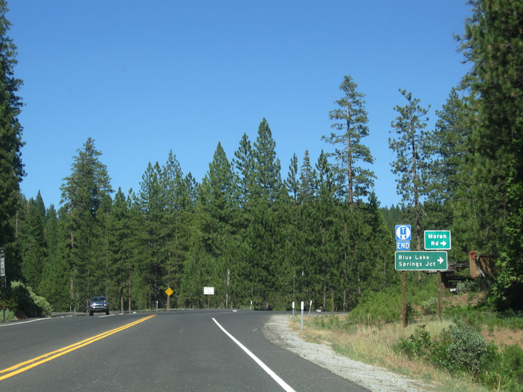
| The truck climbing lane from Arnold Byway concludes at Moran Road, which travels to Blue Lake Springs Junction. The state recommended truck route designation along SR 4 ends at this point. 07/18/09 |
|
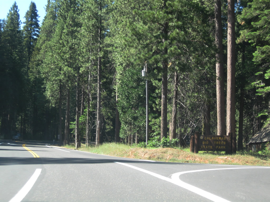
| Traveling through the community of Big Trees, SR 4 next intersect the turnoff for Big Trees State Park. This park preserves the North Grove of giant sequoias and is the location of the Discovery Tree, which is the first Sierra redwood found by settler Augustus T. Dowd in 1852. 07/18/09 |
|
| Big Trees State Park is noted as the oldest continuously operating tourist attraction in California. Hiking and camping are available for park patrons. 07/18/09 |
|
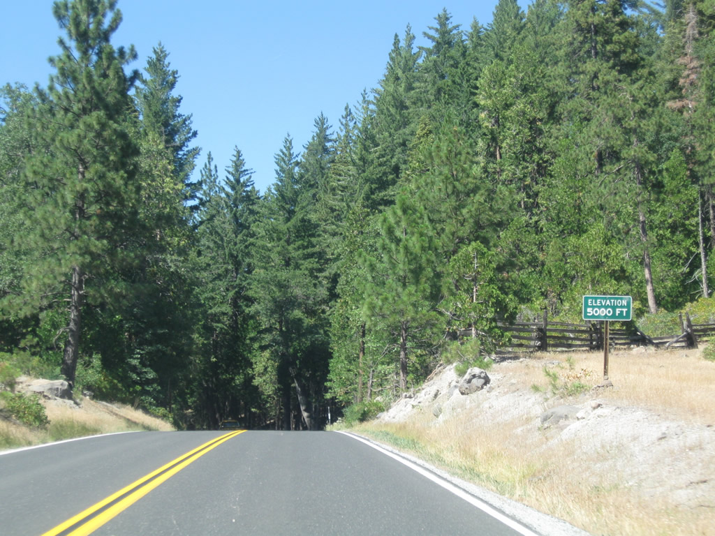
| SR 4 ascends to 5,000 feet in elevation just ahead of Golden Pines RV Resort and Campground at Dorrington. 07/18/09 |
|
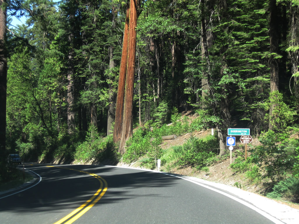
| Dorrington is an unincorporated community encompassing a network of rural residential roads generally east of SR 4 and Summit Level Ridge. 07/18/09 |
|
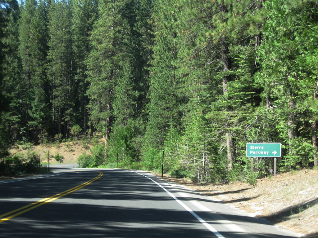
| Sierra Parkway arcs southeast from SR 4 into the Dorrington residential area. 07/18/09 |
|
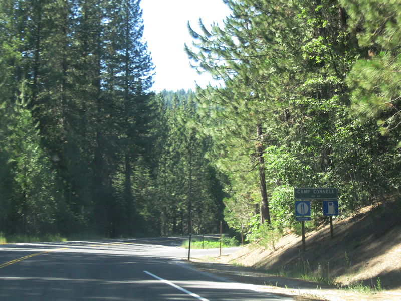
| The unincorporated community of Camp Connell lies just north of Dorrington along SR 4 (Ebbetts Pass Highway). 07/18/09 |
|
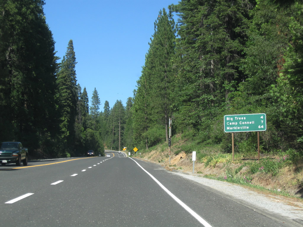
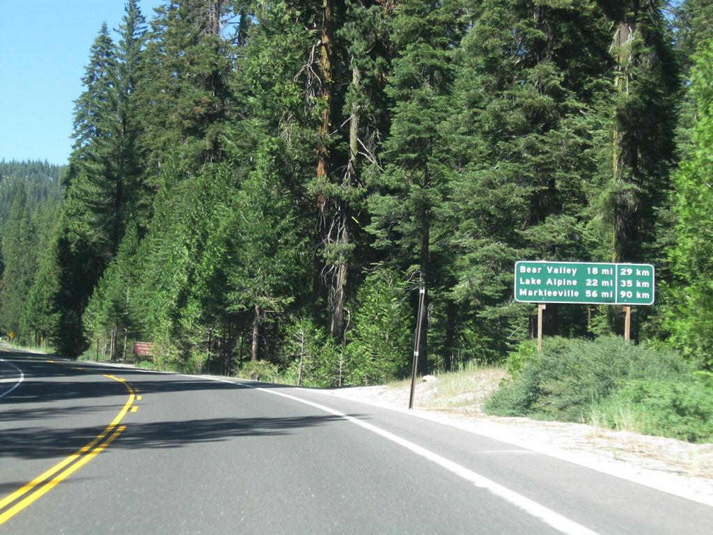
| Following the Summmit Level Ridge and leaving Camp Connell, this distance sign provides the distance to Bear Valley (18 miles), Lake Alpine (22 miles), and Markleeville (56 miles). 07/18/09 |
|
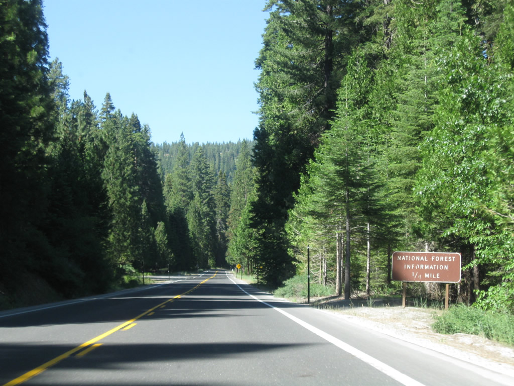
| A ranger station and information center for Stanislaus National Forest lies on the left side of the state route. SR 4 over Ebbetts Pass is part of the Ebbetts Pass National Scenic Byway. 07/18/09 |
|
| While most sections of SR 4 between Arnold and Lake Alpine navigate through S-curves, others are more linear, such as this one east of Camp Connell. 07/18/09 |
|
| Another roadside sign advises of the status of Ebbetts Pass. 07/18/09 |
|
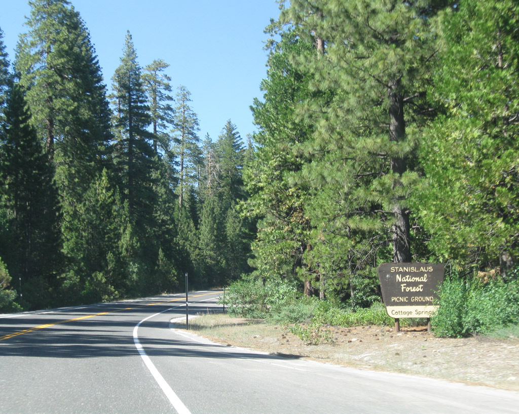
| SR 4 east at the Cottage Springs picnic ground in Stanislaus National Forest. 07/18/09 |
|
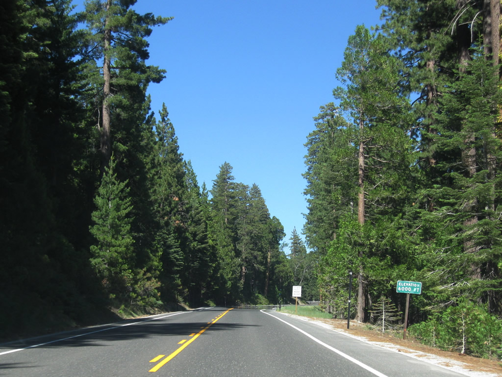
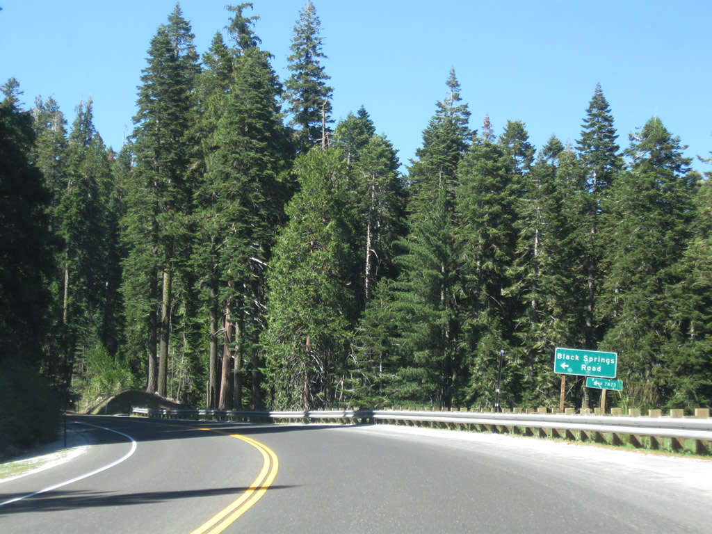
| SR 4 continues to gain elevation, surpassing the 6,000 feet mark between Cottage Springs and Black Springs Road. 07/18/09 |
|
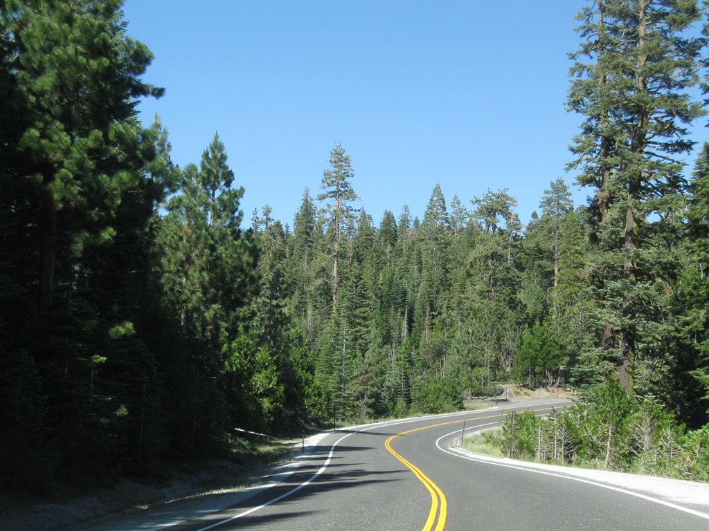
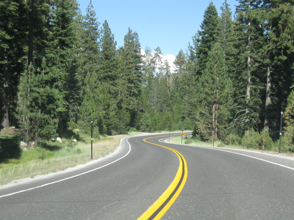
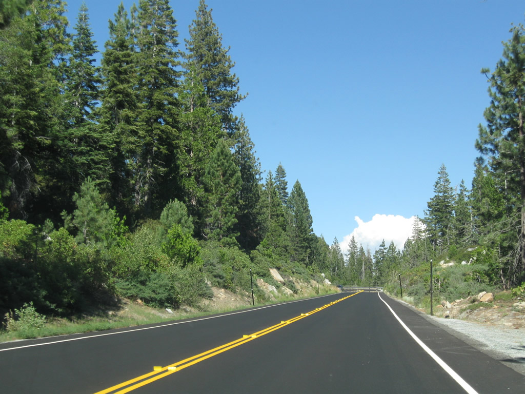
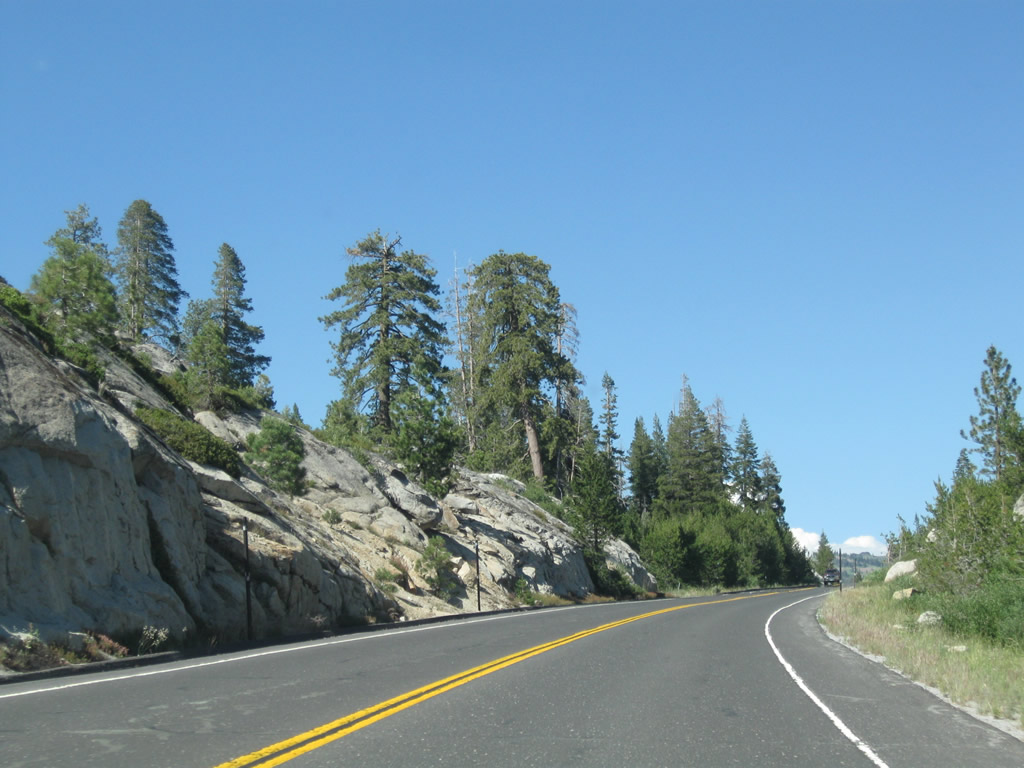
| SR 4 (Ebbetts Pass Highway) which has been following the Summit Level Ridge, traverses areas of Stanislaus National Forest along Bailey Ridge, then proceeds northeast between the North Fork of the Mokelumne River and the North Fork of the Stanislaus River. 07/18/09 |
|
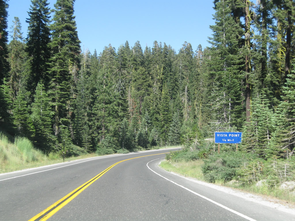
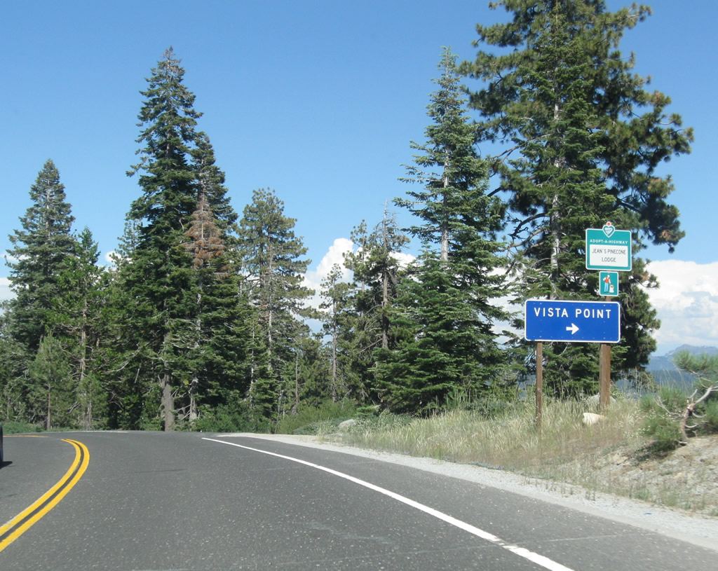
| The Liberty Vista Point provides a view south from SR 4 (Ebbetts Pass Highway) into the valley created by the North Fork of the Stanislaus River. 07/18/09 |
|
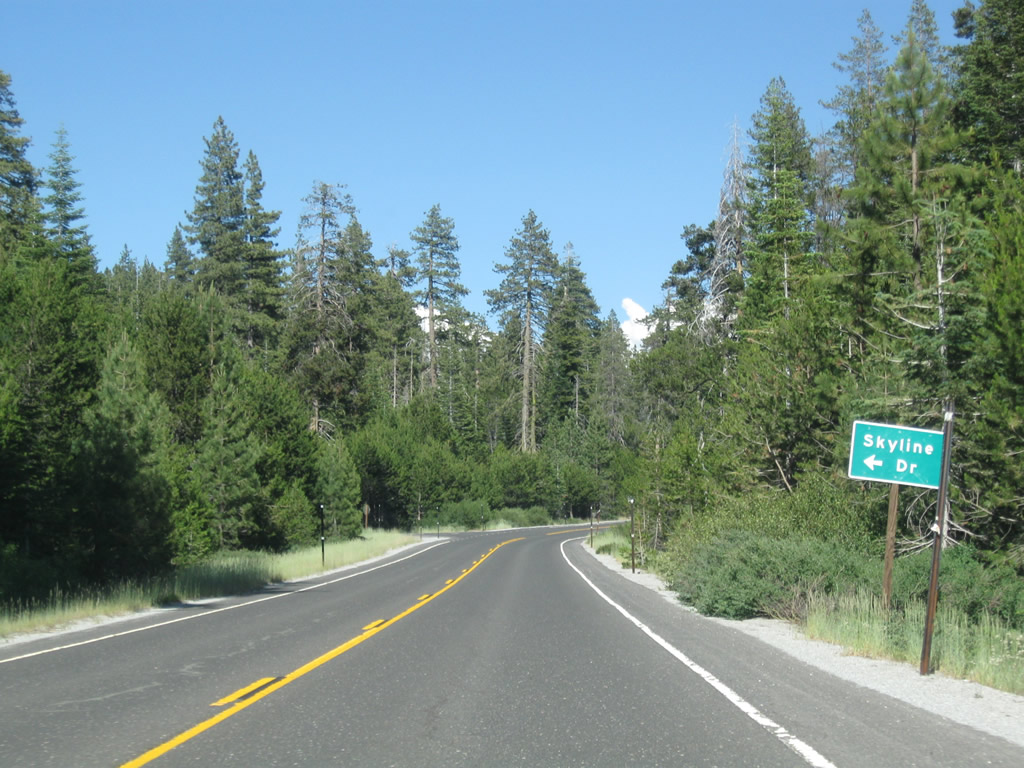
| SR 4 (Ebbetts Pass Highway) passes through Big Meadow and by Big Meadow campground to Skyline Drive north. 07/18/09 |
|
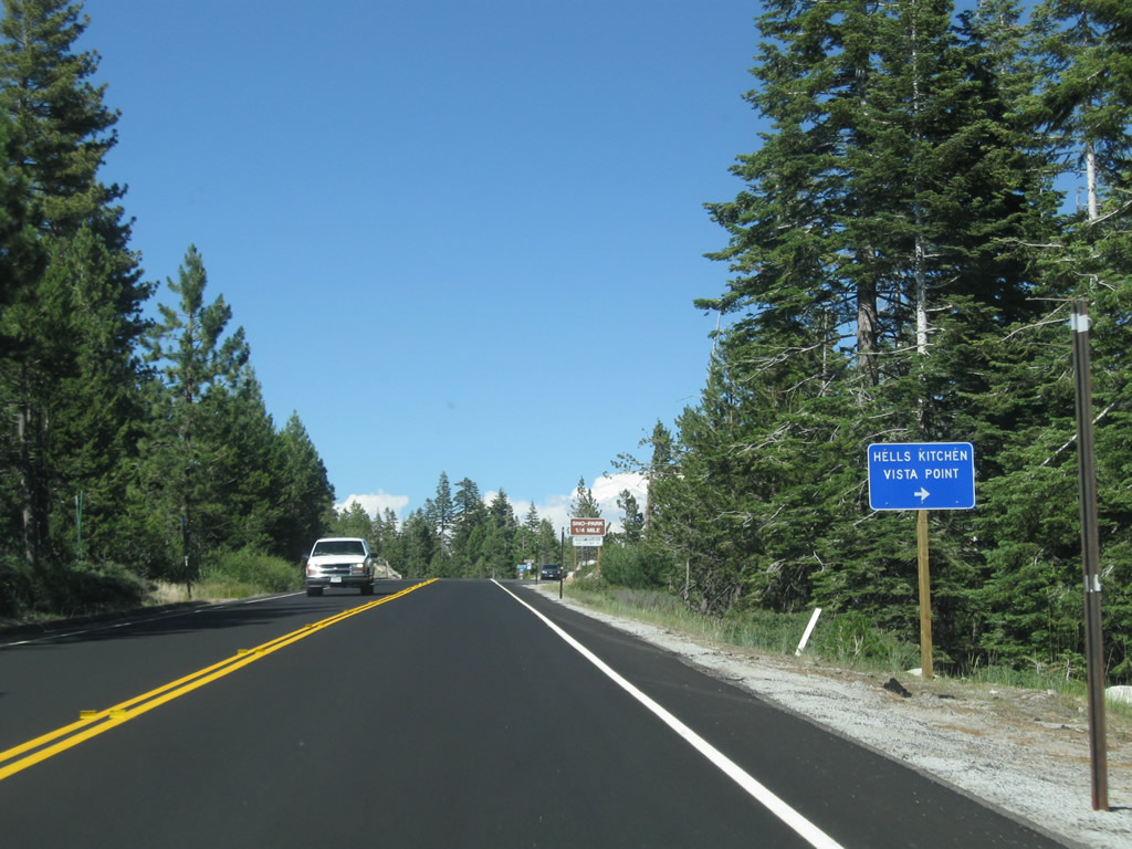
| Curving northeast from Big Meadow, motorists along SR 4 east next reach the Hells Kitchen Vista Point. 07/18/09 |
|
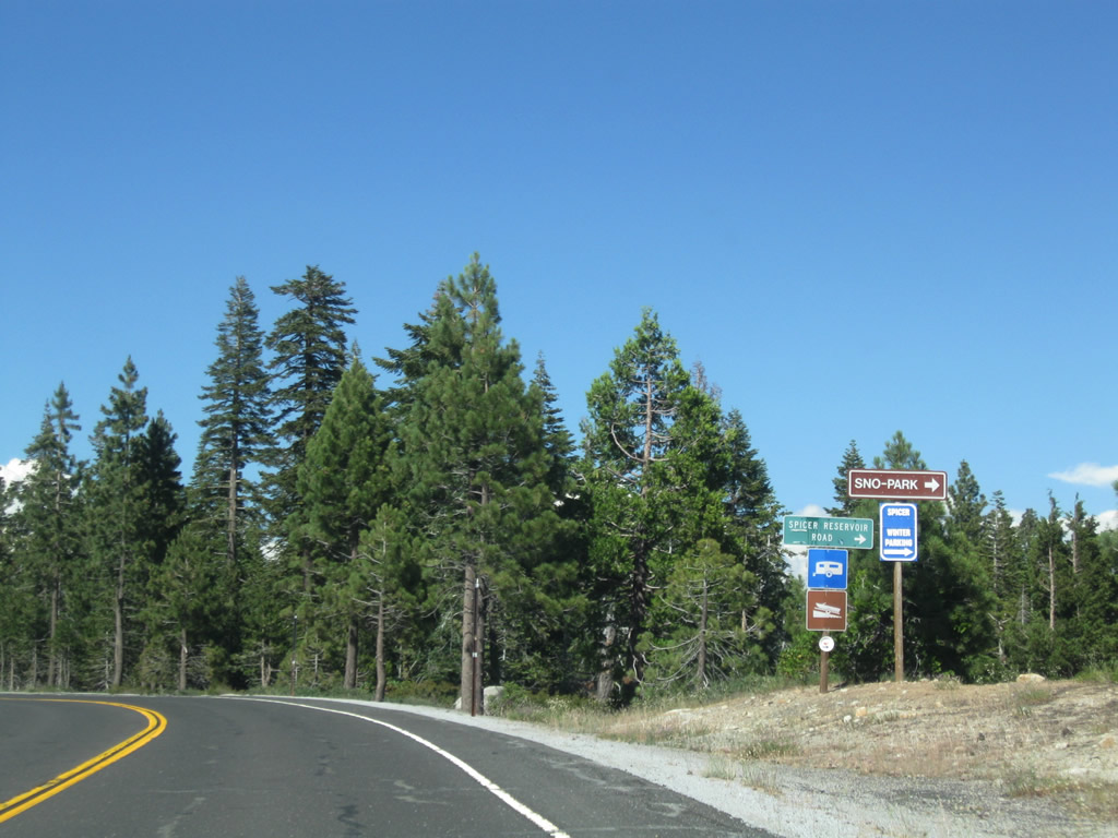
| Forest Service Road 7N01 / Spicer Meadow Reservoir Road meanders east from SR 4 to Spicer Sno-Park and Spicer Meadow Reservoir in northern Tuolumne County. 07/18/09 |
|
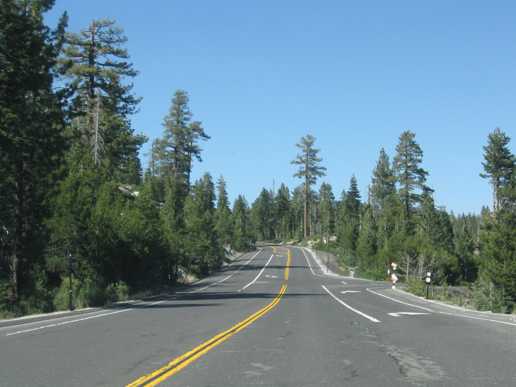
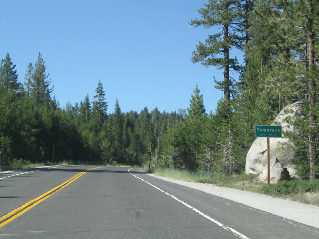
| SR 4 enters the settlement of Tamarack just ahead of Onion Valley. 07/18/09 |
|
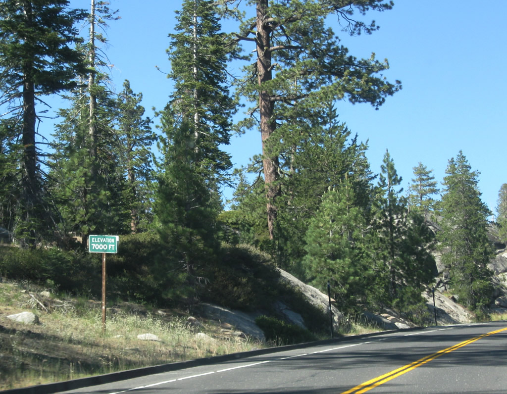
| The 7,000 foot mark along SR 4 lies just east of Tamarack and Onion Valley. 07/18/09 |
|
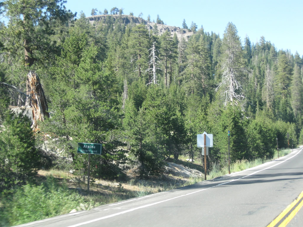
| Crossing into Alpine County along SR 4 eastbound, south of Corral Gulch and west of Bloods Meadow. 07/18/09 |
Page Updated 07-20-2018.

 East
East