- Welcome to AARoads Forum.


News:
The AARoads Wiki is live! Come check it out!


Recent posts
#11
Traffic Control / Re: Unique, Odd, or Interestin...
Last post by Rothman - Today at 05:09:58 PMProbably been shared before. Heck, I probably shared this one before. Still, it's a fun custom job that I passed once again:

#12
Great Lakes and Ohio Valley / Re: Illinois: Round Mile Mark...
Last post by NE2 - Today at 05:08:52 PMIf the local IDOT district refers to it as 316, does that not make it at least semi-official?
#13
Great Lakes and Ohio Valley / Illinois: Round Mile Markers,...
Last post by Rothman - Today at 04:57:35 PMAbout two-and-a-half months ago, I got into a discussion about alleged "hidden routes" in Illinois somewhere out there on the Interwebs. Turns out that some people think that markers like this:
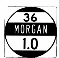
can indicate "hidden state routes."
To confirm their suspicions, I reached out to IDOT and asked about the markers and why they have route numbers on them that may not be signed or have routes in IROADS. I referenced a specific example where one of these markers indicated a route 316 where the IROADS indicated it did not exist. I got a response from their Operations group:
"While the route near Charleston is not officially designated as state route 316, this is what our local IDOT district and residents in the area refer to the road as, so 316 was chosen for display on the reference signs."
Therefore, one should not use such markers as reliable indicators of official Illinois state routes.
#14
Southeast / Re: I-40 in North Carolina
Last post by ARMOURERERIC - Today at 04:50:01 PMHow much time can elapse before NCDot has to recalculate a design because of increasing traffic count? I ask because after several options were presented in 2017 for the improvement to Exit 103, US 64 in Morganton, opting to go with a larger "tight diamond", the traffic at that interchange continues to increase dramatically, do mostly to the additional educational institutions that have been added to the grounds of Western Piedmont Community College. This added traffic even more stresses the left from 64 west to 40 east. When NCDot went with the larger tight diamond, I stated that this would be inadequate, it is even more likely so now.
#15
Great Lakes and Ohio Valley / Re: Ohio
Last post by Rothman - Today at 04:37:46 PMQuote from: seicer on Today at 03:32:56 PM"Oh, brother." Again, no citations were provided, and only vague statements were made. Check.
Looking through the FHWA, nothing under "NEPA" forces a DOT to mandate tree or vegetation encroachment on the right-of-way. Under the Federal Aid Policy Guide 752.4:
"Landscape development, which includes landscaping projects and other highway planting programs within the right-of-way of all federally funded highways or on adjoining scenic lands, shall be in general conformity with accepted concepts and principles of highway landscaping and environmental design."
If this was the Highlands Scenic Highway in West Virginia, considerations may need to be made on landscape or vegetation encroachment and management. A highway through central Columbus isn't going to violate "NEPA" or the FHWA. As ODOT's own guidelines and policies state, each municipality needs to submit an action plan to maintain said vegetation. If the City of Columbus (in this instance) did not, then ODOT can fault the city for allowing the vegetation to become a nuisance and have it removed.
Nothing under 752.4 also mandates ODOT to keep excessive tree growth or vegetation, either. It would be considered appropriate in urban and rural areas for grass to serve as the vegetative buffer.
You need to read what I wrote again.
Broad policy statements and even legislation are not where you're going to find the actual processes that govern what is included in a design approval document, ADPs, or PS&Es and their supporting documentation.
My citation is simply my past few years being directly involved with project development and the fact I just had this discussion with a NYSDOT RLA just two weeks ago or so.
#16
Pacific Southwest / Re: CA 203
Last post by Voyager - Today at 04:31:09 PMQuote from: heynow415 on April 22, 2024, 12:38:08 PMQuote from: cl94 on April 22, 2024, 01:27:44 AM9 miles (the approximate distance required from the base on the east side) is totally feasible and was about the same length as the longest road tunnel that existed in the late 70s.
The biggest problem with anything further south is that any pass would be higher, any tunnel longer, and any tunnel would pass through a portion of the Sierra with far more tectonic and volcanic activity. A tunnel in the Mammoth area is not feasible because Mammoth Mountain itself and the surrounding region have high levels of volcanic activity. Something in the Kings Canyon area may be feasible under modern standards, but the national park exists to stop construction of a road across the Sierra.Quote from: andy3175 on April 21, 2024, 11:15:37 PMQuote from: Max Rockatansky on April 21, 2024, 10:40:49 PMUS 50 was conceptually explored as part of the 1973 Federal Aid Highway Act. Adam will eventually have something on that for our page as he found a bunch of documents regarding it.
That's right! I had forgotten about that but had encountered the freeway proposal when I was researching Lake Tahoe-area roads. I'll look forward to the update on your site. I am glad you're taking the time to research these things, as I just don't have the time as I used to. Thanks.
And by the time it was explored for federal funding, it was DOA because of Tahoe protections. California would have needed to get shovels in the ground by the mid-1960s to have any shot at getting it built.
(personal opinion emphasized)
Another advantage of a 108/Sonora Pass tunnel alignment for an I-70 extension is that it would have lined up nicely with passing just south of Stockton (and the Port of) and then as an east/southeast entry to the Bay Area via the Altamont Pass/I-580/I-205/SR 120.
I always thought it was strange how 108/120 are basically freeways up to the Sonora area and then 108 has sections that keep going as random freeway and expressway in the mountains for it to just go straight into a windy road after Strawberry and Pinecrest Lake.
#17
Mountain West / Re: US 93 In Arizona Progress
Last post by kdk - Today at 04:29:29 PMThe widening through Wickenburg seems to be nearing completion. North of Vulture Mine traffic was now separated with NB/SB each on their respective own side of the median on the new road. One lane was closed on each so it still only had one lane in each direction in use, looked like for some finishing work on the roundabouts. One part of the segment south of Vulture Mine has a bit of work still but looks like the project should be complete in about 60 days or left.
Then I believe they'll start on the segment north of Wickenburg Ranch.
Then I believe they'll start on the segment north of Wickenburg Ranch.
#18
Traffic Control / Re: Unique, Odd, or Interestin...
Last post by 74/171FAN - Today at 04:07:21 PMSome Bland, VA, signage most along VA 98 (https://www.facebook.com/photo/?fbid=10220242148084384&set=a.10220242338649148)


#19
Great Lakes and Ohio Valley / Re: Ohio
Last post by TempoNick - Today at 04:05:54 PMQuote from: seicer on Today at 03:32:56 PMNothing under 752.4 also mandates ODOT to keep excessive tree growth or vegetation, either. It would be considered appropriate in urban and rural areas for grass to serve as the vegetative buffer.
Without the vegetation, I bet the sound on the other side of that Gahanna wall is unbearable. That's what happened when they put the sound wall up around me. They may have fixed it for people living along the freeway, but they ruined it for me.
But I don't think those sound walls have anything to do with actually deadening the sound. I think it's all about covering up the ugly houses so you don't have to see them from the freeway. Yes, I'm being facetious.
#20
Traffic Control / Re: Erroneous road signs
Last post by 74/171FAN - Today at 03:52:06 PMOn VA 42 WB approaching SR 666 (https://www.facebook.com/photo/?fbid=10220242140964206&set=a.10220242338649148)

On VA 348 WB at VA 16 in Hungry Mother State Park (https://www.facebook.com/photo/?fbid=10220242176485094&set=a.10220242338649148)

On VA 348 WB at VA 16 in Hungry Mother State Park (https://www.facebook.com/photo/?fbid=10220242176485094&set=a.10220242338649148)