- Welcome to AARoads Forum.


News:
Thanks to everyone for the feedback on what errors you encountered from the forum database changes made in Fall 2023. Let us know if you discover anymore.


Recent posts
#1
General Highway Talk / Re: Roads that you have been o...
Last post by cockroachking - Today at 06:10:24 PMBesides the common answers of Key Bridge and I-95 North Philly incidents, the only other ones I can think of are NY-218 and the NY-28N bridge over Fishing Brook before they washed out over this past summer.
#2
Mid-Atlantic / Re: Francis Scott Key Bridge (...
Last post by wdcrft63 - Today at 05:52:36 PMThurgood Marshall, the Supreme Court justice, was born in Baltimore.
#3
Traffic Control / Re: US/State mixup shield erro...
Last post by 74/171FAN - Today at 05:45:14 PMUS 16 in Marion, VA, again. (https://www.facebook.com/photo/?fbid=10220242199005657&set=a.10220242338649148)

#4
Off-Topic / Re: Layoffs at Tesla
Last post by bing101 - Today at 05:32:13 PMhttps://apnews.com/article/tesla-future-sales-decline-robotaxi-artificial-intelligence-b60696cb69d7735983abcf51aee7f743
Here is more on Tesla specifically.
Here is more on Tesla specifically.
#5
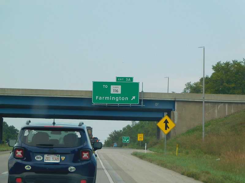
Great Lakes and Ohio Valley / Re: Illinois: Round Mile Mark...
Last post by 74/171FAN - Today at 05:25:27 PMSo IL 905 is still a thing right off of I-474?? (https://www.facebook.com/photo/?fbid=10219520080833154&set=a.10219520161635174)
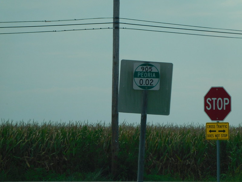
Exit being referenced to:
Exit being referenced to:
#6
Traffic Control / Re: Unique, Odd, or Interestin...
Last post by Rothman - Today at 05:09:58 PMProbably been shared before. Heck, I probably shared this one before. Still, it's a fun custom job that I passed once again:

#7
Great Lakes and Ohio Valley / Re: Illinois: Round Mile Mark...
Last post by NE2 - Today at 05:08:52 PMIf the local IDOT district refers to it as 316, does that not make it at least semi-official?
#8
Great Lakes and Ohio Valley / Illinois: Round Mile Markers,...
Last post by Rothman - Today at 04:57:35 PMAbout two-and-a-half months ago, I got into a discussion about alleged "hidden routes" in Illinois somewhere out there on the Interwebs. Turns out that some people think that markers like this:

can indicate "hidden state routes."
To confirm their suspicions, I reached out to IDOT and asked about the markers and why they have route numbers on them that may not be signed or have routes in IROADS. I referenced a specific example where one of these markers indicated a route 316 where the IROADS indicated it did not exist. I got a response from their Operations group:
"While the route near Charleston is not officially designated as state route 316, this is what our local IDOT district and residents in the area refer to the road as, so 316 was chosen for display on the reference signs."
Therefore, one should not use such markers as reliable indicators of official Illinois state routes.
#9
Southeast / Re: I-40 in North Carolina
Last post by ARMOURERERIC - Today at 04:50:01 PMHow much time can elapse before NCDot has to recalculate a design because of increasing traffic count? I ask because after several options were presented in 2017 for the improvement to Exit 103, US 64 in Morganton, opting to go with a larger "tight diamond", the traffic at that interchange continues to increase dramatically, do mostly to the additional educational institutions that have been added to the grounds of Western Piedmont Community College. This added traffic even more stresses the left from 64 west to 40 east. When NCDot went with the larger tight diamond, I stated that this would be inadequate, it is even more likely so now.
#10
Great Lakes and Ohio Valley / Re: Ohio
Last post by Rothman - Today at 04:37:46 PMQuote from: seicer on Today at 03:32:56 PM"Oh, brother." Again, no citations were provided, and only vague statements were made. Check.
Looking through the FHWA, nothing under "NEPA" forces a DOT to mandate tree or vegetation encroachment on the right-of-way. Under the Federal Aid Policy Guide 752.4:
"Landscape development, which includes landscaping projects and other highway planting programs within the right-of-way of all federally funded highways or on adjoining scenic lands, shall be in general conformity with accepted concepts and principles of highway landscaping and environmental design."
If this was the Highlands Scenic Highway in West Virginia, considerations may need to be made on landscape or vegetation encroachment and management. A highway through central Columbus isn't going to violate "NEPA" or the FHWA. As ODOT's own guidelines and policies state, each municipality needs to submit an action plan to maintain said vegetation. If the City of Columbus (in this instance) did not, then ODOT can fault the city for allowing the vegetation to become a nuisance and have it removed.
Nothing under 752.4 also mandates ODOT to keep excessive tree growth or vegetation, either. It would be considered appropriate in urban and rural areas for grass to serve as the vegetative buffer.
You need to read what I wrote again.
Broad policy statements and even legislation are not where you're going to find the actual processes that govern what is included in a design approval document, ADPs, or PS&Es and their supporting documentation.
My citation is simply my past few years being directly involved with project development and the fact I just had this discussion with a NYSDOT RLA just two weeks ago or so.