County Road 585 parallels the Suncoast Parkway to the west between County Line Road (Hernando County Road 578) and State Road 50 (Cortez Boulevard) in the Spring Hill area. Following Anderson Snow Road north to Spring Hill Drive and Barclay Avenue to SR 50, County Road 585 carries just two lanes except for a four-lane portion between CR 574 and CR 572.
|
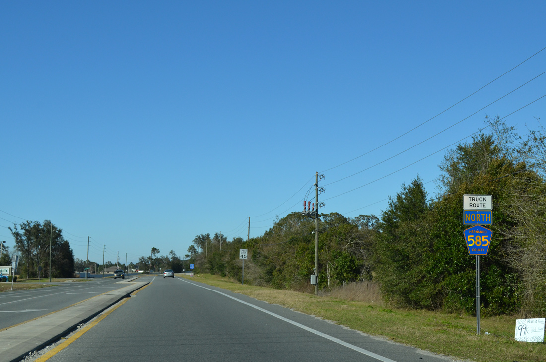
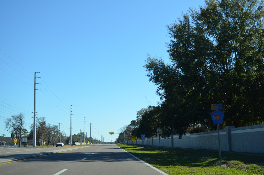
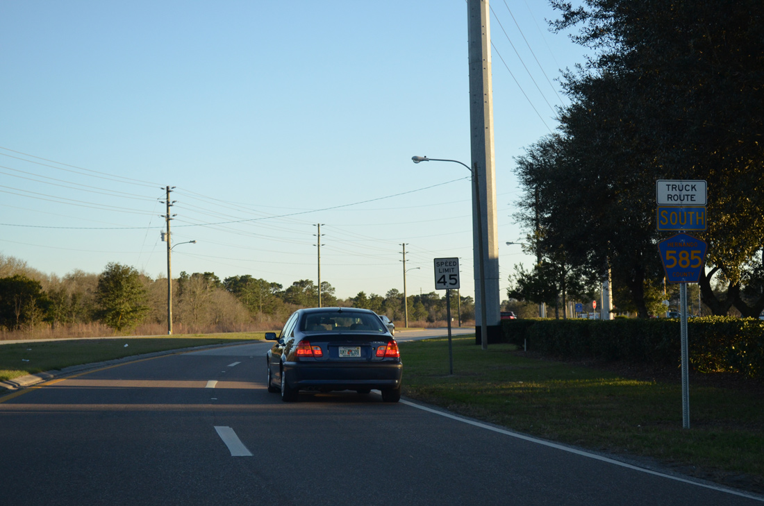
| The first shield for County Road 585 north includes a Truck Route banner. Some County Roads in the Spring Hill area include these banners in place of cardinal directions to reflect their status as truck routes. 02/15/14 |
|
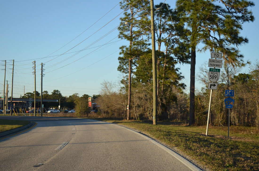
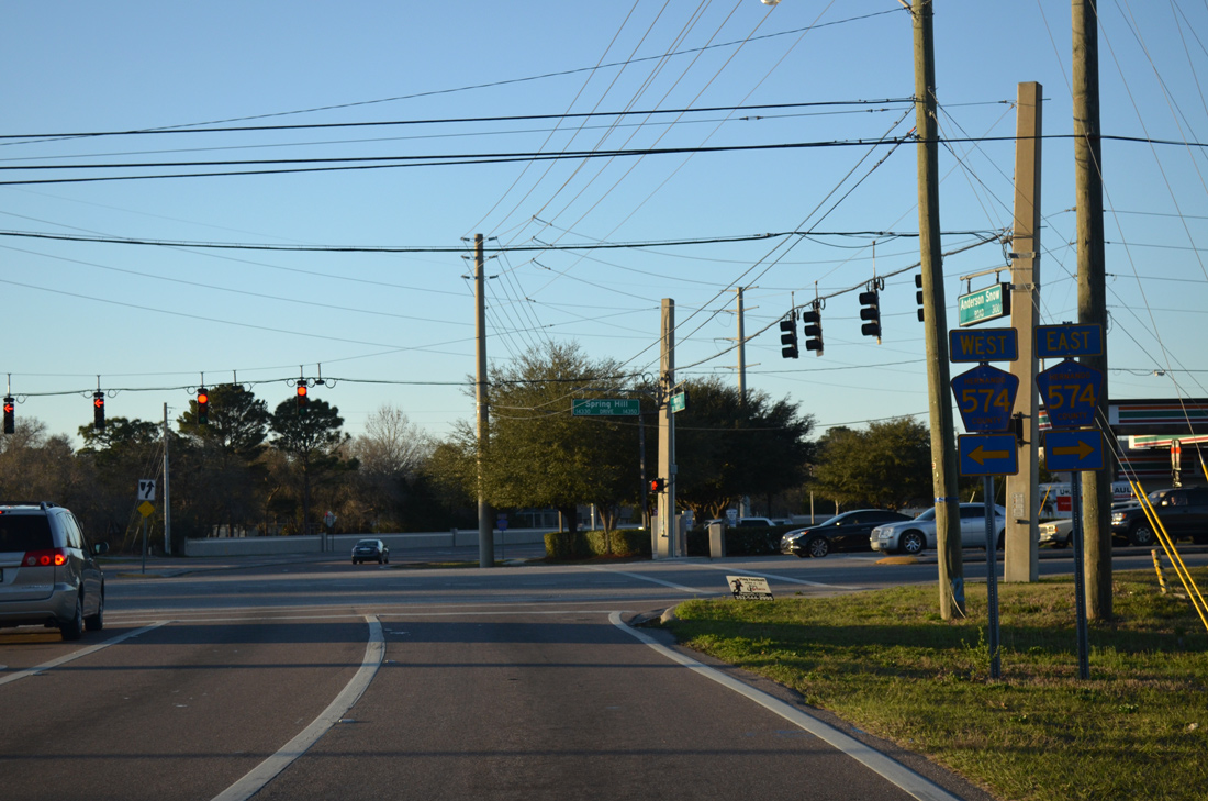
| Approaching the commercialized intersection with Hernando County Road 574 (Spring Hill Drive) on County Road 585 north. 02/09/14 |
|
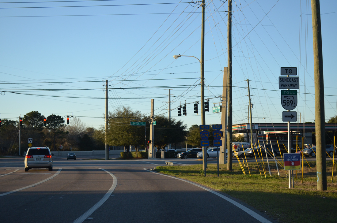
| Spring Hill Drive leads directly to a diamond interchange with the Suncoast Parkway just east of Anderson Snow Road and Barclay Avenue. 02/09/14 |
|
| Totaling 12.46 miles, the Hernando County segment of CR 574 winds west through Spring Hill to U.S. 19 (Commercial Way) and east to Brooksville-Tampa Bay Regional Airport (BKV) and U.S. 41 (Broad Street). 02/09/14 |
|
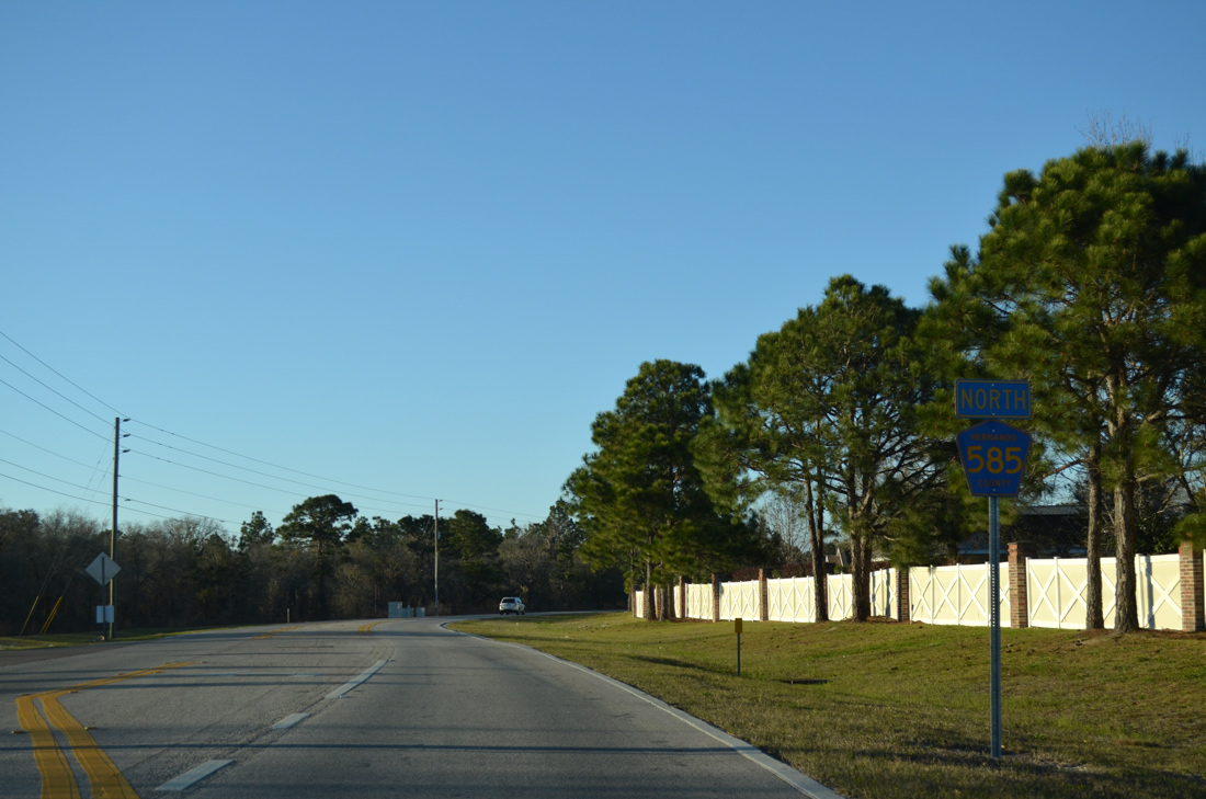
| Continuing north from Elgin Boulevard west and Powell Road east, County Road 585 lines the west side of the Silverthorn Country Club community before transitioning into more rural areas. 02/15/14 |
|
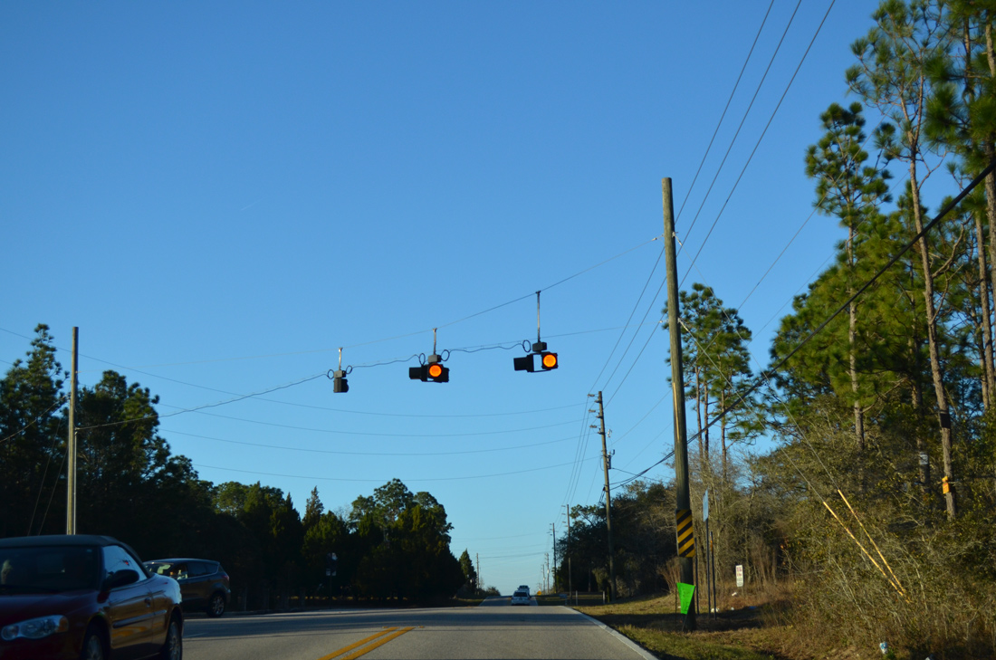
| A set of flashers hang above the intersection with Lawrence Street west. Lawrence Street meanders west from CR 585 through The Oaks subdivision to end at Mariner Boulevard (CR 587). 02/15/14 |
|
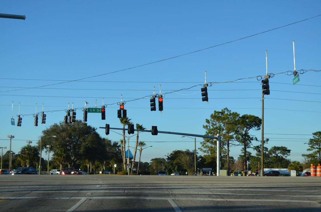
| Hernando County Road 585 (Barclay Avenue) north concludes at SR 50 (Cortez Boulevard) opposite Brookridge Central Boulevard. SR 50 leads west as a busy arterial to Weeki Wache and U.S. 19 and east to Brooksville. 02/15/14 |
|
| Barclay Avenue (County Road 585) expands into an urban style four lane arterial between County Road 572 (Elgin Boulevard west / Powell Road east) and Spring Hill Drive. 02/15/14 |
|
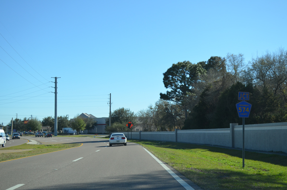
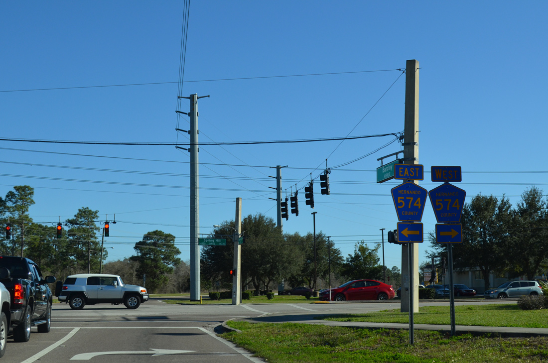
| County Road 585 kinks eastward to meet County Road 574 (Spring Hill Drive) by Barclay Crossing shopping center. CR 574 represents the main route through Spring Hill to the west. 02/15/14 |
|
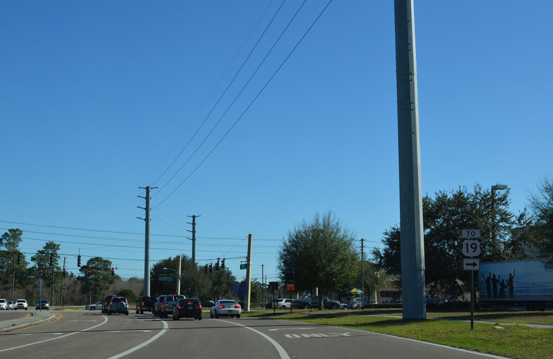
| A U.S. 19 trailblazer directs motorists along Spring Hill Drive west. County Road 574 formally ends at U.S. 19, 9.4 miles to the west. 02/15/14 |
|
| East from County Road 585, CR 574 meets the Suncoast Parkway ahead of Brooksville-Tampa Bay Regional Airport & Technology Center. The four lane arterial continues to U.S. 41 north of Ayers. 02/15/14 |
|
| Hernando County Road 585 follows Anderson Snow Road south from CR 574 to Anderson Snow Sports Complex and the county line. 02/09/14 |
|
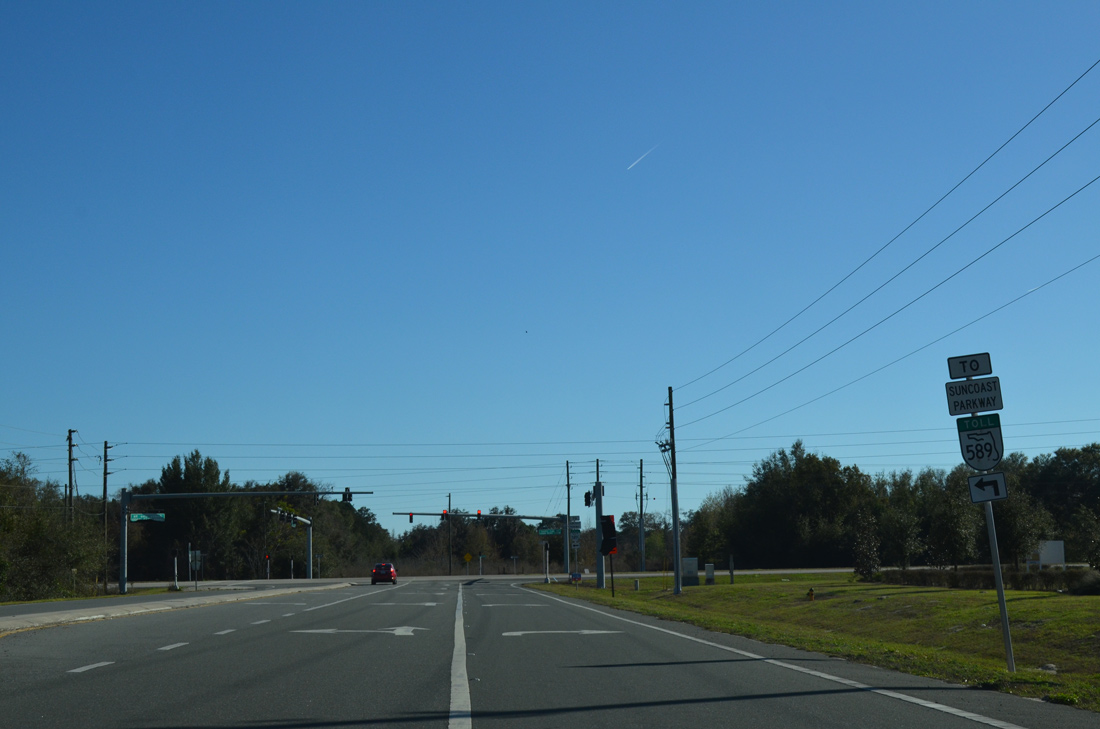
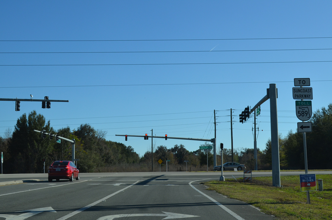
| Anderson Snow Road curves westward, leaving its original alignment for a short arterial stretch preceding County Line Road. A diamond interchange with SR 589 Toll resides just to the east. 02/15/14 |
|
| A second SR 589 trailblazer takes the place of County Road 578 pentagons as CR 585 ends. County Line Road doubles as CR 578 east to U.S. 41 and Masaryktown and west to U.S. 19 (Commercial Way). 02/15/14 |
Page Updated 02-19-2014.