


County Route J-1 originates from SR 25 at Paicines in San Benito County. Following Tres Pinos Creek, CR J-1 winds eastward to the Call Mountains and Panoche Pass. Emerging into Panoche Valley northeast of Walker Peak, the county road turns north along Little Panoche Road to Glaucophane Ridge and Mercey Hot Springs.
Crossing into Fresno County, CR J-1 makes a long arc through Little Panoche Valley to enter the Central Valley ahead of Interstate 5. The remainder of the route follows a linear route across agricultural areas to Belmont Avenue in Mendota.
| Fresno County J-1 east |
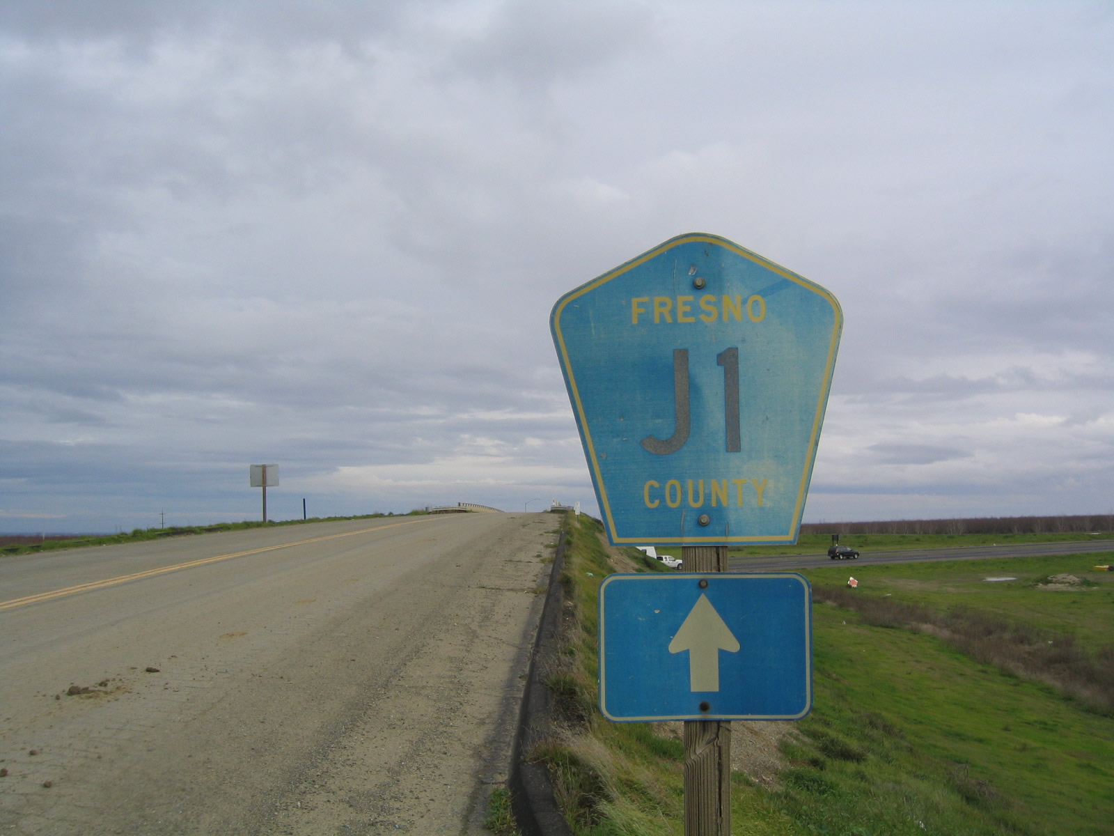 | This Fresno County J-1 route marker is posted on eastbound Shields Avenue as it passes over Interstate 5. 01/02/05 |
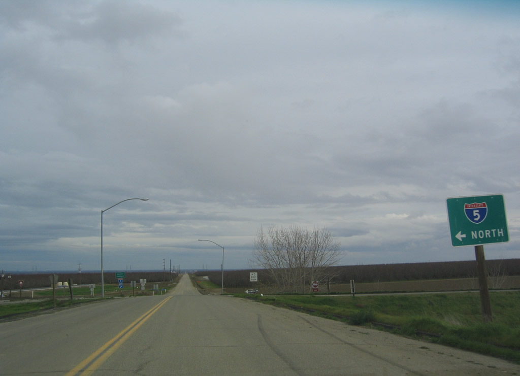 | Fresno County J-1 (Shields Avenue) meets the on-ramp to Interstate 5 north to Tracy and Sacramento. The county road continues east toward Mendota. 01/02/05 |
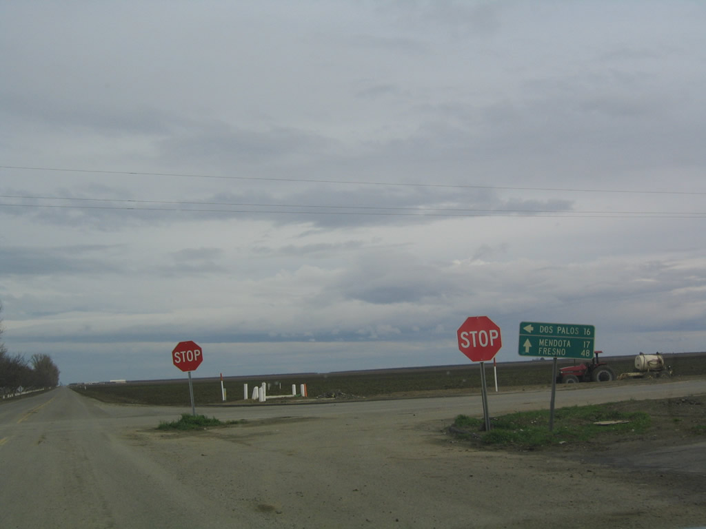 | 3.7 miles east of I-5, CR J-1 (Shields Avenue) intersects Russell Avenue. Russell Avenue heads north to Dos Palos and south to Interstate 5 at Exit 372. 01/02/05 |
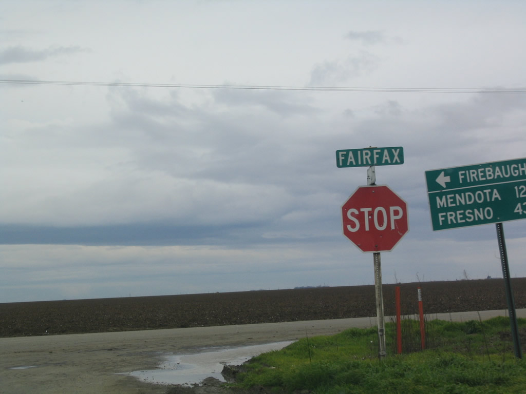 | CR J-1 turns south along Fairfax Avenue at the east end of Shields Avenue. Fairfax Avenue ventures north to Firebaugh. 01/02/05 |
Photo Credits:
01/02/05 by AARoads
Connect with:
Interstate 5
State Route 25
Page Updated 08-15-2017.