
Harford County lies just east of Baltimore and falls within the city's metropolitan area. Much of the county is reserved for agricultural interests, with a swath of suburbia along U.S. 40 (Pulaski Highway) east from Joppatowne to Havre De Grace and northward along the MD 24 corridor to Bel Air and Hickory. Most of the southern portion of the county, including virtually all of the Chesapeake Bay shore line lies within the U.S. Army's Aberdeen Proving Ground. Northward, rolling hills give way to cliffs and rock formations both along the Susquehanna River and in beautiful Rocks State Park.
Harford County State Routes
| Route | West / South End | East / North End | Mileage | |
|---|---|---|---|---|
| 7 | U.S. 40 Baltimore | U.S. 40 Aberdeen | 11.32 (22.83) | |
| 7(A) | U.S. 40 Havre De Grace | U.S. 40 Havre De Grace | 2.66 | |
| 22 | U.S. 1B & MD 924 Bel Air | Aberdeen Proving Ground | 12.91 | |
| 23 | Pennsylvania state line | U.S. 1B Hickory | 20.58 | |
| 24 | Aberdeen Proving Ground | Pennsylvania state line | 25.17 | |
| 132 | Aberdeen Proving Ground | Aberdeen | 2.15 | |
| 132(A) | MD-132 Aberdeen | MD-22 Aberdeen | 0.24 | |
| 132(B) | MD-22 Aberdeen | U.S. 40 East of Aberdeen | 1.43 | |
| 136 | MD 7 Bush | MD-23 south of Norrisville | 30.04 | |
| 138 | Baltimore County line | MD-23 Blackhorse | 0.93 (9.24) | |
| 146 | Baltimore County line | MD-23 Madonna | 5.14 (16.81) | |
| 147 | Baltimore County line | U.S. 1 Benson | 2.96 (18.81) | |
| 152 | Aberdeen Proving Ground | MD-146 south of Madonna | 17.34 | |
| 155 | MD 22 Churchville | U.S. 40 Havre De Grace | 9.06 | |
| 156 | MD 22 Smith Chapel | MD 155 west of Webster | 3.92 | |
| 159 | Bush River | U.S. 40 Aberdeen | 4.73 | |
| 161 | MD 155 east of Level | U.S. 1 north of Darlington | 5.38 | |
| 165 | Baltimore County line | Pennsylvania state line | 18.98 (20.38) | |
| 439 | Baltimore County line | MD 23 north of Shawsville | 1.22 (7.19) | |
| 440 | MD 543 Ady | U.S. 1 west of Hopkins Corner | 5.65 | |
| 462 | MD 132 Aberdeen | MD 155 west of Webster | 4.15 | |
| 490 | Tydings Mem. Park Havre De Grace | MD 7 Havre De Grace | 0.31 | |
| 543 | U.S. 40 | MD 165 southwest of Whiteford | 19.08 | |
| 623 | MD 161 Darlington | Pennsylvania state line | 7.26 | |
| 624 | MD 165 southwest of Whiteford | Pennsylvania state line | 3.02 | |
| 646 | MD 543 north of Ady | MD 136 Prospect | 3.31 | |
| 715 | U.S. 40 west Aberdeen | Aberdeen Proving Ground | 1.06 | |
| 755 | Aberdeen Proving Ground | U.S. 40 McComas | 1.79 | |
| 763 | MD 155 Havre De Grace | Glow Road Havre De Grace | 0.28 | |
| 922(E) | U.S. 1B & MD 924 Main Street | U.S. 1B Baltimore Pike | 0.24 | |
| 924 | MD 24 north of Van Bibber | U.S. 1 & MD-24 Frogtown | 7.34 | |
| Source: State Highway Administration of Maryland Highway Information Services Dvision Data Support Group, State Highway Location References - 2009 | ||||
Highways in Harford County
| Route | Western or Southern Entrance | Eastern or Northern Entrance | Harford County Mileage | Mileage |
|---|---|---|---|---|
| I-95 | Baltimore County line | Millard E. Tydings Bridge | 18.39 | 109.65 |
| U.S. 1 | Baltimore County line | Conowingo Dam | 19.98 | 81.00 |
| U.S. 40 | Baltimore County line | Hatem Bridge | 18.61 | 231.39 |
| U.S. 1 Business | west of Bel Air | east of Hickory | 6.90 | 6.90 |
| Source: State Highway Administration of Maryland Highway Information Services Dvision Data Support Group, State Highway Location References - 2009 | ||||
| Maryland Route 138 |
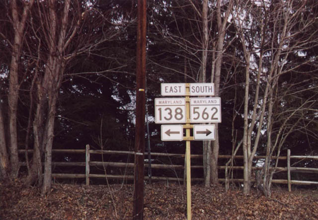 | Just west of the Harford County line is the MD 138 turn from Shepperd Road east onto Troyer Road north. MD 562 (Old York Road), a spur to Markoe Road, ties into the intersection from the south. 01/25/00 |
| Maryland Route 440 |
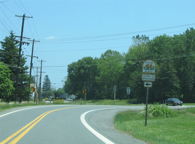 | Approaching U.S. 1 (Conowingo Road) on MD 440 (Dublin Road) eastbound. MD 440 travels a short distance between MD 543 (Ady Road) and U.S. 1 east of Dublin. 06/05/05 |
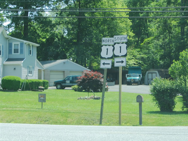 | U.S. 1 shields posted at the east end of MD 440 (Dublin Road). U.S. 1 travels east toward Darlington and Conowingo Dam and west to MD 136 (Whiteford Road) south of Dublin. 06/05/05 |
| Maryland Route 623 |
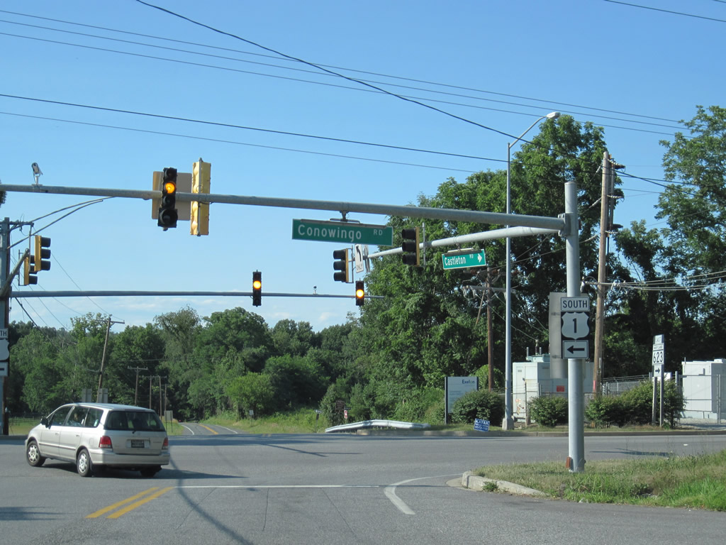 | MD 623 (Castleton Road) intersects U.S. 1 (Conowingo Road) just north of its beginning at Darlington. The connection provides a cut off from MD 161 north to U.S. 1 for Cecil County. MD 623 otherwise continues northwest to Berkley, Castleton and York County, Pennsylvania. 06/30/10 |
| Maryland Route 763 |
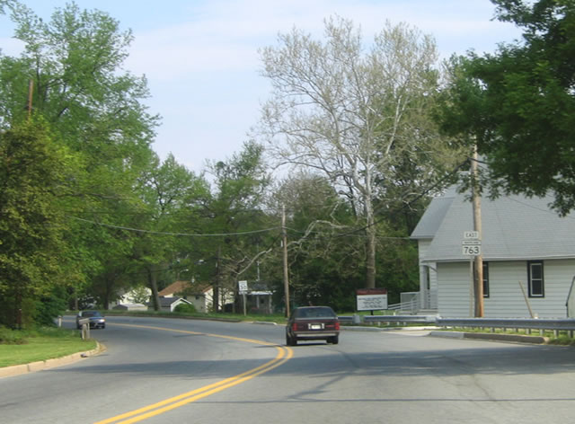 | MD 763 constitutes a short spur between MD 155 (Ohio Street) and Juniata Street in the city of Havre de Grace. Superior Street carries the state route underneath the Thomas J. Hatem Bridge (U.S. 40) to the city street grid south of the span. 05/01/04 |
Photo Credits:
01/25/00, 05/01/04, 06/05/05, 06/30/10 by AARoads
Page Updated 08-20-2010.